

Rhodo minus at Panthertown
Panthertown Backpack Trip 2014
Dana Koogler
Catherine Howell
Jennifer Bennett
Friday June 25- Sat. June 26, 2014
Friday hike distance 4.2miles
Sat. hike distance 11.2 miles
Pictures are here beginning with frame 55
Panthertown Pix


Top: Greenland Creek Falls
I had planned to meet up with my best friend Cathy and another friend, Jenny Bennett to go
backpacking. We agreed on Panthertown North Carolina. I headed over to Cathy's house
Thursday evening to visit with her and meet another of her friends for dinner. We had a good time
of fellowship together and a nice meal. We packed up that night for our trip. We planned to meet
Jenny at the Cold Mountain parking area.
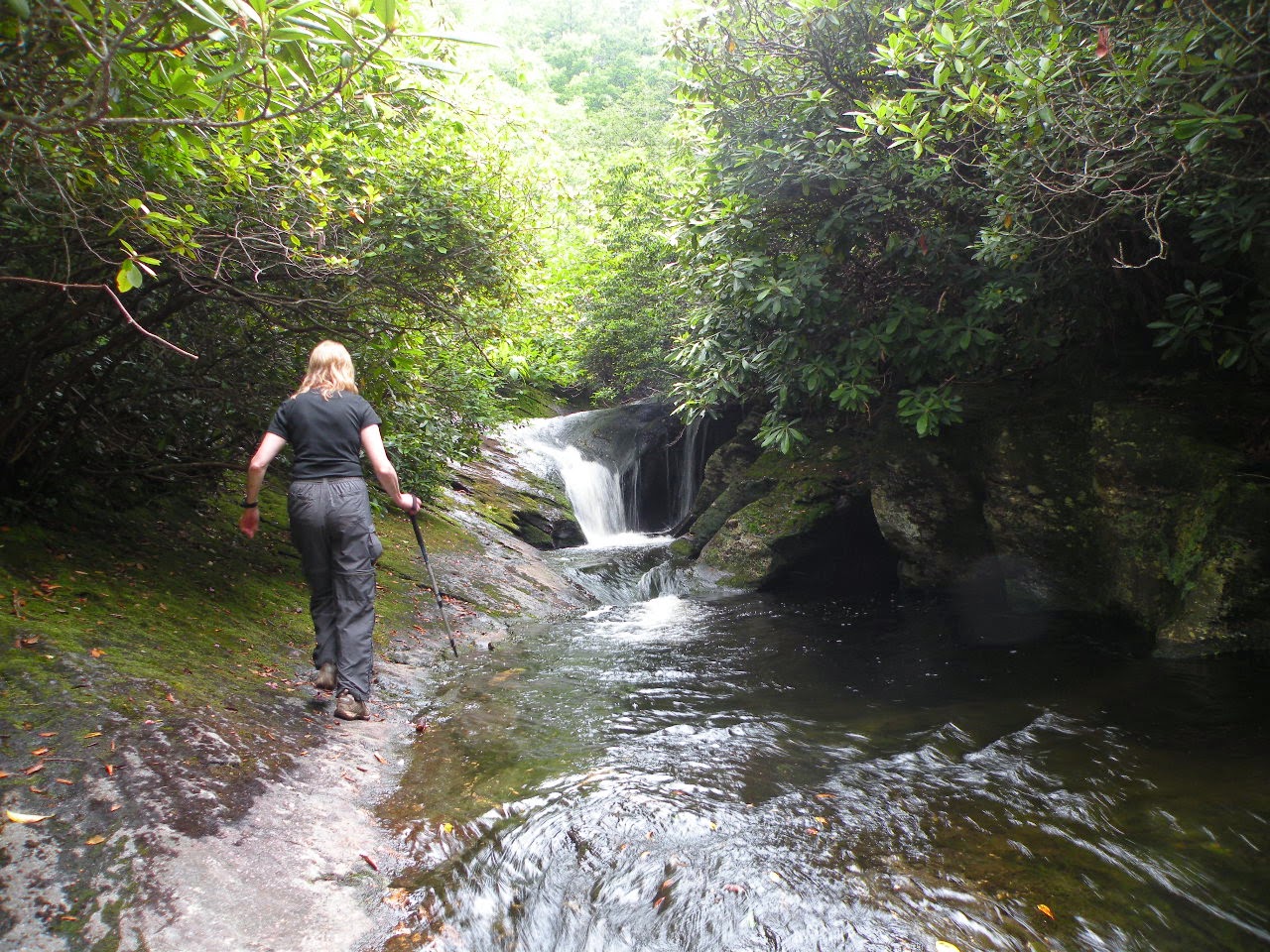
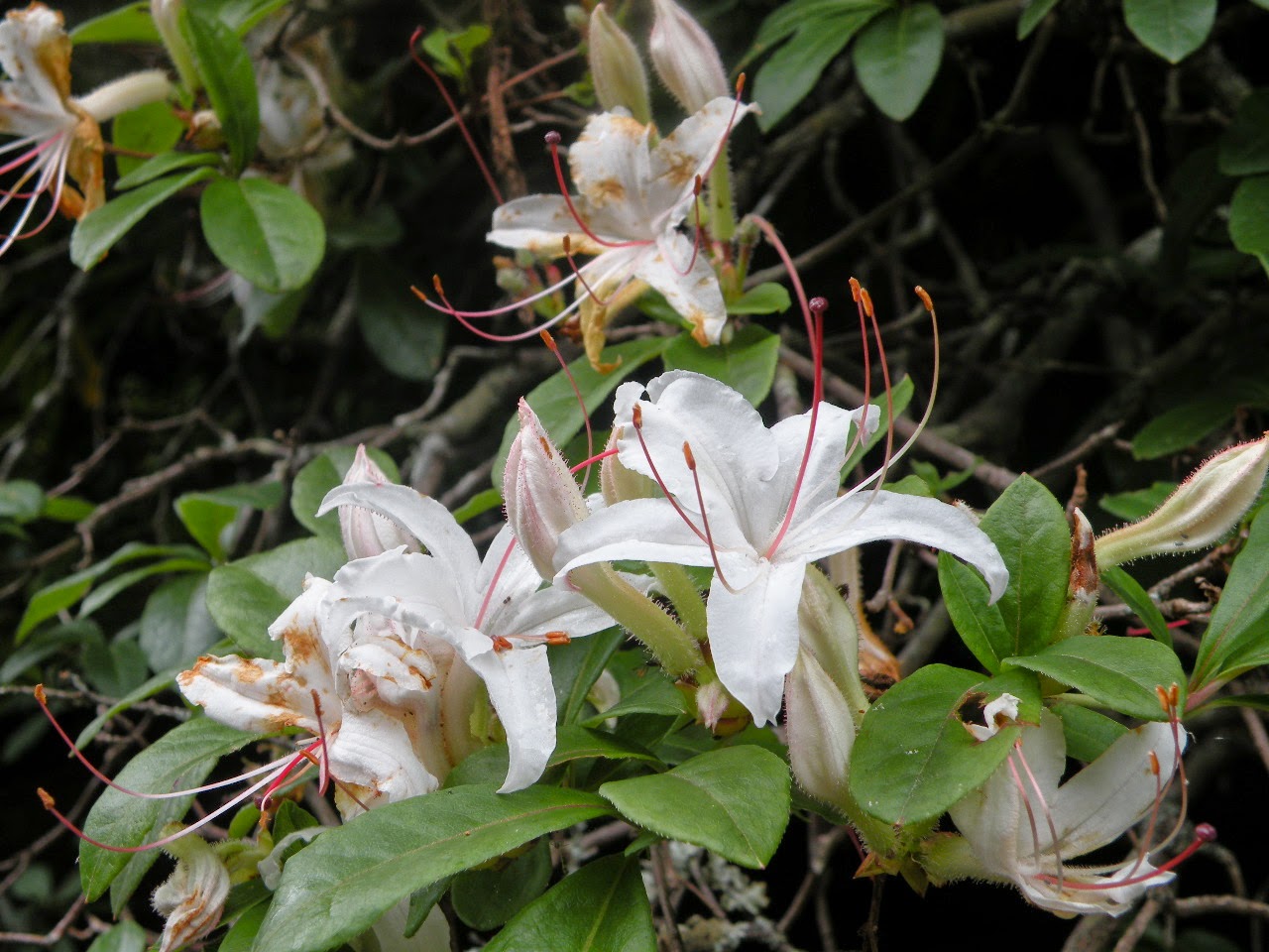
We arrived and finally got together and set out. We headed down the trail to Mac's Falls and Pothole Falls. We all wanted to see waterfalls this trip including some new ones. A short hike later and we made it down to the first falls. Mac's Falls is a low, scenic waterfall with a pretty plunge pool. The water in Panthertown is stained brown from tannins. It is also flecked with mica
particles. The rhododendron blooming was pink and white rosebay and a few blooms of Carolina rhodo. Purples and pinks and deep greens of Summer. My companions kidded me about how I am so bad to get in the creek. I did not go swimming this trip since it was rainy, but I did get in the creek. We were taking in Mac's Falls and then ambled down to see the nearby Pothole Falls just below it. It is also a low, scenic waterfall hemmed tightly into the same stream. It is carved out
by the water and very different from Mac's Falls. Below this falls was a rocky shoals.

Top: Jenny approaches Pothole Falls
Bottom Macs Falls
We had planned to set up camp in a good location and hike out from there.
We did not want to lug that stuff all over Panthertown for the entire time. Cathy and I knew of a good campsite from last year. It was along Greenland Creek and near waterfalls Jenny had never seen before. We decided to take her to see those today. We'd just camp there. We made our way along a lower portion of trail along Greenland Creek as the rain cut loose. We had some cover from the tree and shrub canopy, but we were still getting rained on. We donned our rain gear and continued. We made it to the trail intersection and the trail confusion cleared up.
We were close to the camp site so we went a few steps further and arrived.
We set up our tents and made camp. We ate a quick lunch and the rain let up a bit.
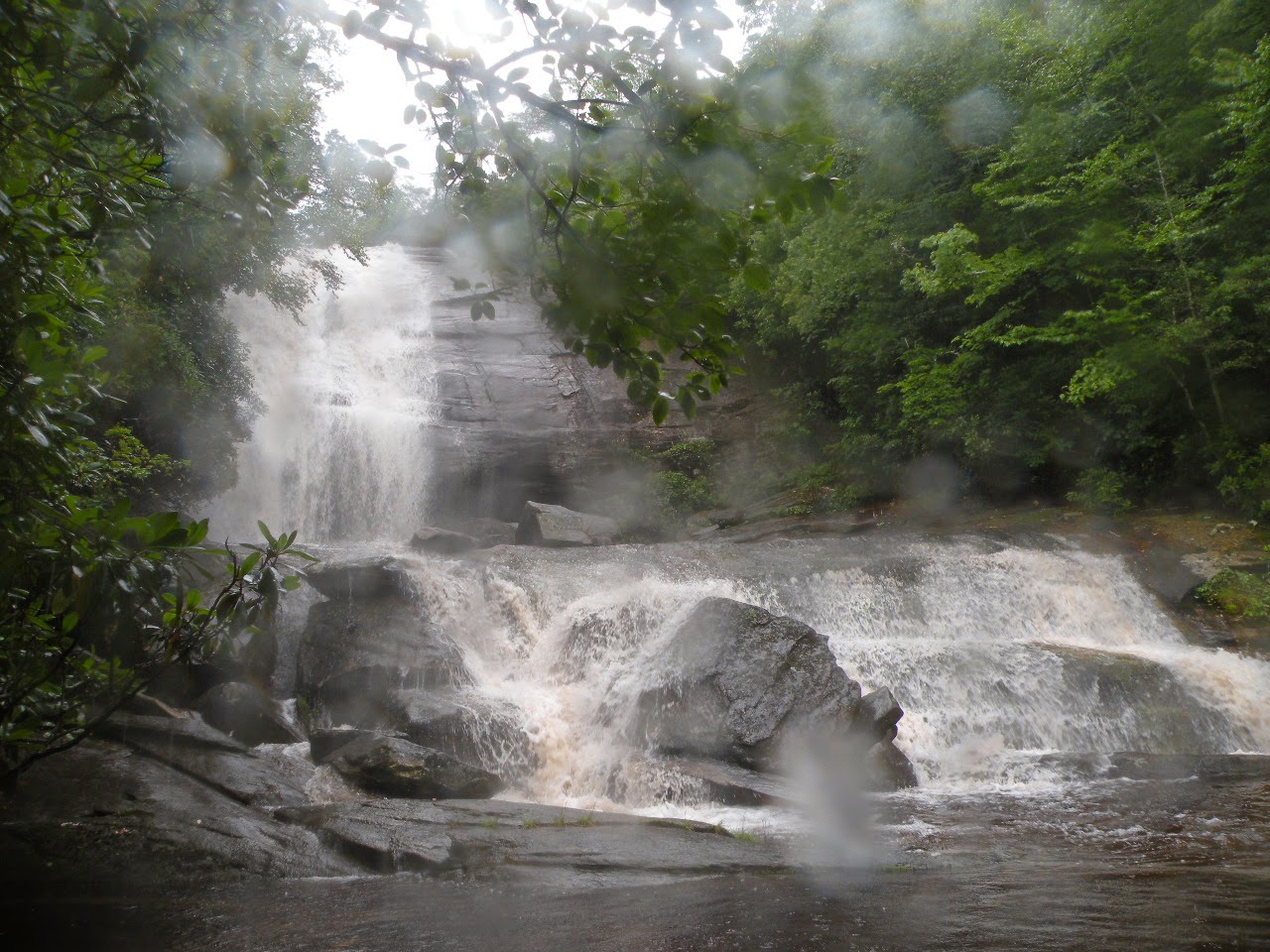
We would continue down the Greenland Creek Trail and go off trail all the way to see
Greenland Creek Falls, Halfway Falls, and Carlton Falls. I was dreading the climb up above
Greenland Creek Falls. I had done it before so I knew what was waiting for me.
Yet the things I found hiking with these two ladies in the rain was that with company... the discomfort is less. Having done it before... somehow it seems not as bad this time.
The rain continued, but we did not let it stop us. The stream was murky and brown having been churned up by the torrential rain. The falls were not quite as scenic due to that, but they made up for it in volume! It is always neat seeing another friends response to their first visit to
a pretty place. Jenny was digging Panthertown and everyone was getting on well. It struck me funny that here I was off trail in the wilderness in Summer and completely at ease. I was not one bit concerned about snakes. I felt charmed. Is this rational? No. It is me though and I never claimed to be anything but crazy head to toe 24/7.


Top: Greenland Creek Falls
Middle: Halfway Falls
Bottom: Carlton Falls all muddied by the hard rain.
We took in all the falls up Greenland Creek and made the trek back to camp.
The rain finally quit. We were wet and dirty. We were tired and hungry. We had a good
meal over the backpack stove. Chicken and fried rice. Jenny had brought homemade goodies!
Butterscotch brownies! We enjoyed them and her tremendously. I got cleaned up a bit and
after some sitting around the campfire time of chatting we turned in. Cathy and I racked in the same tent. We talked a little while, but soon were asleep. I kept waking up through the night thinking it was raining. It wasn't. All I was hearing was the wind and the stream. I rested ok, but I've slept better on backpack trips. I am not sure what was wrong with me. I did not feel bad.
My rest was just broken. I chalked it up to being excited.
Next morning over coffee and oatmeal... we learned that Jenny was not feeling up to par.
She hurt her hip long ago and it had been bothering her. She decided the wisest thing to do was to
head out for home rather than aggravate it. We hated to see her go, but understood. We hiked
out with her to the parking area. We saw her off with lots of hugs and promises she was not getting away that easy. We'll have to do it again soon when she is feeling better.
Once we knew she was safely on her way we headed out for the days hike.
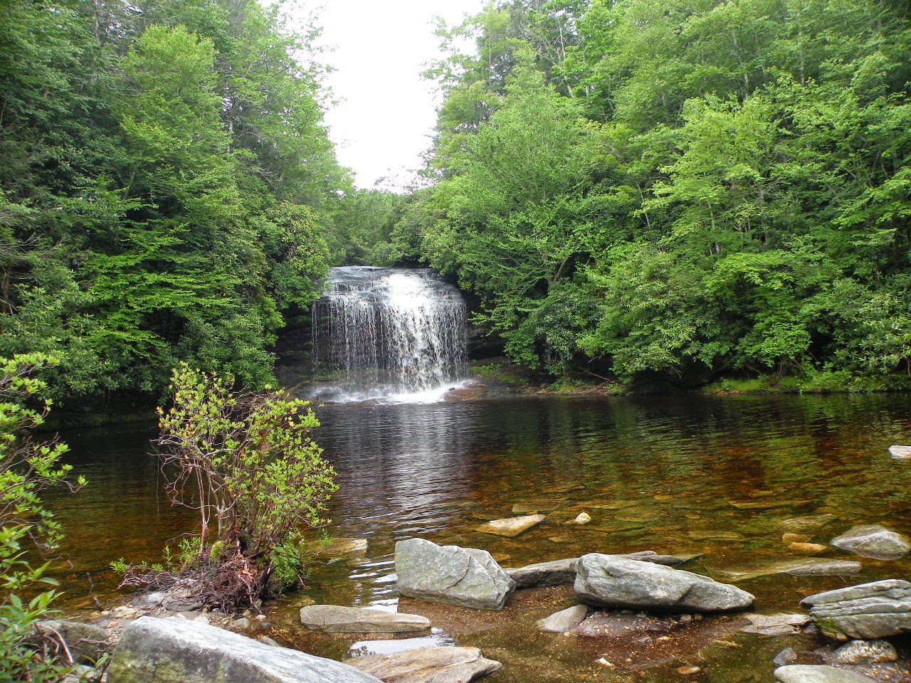
I had not been to Schoolhouse Falls since my kids were ages 12 and 15! The last time
I was there I was with them. We hiked with Rich, Harry, Jan, KT, Cathy, Kenny, Dana, Jared
I was there I was with them. We hiked with Rich, Harry, Jan, KT, Cathy, Kenny, Dana, Jared
and Crystal.. and maybe more but that's all I recall. We made it as far as just below Riding Ford Falls that trip. We were going to head for Devils Elbow, but it was late in the year. It was raining and very slick. It was going to require wading the Tuck. It was also going to require putting up
with swimming with snakes. My kids weren't having it. So we wrapped it up and headed back to Harry's that trip. I still need to finish that trip!
Today we approached Schoolhouse Falls from the opposite direction of the last hike.
We were confused. We asked people about it and it turned out they were heading the same place
so we all hung in there together. We made it safely and I admit this hike is a tad longer, but it was easy and quite pretty. Schoolhouse Falls was beautiful as always! Such a nice spot.

Schoolhouse Falls

Rhododendron arborescens blooming at Schoolhouse Falls
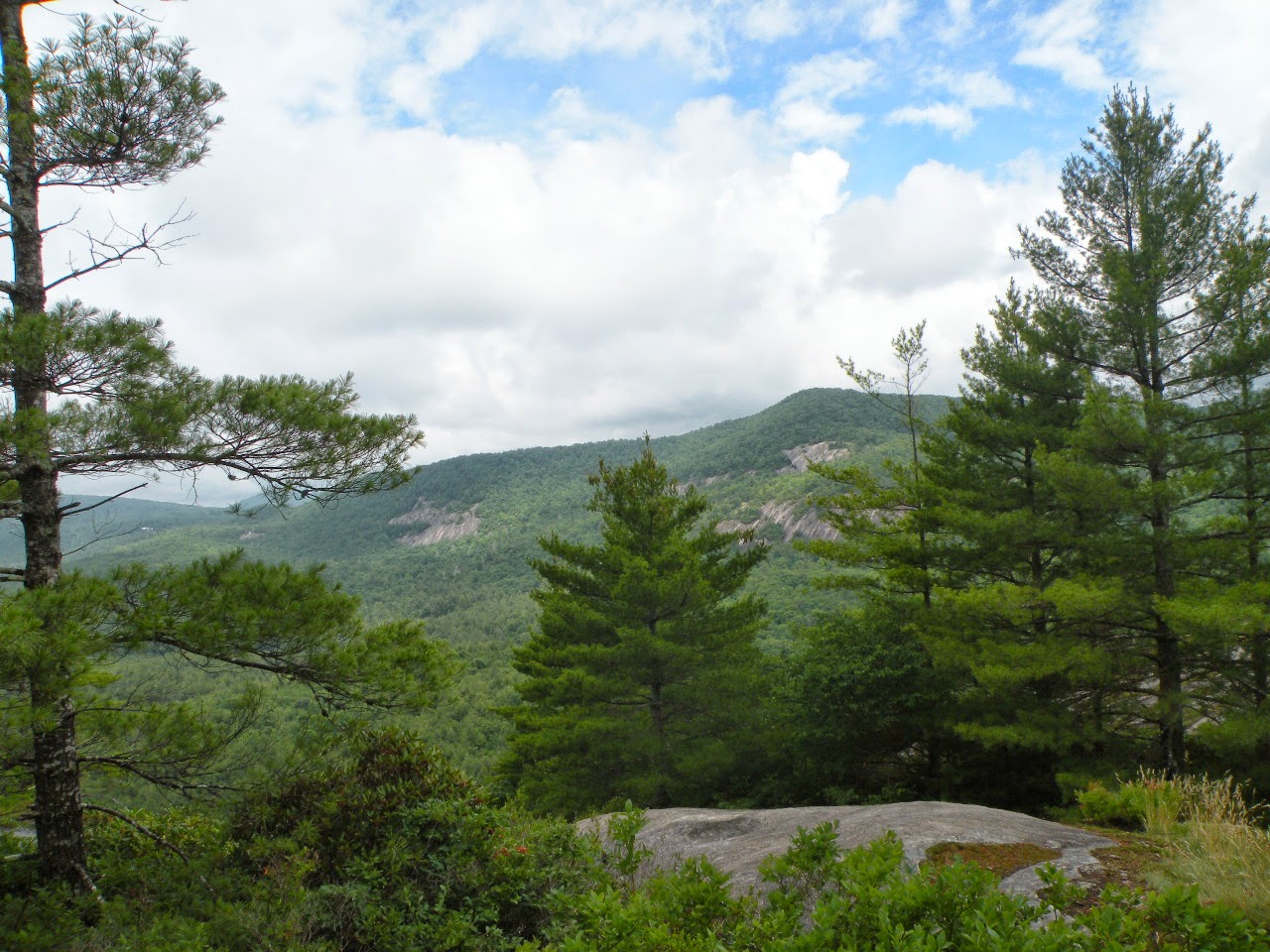
 Top: View from Tranquility Point
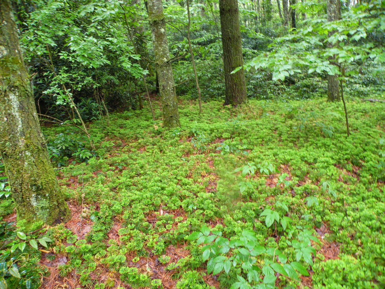
 Top: running cedar coats the ground along Mac's Gap Trail
 Cathy and some little boys at Granny Burrell Falls.
The rain began falling on us again before we even left Schoolhouse Falls. We donned our rain gear. We parted company with the other hikers and continued on our planned route to Tranquility Point. It is a high overlook on Little Green Mountain. I had not been to any of these overlook type hikes in this wilderness so I was pleased. We found it easy enough. We enjoyed the views from the large rocky outcrops. The rain had stopped again. My camera was fogged while trying to take photos here. It was bad and getting worse. Having my camera malfunction for me is
a hardship. It is not as bad as double vision, but it really upsets me. It is like a part of me on hikes. I feel like one of my eyes have been put out. I was trying to make the best of it and hoping
the camera would somehow be okay.
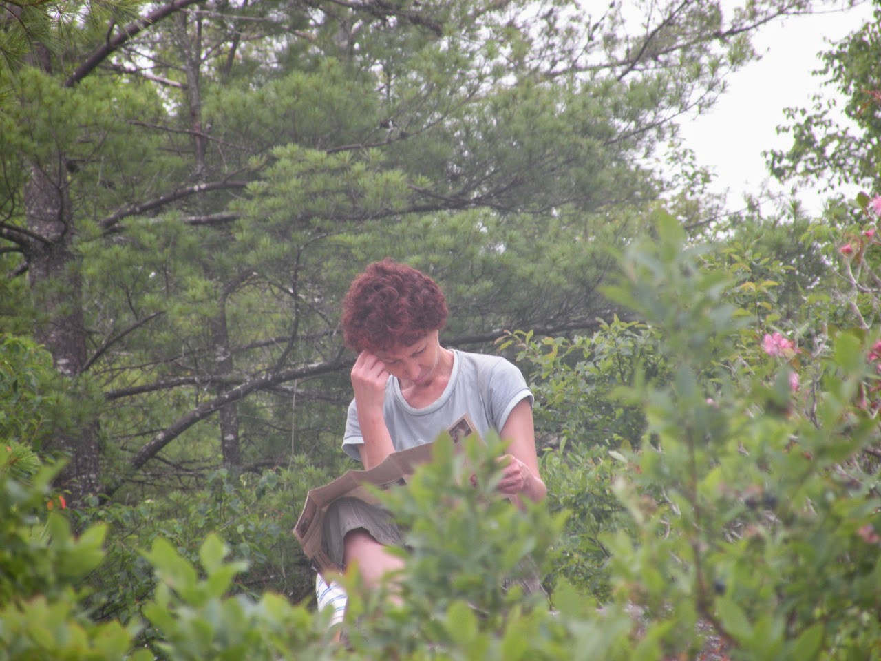
The views here were gorgeous. The heath vegetation was pretty. We were surrounded by ripening blueberries which we ate. We also saw fire cherries. We tried them all. We saw true rhodo minus.. the small cousin of catawba rhodo. Carolina rhodo is the middling sized cousin of both. All are pretty. We had passed a good number of people who camped at a spot near Tranquility Point. I would not care for it as a camp site. It requires a long trek back down to the stream to get water then haul it BACK UP the mountain to camp. No thanks! It was not wasted on me that Cathy told me on the hike up the mountain she had done this before. I couldn't help wondering why she felt the need to study the map while I was taking pictures? I knew what it most likely meant and just readied myself for it. More trail confusion was on the way. Ah the joys of hiking in Panthertown.


Bottom: Cathreen studying the map of Panthertown awfully hard.
You can tell in the bottom photo how bad my camera was fogged at this point. I was distressed about that.
We left Tranquility Point and motored on. The plan for the day was this: Parking lot at Cold Mountain Trail head .. Panthertown Trail to Schoolhouse Falls, up Little Green Mtn trail to Tranquility Point, down to Mac's Gap Trail and out to Granny Burrell Falls. Red dot footpath near Granny Burrell Falls to the top of Big Green Mountain. Hike along the top of Big Green Mountain to enjoy the views off The Great Wall of Panthertown. Merge onto Big Green Trail and back around to the campsite near Greenland Creek closing our loop hike for the day.
Go ahead and laugh now those who are familiar with Panthertown. Josh Simons, Todd Ransom,
Stephen Wilder... I can hear you now. Yeah. We were crazy and the person unfamiliar with Panthertown will see why later.
It was only a matter of steps away from Tranquility Point and minutes until we were experiencing trail confusion for the second time today. We did what we sometimes do. We go back to where we knew we were on track and do it over... what did we miss? Okay this trail heading down hill doesn't look right. Let's try going on this one that turns right and goes into the woods by those tents. Yeah. This must be it! I prayed Lord! Please help us through this?
He is always faithful to answer. It was not long til we did not like that option either. The trail was growing sketchier by the second. Trail Dawgs that we are... we pushed on through the brush and
emerged onto the open rock face that rims Little Green Mountain. We could hear people. We headed in their direction. They could hear us and were heading in OUR direction. Both groups hoping we could help each other. We did help each other, but we were both crazy. Helping them showed me the depth of our insanity. They showed us where we needed to get back on track.
We said we'd take them up the trail and show them where they needed to turn to continue.
I can barely type this from laughing at the thoughts of it. The look on their faces when I took them back to the hole in the thicket we came out of and said to them "You go in here!" ~~~>
The internal dialogue was something like this. damn. how embarrassing. yes, we really came through that and it turned out ok. can't believe i'm asking them to do that. No mention of I cant believe WE did that. That part was unquestioned. Its what we do.
Thank goodness another man came along right about then and said "No, let me help them. Y'all go on". We took him up on it relieved to have found them assistance and gained some assistance for ourselves. We saw moments later that the trail was marked ON THE ROCK on the ground... with white arrows. Ok then. We came to the intersection of Mac's Gap Trail and Little Green
Trail. We turned right onto Mac's Gap Trail and headed toward Granny Burrell Falls.
I felt like everything was going to be smoother now as the trail was like the Road to Hell... wide and easy. It was mostly gentle grades or level right across the valley floor.
I liked this trail more than all others. It is too pretty for words. It is the quintessential Red
Riding Hood forest. Tall stately pines towering above. A sandy, level trail carpet of pine needles.
It smelled so good. We were also shopping at this point for camp sites for future trips!
We found some too! We wanted pretty and near water. We found all of that. The forest floor here
is over run with ground pine, running cedar, and ferns. It is like a natural cathedral.
The bog of Panthertown is there with its mushy soil too fragile to walk on, but one can peer over into it. Mosses of all different kinds abound. Foxtails run here and there across the ground.
Great mounds of sphagnum. Pincushion mosses of pale celery green. It is delightful to see and touch. Birds sang and flitted. The rain started and stopped as it had all weekend.
I was very down about my camera, but just kept trying not to think on it.
We made our way to Granny Burrell Falls watching every turn off the trail closely. We frequently checked the map against the reality of what we were seeing.


Bottom: Mac's Gap Trail. We've hiked it all! Coated in rusty red, soft pine needles over sand.
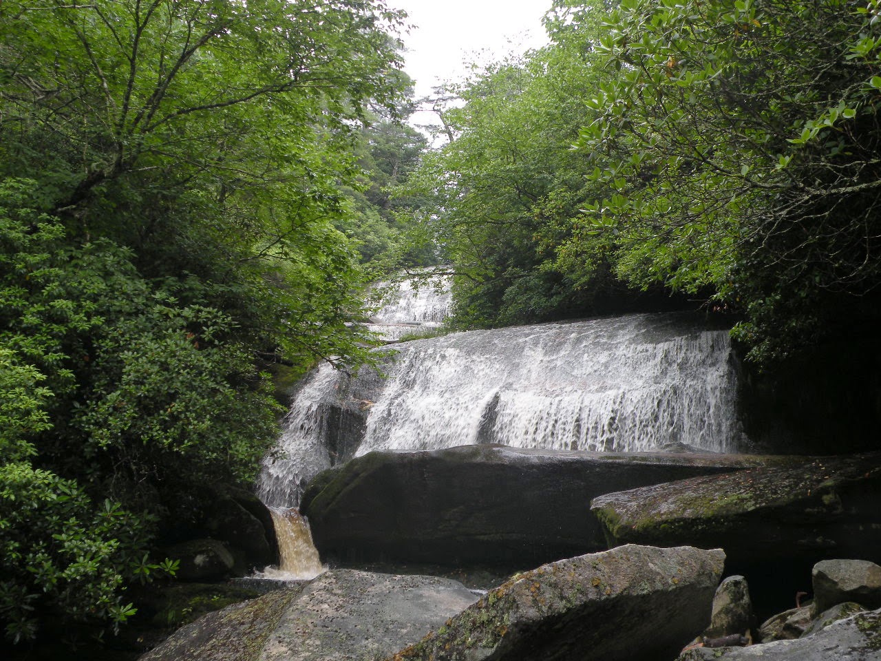
We arrived at Granny Burrell Falls to a cacophony of laughter and squeals. It was clear there were lots of people enjoying the falls today before we ever got there! It was a happy sound and we did not mind. We talked to nice families and children. We sat down at the top of the falls and watched kids have races with "boats" of sticks letting them go down the stream. Kids were sliding down the low, pretty falls. The brown stain of the stream is oddly beautiful with the gold flecks of mica minerals in it. Gray beach of stones. Placid pools on this beach of dark brown water.
Sunshine. Clouds. Sprinkles of rain. The weather changing its mood moment my moment.
I had the company of my friend and all this natural beauty. Salami sammidges. Fresh cheese.
Veggies and dip. Apple slices. Grapes. yummy! We took in the falls and I got out my camera for photos. All the fog was gone! Praise the Lord for that! My camera was going to be OK.
What a relief.
I was having my misgivings about the planned route. I knew that those red dots on the Panthertown Map can mean just about anything is possible. The red dot path up to Carlton Falls is cake compared to some off trail hikes we've done. The red dot path here to the top of Big Green on its far end..... ? My thought on it based on the topography was that this was not going to be the case. It is extreme. I had doubts it was used at all if ever. I did not want to rain on the parade, but wanted to go along and get along. We would do it if it could be done. We hunted for it.
We tried the tiny path that lead above Granny Burrell Falls to see where that went??

The unofficial path turned out to be worth hiking. The rain storm was upon us in earnest again.
We donned all our rain gear. I put my pack cover on. My poor camera had been through enough! We hiked this short path that felt like I had stepped into a windowless closet and closed the door behind me. Parts of this rhodo tunnel were so impenetrably black. Add to that the 2 pm full on thunder storm with a downpour of rain amplifying the darkness at mid afternoon.
We passed another pretty cascade and slide on the upper part of the stream above Granny Burrell. We passed a strange tailwaters of the stream. The stream split off into an odd cut away section where the water backed up. It was black. The rhodo tunnel here above that stream was pitch black. The stream was pitch black. I was not scared but captivated. It is impossible for a camera to show a scene like that, but I am glad I got to experience it. We emerged about the time
the rain let up a little on the Great Wall Trail. We knew where we were, but this was not right.
We would be below the mountain not on top of it. We headed back to try try again!
We had more hikers ask us about their own trail confusion. We helped them.
We asked two ladies about the foot path we were seeking. They did not know where it was, but the one lady said she had heard it was "serious". She seemed to know what she was talking about and the topo map bore it out. We stopped by an unofficial campsite that had been formed
near Granny Burrell Falls and at the back of it was a path. Cathy said it petered out as it headed up and she was not convinced this was it. I had doubts, but felt this WAS it. I figured it was hardly ever used and thus was going to be like that lady said. SERIOUS. Hard to find. Hard to follow. Hard to climb. Since we were unsure we struck a wonderful compromise that suited me to a tee. We'd just hike Mac's Gap Trail back. This would give me a chance to enjoy the beauty of the trail and forest. I'd get a chance to photograph it. I felt confident we'd not have anymore trail confusion. We would be OK.
We hiked it back and got rained on some more. Toward the end of the hike the sun was trying to come out. It was uphill part of the way, but not too bad. We finally got back to camp.
I was happy, but very tired. I was picking up a vibe from my pal. I turned to Cathy and asked her what she wanted to do? She hemmed and hawed. I could tell she was trying to spare my feelings.
I told her I did not care one way or the other. Either way I felt like I won. Either another night in the woods with my friend OR go back home early and get clean and dry and sleep in a real bed??
She said she wanted to leave. She was tired of being wet and dirty. We packed up and headed home. I was happy as a clam. I like backpacking, but I can be such a pussy sometimes.
I am a woman of great contradictions. I will crawl through the brush and be like a wild animal.
I can grow tired of the dirt,wet, mud and be ready to go home, get clean and dry and be smelling like Bath & Body works. I can hike my toenails off, but then be ready to go home and get a pedicure and paint those same raggedy toes. I had blisters and hamburger feet.
My hiking boots had fairy glamor gold sparkles all over them mingled with mud.
What a groovy trip. I can't wait to go again. Next time.. Salt Rock Gap.
We're gonna hike the top of Big Green mountain and find that path down off the other side!
Came home and posted on Exploring Panthertown Facebook group... I was right!
The campsite trail WAS the footpath up to Big Green. It is skeery and sketchy!
Let the suffering never end! LOL
Below is a short video of Granny Burrell Falls
No comments:
Post a Comment
Thanks for reading and commenting. I enjoy hearing from those who read & make use of my blog. I have made some wonderful friendships through emails from readers. I respond to all comments and emails. I appreciate folks reaching out to let me know when my blog entries are not functioning correctly or if the situation somewhere has changed. Many Blessings to you!
Dana 🐝