Wednesday, January 21, 2015

Crossville Weekend Scouting Trip

Caney Fork River with trees growing in it


Crossville Weekend Scouting Trip  
Friday Jan. 16-Sun. Jan 18, 2015
Dana & Kenny Koogler

Day 1--Saturday
  We planned to run away from home this past weekend and so we did.
We wanted to spend a day of riding the RZR and a day of hiking and/or bushwhacking.
We got us a hotel in Crossville and spent a couple nights.    We waited until hunting
season was officially over before attempting it. 

      We want to come to Virgin Falls from a different route via Big Bottom.
The Caney Fork River was far too deep and running too swiftly to cross as expected.
We were determined not to let that stop us from exploring and having a good time.
We opted instead to ride as far as we could from Big Bottom.   We then planned to go 
around to the Mooneyham side and see if we couldn't come in from that way. 
We wanted to learn the other access point especially in the event we'd ever be in there
and the river would come up fast.  

      We got up early Saturday and went out with the RZR to ride.   We arrived at Big Bottom
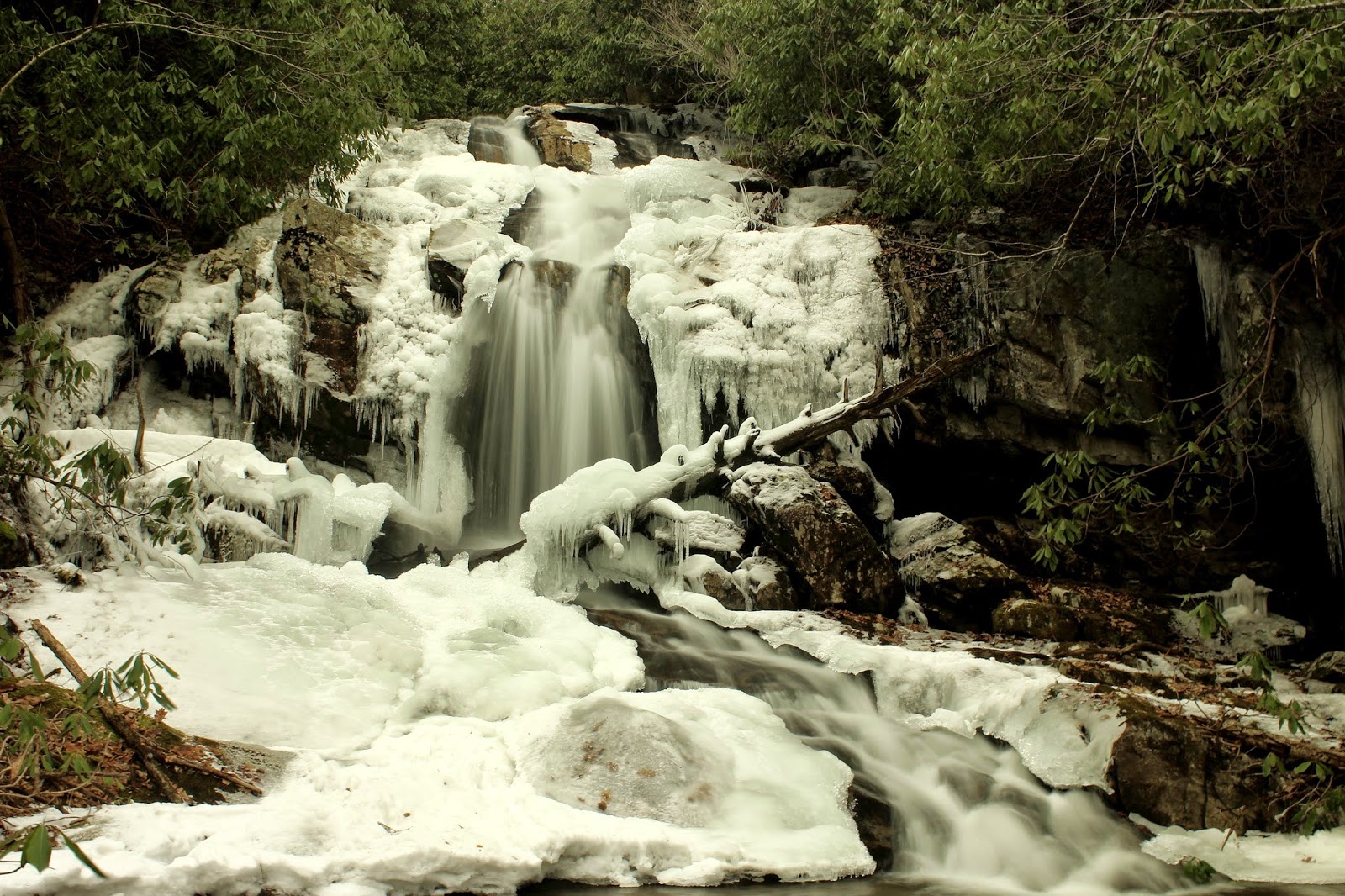
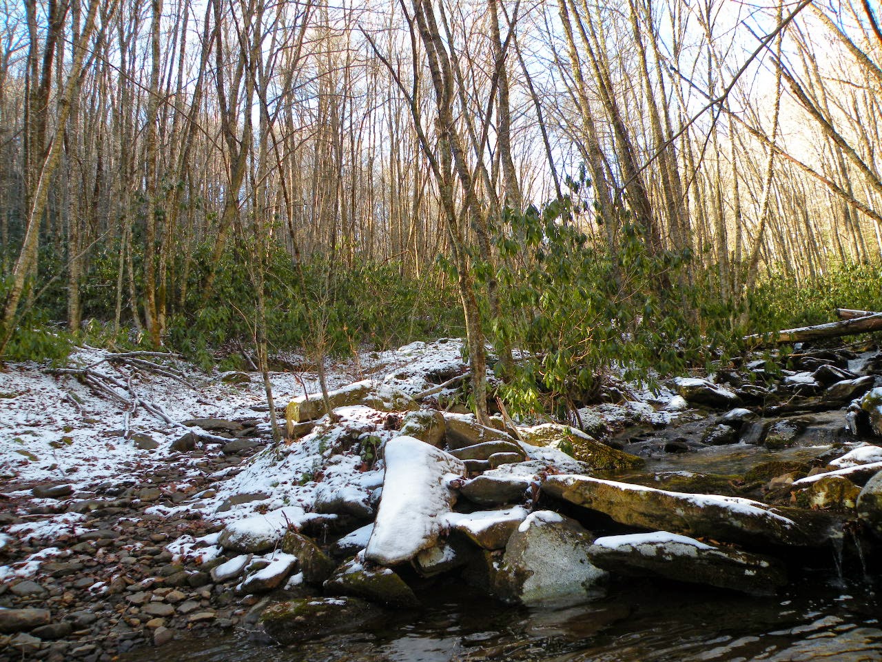
having passed Lost Creek Falls on the way.  It was looking good and we decided we'd eat lunch there and I could practice photography with the camera.   

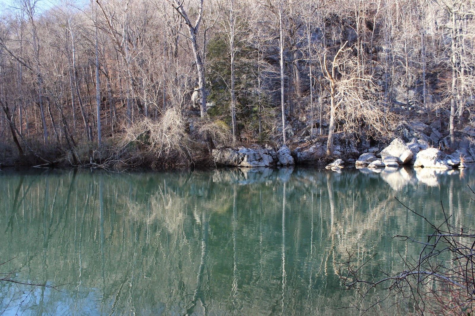
     The Caney Fork was huge today.    We made it all the way up the trail to where there is a sign indicating Foot Travel Only from there on.   The GPS indicated it was 0.7 miles to Virgin Falls. Kenny was interested in walking there from here. I was not interested in bushwhacking that distance over that terrain to Virgin Falls. That would have been one extremely rough 0.7 miles.  On the way to arrive at that point was something else.
We had to winch up the steepest bank we've done to date.   We had a wheel off the ground at one
point and we were both uneasy about the possibility of turning over. Kenny also had to cut downed
trees off the trail. I helped him clear the debris. Along the way  we found a small waterfall
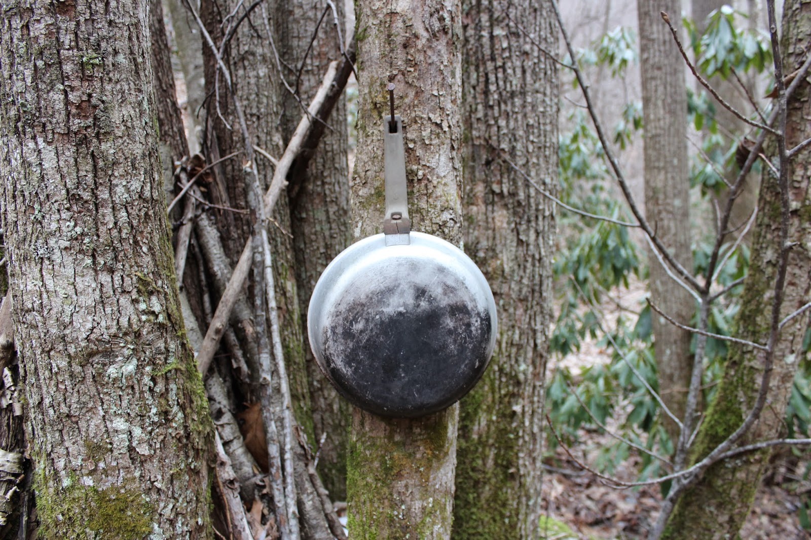
that looks to me to be a wet weather type.   It was pretty though and I got out to take photos.
 Caney Fork River near Big Bottom
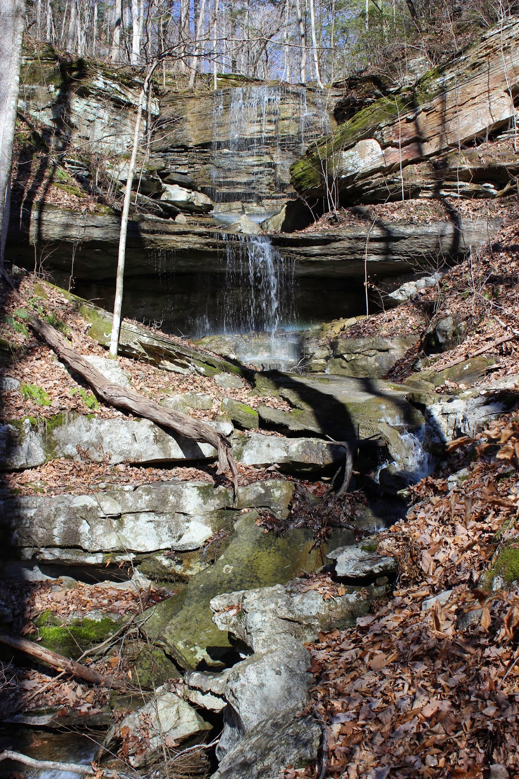
Small waterfall way on up the holler.

 Stone wall remnants along the trail. There was an entire community back here, but it is erased
by nature and the river now.
Wide, deep ford.  You can see the bottom here for quite a ways, but there is a deep spot that is running fast out past where you can see.  


     We saw a few other riders today just out messing around.   Since we could not get across 
we did not have much riding to do on this side of the river.  We left the trailer parked at the end and rode back up White Cave Road to Lost Creek Falls to eat lunch.   After some photography time and time spent enjoying the falls we sat down on some boards and ate a sandwich.
We met one of the riders we'd passed and spent some time talking with him. His name is Dan White and is local.   He was a very interesting and fun person to talk with.  He encouraged us
to go check out Welch Point while we were in the area and we promised we would.

   
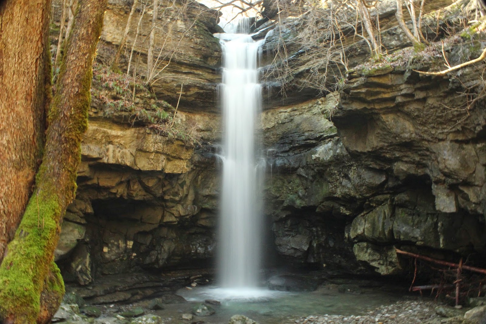
Lost Creek Falls today.


   We went back to the truck and loaded up and headed round to the other access point.
We had never been in this area before and had no idea what we were getting into.   We passed one road that was signed as an entrance for Bridgestone-Firestone but we weren't sure if it was the right way to go so we stuck with the Flowing Well Road.  It was a muddy, rutted quagmire, but
we did find the place to go in from here.   They are logging it and it has torn the ground up.
We went out through the pines in what looked like a tunnel!  We began heading downward losing 
elevation.   It was rocky, rough terrain.   We had the GPS coordinates for the Davis Cemetery.
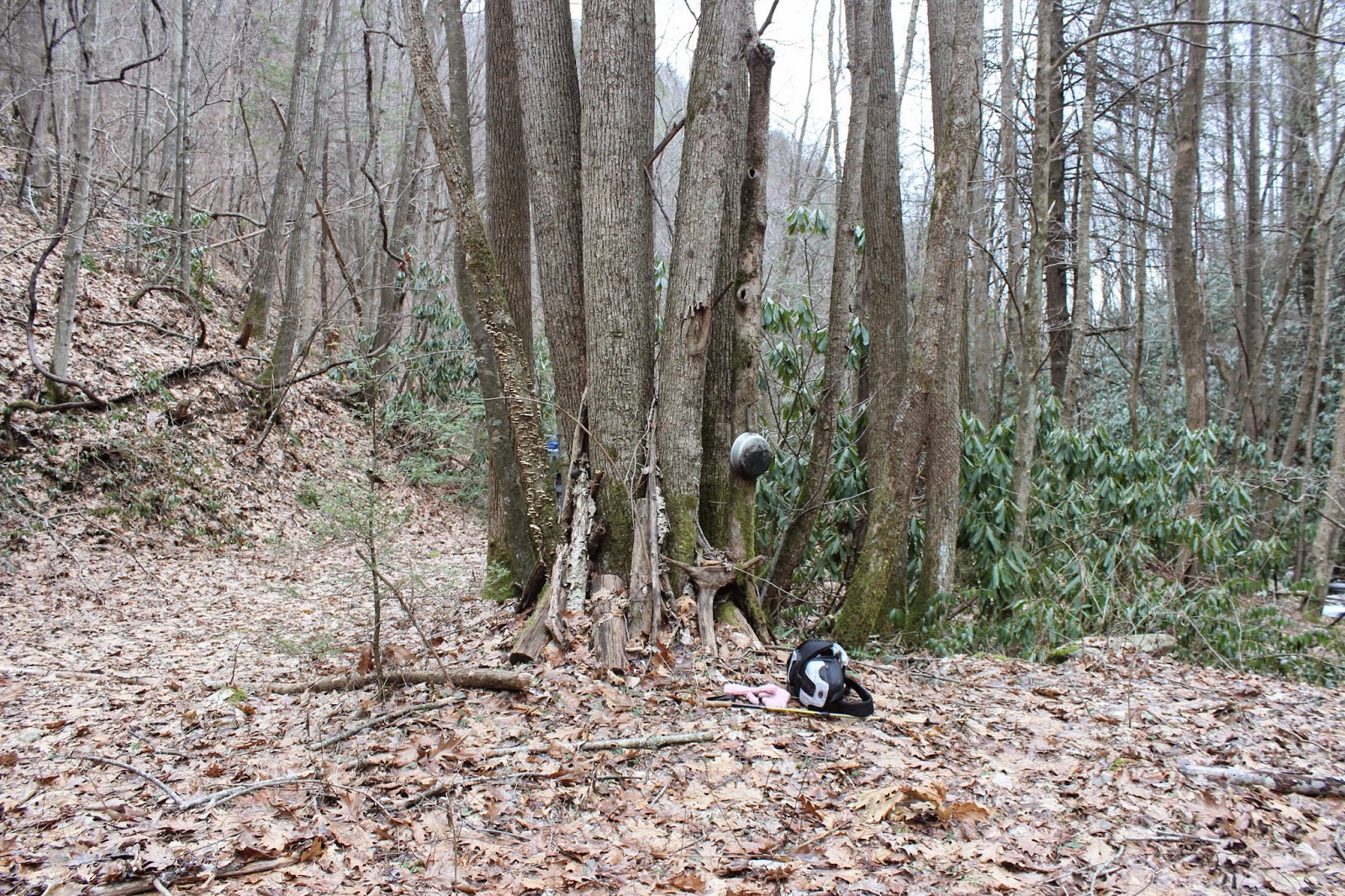
We knew we could take the ATV that far.   We finally made it there and were pleased to see it.
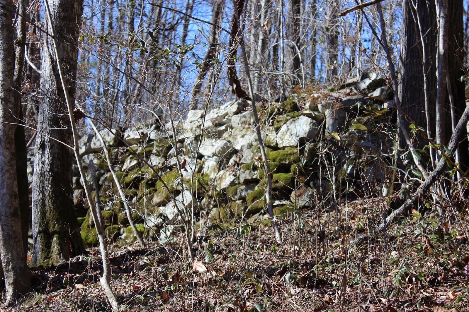
Davis cemetery. It is very remote and old. It has comb graves like some others in the plateau.


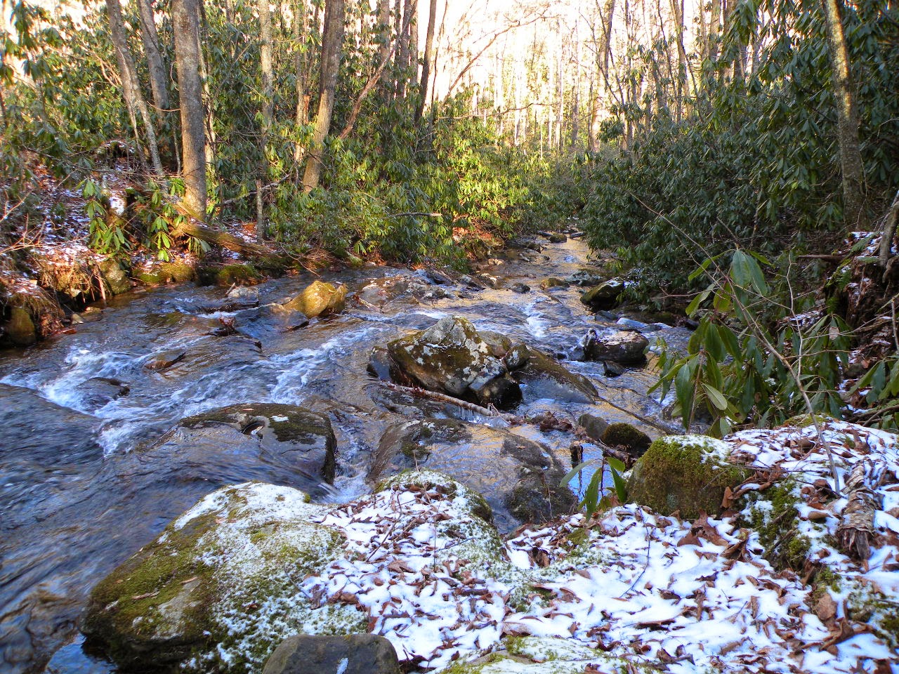
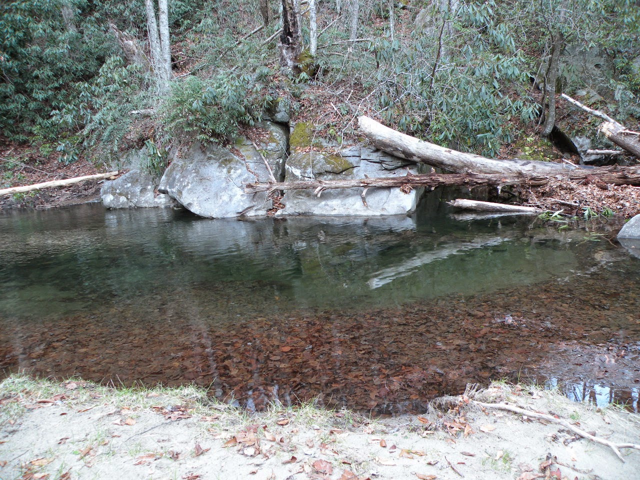
     We explored a bit further making it down to the Caney Fork and Fish Hole Ford.  The river has deep blue holes of water and spots where rapids gush past.   It was unfordable today, but Summer will have the water down and we'll be able to make our trip down here. We'll make a Summer trip to Virgin Falls and Rose Cave.  It will be a good time to swim.   
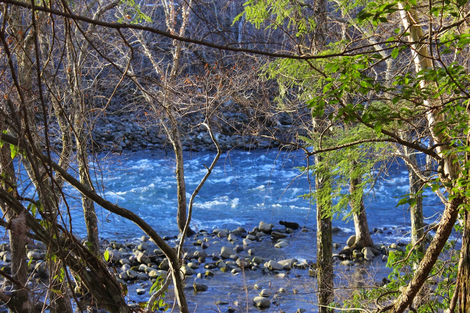


Top --Fish Hole 
Bottom -- a spot of rapids below The Fish Hole Ford


   We went back to Davis Cemetery and headed back in the direction of Big Bottom along the river.    The signs indicated it was OK to take the RZR on these trails.   We planned to go as far as the uncrossable ford we saw from the OTHER side of the river.   We made it and the ride was quite pretty.  We sat checking out the rapidly flowing waters of the Caney Fork a group of three or four other riders passed by on the far side.  They sat watching us for awhile. Probably wondering if
we were foolish enough to try to cross.   We were loosing the light quickly down in this holler. 
I was getting cold for the first time all day.   We began making our way and found some trails down in there that will make for another good ride in the future.  Fun trails that have whoop dee doos like a rollercoaster!    We made our way gradually back up over rocks and the steep slopes.  
It went easier than we'd expected.   Once we emerged from the pines on the plateau level we were treated to a beautiful sunset.   There is nothing like a sunset on the Cumberland Plateau.
Black pine tree silhouettes against the orange gold glow on the horizon.   The sky was painted hot pink, purple, orange, gold, lavender. We watched as it faded to a pink gold glow.
  
    We loaded up and headed back toward Crossville. We were muddy, tired, cold and dirty, but very happy.   Back at the hotel we got showered up and went out to eat at the Vegas Steakhouse and Lounge. It was delicious! We were glad we tried it.  Kenny had a steak and baked potato and a beer.  I had egg plant parmesan and a glass of burgundy.  It is a nice atmosphere for dining and the service was fantastic.  

                                 Day 2--Sunday

   Sunday morning we got up and packed, checked out and headed to breakfast.   
We enjoyed Shoney's Breakfast Bar.  They made their money off me today.  It doesn't make
sense to order the breakfast bar when you're dieting, but I did it anyhow. Sadly many Shoney's 
restaurants are closing down across America.   

    We planned to make an attempt to find Rogers Creek Falls and Puncheon Camp Creek 
Twin Falls today.   We had tried before.  Today we planned to go round and come in from another
direction.    We went round and approached from the west/ southwest.    First try today was
to come in as close as possible by road on Puncheon Camp Road.   It was a better mud bog 
four-wheeling event than waterfall attempt.  The truck was caked even more with mud.  We 
went as far as we could but only got within about 0.4 miles from the end of the road. 
The terrain past the mud road was unforgiving.  Pine plantation and deep gorge.  

    We turned around and headed back and tried again from Bryant Mill Road.  We were able
to park near a gate and walk back that way along an old logging road.   We hiked a very tough 0.6 miles across muddy fields, pine stobs, weaving our way through swamps, claustrophobically  close 
pine thickets, and down over the side of a steep bluff.   We managed to get within 50 feet of the falls and could hear it thundering and see it, but could not go further.  We had 100 feet of rope with us to rappell down, but no guarantee of a way back up once down there.   A crawl back up the bluff
and a hike out the cliff line revealed that the further east we went the worse the terrain got.  
The cliff line was deeper the more we went east.   I was exhausted and frustrated.  


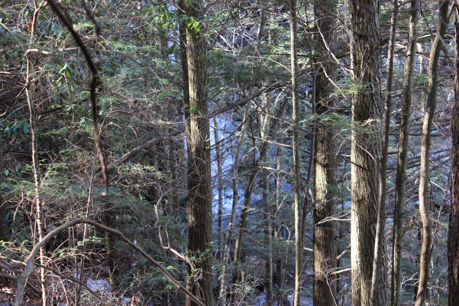
    Frustratingly close glimpse of the falls through the trees.  :-(

    We made our way back to the truck trudging along.  It was easier going back than it was coming down.   Once back at the truck we pondered what to do?  We plugged both the Crusher Hole in and the Welch Point GPS coordinates in and decided to go see Welch Point instead. I wanted a sure thing.  I was too frustrated to face anymore defeats today.    

    We ate lunch at Welch Point and soaked up the view.  We visited with Ken and Dave.. two fellows who have a camp nearby.  Their people are from the area and they were funny.
It cheered me up as did the pretty view.    We will come back and try those falls again another day.


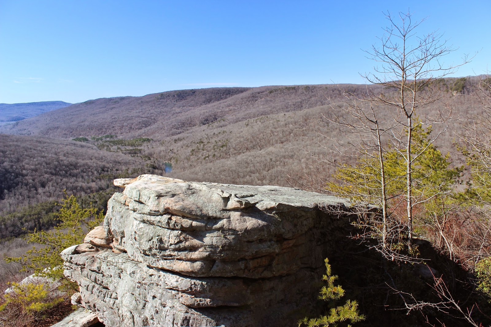
View from Welch Point.  

              
** Magicmomma's Crystal Ball of the Future**


 I see us making it to Rogers Creek Falls and Puncheon Camp Creek Twin Falls.
Visiting the Crusher Hole
Making a big day of hiking to all the Pollys branch area falls and overlooks

Tuesday, January 20, 2015

Lower Higgins Creek Falls Trip

See the Betty Butterfield Video HERE for 
the significance of a SKILLET* found out on the trail!  Mmmhellooo!

Lower Higgins Creek Falls Hike

Sunday Jan. 11, 2015
Dana & Kenny Koogler

Approx 3 mi. RT


   Kenny and I decided to visit some place we had not been for awhile.   I used to do all kinds
of hiking and bushwhacking and camping in the Northern Cherokee National Forest, but had really
slacked off in favor of other destinations.   We sat down together and perused my lists of possible trips.
Lower Higgins Creek Falls had been on our list for awhile and that is what we set out to do.

      We had to go through the usual logistical wrangling.  Being married to Kenny Koogler or 
best friends with Cathy Howell means one thing will always happen prior to trips.    We're going to
go over all possible route permutations.   Folks like them have one built in assumption for getting to a place.
"There HAS to be a better way!"  There has to be a shorter route, more direct route, one with less chance of
getting caught in traffic, etc.   So I have learned if I want to make my life a little simpler to do the math on the route options before starting out.   Dana just looks at the map and says "Eh, this will do." but I have  help satisfy the rest of the party that the best possible route has been chosen.    My tomtom navigation system and google maps had both said that going up I-81 and down I-26 through Johnson City to Erwin was the best way.   It was and so that is the route we chose.     

     It was cold and we had bundled up for the hike as it was cold, but clear.  The day warmed up to about 40 degrees.  We found the place with no problems.   We saw only one other vehicle at the trail head.
A deputy dropped on patrol and we spoke to him and began our hike.    It goes over a rotten looking 
bridge constructed of boards and maybe logs.   We followed the stream up.   It was not very hard, but the
trail was icy in places and rocky.   The stream was quite pretty and so were the woods. 

     About the time we arrived at the falls we saw our first fellow hikers of the day.
What a happy meeting that turned out to be.  We had been aware there were more falls along this stream and had the waypoints for the upper falls, but lacked any firsthand knowledge.  Our meeting of people included Martin Garrett and his pretty daughter.  He is as crazy about waterfalls as we are and is a wealth of knowledge about the area.  Both of them shared their knowledge freely. It was most fortunate. 
Instead of the plan we'd had to hike to Lower Higgins Creek Falls and go down to Rocky Fork... we spent 
our entire day here!  We made a new friend and hopefully it won't be the last time we are on the trail with him.   He gives accurate, easy to understand directions and the waypoints for the upper falls were 
no longer needed.

        Lower Higgins Creek Falls was partially frozen, flowing very well and beautiful!
It was one of those moments we wondered why we hadn't come here sooner?  

      Lower Higgins Creek Falls

      
Upper Higgins Creek Falls.. somewhat smaller but just as grand. 


      Today was practice day with my camera equipment.  Becoming so ill last December and spending three months recuperating played heck on many areas of my life.  Double vision was making my life rough just 
getting around and doing normal every day things.  I knew better than to tackle learning camera equipment during that time period.   Once I was well I found I still gravitated toward the easy way. Use the old, familiar Nikon or just use the new camera to point and shoot. I've been getting more serious about working on my waterfall photography skills and mastering the new camera.   I am still fighting with the ND filter as you can tell above.  Its improving though.

       We had to ford the stream twice to get to the Upper Falls.   Martin did a good job describing that as well.    The first crossing was easy and got me a standing ovation and applause from some lady hiking with Martin and his buddies!  Too funny.    The second crossing was icier and trickier, but Kenny helped me and 
it wasn't bad.  I can tell my balance and creek crossing skills are getting much mo' bettah.  My balance is
improved.    Higgins Creek has two other nice waterfalls between Lower Falls and Upper Falls, but there is no trail down to them.   We could glimpse them from the trail, but roped descents to them will have to be done on another trip.   We sat and ate our lunch at the upper falls.   

     We continued up a little further to satisfy our curiosity about what else might be up there?
We found a nice little slide and a small cascade in addition to the rest of the falls.  No trail to these either,
but you could tell other folks have walked down through the gentle slope to view them.  It was very easy.


       Top--upper cascade
Bottom--Slide below the upper cascade.

     We headed back down the trail.  We decided we'd see how we felt and what time it was as to 
what else we'd try to get into.   We had the GPS coordinates for the Rocky fork tract and thought maybe if
we were feeling froggy we'd hit up some of the roadside attractions.    
We had seen a side logging road taking off near a side stream on the way in.  Martin was over there exploring and shouted back that he had not been up there yet, but would get up there to look for falls at some point.    We later realized that was Burchfield Camp Branch and there is a waterfall up there, but it is small. It is on Tennessee landforms. Its about a 12 ft falls.    Further up the trail is part of the Rocky Fork Tract and the hidden lake. The name of it is Birchfield Lake I think.   It was a manmade lake used by the timber company who owned the land.  They built it as a reservoir of water to help fight forest fires.

       On the way back was when I saw it... the SKILLET hanging on a nail on the side of a tree.
We hiked the Rocky Bottom Gorge in NC for New Years many moons ago. There was a skillet hanging
in a tree that day too.  I launched into being Betty Butterfield with her whole whole lotta emotional problems most of which is existential.   The 49 second video on the link at the beginning of this blog entry 
tells about her being woke up hit in the back of the head by a 400 lb man with a skillet.  Her ex husband
is a double amputee Vietnam Veteran with PTSD and OCD.   She had to leave him because he was POW in his own mind!  My dark sense of humor flaring up again.

       We made it back to the jeep and it was 3:30 pm.   We are getting old and worn out.
We just wanted to go back to the house and flop down and be warm and together.  So that is what we did.
It doesn't take much to make me happy.  

Skillet on a tree. 

Mitchell Lick Scouting Trip

Mitchell Lick Scouting Trip 

Jan. 2015
 Dana & Kenny


Mike Gourley, Bob Marshall, and myself had discussed a shuttle hike from the Cherohala Skyway
all the way through Snowbird Wilderness to see the various waterfalls.   Someone in the past told me
they had done the trip that way and it was the ONLY way they'd ever go see Upper Falls on Snowbird 
Creek again.   Rough, but easier coming down that climbing up.    I also became aware thanks to Kevin
Umberger's doings that it was an area that is a maze of old logging roads and a good place to get lost.
I had a tough experience there hiking in the past and knew first hand he was correct.   It is not a place I'd
ever go hiking alone.    He had questions about where in the world "Mitchell Lick" was??

     Kenny and I decided to scout it and find out for ourselves.  It was rough going, but we made it there.
We stopped and had lunch at the gap at the top of the mountain.   It was so cold and the wind in the gap
was blowing pretty stiffly.    The only time we got real cold all day was sitting there trying to eat lunch in 
that infernal wind.      We motored on again and found ourselves in the headwaters of a stream out further.


         We finally got oriented and continued and made it down to Mitchell Lick.  
It is where the old King Meadows Trail #154 and Snowbird Trail #64 come together.   It is a large, nice campsite.   The intersection there also heads west toward State Line.  It is a lonely, remote, isolated spot
upon the earth.     It was hard getting there. It was hard getting back.  At the end of it all I was satisfied 
that I could find my way down through there especially with company and the GPS. 


Squally Creek Scouting for Waterfalls

Squally Creek Exploring

Dana & Kenny Koogler

Thursday January 1, 2015

Photos are here Squally Creek


   We really like the Robbinsville, North Carolina area and Graham County.   
A relative shared with us a tip about a spot he'd been recently with friends.  Back around Halloween.
We'd been keen to go since then, but did not get the chance until after the Holidays.    We started our 
New Year off in 2015 by hitting the trail and exploring.    

     We went up to West Buffalo and  hoped to see some pretty things along Squally Creek.
We were not disappointed as the stream is a series of beautiful cascades, small falls and slides.  
It is wild and green. It also has that gritty element that we have developed a taste for.


Squally Creek stretching on before us.  Looks like some in the Smokies without all the people.
Pretty cascade along Squally Creek

Another small falls along Squally Creek a little further up.
I think there are more falls, but need to go back and be prepared for some creek walking.

     We passed old abandoned trout farms, private residences, Unabomber type shacks, disused hunting cabins, and all sorts of sign of human habitation along the way.   It always makes me very nervous when I see the faded stars and bars flag flying over a shack.   Gulp!  It was cold and the deep shade here in this holler had snow lying about on rocks in the stream. Icicles hung in some spots.   


Snowy ford of Squally Creek . This little area on Earth is so lovely.

   We proceeded up into the headwaters and the terrain leveled a little bit.    It lies below Hooper Bald. 
We keep ambling around and before we knew it we came out to this frame for a shelter..


This is at King Meadows. After studying the map we think it might be possible to follow the drainage down
from King Meadows to Upper Falls on Snowbird Creek.  It would bring you out right at it, but it remains
to be seen whether I do that or not.   

     We ambled around in the mountains and found according to the GPS we were closing a loop.
We passed some hunting or fishing camps on South Fork Squally Creek.   It was so isolated an area it was hard to believe we came upon anyone! 


South Fork Squally Cascades, sunshine, snow!


We made it back to where we parked and this is what Squally Creek is like down at that elevation.
How do you like that coolin' board? 

We had a good time and will go back again. 

Chimney Rock and Lake Lure Anniversary Trip

Roses past season on the Flowering Bridge at Lake Lure.

30th Wedding Anniversary Camping Trip

Dana & Kenny Koogler
married Saturday November 10th, 1984

   
  Kenny and I first ran into one another when I was 12 years old and he was 13.  We
were at Indian Bottom Campground. I was there on a youth campout with the Baptist church.
He was there with a cousin, Kenny Gordon.  I met both of them for the first time. I was shy and didn't 
want anything to do with them.   I ran into him again when I moved and started the tenth grade of high school.  He was wild and loud and I still wanted nothing to do with him.  Little did I know that was going
to be my future.  I had no idea then that I'd end up married to him and have a family with him. I'm sure 
glad we did end up together.   We've been together for thirty-three years.  

    We wanted to go some place different for our anniversary.  We wanted to camp and hike, but 
Kenny's stipulation was that we were not going to do any extreme hiking.   I wanted to make at least
one waterfall hike to work on my CMC waterfall 100 challenge.   We got to talking about it and realized
we had not ever visited Chimney Rock State Park and Hickory Nut Falls.   Crystal and Adam and the rest
of the family had been to Lake Lure many times and loved it.  We figured this was the place for us. 
We'd check out the Chimney Rock State Park and Hickory Nut Falls.  I'd be able to scratch one off my waterfall 100 list.   We could try some new restaurants and do some shopping.  It was going to be fun.

      The problem I had not expected in hunting up campgrounds in the area was the time of year.
Many campgrounds in the area close up October 31st.    We were heading over the weekend just prior
to our anniversary.  I finally found a Good Sam rated campground on past Lake Lure. It was Rutherford
Mountain Campground. The photos of it looked nice.  I spoke to the owner on the phone and he was 
very nice.   We'd stay there and it was a solution to our dilemma.   The drive through the area was gorgeous!
We got set up at the campground and decided to go through Rutherfordton just to see what it was like.
It is a quaint town and the mountains around it are too pretty!  Great views and the Autumn colors were peak there.   We got the few grocery items and a movie at Red Box in town.  On the way back toward
the camper we decided to stop and try a local eatery for a nice meal.   We ate our anniversary dinner at 
Scoggin's Steak and Seafood House.  Lord have mercy!  That place is great and we will make a point of going back!   They have light houses painted on the walls.  I went down through there looking and out of a dozen lighthouses I had visited nine.   I cannot recall which ones I still needed, but that was my growing up.
Outer Banks NC twice a year then still going there when I got to be an adult.

   Saturday morning was chilly, but clear.  We got ready and headed over to Chimney Rock State Park for the day.   We stopped by the Flowering Bridge in Lake Lure on the way.  It was quaint. The views from up top of Chimney Rock were incredible.

     
Chimney Rock


View from up top of Chimney Rock


One shot of the flowering bridge.


We hiked all we could at Chimney Rock. Up those stairs and out the mountain til it ended.


Here is a very bad shot of Hickory Nut Falls. I forgot and left the SD card out of the camera.
I had to do the best I could with what I had. I went back a second time and got shots of some stuff, but
the best I had for Hickory Nut Falls was a zoomed in shot from the parking lot across from it.


Another view of the Flowering Bridge.


     We had a great 30th wedding anniversary trip. We liked the little town of Chimney Rock.
Living near Gatlinburg though.. it is a lot like that.   I did love some of the funky antique shops and would
go back again.