Purple Phlox growing in Ozone Falls SNA
Ozone Falls State Natural Area
Sat. April 29, 2017
Dana & Kenny Koogler
Pictures are here beginning with frame 616
I recently learned of a falls close to Ozone Falls. I had seen Chris Oliver's photos of it.
It was really pretty. I decided that while I would not make a special trip to see it that I would
go visit that waterfall next time I was over there. I made one attempt and got to thinking maybe
it was not a good idea once I was there. I was not sure at the time if the property was private.
It was heavily posted on the far side of the stream. I decided to put it off and check on the
access before going. I found Tennessee Property Viewer which Bryan Taylor told me about
long ago. I was able to use that and check to see about the ownership of the land. I was happy to
learn that the state of Tennessee was the owner of the property and its access road! The posted land
was the tract on the far side of the stream only. Once I had this knowledge I made plans to return
with Kenny to see the falls. We had not been riding in the Dogwood Area in several years.
We'd make a day of it.
We got up and started our day. We loaded up the RZR and brought it over to Cumberland County. I had been concerned about how we'd park the truck and trailer at the trail for Fall Branch Falls. We parked across from Ozone Falls to start with. We walked over to see Ozone Falls first.
Not a soul at the trail or the falls this early in the day. We could hear the falls way before we ever got
near it. It was the most water either of us had ever seen coming over these falls. Good news since that meant the second set of falls should be worth the visit today!

Ozone Falls was roaring and beautiful today!
Once we had taken some time to enjoy the beauty of Ozone Falls we walked back to the truck.
Two persons were there now getting ready to hike to the falls. We unloaded the RZR and got in.
Now is when it comes in very handy to have made this buggy road legal. We jotted down the road the short distance to the trail head for Fall Branch Falls. No worries now about parking. Once there
Kenny deemed he could have both parked and turned around. I had no way of telling for sure. It looked tight to me, but he is used to seventeen point turns. It was only 0.3 miles back the old road
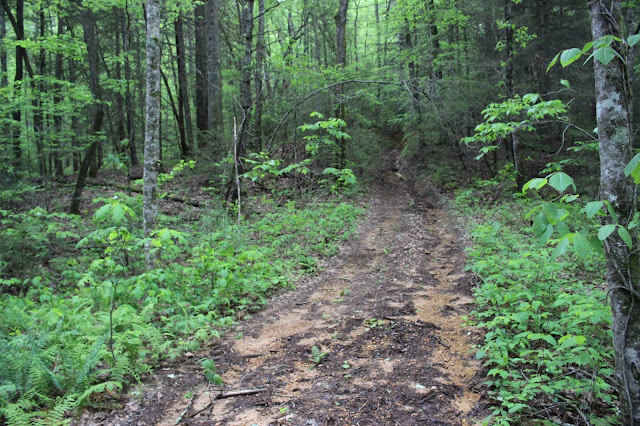
to Fall Branch Falls. The road is rutted and has deep holes of mud and standing water. We came to a point where another stream flowed down and crossed the trail. This had to be it. Sure enough the old road continued straight, but one arm of it curved left and stopped. We walked the short distance up the bank. The woods were open and the going was pretty easy. The forest was mainly hemlock.
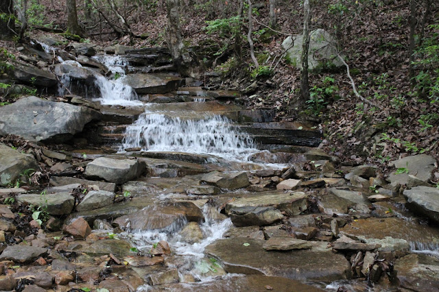
It was a gorgeous setting. The stream was flowing down the slope in a series of drops. Large boulders coated with moss and ferns sat in this holler. The falls was quite pretty.

Above is one of the lower drops of Fall Branch Falls.

Here is the uppermost drop of Fall Branch Falls. It is very picturesque.
We wandered around the creek and the banks for awhile enjoying the falls.
The forest itself was such a pretty setting. Once back down the bank we continued on the old road
and explored a little more. We saw the point where the stream for Ozone Falls empties into the branch. There was some little structure over on the other side. It was a shack. Don't know the history on that one. We did go back in Renfro Holler a little bit. We did not venture too far in since
it butts up against Renegade Mountain and that is private property. It is ok to be back there.
I had originally provided directions how to reach this. I am not going to do that anymore. Not trying
to be selfish. I posted directions to some places that I thought folks could benefit from. I also posted
as accurate an estimate of the difficulty level as possible. I had someone bring two things to my attention. One fellow said he didn't always trust guidebooks and maps and how much less he'd ever
use a blog for directions. Another thing that happened was someone used my directions to try to located a land form and was unsuccessful. They were ok, but felt that the directions being available
provided a temptation to try it. So for these reasons 1. I'm wasting my time and 2. I'm possibly providing a temptation that may get someone hurt or killed.. no more directions. I will continue to share info with my core group of friends, but that's it. My giving people the benefit of the doubt is not always a good thing. I am a rough creature and my assessment of the difficulty is probably not accurate.
Just know that the falls is there. It is listed on Tennessee Landforms here
Waypoints for Fall Branch Falls Also know that it is on public land and it is ok to go. Just find it yourself. It is an exercise in navigation. It is a pretty easy one.

Below is a short video of the various drops of Fall Branch
And here is a video of the powerful and stunning Ozone Falls today
We loaded the RZR up and headed round to the Alloway entrance to Dogwood riding area.
We were on the trails pretty quickly. No one else looked to be there to ride. I had recently realized we only thought we had found and seen The Basin. No. The Basin is up at the far end of that holler. I wanted to see it. I figured there would be a good waterfall there or at least it would be pretty and interesting. We had seen Basin Rock and Basin Falls. I wrote down all the waypoints at home and walked off leaving them lay on the desk. We did not find the basin today. We did find
the access point off Highway 68. Don't know that we'll ever need it, but its good to know where it is and that it is usable. We did find the cut across trails we had never seen before. We found some pretty streams and rock forms we had never found. It was very pretty. It started to rain on us.
We put on rain gear and ate lunch at some point. We continued exploring and trying to find our way
ever closer to the basin. We got within 0.2 miles. I knew it would be a foot trek from there and by now it was raining steadily. We decided to bug out.
We stopped to talk to some guys we met who were riding also. I asked them if they had ever been to The Basin? They said no, that it was a walk to it and they had not tried it. We discussed how
the trails were messed up by logging. They also informed us that access to Basin Rock and falls was now cut off by the land owner. Folks had been abusing the privilege of going there. Building fires ON the rock and littering. Sloppy behavior that ruins it for everyone. We were glad we got to see it before access to it was lost. It is now fenced with barbed wire.
We will come back and try again to find The Basin. I also want to find the house ruins near Black Mountain Rocks. Just gives us something to look forward to.
Wet weather falls today. the trail and the stream are one and the same.
muddy trails through a beautiful forest
Deep dark hemlock woods
Pink lady slippers we saw. Found a large patch of these.


No comments:
Post a Comment
Thanks for reading and commenting. I enjoy hearing from those who read & make use of my blog. I have made some wonderful friendships through emails from readers. I respond to all comments and emails. I appreciate folks reaching out to let me know when my blog entries are not functioning correctly or if the situation somewhere has changed. Many Blessings to you!
Dana 🐝