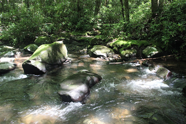
Above is a photo of the ford of the Tellico River on this hike
Tellico Falls & Upper Tellico Falls Directions
Driving Directions from Tellico Plains, TN:
From the Intersection of SR 68 and Hwy 165 Cherohala Skyway in Tellico Plains travel east on 165 for 5 miles to bear RIGHT onto River Road. (River Road is the one that goes up to Bald River Falls) Stay on River Road for 17 miles. You will pass through Green Cove and pass numerous campgrounds along the way with the last being State Line.
All have restrooms, but State Line is the last place for a bathroom break unless you just want to pick a bush.
Once you pass the vault toilets for State Line on your right you are very near the next intersection. River Road will continue and on some maps changes to "Davis Creek Road", but follow it ahead to where it will bear right to cross a bridge. The road is paved up to this point.
Look for a continuation of River Road that goes straight instead of crossing the bridge. If you have a vehicle like an SUV or truck with reasonable ground clearance and good tires you can continue to drive for about another mile on this gravel road. My jeep is a stock vehicle and it made it like a champ.
You will follow it to its end just shy of a campsite on the left.
Park here and the hike begins
Hiking Directions:
Walk from the spot where you parked about 0.20 miles to a ford of Tellico River which by now is more like a creek. Despite it being narrower it is still always an over the top of your boots wade. Come prepared with water shoes or old sneakers and ford here. If the water levels are high from heavy rains turn around and plan to hike it another day. It is unsafe in high water. The photo at the top of this directions page is the ford in normal water levels.
Once across the ford you will bear right on a faint but obvious path and go 0.10 mile to a ford of Peckerwood Creek coming in from the left.
{There is a falls upstream on Peckerwood Creek, but there is no trail. It is 100% creek crawl or rhodo bushwhack. It took us an hour to go 0.20 miles! }
Cross Peckerwood Creek which may also be over your boot tops so its best if you can just leave those water shoes on until you make this ford. Once you cross this stream walk ahead on the main path for 0.50 miles to Tellico Falls. Upper Tellico Falls is about 200 feet further on the same path.
Below is a photo of Upper Falls on Tellico River
This falls is viewable from the trail. There is no way down from this point. It is a sheer drop.
Turn around and retrace your steps the way you came.


No comments:
Post a Comment
Thanks for reading and commenting. I enjoy hearing from those who read & make use of my blog. I have made some wonderful friendships through emails from readers. I respond to all comments and emails. I appreciate folks reaching out to let me know when my blog entries are not functioning correctly or if the situation somewhere has changed. Many Blessings to you!
Dana 🐝