Friday, November 2, 2018

Huntsville Falls & Abandoned Railroad Tunnels on Phillips Creek

Red leaves at the edge of a field in Huntsville, TN


Huntsville Falls & Abandoned Railroad Tunnels on Phillips Creek 

Kenny & Dana Koogler

Saturday Oct. 27, 2018

Total hike distance 2 miles RT

Waypoints for the Phillips Creek Tunnels
South Tunnel 


(Tunnel Directions updated as of August 2021 with an alternate approach as promised)


Pictures

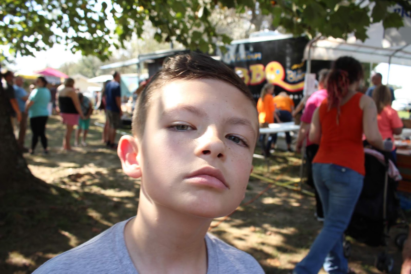
Jared & Gabe in our living room

  I had been wanting for some time to see a number of separate features in the Huntsville, TN area.
We sat down and talked it over.  We decided to just take the jeep and hike instead of go riding.  
We figured it was going to be too much jumping around to make it worthwhile.  We also had 
Crystal & Adam keeping Gabriel for the day so we had a shorter day to explore.   Jared came up and visited with them and helped. Bethany, Averie and Walter also came over. Gabe had the time of his life being treated like a golden child by Averie!  She even got him to eat!   He had fun and so did we.
It was great to get a day out as a couple.
 Above and below: Averie Lindsey and Gabe Koogler


    We stopped by Huntsville in Scott County and easily found the old jail and the waterfall behind it.
It is called Town Spring on Google maps, but on Tennessee Landforms it has the designation 
Huntsville Falls.    A short distance past it is Paint Rock Creek Cascade.  It is on the old Litton
Covered Bridge Road, but that is all private property.  I read in the paper that while it is technically still a county road it is hotly contested by the folks living out that way.    They want it closed to traffic.   It wasn't worth taking the risk or upsetting someone over seeing a six foot high cascade.
I also lost interest in going out that way once I found there was no longer a covered bridge on it. 
Below: the old Huntsville Jail right in the middle of town
   
IMG_9050

IMG_9052
Old Town Spring Park
IMG_9048
Huntsville Falls aka Town Spring. Hard to tell from this photo, but it is a fair sized waterfall. It is about 20 ft high.
Above: the set of steps leading down to the falls.  It provides an observation platform to view the falls

Below is a short video of the waterfall. It would not be worth a special trip to see by itself, but if you are in the area it is worth the short time and effort it takes to visit.


     We had several things we wanted to see so we did not tarry long.  The day was drizzly and overcast.  A fine mist of rain came down periodically and it was cold.  The colors on the drive had been very pretty though.   We did some recon prior to the visit as it related to access points for finding the abandoned train tunnels.     I am not including directions to these on this blog.  They are visited a fair amount by people, but technically the property is still posted.  I don't know if that means the land owners really don't want visitors there or if it is posted mainly to prevent them from being sued by someone who might get hurt.   I could easily describe how to get to the tunnels, but I could not really tell you how to get to all the stuff we saw while wandering up and down the creek and through the woods.  I'd get you lost for sure. 

      We pulled over through a field and I was pleased how well my jeep handled the rough terrain.
We had to go through one muddy spot, but it didn't stop us.   We came to the crest of a hill and could see before us the current railroad in the distance. Below us lay the oldest railgrade and between the two lay a road that was the remains of a third rail line.  It had to happen between the two time periods. 
 The current railroad is at the top of the far hill. At the base of this hill is the oldest rail grade.
 First look at Phillips Creek
Old railroad tie that has washed downstream

  Phillips Creek is a fair sized stream.  Bigger than we anticipated.  We had to end up fording it a couple times.   We stayed dry which was amazing.   We had not planned on creek crossings.
Once across we came to the gravel road which was the rail grade that hit during the time period between the first one and the current one.    Hunting tunnels is a little like hunting arches.
Harder than hunting waterfalls because you don't have as much to go on.  They don't have to have a stream.   We missed a few turns, but we would have missed some spectacular scenery if we'd found the tunnels right off.   
Phillips Creek Autumn dark
Phillips Creek.    We crossed right upstream from this spot.

Phillips Ck tranquil pool
Above: Looking downstream on Phillips Creek. What glorious Autumn colors!

We wandered up through here in our search.  It was not necessary as it turns out, but had we not done so we'd have missed some pretty stuff.    The old rail road cut went through here and to me this looks a bit like a tunnel it is so narrow and dark!  Just beyond this we climbed up over a berm of earth and walked on the far side of the stream.  We ended up coming down a finger of land to the confluence of Phillips Creek with another side stream!  From here the stream got stronger and prettier with more water.  
  I found a place to ford and kept going until I got a good view of this small, scenic cascade.

   cascade on phillips ck

  The area is a maze of old paths and rail cuts.    Finally Kenny said we were closer to the southern tunnel than the north one.   The smartest thing to do was go in search of that one and double back looking for the north tunnel.  We'd bypassed it somehow.  I guessed it was on the opposite side of a bridge we crossed on the gravel road.   It was one place we did not investigate.   While in this spot hunting for the south tunnel Kenny hollered out that he could see it.   We went down stream a bit further and sure enough we come to the South tunnel. It was really pretty, but I could tell it was not what I'd been looking for.  Something was off about it.   
Below: South tunnel 
   IMG_9105
   
    Kenny pointed out something to me that I had not paid attention to.  The stream flowed then disappeared underground!  Very unusual for this part of the Cumberland Mountains. You see it frequently in the Cumberland Plateau.    It was apparent that the stream turned out this way due to the railroad coming through.  The very first time I saw a photo of the South Phillips Creek tunnel I was intrigued and wanted to see it.  At the same time I had that something isn't right about this photo feeling.    What was wrong was WHY is water flowing out of a tunnel where the trains used to run? 
Water and railroads don't go together well.    The answer was simply that the original tunnel didn't have water flowing through it.  The stream ran by in its channel and the tunnel alongside it. 
Later when they found it necessary to close the tunnels and reroute the line, they blasted this tunnel's floor and diverted the stream.  During times of heavy rain and flooding the stream flows through the tunnel.  On the far side is a 10 foot falls.   The rest of the time the stream flows underground.  We walked on down past this point and saw that it does this a couple times coming up and going back underground again!   Water stood in the middle of the tunnel, but it was not real deep.  It was common practice to "daylight" abandoned tunnels.  They'd be blasted so they were open on top.
I am glad they didn't blow all of them up.   
   

 Phillips Creek flows
It pools up and then goes subterranean. The dam here is the newer rail bed.
 Kenny near the mouth of the south tunnel.


I am standing at the mouth of the tunnel just inside it.  The shimmer on the floor is the reflection of the far end in the pool of water in the middle.  The two channels along either side must have been the level of the old floor. 

    I debated going through the tunnel, but Kenny discouraged me from doing so. It was slow going because everything was super slick.    He felt like it was too unstable and just didn't want to attempt it.    We walked the newer rail bed and went back down that to the far end and it was faster for sure.
We then had to climb down over the bank holding onto trees to get down where we could see the far end of the tunnel.   It was rather pretty. This is the end where the waterfall is if we have lots of rain.


Far end of Tunnel #14


You can't tell it from this angle, but this is the brink of what would be a waterfall. just outside the tunnel.

   We walked the old railbed down a bit further.   We enjoyed the Autumn colors and scents.
It felt so good to be outdoors getting some fresh air and stretching our legs.   We strolled back at a leisurely pace.   We hoped we'd find the other tunnel too.   Kenny was in full engineer mode.  He was studying the way the old railroad must have run. You could practically hear the wheels turning in his brain.   He was figuring it out fast.    He sent me down along the old railbed in one direction to look for a path to the left as we headed out.   He doubled back to look where he thought it might be.
It was only a matter of seconds til he hollered to me he'd found it.   He indicated for me to head toward him.    Sure enough across Phillips Creek was one end of the tunnel. The cut here was narrow and steep sided. 
Below is the first entrance of the north tunnel.  Beyond the berm of earth the tunnel was powdery dry!   We were able to go clear through it.  It was in good condition. 
Below the north entrance of Tunnel #13.  you can see brick work on either end of this.

  We were thrilled to have found both of the tunnels.   It was a neat experience.  Other things we hoped to do today, but ran out of time.  

  Tunnel #15 at Robbins TN
The Eternal Flame and Puncheon Camp Falls at Norma
Glenmary Coke Ovens and Powder House
Tank Springs at Lafollette
Lafollette Coke Ovens

     Two of these are on Tennessee Landforms.  Tank Springs is on Google maps.  
The rest is not.    Suggestions for anyone who might be searching for something interesting to check out.     
    

    We hiked back to the jeep easily.  We grabbed some lunch in Oneida and headed home.
Just a short outing refreshed us greatly.    Gabe had a good time playing with his cousins.  

Below is a 10 minute video of the tunnel search and find.  Longer than the usual videos for me, but that is the readers digest condensed version of half days adventure.


Thursday, November 1, 2018

Allardt Pumpkin Festival


Allardt Pumpkin Festival

Saturday Oct. 6, 2018

Kenny & Dana Koogler
Michael and Tessa Lindsey
John Ungerer


    We had been to the pumpkin festival one time several years ago.   We liked it so much we had
often talked about going again.    It was a cold, rainy day that time, but we had fun despite the 
weather.    We had a weekend opportunity to take our older two grandchildren and spend it with them.  They seldom get to do anything with us unless Gabriel is along. They love him as we all do, but he is a little fellow.  Two year olds demand lots of attention.   We planned to meet our
friends over there. We had a good time visiting with John, but Sharon's daughter was taken ill
in Florida. She had to go down to see about her.   We had a nice sunny day, but it was rather hot for October.   I think we all preferred cool and rainy to the heat!   We were so ready for it to cool down and stay cooler.   

     We noticed there were lots more people this year than the previous time.   We also noticed
that the pumpkin festival itself had far fewer pumpkin entries.  The focus has shifted and gotten very commercial.   We enjoyed the old car show.  We checked out the pumpkins, giant watermelons, gourds and such.    We walked around and checked out the various vendors and food trucks.  We had some really good barbecue for lunch.   The kids played on the playground.
It did not take long for us all to tire of the heat and the crowd.  We were ready to get out of there after only a couple hours.    We had a pretty good time, but any future trips will be to some other festival for Autumn.    Maybe we'll try the Mayfield Dairy Pumpkin Patch and Corn Maze next year.   


 Granddaughter Tessa age 5 Papaw and grandson Michael age 9 in the background. Old car show.
 Kenny's fantasy car..


 Giant pumpkins! 
 Above and below.. kids at the bouncy house

 crowds of people
   Michael throwing attitude!  

Tuesday, October 9, 2018

Exploring Off the Cherohala Skyway-Swan Cabin & Cold Branch Falls

green headed coneflower

Last green-headed cone flower lingers into Autumn


Exploring Off the Cherohala Skyway--Swan Cabin & Cold Branch Falls 

Dana Koogler Thursday Oct. 4, 2018


  I got a chance to go hiking Thursday.  I looked over my wish lists and finally settled on 
a trip to some spots off the Cherohala Skyway.   I've had a heel that is really smarting so I
would have to plan lots of shorter adventures with plenty of bail out opportunities if it got
too bad.    I drove down to Tellico Plains and it was a beautiful Autumn day.  Up at the high elevations it was sixty-six degrees and sunny.  Lots of puffy white and gray clouds 
and some fog up that high.   I had wanted to hike out to the Swan Cabin and explore around it.   I found the gate unlocked, but  I parked just inside it and walked.  I did not know if anyone would be renting the cabin, and I did not want to be rude.   I hiked the short distance in to the cabin to find no one there.   I had learned of a slide type falls behind it.
I wanted to try to locate it.  I had no way points or information other than the fact it existed.
Above and Below-- photos of the cascade I found very close behind the cabin. I did not believe this was really the "Swan Slide".  Turns out it wasn't!

   I found a sign pointing the way to the falls and a rail fence with a gap in it. A video I
watched indicated the folks hiked back through that spot to reach it.   I went ahead and
quickly found the same conditions they did on the video. Lots of rhodo, but it got worse.
Huge downed trees and an absolute wall of rhodo.  I found a small cascade, but it did not look right to me.  I could not recall exactly what size the "Swan Slide" was. I knew it was not a huge waterfall, but this still didn't look it.  I then wondered was I mis-remembering it?  Was this it and it just had less water on it?  That couldn't be right. Cold Branch had more water coming over it today than I'd ever seen before.   I did some snooping around, but could find no way to progress. No signs of others pressing on in any direction.   I finally decided with a hurt foot, being solo and a long way back
 in the mountains it would be best to gather some more info and come back with Kenny to hunt further another time.  I learned after getting home and watching the video another time sure enough that was NOT the Swan Slide.    (watch the video at 12:49 to 15:59 )  **Edited to Add**
Per "Chuck" Francis....... the Swan Slide is a very short hike.  Instead of going through the gap in the fence bear right onto the trail to it from the road before the cabin.   It goes higher and avoids the downed trees and the low cascade I found.   Thanks my friend!

     I doubled back and took some video footage and photos of Swan Cabin.  It is a pretty spot.
The start of Autumn color was in the trees around it.  All down the lane were blue and white striped
gentians and asters of pale lavender.     I waded out into what is known as Swan Meadows beyond the cabin.  It was the first time checking this out.  Not a lot blooming, but a few things.   A few ladies tresses orchids, stiff gentian, haw bushes with bold red berries, lots of beautiful goldenrod wands, white asters, and lots of hitchhikers. I came out covered in them!  Briar scratches all over my legs.
It was still pretty. Meadows in this area come in different flavors.   What is known as a meadow may have been allowed to grow up into a second growth sized forest. It may be kept partially mowed and maintained or be anywhere in between the two.  Swan Meadows is a tweener.    It is still pretty.
I would like a chance to return and see what it is like in Spring and Summer wildflower wise.
Maybe I can find Swan Slide and check out flowers at the same time!  I hope so.   The road coming up here from Santeetlah is closed several months of the year.   


Swan Cabin in field

Above: Autumn is coming to the high elevations around the Swan Cabin


trees with fungi shelves
Wall of rhodo and tall trees with shelf fungi near the stream 
fence around swan cabin

The gap in the fence is where the trail starts to the slide.  I wonder if it would be easier to come down to it off Bob's Bald? 


path with leaves
This path heading west straight out from the cabin goes to Cold Branch as a water source. It continues in the direction of Strawberry Knob and the  FR 81 and 81G
front view Swan Cabin
 Straight on view of the Swan Cabin
Swan Meadows
My first glimpse of Swan Meadows
Autumn colors coming to Swan Meadows
 Some color comes to the Meadows
The bright red mass you see bottom left is a haw bush.  May haws make delicious jellies!  
Very tart. 


goldenrod
 Goldenrod blooms in the meadow

Mayhaw fruit
Above-- close up view of Mayhaw fruit
Mayhaw berries  are a very Southern fruit
 Smilax leaves have turned red!
 Asters in the field
 The sky changed every few seconds!
 Nodding ladies tresses orchids in the meadow
 Stiff Gentian in the meadow
 Profile shot of the Swan Cabin
 Decorative Gentian.. striped blue and white! These bloomed all along the road

Road to the Swan Cabin 


Cold Branch Falls 


  Once I had satisfied my curiosity about all things Swan... I walked back up the road to the jeep.  I sat down and cooled off.  I drove back down to a pull off above Cold Branch Falls. 
I ate a sandwich and once I was done I walked down the road to visit a waterfall by the road.
The heel of my left foot has been hurting like a son of a gun lately.   I was hobbling like Chester off Gunsmoke.   I managed to crawl down over the bank and take lots of pictures of the lower falls on Cold Branch.  It was the most water I'd ever seen coming over the falls. What a beautiful early Autumn day.  The high temperature for today reached sixty nine degrees.  It was nice.   I saw parts of this waterfall I had never visited before. Previously it would not have been worth doing what I did today.  I climbed all the way up and down it and crossed the creek to the far side to get shots from over there.   I stayed an hour or more.   I really enjoyed it and lost all track of time. My weary soul was soaking up negative ions like a sponge.  I was totally chill.    I was fine until I got ready to leave and then the heel pain reminded me that while my spirit was willing to do a great many things.. my poor body was ailing.   By the time I hiked back to the jeep I had popped out in a sweat from the pain.   I took some motrin and got off my feet.   
 I approached the falls so close to the top here is where I came out.  I was right up in it!
 The brink of the falls
 Middle ways down the falls. Another new viewpoint for me of this waterfall

The near side of the falls had water flowing on it today!  

 I worked my way across the stream to get this viewpoint
 Standing mid stream

Lower Falls on Cold Branch 


Above is a short pretty video of various views of the falls

Santeetlah Headwaters

    Initially I thought I was done for the day.  The motrin began to kick in along with my usual heavy dose of nosiness.   I stopped to take pictures of lobelia along the road. Butterflies nectared on these pretty blossoms.  Sunflowers and what was left of jewelweed lined the roads.   It was still very green around this part of the forest, but the leaves were turning yellow and brown and falling.   I got some nice shots of falling leaves in my videos.   I was driving back toward the Skyway when I noticed that a usually gated road was open.  I could not stand it and had to turn aside and follow it.  I believed it would end pretty quickly at a gate, but I was pleasantly surprised to find it went on for a good distance. I realized I was making it up into the Santeetlah Creek Headwaters. This is a place to look for unexpected waterfalls and massive trees!  It is also a place you will probably have all to yourself.    Finally I did come to a gate and
had to turn around. It was a quiet, beautiful drive with lots of scenic cascades along the way. 
During a time of heavy rainfall or good water volume like now it would be worth walking the road past the gate.  The road dead ends at a gate high in the mountains.  Looking on the map the road number changes from FR 81C  to FR 2654.   Continuing on foot would bring you out on the back side of Little Huckleberry Knob and beyond.   Based upon what I saw up in here I will be back.   It is beautiful and tranquil.    I spent time walking the creek and photographing a few un-named cascades and pretty Autumn leaf scenes.    
The last of the great blue lobelia and spotted jewelweed along the forest road
 Cascades along the creek
 Further up the stream
 Beautiful golden leaves in the water
The old road really had the crunch of Autumn and the spicey smell of it too! 

Magicmomma's Crystal Ball of the Futurecast

  I foresee a return camping trip to the area to visit all seven of the known, named waterfalls in the Wolf Laurel area.  I see a trip to visit the Swan Meadows to scope out what sort of blooms there are in Spring and Summer.  I see myself exploring more of the Santeetlah Headwaters to find huge, old growth trees and previously un-known waterfalls.   
    
Below is a short video of the Swan Cabin, Meadows and Creek.