

Indian Paintbrush blooming by Bunches Creek Road
Chasing After a Second Spring --
Camping Trip to the High Elevations Part 2
Friday May 14, through Sunday May 16, 2021
Dana & Kenny Koogler
Photos are from multiple trips. Cued up to the current batch.
Click Right Arrow to Advance to Next Frame
Browning Cabin
We headed toward the Blue Ridge Parkway after we had done all we wanted along the Balsam Mountain Road. I wanted to locate a landmark I had seen photos of, but had never seen. I had seen photos from several people on social media of a spot along the parkway called The Browning Cabin. It was intriguing to me. I think part of what fascinated me was the fact it sits right by the parkway, yet we had passed by without ever noticing it over many years. I knew it was within sight of the road near Soco Gap. I had only a general idea of its location.
The first place we stopped was a trailhead for Mountains to Sea trail at Soco Gap.
It was not there. We moved on out the parkway heading east. We didn't have to go far until I spotted it above the parkway in the trees. It is by the Mountains to Sea Trail, but not where we stopped the first try.
It was not there. We moved on out the parkway heading east. We didn't have to go far until I spotted it above the parkway in the trees. It is by the Mountains to Sea Trail, but not where we stopped the first try.
The Browning cabin is named for R. Getty Browning who rented and eventually bought the cabin. He was an engineer for the U.S. Department of Interior. He walked the ridges west of Asheville, North Carolina to plan the route of the Blue Ridge Parkway. He presented his recommendations to Washington including maps of the area in 1934, and helped convince them this was a good idea. We have him to thank for helping bring the parkway about! The Browning Cabin was initially part of the Davey Farm. It belonged to Jim and Jeanette Davey.
Below is a photo I found online.. not mine.. of R. Getty Browning. I have included links in these paragraphs to additional info you can follow to tell about Mr. Browning and the Davey Farm history.


It was at one time a well constructed and attractive cabin in a pretty location.
It had gotten electricity before this all caved in. They had water via a tank with a gravity feed and pipes. I was tickled to finally locate this and get to check it out for myself. I had another cabin I wanted to locate today, but that one turned out to be at Balsam Gap which is over near Sylva. That will have to wait for another trip. I hope I can find it.
Below: a look at the tank which was a water reservoir for the cabin. It is connected by pipes.


Blue Ridge Parkway
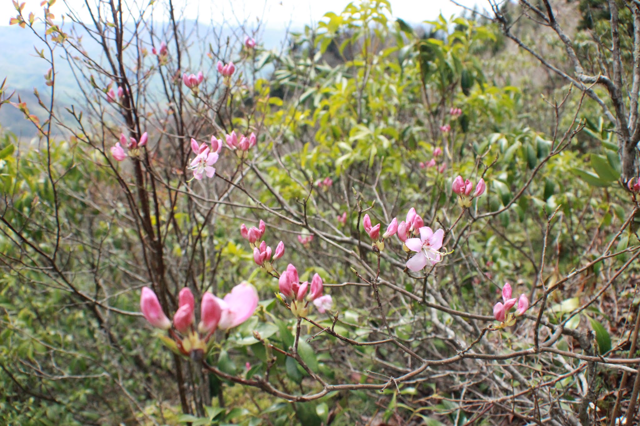
We continued east on the Blue Ridge Parkway heading toward Waterrock Knob. We stopped at numerous overlooks. It was stunning today. The views were clear and sparkling. The Spring wildflowers were thick along the roadsides, and the trees up high were blooming. Sarvis berry and wild cherry trees and Carolina silver bells dotted the mountains with white. It is a sharp contrast against the black green of balsams. Intermingled with all this were reds, orange, bronze, and pale pea greens of maples, oaks, and other trees sprouting new growth.  Above: the best spot I saw all day to illustrate what Appalachian Spring is like in the balsam zone up high.
 Above: a view from Thunder Struck Ridge Overlook


Above: another look across the mountains from the parkway
Below: I liked this view, but I also liked the evergreen tree taken over by lichen.

Waterrock Knob
We went as far out the parkway as Waterrock Knob. You can find plenty of picnic spots along the Blue Ridge Parkway, but you can also come to long stretches with no facilities of any type. We were happy to arrive at Waterrock Knob where they have ample parking, hiking, picnic tables, restrooms and a nice visitor center with information and souvenirs. We were hungry so the first order of business was to pick a spot and have lunch.


And below a view of the entire shrub and its blooms
We did not hike to the summit of Waterrock Knob today. It was never part of the plan. The views from up there are not as good as they are in the parking area. We did find the restrooms clean and open. The visitor center was also open, but at the time of this writing they were still requiring masks to enter. We went in and spoke with the very nice man who was the person running the place. He answered our questions. Kenny had seen a new tower visible from the Soco Gap area. We learned it is a Verizon communications tower. You can hike up to it if you want, but there is no climbing it or view from it. It is a shame because it looks pretty cool out there on the ridge.
We found souvenirs today at the visitor center that were perfect. We got a set of Blue Ridge Parkway coffee mugs for our camper. I got a parkway patch and a refrigerator magnet. I mistakenly donated all my pretty souvenir magnets a year or so ago. I'm in the process of collecting some good ones. They have a fire place at the visitor center and it was burning today. It was still a little cool up high.


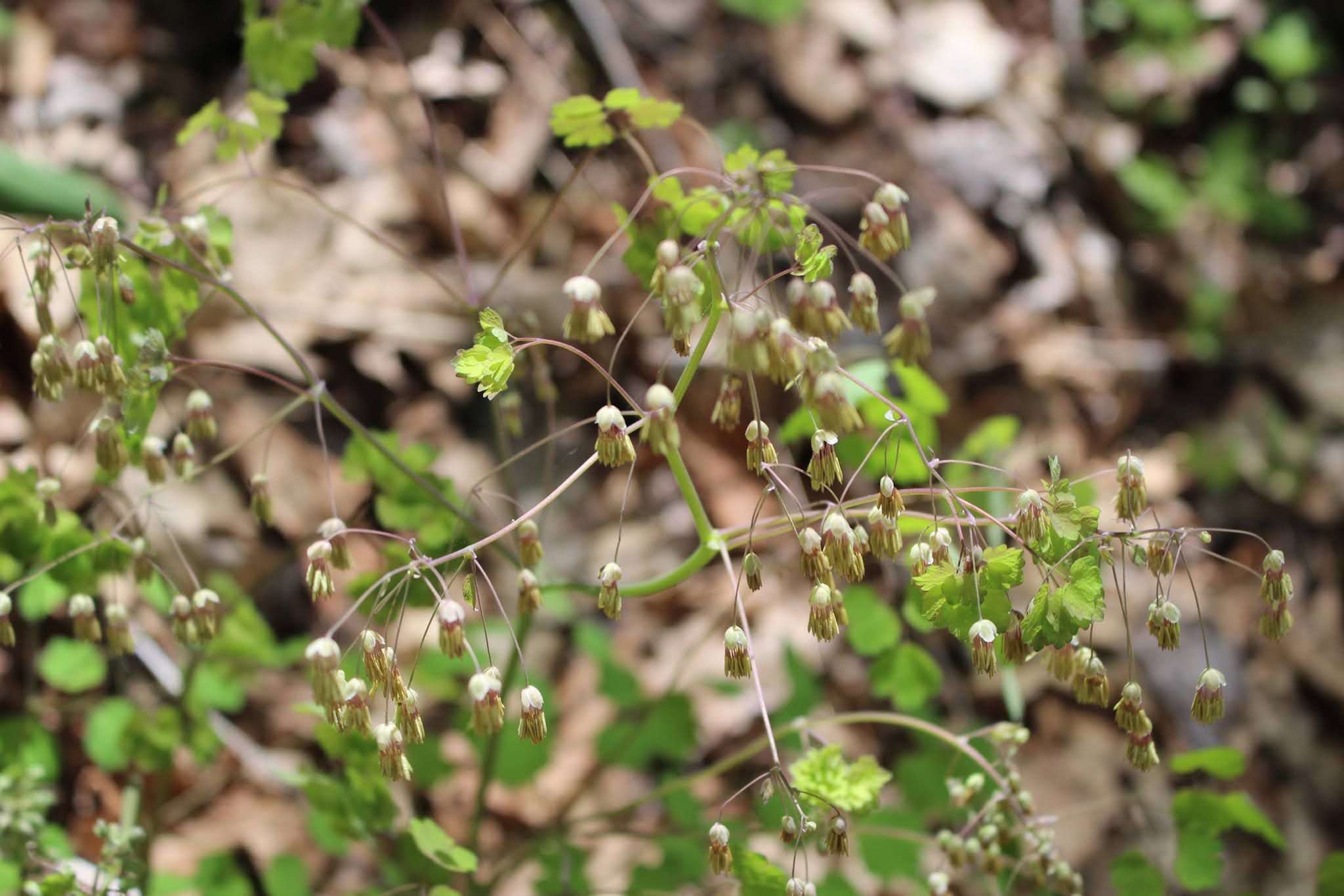
On the ride back the parkway toward Cherokee I stopped to see some of the pretty wildflowers. Lots of great white trilliums and wild geraniums and such.
Below: a look at Carolina silver bells.. they are very delicate blooms


Below: masses of trilliums up the slopes along the parkway


Above: red maple leaves opening


Above: red maple leaves opening
Bunches Creek Road
One of the things we did today was unplanned. It was totally spontaneous.
Driving the parkway back toward Cherokee, we noticed just before we got to Big Witch Gap that there was a dirt road in easy view paralleling the parkway! We arrived at the gap and decided to drive Bunches Creek Road to see where it came out. We have driven part of it before. We drove it from the parkway down to Big Cove. Today we would see where the rest of it went? We followed it up the mountain. We began seeing some real nice wildflowers. Wild geraniums, golden alexanders, Indian Paintbrush, wood betony, and a few pink lady slippers.


The road had a wonderful overlook and was for the most part in excellent condition. We met a few people coming down the mountain. The road came out in the midst of Mile High Campground which is PRIVATE, but the road is very much PUBLIC. We asked directions of the owner lady which fork to take to reach the spur road? She initially was friendly and answered us and was helpful. She then turned hateful and began fussing at us because "this is a private campground". A point she repeated at least three times with her tone growing angrier all the while. I don't know if she is racist against white people or not, but she was pissy. She cannot prevent folks from driving a public road. I have a feeling she has grown tired of dealing with people coming through the campground. I guarantee the road didn't just start going through the campground. Perhaps she should have considered that fact prior to buying it? I am including the experience here not to condemn her, but to warn others who will no doubt encounter her and this attitude if they drive this road. Prepare yourselves.
We went round to the spur road, back down the parkway and back to Big Witch Gap. We turned onto Bunches Creek Road again and this time went down toward Big Cove as we have done before. I had forgotten how steep the drop offs were on the sides. I wished I was driving. It was a pretty drive and worth it, but I am not in a hurry to do it again. We encountered a nice couple in a side by side. The man was white, but the woman was native American. They answered our questions about the use of side by sides on BIA roads.
You have to be an enrolled tribal member of the EBCI to do so. They are considering opening that up to outsiders for a fee in the future so we shall see.


Cherokee for shopping & ice cream
We made it back to Cherokee and were growing tired. We were ready to do something else. We stopped at Nancy's Ice Creams and had some scoops of delicious ice cream. Kenny got cookies and cream. I got pistachio. We sat outside on the patio and enjoyed the afternoon. We checked out the Southwest Store next, but didn't make any purchases. They have lots of nice things though.  Above: exterior of Nancy's Ice Cream

Below: a bored Cherokee dancer between gigs...

It is worth mentioning that I missed a great opportunity to shop in Cherokee.

It is worth mentioning that I missed a great opportunity to shop in Cherokee.
I had been wanting some pottery by Gregory Kickingbird Warren. I did get some in Townsend at Dogwood Mall, but it is sold right in Cherokee at Bearmeats Indian Den. I regret not knowing this or checking out the store. Any subsequent trips I will remedy that. They have authentic and unique native American art. Kickingbird Pottery is amazing and very affordable!
I got two pieces .. a sweet grass scented candle and a small pot which now has a sedum growing in it!
Below is a photo of my first two pieces!
You can find it at Bearmeats as mentioned, Dogwood Mall and Sequoyah's Birthplace Museum. These are just a few locations I am aware of where it is sold. His wife, Stormy Warren is also very talented and makes many natural soaps, lotions, chapstick, salves, and so forth. Dogwood mall sells these for sure.

Mount Noble
The last thing we did today was to drive up Mount Noble. We had been in Summer several years back. It was very nice and I found all kinds of beautiful scenery, views and Summer wildflowers. Today I hoped I'd see lots of different Spring wildflowers. First of all it took us a bit to get oriented and pick the correct road to head up. We were more focused on heading to the hiking trailhead today.
Wrong! We had to go out of town and start up Adam's Creek Road instead.
A summary of the trip was that while it had lots of pretty Summer flowers there isn't much in the way of Spring flowers. I saw very little. The view was pretty. The creeks on the mountain were running good. We saw quite a few people up there since it was a pretty day. I won't be in a hurry to go back after two trips.


Below: pink lady slipper.. the only one I saw up there!

 Above: oak trees in a meadow on the mountain


Below: close up view of red oak leaves

 above: this is an oak gall.. it is the first time I'd ever seen one like this
Sunday to Home
 Above: Soco Creek and the skillet


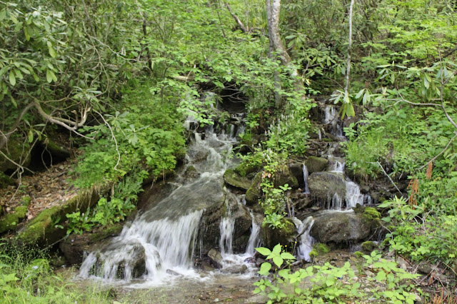
Above: a pretty roadside cascade going up the mountain.
We stopped in Cherokee on the way back to the camper. We went in Family Dollar which is the only game in town when it comes to general merchandise. We picked up a few items we realized we were lacking in the camper. Mainly silver ware. Once back at the camper we relaxed and fixed a nice dinner. It was a tiring day, and we had fit a lot into it. We rested well and the next morning woke up and prepared to head home.
Sunday to Home
Sunday morning I got out and walked around looking at the campground.
We across from Soco Creek which runs right through the grounds. I looked along the creek bank and there was a Betty Butterfield skillet for my collection! It made my day!

Below: the skillet zoomed in... looks like someone scorched it and tried to scour it out.. then gave up!


It was good to get home. Below are some notes to myself to remind me of things I want to accomplish next trip over here. We would definitely return to Happy Holiday RV Village. They were great!
**Want to look for a 2nd cabin with a waterfall beside it around Balsam Gap**
Want to check out the road on the opposite side of Balsam Mtn Rd that goes down under the parkway... and comes out in Cherokee "River Road" #434
**missed opportunity to buy Kickingbird Pottery at Bear Meats in Cherokee
Next time around need to go there** done as of 6/23/2021
Want to check out the road on the opposite side of Balsam Mtn Rd that goes down under the parkway... and comes out in Cherokee "River Road" #434
**missed opportunity to buy Kickingbird Pottery at Bear Meats in Cherokee
Perhaps revisit the Oconaluftee Indian Village.
No comments:
Post a Comment
Thanks for reading and commenting. I enjoy hearing from those who read & make use of my blog. I have made some wonderful friendships through emails from readers. I respond to all comments and emails. I appreciate folks reaching out to let me know when my blog entries are not functioning correctly or if the situation somewhere has changed. Many Blessings to you!
Dana 🐝