I saw where Tennessee Green was hosting a hike in the newest state park for our state. I signed up to go on the Dog Cove guided hike. I signed up for two persons in case Kenny could go. I figured if he either did not want to go or could not because of work.. I could ask a guest. He did end up having something else going on so I invited a friend. I called my buddy Gary Free who lives up at Top of the World here in Blount County. He was interested in riding along with me so I had company for the drive. It was very nice.
We met at my home and drove over to be there for I think the start time was 9:30 a.m. CST. We got there just in time. We got parked and joined the group just as ranger Stewart Carroll was giving the introduction talk. He then turned it over to the hike leader, Ranger Randy Hedgepath. We had a good sized group.
Several folks who work for TennGreen were among the group. Again, this is the trouble with typing up trip reports that are way behind. I can't remember a lot of the details regarding the people, their names, titles, etc. At any rate the hike was not to be a difficult one. It was a 3 mile round trip hike to the interior of the park. We hiked out to the Beecher Wallace homeplace and back.
I had hoped it would be to the waterfalls there, but those I later learned are further back and part of the Hardie Parcel. They have since lead hikes to that, but I have not had the freedom to attend. I need to remedy that.
We had a beautiful sunny Saturday. The temperatures were just right for hiking. I never got hot or cold. The group was very laid back and Randy pointed out lots of things along the way. He identified types of trees, plants, and shared lots of facts about the ecosystem and geology there. Candy was the name of one of the attendees. She was a descendant of Beecher Wallace. Having her along was great. She shared her memories of the place and the people. I learned that several of Beecher's grandsons had passed on since the place was donated. It was sad to know that.
The folks on the hike asked many good questions and Randy answered them whenever he could. It is cool to hike with a group of persons who are truly interested because they asked a lot of questions that popped up in my own mind!
I did not have to ask.
Below: a bluebird day and a view out across Dog Cove toward the bluffs of the plateau
Below: friend Gary Free is taking in the view
Below: hike leader was ranger Randy Hedgepath
Below: an old stacked stone wall along our hike!
Below: Randy Hedgepath and some of the group at a trail intersection.
There are two ways to hike to the Beecher Wallace Home site. A low road and a high road. We were obliged to take the high road thanks to high water! The low road becomes flooded at times. So our hike today needed to be an out and back via the upper trail, but it is nice to know it could be a loop.
Below: approaching the Beecher Wallace house. Man! We had a great weather day. The sky is cobalt blue!
Below: The front of the old homestead. It is being restored. It has a new roof on it and the chimneys are stabilized. It is a work in progress.
Below: back of the homestead
We sat down here and ate a snack, rested and got a drink.
Above: One of the folks from TennGreen showed us this sinkhole.. swallet where the waters of the creek go underground to one side of the old Wallace homeplace.
We hiked back to the vehicles and that is when Randy Hedgepath realized he knew me from my blogs and Facebook. We had a good laugh over that.
I will post more pertinent info and good directions for Dog Cove once I have gotten more familiar with it myself.
Just know that it has no restrooms available and at least for now none are planned. There is parking. This state park is not going to be developed as some are. It will remain largely as it is. Perhaps some day a vault toilet or something like that will be put in. Here is a link to Alltrails that has a fairly good map.
There is an upper trail with views and an arch on the west side of the cove.
Rylander Cascade
My friend Gary had not been to this area so I wanted him to have as good an experience as we could and see some more stuff. We drove down to the trailhead for Rylander Cascade and hiked out the easy 1/2 mile to see it. It was flowing pretty well today.
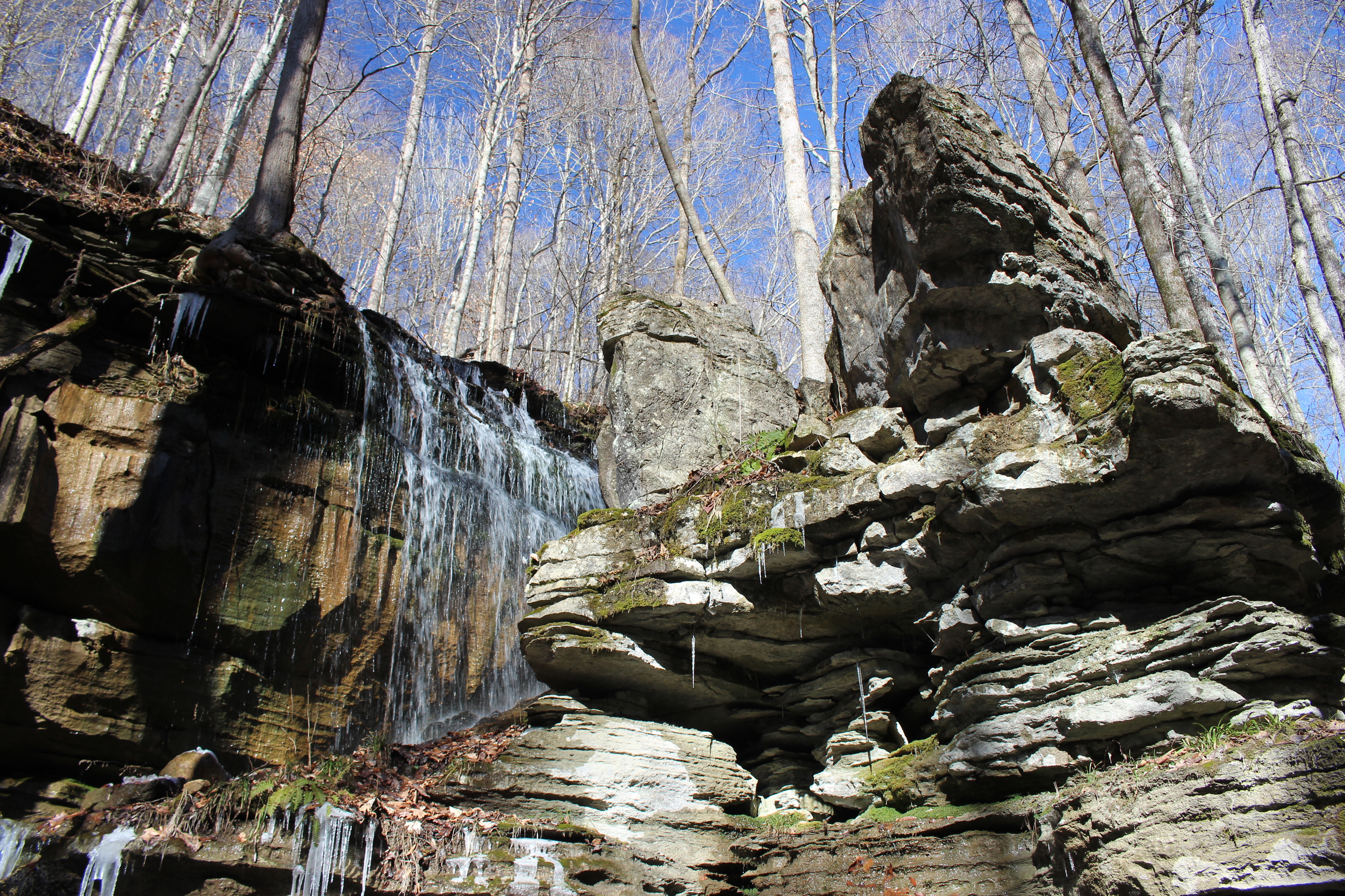
Above: Rylander Cascade and the rock spire near it
Above: all the water for Rylander Cascade emerges at the top of the bank, flows over the falls and is swallowed into the ground here.
Above: a little better view of Rylander Cascade and its icicles
Above: Big trees and blue skies
Above: Gary taking pictures of Rylander Cascade. He hiked up the bank to see where the water emerges from the ground at the source. It is a spring.
Above: moss and icicles around the cascade.
Lost Creek Falls, Dodson Cave, and Merry Falls
Back at the jeep we drove up the road and stopped to visit Lost Creek Falls, Dodson Cave, and Merry Falls. Gary had not experienced any of these.
It is a short walk down over the bank on a well constructed, but slippery trail.
There are roots, rocks and icy patches. The sink that holds all of these features was a wonderland today! It was like an ice palace!
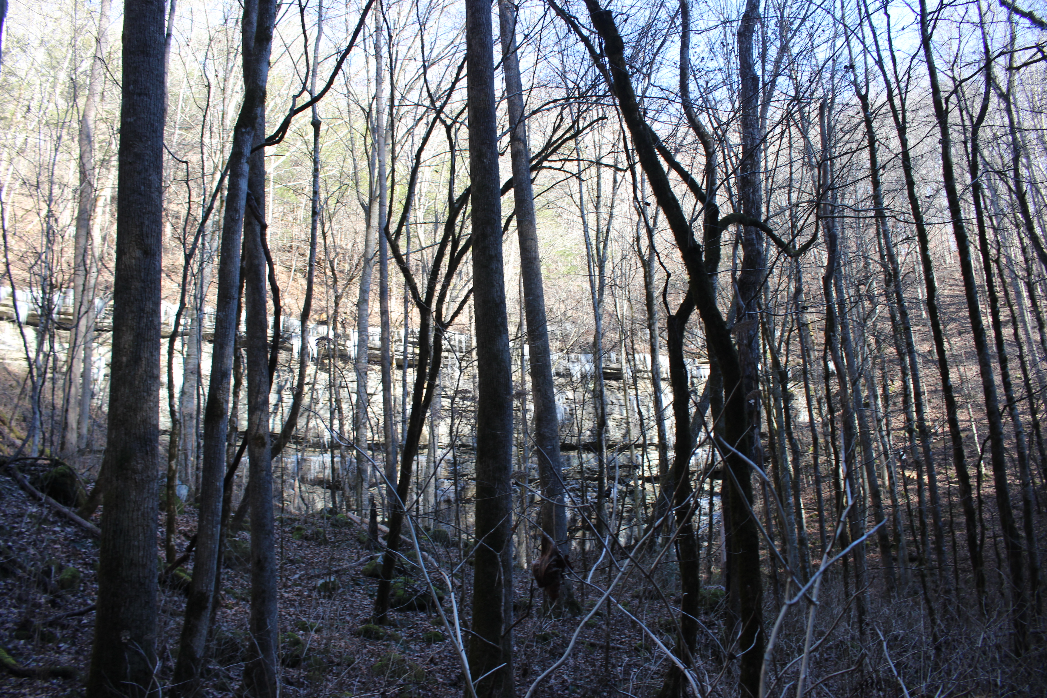
Above: looking toward Dodson Cave and the huge bluff above it through the trees
Above: the stream that flows over Merry Branch
Above: Merry Falls
Above: rows of icy teeth along the cliffs at Lost Creek
Above and below: different compositions of Lost Creek Falls
Above: one of the few other hikers we saw down in here today. He is in there for scale. Lost Creek Falls is about 60 ft high
Above: a rock spire above Lost Creek Falls
Above and below: views of the fairy land of ice coating everything. It was magic!
One last look at the ice coating everything
Gary really liked Lost Creek and the waterfalls and cave.
Next we motored on to head home.
Below is a video of Lost Creek Falls
And last but not least... a video of Merry Falls
Wildcat Falls & Sunset Rock
We were heading home along Hwy 70 and decided to pull over to see Wildcat Falls which is a very pretty roadside attraction. It dries up in Summer where it is not always worth seeing, but today was running great! The ice around it made it extra pretty. We also pulled in and parked at Sunset Rock to take in the view out across the plateau! We fit a good many things into a day of exploring. I enjoyed Gary's company. He is a fine friend to have. Kenny and I have both enjoyed getting to know him. He is funny and smart and kind. He is also a total gentleman.
above: icy cliffs of Sunset Rock
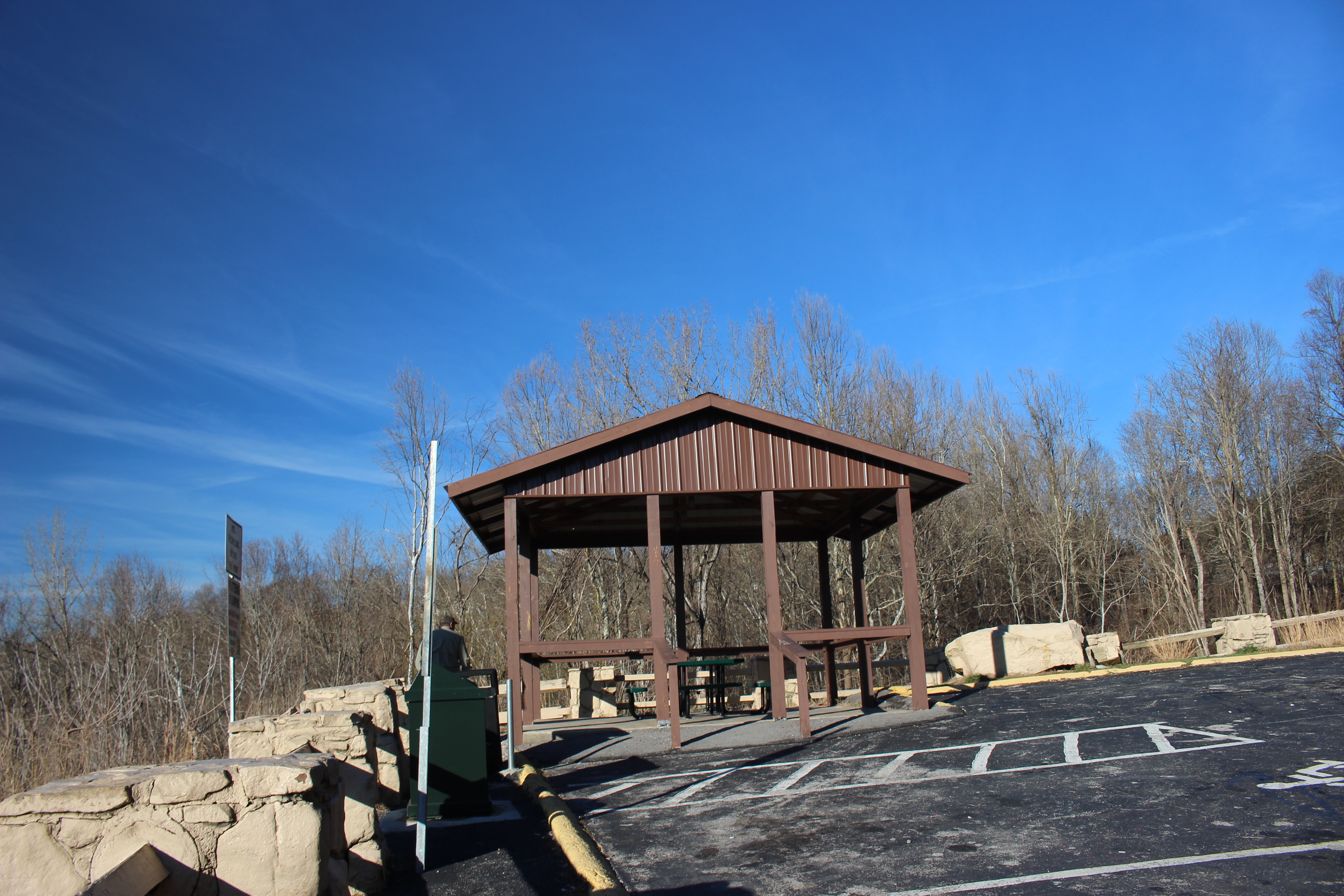
Above: new and improved .. they have put in a picnic shelter at Sunset Rock and trash cans.
Above: view from Sunset Rock out over the plateau
Above: Wildcat Falls back in the holler
Below: Wildcat Falls with me zoomed in. look at all that ice!
Below is a short video of Wildcat Falls
No comments:
Post a Comment
Thanks for reading and commenting. I enjoy hearing from those who read & make use of my blog. I have made some wonderful friendships through emails from readers. I respond to all comments and emails. I appreciate folks reaching out to let me know when my blog entries are not functioning correctly or if the situation somewhere has changed. Many Blessings to you! Dana 🐝


No comments:
Post a Comment
Thanks for reading and commenting. I enjoy hearing from those who read & make use of my blog. I have made some wonderful friendships through emails from readers. I respond to all comments and emails. I appreciate folks reaching out to let me know when my blog entries are not functioning correctly or if the situation somewhere has changed. Many Blessings to you!
Dana 🐝