

Gabriel Falls from the old road above it.
Gobey Directions
I am going to try to share some directions for folks to visit the features we've found at Gobey.
Before I got any further... Tom's page link above says right on the top.. no ATVs. He's my friend and I respect him. The reality is that folks use the old roads at Gobey for atv riding all the time. Many of those trails link up with Wind Rock or Brimstone. We mainly stay on the roads themselves and our machine is licensed for moderate speed use on roads.
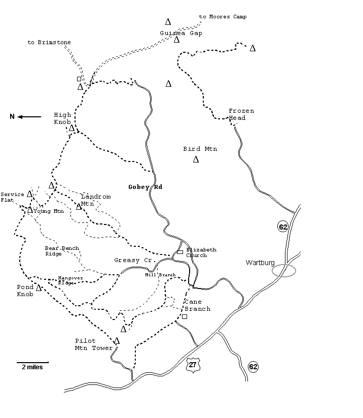
Here is a map of Gobey area borrowed from TN landforms. It is an overview.

Click the link here and
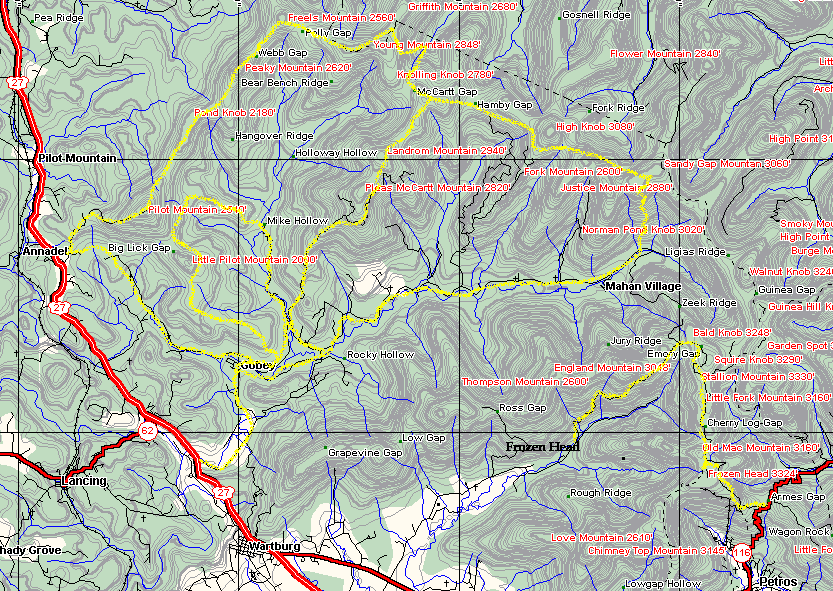
here for more detailed maps
Driving Directions from Wartburg: At the intersection of Hwy 27 North and Gobey Road
Turn RIGHT onto Gobey Road. Gobey Road runs slightly over 14 miles along the Emory River.
It turns to gravel halfway out and the condition of the road deteriorates some the further out you go.
The area on the right toward the Emory River is designated as part of Frozen Head State Natural Area. It is gated numbering 1 through 5.
Gate #1-Sang Branch
Gate #2 Laurel Fork
Gate #3 Phillips Creek
Gate #4 Rayder Branch
Gate #5 Emory Headwaters Trail
Parking to mountain bike or go four wheeling
There are a couple places you can park. Park at your own risk. People have had break ins and thefts, but we've done ok by parking carefully and not having anything in the vehicle to steal. It is still a risk because folks have had trailers and atvs stolen.
First parking spot is the vacant lot on the left when you first turned onto Gobey Road.
It is large, free, and within easy sight of plenty of traffic. A bit less likely for someone to try to break in in full view of plenty of witnesses.
Next parking spot is 3 miles out Gobey Road after you cross the first bridge over the Emory River. It is at the intersection of Scutcheon Road and Greasy Creek Rd with Gobey Road.
Third parking area is 4.5 miles out Gobey Rd at the 2nd bridge across the Emory River.
It is where Gobey Rd intersects Griffith Rd and Fox Jones Rd.
Numerous roads go left and uphill off Gobey Road. Some are named and others are not.
I know precious little about any of them so I will share directions to only the falls we've found up there. The rest you'll have to check out for yourself.
As for the Gated Roads-- What to See
Gate #1-Sang Branch.. excellent scenery, cascades, historic old stone walls, excellent Spring wildflowers, partial views off the mountain near the top, interesting boulder forms up top.
Gate #2--Laurel Branch --Beautiful scenery along the Emory River, excellent Spring wildflowers,
old railroad supports, numerous cascades and placid holes of water.
Gate #3 Phillips Creek-- Pretty stream to walk by, excellent Spring wildflowers, historic house foundations.
Gate #4-- Rayder Branch-- historic home foundations, pretty stream, beautiful forest, good Spring wildflowers
Gate #5 Emory River Headwaters. -- Beautiful stream, historic coal tipple, great Spring wildflowers, partial views from near top.
Directions to Waterfalls @ Gobey
Drive 7.8 miles out Gobey Road.
(You will go 0.8 miles past Garland Stewart Rd on your left)
Turn LEFT onto the first un-named gravel road on the LEFT
A creek comes down beside it and it had neon orange flagging at the end when last there.
To Reach Gabriel Falls
From where you turned on the un-signed gravel road go less than 0.20 miles to a ford of Little Creek.
You can probably drive through it with a four wheel drive, high clearance vehicle. Otherwise you'll have to wade it. Once across follow the gravel road less than 0.10 mile to where you can see Gabriel Falls down to your left.
Back track 50 feet to where you can walk down to the creek and ford again.
Approach the falls from river right. (meaning the stream is on your right side)
There is an old logging grade to follow out to where you can work your way down the bank to the base of the falls.
There are cascades above and below Gabriel Falls.

Above: Gabriel Falls

To Reach Atlas Falls...
Back up and reford Little Creek and turn left onto the main gravel road that follows Little Creek..
Stay straight. There are lots of beautiful cascades, pools of water, Spring wildflowers, and wet weather waterfalls all along the way.
Go 2 miles out this gravel track and you will ford through the creek 3 times. Atlas Falls is 1/4 mile after the last time you drive through the water.
It is down the bank on the right within plain view of the road.
A pretty wet weather falls is 50 feet up from Atlas Falls.

above: Atlas Falls
Below wet weather falls 50 feet upstream from Atlas Falls

As a local who’s parents, grand parents, great grandparents and great great grandparents lived worked and died in those mountains, it’s good to see other people who respect the history of this area. I’ve grown up and continue to roam these very same mountains. They are full of gems like old abandoned mining equipment and lots of hidden homeplaces. Thanks for sharing!
ReplyDeleteThank you for reading and taking time to comment. You are blessed to come from such a storied, beautiful area. I can't believe I"m just now seeing t his comment and responding. My apologies!
Delete