Showing posts with label #bridgehunter. Show all posts

Thursday, March 18, 2021

Historic Sites & Scenic Drive in the Etowah Area


I am holding up the blooms on some very soggy Spring Beauties


Historic Sites & Scenic Drive in the Etowah Area 

Tues. March 16, 2021

Dana Koogler


Photos are here starting with the first frame

Click the Right arrow to advance 

Hiwassee River Area Photos 


  I was excited that the kids were on Spring Break this week.  It meant that I would have a break from the routine of taking Gabe to preschool. I would possibly have a chance to get out and do some hiking by myself.  It also meant that I might get a chance to do some activities with my grandchildren aside from the usual things.

   Gabriel told me on Wednesday prior to Spring break starting that the weather forecast wasn't looking good. He said it was supposed to rain.  Gabe is four years old so while I believed him, I did not let the prognostication of bad weather concern me too much.    I figured how bad could it be? 

  Oh but how right he was!  The forecast for the week was for rain, rain and more rain.  I had plans to do some family errands and activities with my daugther-in-law and grandkids Mia and Gabe on Monday.  I did not find out until 10 a.m. Monday morning that those plans had fallen through.  I was a little discouraged, but decided to use the time to get some Spring cleaning done.  I rearranged the rest of my week to free some days up and told myself I'd get out on Tuesday to do some hiking and exploring. 

    Tuesday was rainy, but it was not cold.  I was itching to get out of the house. I decided to stick with my original plan and head toward Etowah and Reliance. 

  I hoped that by going further south I'd stand a better chance of seeing some early Spring wildflowers.  I also knew that rain is hard on wildflower blooms.  Any that might be up can get beaten down and droop over because of the rain.  The overcast gloom doesn't help as they need sun to flower.   I went over my lists of things I wanted to do and see.  I would make sure that I had plenty to occupy my day. I would hit up historic sites.  I would hit up a scenic drive I'd been wanting to take. None of it would put me too far from my vehicle if it rained all day.  I hoped against hope that it would clear off. 

         I  was encouraged driving down the road that while cloudy the rain was holding off.   I was able to see a little sunshine over toward Starr Mountain.  I stopped to take a picture of this pretty sight. 

Above:  an overcast day, but some fluffy clouds over the mountains and some sun trying to shine

  I decided to start with the things I'd wanted to visit on a recent trip to the Samuel Cleage Cemetery and some bridge hunting.   I stopped by the site of the Old Federal Road and bridge.   It is private property, but the road can be seen from the highway. I pulled over and decided that I would chance walking the 100 feet to the bridge from highway 411.   I did not stick around, but checked out the remaining segment of old road and the very rotten bridge and the creek. It is still there, but the decking is absolutely squishy rotten.  I did not dare go out onto it.  I stepped on one corner of it and could feel the wood give. It is part of an old road that ran from Athens to Etowah.  There is a different Federal Road that ran a much further distance from Knoxville down to Augusta, Georgia at least.    


Above: Old Federal Road visible from Hwy 411. There is a pull off there to get out of the way of traffic.   It is gated, but you can see this from the gate.  Just at the vanishing point toward the center is the bridge.   

Below is a shot or two of the bridge itself. 


Below is a closer shot of the bridge which better illustrates the condition of it.


And finally a look at the pretty stream flowing beneath it which is Cane Creek.


     I was pleased to have finally gotten this one under my belt. I could now add it to my collection of bridges I'd visited.   I did not linger here, but got back to the jeep and continued on toward my next destination.  I wanted to see the old Cog Hill Mill.  It was quite pretty back in the day. It was a wooden grist mill painted barn red that sits in rural McMinn County to the west of Etowah.    I had seen some real pretty photos of it by various people.  A tornado back in 2011 tore through the area and the mill was one of the structures badly damaged.  I knew it did no look the same, but I wanted to see what was left of it while at least some still stood. 
 
   I found it easily on Cog Hill Road.  I had found a spot on the corner to pull off the road safely.  I was then able to walk round to the edge of the road and take pictures and stay out of the way.   It was so run down and crumbling so badly I would not have dared get much closer.   It is a shame this had to happen.  Once the tornado tore it up it was exposed to the elements which in the decade that followed has caused it to decay further.   

   
Above: Cog Hill Mill -- what is left of it.  I liked how the pear blossoms dress up the scenery.  I also think it looks really odd to see that set of wooden stairs going up to nothing out in the open.   

  I walked to the bridge and looked upstream.  You can see the mill weir and some of the old rock work.  My photos of that came out very blurry because it began to drizzle on me.   I was trying to use an umbrella and take photos and that was not a good plan! 
Below : part of the machinery of the mill's workings

Above: blurry shot of the stream and the mill weir

Above: the back of the mill is a little more put together, but it is not long for this world. Cog Hill Mill was built in 1893 and in use until the 1990s. It is private property, but you can view it from the road about as well as I did here on foot.

    Once I had finished up my mill visit I continued down Bowater Road to Trew's Store which is a national historic landmark in McMinn County.   The drive to get there was pretty also!  I love old country roads.


Trew's store in the old community of "Dentville"  This was the store and post office back in the day.  It lies about halfway between Calhoun and Etowah. 
Bowater Road #163 runs between Hwy 11 and Hwy 411.  Trew's store sits by the side of the road at a wide dirt lot.  The store was begun in 1890 by John Wesley Trew. It operated as a family business among the children and eventually grandchildren until 1975.  It made the national register of historic places in 1976. 

   The area along Bowater Road is filled with pretty rural scenery and odd little ruins of spring houses and such.   It is an area that right now time has passed by.
Below is a photo of a neat looking very faded old barn that is across from Trew's Store.   I looked to see how much further the McClatchy Woolen Mill would be from here?  My google maps said eight miles.  I decided against going. It would have to wait for another day.  I wanted to go hunt wildflowers. 


   I returned toward Hwy 411 and drove down turning onto Spring Creek Road. This is the road that takes you past Gee Creek State Park and Campground. 
I had driven it with Kenny in Spring several years ago and loved it!  I was hoping to see lots of flowers today.  The scenery alone is worth the drive though. 
I did not stop at the state park or the Fort Marr Blockhouse today.  

       I stopped by the boarding platform for the Hiwassee Excursion Train.  It was sitting there "idling".  I guess waiting for passengers maybe?  I took a moment to admire it and take photos of it.  If there is ever any doubt as to the railroad in that area being a live line... here is your proof. It is indeed!  


Above: Excursion train at the boarding platform across from the state park.


   I drove on down Spring Creek Road enjoying the pretty rural scenery.  It begins near a residential area, passes the state park, and the further you go the more isolated it becomes.  It eventually brings you to a turn onto a road that puts you back on Tellico-Reliance Road and I was then able to continue down toward Webb's store.  

     Below: a view of Spring Creek Road.  It is rough, rutted, and has lots of mudholes, but was easy in my jeep.   A passenger car can drive this if you take your time and be careful.  It is hard on the suspension of a non four wheel drive vehicle. 


    The road is lined with pretty scenes of the Hiwassee River, a trail that goes past Watertank Branch Falls and on up to the Hiwassee River Bluffs.  It also has quite a few wet weather cascades coming down within view of the road.   I stopped and enjoyed taking mini hikes up some of these little paths.  Wildflowers were out, but certainly not anywhere near peak.  It is a little early.  I was also surprised that some of the falls which had a lot of water my previous visit were not running as well today.    The trees back in this holler stay shaded and the humidity is such they are coated in moss!  It looks like a little piece of the Pacific Northwest in East Tennessee!  


Above and below: Two looks at Spring Creek


Above: Wet weather cascade number 1

Above: a view down an un-named stream at the verdant green moss and deep dark forest! 

Above:  Rue Anemone in bloom on the forest floor. I saw lots of this today.

Below: tree trunks and rocks coated with pretty green moss
Below: a closeup shot of what coats the branches of trees and their trunks all along this road. 

Below: a second side stream with red rocks and white water cascading down to join Spring Creek.


Above: Wet weather cacade number 2.  I bet today it is running better! We have had a couple days of rain now!

   I turned onto the Tellico Reliance Road at last and had not gone far when I glanced to my right.  At the site of a now demolished old house was the largest forsythia bush I've seen in my whole life!  It was glorious sunny yellow blooms festooning this place.  I saw no one was coming either way and stopped briefly to photograph it! It was worth the stop.


Above: huge forsythia bush!

  I did not stop at Webb's store today or any of the other historic spots.  I have visited those more recently.   I was getting hungry and so I drove SR 30 westward toward hwy 411.  I took note of the pull offs for the things I wanted to photograph. I then pulled into the Hiwassee River picnic grounds.  They have restrooms and picnic tables, river access, trash cans, and plenty of parking.   I stopped and relaxed and ate lunch. I visited with a pair of muscovy ducks.  I took time to walk down to the river.  I enjoyed the views across to the Hiwassee Bluffs and the misty fog that encircled them.    I then walked around the picnic area to check out wildflower potential.  I didn't find anything much so I left my vehicle at the picnic area and walked down the road a short distance to photograph a roadside cascade.  I did not linger long on the road.  There are either no shoulders to the road or so little it is not safe to walk this curvy road.  Consequently I limited how much of that I did.

     Below: my friends the muscovy ducks! 


  Muscovy ducks are native to central and South America and Texas in their truly wild form.   They are often domesticated and thus you find them in other areas of the United States.  They are good fliers, can perch in trees and build nests in cavities in trees.   They sometimes mate with other duck varieties and have hybrid offspring.   These ducks may be someone's escaped domestic ducks.  I frequently saw these ducks in Virginia along Christian's Creek. A local farmer had them and they spent time in the river.  

Below is a view of the Hiwassee River and the bluffs and the fog.
     

 Below is a tall, wet weather cascade I photographed about 1/10th mile before the picnic area on the opposite side of the road. 


  Once I got done with my picture taking I tried to decide what next?  I really did not feel like doing what I originally planned.   I had thought I was going back down to the Tellico Reliance Road and then turn off it to try to go see Towee Falls.   I  looked at the map, and considered back on the previous trips to find Towee Falls.  The last one was a miserable failure, but funny now.  We somehow missed the turn and ended up back out on SR 315 and were darned glad to see it since we knew if we stuck with that we'd get back to Tellico Plains.  Along our way we passed a road "Towee Falls Road" and Kenny said hey? I told him drive on! I was done.  That area is a confusing snarl of roads with Towee Falls road being the worst.   I did not feel like going through that today.  I figured if I am going to be lost I at least do not want to be alone for that.  I need someone along to blame it on them! 😁😄

    I decided instead to go back toward the store and get some photos of the Vaughn Webb house in all its Springtime splendor.   I had gotten some wonderful photos of it in Summer. Now I would have some from Spring.  I pulled over at the near end of the driveway first and got a few shots.


Above: Vaughn Webb house is a gingerbread style house with lots of ornamental trim.  While I love how it looks I sure wouldn't want to have to maintain it or paint it. The forsythia really draws attention to it.

Above: peak of the roof of the Vaughn Webb house through a wreath of forsythia

Below is a vista you would see from the lawn of the house.
The Hiwassee River and the knobs surrounding it mingled with the fog.  I liked the daffodils in the foreground.

Below: a shot from across the road with the house centered up properly. Daffodils framing the front wall and gate. 

  I realized when I got ready to move that I was in a tough spot.  I did not have room to turn around.  I was parked where I would have to back into the road in a curve and be unable to see any oncoming vehicles.  I walked up the lane and could see no one was parked behind the house.  I got in and pulled through their drive which goes from one side to the other.  Whew!  I should have pulled down to the far end and parked there. In the future I will do that.  

    I decided to head back toward Highway 411 for my trip home.  I did not feel up to a narrow, winding country road to Tellico Plains then more road to get home.

I stopped off by Quinn Spring picnic shelter.  Here they have restrooms, picnic tables, grills, and a covered picnic shelter.  There are a couple hiking trails also.

I strolled around and looked for wildflowers. The only ones I saw were bloodroot with their petals closed, petals knocked off them by the pelting rain, or tight buds.

I snapped a few pictures and was ready to move on.

Below is the best shot of flowers I got today.  I loved the pink tint to the blood root buds. I've never seen them like this before. 


Below is the Quinn Springs picnic shelter. It is very sturdy and attractive.


  I had a thought on my drive up Highway 411.  I had been wanting to stop in Etowah and get photos of the trains and the depot.  Today was as good a day as any.  It did not take me too long to arrive back in town to do just that.   

   The depot is large and there is ample parking.  The excursion train leaves from here.   It is not only the historic depot, but is a bandstand and a city park. There is a walking path, a picnic shelter, restrooms, and trash cans. 

   I spent some time walking at the park.  I enjoyed checking out the rows of freight cars and the caboose.   I photographed two surprise bridges. One is made up of railroad ties!  The other is a dressy pedestrian bridge over to town.

Above: the historic Etowah Depot on a cloudy day.

Below is a view of the picnic shelter and the walking path which encircles it.


Below: a bright red caboose is a cheerful sight on a gloomy day!


 Below: the pedestrian bridge that leads to the historic downtown from the depot and park. 


 While I did not see many wildflowers today I did see lots of Bradford pear blooms, daffodils, forsythia, and even a few red maple buds! I like those.


Last of all a view of the little gazebo in the front of the depot.  

It is built of Tennessee Craborchard stone from the plateau!


  I concluded my visit to the area.  I decided to head home.  I had a good day and made the best of a gloomy, rainy, dreary day.  I couldn't help noticing and chuckling at the irony of the fact by the time I got to Madisonville the sun was coming out.  wah wah wah........... 

  Oh well.   There was nothing for it.  I enjoyed the drive home. The road is a good one.  It passes through some beautiful country that is always easy on the eyes.  All in all it was a good day.   I went home and prepared teriyaki chicken and shrimp on the grill with some grilled pineapple.   A nice dinner with the hubby and a relaxing evening.     

   Wildflowers will get here soon enough and give me something to look forward to.


Thursday, March 11, 2021

Rock Creek Double Trestle and Crooked Fork More Steel Rails


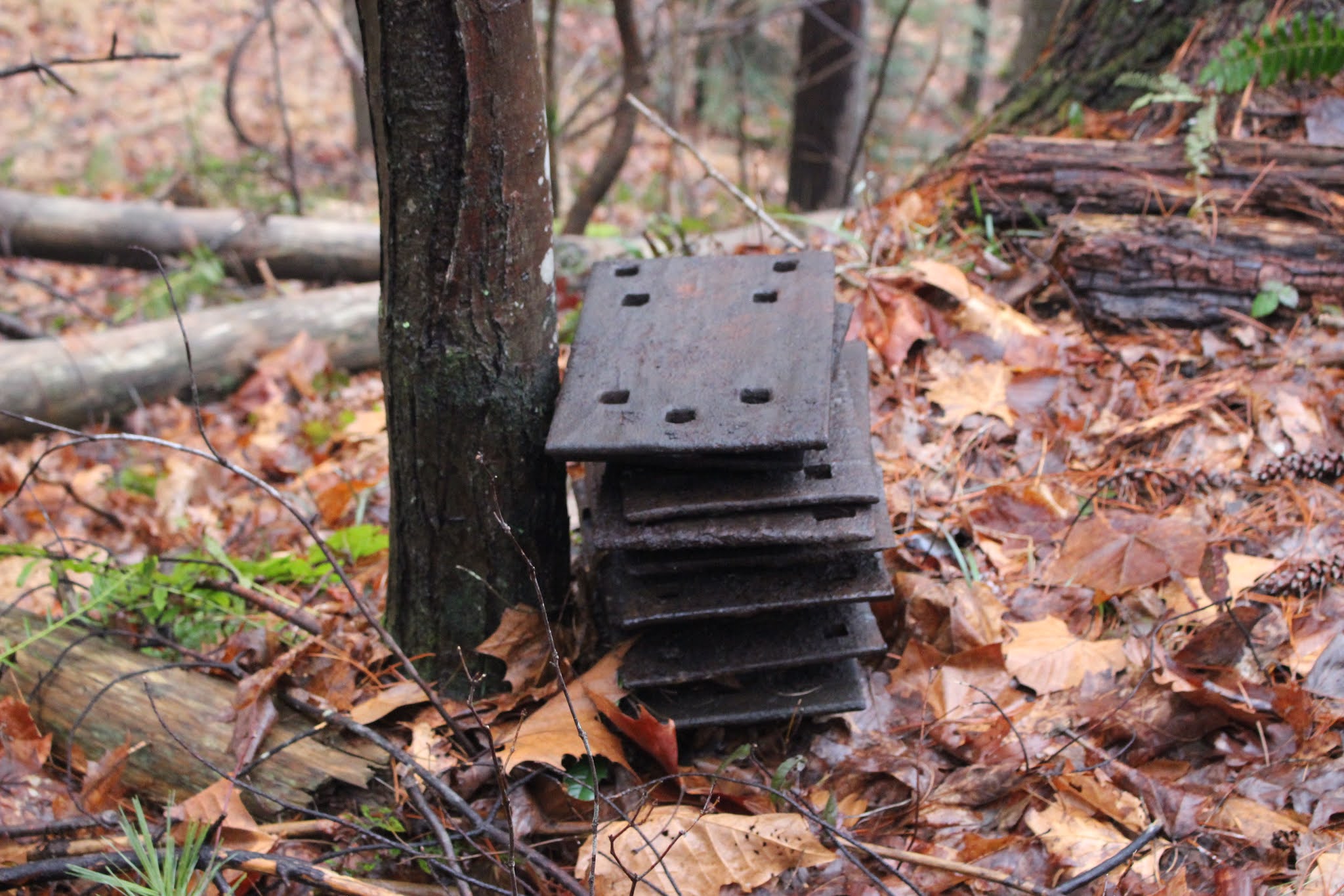
One of the clamps that helps hold the rails down on the railroad. 


Rock Creek Double Trestle and  Crooked Fork More Steel Rails


Saturday February 27, 2021


Kenny & Dana Koogler

Pictures are here Rock Creek Trestle Pix 


Bridge Hunter Page for Morgan Co, TN


  We had such a great time on Valentines Day when the opportunity presented itself to go again we both agreed we wanted to go back.  We wanted to try to see a few of the spots we had missed.  Kenny had put some thought into how much he wanted to reach Old Tunnel 22.  He originally looked at the map with me from Satellite view and asked "Doesn't that look like a gate?"  To which I had to agree.  So it appeared the only way we were going to reach that tunnel was via fording the river.    

    Today we parked at a better spot with more room.   We found a vacant lot in town on a Sunday where no one was going to be bothered by us.   We have the RZR tagged for low to moderate speed roads so we were able to putt around from the parking spot toward the spots we wanted to visit.   I asked to stop by Old Highway 27.  I had not realized there was an abandoned stretch of road and a bridge there.   It was not great, but I wanted to be able to say I'd seen it. 


Above: Pretty green Emory River.  This is the view from the Old U.S. 27 bridge. 

Below:  this is the bridge itself.  

Below:  I found an interesting composition for a bridge photo.  This poor bridge has seen its better days. 


    The thing I most wanted to see today was the Rock Creek Double Trestle and Rock Creek itself.   I had run across someone else's photos of the stream and saw an opportunity to enjoy the sight of more green water.  I figured it would be a great photo op.  The day was misting rain, overcast and foggy.  It was threatening heavy rain toward evening.  We put our wish list in order of importance and motored onward toward an old road in Lancing that would provide access to see the trestle.

     We found it without any difficulties.  It is in a little pocket of Lancing off the beaten path.    We no more pulled up and I got a couple shots of the trestle empy when a train approached!  I had so hoped I'd get to see one cross here.  Today we were in luck!  A big freight train rumbled across the trestle and I was able to get a good video. Below is that video.


Below is the first photo I took of the double trestle just before the train arrived.


Below: a shot of the supports and the river below


Below is a shot of the train crossing the tracks


And below the end of the train as it heads on down the line. It is north bound.


   We made our way carefully down the embankment on the right side of the trestle.  It was a little slick and intimidating.  The ground was not as crumbly as I'd thought it might be.  Once we were over into the woods and had trees to hang onto it became easier.   We passed more of that communication equipment discarded down over the bank.  It seems whatever they don't use they just leave it laying around.  Old rail spikes, clamps, rails, tanks, telephone poles, and cross ties.


Below: a rock outcrop that sat under the trestle.   Once we were down far enough you could look over there and see someone was using it as a camp.   I would not have gone near it for all the tea in china.  


   I looked over to my right once I reached the bottom.  There sat some type huge concrete enclosure like a tank.  I foolishly walked over and looked down in it. 
I wished I had not.  I saw something furry and wet floating in the corner in water. 
I had the same concerns about that tank that I did the mattress rolled up under that bluff.   I was afraid we'd find a corpse down here, but thankfully we did not. I know that is morbid, but the thought did cross my mind. 


Above: Looking straight up at the train passing over head. 
Above: The upstream view on lovely Rock Creek.  The fog really adds to it. 
Above: Looking downstream on Rock Creek's green waters.  It was all I had hoped for and more.  I liked that they left the old stone piers of the former railroad trestle. 
Above: a view of the double trestle and you can just see that odd concrete tank.

Above: Looking downstream through the fog on Rock Creek.  
    

  We walked around and checked out the area.  At last we had to begin the climb back out.  Kenny insisted we ascend on the opposite side saying it was not as slick.
I obediently followed.  It was not as slippery, but it also was steeper and had nothing to hold on to. No place to rest.  My poor legs were in knots of charley horses by the time we got up to the top.  I had the Gumby legs.  I was mighty glad to see the top again and some flat ground. 

Above is the climb we had to make. No photo can really show how bad it is and how steep. You can see Kenny up there tiny in the distance and me ... down here toiling bravely up the hill.  I was determined. 

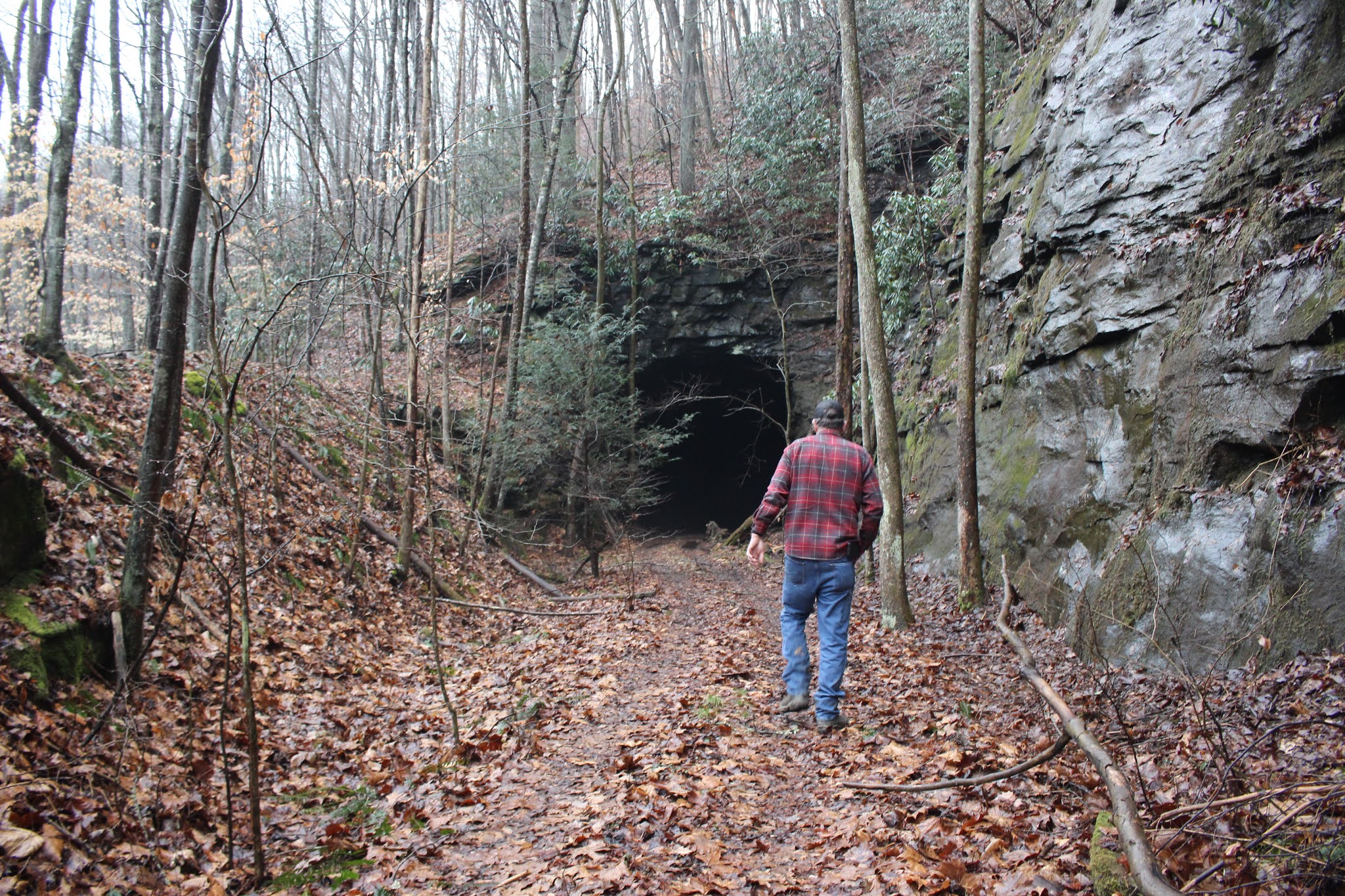
   We moved on from Rock Creek toward Lancing and the trail Kenny believed would get us to Old Tunnel 22.   I was not holding my breath.  I really wanted to see that one and was afraid to get my hopes up.    Thankfully we trucked right along and ended up coming out right at the tunnel.   It is an awesome spot!  
I just liked everything about the setting.  
  
  The forest itself was pretty. The rock bluff it was cut into was pretty and very rugged.   The tunnel was attractive and mysterious looking in the fog.  
Kenny had remembered to bring lights so we could go on through. Off in the distance we could see flashes of the glimmering green Emory River.  White capped waves and foam could be glimpsed through the coppery beech leaves still clinging to the branches of trees.   We found an entire stack of those number caps they used to put up to indicate the tunnel number.    Left there to rust.   We went through and it was nice and dry thankfully.     You can hear water dripping, but it is on the sides and only a little bit.   

Below is a video of the walk through the tunnel.   On our way back through a train passed through the other tunnel on the live rail line nearby!  What a rumble!  It was an eerie and kinda cool experience.  It definitely got our attention.
 

Larry Johnson, I am talking to you at the end of this video! 😀


Rock outcrop near the tunnel
Above: my favorite view of Old Tunnel 22. South portal
Above: The Emory River is just gorgeous!
Above: Let's see.... ? I can have six more tunnels since I have six more number plates! 
Above:  Now we are looking at the old abandoned railroad crossing over the Emory River from the opposite side.  

Above: Hiking out the railbed beyond the north portal of Old 22
North Portal of Old Tunnel 22. Kenny preparing to hike back through. This is about when the train started through the other tunnel next to us!
Foggy view as we near the south end on the return trip!
Above: a spider was in this hole. No kidding!  


Above: emerging from the tunnel on the way out.  A little water at the start, but not bad. 
Above: a foggy view out over Morgan County on our ride to have lunch. 

    We got our butts back to the RZR and left outta there.   We were getting hungry. Kenny wanted to motor on so we could fit more stuff into the day before the rain hit.   We went out through Lancing and toward the back side of Wartburg to Montgomery Road bridge where we pulled over to eat lunch.  It was a right pretty spot out of the way.   That ham and salami sammidge was good and fueled us up for the next half of our day.  

  I took a moment to photograph the river and the bridge here before we left. 
Below: current day Montgomery Road bridge over the Emory River

Above:  if you look across the river you can see where the bridge used to cross. The rock foundation is still there. 
Below: a glance upstream on the Emory River.  


  Once we were done with lunch we had a choice to make.. we figured we could either go hunt up tunnels 19 and 20 or head toward Nemo and visit Crooked Fork Trestle.  I had never seen anyone's photos of it.  We only realized it was there from studying the map in preparation for the trip.  Two, two count 'em.. two map nerds.  
Good thing I married one.  

    Tunnels 19 and 20 did not seem as interesting as Crooked Fork Trestle so off we sped toward Nemo.   There were lots of people here today.   Parking lot was packed.   We headed down along the railroad tracks again.   On the way we glanced at the falls we'd seen a week ago, but did not stop to take pictures.  It is worth mentioning that the graffiti on the current day tunnel 24 is gone! Someone painted over it.  Yay!  and Thank you to whomever did that good deed. 

       We heard water about halfway to the trestle and noticed a wet weather falls we had not expected.   We did stop to take a look at that. It was right pretty.
Below is a short video of it. 


Above: nice wet weather waterfall just before Crooked Fork 


    The terrain on the left of the tracks where we were got tight so we listened and looked and carefully crossed the tracks.  It was scary.  I didn't like it.  
Once we had the machine safely away from the tracks we recrossed and walked the cross ties toward the trestle.   Always listening out for trains approaching. 
We did not tarry here.  I took a look up the river at the power of the stream.  I snapped a few quick pictures of the trestle and that was enough for me.  I knew based on the time another train was likely to come through soon.   We hurried back to the RZR.   Once there we got in and the rain began just to drizzle.   We sat in the dry  and a train came!  I made a cool video of it crossing the trestle. I couldn't believe our luck today!   

    Below is the Crooked Fork Trestle video.


Above: Kenny walking toward the trestle.. southbound on the tracks
Above: Crooked Fork Trestle is a powerful looking structure! 
Above: Crooked Fork thunders beneath the trestle and into the Emory .  It looks scary at this water level. 
Above: a train is coming! We're going to get to see one cross!


Above: a quick photo of the train as it passed.

      Once the train went by we quickly recrossed and headed back toward Nemo Bridge.   I did not like crossing here any better this time.   I think everything we did today is one and done.   

     Once we got back toward the Nemo bridge we parked and walked down along the river to see Nemo Rapids.  You can see them well from the bluff above the river.  I wanted to go see them up close.  They sit on a nice little beach area with sand and pebbles.  Fog swirled and crept along the surface of the water.  
  
  I drew a face in the sand as I have done in the past.  I made black teeth using coal chunks.  

Above: sandy beach area at Nemo Rapids
Below: my bad teeth smiley face 

Above: The mighty Emory River and Nemo Rapids. 
Above: The mist floats around the mountains in the distance
Fog creeping over the face of the water
I liked the rooster tail this rapid was throwing up. 
 Above: Fog surrounding us.  
Below: I stopped to take a photo up under the modern road bridge of Nemo Bridge. 

  We enjoyed the scenery here.  I felt satisfied after having seen the rapids.   I got some good photos and video.    The rain began to come down now so we headed back to the RZR.  We still had to get back to where we had parked.  Kenny made all the right turns this time so it was much simpler.  We sometimes feel like Wartburg is Downtown "You Cain't Git Thar From Hyere"  Norma, Tn is another place like that! 

      What a fun day!  We made it back to the truck. All was fine. Nobody messed with anything.   I helped Kenny load the machine and strap it down.  Last trip I was all over it. Today I had gone stupid and bumble, fumbled around with the straps like I'd never used them before.  I knew the question was coming. Sure enough Kenny says "What's going on over there?"  "arrgh!" was my response and then I burst out laughing.  Getting silly did nothing to help me fix it, but I finally got it done.    
    
        The things we did not do today: 
Tunnel 19
Tunnel 20
Did not get to see the mill dam over Rock Creek
Did not take time to go hunt the waterfall behind the campground.
All things to look forward to another time. 

      I will wrap up the trip report with a final video.. the one of Nemo Rapids.