
Bryson City Vacation Trip
August 2017
Dana Koogler
I am fully six months behind on my blog at this point. The only way I can envision to get caught up is to focus on the back log of entries as Readers Digest Condensed Versions.
My life has been radically altered and I am back to the Mamahood. I've gone from being a free and easy retiree and grandma to raising an 18 month old.
Right now blogging and documenting of vacation trips is the last thing I'm concerned about.
We took the camper during late July or early August and went camping over in the Bryson City area. We got out and explored and did some relaxing and bushwhacking. It was very hot and the bushwhacking turned out to be a dreadful idea. Some of what we did on vacation was fun for us, but many would not have considered it fun. Kenny and I spend time poring over maps and wondering what is there? We sometimes get to go check to learn if our speculation was correct. More often the list of places we wonder about just grows longer and longer. We never make it there to find out for sure. We set aside some time to clean up the list this go round. We would take the chance exploring these areas regardless if we found good stuff there or not.
Alarka Laurel and the Michigan Lily Hypothesis
A few Summers back I was at Alarka and saw what I believed to be Michigan lilies. I also saw lilies that did not conform to any species type. I wanted to use this trip to try to catch the lilies peak bloom and determine what I was seeing? It was timed perfectly. Kenny went with me and we spent an entire afternoon exploring and checking out the lilies on the mountain. I won't launch into the boring details, but suffice it to say I was pleased to find I was correct. I saw lots of Michigan lilies. George Ellison had told me Walton Smith was likely the reason they were there. He was said to be prone to "improvements". I don't care how they got there. If it was nature then that is grand.. if it was man's intervention that is ok by me as well. They are beautiful! Lots of them too. They are crossing with turks cap lilies and carolina lilies. I saw all three kinds and several hybrids between them.
One other thing we found that is a little disappointing, was the condition of the trail to the upper falls. It is heavily overgrown in places from disuse. The patrols by rangers are increased because of squatters trying to live up there on the mountain and partiers. It is reassuring to see them. Someone had felled trees down over the path. I was able to determine by asking rangers office that it was NOT done by them or any official. It was done by individuals. The day was glorious and clear. The meadow of wildflowers smelled great and looked so nice.


Mt Noble Fire Tower
One of the things we did while there was visit the Mt. Noble summit to the fire tower site. That knocked another one off my list to complete leaving me with 10 tower sites to finish them all.It was incredibly beautiful. Much prettier than expected, but not so much at the tower site. The mountain slopes out away from the tower site were the prettiest part to me. Tall spires of purple New York ironweed and bold yellow golden rod waved in a wildlife clearing. It had grown all sorts of crazy vegetation. Pink rhexia dotted the wetter parts of the field along with light purple phlox. The scent of rain made everything smell marvelous. Sunflowers and lots of bright orange fringed orchids were mingled amidst all those shades of green on the field and in its edges.
We saw lots of bear tracks, deer tracks, and turkeys. There is a view from the top, but it is not an unobstructed view. I would not mind going back to see this spot again.


Mingo Falls & Wrights Creek Falls
We stopped by Mingo Falls and thought we'd also go visit the upper falls.
We had never seen so little water flow on these falls as we found today. Since the volume was not good at all we decided to forget the extra effort needed to see the upper falls. It will have to wait for another time. We instead stopped by Wrights Creek Falls. It is a short easy walk and quite pretty.


Wright Creek Falls
Satisfying Our Curiosity and Cleaning Up the List
One of the things we'd wanted to check out for awhile was some of the roads that branch off the Blue Ridge Parkway and go into the back country of "Charleston" or Heintooga. We spent about half day riding these to see where they lead. We also explored creeks for waterfalls. We did not find any, but did see some nice cascades and pretty scenery. We did find old paths that go way up into the mountains. One is an old railroad grade that eventually comes out near Flat Creek Falls. I did some studying and measuring. It would bring you out near the bottom of the falls, but it would be a terror to try to make the trip that way.


More lilies along the back roads today.
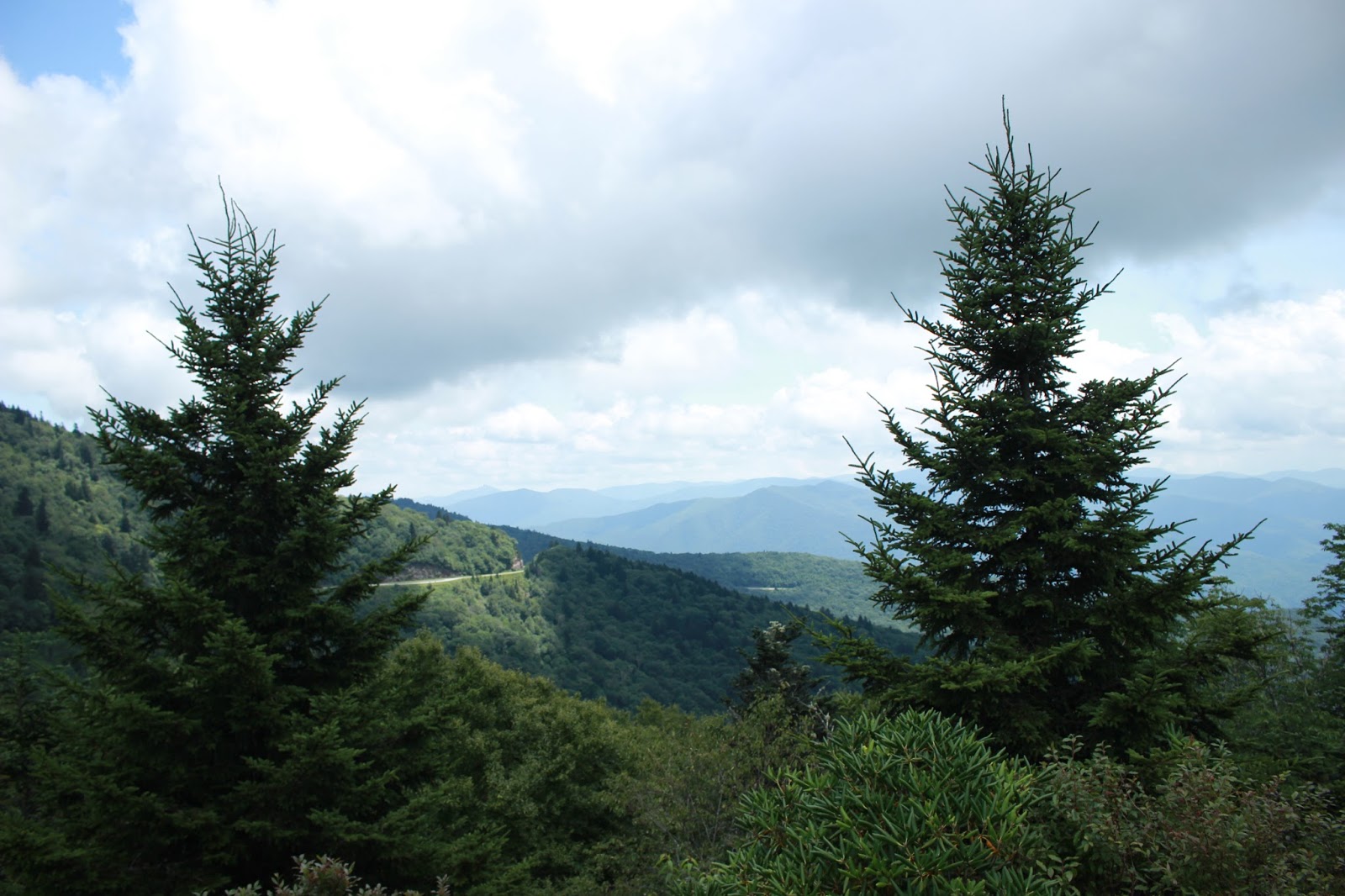
We stopped and had lunch along the Blue Ridge Parkway at a picnic table. The views today were spectacular.

View from Thunderstruck Ridge
Soco Falls & Tower
We realized how long it had been since we visited Soco Falls. We decided to do that since it was so close and so easy. We did not realize there was a look out tower there we'd never visited. We stopped to do both. Soco Falls was covered up with people. It is pretty, but it is hard to enjoy with so many visitors. It is nearly impossible to get a good photo on a day with that many people. The tower was neat and the view out over the valley was worth the fifty cents to go up. We could see Ghosttown in the Sky!

Quick snapshot of Soco Falls


View from Soco Tower
Waterrock Knob & More Parkway

We explored off the Blue Ridge Parkway. One scene was near the water works.
Lilies and sunflowers and angelica and lots of drunken bees!

Source of the water I heard flowing down the mountain! Off the parkway.
Piney Mountain Falls & Bearwallow Falls
We had decided to try to visit some of the unfamiliar waterfalls in the Cullowhee area.
We knew some of them were off trail the distances to them were short so we figured it would be pretty simple and easy. We did not come close to guessing the difficulty level once you factor in Summer vegetation and heat and humidity. It was a bad idea, but we did it just the same.

Confluence of Piney Mountain and Bearwallow Creeks. We had no trouble getting to this point.
We came out exactly right.

I was so hot on the hike out I got right in this hole and sat down.

 Lower falls on Bearwallow Creek
 Upper portion of Piney Mountain Falls

We worked our way upstream to Piney Mountain Falls. It is beautiful, worth the visit and we had it to ourselves. The time of day made it extremely difficult to get a decent photo. We were warned in advance by Kevin Adams. He hit the nail on the head.

A very poor photo of Piney Mountain Falls. The dappled light makes it hard to see.
While I took photos of the main falls Kenny explored further upstream. He came back and indicated for me to follow him. I did and we worked our way through loamy, black soil and loose rock and rhodo to the upper portion of these falls. We sat there and had lunch. It was a nice spot.
We then went back downstream and across the intervening ridge toward Bearwallow falls on the opposite stream. We never made it to the main falls. I was so hot I thought I would have a heat stroke. I was over it. We got to see the lower drop, but we'll have to go back for the rest.
I soaked in the creek to wash off some of the stench and cool down before our hot, difficult climb back out of that hole. We made it, but I won't try that again unless its during much cooler weather.


Sun peeping through the forest canopy.
I was glad to see flat ground again and get something cold to drink and rest. We had a pretty good vacation and it was mostly restful. Some stuff worked out fine. Other stuff not so much, but it was great to get away together. That's what I liked best.


