Showing posts with label Conasauga Falls. Show all posts

Wednesday, June 24, 2020

Conasauga Falls and Scenic Drive with the Family Round 1

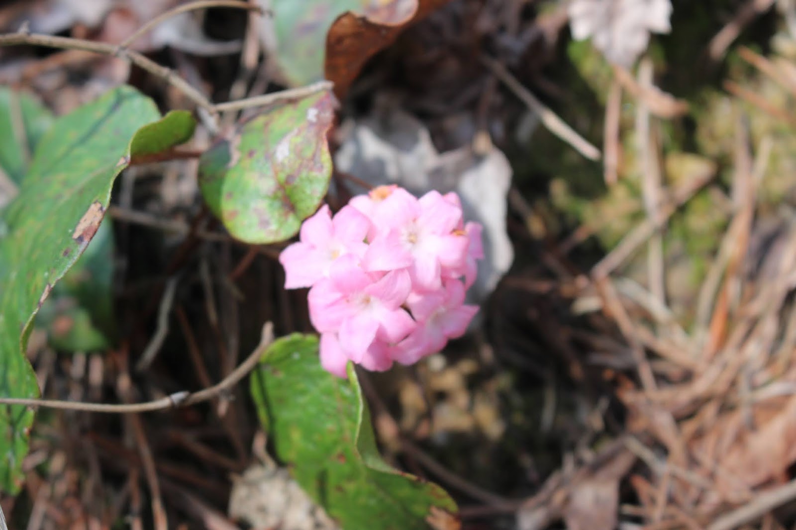
Trailing arbutus along Conasauga Falls trail. 
One of the earliest flowers to bloom in Spring. 


Conasauga Falls and Scenic Drive with the Family Round 1

3/27/2020

Dana Crystal, Michael ,Tessa

(Either X out the top right box or click the right arrow to advance. Photo 
album is a combination of several trips.  Pictures start with the photo of bright pink clump of trailing arbutus)


    This is one of the slightly abbreviated trip reports I'm catching up on. 
This took place right at the start of the corona virus crisis of 2020.   School was out because of that as well as Spring break had just started anyhow.   We were trying to get out and hike each week as a family.  
IMG_9342.JPG
      Above: Michael and Tessa start our hike

   We decided upon Conasauga Falls as a hike with other options to come later in the day.  I had long wanted to try driving Witt Road and Hot Water Road to make a loop back to Coker Creek from Conasauga.   I had been told by Nate Yarbrough it was a very pretty drive.  I still had not tried it.
IMG_9344.JPG
     Above: vernal iris likes dry pine woods

   We drove to Tellico Plains and on to the turn for Conasauga Falls trail.
We got to the end of the spur road and parked.   We saw one vehicle already there.   Another pulled up as we got out.   It was a mom and teen aged daughters.
I felt confident Tessa would be easily able to handle the 1.3 mile hike today.
It is a gradual downward hike on a good trail with switchbacks.    The day was warm and promised to get warmer.     We hiked out through the piney woods.
The forest smelled great. Fresh air and pine needle fragrance.     We saw trailing arbutus waxy pink dots along the path.  We saw vernal iris and  dwarf crested iris purple blooms also.

     We had to use care on the approach to the end of the trail.  The trail becomes more narrow and tricky.  Rocky areas and lots of tree roots.  We made it down without incident.    The stream was visible below. The kids and Crystal were really wowed by their first sight of Conasauga Falls.  It was running great today!
IMG_9346.JPG

Beautiful Conasauga Falls. You can see a teen girl standing looking at the falls about halfway up.  Great for scale!
Below: Michael throwing sticks or rocks. Tessa gets a drink of water. Crystal looks on.
  IMG_9350.JPG

Below: Michael.. my grandson age 11.  He is getting so tall!
IMG_9351.JPG
Below: Tessa has found a pretty pebble
IMG_9354.JPG


   We sat at the falls and enjoyed the cool mist and talked to the mom and her daughters a little bit.  They are home schoolers so they were not as affected schedule wise by the corona virus.   Dad worked from home. Mom was the teacher.   A pretty good set up especially for living that far out in the country.

     We made the hike back up to the top and vehicle.  We discussed what to do next. The kids liked the idea of driving through the creek and playing in the water.   I was good with that.  We figured we'd do that next since it was close.  If we had time left over and energy we'd add something else on. 

    We took my jeep with Crystal driving and me navigating round Witt Road.  I had been on it once before but only a short distance.   It is a winding gravel road.    It wasn't long til we got to the first creek ford. We pulled over to explore. 

IMG_9359.JPG

  A short stroll downstream of about 25 yards had us standing beside a pretty cascade on Conasauga Creek!  
IMG_9383.JPG
 We walked on downstream a bit further.  It was just incredible.  Lots of holes of clear, sparkling water, colorful pebbles and scenic cascades. 
IMG_9362.JPG
Conasauga Cascade. Here we are about  1/2 mile above the main falls we just visited! 
IMG_9363.JPG
Above and below
Sitting down to check out tiny pebbles.

IMG_9370.JPG

Below: Crystal is lost in thought.

IMG_9364.JPG

Below: Michael gets ready to wade the creek.
IMG_9371.JPG

Below: Not to be so easily outdone.. Tessa gets in the water too

IMG_9372.JPG
Below: path by the stream heading down along a series of picturesque cascades
IMG_9384.JPG

IMG_9387.JPG
Below:  mossy interesting boulders to scramble around above the path
IMG_9392.JPG


  We were beginning to get hungry so eventually we worked our way back toward the jeep.   We'd packed a nice lunch of sandwiches and fruit and chips.
We spied a black snake as we neared the vehicle.  The kids both like snakes and are fascinated by them.   He'd been under my jeep, but was slithering across the road.  
Mr. Black Snake... where are you going? 

IMG_9394.JPG

and he answered.. four wheeling! as he crawled across the top of a big gravel pile and down the other side of it.  Then he headed for a nearby tree and began crawling up it.

IMG_9400.JPG
Tessa ran over to the tree to watch him and talk to him.

IMG_9401.JPG
In this image above you can see where he is going.. up the tree to that small knot hole!  

Eventually he disappeared into the knot hole... all of him! Here is a funny picture with just his tail hanging out
IMG_9404.JPG

Below is a video of the snake and his doings


     The kids played in the pretty creek and we ate our lunch here at this spot.  It was really nice.    We then drove through the creek and continued onward. Below is a photo of the first creek ford.
IMG_9399.JPG


   We forded the stream several more times. The drive was glorious.  We had so much fun.  The road is rough. We took a wrong turn once and ended up in someone's driveway. Such is life in the Coker Creek area. pfffftt..
Crystal had to execute a seventeen point turn around, but we got righted and made our way round to Epperson Road and Hot Water Road and back out to Hwy 68.  We were all worn out so we headed home.    What a fun day!  The kids were already talking about coming back and bringing Papaw and Gabe.  They were discussing bringing various family members back to see this place. They were going fishing, tubing, etc.  Gee.. where do they get it?

 Below is a short video of Conasauga Falls


Below a short video of Conasauga Cascade


Conasauga Creek Scenic Loop Drive & Buck Bald Directions


Conasauga Creek 

Scenic Drive & Picnic Directions


Monday June 15, 2020

Dana Koogler 


  I am starting a new blog series for various places to take a scenic, fun drive in the country and have a picnic or cookout.    I hope it will be a useful and inspiring tool for folks to access. It will be helpful to myself to be able to refer back to it.    The new series will be searchable by looking up Scenic Drives and Picnics.    I have written a blog on great picnic locations twice before and it was a success both times.     I think this will be even better.
It will be suggestions and directions that can be printed off.  

      
 Overview-- Scenic Drive down to Tellico Plains and around a loop from Hwy 68, around Witt Road, to Hotwater Road and back to Hwy 68 at the Coker Creek Visitor Center.  We cooked out at Buck Bald at the end of our day.   It is right at 12 miles from the point you start at FR 341 along Hwy 68 and come out across from the welcome center.  

**Warning**
This drive is a mountain road and as such is rough and rutted in places.  It requires you to drive through streams four or five times.   It is recommended to drive it with a high clearance, four wheel drive vehicle.
We noted downed trees in numerous places along it.  It probably isn't a bad idea to carry a chain saw or be prepared to turn around if need be.  My daughter drives a Toyota Highlander and is unaccustomed to four wheeling, but handled it like a boss.   Same warning applies for driving to Buck Bald except the road is in better condition and you do not have to ford streams.

Conasauga Creek Scenic Loop 
      Driving Directions:  From Tellico Plains at the intersection of Hwy 68 and Hwy 165 (Cherohala Skyway) stay straight on Hwy 68 South for 2.20 miles and turn RIGHT onto FR 341 (Witt Road) which is signed as a turn for Conasauga Falls.   Stay LEFT at the spur road for Conasauga Falls. 
Remain on this road for 7.5 miles.  At this point you will come to an intersection where the road appears to bend left or go straight. Stay STRAIGHT here though the road is rough and rutted looking.  
Drive for another mile and bear LEFT onto Cannon Ridge Rd. 
Drive 0.20 miles and Stay STRAIGHT on Epperson Rd. for another 0.70 miles and bear LEFT onto Hot Water Rd.  Stay straight on Hot Water road another 2.50 miles and you will come back out on Hwy 68 
directly across from the Coker Creek Welcome Center.  

  Route Highlights

 This route provides an opportunity for a side trip for a short easy hike by driving the Conasauga Spur Rd to its end.. you could hike down and back to see the beautiful Conasauga Falls.  
IMG_9346.JPG
Above: Conasauga Falls is about 1.5 miles Round trip.
   Numerous shallow creek fords to drive through on your way provide scenic places to relax and stroll around. Kids can play safely in the creek.
A side trip downstream from the first ford provides an easy view of some very scenic cascades on Conasauga Creek as well as a wide place to park and picnic or play.      The first and 3rd fords were our favorites for both scenery, pull off space and good play spots.
Above: Conasauga Creek near the first ford. 

Above: Down from the first ford about 300 feet is this pretty spot.      Gorgeous forest drive with Spring and Summer wildflowers abundant on the roadsides.  Emerges at a residential area where the drive through the country provides a view of the Unicoi Crest in the distance.  Beautiful country scenery with barns, quaint country homes and lawns, horses, and old buildings.  
Above: Third crossing is a glorious spot to play in the creek or bring your fishing pole!      Restroom stops during non Covid times are available in Tellico Plains at the visitor center as well as at the Coker Creek Welcome Center once you come back out on Hwy 68.    

        Buck Bald Driving Directions

From the Coker Creek Welcome Center along Hwy 68 head SOUTH on Hwy 68 for five miles to a signed turn to the LEFT onto Old Highway 68 for Buck Bald.  Stay on the main gravel road that climbs 2.25 miles up to the summit of Buck Bald.  You will only encounter one intersection. Stay LEFT and keep winding round the mountain til you come to the top. 

  
 Buck Bald Attractions:
360 degree view atop a grassy bald of the entire Unicoi Crest and surrounding mountain ranges.   One picnic table available on top to use. 
No trash receptacles so take your trash with you when you leave.  No restroom facilities.

 Quiet, cool mountain top with plenty of space to let kids run around and play or fly a kite, or watch the sunset. 

**What Could We Have Done Better? **
Take along Bleach wipes for the picnic table.
Take along a larger trash bag
Bring own lawn chairs or blanket for sitting on the ground should the table already be in use by others.


 File:Camping-Chair-Background.gif - Wikimedia CommonsDIAMOND SHIELD - "Postage Stamp" Doll Quilt — Another Chance Quilts

 Buck Bald to the Southeast.jpg
above: Buck Bald has a 360 degree view! 
Below: Getting ready to fire up the grill to cook burgers


Friday, December 18, 2015

Hiking with Anne-Cherokee National Forest


Its the 4th skillet in my Skillet Collection
Found at Ballplay, TN.


Hiking With Anne in the Cherokee National Forest 

Thursday Dec. 12, 2015

Dana Koogler

Mary Anne Brewer

Hike distance for the day 6.75 miles 


     I had hiked with Anne before, but it was at a Smoky Mountain Hiking Club function.
It worked out that we went hiking together last Thursday.   Discussing it I tossed out suggestions for her and sent her some photos of places we might venture. I told her to decide which ones she liked.
I also told her that we should be able to fit them all into a day.    We met at the Tellico Plains Visitor Center on Thursday morning a little before 8:30 am.   We made a quick stop at a local convenience store for a bathroom break and last minute touch ups on provisions.    We took my jeep from 
Tellico Plains for the remainder of the day.  At least two of the spots we were heading to would be rougher roads and one in particular I was concerned about.    


           It was a beautiful day. It warmed up to nearly 70 degrees, sunny with a light breeze.
Our first stop was the pull off for Fall Branch Falls.  She had not seen this one yet, but had heard someone discussing a waterfall reachable from the Rattlesnake Rock area.   We hiked down to see it
and it was flowing fantastic.  We forded the stream by rock hopping.   It is a wilderness trail, but pretty good condition.   I have been numerous times and I really see the difference in the tree canopy cover with the dying of the hemlocks and the damaging wind storms the past several years.   The falls is gorgeous and she really liked it.   
 Anne taking photos of the falls.
Fall Branch Falls, TN Southern Cherokee National Forest. 


    We headed back up and boys howdy.. it was up up and more up. But then it leveled off and we were back at the jeep!   On to the next stop!   We headed in the direction of Ballplay Falls.


                Ballplay is along the old Buck Highway way out in the country. It is in an area one doesn't typically expect to find waterfalls, but there are some in there hiding.    The extra good thing is the drive is pretty and the setting is pretty too.    We parked and sat down on the porch of the old house to eat a quick lunch before hiking.   The stream flowed past and it was quiet.     The day continued to be nice and mild.   Curious cows watched us from the nearby fields hoping we had brought hay for them.    Once we had finished eating we grabbed our hiking gear and hit the trail.   We picked up a trail behind the house.  You can see it from where we parked, but the first hundred yards of that old road are choked with rhododendron.    It is best to walk on back of the house and pick it up at another spot avoiding all that mess.     

          The hike to the falls starts out as a gradual uphill grade.  Part of the trail is narrow and crumbly.
We just took our time and eased past the bad spot.     Long way down if you miss a step here.
There is another spot where you go under and around massive tree stumps.  Another bad spot in the trail has been repaired by logs building it up and keeping it from sliding off the hillside. 
Far below us the creek murmured.   We had glimpses of blue mountains and skies and deep green pines across the gorge from us.   It was not too long until the trail made a sweeping right turn and leveled off some.     The pine woods we hiked through smelled so good.  It was quiet other than our conversation.   What a good day this was turning out to be.  

        We began our gradual descent toward the stream.   Below we could hear the creek talking louder now.   The falls were close!    I had previously warned Anne that this trail was not well maintained and some of it might be rough. I anticipated that the only place which might be tricky was the last couple hundred yards to the stream level at the base of the falls.   Anne had not been concerned about anything we'd run into up until this point.  We were in for a nasty surprise.  We were faced with a snarl of downed hemlock trees of large girth.   They were peeled of their bark and very slippery.
Anne goes off trail with Tammi Layhue, but she looked like she was dreading this mess.  I entered the  tangle and scouted it to see what was going on?  I could see it was not as bad as it looked. 
Once through it the trail was on the far side once more.   We were within feet of being at the falls.
I described to her what we were going to have to do to reach the base.  I also told her that if she was not comfortable with going into this stuff we'd turn around and do something else?  Tough as iron and twice as determined she refused to give in!  "We're this close to the falls! They are right there!
I'm no quitter!" True to her word she is no quitter.  She is instead a determined, great humored, strong hiker.   We wriggled over those downed trees, through briars and down the bank.   We made it!
We stood at the base of Ballplay Falls high fiving one another! 

             
 Anne at Ballplay Falls.
 You can count every pebble in the bottom of the stream today. It is so clear!

Ballplay Falls is forty feet high and river wide.  You cannot really get a good vantage of the upper drop of the falls. The terrain is so dramatic there is no place to stand to photograph the upper falls on the far side of the river.  On this side the rhodo has choked the bank thickly leaving to place to stand.
Our spot at the base of the falls is IT!


             We enjoyed the falls here.  The stream below where we stood rushes over stones standing at odd angles.  It pretty quickly makes a bend and disappears around it.  The stream makes several turns before merging with another stream on the next ridge.    I thought about Paul Gamble today and hope to return here with him or him and Kenny so we can find the other falls he told me about. I found the creek it was on back in Spring, but talk about being clogged with rhodo!  He says he knows a better way to access it by taking the right side of the trail we passed earlier.  Says that will take you up to a point where you can just drop off to it!  

               Eventually we headed back up the bank.  I went stupid for a minute or two.
I tried crawling up the first open hole I came to. I encountered more briars and snarled vegetation that I had on the way down?  I backed up and tried again at a slightly different spot.    I still didn't get anywhere.   It hit me "I'm making this way harder than it has to be."  I told Anne to let me take another gander at the terrain and we'd figure this out.   I turned around and upon another look realized my mistake.  Before us was the hole we'd come down.   I remembered Anne remarking on the way down that getting back up it was going to be more problematic. I agreed with here in that instant and I agreed with her now.   Yet we struggled our way back up it.   We made it.  The wet, mushy bank here is also made up of small rocks and loose chunks of dried red clay.   It isn't the surest footing, but we found that it was short lived.   I thought of Jenny and narrowed the focus to the most immediate task. Get that little thing done....... then move on to the next step in the rhodo dance.   Before you know it.... You're out of there! It felt great to get back in the clear.  We shed layers of clothing and got a drink before hiking back out.   Once back at the old house we took time to photograph the house, barn, and outbuildings.   It is a place with lots of history.   We also took a few minutes to stop off at the Williamsburg Cemetery on the hill on our way out.   

 Old home place at Ballplay
 Anne walking along the muddy lane
Barn on the left and Ballplay Creek. You can just see the edge of the house and the wrap around porch.  The bridge is constructed of old fuel tanks.

          Ancient hog pen and old tires on the far side of Ballplay Creek.  I had never walked round here to check this out until today.

A look at the Williamsburg Cemetery.  It is pretty modern and very well kept.

I stopped on the way back out the old dirt road.  I wanted to get a photo of this scene.  We had passed it on the way in.  It was still the same on the way out.   Anne asked me "How does stuff like that happen?" and it hit me that based on where I am from......... It didn't have to be explained to me.

Shades of Vesuvius and driving in South River after SOMEBODY had too much to drink and decided to not only ford the river, but drive up the river with the mower on the back of the truck.
Not naming any names.   It wont me.   Mowing the yard works up a powerful thirst though. 


        We headed back toward Tellico Plains.   We by passed the visitor center and Anne's car
so we could go to Conasauga Falls which is not far off.   A fellow had described the condition of the road to Anne as being way worse than what it truly is.   I told her to take note of it today on the drive in to see for herself.    It really wasn't that rough.  Long as she is just going to the falls and back ought to be fine.  One turn down there takes you to a drive through the creek place and that could be rough in high water.    We passed one vehicle on our way in.  A fellow in a pickup truck who appeared to just be driving round enjoying the pretty weather.

              We hiked down the trail 1 mile to Conasauga Falls. It is a pretty hike again through a pine woods.  The trail is in good condition, but it does have a few rocky sections.    It gives you more glimpses of blue mountains seen through green pine trees.   We also saw some small cascades above the main falls which are scenic.    Conasauga Falls was running great today!   
Conasauga Falls rolling along!  

          We enjoyed the waterfall and when we were ready we hiked back out.  It is downhill on the way in and uphill on the way out.  The switchbacks make it a lot easier to take!
Anne is a great hiking companion and an interesting person to converse with.   I had an awesome day with her and I very much look forward to our next adventure.    She hikes at a similar pace to me.

      We parted company and said our good-byes.   Thanks Anne for spending time with me.
It meant a lot to me.