Showing posts with label morgan county. Show all posts

Friday, June 6, 2025

Gobey Four Wheeling Rock Ledges Trail to Brain Rock Overlook and Pilot Mountain Lookout Tower


above: seven sisters rose in bloom


Gobey Four Wheeling 

Rock Ledges Trail to Brain Rock Overlook & Pilot Mountain Fire Tower

 Sat. May 31, 2025

Dana & Kenny Koogler

Pictures are HERE


  We originally planned to take the pontoon boat  out on the lake on Saturday.   I was disgusted that we hadn't even had it out this season.  The problem was that the excessive rain had the lawn like a sponge.

Not wanting to tear the yard up or get stuck moving the boat right now was a bad idea.   I didn't care after my visit at the Morgan County Heritage Museum Thursday.   Reading my new book about Gobey had me intrigued and I was keen to do something different.   I suggested to Kenny that we take the RZR and go exploring at Gobey.  He jumped at the chance!  We were  both excited about the prospects. 

We knew the rain would have the rivers and waterfalls running very well.   Kenny got out Lifetime Maps on the tablet and we found out that an overlook we wanted to see was on there!  We'd finally go see Brain Rock and try a new trail. We could also visit the Pilot Mountain Fire Tower at last.  It was one of those places we'd talked to death, but never ventured.  Today we'd fix all that.  

      I have found that my lack of energy has caused me to rethink some of my elaborate plans and schemes.   I had planned on fixing a steak dinner and packing us a picnic for the next day on the trail.

I realized I am my own worst enemy.  I make my life complicated with all these plans. Why work so hard, go to such trouble and expense and time to prepare a meal that takes minutes to consume? 

Nope.  Today work smarter, not harder.   I figured out a dinner solution that could double as lunch solution for the next day.   Much more efficient and thrifty as well.  Adversity and struggle are making me re-evaluate many aspects of my life.   Pay attention to that comment as it is going to be on the quiz later! 😁  Much to Kenny Koogler's chagrin! 


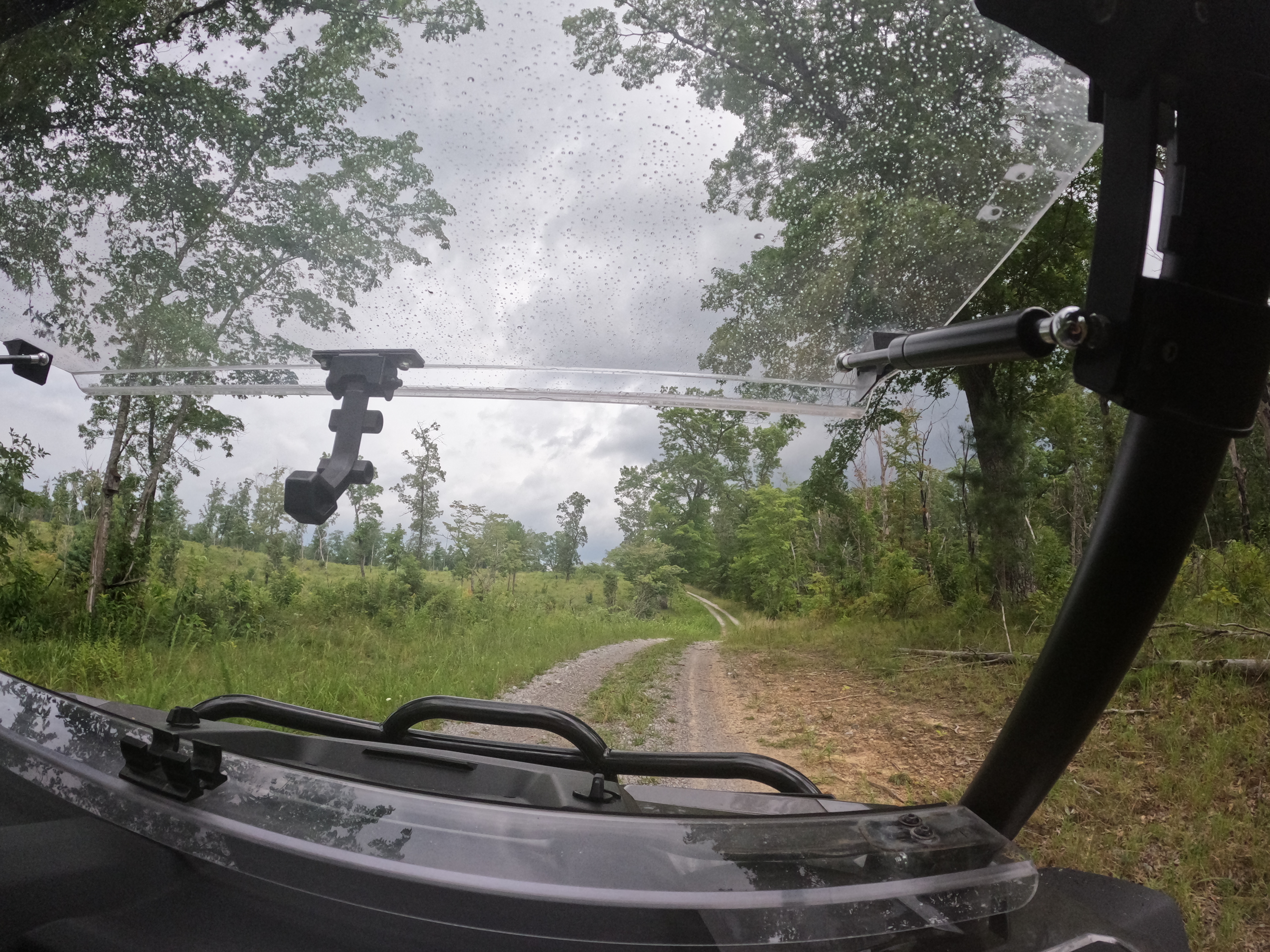
        We parked at Elizabeth Church today since it was handy to our starting point.   We started off at Greasy Creek and went up from there.  The ride to Brain Rock was pretty and seemed pretty short and straight forward.   

Below: Elizabeth Church. One of four churches originally at Gobey. It is one of only two that remain.


Below is a view of Pilot Mountain in the distance from Brain Rock. 


Below:  the surface of Brain Rock is where it gets its name.  


Below:  mountain laurel was in bloom today in many spots including at Brain Rock. 


Below is a video clip from Brain Rock Overlook


  We enjoyed the overlook tremendously.  It felt good to have finally found it. It was much easier than I expected.   Lifetime Maps to the rescue!   We moved onward to our next spot.  Kenny wanted to go to the waterfalls next. I said no because we had already seen them several times.  I wanted to stick to the plan of visiting Pilot  Mountain Lookout Tower.  He conceded the point and on we went. It was a fateful and fortunate decision.  I was batting a thousand today!  


      I had watched videos that mentioned Rock Ledges Trail as well as Brain Rock.  I was intrigued by the rock ledges aspect more than anything.   I have ridden parts of Gobey that were strange, convoluted and fun. They are paths that were left over from former coal mining days.   Today would be another adventure experiencing those old paths.   What I was discouraged by on all these videos is that most of them failed to show the mentioned feature.   Brain Rock was shown, but the Rock Ledges trail really wasn't.  I wasn't able to find a single photo or video that truly showed Pilot Mountain Lookout Tower. It only showed the trails which all began to look the same.   

      We continued our ride watching Lifetime Maps as we went.   It really helped us pick our route and what was out there to see.   The Rock Ledges trail was an instant favorite with us.  The scenery is beautiful and dramatic, and the ride was a challenge.   You wind along just beneath the level of impressive rock ledges on the sides of the trail.   Not one area is like another.  It is continually changing.

All of it is beautiful.    We saw a surprising amount of wildflowers in bloom for this time of year!

   Below are several shots of the various rock ledges.  


  The woods were in leaf out, but you could still see a lot today.   We saw flame azaleas, butterflies, a hawk, a scarlet tanager, frogs, tadpoles, dragonflies, and many other beautiful things.   Indian pinkroot was thick today though most were just starting to open. The tiny bright red spires were popping up all along the forest floor.   We saw two flowered cynthia, fire pinks, daisies, rock lilies, multiflora rose, Cherokee roses, and Seven Sisters Roses in pale pink, hot pink, and red! Day lilies were abundant along the roads and trails. 

Below: this ox eye daisy is odd looking with its narrow pointy petals

Below: multiflora rose in a deeper pink than I am used to seeing.  


above:  first sighting this year of flame azaleas in a deep red orange
Above: Virginia spiderwort just opening up

Below:  Indian Pink root
Below: two flower cynthia one of the blooms is very droopy


  One of the most exciting spots along this trail today was when we came to a spot with a drop off and a badly eroded ditch on the left... a deep tailings pond on the right and the trail on a narrow slope right between them.  I was tempted to get out of the machine, but Kenny got out and checked it saying "oh this won't be bad." and so I rode it out. He made it look easy.   It had some pucker factor though!  

  We came to a place that the map called Knolling Knob.  It was a steep climb on the trail up to a nice flat area in the forest.  I had brought the backpacking stove and equipment to fix us a hot lunch.  We warmed up sloppy joes on the trail and even toasted the buns in another pot.   It was better than a cold sandwich and was nice and quick.   We were able to clean things up and get going again in short order.

I noticed someone had discarded bags from those bagged cocktails and the containers from jello shots.

Apparently trail drinking makes it just too hard to care about picking up ones mess.   


       This is a good time to share the elevation profile Kenny showed me when we were home again!

Below: elevation track on Lifetime Maps from start to finish. Start on the left.. finish on the right.  whew!  Little by little we're learning to use the features on Lifetime Maps.  It tickled me pink to be the one who knew how to fix it when Kenny messed it up and lost our tracks.  I also learned to save a track.  We found the compass and GPS feature on it as well. 


 The section of trail immediately after Brain Rock was very muddy. It reminded us of the Water Trail at Turley.  It is now closed by the TWRA.   

     The next really fun and tricky spot was a place on Rock Ledges trail that was three or four deep mud holes one right after the other.   There was a work around, but it was sketchy sitting off camber.  After some ciphering things out and testing the depth and firmness of the bottom of the mudholes it was decided to go on through them.   Below is a video of that process.


We successfully made it through that stretch of trail and swung around the next section.  We could see a mountain off in the distance that was like a very pointy triangle.   It was Peak Mountain.   We passed over Young Mountain and came to a spot under the rock ledges where the map indicated "Draft Dodger Cave" this has to be Boog's Den.   I read about it in my new Gobey book I bought on Thursday.  We decided to tackle that in cold weather as snakes are out now.  It involves climbing around in the rocks to locate it.    I have seen a photo of it so maybe we can find it.   We will try again this Winter.


      The next section was a kiss your butt turn that took us to The Crosses.  I don't know if the people were buried there, ashes scattered there, died there or what , but there are three crosses at this spot. 

It has the deceased names on each one.   It is a pretty spot with a partial view.  

above and below: three crosses Braxton Shannon, Michael Love and Wormey Bales.  


Below: this is part of the Kiss your butt turn! 


above: an interesting and wide open forest in one spot along our trip. 

Below:  One of many downed, massive white oak trees today.  We saw three fallen white oaks. It was like the ENT grave yard. Very sad.  


Above: grassy path along Peak Mountain heading to Pilot Mtn. 

Below is a photo of the tailings pond that sat to the right of a narrow place where we had a drop off on the LEFT.... 


Below is a closer view of the tailings pond and if you look closely it is full of half grown tadpoles turning into frogs! 


Above: a pretty stretch on the trail with another huge boulder on the left. 

  Once we approached Peak Mountain we encountered part of the trail tightly encroached with vegetation on all sides.  We had a slope below us and a slope above us.  We ran into another mess with two downed trees and the tops of them were what crossed the trail.  Kenny opted to take the work around rather than spend time clearing this tangle.   He backed us up and we hit the work around. About that time here came several machines UP the trail. Thankfully we had room to pull over and let them pass.  It was three couples riding side by sides. They were the only folks we saw all day.   

      We wound up and down and continued in a counter clockwise direction until we were nearing Peak Mountain.  The trail doesn't cross the summit, but goes around the shoulder of the mountain.   It was a very pretty part of the ride with partial views for much of the way.  One part of Rock Ledges Trail is a knife edge where you can easily see from one side of the ridge to the other with a long way down on either side.     The   Peak Mountain section was nice.  It had more interesting rock forms, flowers, and views.    


Below are some fire pinks I saw on Peak Mountain

Below: Eastern Tiger swallowtail butterfly on flame azaleas on Peak Mountain
Below: another flame azalea shrub on Peak Mountain. You can see the lichen covered rocks that were strewn on the upslope. 
Below: Peak Mountain trail 


Below: view from Peak Mountain Trail 
Below: looking ahead on Peak Mtn Trail 
Below: elderflower with a meadow frittliary butterfly

Below is a view from Peak Mountain of approaching Pilot Mountain I think. 


Below is a video of the view from Peak Mountain


  We continued onward toward Pilot Mountain.  It helps to be able to see on the map track how close you are getting not to mention which turn to take.   We found the trail up to Pilot Mountain summit to be in good condition most of the way.    Coming off was pretty, but another matter. It was rougher and more eroded.   We arrived atop the mountain and found the antennas and the fire tower.  The tower is in bad shape.  Most of the steps are missing and it is fenced inside an enclosure.   The summit is flat and you still have partial views. No wonder we don't see videos of it or photos. It isn't much as lookout towers go.  It was still satisfying to visit.  I walked down the slope to see fire pinks growing in an old stump!  


     Below: partial views from the summit of Pilot Mountain.  Just beginning leaf out here! 

Below: looking up at Pilot Mountain Fire Tower 
Below: a zoomed in view of the cab 


Below:  fire pinks growing in an old stump down the slope from the tower 

Below is a short video clip of the fire tower and the summit.  I actually show the tower.  


  We took time to get a drink at the summit and motored onward.  We'd head back toward the Elizabeth Church and then on up into Gobey toward the waterfalls.    The ride down to the church was pretty, but rutted. We passed several ponds and small streams. The forest we passed through was largely hemlock and loblolly pines.  The pines were clearly planted as they were all in straight rows.   


       We came down through a small residential area and eventually passed the Caney Creek Church where they had some kind of doings. Maybe Vacation Bible School as a lot of churches are doing that this time of year.   They had a good crowd!  


          Once we passed the truck we stopped by the bridge for me to get some photos of the roses and the river.   The Emory River this time of year is jade green and this year is full of water!  It can get pretty shallow in Summer.   That is more  usual.  


Below: shimmering waters of the Emory River near the bridge. The ruins of the lumber mill are in the forest just out of sight at this spot.   

Below:  a mass of seven sisters roses covering an old rotting log at the bridge


          We passed the first gate up Gobey along Macedonia Road.   The next left took us to the turn for Gabriel Falls. We visited that first.    We could hear it from the road easily. We went up past it, turned around and came back down to it.  We got out and bushwhacked carefully from the road to the creek. We had our eyes peeled for snakes.  Thankfully we didn't see a one.   It was brushy and briary to reach the falls, but it was a short bushwhack. We followed a rugged old road bed to it on the far side of the stream.   It was not easy, but it was possible.   Kenny slipped and busted his butt on the way.   That is usually my job, but I was very, very careful today.   We had to then cross back over to reach the falls from here.    They were running real good and it was worth the effort to see them today.  There is a small lower cascade just a few feet high, but real pretty.


Below: Gabriel Falls in good Summer flow


Below: the lower cascade of Gabriel Falls 

Above: Gabriel Falls from further downstream. It gives you an idea of the terrain. It is steep sided all around it. 

Below: closer view of the lower cascade


Above: Looking up at the sun around 3:30 pm.   I read in the Gobey book that the sun didn't come up until 10 am or so and went down around 3 pm.  I'd say this was owing to the terrain and the dense forest cover! 


         I made an offhand remark something to the effect that "It isn't that high up to the road. It is a shame there is no way to reach it from here."  That was like waving a red flag in front of a bull for Kenny.   He waded into the brush over there with those tall snake stomper boots on.  He yelled for me to come on over there.  I asked him WHY?  to which he responded there was a good photo to be taken from that spot.  


  It was then I had an epiphany. The lightbulb came on over my head and I realized he was lying to me.

I had two logs over the front of the falls where I was directly in front of it.   Over on that side they'd be even more of an obstruction. Not to mention the rhodo in the way!  I told him NO!  He then had to say the truth.  "Come on over here and I can help you get up to the road easier than the way we came."  

 Now I KNEW he was laying it on thick.  He was trying his darndest to get me into a fix with him.

Nope. Not today hoss.   I refused and the crest fallen look on his face was priceless.  Why oh why have I failed to realize this all those years before?  He is a shyster.  Trying to trick me into trouble.  Lead me not into temptation. I can find it myself!    I told him to go ahead and do what he wanted, but I was going back the way I'd come.   He came trotting back. Part of the walk back was listening to him Man Splain to me how he was going to hoist me up and put my butt on his shoulders and heft me onto the road.    Sheesh.   He was REALLY disappointed which made me even more tickled that I didn't fall for it.   It seems old age is smartening me up to his treachery! 


    Below is a video of Gabriel Falls


     Next we went to Atlas Falls which was a short distance up the road.   It was running really well also.

It is a short walk down over the embankment, but it is clear folks are riding right down to it.  Kenny opines that he  bets folks are trying to climb it with the machines. He might be right, but I doubt it. 

 I was growing tired and about ready to head home.  We enjoyed a brief visit at Atlas Falls before we went back to the truck.


    Below: Kenny in the snake boots at Atlas Falls 


  Below is a video of Atlas Falls from today. 


   We made it back to the truck around 5:30 p.m.   We loaded up and got going.   We agreed to stop by Buddy's Barbecue in Oak Ridge for supper. I am tired of cooking lately.    Cooking generates a big kitchen mess and mine seems to stay messy anymore. 

     We had a grand day together.   It was a memory maker for sure.   We had so much fun and saw new terrain.  We both agreed this trip makes us want to go back to Gobey next Spring to see what blooms in the new area up high?   Maybe we will.  


     It was a perfect day with fun, adventure, beauty and romance to cap it off.  


Wednesday, August 16, 2023

Catoosa WMA Exploring


Above: Brown Eyed Susies growing at Catoosa 


Catoosa WMA Exploring 

Sunday August 6, 2023 and Saturday August 12, 2023

Kenny & Dana Koogler 

Catoosa Pix Here 


**You can purchase  a good map of Catoosa WMA from the TWRA. I have one .
It has been quite helpful.  I included the how to order a map on the link above for directions.**


Preface

    My initial purpose in writing this blog entry was simply to tell the story of what we experienced at Catoosa.   Subsequent questions of my own, my husband's, and those of others made me realize I should provide some directions and useful information.   The primary purpose of Catoosa WMA is for hunting.     It is a multiuse area with lots of other things to do.  Hunting wildflowers and wildlife viewing and  just exploring are  allowed. 
You  have to familiarize yourself with the the place and the regulations.    I made a separate page for the directions and regulations.  It is printable to take along. You don't have to read this trip report to find them.  I often find my own directions useful  even when I am the one who wrote them, and should be familiar with them.


Catoosa History and Visits 


   Kenny and I always enjoy visiting Catoosa Wildlife Management Area.  It is located in Morgan County.  It is a multi use area with hunting, fishing, boating, hiking, and limited ATV use available.
It is a beautiful area with a rich history.      It was a common hunting ground for several Native American tribes.    It was forested at one point, but there are descriptions of it being a huge grassy plain with scrub and very small trees now and then.    It was that way from grazing animals and periodic prescribed burns by the Indians.  They were way ahead of us in the forest management department! 
It was hard for me to understand what was being described with regards to the grazing.  I was not sure what the context was. I did not think the Indians had livestock ?   It was not domesticated animals. It was huge herds of buffalo, deer, and elk that were doing the grazing!  

        Today Catoosa is a remnant grassland or prairie of what once was.   I always love seeing the Oak Savanna restoration and watching the progress.   They are managing it today with equipment, and a heavy dose of "Squirt and Burn"  Brush killer applied.  Periodic prescribed burns.     I have watched the plant communities grow and become more vibrant over the years.  It is amazing to see.
 We always see interesting wildlife out here.   Today I saw a clearwing hawkmoth, butterflies, a goldfinch, a fawn with spots,  a copperhead snake, and a hawk!   

    We went out after lunch since my mom had been down for a visit.  She left to go have breakfast with Jared & Lydia and the kiddos.   We goofed off awhile and finally the drizzle outside stopped.  We threw out stuff together and headed out.  A friend had told me where I might be able to find some special flowers.   I wanted to try to locate them while they were in bloom.   We ended up not finding them the first trip, but returned for my birthday and found them.  This trip report is a combination of the two trips.  It was more fun the second trip.  What an adventure! 


Above: Clearwing Hawkmoth on wild bergamot.


        Catoosa is huge and has numerous access points.  You still have to be careful and think about what you want to see as well as where it is located in relation to the entrances.  Keep in mind  the Daddy's Creek bridge is out at Hebbertsburg Road near Devil's Breakfast Table.  We needed to be on the western side of Catoosa for our purposes today.     We initially were on the Struggle Bus because we thought we knew what we were doing.  We forgot that there is  Peavine Road (SR 101) and Peavine Fire Tower Road.    A brief mix up and sort out and we were on course for the day.

          I saw lots of wild bergamot with its delicate frilly lavender blooms.  A clearwing hawkmoth was feeding on nectar along the road.    I always enjoy seeing these tiny creatures.  They are a moth, but they look like a hummingbird, butterfly combo!   


Above: Wild bergamot was abundant all along the roads today as well as in the fields. 


    Catoosa is managed by the Tennessee Wildlife Resources Agency.   We have watched over the past two decades as things changed out there for the better.  I have to hand it to them. They have done a marvelous job with this place.   Southern Grasslands Institute I believe has worked with them to restore this savanna and protect and promote  wet grasslands, seepage slopes, and a wide variety of habitats that are fading fast in today's world.   I am not a believer in cutting down old growth timber to restore grasslands, but I know that quail habitat, pheasant, dove, deer hunting, and small game all depend upon grassy fields and disturbed areas to forage.   Take a look sometime at the types of vegetation you see in forested areas where there has been no  disturbance for a long time.   Then take a look at a power line cut or field where there has been some kind of man made disturbance.  There is a lot more variety in the disturbed areas than there is in the "unspoiled" forest.   Many years of fire suppression allowed timber to grow, but in the wake of the forests the grasslands vanished. So did the little mini ecosystems within those grasslands or prairies. 


Below is a view of the Cumberland Plateau viewed from across Catoosa.


Above and Below: Potters Ford crosses the Obed River. It is a particularly serene, peaceful place and quite beautiful. Lots of wildflowers here.  


Above: Tall purple phlox and lots of woodland  sunflowers at Potters Ford. They are abundant here.  
Below is a close up of the tall purple phlox (Phlox paniculata) 


Below: Also seen at Potters Ford Greenheaded Coneflowers 
Rudbeckia lacinata.  The Cherokee's ate these and call them Sochan.  They are a pot herb.  
I have done some reading and found that early in Spring when they first come out they pick the tender leaves and boil them and drain off the water. They then fry them up with oil and often other herbs.   They are a bitter herb.  The leaves and roots of this plant also have medicinal uses.


Above and below are views of Joe Pye Weed with it's fluffy pink blooms.  It is a great pollinator plant.  
Eutrochium purpureum.


Below:  Phlox paniculata a possible escaped cultivar.. Bright Eyes is an old favorite.  Folks used to live near here so I wonder if it came from an old garden?  


Above: Starry Campion seen at Potters Ford 
Silene stellata


 Above is a video of lovely Potter's Ford  and the tranquil Obed River


  Catoosa is a large area at around 85,000 acres. I believe that number was prior to the addition of the Terry Tract on the far western end of the WMA.  It was added in 2023 and is 1740 acres.  Here is an article about that acquisition.      It will maintain access to a couple streams including the Obed River.  I am interested to see what opportunities this will open up for users of the area. 

        I had to sit down and do some thinking about the reasons Catoosa has been so attractive to me.  They are many.   

  • Far fewer visitors encountered 
  • quiet/solitude
  • wildlife viewing 
  • exploring and the unknown
  • the views and scenery
  • history
  • botanizing
  • photography opportunities
  • four wheeling
  • hiking
  • variety of textures and the ungroomed character of its roads and trails compared to trails elsewhere 
Lastly there is some ineffable quality about it that just draws me.  I think part of it can be explained by the fact I grew up on a sage barren in Virginia.  A grassland where there were views of the surrounding mountains, and fields of rust gold broom sage.  The forest behind where I lived was an oak-pine forest.   Catoosa has many characteristics that remind me of pleasant childhood memories.    I realized also that the people I encounter at Catoosa have all been very nice so far.   People who are warm hearted, pleasant, willing to share information, having a good time, and happy to see others enjoy themselves.  

           
Above:  Another view of the large masses of brown eyed susans growing along the edges of the roads 


Below: Rose Pinks were a common sight on both trips all along the roads and out in the fields.


Above: Butterflies nectaring on butterfly weed 

Below: a close up of the butterfly weed after they flitted away. Tiny orange gems!

Below is a photo of  Helianthus silphiodes the Ozark Sunflower. These were abundant on both trips.  They are elegant looking to me.  


Below: Otter Creek flows tranquilly onward. It has a bridge and a ford side by side.   It is a tributary of the Obed River. 


Below: Dolls Eyes were growing by Otter Creek in the forest.  You can see where they get their name as they look like little eyeballs you'd place in a doll.   They are the fruits of Appalachian Baneberry.


Above: Yet another vista across the WMA

Below:   This view  was one of my favorites.  Click on the image to view it full sized to get the full effect.  The colors and textures standing before those blue green mountains are a treat for my eyes.   You can see the beginnings of Autumn colors creeping in to the scrub here. Red leaves dotted in there amidst green trees.  Also the  various shapes and tones of the goldenrod are especially pretty.


  Our visit of August 6 we went looking for orchids and failed to find them.  Yet it was a good time and I believe all it really did was whet our appetites for more adventures in Catoosa.  It was a hot day and very humid, but clear.     We looked all around the oak savannas for those orchids.  
I believed I knew where they would be, but I had failed to take into account one important factor in the search.   Going below the slopes and flat plains up top would yield interesting, and better results.     It doesn't take a lot of elevation change to make a big difference.   Out in the plateau the area is a plain with mountains, and inverted mountains in the forms of wide gulfs.  Thanks to the flat terrain there are lots of ponds and lakes visible everywhere you go.  The water has to go somewhere.  Run off water is going to take advantage of any slope and roll downhill. 
Lots of mini ecosystems can be found in these spots.   

      Catoosa has loads of wildlife ponds in various states of existence. Some are clear and you can see fish in them. Some are murky and scum covered and so thickly surrounded with vegetation you can't really get close to them. They are swamps.   One really pretty pond is near Potters Ford.  It is clear and shimmers in the sun. 


       Above: wildlife pond at Catoosa near Potters Ford


  One of the things we witnessed on trip # 1 was a hawk dining on a copperhead.  He flew up and lit in a tree when we passed by.   I got out to see if the copperhead was still alive? He was not. He'd already been run over by a vehicle. The hawk was merely the clean up crew today.
Below: Hawk after he landed in the tree. Sorry it is blurry.


Below is a photo of the copperhead or what is left of him. The photo doesn't do a good job of showing the scale of the snake.  He was just out of the juvenile stage.  Having lots the neon green tail tip, but not large at all. 


Above:  A photo of one of the areas of oak savanna restoration and the signage.  
Below: Another vantage point to look over the savanna


Below:  A photo of a drum chopper used by the area managers to break up woody vegetation. Kenny explained the use of this to me. I am still not 100% sure I understand how it is used. It is pulled behind a tractor or piece of equipment and it rolls along chopping brush and smaller woody pieces.  He said they use it after timbering to take care of the remaining pieces and brush. I think that is true, but I read that they also use it before doing prescribed burns.  Interesting. 


Trip One we did not find the looked for orchids so we went on down to Daddy's Creek. It was looking beautiful today. 

Below is a view downstream toward what is left of the rickety bridge.  They  have placed huge blocks of stone on either end of it to prevent anyone attempting to drive on it.  Today we could have forded Daddy's Creek either on foot or in the RZR safely. 


Below is a view upstream of the swimming and fishing hole on Daddy's Creek. A man and woman were the only ones taking advantage of it.  If you enlarge the photo you can see them.  


Below is a video of Daddy's Creek on August 6, 2023 visit #1


 We did not tarry long down here.    We headed back the way we'd come.  On the way out we passed a large patch of bright red cardinal flowers growing in the ditch by Potters Ford.
See them in the image below.  These attract butterflies and hummingbirds. 


  Having struck out we decided to call it a day on trip one and headed for home.  We were in my jeep on trip number one.    Trip two we brought the RZR.    


Try, Try Again! 


  We had a long planned family camping trip for my birthday Thursday through Sunday at Indian Boundary.   Kenny put a lot of work into planning it and reserving campsites for everyone going.   Our daughter Crystal, son-in-law Adam, grandkids Michael and Tessa. Our friends Gary and Kaylee and their little boy Kash,  ourselves and Gabe & Mia were all to go.    We arrived on Thursday midday.   It was a little rainy Thursday morning, but let up.   The forecast called for better days Friday, Saturday and Sunday.    I believe Gabe is correct when he says weather forecasters have the world's worst job. He calls them Wrong Guessers.  He was oh so right this time.    They missed the forecast by a mile.    Friday dawned rainy.  The other bad thing was the No Can Do Attitude of so many of the rangers down in the Cherokee National Forest.  I won't get into that, but I see it is there and growing worse.   

       We were down in that hole with no way to get a phone signal to even check the forecast to see the radar. We finally took a ride out to Tellico Plains in hopes of the weather breaking and we'd get to go hiking, swimming, exploring. All the fun things we wanted to do.  It just wasn't in the cards.   We had a comin' to Jesus meeting in that truck. I told Kenny I appreciated all the effort, but that I was not having fun and neither was anybody else on this trip.    I was not spending my birthday cooped up in a camper in the pouring rain with two dissatisfied kids.    The kids quickly chimed in that they were over it.  We went back to the camper and packed up and headed home.

                  Saturday morning dawned clear and pretty. Today was my birthday and I wanted to spend it doing something fun.   I decided by golly I was going back to see if I couldn't find those orchids.   I had handled disappointment on the camping trip.  What was a little more if it did not pan out?    

               We took the RZR this time.  We parked along Genesis Road and went in from there.
We took Potters Ford Road and cut across to Otter Creek Road. This was the most direct route to get us across.    We found our trailhead we wanted to try and parked the machine.   I insisted we were wearing our snake proofing today.   It was getting hot outside, but we sprayed down with loads of DEET.   We donned our snake gaiters or boots and headed out.  

         I spotted several nice ladies tresses orchids today from the place we parked right on into the area the other orchids lived.  


Above: Some variety of ladies tresses. It is a native orchid.

Below are a couple other neat flowering plants I spotted. 
Canby's lobelia is the one immediately below.


Below is some type of St. John's wort. It is likely Coppery St. John's wort. It is "glabrous" or smooth all over. I had seen this before somewhere. It was very pretty. I only saw one plant of this.  
Below: Steeplebush Spirea tomentosa... a native species. I am not sure this isn't the first time seeing the native form.  I have seen loads of non native, invasive Spirea japonica. 


  We started out on a foot travel only trail that initially was pretty clear.   I was enjoying checking all around for wildflowers.   Kenny was tromping along up ahead of me.  The trail quickly became more brushy, and weedy.  It got to the point I was watching like a hawk. I was on high alert not for flowers, but for snakes.  Last Summer's foolish encounter with a huge rattlesnake had me with my head on a swivel.     I was not letting my guard down today.  

     At this point I was briefly not having fun, but it wasn't long until the path thinned out a bit and became more open once more.   We passed through spots that were quite boggy and muddy thanks to the rain.     Kenny was grousing to himself "I hope we are on the right path today. It is mighty hot out here not to know where we are going."  In my mind I was in agreement, but kept my mouth shut. This was after all, my idea.    Moments later he sang out "No matter! I see 'em! They are HERE!"  
Now was one of those moments I knew that my botanical proclivities had changed him. Just as his engineering shows and career have influenced me.... I have at least influenced him some.
He likes finding rare and special places and flowers too.     

    Sure enough I rounded a bend and there in the brush were the first two yellow fringed orchids!
I have seen these in great numbers and in too many locations to quite remember them all.  I have only seen them in a few locations in our home state of Tennessee.   One was in the Smokies in Blount County... the other was in the southern Cumberland Plateau.   I so enjoy finding native orchids.


Above: First two orchids along the trail 


Above: The photo above doesn't show it well, but the ground here is disturbed and has holes and water standing.  


The image below is another spot where the water was the most.  It may be a creek or the headwaters of one. 


Below: We passed a large patch of Maryland Meadow Beauty.


Below: A close up of Maryland Meadow Beauty. It is a white color while Virginia Meadow Beauty is pink.  Both like wet meadows. 
Below is a rock outcropping I ran across.  I had to go snoop around it. Spots like this can be special environments to find unusual plants and flowers. This was true here.  Nothing super rare, but it was neat.  The rock was a seepage spring and slick as snot.  I just about fell climbing around here. 


Below: a closer look at the rocky seepage. Pineweed aka Orange grass, reindeer moss,  and Curtiss' milkwort.  Orange grass has a very pleasant citrus scent if you crush the stems.  I have seen this before on the property we used to lease in Tallassee.  It was growing in a rocky area. 


  Kenny was ahead of me over in the scrub of the wet grassland.  It was about knee high in most places.  Low shrubby growth, grasses, and tiny tree sprouts were around.  The ground was irregular with tussocks of grass and the occasional hole.  Kenny was very excited for me to get over to where he was. "You're not gonna believe it!"  I pushed on toward him and there they were.  Yellow Fringed Orchids everywhere I looked. They stretched on as far as the eye could see.   In nearly every direction.  It was an amazing sight and a real treat.  It was the perfect birthday present.   There may not be many women who want to spend their birthday getting swarmed by gnats and bugs, sweating in the heat and humidity, wading around in knee deep brush and weeds, but I did.   I do when the pay off is as great as this was.  


Above and below: Views of orchids .. Platanthera ciliaris in huge numbers. 


Below: A close up shot of one individual orchid to give a better idea what these look like.

Above: I liked this moody, dark shot.  The sun must have gone behind a cloud.  It was overcast today now and then.  I like  how the gloom sets off the neon orange colors of the orchids. It really makes them pop!  These photos are best viewed full sized so click on them. 

  I remembered to make a video of the flowers this time.  I'm doing better about video taping things aside from waterfalls.  It is a process. You get a feel for the conditions watching it. The bugs were horrendous. Despite our Deep Woods OFF we still had to contend with them.  Yet we did not get a single mosquito bite or tick!  


Below are a few other interesting finds in the grassland.  I saw Narrowleaf Mountain Mint for the first time. I pinched off one leaf and crushed it. Though it doesn't look like typical mint it certainly smells like it.  


Below is one of the varieties of Blazing Star 


Above: A large Polyphemus moth fluttering about in the grass.   I think it is a male because of his richer, deeper brown coloring. They are not rare.  I had never seen one before though.   They are a silk moth.   He is named for the mythical cyclops Polyphemus with one huge eye. 


We hung around wallowing in the beauty of the orchids and grasses. Finally the heat, bugs and humidity got to us and we began our walk back.  Below is a photo of Kenny way ahead of me. I am lollygagging because I am still trying to make sure I don't miss anything.  


  We made it back to the RZR and got out of those hot gaiters and got in the machine.  We headed onward with the wind  cooling us off.  It was a blessed mercy.    It was near lunch time or after, but we were a little too hot to worry about eating for a bit.  The other part of the plan today was to continue toward Daddy's Creek and ford. We would then proceed on to Crab Orchard Creek where I wanted to swim and get underwater photos and video.    We got down to Daddy's Creek to find the water levels dangerously high.  When creek kayakers are arriving in great numbers you know it is too high to ford. They were rolling in droves across the river.   We were mortified and turned around.  Kenny at this point said "No worries. We'll get there some other way."   We went back up the road to the first shady spot we found. We pulled over to eat lunch.  While there two hikers emerged from the Cumberland Trail through the downed tree we saw across the trail.  They were good sports. They  had done an out and back. They found the heat and humidity to be a bit much today so they did not go far as they planned.  It was nice talking to them.

          We began our drive back. I asked if Kenny minded for us to check out some side roads? He agreed readily.  We did and it was fun!  The roads we picked dwindled down to trails. We had views out from high places.  We had beautiful forests and meadows to see.   It felt so great to be free, having fun, and not having a locked in destination.  We were just exploring.  We'd had success today thankfully finding the longed for orchids.  Now it was all just exploring for the pure enjoyment of seeing what was out there?     We ambled round for quite awhile heading in the general direction of the truck, but taking lots of side trips.  Many of them form loops back to the main road.  

       We had our first downed tree encounter on the first side road.   We were within 100 yards of the main road and happened upon several downed trees so bad we could not proceed.  We did not have the chainsaw along today.   Another fellow pulled up on the opposite side in a RZR with his wife. We all had a good laugh at the fix we found ourselves in.   No sense getting tore up over it.

        Below is a view from on high. You can really see the beginning of Fall colors in the scrub brush.  Up high the leaves were turning red and orange. 

Above:  Wild Senna is one of the nice surprises we saw along the side trips.  It looks like little monster mouths. I've seen this only once before. 

Below: Another bonus find was the beautiful swath of Possum Paw fern we spied by the trail in a wet area.  The binomial for it is Lygopodium palmatum


Below is a large patch of Virginia Meadow Beauty (Rhexia virginica) with its deep pink flowers.
It was growing in a wet area. 


  I recalled seeing an area with a lot of ponds.  It was beginning to make me doubt myself if I had just made it all up in my head.  I could not remember where I had seen them. Today's side ramblings we passed all of them.  The vegetation has grown so much over the past decade we could not get good photos of them today.  These ponds were filled with scum and dead trees. 


Above is a view out the windshield on a side trip.  It was beautiful on the northern edge of the WMA.


  Finally we came back out to the main road.  It began to rain.   It did not last too long and it let up. 
It just drizzled.  It was cooling things down so that was nice.  We had one more side trip planned.
A loop off Potters Ford Road that would change the scenery up on the way back to the truck.
We were on that when the bottom fell out and the rain set in.   We encountered downed tree after downed tree.  Some we made it through with a little work.  We were getting drenched, but we were laughing.  We got within sight of the main road and had to turn around. Two massive trees down over the end. Kenny cussed and we headed back the way we'd come.   We were laughing at our luck. It was a bit of excitement and variety to wrap up our day.  The rain stuck around so no point going to Crab Orchard Creek for a swim. The lightning and thunder made that unwise.   


Above is a photo taken through the RZR windshield in the downpour.


   Below is a video of the ride highlights. 


   Once we got to I-40 the drive home was long and in the rain.   They are repaving and we sat in traffic for 30 minutes plus.  I was in such a great frame of mind I was unconcerned.  We stopped in Lenoir City and grabbed fast food at Arby's. We were wet and muddy, but happy and laughing. 
What a good birthday it turned out to be after all!  I was so grateful.

 
      Upon getting home I did some more reading on the Southern Grassland Institute and the work being done in habitat and grassland restoration at Catoosa.  I knew to my lay person eyes things looked better.  Reading this article I found once I got home and just savoring the experience I understood two things: 1. I was correct and things actually are better 2. I learned the almost magical WHY things are better.    Once Catoosa's oak savanna and grasslands began to be restored something special happened. 
The conditions returned to how they were supposed to be. Unknown to the land managers there was an underground treasure box of seeds!  The ground was full of the seeds of former plants left over from the time it was a grassland.   Return it to its proper state and the plants emerged and flourished.  

 It is an amazing success story.    Below is a photo of one of the humble little plants I found on the wet grassland for my first time sighting.  It is called Roundleaf Thoroughwort.   Eupatorium rotundifolium.
It may not look like much, but it has well proven anticancer properties!  
It occurs to me we do not know fully how important restoration of these grasslands and mini ecosytems may be to our own survival.    Perhaps in the plants or flowers contained in such places are the cures for various ailments?    I do know that I am pleased to see how this is shaping up.   It is beautiful and the wildlife seem to thrive here.  

Above: Roundleaf thoroughwort is a cancer killer!