

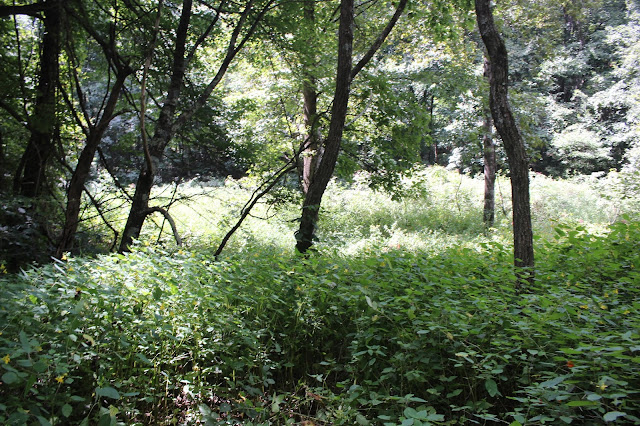
Poke Berries growing near Tipton Knob
Boondocking in the Cherokee National Forest--
Camping and Exploring Around Tellico Plains
Dana & Kenny Koogler
Friday Aug. 30 through Monday Sept. 2, 2019
Pictures are here Doc Rogers Country Pix
starting with frame #187
**removed directions here to Doc Rogers Hospital Ruins**
The Koogler's have been going through some upheaval lately to our lives.
Kenny worked in Miami on a project for seven weeks. He returned home to a mountain of projects that need working on. The biggest two were our new storage shed needed to be finished or gotten to a point where it was at least usable. The second and even more dreadful.. our son's bathroom at his house needs torn out and remodeled. Add to that the odd assortment of other home fixer uppers that needed doing. Grandkids birthdays and the need to catch up and spend time with them. Add to that the fact that Papaw is going to have to make one more trip back to Miami, but doesn't know when.
It has been like being dragged behind a NASCAR vehicle at a high rate of speed and out of control.
We both needed a get away from all of it. We had planned to go camping for Labor Day.
I have been suffering from an unfortunate effect of being a menopausal woman. Hormone disruptions can cause a woman in this stage of life to have difficulty making decisions. No kidding!
I have had very few times in my life where I felt like this, but it hit at last. Kenny was looking at me like who are you and what have you done with my wife?! The Rush song "Freewill" has lyrics that say "if you choose not to decide, you still have made a choice". Indecision went on long enough that by the time we finally figured at least where we wanted to go......... we had reckoned without one important factor. It was Labor Day weekend! We had wanted to go to Indian Boundary campground. The only thing available was overflow camping. That meant no hook ups.
We discussed it and came up with a more exciting idea. We had long talked about taking the camper and staying somewhere more remote with no hookups. Now was as good a time as any!
We'd go up the river in the Cherokee National Forest and stay. I was reading one day before our trip and found out there is a name for that. "Boondocking" is self contained camping away from a developed campground and hookups. I had done this before when I was twelve years old with my parents, but did not know there was a name for it! To me the boondocks is where I was from!
We talked it over further and upon looking at all the places we wanted to hike and explore we figured it might be good to take along the RZR. We could use it street legal on the forest roads. Easier to find a spot to pull over as it takes up less room. It is fun and uses far less fuel than the truck. I felt like an idiot driving up into the remote wilds of the Cherokee National Forest with the Battlestar Galactica. The diesel truck, the fifth wheel camper and towed behind that the trailer with the RZR, generator and water containers loaded onto it. We got some odd looks from people.
I was not too sure about our decision to do this because of the gawkiness of our rig. I was also not too keen on the stink eye looks we got from people over the use of the RZR. There are lots of folks who are not aware you can legally use them on roads in Tennessee as long as the speed limit doesn't exceed 40 mph. Also you have to have them conform to street legal standards. Jump through all the hoops to be able to do so. Dirty looks aside, we did it.
Friday
We camped at Birch Branch Campground which is about mid way up the river.
It is four miles from State Line and about that far from Green Cove. We were the third campers to arrive at the spot. We had one couple who was tent camping. We had another couple who had an RV.
We had brought along the generator, filled the tank with water, and plenty of back up supplies.
It didn't take long to get set up. Once that was done we ate some lunch and set out to use the rest of our day to explore. Kenny had talked to a co-worker or two who were from this area and knew it like the back of their hands. Benjy Shaw and Randy Brummett I believe. Anyhow their tell of things was VERY helpful. The information was spot on. We learned there is indeed a dump station and potable water at a ranger station along the road. It is easy access. The campground has vault toilets, fire rings, picnic tables, and lantern holders.
 Above and below: our camping rig which was a great source of wonderment to all who beheld it!

It is four miles from State Line and about that far from Green Cove. We were the third campers to arrive at the spot. We had one couple who was tent camping. We had another couple who had an RV.
We had brought along the generator, filled the tank with water, and plenty of back up supplies.
It didn't take long to get set up. Once that was done we ate some lunch and set out to use the rest of our day to explore. Kenny had talked to a co-worker or two who were from this area and knew it like the back of their hands. Benjy Shaw and Randy Brummett I believe. Anyhow their tell of things was VERY helpful. The information was spot on. We learned there is indeed a dump station and potable water at a ranger station along the road. It is easy access. The campground has vault toilets, fire rings, picnic tables, and lantern holders.


We got in the RZR and headed out in the direction of Big Oak Cove Campground. That was Kenny's next choice for place to stay. It was more crowded and we were kinda glad we didn't stay there. We turned and went up the road just before the campground. Kenny recalled being there before, but turning around. I did not have clear recollections of it, but eventually did remember being there. We just rambled round and ended up somewhere the trails played out. I put a way point on the spot so I could later look to see where we had been. We could not proceed past a gate in one direction. We could not proceed straight ahead as there was a drop off and no more trail. We doubled back and headed the only other way we could go. We had partial views off into the distance. At one point we were on a narrow ridge where we could easily see off both sides! The late Summer wildflowers were thick. Lots of sunflowers, blue lobelia, cardinal flowers of bright red, and tons of orange and yellow jewelweed. Goldenrod was plentiful as was pale pink Joe Pye weed and the deep purple of New York Ironweed. We saw lots of butterflies flitting about.


We began to pass some small, mowed grassy balds on our right. We checked out a few of them.
One was Little Bald. It was not real remarkable. We continued on and found a spectacular view from a spot along the forest service road. It was astonishing.

Above: View of the Southern Unaka mountains from the cut out along an old forest road.
Kenny found he had cell phone signal at this spot with the view. He used google maps to figure out where we were. We were heading in the direction of Beaverdam Bald which was one of the spots he wanted to see after talking to Benjy. We had never been before so we were pleased to hunt up something new. It didn't take long til we found ourselves on the road that climbs the rest of the way to the bald. The sides of the road were thick with black elderberry. I picked a bunch of them, but by the time we got them home they had soured and molded. The flowers along here were unbelievably thick. We saw lots of American spikenard along the road. Once we got up to Beaverdam Bald the terrain opened up some. It is a grassy bald that is only partially mowed. A couple old apple trees grow there and that tells me someone had a dwelling there at one time.
The Benton MacKaye Trail goes across the bald. We went to the very end of the bald where it forms a loop. It was very overgrown. The path doesn't get much maintenance and very light use.
I got to looking round and got a nice surprise. There growing at the far end of the bald was a whole bunch of the pale yellow/white form of jewelweed! I had never seen it before, but had wanted to since learning from Jim Fowler and Alan Cressler that it existed! Now I was surrounded by it.
All three colors of jewelweed here in this one spot. Deep red orange spotted jewelweed, bright yellow and pale yellow jewelweed!


Bluebird day in the Cherokee National Forest!
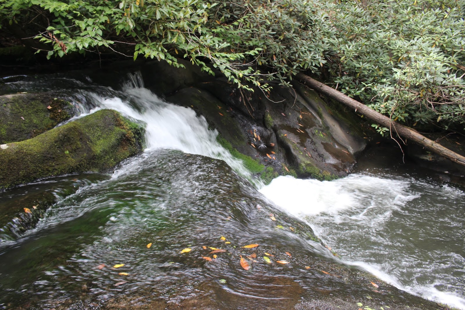
 above: Cascades along Tellico River
 Above: Dolls eyes
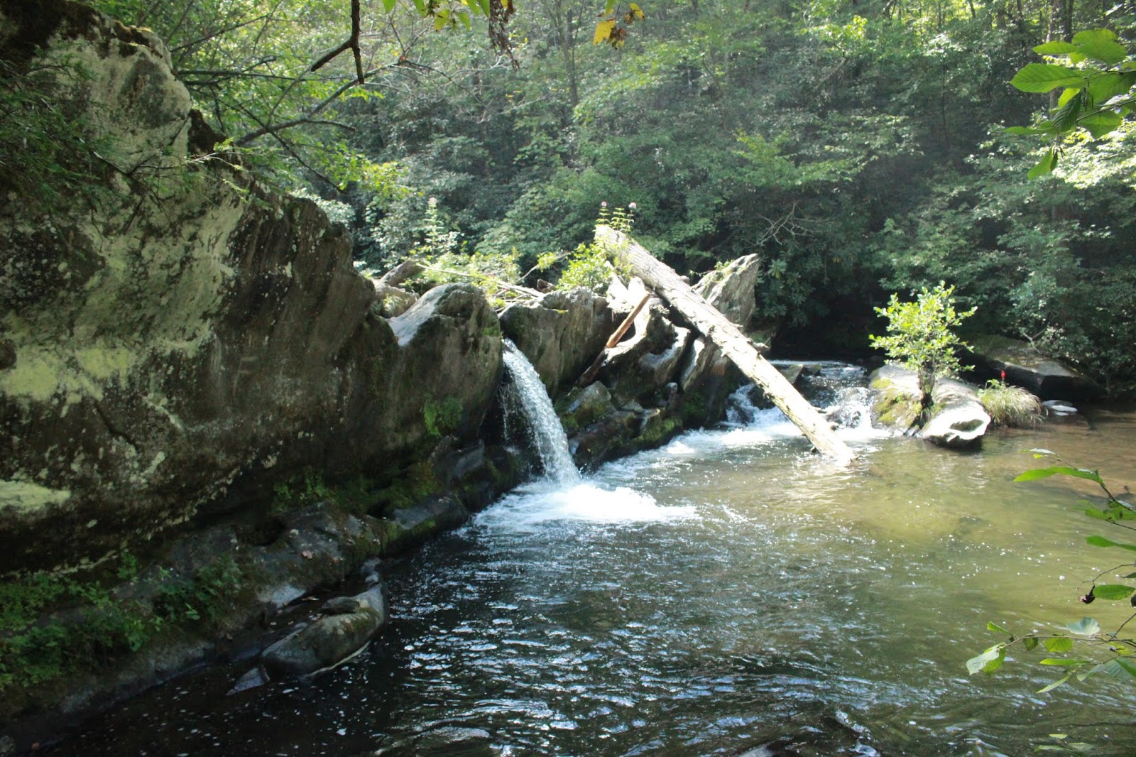
 Above: Davis Creek Falls is about a 20 footer and worth the short bushwhack to see.
 Above and below: Birch Branch camp site has a lovely view of the stream. We listened to it murmuring while we slept.

 View from Waucheesi Bald
 Road to Waucheesi.. loads of flowers! This is near a slide area. The road went off the side of the mountain!
 Waucheesi Bald. We never saw another hiker all day.
 Purple Disc sunflowers atop the bald
 Benton Mackaye trail
 Approaching Tate Gap.. tall weeds at the bottom of the picture you can just glimpse a mashed down area where something big slept.
 Kenny ahead of me at Tate Gap
 Spotted jewelweed
 the old road up from Coker Creek. Doc Rogers Lane
 Kenny checking out the ruins


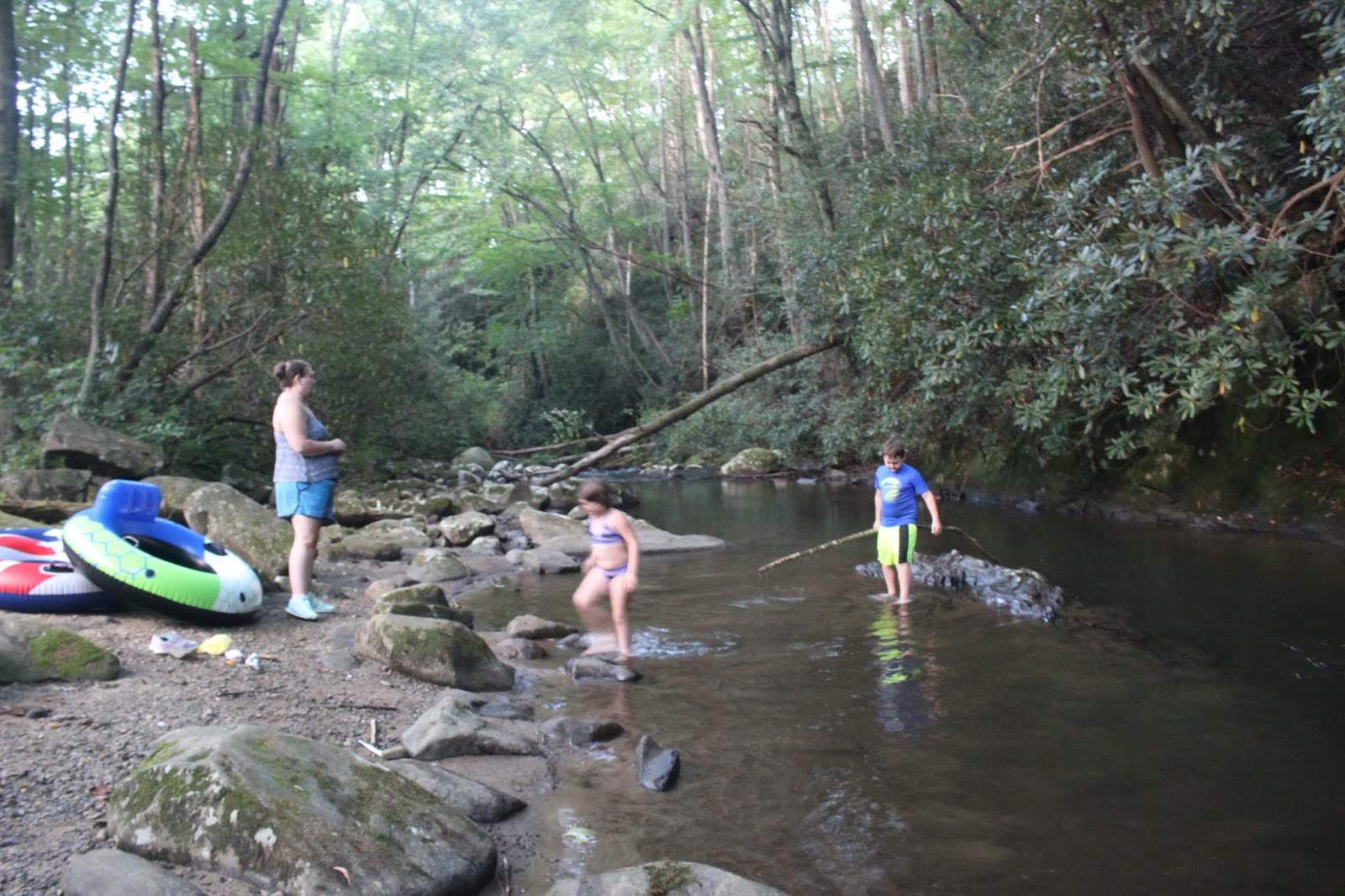
 Above: two of the kids and their mom watched with me to see if we could spot the otters again.
 Above and below: Kenny is helping the dad reinflate a tire on their trailer. The kiddos are looking on.


 Below: abandoned house on Old Furnace Road

 Above: Looking upstream on the creek
 Above: My dollar general shoes performed well. They had good traction in the creek. I did get one blister though on my toe. I did not wear socks and should have.

 Joe Pye Weed is thriving here by the stream

 Before down climbing the falls. Kenny is ahead of me. Broad expanse of pretty water.
 Small cascade upstream
 Kenny has gone ahead of me and is downstream below the falls. He has not begun his crossing.
 He's thinking about it.
 a glance back upstream at the low cascades
 I am now standing in the falls with them flowing round me.
 Pot hole below the falls. It is large !
 Kenny is wading the more shallow part.
 But now... he is across he is struggling to get up on the rocks!


I got back down the falls and once I finished my photos and video I put all my gear back in the dry bag. I simply leaped into the water and swam for it until I was back on the rocky shoals that lie before Wildcat Falls and the deep part of the chute. It felt great on a hot day and was easy. No slipping or sliding on the rocks in the stream when you don't have to use your feet!
We soon were back the short distance to Tellico River where we had to ford. It was a little tricky, but again the water was warm and pleasant. The rocks have some slick spots, but many of them are coated with a fuzzy moss that is like carpet. We made it across even quicker today. We walked back to the vehicle and headed toward the camper. Once back at the camper we got cleaned up and went outside to sit down. Our tent camping neighbors had changed yet again. Now we had a couple guys next to us. Opposite us the folks who were there had left. It was down to two groups.
We enjoyed a quiet evening and discussed what we wanted to to the final day of our trip. We decided we'd take the RZR and go round to North River to see some waterfalls. I noticed that our camper was beginning to grow on me. I am starting to think of it more fondly. I knew it would take time. I knew I'd have to make some fun memories here to learn to love it. I was happy to realize it was finally happening for me. Learn to love it ask K.T.'s mom used to say.
 Above and below. Inside of the Koog-Mobile. I am starting to like it better.


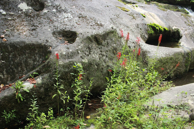
 Scenes along North River at the falls. Lots of cardinal flower and carved and sculpted rocks


 Above: Meadow Branch Falls is about 25 feet high.
 Above: I saw a colony of Autumn coralroot.. a native orchid in the forest near this


Today we had perfect weather. It was not hot. Temperatures here in the mountains were in the low seventies. The skies were blue and sunny with a few puffy clouds. We had a light breeze. The air smelled marvelous and felt very fresh. We were really enjoying ourselves. We did plenty of exploring the backroads, but eventually headed back toward camp. We stopped several times on the way down the road to view some of the many beautiful cascades along Tellico River. We drove up to State Line where I had a revelation, but I'll expound on that in a bit. *
We also pulled over and decided to try to find and visit Davis Creek Falls. It was new to us. I had seen photos of it and knew it was not a long bushwhack, but it was still a bushwhack. The sight of the creek didn't do a lot to convince us this was going to be any good, but we went ahead. We were surprised to find that while there is still bushwhacking to see the falls, there is an old logging road to follow. It makes it a little easier. Once there we had to just find our way down over the bank best we could. You have to clamber around to get a view of the falls while standing in the creek. It was a pretty falls and we were glad we stopped to see it. It is on the list to revisit if we are in the area when there is more rainfall.


We made it back to camp and decided to head down to Green Cove to the store for firewood.
We had never been in the Green Cove store so we wanted to see what that was like. We drove back out to Tellico Plains for a bit. Kenny wanted to rent some movies to watch in the evenings. We had seen a Red Box at the shopping center. We ended up getting three movies. Two were horrible and I am NEVER watching another Liam Neeson movie. They are all the same anymore. Revenge fantasies. Bloody, gory and depressing. I can't watch that stuff.
Another one was a killer of brain cells... Trace Adkins in it as the sheriff of some western town.
Rape. Murder. Fighting. Killing. More stuff I can't and won't watch. The third one was a Johnny Depp movie called The Professor. It was good and kind of sad, sweet and funny.
A professor of English at a college gets a terminal diagnosis of cancer and just goes on a tear of drinking, drugging and letting go of manners and propriety. It hit a heart chord with us both.
We went in the Dollar General to get the few items we'd forgotten. One of which was a cheap pair of sneakers for me to wade the creek in. I had left both sets of water shoes behind at home!
I found a pair of $12 sneaks that served quite well. I also got a copy of Magnolia magazine to read. It is that Chip and Joanna Gaines home makeover deal.
Below is a short video of Davis Creek Falls
Green Cove store was nice! They have most anything you could need. The owners Jim and Annette are very helpful and friendly. We bought firewood across the road from the store on the honor system. A nice chunk of firewood for $10 and fatwood bundle for $5! Hard to beat.
Back at the camper we visited with the new neighbors setting up their tent. I got busy fixing supper. I refused to watch the Liam Neeson movie after it got gory and bad so I went to bed to read and work puzzles on my Kindle. We opened the window and slept with a nice breeze on us. I woke during the night to actually being a little cool. I slept hard and crazily. I woke up in the morning with a major pillow print from sleeping face down!


Saturday
We decided that today we'd get out early before it got hot so we could hike to the Doc Rogers Hospital ruins. I had long wanted to see them and today was going to be the day. We had a simple breakfast and packed us some lunch. We set out. The route to the road for Waucheesi Bald .. the start of our trek... was a pretty drive through the mountains on the RZR. It saved us a lot of gas this weekend! Plus the breeze from the ride was nice. The RZR is built for this kind of driving and we made far better time using it than putting along in the truck. We were blown away at the glorious patches of flowers along the road to Waucheesi Bald. Once up top we were treated to a view far out to Watts Barr lake and the reactor. We talked to some nice bear hunters who knew Benjy on the ride up. One fellow was "Budman" He was very kind and helpful. We encountered him several times today. We exchanged information and pleasantries.


I am standing above the house looking down for a vantage of the entire thing.
We parked the RZR at the far end of the bald and Kenny chained it securely to a tree with a locking mechanism he brought along. We got our gear and headed out. Budman had warned us that Cantrell Top was going to "suck it right out of ya". The hike out to Tate Gap was beautiful and we did not find it hard at all. Oh but we were fresh then and the day was young and had not grown hot. I knew we'd have the hills to go over on the hike back, but I was not prepared for how tough that was actually going to be!
The Benton Mackaye trail is not hard to follow. It is well blazed and though overgrown in places, we never lost sight of it. We did get our legs stung by nettles and clawed up by blackberry briars. We passed through poison ivy, but thankfully did not end up with any rash.
The skies were blue and sunny. The trail at one point slabbed round the shoulder of Cantrell Top mercifully rather than going up over the peak. We passed by one spot that was a knife edge. You could easily spit from one side to the other. Despite the brambles and the heat and toil we endured it was a beautiful hike. The air smelled wonderful. We never saw the first snake or bear or any scary critters. We saw one hummingbird. We started down off Cantrell Top toward Tate Gap. We turned right and began our descent toward the ruins. Tate Gap is a meadow very overgrown. I'd not want to camp there this time of year. Beautiful, but snaky.
Tall flowers towered over our heads. Butterflies and honeybees buzzed around. I could hear and see the zooom zoom of the tiny hummingbird in the flowers. We passed a spot where something big had bedded down. It looked to be a bear waller. Soon we could glimpse the ruins of the old stone hospital down in the forest to our right. The building was the residence of Dr. W.A. Rogers and his wife, Arminda. (Click the link for additional info and photos) They lived there for six years until finally moving back to Tellico Plains. I'd love to have seen it back during its glory days. The remnants of it are still very pretty and the spot itself is quiet and beautiful.
We walked down a trail that led right up to it. We did not have to bushwhack any to reach it which was a relief. We arrived there by it and it was cool and damp. A spring flows out of the basement level in the bottom southwest corner of what is left of the dwelling.
You can look through the window down at the pipes and the water flowing across the ground.
It is the water source for the Benton MacKaye Trail. There is no water anywhere else along this stretch. The ground was littered with colorful rocks, moss, and ferns. Cardinal flowers and jewelweed bloomed in profusion around the site. The first asters of the coming Autumn are beginning to bloom as well. The stone walls minus the roof and windows are stark, but romantic. It looks like the ruins of an old castle or manor house.
We sat down to eat some lunch. We rested up and explored the area a little bit.
The remains of the workings of the old generator lay on the ground. I wondered how they got electricity here or if they even had power. They did indeed. Ironic since we were relying on a generator this weekend for power ourselves! I felt a great deal of satisfaction at finally getting to see this spot for myself. I get aggravated with myself for making so many plans and then not following through. I've tried to prioritized a bit more and get down to brass tacks as to which ones I need to see and do first. I figured one day there won't be anything left of this place to see. I'd best get a look while it still stood. I want to return here in the Winter or Fall when the weeds have died back and the snakes have gone to bed.
Below: View of the west wall of the Doc Rogers house. You can see the fireplace at the bottom.

We finally turned and began our hike back. We took our time, but eventually the heat and the effort caught up with us. It was tougher on the way back. I think because we were already tired and no longer seeing new things and the day had grown very hot with no breeze stirring.
It was a great relief when we finally crested Cantrell Top and knew we had the worst over.
We had a few more pointless ups and downs, but none of them was very hard compared to the big one. The finally push back to Waucheesi Bald from 1/4 mile below at Sixmile Gap was tough and super steep. It was short though and had a few switchbacks to make it more bearable. Next go round I'll visit the hospital ruins from the old Doc Rogers lane at Coker Creek. Much shorter and easier.
Below is a short video of the hospital ruins
Once we were back at the RZR we breathed a great sigh of relief. We were both filthy and dripping wet with sweat. The ride back to the camper was nice. We had a cool breeze and eventually dried off some. We stopped only one time on the return trip. We stopped and enjoyed the Check Dam along the road. It looked so pretty today. I had seen it before, but never really examined it carefully. Today I went all along it. I saw the drill marks in the rock face. Apparently this was a cascade that was modified to form a squared off check dam to keep trout from going further upstream. There is a square hole carved out in it behind the rivulets of water dripping over. A salamander clung to the rock face. On either end the water sluiced round the edges and made a nice little cascade.

Below is a video of the check dam
We made it back to the campground finally and headed straight for the shower. We both got cleaned up and went outside to visit with the neighbors and their kids. They were very nice people.
I had a box of toys in the camper we kept there for the grandkids. They never touch them so I asked the parents of these children if it would be ok for me to give them to the kids to play with? They said of course! I gave them the box of goodies and got to enjoy seeing them play with all the toys. They had tea parties and cooked things and had the best time! I told them to keep them and enjoy them.
The little ones had sweet manners and thanked me. I hung out with them some and watched them do a depth test on a hole of water in the stream. They had seen otters in the creek so we waited and watched hoping they'd come back, but we did not see them again. Several more campers had rolled up on either side of us. The family with the kids had to leave early Sunday morning. They may have been trying to make it back in time to go to worship service.
We built a fire and sat outdoors and enjoyed the evening. We discussed what we wanted to do the next day. We figured we'd visit Ike Camp Branch Falls in Citico first thing in the morning.
We had some supper and slept well again with the sound of the stream flowing past and the nice breeze through the window. Great sleeping weather when things cool down!
Below: First colored leaf of the coming Autumn! Signs of approaching Fall despite hot temperatures and still swimming weather. We are now in Indian Summer.


Sunday
We woke Sunday morning and Kenny fixed breakfast. We had biscuits and gravy. We had a leisurely breakfast and coffee. We packed up our stuff and headed out to start our day's exploring. We drove round to Citico to hike. We had a waypoint for Ike Camp Branch Falls. It is supposed to be a pretty falls, but not real big. We had never hiked from this trail hub before. We found it very confusing. The map didn't show the area in very good or accurate detail. We plugged in the way points and tried to head toward the falls. The GPS did something today it had never done before. It refused to function. It was spinning like Linda Blair's head in The Exorcist. Kenny grew very frustrated with it. Finally we decided to go do something else. He didn't have the patience for this today. I can't say I blame him.

Hiking in Citico
 Above: Hearts a bustin
Below: Indian cucumber root


Hiking in Citico

Below: Indian cucumber root

We went and drove past Shortfoot's Natural Bridge. We drove out J. D. Farm Road to look for a reportedly haunted house. We did not see a thing. Lots of houses, but nothing that looked like an unoccupied dwelling as described. Must be a lot of malarky. We returned our two watched movies.
We went by Indian Boundary to see how the Overflow campers were faring. It was completely full.
We were glad we made the decision to stay elsewhere. We found the store not open yet. We'd wanted to go in and look around. We wanted to purchase another coffee mug to replace one that got broken. We'll have to come back so we can do that.
We drove to Tellico Plains to eat lunch at the local diner. It was not very good and I won't go there again unless I have no alternative. They were friendly and the service was good.
 above and below scenes from around Tellico Plains old barn
 Above: Beautiful skies over Tellico Plains rural country
 Above: Don't know why I'd never noticed this mill wheel before. It is very quaint.
 Above: Old railroad depot in Tellico Plains. Looks like at one time it was the Farmers Co-op building as well.
 Above: Tellico Jail!


Windmill on Tate Mill Road

Love this old house, but now someone is living in it. I guess that is a good thing!
We drove down toward Coker Creek along Hwy 68 so I could get a photo of an abandoned house I like. We found it occupied and fixed up! I missed my chance to capture it as it was.
Kenny did not want to go back the way we'd come. He pulled us over and checked out Google Maps. We were able to find and take Old Furnace Road for the return trip. This was another Benjy Shaw suggestion. Tipi Walter also spoke of it. We were pleased at what a fun and pretty drive it was. Nothing can prepare you for this one kiss your butt turn. The terrain on both sides of this road is super steep in most places. It illustrates very well how deep and isolated some of these hollers are.
Below: beautiful view from Old Furnace Road


We soon came to the end of Old Furnace Road where it connects with the main road at Tellico Beach. We turned and headed back toward the camper up the river. It was a beautiful afternoon. We had talked about going to explore Wildcat Creek, but Kenny went flying by the parking spot.
I was very disappointed. Nothing seemed to be working out right today. He noticed my expression and turned around and went back. He decided to quit being so wimpy about the water and try it.
We parked and I put on my Dollar General sneakers to wade the river in. We went ultralight.
I carried my backpack with a dry bag in it. The dry bag contained my old Nikon camera, the Go Pro, and the truck keys. I also tossed in a drink for each of us. We walked up the road, forded the Tellico River at the mouth of Wildcat Creek. The river was not bad to cross. Water levels are low and it was pee warm! We got to Wildcat Creek and the temperature of the water changed noticeably. It was cooler, but not cold. We began our wade up this stream using care not to slip and fall or step in one of the many potholes carved in the riverbed.
This little gorge is deep, dark and green. We were surrounded by late Summer vegetation and trees beginning to drop a few leaves. Everything takes on that slightly sallow tone this time of year, but I love it just the same. Tall yellow, purple, pink and red flowers were all up and down this gorge. We passed shallow, sandy shoals, smoothed rocks and deep placid pools of water. It was a very short walk til we arrived at a narrowing of the gorge at a bend where it changes to deep green gloom. The walls of the gorge are curled, smoothed, carved by the force of the river over thousands of years. Before us was the small but beautiful Wildcat Falls. Between us and the falls which we had to climb was a narrow, deep channel like a chute. Kenny chose to climb around in the rocks and avoid the water as much as possible. I just went on in and felt the fear, but did it anyway.
I hoped the dry bag would function properly in my pack which was feather light.
The water was not that cold and I just plunged in and felt the coolness of the stream calm me.
I paddled up the stream toward the falls. I came to a tree which has fallen log ago and been wedged in the chute between me and the falls. I slid over it easily. I put my feet up on its lower branches and carefully climbed over it. Once over it I looked up to see Kenny still climbing in the rocks.
I continued through the chute swimming smoothly until I got to a rock on creek right where I could slide out of the stream easily. I had made it! I now stood at the base of the falls. Kenny somehow managed to make it across though I did not see exactly what he did to get there. We both began the climb up the falls. It was as I was told. Not bad. It is green and mossy and not slick. There are carved out holes in the rock to hang onto. Before I knew it I was standing at the top of the waterfall looking back! It was not bad at all.
Kenny soon joine me up top and we continued making our way up the beautiful stream. We saw lots of pretty scenery, but alas we did not find anymore significant waterfalls. Just a few small cascades and riffles. It was still satisfying to me to finally do this. I think the water levels being very low made it easier, but probably not as pretty and dramatic as it could have been. I sat down and took out the Go Pro to take my first videos. The dry bag functioned perfectly! Not one drop of moisture inside the pouch. I was really pleased. I took some photos and got reacquainted with my Nikon Coolpix. It is a fair camera and more expendable than my Canon. Still glad it didn't get drenched and ruined. I need to remember to put this camera in the camper for a backup.
I also need to remember to put the Chromebook in there with the charger.
Driving Old Furnace Road did more to illustrate how deep and steep sided this gorge is.
The opposite side of the road has another gorge just as deep, but not as steep sided and narrow.
I want to drive around more back in there and explore sometime when we've had good rainfall.
See if there are any waterfalls that are not yet documented.


Above the color of the leaves and trees this time of year reminds me of the words to The Lady of Shallott poem and song.
In the stormy east-wind straining,
The pale yellow woods were waning,
The broad stream in his banks complaining.--Alfred Lord Tennyson and Loreena McKennitt 

Golden Wingstem blooming.
A kingfisher bird squawked at our presence and flapped on away. I remembered seeing him this time last year! The stream flowed past as I sat down to rest and have a drink. I was very pleased at having done something I'd been a bit scared to do. Swimming over logs and through a narrow channel where you cannot see bottom is not something I do often. Finally Kenny admitted he was glad we'd done this and he was really enjoying it. He also agreed that with water levels and far up the gorge as we'd gone.. he was over it. We headed back downstream carefully. It was a little easier because we knew which spots were best. We soon arrived at the top of the waterfall to climb down. I got out the Go Pro and camera to get photos and video. Kenny went ahead of me and got started across. His method took longer and was far more difficult.


Carved out rocks to the left of the falls facing downstream.

Above is a shot of the falls and the part we had to swim taken last year. I was so excited this time I failed to take a photo from this spot. It did not look a lot different.
Below is a video of Wildcat Falls
I got back down the falls and once I finished my photos and video I put all my gear back in the dry bag. I simply leaped into the water and swam for it until I was back on the rocky shoals that lie before Wildcat Falls and the deep part of the chute. It felt great on a hot day and was easy. No slipping or sliding on the rocks in the stream when you don't have to use your feet!
We soon were back the short distance to Tellico River where we had to ford. It was a little tricky, but again the water was warm and pleasant. The rocks have some slick spots, but many of them are coated with a fuzzy moss that is like carpet. We made it across even quicker today. We walked back to the vehicle and headed toward the camper. Once back at the camper we got cleaned up and went outside to sit down. Our tent camping neighbors had changed yet again. Now we had a couple guys next to us. Opposite us the folks who were there had left. It was down to two groups.
We enjoyed a quiet evening and discussed what we wanted to to the final day of our trip. We decided we'd take the RZR and go round to North River to see some waterfalls. I noticed that our camper was beginning to grow on me. I am starting to think of it more fondly. I knew it would take time. I knew I'd have to make some fun memories here to learn to love it. I was happy to realize it was finally happening for me. Learn to love it ask K.T.'s mom used to say.


Monday
Monday morning we got up and I fixed us a good breakfast. After breakfast we went up the road to look for Holder Cove Falls. I had the maps out the night before comparing the area now to what we were seeing. I was especially interested in comparing the map of the former Upper Tellico OHV area to current day. It has been closed down since about 2009. I was glad I paid the $10 to purchase this little map of a recreation venue that no longer exists. We went a short distance up the road and pulled over. I had spotted a well worn path across from the restrooms at Holder Cove campground. We walked 250 feet off the road and stood beside a nice little waterfall. It's about 20 feet high. Very picturesque. Well known by campers. Crazy that we'd never visited it til now. I got a waypoint from it and will submit it to Tennessee Landforms. Unbelievably it is not on the database!

Holder Cove Falls which I learned about courtesy of Paul Gamble.
We loaded up our gear and set out for North River. We went by the camper convenience area where the dump station, bathrooms, and potable water fill up is located. We realized there are camping spots there, but they are used by TWRA personnel. That is kinda cool. They get to camp as part of their job description. It may not really be fun, but it sounds like fun to me. We started around the loop that can be made using North River Road. We came out at the bridge below the Donley Cabin. Kenny was stopping and checking out various camping spots for possible future trips.
The one along North River just below the bridge was my favorite, but all of them on that side would be good. The ones opposite the creek are not as appealing.
We saw quite a few parties camped there. Folks hiking, folks riding horses, fly fishing. Multi use really can work. We stopped by North River Falls. The waterfall is not very large. It is only nine feet high, but this spot is especially pretty during late Summer. The carved and layered rocks and cascades are interspersed with bright red clumps of cardinal flower! Deep green with bright red. I don't think I've ever seen it look prettier.


North River Falls


Below.. North River flowing onward downstream

We enjoyed taking in the scenery very much. One thing we both noticed was that thanks to controlled burns it is possible to enjoy seeing some really dramatic, large rock formations on the bluff above the road. It wouldn't be fun to go up there this time of year with the snakes and what have you, but during Winter it would be cool to explore up there.
We continued up the road til we came to Meadow Branch and we parked and walked down to see the falls. They are being visited more regularly or so it seems. There is now a tracked down path to the falls and I'm in favor of that. It was easier than usual to make our way down there to see them. We checked out two levels of the falls. I know for a fact there are additional cascades above and below this waterfall.


above: Upper Meadow Branch Falls and there is even more on up.
Below is a video of the falls
We saw one other couple drive a RZR past us when we were on our way back up the slope from the falls. They were headed up toward Whigg Meadow. We got in the RZR and began our trip back to close the loop. We stopped at another nice cascade we passed and got some photos. I'd love to bring an inner tube and float here sometime. It is pretty and looks like an inviting hole of water.
Above: North River Chute with the huge river wide fin of rock sticking up

Standing on the shoal in front of the chute. What a nice spot!
Finally we made our way back to the river road and back to the camper. We packed up our stuff to get ready to leave. We left with regret at the trip being over. We had such fun, but that is always a better position to be in than to be longing to return home from a misery trip!
The "boondocking" excursion turned out to be a great success. It was however somewhat of a shakedown cruise since we'd never done it before. Here is what we learned:
- We love this style of camping and are hooked. It was far more satisfying than staying in a developed campground.
- We need a new battery for the camper.
- We should buy a stronger, quieter generator
- We will fill up the tanks with drinkable water once we get to the ranger station next time and save the weight during transit.
- Taking the RZR along to use on backroads really makes things easier and saves fuel.
- Don't bother with movies next go round. We're better off without them.
Now before I forget........ let me back up and address the Upper Tellico OHV area that is now closed. We ended up quite by accident on the old trail system or a snippet of it. We were up on Tipton Knob. I know this for fact because of GPS waypoint I marked while there.
I checked it once I got home. The trail system that used to exist is largely still there, but no longer open or maintained. The area around this is private land apparently. Some chunk of private inholding in the National Forest. It hit me that while I thought of Tellico OHV area as being related to Tellico Plains it is NOT and never was. It is North Carolina and part of the Nantahala National Forest which is not now nor has ever been particularly off road friendly.
North Carolina is not real off road friendly. I also realized that while I was totally bamboozled at the closure and changing things... I am making too much of it. The trail system is still there and most of it still accessible for foot travel which suits me fine!
The low water ford bridge that is built at State Line is where we used to have to drive through or wade the creek to continue. I was making this into a scenario like we had changed planets or something in my own head. A review of the map and a reality check show that it is not that complicated.
I am going to try my best to write up a blog entry about the whole Upper Tellico OHV closure debacle. I hope that in doing so it won't ruffle any feathers for it was and still is a touchy subject. Lots of volatile and differing view points on the matter. ( As of 9/17/19 the blog entry is written up about Upper Tellico OHV)
All in all a successful camping trip and very enjoyable. We learned what our camper will and won't do with the use of a generator for power. At the time of this writing Kenny has already acquired a better generator and I think he has fixed the battery situation.
His shed is now under roof. Thank you Andy, Randy, Anthony and Adam for the help in getting it to that point. It is a great relief to us both and our garage and driveway are now useable again!
In Magicmomma's Crystal Ball of the Future I see:
- Many more boondocking trips
- A write up on the Upper Tellico OHV and some lairnin' accompanying it
- The opportunity to save money and delve deeper into the areas where we venture because we'll be staying there!
Below I leave you with a couple videos from North River.
No comments:
Post a Comment
Thanks for reading and commenting. I enjoy hearing from those who read & make use of my blog. I have made some wonderful friendships through emails from readers. I respond to all comments and emails. I appreciate folks reaching out to let me know when my blog entries are not functioning correctly or if the situation somewhere has changed. Many Blessings to you!
Dana 🐝