

Spotted jewelweed in bloom along Laurel Run Trail
Holston River Rambling-
Laurel Run Falls and More
Dana Koogler solo hike 2 miles RT
Sunday Aug. 16, 2020
Pix are here: Holston River Rambling
 Above: historic cabins along the trail at the start of the hike.
 Above: the hike to Laurel Run Falls starts out wide like an old road, but narrows down to more of a true trail.
 Lots of these yellow flowers along the way today.
 Above: Laurel Run Falls. The falls themselves don't look too bad, but the plunge pool is sure muddy.

Kenny had to work over the weekend. My original plan was to pack up and go hiking Saturday morning early and spend all day out. It rained cats and dogs Saturday morning. I checked the weather radar. I could see we were in for rain most of the day. I decided to change up. I would do something that would not involve spending the day fighting the rain. I knew Pratt's Country Store was open on Saturdays. I would go to Fountain City today and put the hiking off til Sunday. The weather for the next day looked more promising.
I woke up Sunday to pea soup fog. The radio weather said Morristown area was under a fog advisory. I decided to tarry at home a little while and give the fog time to burn off. I left for Church Hill at 8:15 a.m. I had a trip itinerary planned that would run from working my way back southward.
My original trip plans for this area were:
- Laurel Run --hiking to the falls
- Phipps Bend
- Stony Point
- Surgoinsville Creekside Park and covered bridge
- Crockett Spring Park in Rogersville
- Amis Mill & Ebbing and Flowing Spring
- Bulls Gap
Laurel Run
I realized it might not all fit into one day, but I would always rather have stuff left over than a lack of sights to see. My drive up was smooth with light traffic.
The day was shaping up to be very pretty and so far was cooler outdoors.
I left the interstate at Baileyton to head cross country to Laurel Run Park.
I had my moments of doubt where the google maps was taking me, but I kept going. I was enjoying the drive through some beautiful country.


About the time I began to have serious doubts I turned onto the Laurel Run Road. I went round to the parking area and felt very relieved to have located this remote place. It is an odd little area in Church Hill. The park I was to hike in was very remote, but across the Holston River were huge McMansion style houses. I saw only a few other people here this morning. I had both the Waterfalls of Tennessee guide with me, and printed directions from Appalachian Treks . I got the feeling after a little hiking that neither of these was totally up to date. Thankfully I found bridged crossings on all but one of the places I had to ford the stream. One bridge sits beside the old one and is very newly replaced.
Laurel Run Park has a good bit of hiking, but today my destination was Laurel Run Falls which was only 0.9 miles one way. Laurel Kiner Falls is an additonal 0.1 for a grand total of 1 mile one way. I knew of Logger Falls and Kiner Creek Falls which were beyond these falls by at least 0.3 miles one way.
I had directions to them, but had not yet made up my mind. I knew neither was on an officially maintained trail. I was 1/10th mile from reaching Laurel Run falls when a sound and movement caused me to look back over my right shoulder. I saw across the stream from me about 75 feet away a tree crash to the ground. It was nowhere near hitting me, but it got my attention. I decided I'd make it to the falls and ponder what my next move was.
I arrived at Laurel Run Falls and there was a fellow there named Scott. He had been just ahead of me the entire trip. I'd get glimpses of him every so often.
We exchanged greetings at the falls and he continued on up the trail. I had asked him if he was going to the other falls. He wasn't aware of them. I described where they were supposed to be. He went on his way. I set up to enjoy the falls and take some photos. Laurel Run Falls is only about fifteen feet high, but it is rather scenic. Today it was running fairly well owing to the hard rain the day before. Unfortunately the water was very muddy for the same reason. It was still good to finally visit a falls I'd long seen in others photos, but never been to in person. The forest here is deep and green and the trail is in pretty good shape.


Above: a photo taken from further back of Laurel Run Falls. The sunshine coming in through the trees was real pretty.
About the time I was done taking photos and video the fellow, Scott came back by. He stopped to show me a photo of the small cascade above this falls.
He spoke to me a bit more about the other two falls I'd mentioned. I think he was a little worried about the idea of me trying to find those solo. I shared his concerns. The tree falling in the woods near me was still on my mind. I was not completely alone on the trail as people passed by now and then. Off trail that would not be the case. Talking to Scott I realized I wasn't prepared to do that alone. I felt unsafe and totally in the dark about the way these trails run.
No idea what I'd encounter. It might end up being easier or much worse. It would have to wait for another visit. Initially I thought I would not return here. I believed wrongly that there was no way to catch these falls with plenty of flow.. minus the mud. I have since seen photos that show me it is not the case.
 Above: murky little Laurel Kiner Falls is perhaps five feet high.
I continued up to Laurel Kiner Falls..the little five foot cascade only 1/10th mile further. It was not much, but it was not a lot of trouble to reach either. I did see some beautiful red cardinal flowers by the trail. I thought to look on the return hike for crane fly orchids which should be out this time of year. I was fortunate to find a pair of them!
Below is a video of Laurel Run Falls
 Above: macro shot of one of the two cranefly orchids I found. They are very fleshy toned and hard to see in the woods. I saw other hikers passing me as I took these photos. They may have thought I was taking a picture of thin air.
Below is a photo of a tall, pretty clump of cardinal flower I saw today on the trail.

 Above: Abandoned base of the cooling tower for the never completed nuclear power plant at Phipps Bend. The Holston River would have supplied the water for the cooling tower. I asked a friend who retired from TVA why this was never finished? Two reasons were given... over estimating the need for the facility and underestimating the cost.
 Above: Wild vervain was the only pretty and different Summer wildflower I saw.
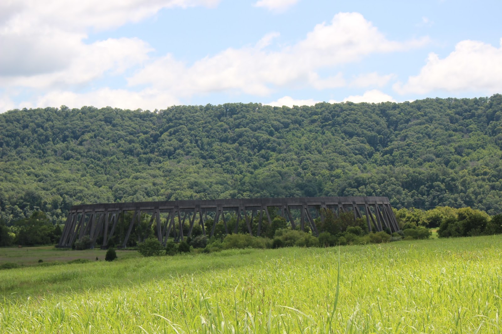
 Above & Below: the railroad bridge on the Phipps Bend road was kinda cool.


Above and below: several images of Stony Point. The house has modern updates in the form of electric lighting clearly obvious outdoors. It has a Fleenor Security Placard near the door. It is a shame for it to be in this condition. I hope in the future someone takes initiative to fix it up.


 Above: the sign for the park right along the main road
 Above: nice lawn swing
 Above: shady picnic spot
 Above: beautiful little covered bridge
 Above: another railroad bridge here at the parks edge.
 Above: a look beneath the bridge and at the side of it as it crosses the stream

Crockett Spring Park in Rogersville
About the time I was done taking photos and video the fellow, Scott came back by. He stopped to show me a photo of the small cascade above this falls.
He spoke to me a bit more about the other two falls I'd mentioned. I think he was a little worried about the idea of me trying to find those solo. I shared his concerns. The tree falling in the woods near me was still on my mind. I was not completely alone on the trail as people passed by now and then. Off trail that would not be the case. Talking to Scott I realized I wasn't prepared to do that alone. I felt unsafe and totally in the dark about the way these trails run.
No idea what I'd encounter. It might end up being easier or much worse. It would have to wait for another visit. Initially I thought I would not return here. I believed wrongly that there was no way to catch these falls with plenty of flow.. minus the mud. I have since seen photos that show me it is not the case.

I continued up to Laurel Kiner Falls..the little five foot cascade only 1/10th mile further. It was not much, but it was not a lot of trouble to reach either. I did see some beautiful red cardinal flowers by the trail. I thought to look on the return hike for crane fly orchids which should be out this time of year. I was fortunate to find a pair of them!
Below is a video of Laurel Run Falls

Below is a photo of a tall, pretty clump of cardinal flower I saw today on the trail.

I wrapped up my hike and began the trek back to the jeep. I was beginning to see more people out on the trail. It was also getting hotter. I stashed my gear once I was back in the parking lot and moved on to the next part of my day.
Phipps Bend
I like abandoned stuff and one of the intriguing spots was the never completed nuclear reactor at Phipps Bend. I saw there was a walking trail along the river also. I hoped for great Summer wildflowers. I found it without any trouble. It is mainly just an industrial park now along the Holston River. I was disappointed in it. It wasn't very pretty and had very few flowers. Nothing real showy or special. I did see the remnant of the cooling tower for the reactor. It was also not very exciting.


Stony Point
I looked at the google map in my trip planning. I saw an old house on the corner of Phipps Bend Road that interested me. It turned out to be Stony Point. It was built before 1791 on a post Revolutionary War land grant to William Armstrong circa 1780. It was a brick home and one of the first brick homes in East Tennessee. It was later built onto and thus the outside appearance is two obviously different construction periods. The older part looks to have been stuccoed over and the newer part is red brick. It sits abandoned and badly overcome by vegetation. I walked up the drive to snap a few pictures, but I did not know if it was ok to be here. I also was uneasy about the deep grass and weeds in the yard. I sure didn't want to get snake bit or get chiggers. It is on the national historic places registry. Though Stony Point was not too thrilling either... It was right in the area.


Surgoinsville Creekside Park & Covered Bridge
Once back in my jeep I headed toward Surgoinsville just a few miles down the road. The next stop was the Creekside park and bridge. On my drive to there Kenny phoned me to say he was on his way home from work. He had to work all weekend long. It really made me sad. I wished he were with me. It put me in a funk. I stopped at the covered bridge park next, and got out to look around. I only saw one other couple there. Surgoinsville is a very small town. The name means Doctorsville in French.
Goins is French and means 'descendant of Gudin' (God's friend).
The park is extremely small, but attractive. Surgoinsville Creek flows down through it and into the Holston River. The little covered bridge is the highlight of the place. It has four or five picnic tables and a pavilion. It also has a lawn swing facing the creek. Not a real exciting destination, but worth a stop since I was in the area for sure.


Above: Surgoinsville Creek flows down over tiny ledges.
I can't say I was real impressed with this little park, but I did like the covered bridge.
I was growing tired. I felt lonely and missed Kenny. I was hungry and needed lunch. I decided to save the remaining spots for another trip. I wanted to go eat lunch and head home. The back roads drive through Surgoinsville toward Rogersville was lovely! The hills have lots of historic homes and structures along them. It is just very pretty. The rest of the drive today from Rogersville through Bulls Gap and over to the interstate was gorgeous. We live in a magnificent part of Tennessee. I don't regret trying something new today, but it was a little disappointing.
Next time in the area I will hit up the rest of the missed stuff plus add one.
- Amis Mill & Ebbing and Flowing Spring
- Bulls Gap
- The Pressman's Home
On the drive home I heard a beautiful new song by Morgan Wallen who is a country music star from Sneedville. I am posting it below to end my report. It always makes the drive more pleasant to have good music.
**Edited to Add on 11/26/25 I found the video I originally added unavailable to view. I changed it to this great new song by Morgan Wallen called "TN".
No comments:
Post a Comment
Thanks for reading and commenting. I enjoy hearing from those who read & make use of my blog. I have made some wonderful friendships through emails from readers. I respond to all comments and emails. I appreciate folks reaching out to let me know when my blog entries are not functioning correctly or if the situation somewhere has changed. Many Blessings to you!
Dana 🐝