

Big Sink Winter Visit 2021
Saturday January 9, 2021
Pictures are here Big Sink Winter 2021 Pix
Big Sink Info on Tennessee Landforms
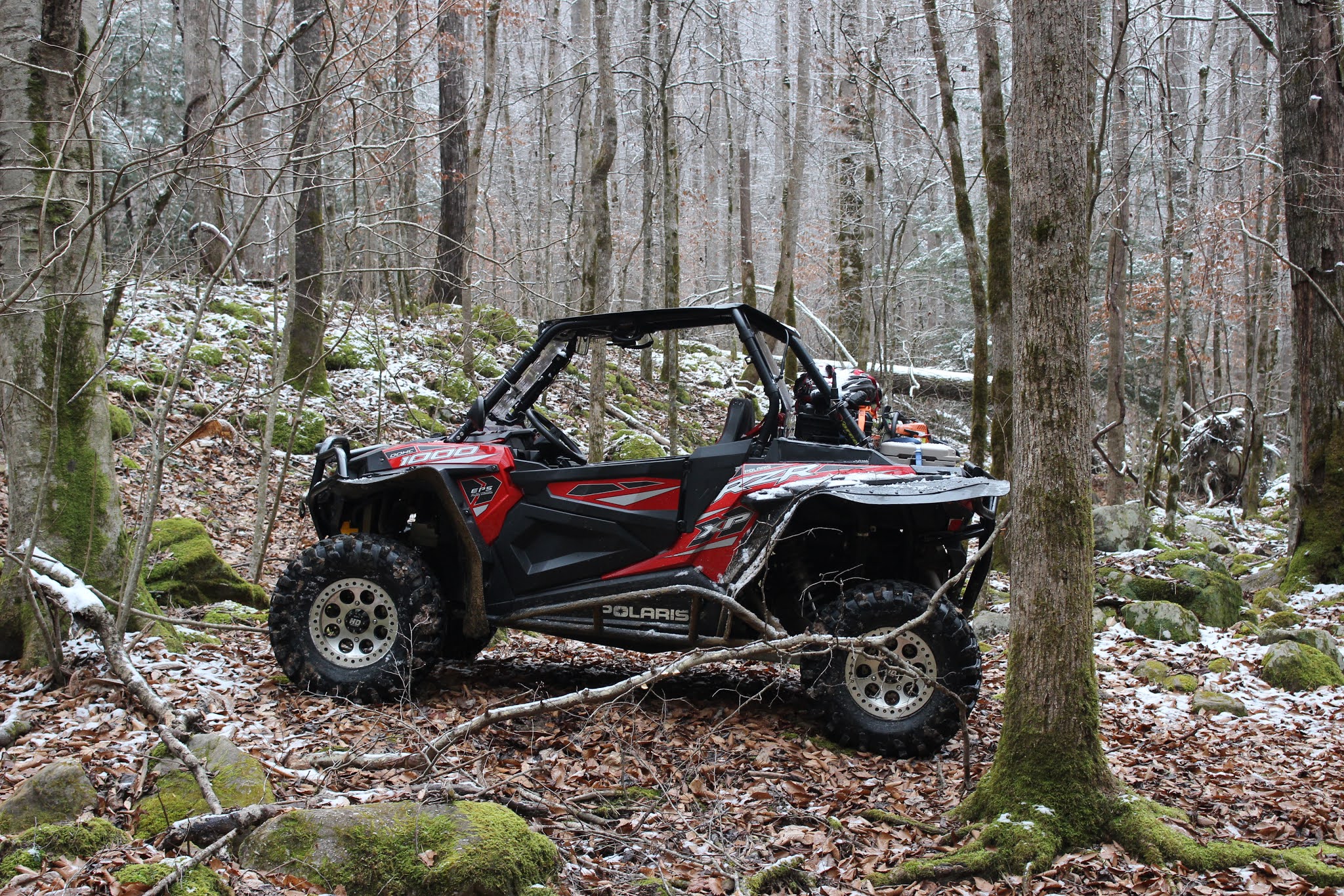
Kenny and I took off on Saturday to go ride the RZR. I had not been riding in months. Neither one of us was exactly sure where we wanted to go or what to do.
We knew we wanted to go riding and it was going to be somewhere in the Cumberland Plateau. We sat down one evening and discussed it. I realized that the upcoming Saturday was the first day that Big Bottom WMA would be accessible again. Hunting season officially ended on Friday. Though we'd been there so many times it had been quite a spell between visits. We'd never been there in the snow. We figured today a snowy ride in the plateau would be beautiful.
We've had a cold, wet snowy Winter that has been more like true Winter! It was supposed to stay cold today. It was 29° when I woke up and never got above about 35° all day. We drove out to Crossville and on out Lantana Road to Mooneyham. We figured the Caney Fork would be running too high today to safely cross. Best thing to do would be to come in on the high side of things and go from there.
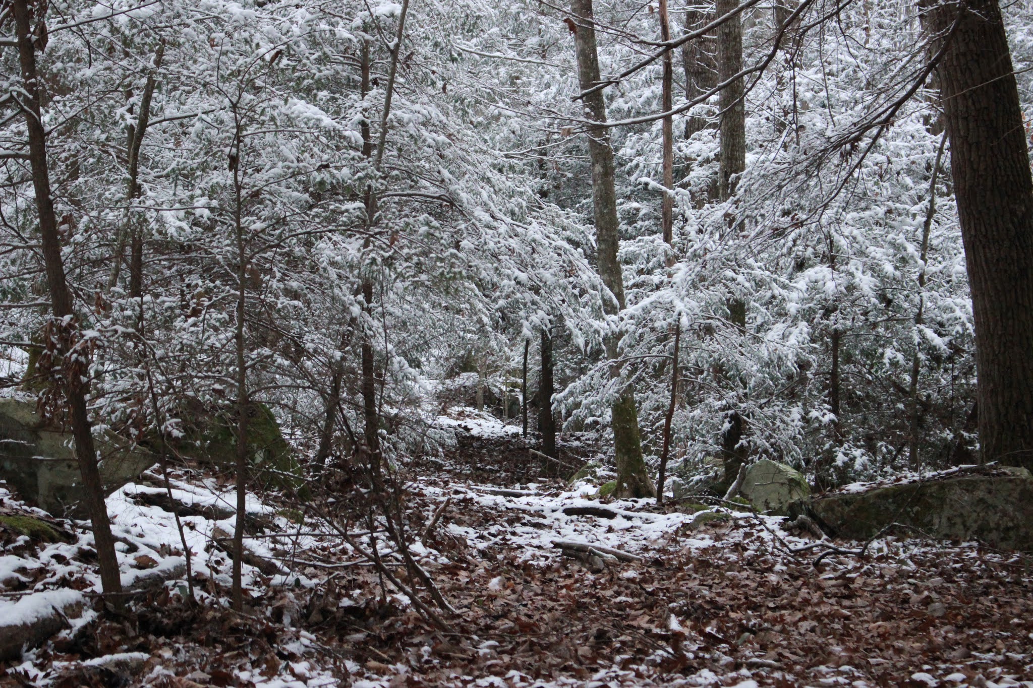
Below -- the first photo is the spot where we parked. The rest are just photos of the snowy area and the trail where we started down into the sink.


We arrived to find that the warden had not taken the signage down yet. We went ahead and chanced that we were correct about the dates. It was bitterly cold and snowing. The forest was hushed and beautiful. We never saw a soul all day long. That was nice to have no crowds to contend with. It is one of the reasons I've grown to dislike some of the areas we ride. Lots of people.

Above: a view of the thick stand of pine trees. coppery needles mixed with snow.
We unloaded the machine and packed all our stuff on the back. We headed out and when we came to an intersection through the snowy woods we decided we'd do something different. We would go a different route. We started DOWN the trail we usually come up and out. It is steep and difficult. Kenny figured it would be simpler to go down it and get that out of the way first thing. Coming up it with that amount of snow and ice would probably mean winching. Trying to get out on the trail that steep and even hook up the winch cable could have been quite an ordeal.
It was fun going down it. A rollercoaster ride through the fluffy, powdery, beautiful snow! Dramatic scenery all around us. Steep cliffs and beautiful evergreen trees laden with white powder. I had on a heavy, puffy camo coat, gloves, hood, scarf to stay warm. I was toasty. At least I was until I got a big glob of snow down my back and into my pants. Somehow those heavy branches we were sweeping against dropped a shovelful of snow on me that managed to go down my neck, back and behind. Brrrr! Thankfully I am hot natured and dressed warmly. It dried up in no time.
We crawled down the hill slowly. A roll over in places would have been a catastrophe. The worst spot would have been like taking a spill down the side of the bluff near Car Hauler in in Pickett. We made it past the crux and with that over with the rest of the descent was pretty routine. It seemed like no time at all we were down at the bottom. I could hear the falls of Big Sink on our left. Huge mossy green boulders stood round.


Once we'd visited the cabin we continued down the sink toward the next stop.. Little Sink Falls. Two streams merge into one and then drop a short distance over a low, wide falls that is sheltered partially under a massive boulder. Once over the falls the stream does not pool, but disappears almost immediately into a swallet in the earth. We planned to stop here and fix lunch and do some exploring.

I had made chili and cornbread to bring with us. We brought the backpacking stove and heated it up. A nice hot picnic lunch in the shelter of the boulders here. Out of the wind. The day had warmed up some. A good hearty lunch of hot food helped us replace some of the energy expended in the chill today. Kenny went off to explore up the two streams. I took the time to get some photos of the falls.
I walked between the split in the boulders like some mossy wallpapered hallway.

The slope beside the boulder is gradual down to the falls. Trees had fallen from clear across the trail, down across the stream bed, and landed next to the boulder. It was necessary to go down between them to reach the falls. I took photos and video from all angles. I got beneath the overhanging boulder right by the falls. The lighting is great here for photography, but every time I am here I climb under then get uneasy thinking how I'd be mashed like a grape if that boulder ever shifted. It is the size of a small house.

Below: Little Sink Falls from beneath the boulder

Below a video of Little Sink Falls
Below is a view of the huge rock that over shadows this pretty falls.


We have explored up it all the way to plateau level. There are no falls along it. It is a neat trail. Very dramatic scenery and rock cliffs, boulders and forest. The stream is subterranean with large boulders in it. The map shows that the trail at the top should connect with Long Rock Road, but when we reached the top we found in reality that was not the case. I wonder if it did connect at some point in the past?
Once we'd tired of hanging round Little Sink Falls we piled back into the RZR and proceeded on our trip. We headed on toward the next spot.. Mill Hole to see the sinkholes of water and perhaps some waterfalls. We found the other sinkholes to be devoid of water and Lynnie Gal Falls was not flowing either. It is hit or miss. As we pulled alongside Mill Hole we could hear it roar from the brink of the sinkhole. We headed down in there through the woods. It is a deep sinkhole
I asked Chuck Sutherland how they arrived at the depth measurement for Mill Hole? or ANY sinkhole for that matter? He explained it and I will try to share it here with my limited understanding.
Below: a view standing on the low edge of Mill Hole... looking across to the higher side. I take this photo about every time I come here hoping to illustrate the topography, but it never can capture it adequately. One of the things that has helped impress on me how deep and large it is... is going down in it. Then going around it to the high side and being up there. It is scary.

When you stand facing Mill Hole you are going to have to approach and enter it from the low side. Before you and around the other half of it are extremely high, steep walls. Sheer cliffs for the most part. So using the LiDar data they extrapolate an image that lets them see if this were a 3D bowl in the ground ...at what point would water begin to flow over the lip of it were it filled... and whatever that depth is... that is the depth they assign to the sinkhole.
Mill Hole is 117 feet deep. Standing down in it .. I find it hard to believe that is all the deeper it is. I think it is the scale of the walls around and the dramatic setting. Twin waterfalls flow out and down and form a short stream. It flows perhaps 400 feet across the floor of the sinkhole then percolates into the ground disappearing like so many other streams in this area. A grist mill once sat down in here powered by the water from the underground streams and waterfalls. A road gradually spiraled down into the sinkhole permitting horse and wagon rigs or trucks to bring grain in and out.

Today we walked down the old road until it ended and then continued climbing down over the bank to the falls to see them. They were not as impressive as we have seen them in the past, but they are always pretty.

Below is the stream continuing across the floor of the sinkhole. Look how clear it is!


Standing below the falls.


Above: gazing into the pool of water at how clear and light blue tinted it is. I saw no life in this water today.

Above another look at the various colors and textures of rock in the short stream flowing off into the distance.

Above is a photo that illustrates the position of the falls relative to one another. They are side by side. Can you see Kenny in the middle? It is good that he is in there for scale. Makes him look tiny!
We enjoyed the falls here. I stuck around and explored a good bit. Just soaking it up. I began to get cold at last and was ready to leave. Kenny and I got out of there and by the time we made it back up and to the RZR we were ready to head home. We were both growing cold and tired. We had a fair amount of riding to navigate back out of here. I got the feeling Kenny was unsure exactly which path to take to get us back to the top. It wasn't long til he got his bearings and had us climbing up and out of there. While the day had warmed up and there was little snow left in the bottom of the hole.. we began to feel the chill return as well as the snow on the climb back out.
Before long the snow was everywhere again. The wind had picked up and the air turned significantly colder. By the time we arrived at the truck we were more than ready to get warm and leave. It was a fun day and a tiring one. It was great to see some beautiful scenery, have a little adventure, get some fresh air and sunshine. It was good to have some time just the two of us. We're a good team.
I helped him load the RZR and strap it down. We were satisfied with our day.
Spring will always be my favorite season down in that area, but Winter was pretty also. You get a different look at things when the leaves are off the trees.
Below is a video of Mill Hole in Winter from our trip.
This is amazing!! It’s so pretty! We are moving to TN in 8 weeks from Az ... can’t wait! I love seeing all the beauty there!
ReplyDeleteThanks for checking it out and taking a moment to comment. I hope your travel is safe and your move uneventful. I have visited Arizona a couple years back. It was beautiful in its own way. I'd go back on a vacation trip. I missed several things there I wanted to do.
Delete