

Log by the bridge over McGill Creek with fungus growing on it
McGill Creek Falls Trip Report
(2nd try)
Kenny & Dana Koogler & grandson Michael Lindsey age 11
Saturday January 2, 2021
**The website information on the link above says that the CT is not open past the bridge over McGill Creek. It is not completed officially, but it IS open and can be used. It does not have an official connection to Leggett Road at this point so
it is best to hike it as an out and back. **
We had wanted to get out and hike some for exercise and fresh air. We had promised our oldest grandson, Michael, age eleven, we'd hike with him over Christmas break. We realized that we'd best get cracking on that as school was set to resume on Tuesday. We planned with him to go hike to McGill Creek Falls down near Dayton. It was not a real long ride. We stopped and got breakfast and then continued down the road to the trailhead. It is actually just past Dayton out in the countryside near Graysville, Tennessee. It is one of the newer sections of the Cumberland Trail.
I had seen people's photos of McGill Creek Falls and how pretty it was.
I wanted to see it for myself. I knew that the bridge was up to ford McGill Creek, but had been told previously it was a rough bushwhack from just past the bridge to the falls. I heard back from friend Gary Stephens that the trail was now constructed so as not to be a bushwhack any longer. Though the trail is not officially open we decided to chance it after he gave it a thumbs up!
Michael is a pretty able hiker and getting to be moreso all the time.
We selected the parking area along Brayton Mountain Road. It has room for a couple vehicles to pull off. The views down the mountain here were great. Wide and sweeping terrain unfolds before you. The trail is well marked, but you have to pay attention as the area is crisscrossed by former logging roads and atv trails.
ATVs are no longer supposed to be in this area. You couldn't take one further than McGill Creek anyhow because of the terrain. It would be a boring ride for sure.
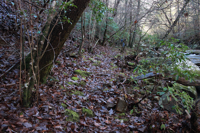
We began our hike along the shoulder of the mountain heading toward the first stream crossing. We came to the first crossing which was an easy rock hop thankfully. It is across a small spring branch that empties into McGill Creek.
The terrain flattens out here for awhile and parallels McGill Creek stream left.
It is very pretty. We did see one massive landslide area and some fallen trees that came down at the edge of the creek, but it was across from us and did not affect our hike. 

Above: part of the hike along McGill Creek is fairly level, but not for long!
We worked our way through some boulders and down to the bridge that crosses McGill Creek. It is well constructed, attractive and offers a safe, dry way over the creek. It also provides a good platform to take in views of the cascading waters of the stream. We spent a little time there checking out the view.

Above: Kenny gazing upstream from the bridge

Below: view upstream was very pretty. One cascade after another!

Once across we resumed our hike on the trail. I could tell that while we were on the proper course it had changed. It was no longer blazed except for occasional survey tape. It was a little more rugged. I think they have not worked all the kinks out of this section. The website does say the trail is not open beyond the bridge.
While the trail is a little tougher here, it is certainly open and easy to follow for the most part. Michael took one slight detour on the hike back, but it was a matter of perhaps 10 feet in the wrong direction.  Above: Kenny & Michael ahead of me on the gently winding trail
Below: A look at the trail behind me. Copper beech leaves give the forest a dash of color on a Winter day.

Once across the bridge and on to the opposite side it was only a quarter mile til we arrived at the falls. The maddening part is that the first bit is easy and you soon come to a point where you can get your first look at the falls in the distance.
The trail here instead of taking a direction course to the falls goes up, up, up, and around.. and back down to the falls. Why? Because the gorge slopes are steep here and there is no place to walk down next to the creek. We went a tad over 1/10th mile on the far side before the terrain squeezed in tight forcing us to climb to get round the boulders and the cliff.
Below: blue skies over Winter trees of green and gray. We were down in a hole for sure!

Below: the trail climbs now

Below: can you see the tiny sliver of neon orange survey tape? 

The stream below the trail
Below: I loved this shimmering pool along the creek


We approached the falls from above it working our way down the bank slowly and carefully. I was impressed with what I saw. I knew it was a pretty falls from seeing other people's photos, but until you are there it is hard to get a feel for how powerful the stream is. The falls was larger than I'd expected and running very strongly. Seeing it in person and especially from the side conveyed the scale of it better for me.

Side shot of the falls
Kenny was prowling around looking upstream. Michael had sat down and was talking to me above the roar of the falls. I could only hear parts of what he was saying, but he was talking about climbing on the falls, swimming there sometime, and then he went on to tell me he was going to swim at Abram's Falls next time he was there. This lead to a quick physics lesson about waterfalls, swirl eddies, and hydraulics. I reminded him how quickly things can turn bad such as the time he slipped and fell blacking his eye at Gee Creek. He blanched out white at the thought. It was a pigman's legacy moment. I hated to be the one to deliver the sobering message, but if it saves my grandson's life I'll play the bad guy.
I have been striving with all my grandkids especially Michael since he was a baby to teach them to enjoy the outdoors responsibly. To have fun, but be smart about it and not to take foolish chances. I got some photos of the stream at the brink of the falls. I then very carefully made my way down over the slick bank to get pictures from the base. I tried my best to convince Michael to come on with me, but he was still stunned I guess. He was getting over the shock and realization of what he'd been contemplating and how dangerous it could have been.

Below: same falls.. silky shot

Once we'd finished visiting here Kenny urged us to go up the bank and see another falls he'd spotted. It was on a side stream that flows down and empties into McGill Creek. It was quite pretty today and worth the short side trip to see it. I have a feeling that part of the year it dries up a good bit. From here we could look upstream and see an even larger falls. No trail between here and there. It would be a bushwhack and rock hop. Not real far, but tough. Michael was not feeling the off trail thing. He was far more reticent now.


Above: Looking upstream you can see many cascades and white water. It is hard to see through the trees the size of the other falls. If you look at McGill Creek on satellite view it is easy to see the force of the stream and the fact it is rugged and one waterfall after another.


Above: I am at the base of the falls looking downstream. It is hard to see, but there is a spring flowing out from beside and under this boulder on the right. I walked down through there and the bank had at least three springs running!
Once we got done checking out this area we turned and retraced our steps along the path. We were still on the super steep, rocky section that works around the cliff to put you at the falls when we encountered our first other hikers of the day.
We ran into a man and woman and greeted them. Once we'd gotten closer we stood and talked with them a bit. They were very friendly and a pleasure to chat with. They both knew a lot about the area and lived nearby. They were just out for exercise today. We stood there discussing the trail and the area I kept thinking they looked mighty familiar.
Before we parted company I worked up the nerve to speak up. "You both look extremely familiar to me. I think I keep up with your blog and have for some time now. " They both grinned and introduced themselves. They are a sweet couple.. Laura and Craig. I keep up with Craig's blog and have for I don't know how many years. It was a treat to finally get to meet them. They realized who I was as well. How funny. Michael was restless and we were aware he wanted to get going so we all hiked out together. They are fast hikers so they put us behind them rapidly.
We decided for the hike back up the hill to the truck we'd try something different. We opted to follow the ATV trail/logging road for part of it. Figuring it might be somewhat less steep. All of it comes out the same place anyhow. It turned out to be a good decision. It was a little milder of a climb. We were emerging back into the sunlight now of a pretty, late afternoon.
We were almost back to the truck when we passed the only other hiker we saw today. A very attractive blonde haired lady passed us going in.. carrying a camera. We exchanged hellos and kept going. Kenny turned to me and said he was concerned about her trying to hike to the falls this late in the day. I could see he was worried. I thought about what we might do and considered leaving our phone number on a paper on her windshield and ask her to call or text to let us know she was ok? Then I felt like it was on the forward side to expect that of a stranger. I said a prayer for her safety and we were at the truck.
The drive home was uneventful and we were all very mellow. The exercise was great. The scenery in the Dayton area and down that way is always pretty. I just like it. It is less crowded. Upon getting home... either that evening or the following day I learned that the lady in question was a lady I am acquainted with through Facebook! Carolyn! She is a member of our Cumberland Plateau Group!
She said she made it out fine of course, but regretted the late start as she had to hurry and did not have the time she'd have liked to tarry at the falls and along the trail. We were tickled to know who she was and that she was fine! She said her husband called to check on her just as she got back to her car.
Already looking forward to the next hike on the Cumberland Trail.
Below is a video of McGill Creek Falls
No comments:
Post a Comment
Thanks for reading and commenting. I enjoy hearing from those who read & make use of my blog. I have made some wonderful friendships through emails from readers. I respond to all comments and emails. I appreciate folks reaching out to let me know when my blog entries are not functioning correctly or if the situation somewhere has changed. Many Blessings to you!
Dana 🐝