***Edited to Add: The Luminary Fire Tower was manufactured by Braden Aermotor Co. It is stamped on each piece of the tower in plain view if you pay attention. Braden Corp. Is currently celebrating their centennial anniversary in business. That means 1923 to 2023! Quite a legacy. With the renewed interest in wind power as an energy source they remain relevant as ever.
Our ten year old granddaughter Tessa has had a rough start to her school year. She has NONE of her friends in her classroom this year. They moved back in March meaning she went from living in a subdivision next door to numerous good friends to out in the country with no friends nearby. It has made for a depressing combination and a strain on her emotions. We decided we needed to take an active part in helping break this cycle of isolation and sadness. We invited her to come hiking with us on Saturday and bring a friend of her choosing. She took us up on it. She invited Olivia Icenhower who is a friend of ours as well. We love their whole family. They are part of our church family we treasure.
I had already made up my mind I wanted to try visiting Stinging Fork Falls and perhaps some other area attractions. I had never visited Stinging Fork in Autumn. I knew the colors should be pretty. I also knew the water levels were going to be low thanks to the dry weather. I wasn't concerned. I figured we'd take the girls to get some lunch and to the Good Will in Rockwood. They have loved it in the past for the bin of goodies to rifle through. We all liked it! It had been a year or more since we got to try our luck in the treasure trove.
We all had lunch at Cracker Barrel. Tessa has loads of food allergies which is another source of difficulty and stress for her. Cracker Barrel has lots of choices of things she can have that are nutritious and good tasting. We swung by the Rockwood Good Will store. It turned out to be a great disappointment. They have taken to bagging up all their little trinkets into ziplock baggies. You buy a baggie for $1.99 and it might have one item in it you truly like. We did not tarry long there. It was a quick stop. We headed on down the road to start hiking.
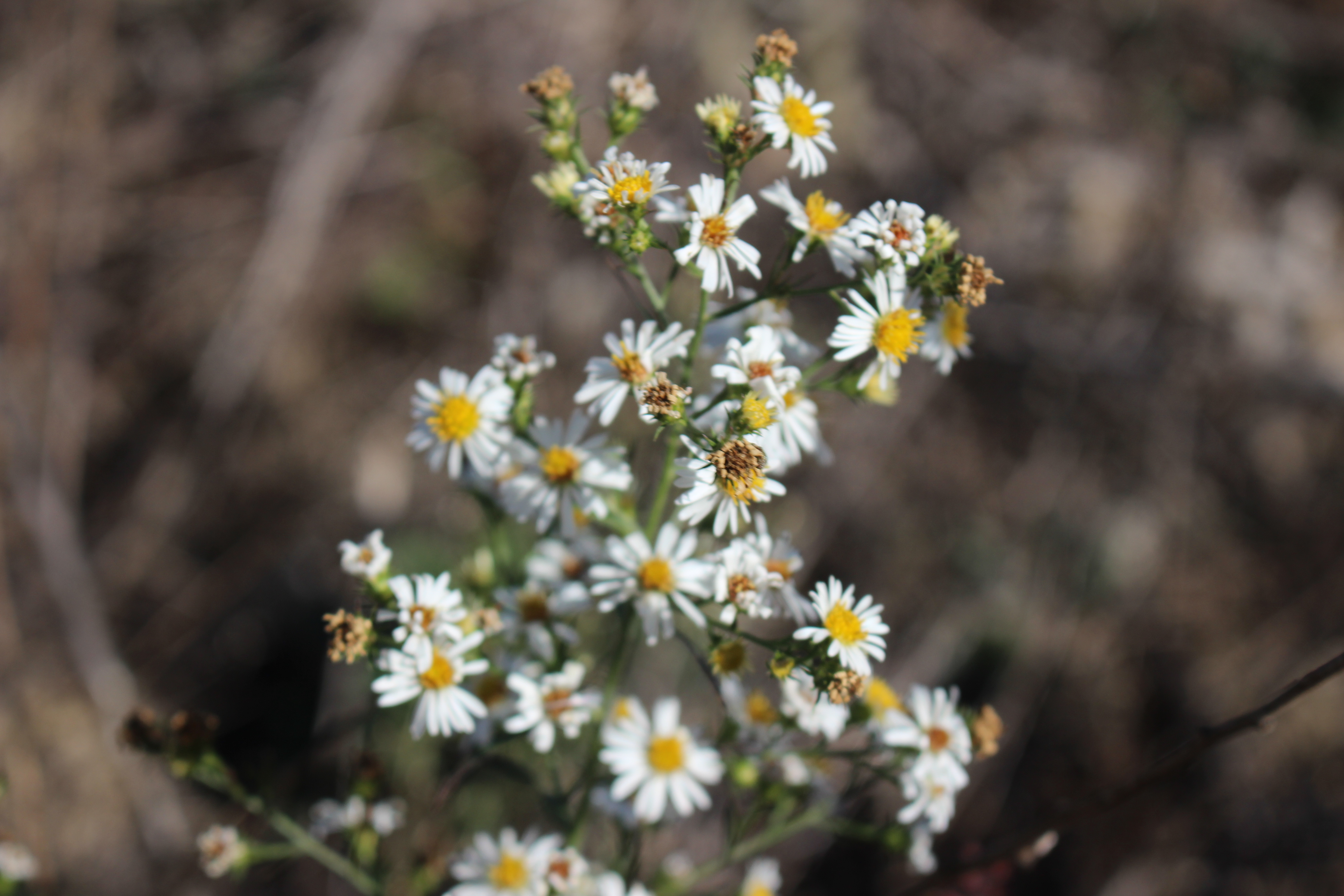
We did not have any trouble locating the trailhead today even though it had been a long time between visits. It is worth mentioning that the fields along Shutin Gap Road have nice views, but the scenery is disturbed also. Lots of clear cutting of timber has taken place. The area around the trailhead parking is the same. Ample parking. Good info kiosk, but torn up by equipment. I did notice a few late wildflowers. White asters, goldenrod, thistles, and a lobelia now and then.
We grabbed our gear and set off down the trail.
Below: photo of some of the cars at the trailhead parking for Stinging Fork Falls.
The shoulders have been cut out along Shutin Gap Road in many spots.
I knew the trail had undergone some changes between my visits so I was expecting it.
It is well marked now with white blazes along the Cumberland Trail portion. It is also well signed at important intersections or double blazed. The side trails such as to Indian Head Point overlook are blazed with yellow. Lots of other hikers today and dogs!
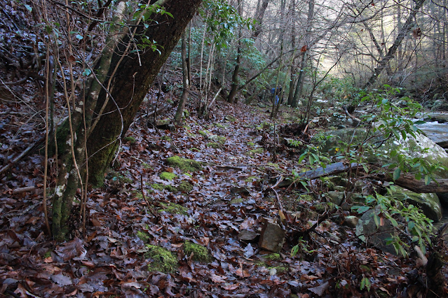
The forest was very pretty on our hike in. Loads of Autumn colors and the sun filtering down through them was a delight for the eyes.
Below: Tessa and Olivia getting ready to go
Below: a view of the Cumberland Plateau through the colorful trees
Below: an example of the view and the clear cutting
Below: goldenrod is sunny and colorful today
Below: Kenny, Tessa and Olivia down the trail in the colorful leaves
Above: looking up through the canopy I see a lot of green yet
Below: a nice level, shady stretch of trail on the way to the falls
Below: Olivia going down the steps
We hiked along the dusty trail in the direction of the falls. The girls were full of energy and ran up ahead. It was no time until we arrived at the sets of stairs that take you down the slope. We could not hear any water at this point. I could see a little water in the stream. Down below us we saw a few people already at the base of the falls. We couldn't see the falls at this point. The CT keeps going. There were a couple dudes ahead of us who were working their way down from that first slide area above the brink of the falls. It was sketchy as all get out. I did not feel good about this with the girls especially. It looked confusing to me. I remembered being able to go down the bank here, but not like this. I also did not recall having to go on past the falls very far. We went out the CT to see if it circled down to the falls. It wasn't long until we came to a side trail blazed yellow. I was relieved we did not have to use that hiker made short cut to the base.
We worked our way up through the boulders and forest to the falls. I know this is not the way we arrived at the falls in the past with 100% certainty. The first glimpse of the falls is the typical fan shape of Stinging Fork Falls. There is no view of it whatsoever when you go the way it is now.
We arrived at the falls to find it just a damp rock with a few trickles of water coming over.
It was very disappointing especially since Olivia and Tessa had never been to it before. They were good sports about it despite the lack of water. They threw rocks and walked around the plunge pool.
The pool was tannin stained brown water with leaves. The forest around it was bright with colors helping make up for the pitiful waterfall.
Above: Dam rock is all you see at Stinging Fork Falls right now. We need rain!
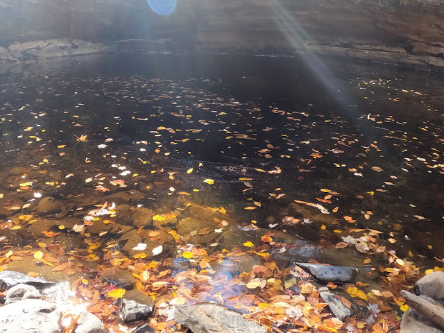
Below: plunge pool at least has water
Above: Kenny, and Olivia throw rocks
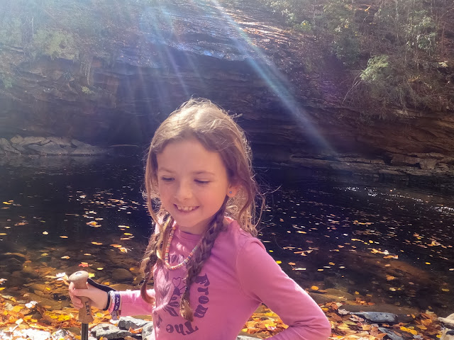
Above: Tootsa Rootsa is happy and that's what I like to see!
Above: you can see the splash from a rock in the bottom right of the image. Sunbeams on the water take the place of the actual falling water.
We sat and rested and got a drink. We enjoyed the antics of the dogs who were on this hike. They were funny and entertaining. There was a little border collie pup who was being restrained from herding every hiker present! We were her flock as far as she was concerned.
We watched some ladies come down the unofficial path to the base. We decided going up it would not be too bad so we'd try that as a short cut on the return trip. The girls made it look like no problem. It was not great, but it was doable going uphill. It certainly shortened up the hike which had turned out lackluster so far.
Below is a photo of the lovely colors at Stinging Fork Falls. At least that was good.
above: A view of the rock formations and colors looking downstream from the falls.
Below is a video of Stinging Fork Falls such as it was.
We made our return hike easily. The guys ahead of us had stopped to rest and one was vaping. I had a thought about vaping vs. cigarette smoking that never occurred to me before. Vaping is very bad for the lungs. Probably as bad if not worse, but the one thing vaping has going for it as opposed to smoking is the fire hazard is far less! No matches or lighters. No smoldering cigarette butts to toss out. I have noticed a significant drop in the amount of cigarette butts I see on trails and other places. Times of drought like now when the fire hazard is great this is one positive.
Back at the vehicle we got in and discussed what was next? The girls were not ready to quit yet nor were we. I had long wanted to see the Luminary Fire Tower. I had a phone signal so I looked it up on Tennessee Landforms. It turned out to be the nearest one to us. We all wanted to give it a try.
We drove way out Shutin Gap Road and continued across the plateau winding way into the boonies. We drove through a community named Luminary on our way. It was a pretty community with some nice homes. Some not so nice homes and some abandoned ones. The Autumn colors were glorious the entire way. We had a bluebird day for weather. I came out of my long sleeve shirt replacing it with a short sleeve tee. I hoped we'd be able to access the tower. The database said nothing about it being private property. We turned right onto Luminary Fire Tower Road. Interestingly Google maps said we had to drive an additional 0.20 miles before we turned so watch out. It isn't always correct!
We followed the road which the maps claimed was a "state highway". It was a bumpy gravel track. Up and up we climbed until we arrived at a forest service gate and a dead end. We had a mere 1/4 mile one way hike to our destination. We headed out toward the tower climbing gradually up the slope. We saw a wildlife pond on our right in a clearing.
We saw a white shed that stood off to itself. Just past that was the tower.
We made it up there and climbed it. Olivia did not care for it and came trucking back down. She was nervous of heights and of the wasps she saw flying. Tessa went up like a little squirrel. No fear! Not one bit of hesitation. I lost count of how many times she went up and down the flights of stairs! The view up top was a grandstand one! I knew this should be good. Being able to read a topo map sure comes in handy. I could see that this tower sat out on the edge of an escarpment with what should be an expansive view in all directions. It was as I had hoped. We could see the Smoky Mountains in the distance! Kenny remarked that we were just over there on that range of mountains looking this way last evening!
Below: one of the brilliant orange trees we saw on the hike to the tower
Below: Olivia and Kenny visible in the shot.. Tessa has run up ahead.
Below: Tessa climbs up the tower with me looking upward
Below: Kenny and Tessa up in the tower.
Below: The view back down the hill from the tower
Below: Looking back over my shoulder to the northwest
Below: the best view of all.. looking southwest is the edge of the plateau! In that drainage over there in the distance we found a large waterfall and a series of cascades years ago. I later learned this tower sat not far away. That is when I decided I wanted to see it.
We enjoyed the tower and the views and began our return hike. It was quick since it was all down hill or level. The colors on the hike back were even prettier.
Above: Kenny and the girls ahead of me. Bright red/orange trees.
We made it back to the truck and promised the girls who were getting hungry we'd take them to get something to eat. We hit McDonald's on the way home as that is what they wanted. Olivia doesn't like icecream! I remembered having been told that before, but had forgotten it. We made it home and by the time we dropped them off it was seven thirty pm. We had a good day of fresh air, sunshine and exercise and some pretty scenery. We left Tessa in far better spirits so we felt like mission accomplished. We will have many repeats of today hiking with her and her friends so she stays healthy and has an outlet to de-stress.
**The website information on the link above says that the CT is not open past the bridge over McGill Creek. It is not completed officially, but it IS open and can be used. It does not have an official connection to Leggett Road at this point so
it is best to hike it as an out and back. **
We had wanted to get out and hike some for exercise and fresh air. We had promised our oldest grandson, Michael, age eleven, we'd hike with him over Christmas break. We realized that we'd best get cracking on that as school was set to resume on Tuesday. We planned with him to go hike to McGill Creek Falls down near Dayton. It was not a real long ride. We stopped and got breakfast and then continued down the road to the trailhead. It is actually just past Dayton out in the countryside near Graysville, Tennessee. It is one of the newer sections of the Cumberland Trail.
I had seen people's photos of McGill Creek Falls and how pretty it was.
I wanted to see it for myself. I knew that the bridge was up to ford McGill Creek, but had been told previously it was a rough bushwhack from just past the bridge to the falls. I heard back from friend Gary Stephens that the trail was now constructed so as not to be a bushwhack any longer. Though the trail is not officially open we decided to chance it after he gave it a thumbs up!
Michael is a pretty able hiker and getting to be moreso all the time.
We selected the parking area along Brayton Mountain Road. It has room for a couple vehicles to pull off. The views down the mountain here were great. Wide and sweeping terrain unfolds before you. The trail is well marked, but you have to pay attention as the area is crisscrossed by former logging roads and atv trails.
ATVs are no longer supposed to be in this area. You couldn't take one further than McGill Creek anyhow because of the terrain. It would be a boring ride for sure.
We began our hike along the shoulder of the mountain heading toward the first stream crossing. We came to the first crossing which was an easy rock hop thankfully. It is across a small spring branch that empties into McGill Creek.
The terrain flattens out here for awhile and parallels McGill Creek stream left.
It is very pretty. We did see one massive landslide area and some fallen trees that came down at the edge of the creek, but it was across from us and did not affect our hike.
Above: part of the hike along McGill Creek is fairly level, but not for long!
We worked our way through some boulders and down to the bridge that crosses McGill Creek. It is well constructed, attractive and offers a safe, dry way over the creek. It also provides a good platform to take in views of the cascading waters of the stream. We spent a little time there checking out the view.
Above: Kenny gazing upstream from the bridge
Above: Michael and Kenny on the bridge
Below: view upstream was very pretty. One cascade after another!
Once across we resumed our hike on the trail. I could tell that while we were on the proper course it had changed. It was no longer blazed except for occasional survey tape. It was a little more rugged. I think they have not worked all the kinks out of this section. The website does say the trail is not open beyond the bridge.
While the trail is a little tougher here, it is certainly open and easy to follow for the most part. Michael took one slight detour on the hike back, but it was a matter of perhaps 10 feet in the wrong direction.
Above: Kenny & Michael ahead of me on the gently winding trail
Below: A look at the trail behind me. Copper beech leaves give the forest a dash of color on a Winter day.
Once across the bridge and on to the opposite side it was only a quarter mile til we arrived at the falls. The maddening part is that the first bit is easy and you soon come to a point where you can get your first look at the falls in the distance.
The trail here instead of taking a direction course to the falls goes up, up, up, and around.. and back down to the falls. Why? Because the gorge slopes are steep here and there is no place to walk down next to the creek. We went a tad over 1/10th mile on the far side before the terrain squeezed in tight forcing us to climb to get round the boulders and the cliff.
Below: blue skies over Winter trees of green and gray. We were down in a hole for sure!
Below: the trail climbs now
Below: can you see the tiny sliver of neon orange survey tape?
The stream below the trail
Below: I loved this shimmering pool along the creek
The trail stays in the bottom of the gorge for a short distance on creek right
Above: more placid pools of water shining in the gloom of the woods
We approached the falls from above it working our way down the bank slowly and carefully. I was impressed with what I saw. I knew it was a pretty falls from seeing other people's photos, but until you are there it is hard to get a feel for how powerful the stream is. The falls was larger than I'd expected and running very strongly. Seeing it in person and especially from the side conveyed the scale of it better for me.
Side shot of the falls
Kenny was prowling around looking upstream. Michael had sat down and was talking to me above the roar of the falls. I could only hear parts of what he was saying, but he was talking about climbing on the falls, swimming there sometime, and then he went on to tell me he was going to swim at Abram's Falls next time he was there. This lead to a quick physics lesson about waterfalls, swirl eddies, and hydraulics. I reminded him how quickly things can turn bad such as the time he slipped and fell blacking his eye at Gee Creek. He blanched out white at the thought. It was a pigman's legacy moment. I hated to be the one to deliver the sobering message, but if it saves my grandson's life I'll play the bad guy.
I have been striving with all my grandkids especially Michael since he was a baby to teach them to enjoy the outdoors responsibly. To have fun, but be smart about it and not to take foolish chances. I got some photos of the stream at the brink of the falls. I then very carefully made my way down over the slick bank to get pictures from the base. I tried my best to convince Michael to come on with me, but he was still stunned I guess. He was getting over the shock and realization of what he'd been contemplating and how dangerous it could have been.
Above: The beautiful McGill Creek Falls from the base
Below: same falls.. silky shot
Kenny helped me carefully get down to the base over the slick rocks. I hung around down there taking photos and enjoying the sight of the falls for awhile. I was able to climb back up myself being extra careful. He once again gave me a hand to help me over the land rock which was slippery. We sat up at the falls and ate lunch. It was not cold, but it was not as warm down here in the gloom of the gorge as it was walking out in the midday sunshine.
Once we'd finished visiting here Kenny urged us to go up the bank and see another falls he'd spotted. It was on a side stream that flows down and empties into McGill Creek. It was quite pretty today and worth the short side trip to see it. I have a feeling that part of the year it dries up a good bit. From here we could look upstream and see an even larger falls. No trail between here and there. It would be a bushwhack and rock hop. Not real far, but tough. Michael was not feeling the off trail thing. He was far more reticent now.
This lay between us and the upstream, big falls we spotted.
scenic cascade on a side stream
Above: Looking upstream you can see many cascades and white water. It is hard to see through the trees the size of the other falls. If you look at McGill Creek on satellite view it is easy to see the force of the stream and the fact it is rugged and one waterfall after another.
a closer look at the side stream with the waterfall. the trail actually curves round and provides a view of this. It appears to continue in its roughed in form.
Above: I am at the base of the falls looking downstream. It is hard to see, but there is a spring flowing out from beside and under this boulder on the right. I walked down through there and the bank had at least three springs running!
Once we got done checking out this area we turned and retraced our steps along the path. We were still on the super steep, rocky section that works around the cliff to put you at the falls when we encountered our first other hikers of the day.
We ran into a man and woman and greeted them. Once we'd gotten closer we stood and talked with them a bit. They were very friendly and a pleasure to chat with. They both knew a lot about the area and lived nearby. They were just out for exercise today. We stood there discussing the trail and the area I kept thinking they looked mighty familiar.
Before we parted company I worked up the nerve to speak up. "You both look extremely familiar to me. I think I keep up with your blog and have for some time now. " They both grinned and introduced themselves. They are a sweet couple.. Laura and Craig. I keep up with Craig's blog and have for I don't know how many years. It was a treat to finally get to meet them. They realized who I was as well. How funny. Michael was restless and we were aware he wanted to get going so we all hiked out together. They are fast hikers so they put us behind them rapidly.
We decided for the hike back up the hill to the truck we'd try something different. We opted to follow the ATV trail/logging road for part of it. Figuring it might be somewhat less steep. All of it comes out the same place anyhow. It turned out to be a good decision. It was a little milder of a climb. We were emerging back into the sunlight now of a pretty, late afternoon.
We were almost back to the truck when we passed the only other hiker we saw today. A very attractive blonde haired lady passed us going in.. carrying a camera. We exchanged hellos and kept going. Kenny turned to me and said he was concerned about her trying to hike to the falls this late in the day. I could see he was worried. I thought about what we might do and considered leaving our phone number on a paper on her windshield and ask her to call or text to let us know she was ok? Then I felt like it was on the forward side to expect that of a stranger. I said a prayer for her safety and we were at the truck.
The drive home was uneventful and we were all very mellow. The exercise was great. The scenery in the Dayton area and down that way is always pretty. I just like it. It is less crowded. Upon getting home... either that evening or the following day I learned that the lady in question was a lady I am acquainted with through Facebook! Carolyn! She is a member of our Cumberland Plateau Group!
She said she made it out fine of course, but regretted the late start as she had to hurry and did not have the time she'd have liked to tarry at the falls and along the trail. We were tickled to know who she was and that she was fine! She said her husband called to check on her just as she got back to her car.
Already looking forward to the next hike on the Cumberland Trail.
I recently reached out to members of my Cumberland Plateau Facebook group seeking input on blogs they'd like to see me write. One lady named Lacy suggested Northrup Falls since that is one of her favorites. It was a good suggestion especially since I had not visited there in several years. It is a short day hike so we set off with several things we planned on doing today. I had a list of three other waterfalls to visit. I also wanted to swing by Cumberland Mountain General Store. I had that on my list of places to visit to include in the Country Store blog series. I figured I'd at least try to fit in a couple things today.
The day promised to be cooler, sunny, and just perfect for hiking.
The drive over was pretty. Signs of waning Summer and Fall creeping in could be seen all along the roadsides. We arrived in Allardt around 10:30 a.m.
We found quite a few other vehicles in the parking lot already, but not an overwhelming amount. The trail was familiar to us as we've hiked it three or four times at least.
Above: photo of the trail heading toward Northrup Falls hiked in a clockwise fashion. Notice the white blaze on the tree on the right?
The trail is a gentle, gradual level and slightly downhill through the trees of a deep hemlock forest. Many of the hemlocks here have the little blue dot at the base indicating they are being treated against the hemlock wooly adelgid to try to save them from this pest. Mushrooms of red and yellow and brown dotted the forest floor along with a few white asters. I also saw a lobelia or two. The forest here was quiet and a light breeze stirred.
Above: a better image of the dappled light marking the forest floor through the trees
Above: some sort of very pretty red mushrooms growing by the trail
Above: the trail has turned and started down off the bluff line
Above: We hiked along the base of the bluff now
above: Kenny surveys the pile of break down rock
Shady places under the bluff
above: a closer look at the pock marked rock face we passed
Above: The photo here makes this trail look very rough and difficult. It is really not though the terrain gets rougher.
Above: You can barely see Kenny's orange t shirt in the bottom left corner. The lady in the white shirt is just another hiker. I watched her climb over those rocks and sit down then slide out of sight with a gasp. I didn't hear anymore of her, but I did see her husband go check on her. She was ok!
Below is an image of a gnarly mess of tree roots you have to climb down to continue. It is a little slippery.
Below: more damp, slick uneven footing as you approach the falls
Above: Northrup Falls from directly in front of it. A great volume of water for this time of year which is usually very dry. Northrup Falls is 63 feet high and more of a true waterfall for the area. It actually drops and doesn't just cascade down a rock face most of the way.
Below is an isolation shot of the top portion of the falls and the layered rock around it.
Above: plunge pool of the falls with as much water as I think I've ever seen in it!
One of the fun things about this waterfall is that it can be viewed from so many different angles!
Above: Another glance at the plunge pool and the forest past it.
Above: This shot I included because it demonstrates how you can walk behind the falls to continue the hike as a loop. It also shows the scale or size of the falls by comparison.
Above: Northrup Falls sits within a stone amphitheater or carved out half bowl at the base of a bluff.
Below: a shot of the spray cliff community that exists because of the constant moisture from the spray of the falls
Above and below Starting to go behind the falls.
Above: view from behind the falls.. a diamond shower! and below you can see it even better
Above: Looking back at Northrup Falls from the far side
and below: an isolation shot of this same position. It sure is beautiful.
We enjoyed the falls and the misty spray off of it. We saw six other hikers down here when we arrived. They all left and for a time we had the place to ourselves! It was enough to get some nice photos and enjoy the solitude.
We did not want to hike the entire loop today. I've done it a couple times before and was not real impressed with the scenery past the falls. It is okay, but not that great. We headed back the way we'd come. It was a treat to see the waterfall running this great in September!
Below is a video of Northrup Falls seen from various positions
Directions to Northrup Falls
Driving Directions from Allardt
From the main four way intersection of Hwy 296 and Hwy 52 in Allardt
follow Hwy 52 East for a little over a mile and turn RIGHT onto Northrup Falls road. The road is signed as such and on the left just prior to the turn there is a sign for Colditz Cove Natural Area. Drive 1.25 miles on Northrup Falls road and turn RIGHT into the parking area and trailhead for Northrup Falls.
Hiking Directions
In the parking area there is a kiosk and a big sign indicating Trail starts Here~~> Follow the well marked trail through the forest on level or gradually downhill to the point you will come to an overlook of the falls in about 1/4 mile. Once here turn left and hike the trail out along the bluff rim. It is blazed with white horizontal bars on the trees. It will eventually bear right and drop down below the bluff line gradually until you are hiking along the base of the bluff. The trail will become rougher as you approach the falls. It is over rocks, roots and can be slippery so take your time and use care.
You will begin to hear the falls and in about 1/2 mile from the time you dropped off the bluff line to the base you will arrive within sight of the falls.
You can do the hike as an out and back or carefully continue round behind the falls and hike in a clockwise fashion following the trail until it will bring you back round to the first overlook of the falls you saw on your way down from the parking lot. Once here turn left and hike out on the original trail 0.20 miles to the parking lot.
There are no restroom facilities at the natural area. Whatever you bring in with you make sure to take it out as there are no trashcans either. Please do not become a social media vandal who leaves your mark through rock stacking, graffiti tagging, carving your initials in trees, or otherwise destroying a beautiful area.
Once back at the vehicle we noted how the number of hikers and vehicles had grown! We were glad to be leaving. The day was growing hot and we were growing hungry. We talked it over and decided to be realistic. Rather than try to go in search of waterfalls we may or may not find and get access to we'd do other things. I had wanted to visit the only spring I heard of on this side of Fentress County. I knew from Nelson Matthews there was one somewhere in Allardt. I had figured out where it was. We were only a few miles from it. I figured we'd go by and take a peek at that and head to the store and diner for lunch.
I am calling this spring of water Baseline Spring because it is along Baseline Road, but it may have another name. I am unaware of one so if I learn different I'll make the needed corrections. The spring is private property, but the owners appear to have generously allowed people to make use of it. It was easy to find.
There is even a pull off on the same side of the road as the spring. It is behind a fence and has a nice pipe fixed so you can fill containers. We met and talked to a nice young man there who was getting him some jugs of water. He said it was the best water he'd found. I had heard it was tested and found pure. He went on to say that it is tested on a monthly basis for contaminants. He also indicated a dye trace had been done on a cave system in the Smoky Mountains and traces of the dye from that trace were detected coming out of this spring! I hadn't heard that before. Not saying it isn't true, but it sounds rather fantastical. I'd welcome comment on that subject from people I trust such as Alan Cressler or Chuck Sutherland or the cave and hydrology experts in the state.
Above: the "gate" that sits at the road indicating you're at the spot for the spring
Above: Young area resident filling jugs of water. He told me it was ok to photograph him.
Above: I'm standing looking back toward the parking spot. Nice shady area near the spring.
Another look at the filling spout of the spring.
To visit the "Baseline Spring from the main four way intersection in Allardt of Hwy 296 and Hwy 52 go East on Hwy 52 for 1/2 mile Here Hwy 52 continues to the right while you need to stay STRAIGHT ahead onto Baseline Road. Drive about 1/2 mile further on Baseline Road watching for a pull off on the LEFT. There is a fence with an opening as shown above and room to park about four cars.
If you pass Car Road on the left you have missed it.
Cumberland Mountain General Store and the Rockabilly's Cafe
I am doing a series of blogs on country stores. One of them on the list was the Cumberland Mountain General Store. I determined that I'd take advantage of being in the area today to visit and prepare for that as well. Turned out perfect since Northrup Falls is a short hike and not enough to take up a day. I did not want to turn around and drive 114 miles and 2 hours west twice for either of those topics alone. It was good to be able to roll the two into one. I debated whether to do the store write up as a separate thing or combine the two. I don't think either topic will be terribly exciting without the other. I will just combine them so this counts as #2 in the country store blog series.
Above is a photo of the front of the store building. The cafe is inside all the way to the back.
Above: Once inside the store all the way to the back this is the entrance to Rockabilly's Cafe & Soda Fountain. It is a little slice of 1950's Heaven right here in Clarkrange, Tennessee.
We were getting hungry and were glad to arrive here at this diner. We'd eaten here before many years earlier. Another spot that was a long time between visits. I'd been back to the store a couple times, but not to eat. You just seat yourself at either an open table or the counter and they'll get round to you to take your order.
They serve burgers, shakes, malts, fries, onion rings, hot dogs, chicken sandwiches, fish sandwiches, sundaes, and just good old scoops of icecream, and soft drinks.
The menus are on the tables and it says right on there :
If you want fast food its available fifteen miles in either direction.
They don't do fast food. It is all cooked to order, fresh, homemade, authentic.
They also serve beer. I don't drink beer or alcohol so I forget about that sort of thing. Kenny likes a beer now and then. He grew up a Presbyterian.
I read the owner uses an original old Borden recipe book he bought from an ebay auction! It was only for sale to restaurants and businesses that sold their ice cream. He keeps the ingredients true to the recipe so patrons get a true taste of the original. Things taste the way you expect them to especially for patrons who remember going to old time burger and ice cream joints. They were incredibly busy as they'd just gotten in a party of twenty people! We had no problem finding a seat or getting waited on. We did see at least two groups get up and leave not wanting to wait I suppose. It was worth the wait. They have ample seating inside, on the screen porch and outside on the covered porch.
Kenny had a burger and fries. I had a grilled cheese and onion rings with a diet coke. 1950s tunes played on the jukebox. I got up to put money in it to keep them going, but it is not necessary. It is set to play all the time! Below is a glance at the jukebox.
Below are some images from inside the cafe
Above: wall decoration of American muscle cars.
Once we had our tummies full and were ready to move on.. we went out to the store to look around. They have lots of cool stuff. It is mainly antiques, souvenirs and old timey items. They still sell old brands of soaps, kerosene lanterns, the chimneys,wicks and such for them. They sell printed flour sack material like back in the old days. My great grandmothers used flour sacks for everything from kids clothes and dresses to quilt backing. I have a quilt made by my great granny that says on the back "Roanoke Feed and Mash" a chicken feed sack!
Above: Behind the counter in the store they sell different kinds of fudge and candy!
Below: A look down through the store.
Behind the candy counter is homemade fudge of several types! They sell other homemade candies and goodies.
Above: Checker board set up in the store
Some wall art above.. loved the Three Stooges sign. Love me some Elvis too.
Above: I liked this Make Mine Western art work. I love old cowboy movies and westerns. True Grit is one of my favorite movies. I still watch The Virginian, The Rifleman, Rawhide, and Gunsmoke.
Above: some printed flour sack material
Above: kerosene lamps and chimneys, they sell wicks too.
Above: Old timey wood cook stove. My granny Painter still cooked on one of these up til a few years before she passed away. She had a regular electric stove, but still used the wood stove too. She mainly used it when it was cold.
Looking down the front porch of the store outside.
I don't know a lot about this store, but I do know a little. It used to be located across the road from where it is now. It was opened in 1923 for business by Todd MacDonald. Sometime in the 1980s it was thought they'd close it and tear it down. It got a new boost of life when was taken over by Ron & Lana Jones. They still use the original register and have left as much of it original as possible.
I know from another interview they've run it twice, but I am not clear on those details. They sell antiques, reproduction antique items, and all sorts of goodies.
They do a brisk business. The Highway 127 longest yard sale is a boom for them.
They close for a week to clean and rest up after it each year!
I don't blame them! They are open despite the corona virus. They have made a few modifications to the way they run things, but it is still a pleasant experience.
If you are ever heading up York Highway in Clarkrange, Tennessee you should stop in to see it for yourself. It is a step back into the past and a welcome escape from 2020.
Above: One look back at this cool old place before we leave.
Directions to Cumberland Mountain General Store:
The store is on the RIGHT side of Highway 127 heading North.
It is about 14 1/2 miles north of I-40 in Crossville.
It is 15 miles south of Hwy 52 in Jamestown and of course on the LEFT heading South.
Be sure to check the website for their hours before planning a visit.
Home, Home on the Clarkrange-- Wandering the Flower Fields
I am admittedly not exactly the most feminine flower of a woman. I have the bad habit of sitting like a dude with my leg cocked up on my lap. It is not at all ladylike. I am also prone to wandering around in fields of weeds. Another not womanly activity, but hey... I've been doing it since I was a kid. Why change now?
All the way out to Northrup Falls today and along Hwy 127 I saw loads of beautiful wildflowers. I hadn't taken photos of any of them. I love this time of year when the fields of flowers are run riot. Before we headed home I talked Kenny into taking me back up the road where I'd seen a nice field of flowers.
It was in a location where no one was likely to be bothered by my presence.
Above: abandoned building in front of the cell tower. Good place to park to see flowers.
We pulled in next to this old car lot and a cell phone tower. Some kind of abandoned building was there also real close to the road. Kenny pulled the truck in there well off the road. He played games while I spent time wading around the fields collecting hitchhikers and chiggers and enjoying all the colors and textures of those flowers. One corner of the field was especially nice. It was even better up close than I'd expected. The lower plants were heal all, and Maryland Meadow beauty. The taller plants were deep purple giant New York Ironweed, beggars ticks of bright yellow, boneset in fuzzy white, pink Joe Pye Weed, Queen Anne's Lace, pale blue mist flower, and dots of bold red cardinal flower. I was in my seventh heaven. I was not worried about snakes, ticks or anything. I just enjoyed the beauty of the blue skies, the sunshine and the colorful flowers. Finally I began to work my way back toward the truck .
I saw quite a few butterflies including one fritillary.
Below: Sweet peas in hot pink and deep purple pokeberries near the old building.
Below: maryland meadow beauty down lower in the field closer to the ground!
above: yellow butterfly on some ironweed
Below: mist flower was plentiful
Above are three views of different clusters of flowers. Each one pretty in its own way.
Below is one final shot of the flowers
I'm a gypsy when it comes to colors. I like lots of them!
I promised to provide directions to see the wildflower meadow as well as the rest of the stuff so here goes:
Wildflower Field Directions
Along Hwy 127 heading north from the Cumberland Mountain General store
Drive less than a miles north on the highway from the store. Pass Mountain Barn Builders and watch for a cell tower and an abandoned white building on the LEFT heading north. Pull in here to park. The wildflower field is in bloom in late August thru September of the year. It is to the north end of the field beside the old building and tower. The address is 6521 S. York Highway Clarkrange, TN.
We wrapped up our day tired, full and happy. I was satisfied and ready to go home. Looking forward to the next adventure!
last of all... a music video from the times.......... back in the 1950s... The Everly Brothers and Bird Dog.