

Above: a freshly bloomed purple wakerobin along the High falls trail

Yellow Mountain Fire Tower Hike & High Falls Hike
Dana Koogler
Wally & Kathy Storey
Waterfall Keepers of North Carolina
April 15 & 16 2022
Yellow Mountain Tower Pix Here
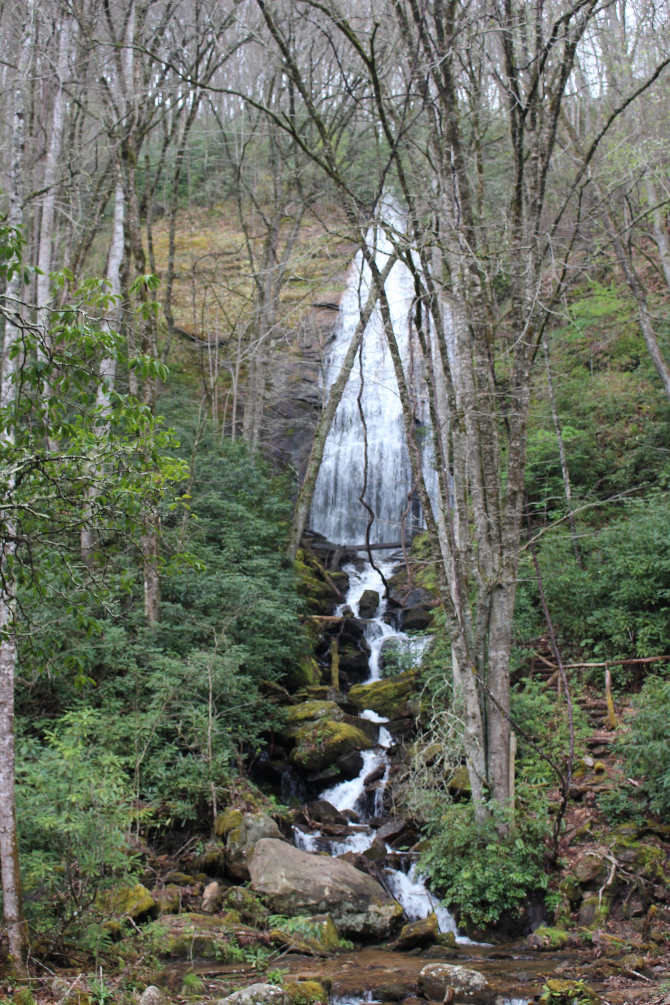
I signed up to participate in a hike for wildflowers and geology hosted by Waterfall Keepers of NC. I am a member and it provided me an opportunity to go on a guided hike with the group to a waterfall I had yet to visit. I am working on completing the Kevin Adam's 100 Waterfall Challenge. High Falls in the Lake Glenville area was on the list I needed to finish. I reached out to friend Wally Storey to see if he and Kathy wanted to get together. It was a pretty good drive to plan on doing only one hike. I suggested that we work on other lists. Wally and I are both trying to finish up the Carolina Mountain Club's Lookout Tower Challenge. We both needed Yellow Mountain Tower. It is a long hike coming in at 12 miles round trip.
We both were committed to finishing it and had resolved to do it.Neither of us was thrilled at the prospect of a 12 mile round trip. It hit me that perhaps there was a shorter way neither of us was aware of? I sat down and googled shorter routes to Yellow Mountain Lookout Tower.
"Ask and ye shall receive, ye shall! "~~Wanda Wayne

Up popped a set of directions on how to hike to the tower from a nearby gap that got the hike down to 3 miles round trip! It required a four wheel drive vehicle, but I have that! I did some looking into it and discussed it with Wally. We would try it. The directions were fairly recent leading me to believe that it was an accurate report. Checking out satellite imagery also led me to believe it was true. I could see the trail and a check of the boundaries showed that it was all legitimate. He met me at Dry Falls early in the day and I followed him to their hotel in Highlands. We left the vehicle with Kathy and we took my jeep to the trailhead not far away.
Yellow Mountain Lookout Tower from Cloud Catcher Lane Directions
We found the trailhead without any trouble. My jeep handled it well, but I honestly think a passenger car with decent tires and ground clearance would be sufficient. We arrived to find no one at the trailhead besides us. I wondered if this trail was not well known? I didn't much care as long as it worked for us. I sure appreciated the contribution of Mr. Caleb Adcock for sharing the knowledge. We made the hike without any trouble. It was a gradual climb with only 700 feet elevation gain and a quarter of the original distance. The woods at this elevation and time of year were pretty dead and brown. Not much emerging yet, but the scenery was still pretty.
Below: This is the view from the first overlook we came to. It was not from the tower site, but from a manmade observation platform built on the side of the mountain facing north.


We spotted a side path leading to the left on our hike up. A manmade structure was just barely visible through the trees. Wally noticed it. We turned aside to see what it was. It was an observation platform facing to the north for the views. I was glad we saw it and got to check it out.
We continued upward from there toward the summit and the tower.
It was a gradual climb and the trail was in good condition. We arrived at the point where the long trail to the summit intersected this shorter path from Cloud Catcher Lane. We bore to the left to continue on our route to the summit. The trails are signed, but very few indicators.
We soon arrived at the mountain summit where there would be no more elevation gain. It was nice and cool up here with fair skies.


I stepped into the doorway of the base of the tower. I saw movement in the corner and it was a bird. I thought at first it was a hawk who was injured. It turned out to be a juvenile buzzard just sitting in there to get out of the wind. He wasn't hurt, but only resting. We encountered several other hikers while we were there. We talked with them and all were very nice people. I remember for sure that the large group we talked to had come up from the same way we did. I don't remember what the others said.
We liked this tower site and were glad to have seen it and be able to check it off our lists. It was a pretty hike and a neat tower. Aside from the views and the tower itself there was not a lot to see. I think though the other way would be longer, in the future if it was Spring bloom season or Summer it might be more interesting to come up that way.
Another possibility would be to hike the shorter route up and see sunset from the tower site and hike back down the easy, simple trail with a head lamp. That would be a nice change.
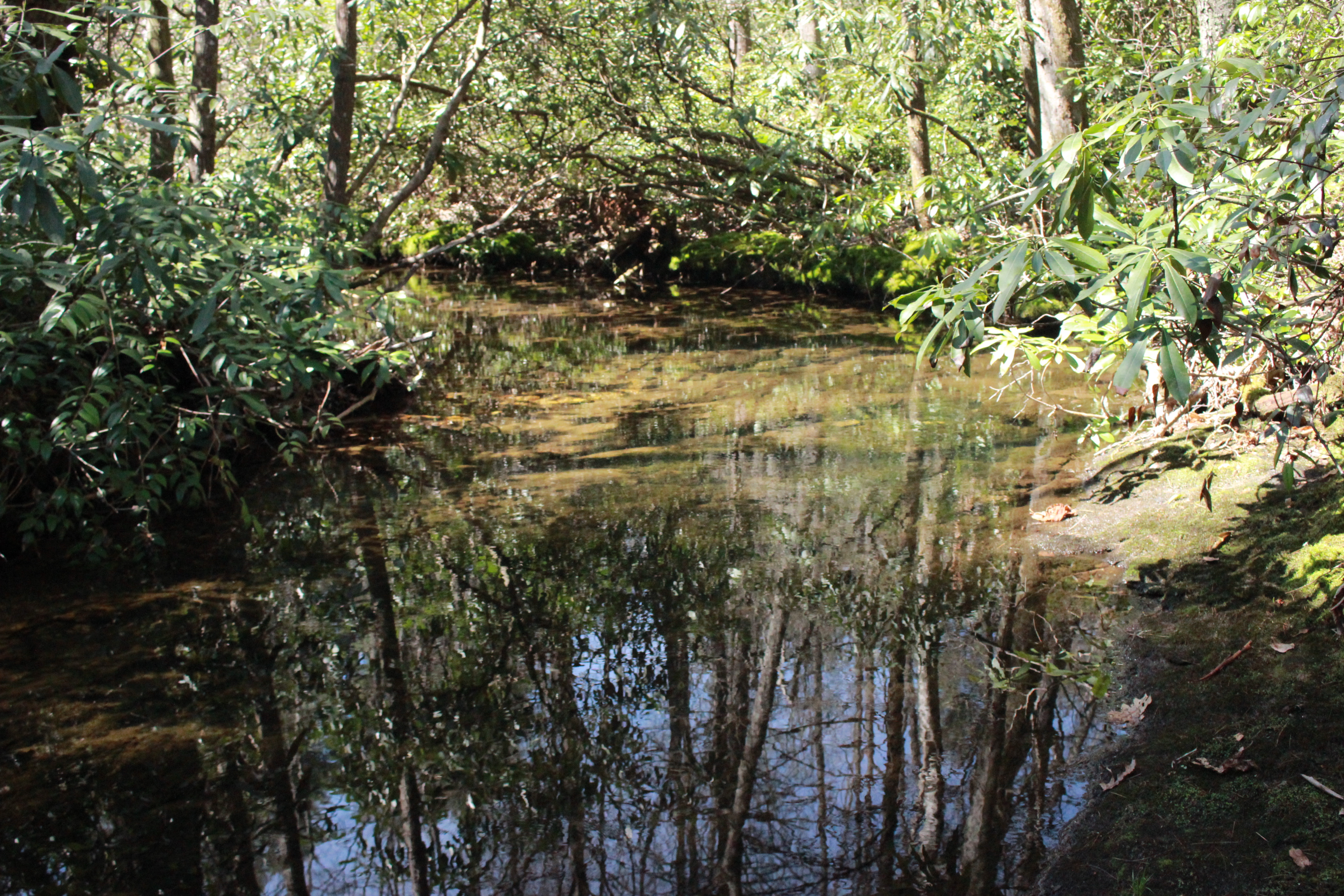
Once we had our tower hike over with we decided to try to find Coyote Falls around Cashiers. We made our attempt from the shorter, upper route. Oh Lordy. We were wandering around in the rhodo and brush. It wasn't the hardest thing we'd ever done, but it was not real fruitful. I finally had enough of it and so did Wally. We just got back out of there and said we'd have to try again with more information. I am sure glad we waited because upon getting home later this weekend I found out that coming in from the bottom route is far simpler and there is a trail the entire way. I watched a video some folks shot of their trip. Yeah. We were making it way harder than it had to be!
🦗

We gave up on hiking for the day. Back at the jeep and glad to be out of the brush we ate a snack, got a drink and cooled off. We headed back to Highlands where we met Kathy at their hotel. We sat outside on the stone patio on a lovely afternoon and caught up a little. We walked through town later and ate supper together at The Ugly Dog Public House. It was a delight to be able to enjoy a nice meal with two great friends.
I was rather weary and so after dinner I said my good-byes and headed back to my hotel in Franklin. I got a nice hot shower and rested. I slept well and got up ready to face the day and our hike to High Falls.
High Falls at Lake Glenville with Waterfall Keepers
I met Wally & Kathy the next morning and we headed to Highlands together. Wally rode with me so Kathy had their vehicle. We planned to meet back at a local coffee house once the hike was over. It is worth mentioning that cell phone reception around Lake Glenville is spotty at best. I was glad we had the framework of a plan in place because communication was not easy. I was also glad Wally had great familiarity with the area. I was much more relaxed not having to navigate and drive. We made our way to the north trailhead off Hwy 107. We found the group beginning to gather at the meeting place. We got out and collected our gear and began to say our greetings and visit with folks. I was pleasantly surprised to see my old friend Kevin Adams himself in attendance!
He looked healthy, happy and terrific! It had been way too long. Everyone I met today was a delight. I am proud to be part of such a positive organization.
Just standing around at the trailhead and gazing at the ditches and surrounding slopes I could see this was going to be an amazing hike. Spring wildflowers were popping up everywhere! We had a guide to describe wildflowers named Susan. We had a geology guide named Bill who was to teach us about the area geology.
I hate to admit it, but I did not take as many photos as I do when I am alone.
It was drizzling rain for one. I was visiting with new people and getting to know them. I was also trying to keep up with the group and not geek out too much on the flowers. It was a real struggle for me to resist the urge to get artsy with the camera, but today was not the day for it.
Below is a very pretty specimen of purple wakerobin trillium. All three sepals are striped burgundy!


The hike from the north trailhead is the only way I've ever hiked to High Falls so I am not qualified to compare the north vs. south routes to the falls. Friend Wally has done both and he said the south route is shorter and very steep up and down. The north hike is longer coming in at around 4 miles but is a lot more gradual and the scenery is marvelous especially in Springtime!
Below is a photo of Kevin Adams on the trail today.

Below: is a photo of the group and the lady in the blue raincoat in the center is Susan, our wildflower guide. She did an excellent job pointing out flowers and identifying them. She knew her stuff!


That would be un-nerving for me. I was happy just coming at normal water volumes thanks.


.jpg)

No comments:
Post a Comment
Thanks for reading and commenting. I enjoy hearing from those who read & make use of my blog. I have made some wonderful friendships through emails from readers. I respond to all comments and emails. I appreciate folks reaching out to let me know when my blog entries are not functioning correctly or if the situation somewhere has changed. Many Blessings to you!
Dana 🐝