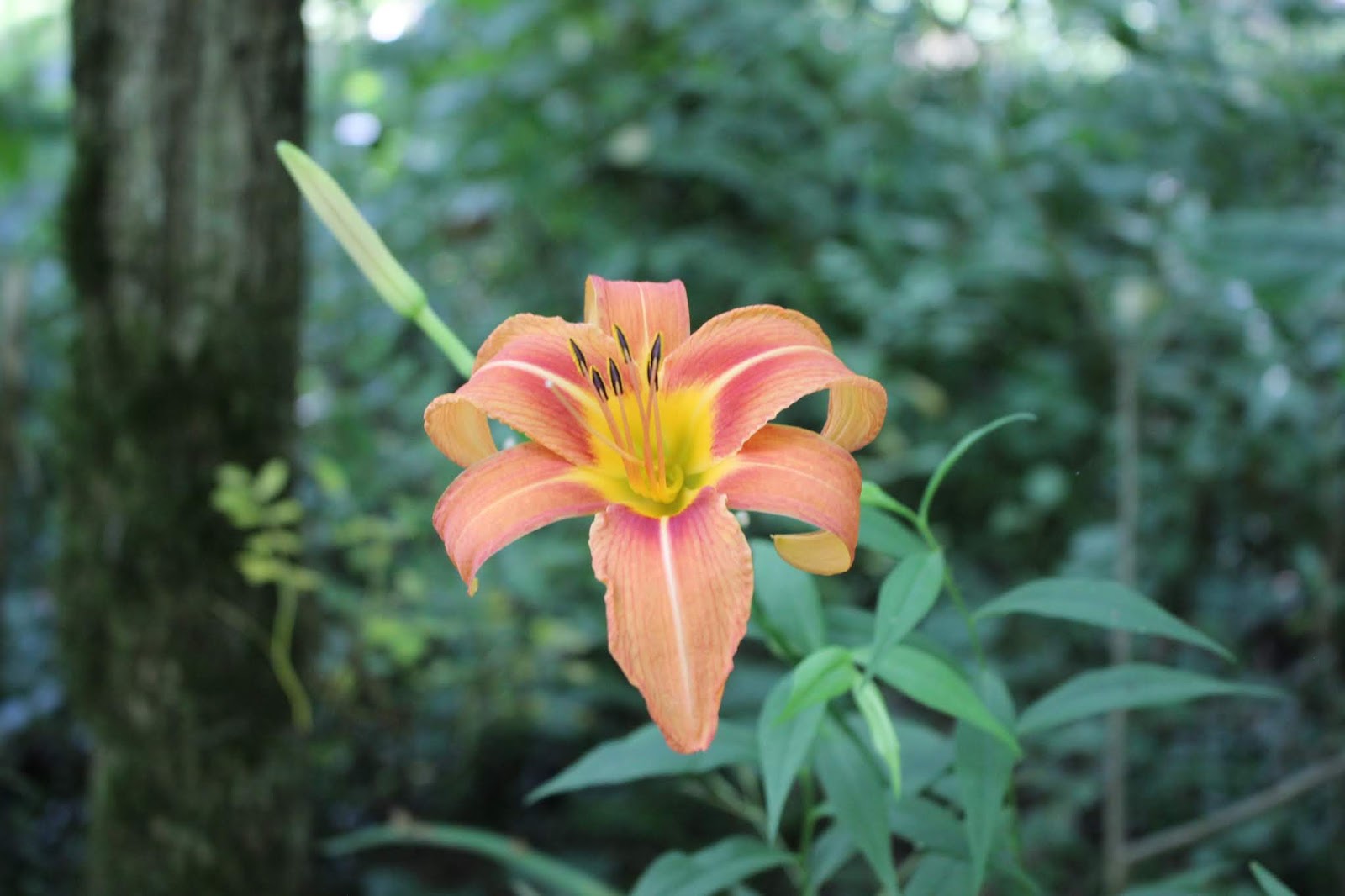
Cardinal Flower growing in Sang Branch creek
Gobey in August
Kenny & Dana Koogler
Sunday August 26, 2018
Back in Spring we went four-wheeling and exploring at Gobey. Kenny had been before, but it
was my first time. I loved it this Spring. We went back a second time later in May. It was not nearly as pretty seeing as how the Spring wildflowers were finished blooming and the Emory River was now dried up to holes of water. We have been intrigued by it just the same and have been wanting to learn all there was to see. I recently figured out we were very close to a lookout tower, but had not
gone to see it. We didn't know of it until the past week or so. We also wanted to go back after August first when they reopen the gates to travel. Sang Branch had been such a glorious Spring wildflower trip. I was just sure it must be holding onto some secrets for late Summer. I wanted very much to find out if I was right? We needed to do something close and something we could
curb shortly because we had plans to come home and eat supper with Adam, Crystal and our grandkids. I told Kenny we would have to avoid what I call rabbit hunts. Aimless spells of wandering just for curiousity's sake.
I had not been completely thrilled about the idea at first. I wanted to go where we could fill a day
of great views, beautiful Summer wildflowers, butterflies, riding, tunnels, swimming holes and all kinds of fun stuff. I sat down Saturday night to see what we might get into while in the area?
In no time my perspective changed and I realized we could easily fill and overflow a day in Morgan County. Now we really wanted to go.
We headed out to Gobey early Sunday morning. We parked and unloaded deciding that we'd try Sang Branch Trail first. Next we'd move on to finding the Pilot Mountain Lookout tower. Both of us
wanted to see both, but we were extremely curious about what that trail would be like in Summer.
We set out in that direction. On the way Kenny realized he had lost a strap to hold the cooler in place. We had passed the most beautiful, enormous field of New York Ironweed. I asked him to drop me off there to take photos while he went back to retrieve the lost strap. He obliged me.
I walked down through a farm field absolutely full of New York Ironweed that was eight feet high.
Amidst the deep purple spires were also found bright yellow clusters of wingstem. I also saw lots of
white dots of Virgins Bower clinging to the plants down low. Cardinal flower was growing in the middle of it all. The edges of the field were lined with spotted jewelweed of deepest orange and
pale jewelweed of light yellow. I stood in the middle of all that beauty listening to the songs of
morning insects, quiet and then the low mournful sigh of a passing freight train. Around me the blue mountains and hills shone in the mist of a new day. It was a little piece of Heaven on earth.
 Above and below... the season of purple and gold has begun!

Kenny arrived to pick me back up so I had to get going. I spied a late trumpet flower in the fence row as I left the field. He had found the missing strap and so we motored on.
We soon came to the turn for the first gated trail. Sang Branch is gate #1. They are closed May 15th thru Aug. 1st, Not sure why, but the gate stood wide open today. The Emory River here flowed with water and Sang Branch came down to meet it. The river looked more like a creek and the creek like a tiny trickle of water. It is still a pretty spot. A dry stone wall runs along both side of it for a distance until it enters the woods.
 Above: Looking upstream on the Emory River
Below: Looking downstream on the Emory.

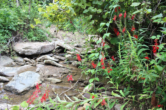 Cardinal flower was profuse in the stream along its edges. Fox grapes grew interspersed with the cardinal flowers.
 Fox grapes growing at Sang Branch. Still green as grass.


Below: Sang Branch trail as we approached Ross Gap. It is a rather pretty scene.


We headed out to Gobey early Sunday morning. We parked and unloaded deciding that we'd try Sang Branch Trail first. Next we'd move on to finding the Pilot Mountain Lookout tower. Both of us
wanted to see both, but we were extremely curious about what that trail would be like in Summer.
We set out in that direction. On the way Kenny realized he had lost a strap to hold the cooler in place. We had passed the most beautiful, enormous field of New York Ironweed. I asked him to drop me off there to take photos while he went back to retrieve the lost strap. He obliged me.
I walked down through a farm field absolutely full of New York Ironweed that was eight feet high.
Amidst the deep purple spires were also found bright yellow clusters of wingstem. I also saw lots of
white dots of Virgins Bower clinging to the plants down low. Cardinal flower was growing in the middle of it all. The edges of the field were lined with spotted jewelweed of deepest orange and
pale jewelweed of light yellow. I stood in the middle of all that beauty listening to the songs of
morning insects, quiet and then the low mournful sigh of a passing freight train. Around me the blue mountains and hills shone in the mist of a new day. It was a little piece of Heaven on earth.


Kenny arrived to pick me back up so I had to get going. I spied a late trumpet flower in the fence row as I left the field. He had found the missing strap and so we motored on.
We soon came to the turn for the first gated trail. Sang Branch is gate #1. They are closed May 15th thru Aug. 1st, Not sure why, but the gate stood wide open today. The Emory River here flowed with water and Sang Branch came down to meet it. The river looked more like a creek and the creek like a tiny trickle of water. It is still a pretty spot. A dry stone wall runs along both side of it for a distance until it enters the woods.

Below: Looking downstream on the Emory.

We pulled up into the trail and were astonished at the Joe Pye Weed towering nine feet tall here.
Butterflies flitted everywhere. New York Ironweed, sundrops, cardinal flower, blue lobelia, and green headed cone flowers were other Summer wildflowers present in the field and in the stream.


Tall Joe Pye Weed and Greenheaded Coneflowers were thick. Sundrops are also in there, but they are hard to pick out in this view. A little bit of honeysuckle persisted here.

Above: Blue lobelia was all along the stream and up the trail.
We continued into the forest on the trail. It was deep and dark in a hemlock glade. Barely any water in the stream here. Nothing blooming to speak of. It was rather boring scenery wise and flower wise. The rank vegetation of Summer heavily encroached the trail making it like a green tunnel. Tiny poplar trees, sweet gums, sycamores and beech trees were thick anywhere from the diameter of a pencil to thick as a child's wrist. Too thick for any of them to be very successful in growing. It is clear that this area is one that has been disturbed in the past due to logging or some other man-made activity. The trail continued and eventually opened up some. More of the same types of wildflowers bloomed here as were present in the stream. The higher we went the less there was to see in bloom. I found it to be a real perfunctory ride since there was disappointly little blooming. The black pond way up high was still there, but had hardly any water in it. I had hoped for some orchids blooming ,but none did.
Finally we came to the rock forms above the trail. Here the ground was soft and squishy. Water seeped from every nook along the trail flowing down, Not enough to be a stream, but enough to drip and make a muddy mess. I can't help wondering when some of these large rocks are going to have the ground softened up enough that they roll down into the trail or on down the mountain?
We approached Ross Gap and as we grew close we got briefly stuck on a log. The RZR bottomed out. Kenny tried to jump over it instead of using the work around made by others. A few minutes with the winch and we were on our way again.

Below: Ross Gap itself was full of weeds way higher than our heads. It is not a place that makes you want to stick around in Summer for sure.

Below: One of the things that was noteworthy about this trail was the presence of massive grape vines. They are the size of trees in their thickness.

We did not linger at Ross Gap thanks to the weeds and how ugly it is during Summer.
We turned and headed back down the mountain. We thought we'd head on and find the fire tower next. We went down Scutcheon Creek Road heading toward Hwy 27 and missed a turn. We had to double back. Once we got to the cut across trail for the tower we motored on pretty good. Until we encountered a massive tree freshly fallen over it. It was lapped down over the entire trail with no way around it. It was our sign to turn around and leave. We would have to try again another time to find it. There are at least two or three other approaches, but we did not have time for them today.
On the way back to the truck we spotted a spring that is set up with a bucket and a pipe.

Someone's engineering project beside the road.
It was a little bit of a let down, but I was still pleased to have gotten to keep a plan.
We had both wanted to find out what the trails were like after August 1st reopening. We now knew what at least one was like. I had held out little or no hope of actually following through the way things have shaken out lately.
We had so much we wanted to see out in this area. I have decided to post a page about what we did NOT finish today for my own benefit in the future. It may prove useful to others for trip planning.
There is far more to see and do in the area than the tiny bit we did today.
Below is the only video I shot today. It is a walk through all that field of New York Ironweed.
**Edited to Add** February 1, 2021
Heard from a reader Michael H, who reached out to say that ATVs are not permitted on the right side of Gobey toward Frozen Head SNA. The gated roads are left open for hunting purposes only during certain times of the year. They allow hunters to use ATVs to retrieve kills, but other than that it is off limits. We were incorrect in our interpretation of the signage out there. We can still go riding at Gobey, but will have to contain it to the opposite side. The riding on the side toward Frozen Head is actually VERY limited anyway and certainly not worth getting in trouble over. The good stuff we're finding out is on the opposite side and there we will stay.