

Dogwood blossom with pollinator
Scona Lodge and Tallassee Creek Falls 2021
Saturday April 11, 2020
Dana & Kenny Koogler
(click arrow on right to advance frame)
We had originally planned to get out for Saturday and do some hiking. We were thinking of hiking off trail to Maynard Creek Falls. Kenny decided on Friday evening he'd prefer to return to the far side of Chilhowee Lake and explore. I was good with that so we set out Saturday morning to do just that. We did a better job preparing this time. We had our life jackets. We had rope to tie up the canoe. We were able to leave from Tabcat Bridge instead of the Scona ferry site down in Calderwood. No worries about making it out of there before the gate closes at 3 p.m. We were able to wait to get a slightly later start since it was in the thirties this morning. Very cold start to the day, but it warmed up nicely.
Only one or two other vehicles at Tabcat Bridge parking lot this morning.
I had left my sunglasses across the lake on a log last time there so I hoped maybe I'd find them today. Ended up not being there, but that's why you buy cheap shades at Dollar General. So it doesn't matter if they get lost or broken. The lake was pretty calm. The skies were blue and the sun was coming out warming everything up. We managed to get through the day without Kenny dumping us into the lake. He is so big he is unwieldly in a water craft.
We put in at the landing for Scona Lodge Ferry and hunted around for my sunglasses. We then continued toward the old lodge site. I wanted to walk further up Maroney Hollow to see if anything more was up there. One really pretty and unexpected sight was the beautiful bloom of a long abandoned cultivated azalea. Big white blooms filled one corner of the forest near the old lodge steps. Yellow tiger swallowtail butterflies flitted from bloom to bloom. It was quite pretty.
 Above: White azalea blooms from a shrub planted by people way back in the day.
 Above: steps to the old lodge patio
A walk up Maroney Hollow was not very difficult, but the only thing we spotted that we did not see last time was a dam in the creek! The trail eventually plays out. Wildflowers today were not as pretty as they were the previous week. The stream did not have as much water in it today.
 Vernal iris blooming along Maroney Creek
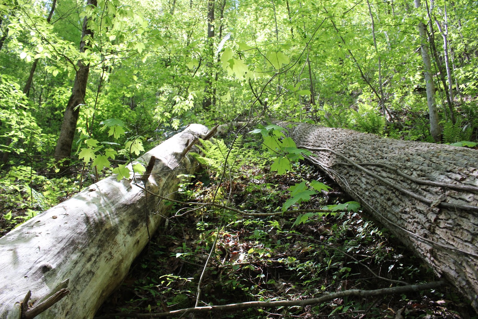
 Above: Logs fallen to go over and under along the path
 Above: Foam flowers along Maroney Creek.

Above: manmade dam on Maroney Creek. Did not see anything further up here that was man made contrivance.
Once we'd done our hike up Maroney Hollow we came back to the clearing and ate a quick lunch. We then stowed our gear back in the canoe and headed over to the other side of the trout weir dam to get out for our hike to Tallassee Falls. I am not 100% sure, but the map shows old structures existed over here on this side of the stream and dam. I have a feeling it was the dwellings of those who worked at Scona Lodge and lived over here full time. There is part of a blacktop road here. On up the hollow less than half mile it disappears then reappears as crumbled chunks of asphalt. The streams undercut the road over the years and washed big pieces of it away. Along this walk you can see all sorts of signs of man's presence in the past.
Nandina shrubs and mahonia growing at sites where homes or buildings used to sit.
 Above: One of many scarlet nandina shrubs in the woods along the path. Man introduced species.
 Above: archangel plant flowering. It is a low, spreading perennial man introduced ornamental species. Thanks Betsy Lee for the name!
 Above: path through the woods. Along here you start encountering chunks of what is left of the road!
 Above: Grassy spot at the old equipment and materials depot
 Above cement pipe segments
 Above: 55 gallon drum
 Above: terracotta pipe
Below: sections of slate sidewalk.

 above: golden ragwort
 Above Mayapple bloom

Above: wild geranium
Further back we also encountered a grassy spot that looked to have been an equipment depot.
It had cement pipe sections, terra cotta pipes, big chunks of slate sidewalk, old metal equipment. Animal traps. The only people we passed in the woods were two turkey hunters who were leaving as we started our hike. We saw a few wildflowers, but they were mostly past peak bloom. The forest over here is beautiful and looks like something from a story book.
Not long after the grassy spot with all the equipment we ran into a spot that was so muddy and swampy we had to detour to the left to work our way round it. We ran upon a wide, open old logging road, but unpaved. It headed up and in the wrong direction for Tallassee Creek Falls. ** We knew better than to follow it. We realized we'd missed a turn somewhere. Thought it had been ten years or better since we hiked to the falls we both knew this was not right. I recalled passing animal cages. We'd not seen those today. We back tracked and very quickly found ourselves following the stream through the woods again.
The scenery was prettier near the creek. We came to our first crossing. There ended up being four of them total one way to the falls. The hike is only 1 mile one way. Once we got going right we did pass the two animal traps I remembered.
 Above: shot of the road we ended up on. I will say more about this at the end of this blog entry.
 Above: Right near this spot is an important turn to get on the correct trail
 Creek to our right most of the hike in.
 Above: animal cage #1

Above: animal enclosure #2.. much larger. It was sixty feet long at one time. half of it has collapsed over the years.
Seeing the old animal cages was reassuring that we were correctly recreating the original route to the falls. My inner compass felt right too. Unless you have experienced brain injury and memory loss... forms of amnesia.. you cannot fully appreciate how marvelous it feels to recall how to get back to a place. I have experienced being on the trail after a brain illness and learning my inner compass was wrong and realizing I had pages of amnesia when it came to recall of past trips how to reach a place. It is very upsetting. Today beautiful memories of our previous trip flooded my mind. I savored it all. God is great to heal and sustain life every single day.
 "Money Shot" from along the trip. Spots like this strike my memory and form strong engrams that come back to me in waking visions and dreams. Filling my head up with beauty.
 Above: Where I picked to cross was calm and comparatively smooth, but over the tops of my boots deep. I did not go back this way, but used an improvised walking stick and a hand from Kenny to cross by rock hopping.
 Above: Sitting down to put my boots back on.. my view of the blown out remains of an improvised bridge. Hard to see here, but there are nail heads sticking up all along it.

Above: Kenny ponders the bridge ruins. Where did it used to sit?
The scenery of the sun speckled stream winding through the forest and the new Spring green woods was a delight. Kenny and I made the creek crossings without too much trouble.
One of them at a particular bend in the stream.. the last one before the falls I knew.... was very deep. I had to take off my boots and wade. Kenny is long legged and nimble so he rock hopped it without any problems downstream. I sat down on my butt on the far side and put my boots back on. We sat looking at the ruins of what had to be where someone fashioned an old wooden bridge across the stream. Kenny did what he always does. He tried to figure out in his engineer's mind how the thing was rigged and where it sat to begin with.
 Above: I remembered crossing just above this beautiful sweeping bend in the stream.
 Above: Looking upstream of our crossing at the sun sparkles on the water
 Above; carpet of dwarf iris

Above: Catesbys trilliums love pine woods and that is what we saw a lot of today. Various shades of pink and white.
Once we'd made that fourth and final crossing on the hike to the falls we encountered the massive blow down that was there years ago. It is worse now. More trees have come down added to the mess. Going in we chose to avoid it by climbing above it and going round.
Once around we realized that the path splits. You can hike it up to the top of the falls where the rock at the top is like a bath tub or you can hike to the base of the falls on the low trail.
We took the low road to the base. I went to the top the first trip to sit in the "tub" at the top and cool off and look over the brink. Not swimming weather today so I was not going to bother.
I always love the first glimpse of a falls even if I have been before. It means we have been successful. We found it! Again! Today it was running much better than our first visit. We were there in August in high Summer. It was beautiful even then. If you peruse the photo album there are photos in there depicting all these things.
Today the falls... all twenty nine feet of it... was glittering white under new Spring green leaves. The pool at the bottom shone deep and crystal clear. We sat down at the falls to cool off and enjoy the beauty of the scenery. We ate a navel orange and boy was it good. Something about hiking that makes food taste even better. Fresh fruit on a hike is extra refreshing. We did not see any trash today near the falls and we did not leave any. This waterfall may not be the largest or most impressive, but it sure is pretty. The setting and the isolation make it very appealing to me. The forest back here is quiet and secluded. It looks like something out of a fairy tale.
 Above: one spot where we the trail could easily have been lost. Fallen debris made it hard to spot. We made one needless ford here or rather Kenny did before I figured out we were messing up.
 Above: Blow down made worse over time.
 Above: on the other side of the blow down... the path resumes, but it is narrow and harder to spot for a bit.
 Above: I can still hear Kenny hollering I see it!
 Above and below : Tallassee Creek Falls in all its glory


Above: if you look closely there is some sort of man made object here. A chunk of concrete from something. We found another spot downstream where a cement structure looked like an old bridge abutment. A water pipe came from the stream to the bank. Perhaps someone had a home back here long ago.
Finally we tore ourselves away from the falls and began our return hike. I put my camera up so we'd make better time. We hiked back out in around 30 minutes since I wasn't stopping to snoop and take so many photos. Plus we avoided lots of small mistakes we'd made on the hike in. We did lose the trail briefly in that muddy area. We parallelled it though and came out connecting with the black top road or what was left of it.
We saw a man and woman fishing near the old trout weir from their boat. They were the only two other people we encountered today over here. On the way back up the lake we passed Miry Branch and could hear the roar of water. We diverted to go there to see if the falls was running really good. Miry Branch cascade turned out to be as big a tease today as ever. Though it roared loudly it was not much. It is a pretty cove and a nice picnic spot. Someone else was already moored there and using it so we left them to it.
Once I got home I later took time to review some old maps and figure where that road we encountered went to. The USGS quad map from 1933 and 1937 shows it going straight back for a bit then hanging to the contours of Tallassee mountain and ending up at Stiffknee Gap near a trail intersection. From there you could turn right and go out to Farr gap. This is in Citico Creek Wilderness. Perhaps some day we'll hike in from Citico. I'd like to be able to say I've visited the place from that way just once. It is interesting to note that back in the day three "roads" or trails connected Scona with Mt. Pleasant/Citico. It is also noteworthy that the 1935 map shows Tallassee Creek being where current day Milligan Branch is on the map. It shows that the stream with the waterfall was Mill Branch. Between the two streams was Blacksnake Branch and it has not changed on any maps I've found. One of the old paths goes along it up towards Farr Gap. ( I have included the link to the historical overlay of the maps. I do not know if it will display correctly. To view USGS Historical Topographic Maps go to the link shown above and type in the area you want to search... then left click on it. It will give you a time line at the bottom that shows you what the area was like during a different time period.
Go to the left and type in the name of the area you want to search. Once it comes up then right click on the map and a timeline box will display various maps that exist for that area in different years. Click on the one you want and it overlays it on the current map!
Below is a very short video of Tallassee Creek Falls
We put in at the landing for Scona Lodge Ferry and hunted around for my sunglasses. We then continued toward the old lodge site. I wanted to walk further up Maroney Hollow to see if anything more was up there. One really pretty and unexpected sight was the beautiful bloom of a long abandoned cultivated azalea. Big white blooms filled one corner of the forest near the old lodge steps. Yellow tiger swallowtail butterflies flitted from bloom to bloom. It was quite pretty.


A walk up Maroney Hollow was not very difficult, but the only thing we spotted that we did not see last time was a dam in the creek! The trail eventually plays out. Wildflowers today were not as pretty as they were the previous week. The stream did not have as much water in it today.



Above: manmade dam on Maroney Creek. Did not see anything further up here that was man made contrivance.
Once we'd done our hike up Maroney Hollow we came back to the clearing and ate a quick lunch. We then stowed our gear back in the canoe and headed over to the other side of the trout weir dam to get out for our hike to Tallassee Falls. I am not 100% sure, but the map shows old structures existed over here on this side of the stream and dam. I have a feeling it was the dwellings of those who worked at Scona Lodge and lived over here full time. There is part of a blacktop road here. On up the hollow less than half mile it disappears then reappears as crumbled chunks of asphalt. The streams undercut the road over the years and washed big pieces of it away. Along this walk you can see all sorts of signs of man's presence in the past.
Nandina shrubs and mahonia growing at sites where homes or buildings used to sit.


Below: sections of slate sidewalk.


Above: wild geranium
Further back we also encountered a grassy spot that looked to have been an equipment depot.
It had cement pipe sections, terra cotta pipes, big chunks of slate sidewalk, old metal equipment. Animal traps. The only people we passed in the woods were two turkey hunters who were leaving as we started our hike. We saw a few wildflowers, but they were mostly past peak bloom. The forest over here is beautiful and looks like something from a story book.
Not long after the grassy spot with all the equipment we ran into a spot that was so muddy and swampy we had to detour to the left to work our way round it. We ran upon a wide, open old logging road, but unpaved. It headed up and in the wrong direction for Tallassee Creek Falls. ** We knew better than to follow it. We realized we'd missed a turn somewhere. Thought it had been ten years or better since we hiked to the falls we both knew this was not right. I recalled passing animal cages. We'd not seen those today. We back tracked and very quickly found ourselves following the stream through the woods again.
The scenery was prettier near the creek. We came to our first crossing. There ended up being four of them total one way to the falls. The hike is only 1 mile one way. Once we got going right we did pass the two animal traps I remembered.


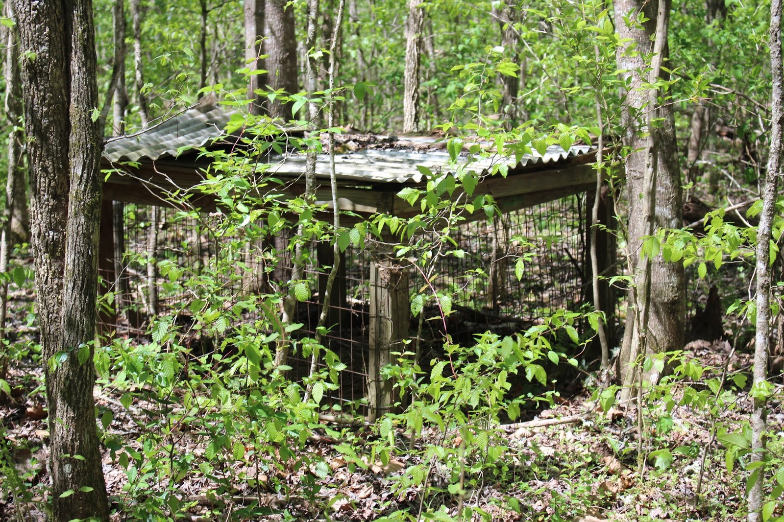

Above: animal enclosure #2.. much larger. It was sixty feet long at one time. half of it has collapsed over the years.
Seeing the old animal cages was reassuring that we were correctly recreating the original route to the falls. My inner compass felt right too. Unless you have experienced brain injury and memory loss... forms of amnesia.. you cannot fully appreciate how marvelous it feels to recall how to get back to a place. I have experienced being on the trail after a brain illness and learning my inner compass was wrong and realizing I had pages of amnesia when it came to recall of past trips how to reach a place. It is very upsetting. Today beautiful memories of our previous trip flooded my mind. I savored it all. God is great to heal and sustain life every single day.


Above: Kenny ponders the bridge ruins. Where did it used to sit?
The scenery of the sun speckled stream winding through the forest and the new Spring green woods was a delight. Kenny and I made the creek crossings without too much trouble.
One of them at a particular bend in the stream.. the last one before the falls I knew.... was very deep. I had to take off my boots and wade. Kenny is long legged and nimble so he rock hopped it without any problems downstream. I sat down on my butt on the far side and put my boots back on. We sat looking at the ruins of what had to be where someone fashioned an old wooden bridge across the stream. Kenny did what he always does. He tried to figure out in his engineer's mind how the thing was rigged and where it sat to begin with.


Above: Catesbys trilliums love pine woods and that is what we saw a lot of today. Various shades of pink and white.
Once we'd made that fourth and final crossing on the hike to the falls we encountered the massive blow down that was there years ago. It is worse now. More trees have come down added to the mess. Going in we chose to avoid it by climbing above it and going round.
Once around we realized that the path splits. You can hike it up to the top of the falls where the rock at the top is like a bath tub or you can hike to the base of the falls on the low trail.
We took the low road to the base. I went to the top the first trip to sit in the "tub" at the top and cool off and look over the brink. Not swimming weather today so I was not going to bother.
I always love the first glimpse of a falls even if I have been before. It means we have been successful. We found it! Again! Today it was running much better than our first visit. We were there in August in high Summer. It was beautiful even then. If you peruse the photo album there are photos in there depicting all these things.
Today the falls... all twenty nine feet of it... was glittering white under new Spring green leaves. The pool at the bottom shone deep and crystal clear. We sat down at the falls to cool off and enjoy the beauty of the scenery. We ate a navel orange and boy was it good. Something about hiking that makes food taste even better. Fresh fruit on a hike is extra refreshing. We did not see any trash today near the falls and we did not leave any. This waterfall may not be the largest or most impressive, but it sure is pretty. The setting and the isolation make it very appealing to me. The forest back here is quiet and secluded. It looks like something out of a fairy tale.


Above: if you look closely there is some sort of man made object here. A chunk of concrete from something. We found another spot downstream where a cement structure looked like an old bridge abutment. A water pipe came from the stream to the bank. Perhaps someone had a home back here long ago.
Finally we tore ourselves away from the falls and began our return hike. I put my camera up so we'd make better time. We hiked back out in around 30 minutes since I wasn't stopping to snoop and take so many photos. Plus we avoided lots of small mistakes we'd made on the hike in. We did lose the trail briefly in that muddy area. We parallelled it though and came out connecting with the black top road or what was left of it.
We saw a man and woman fishing near the old trout weir from their boat. They were the only two other people we encountered today over here. On the way back up the lake we passed Miry Branch and could hear the roar of water. We diverted to go there to see if the falls was running really good. Miry Branch cascade turned out to be as big a tease today as ever. Though it roared loudly it was not much. It is a pretty cove and a nice picnic spot. Someone else was already moored there and using it so we left them to it.
Once I got home I later took time to review some old maps and figure where that road we encountered went to. The USGS quad map from 1933 and 1937 shows it going straight back for a bit then hanging to the contours of Tallassee mountain and ending up at Stiffknee Gap near a trail intersection. From there you could turn right and go out to Farr gap. This is in Citico Creek Wilderness. Perhaps some day we'll hike in from Citico. I'd like to be able to say I've visited the place from that way just once. It is interesting to note that back in the day three "roads" or trails connected Scona with Mt. Pleasant/Citico. It is also noteworthy that the 1935 map shows Tallassee Creek being where current day Milligan Branch is on the map. It shows that the stream with the waterfall was Mill Branch. Between the two streams was Blacksnake Branch and it has not changed on any maps I've found. One of the old paths goes along it up towards Farr Gap. ( I have included the link to the historical overlay of the maps. I do not know if it will display correctly. To view USGS Historical Topographic Maps go to the link shown above and type in the area you want to search... then left click on it. It will give you a time line at the bottom that shows you what the area was like during a different time period.
Go to the left and type in the name of the area you want to search. Once it comes up then right click on the map and a timeline box will display various maps that exist for that area in different years. Click on the one you want and it overlays it on the current map!
Below is a very short video of Tallassee Creek Falls


