

Wild Senna
Short Hike in the Southern Cherokee National Forest
Bullett Creek & Yellow Creek Falls with the Go Smokies Gang
Friday August 1, 2014
Dana Koogler
Mike G
Darlene & Dewayne Allen
Some of the Go Smokians decided to take a little jaunt down to see Bullett Creek and Yellow Creek
falls in the southern portion of the Cherokee National Forest. Mike had been before, but had not known of
Bullett Creek Falls then. Turned out what he actually saw that trip was the difficult to reach upper cascade of Yellow Creek Falls. I had been several times before so I met up with him and the rest of the gang on
a Friday morning to hike. We carpooled down from Vonore.
It was good to see my friends again. Darlene had not rested well and she was wanting a shorter day.
I had promised her that. I needed to not drag the day out too long myself since I needed to pack for Saturday. We drove down the back roads of Monroe County and they got to experience first hand what
happens when I let my tomtom navigation system "Babala" lead us. Where does this road go? I don't know. I've never been here before. I had plugged the GPS coordinates in for Bullett Creek Falls. She picked
a short cut road I had never been on and didn't even know it existed. We were heading in the right direction.
I figured it would come out ok and it did. It wasn't long until we popped out on a road I'd passed by before
and didn't ever use! It did bring us out closer to Forest Road #44 which was what we needed. Thus
we got to experience the delights of "Gay-Lee Road" and "----Creek" road. This is Monroe County TN
and half the sign had been shot off.
I couldn't help noticing changes that had taken place since my last trip there. A home with a long driveway and a gate and a name placard has been put up. The Jones are now residents on Bullett Creek Road. Many hemlocks have died in this gorge and it appears the forest service or someone has cut many of them. I am sure that cutting the dead trees is a good thing to keep the road open and to prevent accidents.
Having one of those dead giants come crashing down on you would ruin your day!


Bottom: Yellow Creek Falls. Low Summer flow and bright sun exposure.
We found a wide spot and pulled over to park. I took a moment and got oriented and found the dirt ditch we had to start down. These falls do not have any official trail to them, but the manway is pretty good.
We found it and there is still some litter there along the road, but most of it has been removed. I no longer saw the old refrigerator in the woods. The trek down is short but steep. We passed a pretty rock outcropping as we went. We were at the stream in no time and clambered down to cross the stream where
we could see the waterfall. It was flowing but the water levels were lowest I'd seen thanks to Summer and
relative drought. I had never visited this falls so early in the day. The light was not good for waterfall photography. Dappled sunlight thanks to the open canopy and early morning angle of the sun.
It was still pretty, but I suppose the changes to the area were a shock to my system. It was good to be there
with my friends. I won't come to this area alone. Ever.


Top : Darlene in sunbeams! She is such sweet spirited friend. I just loved how this turned out.
Bottom: Dwayne and Mike studying the waterfall. Taking some pictures.
We spent some time at the first waterfall on Yellow Creek then began working our way downstream.
The trail goes down stream but stays higher than stream level because of the rock cliffs above the falls.
I was pleasantly surprised to find the manway in good condition. It has been traveled enough to keep it
worn down and relatively free of debris and weeds. We soon came to the edge of the bluff above the falls and we had to decide which way we wanted to go first. Did we want to turn right and go back upstream to visit Lower Yellow Creek Falls or left and go visit Bullett Creek Falls? Mike thought it would be better to go right and check out Lower Yellow Creek Falls. He had by now told me he never saw any of this. He was sure he only visited the uppermost cascade on Yellow Creek. We passed by Camp Crud which is a camping area beneath a rock overhang near Lower Yellow Creek Falls. Camp Crud is what makes me uneasy about this place and why I was so glad to have company to visit here today. I will never return here alone. The first time we came here it was a druggie camp with drugs and drug paraphernalia, trash, abandoned camping gear all lying about. I am happy to say it is not like that now. It is still messy, but nowhere near as bad as the first and second visits here. It is not as clean and tidy as the last visit.

Immense rocky cliffs above the falls

Camp Crud looking.. better, but still cruddy

These turkeys idea of leave no trace camping is to find hiding places for it.
Too lazy to haul it out.

They did hang up their swimming towel though. How thoughtful.
The best thing about today for me was the company. I enjoyed them so much. I am growing to love
my new friends and enjoy trips more when they are with me. Lower Yellow Creek Falls was low flow like
you'd expect but still pretty. Darlene pointed out that it appeared the water was flowing underground here.
She may be right. There is far more water entering the pool than is flowing out if any can get out at all!


Top: Lower Yellow Creek Falls
Bottom: Darlene enjoying the view. I thought I got one of her laying down atop this rock, but I didn't.
One of the cutest images of her will now just have to be in my mind. She was like a little girl laying down belly first on the rock with her face propped up on her elbows watching the falls. Is it any wonder I like her? She knows how to get lost in the moment!
We talked and there was picture taking and then we moved on downstream to visit Bullett Creek Falls.
It was just a short hop over there and it was flowing lower, but still worth seeing! It is a higher, more impressive falls than the other two. I learned from a whitewater website there are two more pretty cascades above the main drop. The main falls is about forty feet high. The upper falls would be a bear to reach. Even the crazy creek kayakers bellyache about getting through this area. They describe the portages as badly choked with rhododendron. It would not be worth it in Summer thanks to the snake potential, rhodo, and the low flow of the stream. If we go back here in Winter when the water is running good.. it is a possibility.
We would not be fretting with trying to portage a kayak in that stuff. Just our bodies and backpacks.

Bullett Creek Falls at Summer time low flow. Still pretty.
We spent some time here enjoying the falls and chatting. We finally turned and headed back
in the direction we'd come from. Mike wanted to check out the trail that we found which goes crosses the rock form at the top of Camp Crud. We did and it turns out that it provides a way to reach the upper part of Lower Yellow Creek Falls. He and Dwayne visited it, but I hung back with Darlene. She was not worried about seeing it and today I was not either. My recent experiences with balance and perception at Paradise Falls had me reluctant to try it. I was enjoying talking to
Darlene so we waited on the men. The ledge above Camp Crud has a neat view of the surrounding area. I got a couple photos of the view from there. It was weird for me, but there is plenty of level ground and a place to get back away from the edge so I was ok with that part.

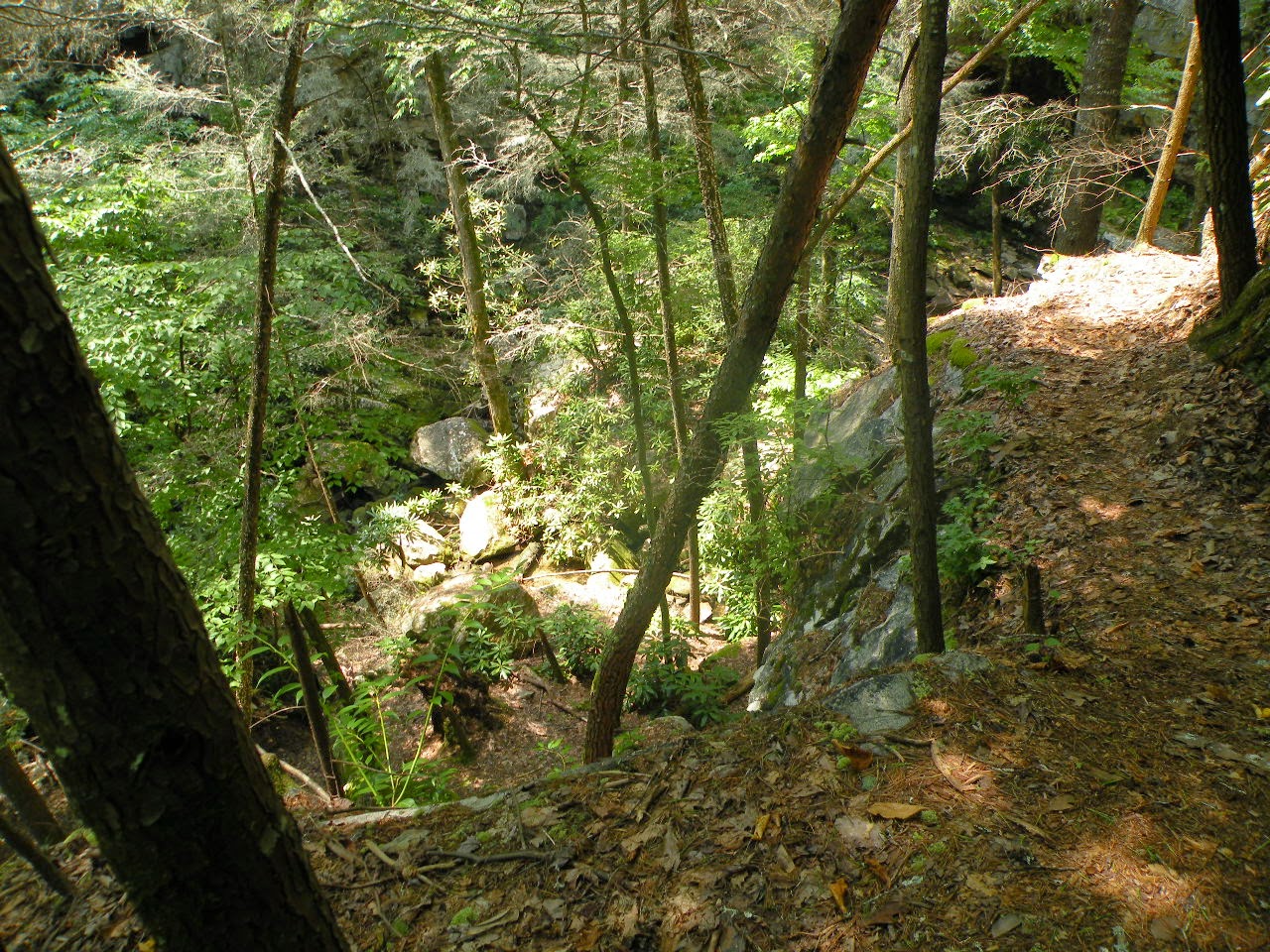
The view down off the bluff at Camp Crud
We headed back and the hike back seemed pretty easy compared to previous trips.
We had that steep climb back out to face, but it is short. We huffed and puffed and got back to the vehicles. Back at the cars I admitted that while I had thought I was going back to Starr Mountain today to
hunt orchids I did not think I could face it again. I was still not ready to return and face possibly failure again.
I sure was not wanting to put my pals through that boring and possibly fruitless effort. We decided instead to head toward Coker Creek Falls. We'd have lunch and fit in a second short hike. We should have prepared better. I should have prepared better. Coker Creek Falls and some of the other waterfalls in the area are hard as hell to find. They are tucked away on a maze of back roads and they are sometimes signed.. sometimes not! I missed the turn for it and pulled over to check directions. We went at it again.
Missed another turn and found ourselves facing back out on SR 68. I looked at the clock and realized it was now two o'clock pm. I had promised Darlene a short day and I was going to keep my word.
I was embarrassed at the confusion on the roads and my lack of preparation. I chalk it up to complacency.
I have arrived at that point where I've been there many times before. I can find it. But can I really?
Yes, I can but only with being prepared. Putting the GPS coordinates in the tomtom makes all the difference in the world! We rolled the windows down and spoke to Mike who pulled up along side.
We agreed to bag the rest of the day and head home. He was going to do some exploring cemeteries and such on his own. He has so many interests he is always able to find something he wants to check out.
I headed back toward Vonore with Darlene and Dewayne. I know how it feels to be so tired you're ill
and while Darlene was a great sport and was not complaining.. I was not going to put her through the wringer. I just couldn't do it. I had a great time and I look forward to the next adventure with my pals!


