Showing posts with label waterfalls. Show all posts

Monday, March 11, 2024

Starr Mountain Spring Wildflowers & Waterfalls 2024


Looking at the back side of an oconee bell bloom


Starr Mountain  Spring Wildflowers &  Waterfalls 2024


Friday March 8, 2024


Dana & Kenny Koogler


Photos are Here Starr Mountain Pix 


     Last Spring I went down toward Etowah to try to catch some flowers in bloom, but was too late. They were already spent for the year.    I was stuck trying to figure what to do this past weekend.  Kenny suggested we try to head south.   He had an unexpected Friday off so we wanted to take advantage of it.  The next day was forecast to be very rainy and cool.  He had a couple ideas of stuff we could do.  I was good with it so down the road we went.  


        I had a theory that the oconee bells I wanted to see might be in bloom. Despite being in Tennessee they were supposed to have been transplanted from elsewhere many years ago.  I knew from friends photos that the oconee bells were in bloom in South Carolina.   Maybe they'd be in bloom in East Tennessee now as well?  I figured it couldn't hurt to check.     Last year even though I missed the flowers in bloom it provided me with a chance to begin a systematic botanical inventory of Starr Mountain.   It also proved to be a fruitful day in turning up a couple new waterfalls to us!  The scenery was lovely and we enjoyed it so much. 


        I let Kenny sleep in and we got going at a leisurely pace.   He surprised me with one of his plans. He asked me to check on my phone to see if The Farm House Restaurant was open in Etowah?    I looked and they were.  He suggested we go have some lunch before we went hiking.  I was happy with that. I'd heard so much boasting from Jared and his friends about how good this place was.  It is an area destination!  Everyone loves The Farm House for meals.   I did NOT know Kenny Koogler had already been without me.  👀   


Below:  Front porch of Farmhouse 


Below: Welcome flag on the porch.  My kind of place!  Country! 


Above: merchandise at the front counter and cash register in the restaurant 


Below:  More of their decoration up in front of the place. 


Above: You can look straight back in this view to the additional large dining area.  
Above: Cell phone shot of the dining area around us.  

Below: Kenny across from me at our table.  This restaurant is one we first became aware of when our son was at Miracle Lake getting recovered.   Hearing him tell about going there after church with his buddies really blessed me.    It was some of the first healthy, wholesome things he began participating in.  Farmhouse Restaurant will forever have a special place in my heart because of this. 


  Kenny had barbecue with macaroni and cheese and green beans. I had a house salad with a baked potato.  Their sweet tea is silky smooth. Perfection!    We enjoyed it and went on the rest of our adventure with lots of energy.    We were in and out of there in the time it takes to go to McDonald's, but with a wholesome meal that is NOT fast food!   If you haven't tried this place you should!  I almost hate to tell people about it. If I go the next time and find it covered up busy I will feel like I should have kept it secret, but it is far from a secret.   It is well known and loved. 


        We headed to Mecca Pike to begin our adventure.   On our way I did keep watch for wildflowers, but since we covered this ground in early April last year I didn't expect to see much.  We didn't see any wildflowers at all along our route.   The road is rougher than last year and more rutted out.    At least it was not muddy.   The first thing I saw with any color was periwinkle blooming near the site of the former White Cliffs Hotel.    I also learned today that the hotel did not sit where I believed it did. It was opposite of that area.  Down over the mountain side by about 200 feet is the spring where they got their water.       

      I did see a few trout lilies this season.  The ones here are very tiny and seem to have more reddish brown coloration than most others I've seen.  They are the Dimpled Trout lily variety.    
Above: close up view of trout lily
Above: Trailing arbutus was along the roadsides and in the forest.  It was such a pretty pink.   It was one of the few flowers in bloom. 

Below:  The black water of a swamp atop the mountain.   This flat, sandstone mountain is an oddity.  

Above; Beautiful clear stream of water flowing. This creek flows year round.  I've never seen it dry up.

Above: another cluster of trout lily blooms.  They weren't more than a few inches high.


  We kept looking as we went along. Nothing in bloom to speak of, but I did find my oconee bells I'd hoped for.    They were done last year. This year they were just getting started good.   These are globally rare and endemic to a few locations primarily in Western North Carolina and upstate South Carolina. 


The three photos above are oconee bells blooming. (Shortia galacifolia ) They are so delicate and beautiful! 


 We proceeded toward the rest of our route. We knew there wouldn't be much blooming besides the few things I'd  hoped to find.   We'd go see some waterfalls on the rest of the journey to fill up the day.

Recent rains have our streams flowing wonderfully!   

Below:  a partial view from the road off of Starr Mountain. It was sunny one moment, gloomy the next.  This pattern was repeated all day. 


Below:  Yellow Creek near a "camp site" that was very trashy. I'm not sure it is actually a legal campsite. 


Below: a layered cascade near the campsite.  It is about 12 feet high.  


Above:  a lovely hole of water and powerful cascade just below the first one.  Yellow Creek was one pretty cascade after another today! 


Above: Upper, upper Yellow Creek Falls.   

Below: a side view of it and the jade green water hole with it. 
Below: Ellis Branch Falls is a roadside beauty.  

I am pretty sure this waterfall is on private property, but there is nothing that says I can view it from the road.   


 We eased down toward the Hiwassee River and Reliance.   Kenny initially wanted to stop at Webb's store and get ice cream, but thought better of it.   We motored onward. I checked the areas along the road where I'd seen flowers last Spring. Not much out yet.  I will have to head back down there once things start blooming good if I get the chance.   I did not bother to hit up a lot of areas in the core of Starr Mountain because there was nothing blooming April fifth of last year. I knew full well there wouldn't be anything out this early.


         Below is a video of the various cascades we visited on Starr Mountain today.  


Notes to Self for Future Trips


Get video of Hiwassee River and Railroad bridge 

Get photos of the old store building along Mecca Pike

Located White Cliff Hotel site and spring down over the mountain

Take RZR and cross Sheehan Branch to look for additional waterfalls 

Webb's Store for a popsicle and a t shirt


Drive Spring Creek Road to see cascades and wildflowers

Stop by Starr Mountain Outfitters for a Bigfoot shirt

Lowry Falls

Left Prong Falls

Reliance Fly & Tackle

Towee Creek Picnic Area 

Check for T flexipes on the slopes near river

Spring Branch Falls

Water Tank Branch Falls

Stairway to Heaven and Bluffs view


Wednesday, August 10, 2022

Walker Sisters & Grayback Falls


Walker Sisters & Grayback Falls 

lead by Dana Koogler
Trip report by Dana Koogler

Saturday Dec. 4, 2021

Hiking With Audi Group

(click the link above for her Facebook Group)

Audelia McCarroll 


Grayback Falls Waypoint on Tennessee Landforms

**Edited to Add Informational Commentary by Barb passed on to her by Jim Lawson ** 8/11/2022


You said you went from Wears Valley into the park, you called it the Wears Valley manway through the gap.  That manway is called The Katy Holler (I know it only by this name) and along the way as you walk up a bit there was a homesite with barn and apple orchards, garden space, etc.  The homesite literally sat right next to the old road.  Jim Lawson's grandfather and thus his father lived up the Katy Holler.  Maybe he will read this and comment. 

   Sometime back during late Summer or early Autumn I was asked to lead a hike to Grayback Falls.   It is a short distance behind the Walker Sisters house.

Kenny and I hiked this in March of 2020. It was a hike/bushwhack. We had fun and had the falls to ourselves!   I got asked by Audelia McCarroll over the Summer would I lead a hike to go see it? It didn't take long speaking with her for me to accept.  She is an awesome human being. Lots of fun and very laid back.    We put it on the books for a weekend in December.   I wanted Kenny to go along since I wasn't sure about finding it again on my own.   

    We scouted it in November around Thanksgiving with our oldest two grandchildren, Michael and Tessa.   We did this to flag it with survey tape in the event Kenny wound up either working or just not wanting to go.   The road to the Walker School is gated off during Winter so we went in via a manway out of Wears Valley.  I have used it many times before.   That is how Kenny and I hiked it in March 2020.   <~~Here is a link to the previous trip report.  This report is a combination of the scouting trip and the actual hike.

    Tessa and Michael are long legged, lanky critters who love the outdoors.

They found the whole thing not much of a challenge.  They were not thrilled with the off trail part, but they didn't complain either.  We had fun.

They were tickled to find the pioneer junk in the woods and get to see a waterfall many folks don't ever know exists.  


  Saturday December 4, 2021-Day of the Group Hike

  I met the Hiking With Audi group at Metcalf Bottoms early Saturday morning.  A large number of people were already gathered in anticipation.

I got my gear and walked over to where they congregated to introduce myself.    I met so many extremely nice, fun people on this trek.  I made all kinds of new friends who were keepers.   It did me a lot of good to get out and socialize.  I  was proud to have been asked to lead the hike and honored to do it.    It is really fun being with a bunch of cut ups in the woods. It is also fun and more interesting being with people who ask good questions!  Questions you may have been wondering as well, but had not asked.  This is the vibe when you go hiking with this group.   It was a large, but very cohesive group.

All getting along. No big egos or show offs among the entire collection. 

Just salt of the earth hikers.   I found myself thinking of Mike Maples a lot on this hike today.  I also thought of my buddy Mike Gourley who has visited this and lead people on an even more involved exploration of the old homesites throughout the forest here.  

       The road was gated today, but Audi wisely suggested we hike in from civilization.  I think we'd have had an altogether different experience coming in from the Wears Valley manway.   They would not have thanked me for that route.   It would have angered and discouraged a good many.

     The hike in from Metcalf Bottoms was leisurely and on a maintained trail.

Not this : Below shown three different parts of the manway that is more of an obstacle course coming in from Wears Valley.


  The day was sunny, perfect temperatures, and fresh air.  The only off trail today was one mile round trip on an unmaintained manway.  There is a very small part of it... say 100 yards where there is NOTHING.  No trace of a trail or manway, but the woods are open here and with it being Winter no worries about snakes. Weeds and vegetation were as optimal as they could be.  The flagging we put in place weeks earlier came in very handy.  I took the GPS and had it navigating for me just in case.  I ended up not needing it at all.

       I had not expected Audelia to be so well informed about the history of the area!  She answered questions for me that I had wondered the previous two trips.  She could tell us how the course of the former road ran back there. She could tell me all about who lived where and what structures went with this pile of stones.  It was amazing!   


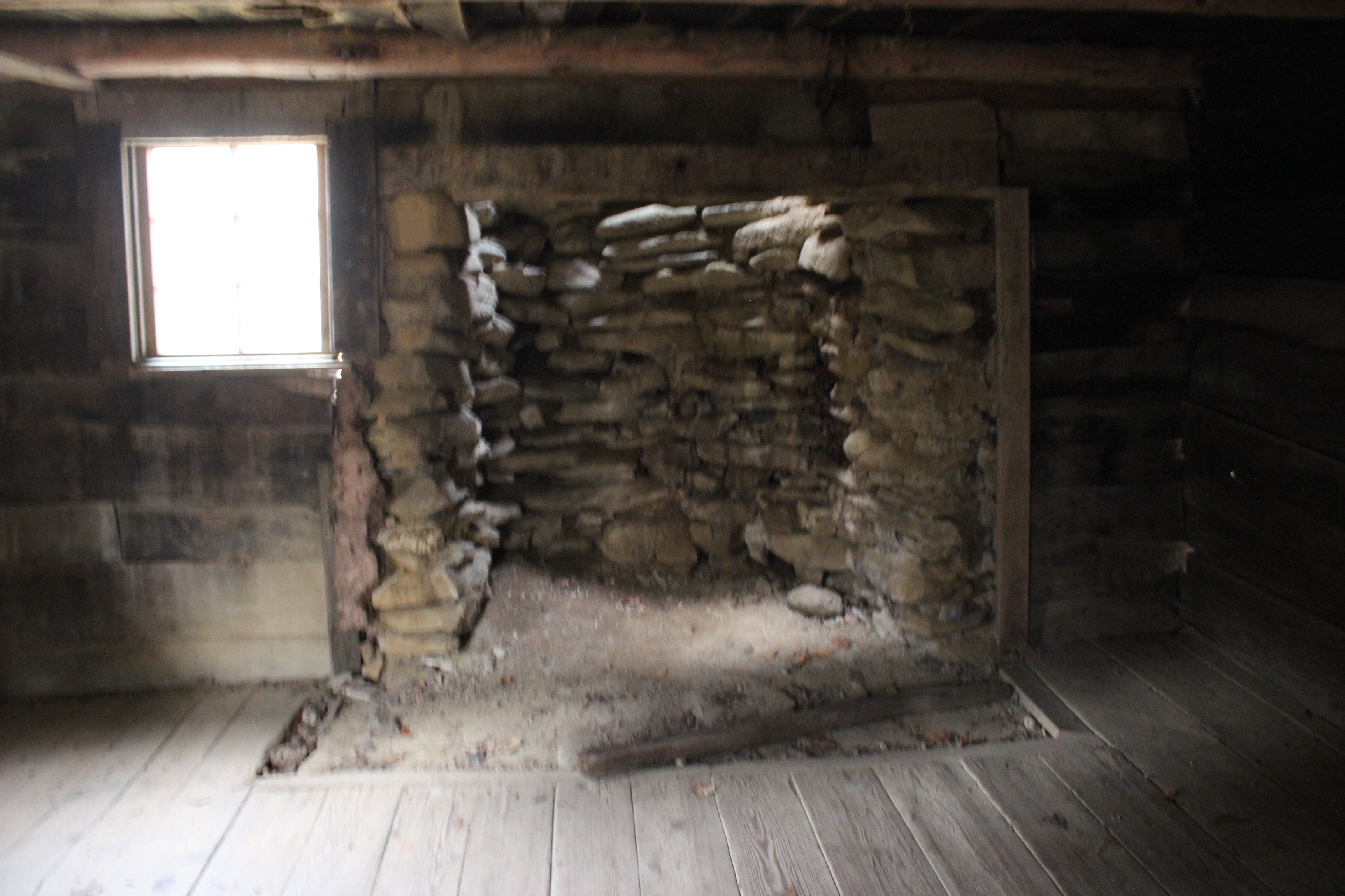
Below are the only photos I took from the scouting trip. Inside the Walker Sisters Cabin.


Above: Grandson Michael by the fire place


Above two photos showing the ladder to the loft in room #2 of the cabin.  Granddaughter Tessa climbed up in there.


Above: The springhouse at the Walker Sisters cabin.


    Once you get to the Walker Sisters cabin in the yard... there is a path leading into the woods. It is not hard to see, but following it is a little trickier.

It gets worse the further you go and the part where there is zero trail.. is just large enough that picking it up from the path you began on would be quite challenging.    So I won't be providing directions to this falls.  I have talked to quite a few people who attempted it and did not find it. I also talked to a couple who DID find it, but went at it the super hard way.   Our first attempt was to try the way they went. It was foolish and we opted to wait for another chance and an easier, simpler approach.


Above: neon orange survey tape  
Above: Spring branch flowing down to Wears Valley on the manway we used trips #1 & 2
Old set of bed springs .. pioneer junk in the woods was a most reassuring marker that I was on the right track


Above: a piece of pioneer junk.. a chunk of porcelain--signs of human occupation

Above: one of several rock piles in the forest on the bushwhack to the falls


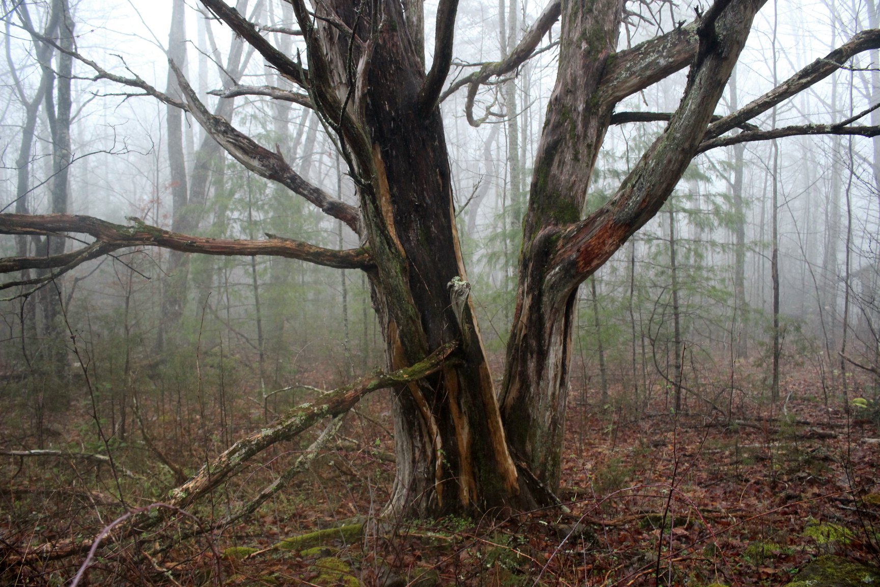
Below: a massive cedar tree is another marker that lets you know you are on the right track. 
Below are three photos I took of Grayback Falls on the first trip. 


Once we arrived at the creek where the falls lies, the real fun began!

The look on Audelia's face was priceless.  She at last realizes I am indeed crazy and who the heck has she enlisted to lead this hike.  We got a good laugh out of it.  But she is a sport for sure.  I will never forget standing IN the creek of this "One Butt Waterfall" and telling her before all present... "I tried to tell you. I gave you plenty chances to back out".  In order to view Grayback Falls it becomes necessary to get IN the creek and clamber around and right up to it close and personal to see it. We had a large group of people. I think it was around 18-20 total including me.  So we took turns climbing up in there to view it. Everyone was cooperative and good natured.  No rush.  

  The upside was this is not a long hike and it was the singular goal for the day.

So we were at a relaxed pace.  

Below is a triple panel of the only photos I took of the falls or this trip today.


  We enjoyed the falls. We made our way easily and carefully back to the cabin.  We  hiked out to the vehicles the way we had come to start with.  It was a nice day.  I am very glad I went. 

Below is a video of the falls


Friday, June 26, 2020

Adventure Village Camping Trip-Headwaters State Forest

Catawba rhododendron in bloom 

Adventure Village Camping Trip-

Headwaters State Forest 


Dana & Kenny Koogler 

Friday , May 22 -24, 2020


  We took a long weekend get away for Memorial Day this year. Just the two of us.    We stayed at Adventure Village.  We were thrilled to be able to get a campsite last minute.   We arrived a little after lunch on Friday.   We stopped by Ingles to get groceries.  We wanted to have lunch in town, but the covid19 pandemic made that a difficult.   You can't use a drive through towing a camper.
You can't go in.  Finally we went to Ingles for groceries.  Once we got that done we simply fixed sandwiches in the camper.  It was quick and simple.  

      We arrived at the campground and found it pleasantly full and busy!
It was nice to see people fishing, swimming, biking, and grilling out.  
People walking their dogs.  It is normal and that is at a premium right now far as I am concerned.   IMG_0990.JPG
Above: Pink Shell Azaleas in bloom on the parkway
       \We did not have a lot of time for activities today with only half day left. 
We opted for a loop drive around Rt 215 up to the Blue Ridge Parkway, back down 276 and back through Brevard to the campground once more. 
The parkway was beautiful.  It looked to be about a month behind the lower elevations.   Pink shell azalea was blooming and it was just too pretty. 
The views were nice, but up near Devils Courthouse it was chilly and a dense fog was moving in.  
Below: fog engulfs the Devils Courthouse
IMG_0992.JPG
Below: a very moody looking view down into the valley toward Pisgah Forest
IMG_0994.JPG


IMG_1003.JPG
Above: Blue Ridge Parkway was not all foggy.  Early Spring up here.
Below: view of Looking Glass Rock. Look closely at the tiny puff of cloud near it!
IMG_1006.JPG

IMG_1009.JPG
above: Flame azalea was along Hwy 276 heading off the mountain

     We made our way back to the campground and prepared dinner and relaxed.
It was a quiet, restful evening.  We planned to go the next day to check out Reece Place Falls in Headwaters State Forest.   We had directions and GPS coordinates. What could go wrong? 

      We set out after breakfast the next day to try to find Reece Place Falls.
We found the back entrance avoiding Busted Rock road, but went one parking area too far.   Oy!    Somehow I had gotten part of Rich's directions from two different routes and combined them into one big mess.  By the time we figured it out we were disgusted and tired. We decided we'd best regroup and try again the next day.  We'd do something else today and see what we could get into.

   On the up side.. we saw some lovely mountain laurel in the parking area.
IMG_1015.JPG

IMG_1014.JPG


If you are trying to find Reece Place Falls.. this photo below will let you know you are NOT there!
IMG_1017.JPG
This trail heads out to Bursted Rock.
Below: we saw some pink lady slippers
IMG_1021.JPG

IMG_1024.JPG
Headwaters State Forest is new enough to still be a work in progress.  Trail was pretty!

IMG_1025.JPG
Further out the trail it was a burned over area.
IMG_1026.JPG
What a bluebird day we had!
IMG_1031.JPG
Below: more deep pink mountain laurel
IMG_1032.JPG


IMG_1029.JPG

Above: sweet white violet was one of the flowers along this pine ridge trail

     Once we figured out what we'd done wrong we ambled back.  We headed toward Brevard.   We decided to stop at Connestee Falls.We had not visited this falls since 2003.    We stopped by and there were a few folks in the parking area. Most of them were leaving as we were arriving.   There was an overlook when we were there before, but now it has changed. It is sturdy and metal. It  is in a slightly different position.  It is possible to see Connestee Falls a little bit and a decent view of Batson Falls.  It was pretty.  Lots of water gushing.  Mountain laurels pink blooms cascaded down alongside Connestee Falls.   I could see how the old overlook used to be.    It was nicer when you could maneuver for a better view of either falls.

IMG_1042.JPG
Batson Falls comes in at angles to Connestee Falls

Connestee and Batson Falls bv.jpg
Above: Connestee Falls and Batson Falls on the bottom left corner of the frame. Batson across the way. (video if you click the link)

     We headed back to the parking lot.  We got out our lunch and had a sunny picnic there at the little park area for the falls.  It is worth mentioning that they have bathroom facilities there near the parking.

IMG_1084.JPG


   Once lunch was over we decided to head to Pisgah Forest to do some hiking in a different area.   I had waited at least two years to experience Pounding Mill trail.   I told Kenny today was the day.   We found our way to a trail access point just outside Brevard at Turkeypen Road.  It seemed obscure to me, but it was busy!  We found a place to park though we wondered if we would.    The hike starts off beside the parking area.  It is South Mills River Trail. 

Fortunately for us the crossing of the river was bridged!
Below: a photo of the neat suspension bridge across the stream.


Bridge SF Mills River.jpg


IMG_1087.JPG
Above: Looking upstream on South Mills River
Below: Pink lady slippers were the flower of the hour
IMG_1089.JPG

South Mills River trail is pretty heavily used by horses, hikers, and mountain bikers.  It is a popular trail for sure.
IMG_1093.JPG
Above: South Mills River trail
Below: more pink ladies
IMG_1101.JPG

Below: South Mills River


IMG_1116.JPG

   We finally turned onto Pounding Mill Trail.   It went from the wide track fit for multi use to foot travel only.  It was nicer that way. 
IMG_1122.JPG
Above: Kenny behind me turning onto Pounding Mill Trail.

Pounding Mill Trail was very pretty.  The slopes were lined with ferns.  The sun shone down through the tree canopy.  It was green paradise.  Vasey's trilliums were seen along the trail.

IMG_1137.JPG

  One place had a very sketchy improvised bridge across a mucky area.

IMG_1142.JPG

IMG_1143.JPG


Below: My favorite color is green.  Fern city!
IMG_1146.JPG

IMG_1147.JPG

  We did not find what we were looking for along the trail, but we had a good hike just the same. 

Pounding Mill Branch is a nice little stream.  See the picture below

IMG_1161.JPG

   
   We were dreading the hike back out.  It was going to be an uphill climb out of there.  Thought it was hot and humid we managed fine.   It was less uphill than it seemed.   Once back at the truck we were ready to go back to the camper and get a shower and relax.   I knew I'd sleep like a rock tonight!  I sure did too!

   We decided to get supper from Pisgah Fish Camp after we got cleaned up.
We had to do take out, but they got our order right and it was quick.   I miss being able to go in and sit down somewhere to eat a meal.

          Sunday we would try try again to find Reece Place Falls. Kenny had figured out what we needed to do.   We had made it way harder than it had to be. 
   For anyone who tries to visit Reece Place Falls click this link here and use Rich Stevenson's  great information on how to get there. Coupled together with reality.. that the way has become much more open and official.. you'll get there easy peasy.  He describes several ways to reach it, but stick with the simplest
It starts off like this The first way in to Reece Place Falls that I mention above is about 1.5 miles one way.

 We parked along East Fork Road and pulled over to where there was parking for possibly four cars.   We walked into a flat gravel lot with a sign by it saying it was Rescue point # such and such for the Connestee Falls EMS.    Walk to the back of the flat area and watch for an opening in the trees where there is survey tape flagging.  Follow the flags down hill and across a very small stream.  It is an easy rock hop.    Turn left and follow the trail that by now is quite well worn to the falls.  Below is the first part of Reece Place Falls. It is huge!

IMG_1168 - Copy.JPG

Below is a better image of the entirety of the falls.  It is really beautiful!

IMG_1186 - Copy.JPG


    We climbed up into the falls and took a look at it from the upper vantage point. The spray taken together with the fact you are now right on top of the falls you really can't see it as well.   It was still fun to scramble around there and see different parts of it. 

    Next we headed to Sassafras Knob to enjoy the lookout tower that sits at the line for NC/SC.    It was a nearby drive and so pretty.   It was cooler up there.
Lots of people around.   We also arrived just as it began to thunder. We wondered if we were going to get a chance to really see it or if the storm would send us packing.      We need not have worried. It was fine, but it was neat to be up there and see the storms power in the distance.   It was raining hard where we had just come from!  All we experienced here was thunder and some wind and some views of dramatic skies.
IMG_1214 - Copy.JPG


IMG_1216 - Copy.JPG
Sassafras Knob Lookout click the link to see the video

IMG_1225 - Copy.JPG


IMG_1236 - Copy.JPG


   Once we had our visit at the lookout tower we headed back down the mountain to continue our day in Headwaters State Forest.   We stopped by a couple spots along Glady Fork Road that we wondered about.  We noticed them on the way to the tower.

  One is Whiteoak Bridge access to Headwaters trail system.  A hike from here across the bridge and left turn would take you toward Graveley Falls.  The other access was more southerly on Glady Fork Road.  It had a kiosk and was obviously someone's home site or camp site?  It had a dog house there. I am not aware of the name of this one, but I called it the Dog House access.   It helps me keep it straight in my own mind.    We didn't really find anything exciting there so we pushed on back toward East Fork Falls.  We took a quick stroll to the falls.
Only our second time here.  IMG_1258 - Copy.JPG
Above: East Fork Falls (click the link to see the video)
Below: more beautiful mountain laurel.
IMG_1260 - Copy.JPG

We barely made it back to the vehicle from East Fork Falls til it began to rain again in earnest.     We were tired and done for the day so we headed back to camp.  We felt vindicated. We'd found Reece Place Falls. We got to visit before it became too popular and crowded.   We made a day of it in the newly acquired state forest.   I am sure there is more there to be found, but I am content to wait for others to find it and I'll come on afterwards.

   We had dinner that evening and were relaxing and talking some.    It was such a beautiful evening.   I did not want to sit around indoors.  I wasn't in the mood to be inside. I'd had a shower and dinner and some rest. I had my second wind.  I was ready to go again!

    We went down to Cathey's Creek Road and went to visit Cathey's Creek Falls.
I was very glad we did.  The drive back that road was prettier than I remembered. The short walk down to the falls was still steep and slippery,but easier than before.   Some of the debris at the bottom of the path was gone.   The falls was roaring!  We had never seen that much water on it before!  It was more than worth the effort to visit.

IMG_1261 - Copy.JPG
       Above: Cathey's Creek Falls with lots of water.

  We drove slowly back toward the camper and stopped in one spot to check out a pretty cascade at the back of an open spot.  It now has a no caming sign, but you can tell it has been used for that purpose in the past.
IMG_1277 - Copy.JPG
Beautiful little cascade within sight of the road
Looking downstream
IMG_1278 - Copy.JPG

IMG_1281 - Copy.JPG
Smaller cascade viewed from the side

And below.. the real story of that second little cascade.
Some one's nasty underwear hung on a branch.  ha!  Wouldn't be a Dana style trip without finding something gross or funny to report.


   We headed back to the camper and rested well that night.  Monday we packed up and headed home.    It was a nice get away.  We are planning to take another one around July 4th. Gabriel has been wanting to go back to Adventure Village camping.   We'll make sure his wish comes true.   

Below is a video of Reece Place Falls