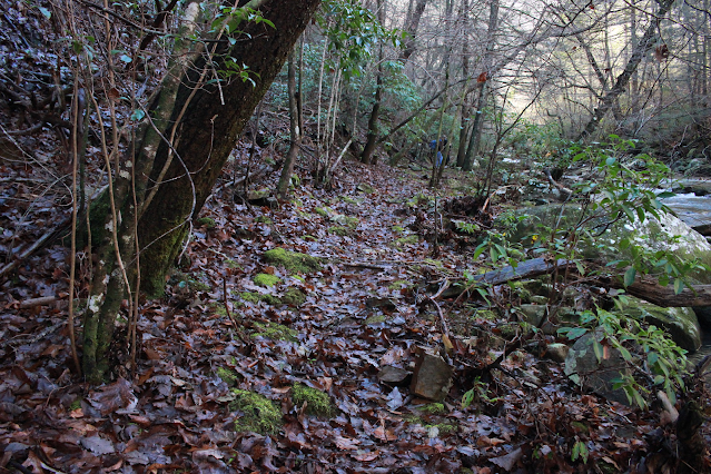
The plan for this weekend was for Sharon to come over and visit and stay with us. We would at some point go to Best Buy as she needed electronics. We would hike on Saturday. Kenny thought he would have to work, but it ended up being only an hour or two. We had great weather on Saturday. It was very cold first thing in the morning, but we planned a fun hike that wasn't too long. We could sleep in a little and get a later start so the day would have warmed up.
We stopped in Rocky Top on the way and had lunch so we would have plenty of energy and not have to tote along a bunch of snacks or stop to eat. We just took drinks and as little gear as possible. Kenny and I have hiked to Bruce Creek Falls before, but whenever we visit here it has been quite confusing. The hike to it along the Cumberland Trail starts down in Cove Lake State Park. It comes in around 5.7 miles distance. The bad part is there isn't much to see along that section of trail. We opted instead to shorten up the hike since we are all so out of shape. We also had no desire to look at and listen to the interstate along that stretch.
We started at the parking area up at Shelton Hollow Lane. It is an easier, shorter hike with something to see the whole way. The hike is 2.2 miles round trip and is easy. This section of the Cumberland Trail is worth hiking! Don't get me wrong. It is one of the most dramatic and geologically varied segments of the trail. While we had hiked to the falls a couple times we had never before hiked to the Devil's Race Track. It is the cluster of rock fins you can see from I-75 North. It is an overlook with a three hundred sixty degree view! Today we planned to go up to see and enjoy it.
The construction of interstate 75 and the proximity of Bruce Creek to the foundations of that project made it necessary to do some engineering to protect the highway. They did not want the stream to undercut the road so they blasted the bluff and moved the stream over forty feet. This created a stable road and a beautiful set of manmade waterfalls! The Cumberland Trail came along later and it ambles along below the highway and beside Bruce Creek's triple waterfalls. It would be hard to miss the blasting lines in the cliff.
Above: The first attractive falls along Bruce Creek. It looks a bit more like a naturally occurring falls.
Below: I am looking downstream along the creek. The sunshine was glorious!
Above: Only about another tenth of a mile further you encounter the second drop of the waterfall. This one is taller and multitiered. It is very geometric and squared off looking. It is pretty, but if you look at the walls of the gorge on the far side you can see vertical lines cut into the stone at regular intervals. These were blasting lines.
Above is a photo of the main falls
The nice thing about this waterfall is you can safely, carefully stay close to the edge and get good photos and video the whole way!
Above: Dramatic shot looking down at the next drop of the falls and looking back down the jade green Bruce Creek from the top.
It is worth mentioning that the Cumberland Trail veers safely away from the edge of the falls climbing high above them. There is another spur trail we took that goes carefully along a narrow edge for a better look. On the return trip we took the easier trail that goes above.
A short distance past the top falls is a super small cascade that is stream wide.
Above: Looking upstream at the bridge. The trail crosses here, but one also continues upstream on the river right.
Above: Looking downstream from the bridge
Above: Kenny and Sharon crossing the bridge ahead of me. Up until now there has been very little elevation gain and very gradual.
Above: Looking upstream at the bridge
Above: sunbeams on the Cumberland Trail.. this part avoids the creek for those skittish about edges
Above: The edge trail above the waterfall hugs the creek
Above: low, wide cascade between the top of the falls and the bridge.
Once we got above the main falls and past the super narrow part the edge trail widened out. It became necessary to scramble on rocks in the creek and over roots for a short distance. We arrived at the bridge where the Cumberland Trail turns and starts up to the Devil's Race Track.
It is a climb from here until you reach the summit, but the trail is very well constructed. The switch backs are merciful. Plenty of places to stop and take a lung break. I could tell that the past eight weeks of working out every day are paying off. It did not tire me so much and my lungs and heart were not taxed.
Shedding nineteen pounds was helpful! About now I had to come out of my heavy camouflage coat. I took it off and strapped it to the side of my backpack.
The trail is rocky with hand holds cut even into logs as a way to help you.
We took a water and air break in a sunny spot where the ground was fairly level.
A short distance further we passed a huge monolithic stone. The trail splits around it. We took what appeared to be the "real" trail and bore to the right.
Standing down here watching people high above me climbing such a steep grade made me feel exhausted just looking at it. By the time we got round there and were actually the ones making that climb it wasn't nearly as bad as it looked!
We kept on putting one foot in front of the other until we came to a rocky outcrop we had to clamber up. I have failed to mention Sharon's wonderful dog Odie came with us. One reason for picking a hike outside the Smokies is so he could come with us. He loves to ride in the car and hike! We were now encountering more and more people. He was so funny. He hiked the trip twice over compared to us. He kept coming back to check on stragglers and herd people.
Once we got up top there was really not much elevation left to gain.
We checked out the first overlook down toward the town of Jacksboro and Caryville. We could see Cove Lake State Park in the distance.
The American flag waves over the highway on the rock outcrop.
Above and below: Two views from overlook #1. The town of Jacksboro is toward the left in the first frame. The second shot shows how blue the sky was today!
Above: The vegetation up on the ridge is scrubby pines, sage brush and reindeer moss. The ground is littered with tiny white pebbles that were at one time long ago embedded in other stones! Back when this was under water.
Above: Looking left from the Devils Race Track main overlook. A mom and daughter duo sit below us.
Above and below: views from the overlook. You can see I 75 down there!
Above: You can see Caryville and Cove Lake State Park more in this shot.
Below: Sharon in deep thought. Odie is by her side!
Below is a video of the overlook
We sat up on the top taking in the dramatic views in every direction.
The Cumberland Trail winds along this ridge on out to Eagle Bluff, Window Rock and beyond. I want to hike it and I will! We finally began our return trip.
We used care coming down as it was steeper and a little more difficult than going up! Harder to apply the brakes! Also we saw more people coming up when we were finishing. The day had warmed and people were getting out now.
We got to the bridge and crossed turning right to hike upstream to the third and final falls. It was only 0.20 miles further if that and the waterfall was running very well. We could hear it from the bridge. I thought it was on Bruce Creek, but it isn't. It is actually a small tributary stream. Today it looked beautiful and was running very well. I expect there are times when it is not worth the walk up to see. It looks like it may dry up in Summer's heat.
Below is a photo of the third waterfall.
Today's hike was just right. We all got fresh air, sunshine, exercise and negative ions! We did not wear ourselves out too much by trying to bite off more than we could hike today for three old folks. Today's exercise feels like I want more and more of this! It did a world of good for our spirits. Odie was happy and everyone on the trail wanted to take him home with them. He is such a good boy!
Below is a video of all three waterfalls in their glory!
At the top of the trip report is a link to directions how to get here and do this hike for anyone interested.
**The website information on the link above says that the CT is not open past the bridge over McGill Creek. It is not completed officially, but it IS open and can be used. It does not have an official connection to Leggett Road at this point so
it is best to hike it as an out and back. **
We had wanted to get out and hike some for exercise and fresh air. We had promised our oldest grandson, Michael, age eleven, we'd hike with him over Christmas break. We realized that we'd best get cracking on that as school was set to resume on Tuesday. We planned with him to go hike to McGill Creek Falls down near Dayton. It was not a real long ride. We stopped and got breakfast and then continued down the road to the trailhead. It is actually just past Dayton out in the countryside near Graysville, Tennessee. It is one of the newer sections of the Cumberland Trail.
I had seen people's photos of McGill Creek Falls and how pretty it was.
I wanted to see it for myself. I knew that the bridge was up to ford McGill Creek, but had been told previously it was a rough bushwhack from just past the bridge to the falls. I heard back from friend Gary Stephens that the trail was now constructed so as not to be a bushwhack any longer. Though the trail is not officially open we decided to chance it after he gave it a thumbs up!
Michael is a pretty able hiker and getting to be moreso all the time.
We selected the parking area along Brayton Mountain Road. It has room for a couple vehicles to pull off. The views down the mountain here were great. Wide and sweeping terrain unfolds before you. The trail is well marked, but you have to pay attention as the area is crisscrossed by former logging roads and atv trails.
ATVs are no longer supposed to be in this area. You couldn't take one further than McGill Creek anyhow because of the terrain. It would be a boring ride for sure.
We began our hike along the shoulder of the mountain heading toward the first stream crossing. We came to the first crossing which was an easy rock hop thankfully. It is across a small spring branch that empties into McGill Creek.
The terrain flattens out here for awhile and parallels McGill Creek stream left.
It is very pretty. We did see one massive landslide area and some fallen trees that came down at the edge of the creek, but it was across from us and did not affect our hike.
Above: part of the hike along McGill Creek is fairly level, but not for long!
We worked our way through some boulders and down to the bridge that crosses McGill Creek. It is well constructed, attractive and offers a safe, dry way over the creek. It also provides a good platform to take in views of the cascading waters of the stream. We spent a little time there checking out the view.
Above: Kenny gazing upstream from the bridge
Above: Michael and Kenny on the bridge
Below: view upstream was very pretty. One cascade after another!
Once across we resumed our hike on the trail. I could tell that while we were on the proper course it had changed. It was no longer blazed except for occasional survey tape. It was a little more rugged. I think they have not worked all the kinks out of this section. The website does say the trail is not open beyond the bridge.
While the trail is a little tougher here, it is certainly open and easy to follow for the most part. Michael took one slight detour on the hike back, but it was a matter of perhaps 10 feet in the wrong direction.
Above: Kenny & Michael ahead of me on the gently winding trail
Below: A look at the trail behind me. Copper beech leaves give the forest a dash of color on a Winter day.
Once across the bridge and on to the opposite side it was only a quarter mile til we arrived at the falls. The maddening part is that the first bit is easy and you soon come to a point where you can get your first look at the falls in the distance.
The trail here instead of taking a direction course to the falls goes up, up, up, and around.. and back down to the falls. Why? Because the gorge slopes are steep here and there is no place to walk down next to the creek. We went a tad over 1/10th mile on the far side before the terrain squeezed in tight forcing us to climb to get round the boulders and the cliff.
Below: blue skies over Winter trees of green and gray. We were down in a hole for sure!
Below: the trail climbs now
Below: can you see the tiny sliver of neon orange survey tape?
The stream below the trail
Below: I loved this shimmering pool along the creek
The trail stays in the bottom of the gorge for a short distance on creek right
Above: more placid pools of water shining in the gloom of the woods
We approached the falls from above it working our way down the bank slowly and carefully. I was impressed with what I saw. I knew it was a pretty falls from seeing other people's photos, but until you are there it is hard to get a feel for how powerful the stream is. The falls was larger than I'd expected and running very strongly. Seeing it in person and especially from the side conveyed the scale of it better for me.
Side shot of the falls
Kenny was prowling around looking upstream. Michael had sat down and was talking to me above the roar of the falls. I could only hear parts of what he was saying, but he was talking about climbing on the falls, swimming there sometime, and then he went on to tell me he was going to swim at Abram's Falls next time he was there. This lead to a quick physics lesson about waterfalls, swirl eddies, and hydraulics. I reminded him how quickly things can turn bad such as the time he slipped and fell blacking his eye at Gee Creek. He blanched out white at the thought. It was a pigman's legacy moment. I hated to be the one to deliver the sobering message, but if it saves my grandson's life I'll play the bad guy.
I have been striving with all my grandkids especially Michael since he was a baby to teach them to enjoy the outdoors responsibly. To have fun, but be smart about it and not to take foolish chances. I got some photos of the stream at the brink of the falls. I then very carefully made my way down over the slick bank to get pictures from the base. I tried my best to convince Michael to come on with me, but he was still stunned I guess. He was getting over the shock and realization of what he'd been contemplating and how dangerous it could have been.
Above: The beautiful McGill Creek Falls from the base
Below: same falls.. silky shot
Kenny helped me carefully get down to the base over the slick rocks. I hung around down there taking photos and enjoying the sight of the falls for awhile. I was able to climb back up myself being extra careful. He once again gave me a hand to help me over the land rock which was slippery. We sat up at the falls and ate lunch. It was not cold, but it was not as warm down here in the gloom of the gorge as it was walking out in the midday sunshine.
Once we'd finished visiting here Kenny urged us to go up the bank and see another falls he'd spotted. It was on a side stream that flows down and empties into McGill Creek. It was quite pretty today and worth the short side trip to see it. I have a feeling that part of the year it dries up a good bit. From here we could look upstream and see an even larger falls. No trail between here and there. It would be a bushwhack and rock hop. Not real far, but tough. Michael was not feeling the off trail thing. He was far more reticent now.
This lay between us and the upstream, big falls we spotted.
scenic cascade on a side stream
Above: Looking upstream you can see many cascades and white water. It is hard to see through the trees the size of the other falls. If you look at McGill Creek on satellite view it is easy to see the force of the stream and the fact it is rugged and one waterfall after another.
a closer look at the side stream with the waterfall. the trail actually curves round and provides a view of this. It appears to continue in its roughed in form.
Above: I am at the base of the falls looking downstream. It is hard to see, but there is a spring flowing out from beside and under this boulder on the right. I walked down through there and the bank had at least three springs running!
Once we got done checking out this area we turned and retraced our steps along the path. We were still on the super steep, rocky section that works around the cliff to put you at the falls when we encountered our first other hikers of the day.
We ran into a man and woman and greeted them. Once we'd gotten closer we stood and talked with them a bit. They were very friendly and a pleasure to chat with. They both knew a lot about the area and lived nearby. They were just out for exercise today. We stood there discussing the trail and the area I kept thinking they looked mighty familiar.
Before we parted company I worked up the nerve to speak up. "You both look extremely familiar to me. I think I keep up with your blog and have for some time now. " They both grinned and introduced themselves. They are a sweet couple.. Laura and Craig. I keep up with Craig's blog and have for I don't know how many years. It was a treat to finally get to meet them. They realized who I was as well. How funny. Michael was restless and we were aware he wanted to get going so we all hiked out together. They are fast hikers so they put us behind them rapidly.
We decided for the hike back up the hill to the truck we'd try something different. We opted to follow the ATV trail/logging road for part of it. Figuring it might be somewhat less steep. All of it comes out the same place anyhow. It turned out to be a good decision. It was a little milder of a climb. We were emerging back into the sunlight now of a pretty, late afternoon.
We were almost back to the truck when we passed the only other hiker we saw today. A very attractive blonde haired lady passed us going in.. carrying a camera. We exchanged hellos and kept going. Kenny turned to me and said he was concerned about her trying to hike to the falls this late in the day. I could see he was worried. I thought about what we might do and considered leaving our phone number on a paper on her windshield and ask her to call or text to let us know she was ok? Then I felt like it was on the forward side to expect that of a stranger. I said a prayer for her safety and we were at the truck.
The drive home was uneventful and we were all very mellow. The exercise was great. The scenery in the Dayton area and down that way is always pretty. I just like it. It is less crowded. Upon getting home... either that evening or the following day I learned that the lady in question was a lady I am acquainted with through Facebook! Carolyn! She is a member of our Cumberland Plateau Group!
She said she made it out fine of course, but regretted the late start as she had to hurry and did not have the time she'd have liked to tarry at the falls and along the trail. We were tickled to know who she was and that she was fine! She said her husband called to check on her just as she got back to her car.
Already looking forward to the next hike on the Cumberland Trail.
We wanted to get out and do something in a different area. Kenny had been working hard and while he wanted to get away.. he did NOT want to hassle with the camper just yet. He talked to me and decided the most relaxing thing for him would be to just book a hotel and make things easy. We booked a stay at
a nice hotel in Dayton. We made plans to meet up with Anne Brewer to hike.
Originally we were going to hike to McGill Creek Falls. Anne is getting over a broken femur. She is doing great, but I sure didn't want to risk harming her.
Part of McGill Creek Falls hike is a bushwhack. We figured that would be best left for another time. Instead we went to another falls I'd long wanted to see... Immodium Falls.
I had never hiked this section of the Cumberland Trail and was very excited about it. Anne met us at the hotel and we car pooled to the trailhead on Saturday morning. None of us had any dealings with this area. We had some directions. Kenny and I had both studied the satellite imagery and thought we could do better than parking at the trailhead. Everything comes with a price tag.
We parked at a road before Retro Hughes trailhead. The distance was shorter, but the trade off was having to hike down a slope that was ugly and made for unsure footing. It was clear cut by loggers. We had to take our sweet time getting down that hill without killing ourselves. No one got injured thankfully.
Once down to the bottom of the slope we entered the woods and picked up a road that was actually part of the Cumberland Trail. Before too long we reached a trail junction and entered the woods and found ourselves on a true trail.
We all agreed it was one of the prettiest sections of the Cumberland Trail we'd ever seen. Interesting rock formations, pretty cascades, deep hemlock woods. The weather was pretty and the skies blue. It was warming up to be a perfect day. We had stopped to get us a sammidge from Subway. It was Anne's birthday today!
Above: pretty hole of water and cascades on Little Possum Creek
It was great spending time with her and catching up on her doings.
She is always a pleasure to hike with or do anything with. We missed Vickie, but maybe we can all do something together before long.
It seemed like no time til we were at the brink of the waterfall on Little Possum Creek.. aka Immodium Falls!
I wanted to see this while it was still Spring because the water is so blue!
Above Anne and Kenny in the creek
Below: rocky cliffs along the hike
We visited at the falls and took in the beauty of the aquamarine waters.
It was really worth the effort to see. We sat down at the falls and ate our lunch. We saw a couple other pairs of hikers throughout the day.
We began our hike back. No wildflowers out yet. We were dreading the trudge back up that hill. It was tough, but not as bad as all that. We took our time and managed to make it back. I'd not do the hike that way again. I'd just hike from the regular trail head. This area is ugly from the logging.
We finished up our day and took Anne back to the hotel. We parted company. We had not done nearly what we expected today, but it was nice just the same. We had been overly ambitious, but it was just talk.
Back at the hotel we got cleaned up and prepared to go have dinner.
We tried a new place to us. Jacob Myers on the River Restaurant
It was very good. It was busy and the wait they said would be long. 45 minutes or more. We decided to try to wait it out since there was not a lot of other choices. We went outdoors and strolled along the river on the greenway. It is a beautiful area. Dayton is a very nice little town.
We were seated in twenty minutes! The food was good. It is a great place to eat with quite a varied menu. I'd definitely go back again. It would be nice to try eating outdoors on the patio when the weather is good. The scenery there next to the river is just the best.
We went shopping at Burkes Outlet and I got a new purse.
We checked out a couple other stores, but didn't have a lot of luck. Dayton's shopping options are limited. We went back to the hotel to relax.
We got up next day and ate breakfast in the hotel. It was really good.
They had a super clean kitchen and dining area. They had pretty much anything you could want. It was just right. We stayed at a Holiday Inn Express.
After breakfast we went to try another section of the Cumberland trail.
We went up the mountain and started hiking. It was pretty, but we were very confused. We were trying to reach some obscure waterfalls we found on Tennessee landforms. We searched in several different directions. One we found, but it was pitiful. Like a cow peeing down a flat rock. The other we never found. The overlooks were pretty. The scenery was good. We finally gave up and headed out. All we got out of it was some fresh air and exercise. Still better than sitting at home.
All in all our little get away was what we needed.

 Bill Stowell waves "Hi! from the Cumberland Trail. Yes. That is I-75 you see in the background. Nothing for it!