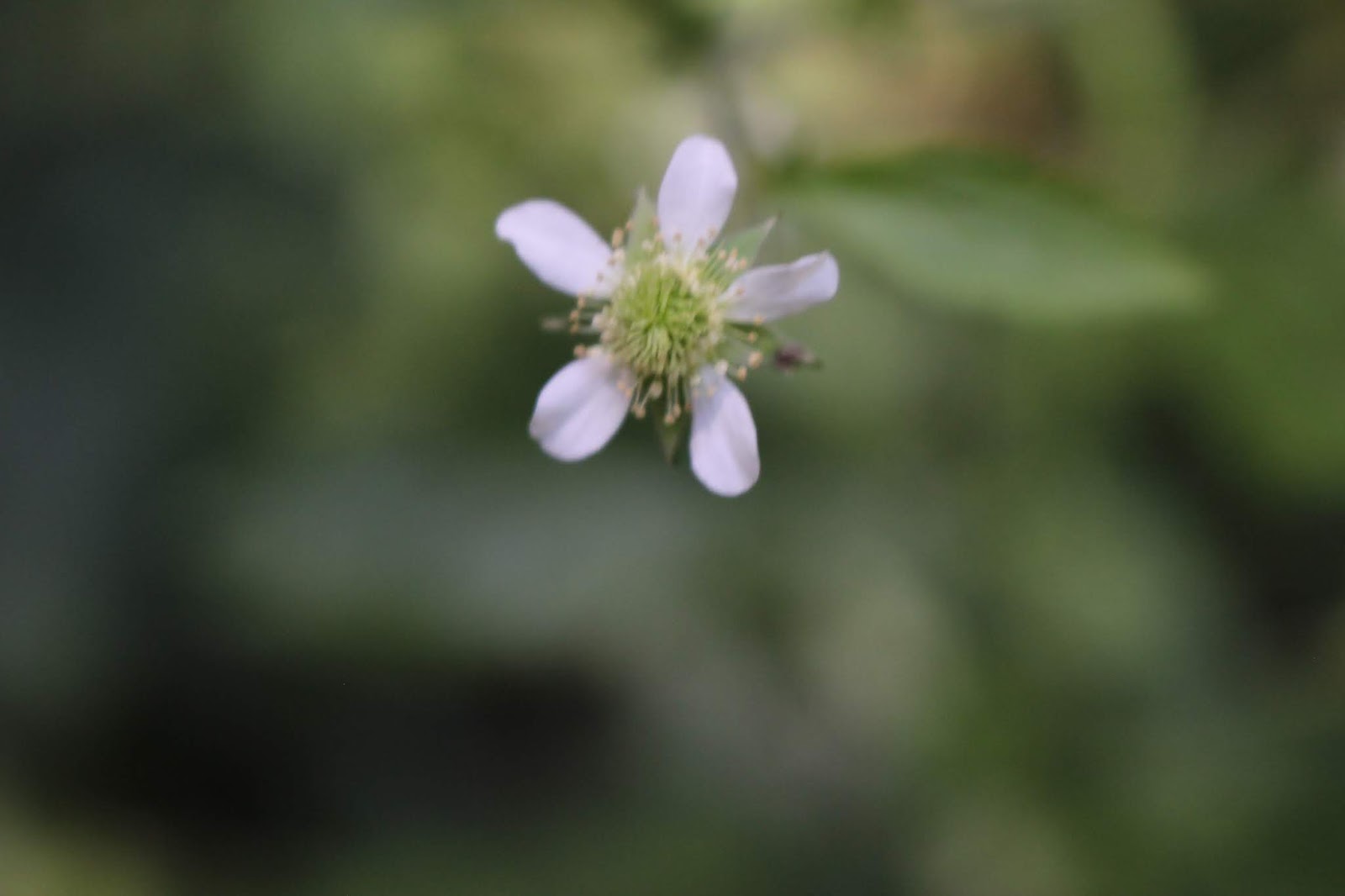
Spurred Butterfly Pea was in bloom today at Window Cliff
Window Cliffs State Natural Area Hike
Dana Koogler and Jay Walker
Wednesday June 26, 2019
Total Hike Distance 5.5 miles round trip strenuous
Window Cliff Pictures
**Edited to Add-- I have modified the entry including the states directions on the
bottom of the page. I have found several instances lately where the state's web pages
are giving error messages. I don't want folks to not be able to find the directions
because their page is down.**
The day Kenny and I had a chance to meet with Jay at Rock Island for a few minutes we started right then talking about hiking together to Window Cliffs. We had planned to go another time, but
for some reason ended up not going. We set the plans in stone this time. I realized how much I missed my buddy. We have a good time. I got the trip info together and we planned to meet in Sparta at the Wal-Mart. Things went to plan and we carpooled from Sparta to the trail.
I drove and Jay navigated. I had my TomTom device on, but I was not sure I trusted it since it had not been updated in awhile. We found the trail area without any difficulty. The directions given on the state's website were accurate and easy to understand. Having been here before did help a little bit. I at least had some idea of the lay of the land. I even remembered some of the road names we passed. We arrived at the trailhead parking lot and got our gear to set off on our hike.
Kenny and I had been here in 2004 before it was a state natural area. We parked at the end of New Window Cliffs Road and got out in a subdivision. We asked a man we saw out in the yard if we could park and walk down to the waterfall. He was very nice and said we sure could. We hiked down an old logging road that was overgrown in places with tall weeds and briars. We had dogs and chickens and lots of parked cars around us to start. We walked down to the river level and forded Cane Creek. It was a short hike and bushwhack. We were able to go downstream on the far bank, and work our way back to the falls. All we saw that day was the falls. We missed the cliffs, and all the other neat stuff there. Today I planned to make up for that.
The hike to Window Cliffs is best done in warm weather when we have had normal to low rainfall amounts. It involves eighteen creek crossings total. Nine one way. All cabled. All slippery.
All up over the top of the boots wading. I had seen trail reviews and photos. It looked like an amazing hike. I read that the last bit on the return trip was difficult since it was all uphill. The distance of 5.5 miles total was not bad. It was rated strenuous. I guess we would find out.
 above: First of many creek crossings.
 Above: Looking upstream at Crossing #1
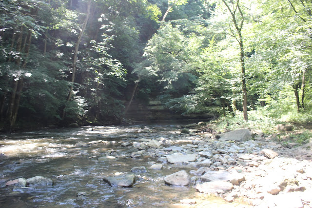 Above: Downstream at Creek Crossing #1
 Above: Jay taking photos with his phone.
The hike starts out in large gravel parking lot at the end of Old Cane Creek Road.
There are porta potty restroom facilities at the trailhead. It is signed and marked well from start to finish. We hiked along a gravel road from the parking area at first on a level track. Once the trail enters the woods the surface changes from gravel to dirt and begins a gradual descent of around 0.70 miles. The forest was pretty and green today. The air had not gotten real hot yet and we had a bluebird day for hiking. The skies were clear and lovely. We arrived at the first of the creek crossings. Interestingly they are signed on the trees near them. CC #1 and so forth. I think they close this area to hiking when the weather is bad and the streams are running high for safety.
I am not 100% sure of it, but it would be smart to avoid this place if we are having lots of rain.
We found the creek crossings today to be pretty and refreshing. We just left our trail shoes on and plowed through. I had water shoes with me, but I did not feel like taking them on and off that many times. Dragonflies and damselflies zipped around the trail. We saw butterflies and a few Summer wildflowers. Spurred butterfly pea was one. Bull thistle was another. Tiny yellow pencil flowers were trail side. Pale leafcup was plentiful. Daisy Fleabane was all around. Lots of blackberries were ripening by the trail. I tried some, but found them very tart.
We saw about three or four places along today's hike where pieces of stone walls still stood.
At the beginning of our day there was only one other vehicle in the parking area. By the time we were heading out on our return hike we passed lots of folks. Everyone was pleasant. You see everything from the totally prepared to flip flops and skirts. Oh well, hike your own hike.
The hike while pretty, was somewhat uneventful for a good chunk of it. We made good time on the trail as it was very easy and level. Somewhere after creek crossing number eight the terrain began to look familiar to me. I finally spotted the place where we came down the bank from New Window Cliff Road all those years ago. It is signed private property very clearly now.
We arrived at a sign that indicated Window Cliffs Overlook to our left and Window Cliff straight ahead. We turned aside to check out the overlook. It affords you a good view of the Window Cliffs straight in front of you.
 Above and below: a couple shots of Window Cliff from the overlook.
 It is quite an interesting and pretty feature.
The waterfall rushed by audible to us now. I knew it had to be close. We only hiked a little further til we were at it. You can view it easily from creek left. The waterfall is about thirty feet high and very picturesque. We viewed it from this side, but opted to ford the stream above the falls to see it from the base. No good way down from this side. The stream is slippery, but if you stay well back from the brink of the falls you can cross safely. Once on the opposite side we worked our way down the bank on layered rocks and made it easily to creek level. I remember the stone that sits in the middle of the stream just in front of the falls. It had a nest of snakes under it in 2004!
 Above: First look at the falls from creek left. Window Cliffs Falls
 Above: Rock in the stream with water snake on it.
 Above: Today only a mating pair of damsel flies was around this stone. Last time nest of snakes under it. Tiny babies!
I was keeping my eyes peeled for No Feet. We crossed to the middle of the stream in front of the falls where it is shallow. I made sure to get photos and video from both sides and from the base.
It was flowing even better than it was the first time I visited. It has a deep swimming hole in front of it. I asked Jay if he wanted to get in and of course he did! We did a little swimming and clowing around in the pool before the waterfall. I finally got out and was looking round. He wanted me to take some photos of him in the water. As I reached for my camera I bent down and one rock over from me were three snakes. Turned out all of them were harmless water snakes. I initially thought one of them was a copperhead,but it was not. I got a good look at them and they were very docile.
Funny that I encountered a bunch of snakes in the same spot in 2019 just as I did fifteen years ago. How is that even possible that I have lived here this long?
 Above: Window Cliffs Falls from creek right.
 We made it to the base of the falls! It is a pretty good swimming hole. The water here was not real cold. It was refreshing, but tolerable.
 Window Cliffs Falls

Jay swimming at the falls.
Finally we got our stuff together and left off swimming to continue our hike. It was fun and helped beat the heat. It made the hike much easier. Jay suggested since we were near the final creek crossing why didn't we just walk right up the creek to it? I had noticed a small, attractive cascade upstream. What I didn't notice was the cable over the top of it! That was our last crossing indeed.
So we walked up the stream. We saw minnows, but no more snakes.
We decided quickly we would finish our hike and come back to this spot for lunch. We'd soak in the natural "jacuzzi' provided by the cascade. We continued the trail which is flat once you cross. It is in a deep, dark hemlock forest that is so gorgeous. We saw a pair of owls and heard them calling.
We saw four or five toads today also! The trail is signed clearly and in a couple spots it turns you away from continuations that would go onto private property. The stream nearby is a rocky deep channel. Cane Creek bends, sweeps and curls its way across the surrounding plateau. It has carved a gorge and oxbows . Window Cliff is a formation that is narrow like a knife edge where the stream swings around it closely on both sides! It has eroded through in a couple super narrow places creating the windows. The trail climbs a little, but again the ascent to the Window Cliff is gradual.
We climbed up there and took in the views which were nice. It is dramatic, but a little bit of a let down as you are ON the cliffs and cannot see them from the vantage point to get the whole picture as you did on the overlook. We were tickled that we made it though. A couple ladies arrived just after we did. We greeted them and I pointed out a crinoid fossil piece I found. I showed it to one lady and explained what it was to them both. I put it in her hand and told her to hang on to it. She had just moved here from Florida. She had never seen one before. I have a couple chunks of crinoid fossil at home already. She seemed pleased.
 We are on Window Cliffs


Nice views up here!
We hiked back down to the stream and crossed. We sat down and ate lunch. Rather I tried to eat. I was so hot all I wanted to do was drink liquids. We got in the creek afterward and sat down very carefully in the stream on the cascade. It felt marvelous! My knee had begun bothering me and the last part of the hike to the cliff I had chill bumps on me from pain. I took one tylenol and soaked in the cool water. By the time we got out.. who knows how long later... I was 100% better! No more knee pain. We spent a good bit of time just playing in the water and enjoying the bubbles and the froth of the cascade. I remembered I had the Go Pro in my backpack. I crept carefully over there to retrieve it. We were able to shoot some fun water videos of underwater, half way submerged and right in the spray of the falls. I made sure to send the footage to Jay for possible use on Tennessee Trails episode. It was so fun to hike with somebody who is agreeable and likes to do the same sort of silly things I do. We had a nice pace and were a good team. He is the kind of person who I like. We can talk plenty or we can be quiet. Either way is cool. We saw several hikers coming back while we were still in the stream. One gal laughed and gave us the thumbs up!
Finally we tore ourselves away from the water and began our hike out.
It was easy and fun. Still refreshing each time we came to a crossing. We passed a man smoking and his cigarette smelled so good to me. We also passed a nice man hiking with a big black dog.
I asked if I could pet him and we made fast friends. The dog was having a blast. He was part Lab so he was loving all that water! The hike out was again smooth and easy and uneventful. The last part uphill was a bit tough, but nowhere near as bad as I'd imagined. It helped a lot that we were wet and cool for the uphill climb.
It was all in all a great day. We got towels and dried off a bit for the ride back to Sparta.
I did not turn on the navigation, but decided to wing it. We did make it back easily, but by a different route! I missed the turn and it was actually a better, easier way. It is simpler to just get off and on I-40 and go and avoid those winding country roads. It is faster and a straighter shot.
Once we got back to Wal-Mart we parted company. I got a big hug from Jay and kissed his cheek.
He is a dear friend and so unassuming. He is so grateful to be hiking and pain free after last year's back surgery! It is a blessing indeed. I don't want to let it be so long between our hikes again.
I am rediscovering my life and my buddies now that my circumstances are changed. It is a very good feeling. Thank you Lord!
Below is a short video of the waterfall and the end has the underwater footage added. Just about half a minute of that.
for some reason ended up not going. We set the plans in stone this time. I realized how much I missed my buddy. We have a good time. I got the trip info together and we planned to meet in Sparta at the Wal-Mart. Things went to plan and we carpooled from Sparta to the trail.
I drove and Jay navigated. I had my TomTom device on, but I was not sure I trusted it since it had not been updated in awhile. We found the trail area without any difficulty. The directions given on the state's website were accurate and easy to understand. Having been here before did help a little bit. I at least had some idea of the lay of the land. I even remembered some of the road names we passed. We arrived at the trailhead parking lot and got our gear to set off on our hike.
Kenny and I had been here in 2004 before it was a state natural area. We parked at the end of New Window Cliffs Road and got out in a subdivision. We asked a man we saw out in the yard if we could park and walk down to the waterfall. He was very nice and said we sure could. We hiked down an old logging road that was overgrown in places with tall weeds and briars. We had dogs and chickens and lots of parked cars around us to start. We walked down to the river level and forded Cane Creek. It was a short hike and bushwhack. We were able to go downstream on the far bank, and work our way back to the falls. All we saw that day was the falls. We missed the cliffs, and all the other neat stuff there. Today I planned to make up for that.
The hike to Window Cliffs is best done in warm weather when we have had normal to low rainfall amounts. It involves eighteen creek crossings total. Nine one way. All cabled. All slippery.
All up over the top of the boots wading. I had seen trail reviews and photos. It looked like an amazing hike. I read that the last bit on the return trip was difficult since it was all uphill. The distance of 5.5 miles total was not bad. It was rated strenuous. I guess we would find out.


The hike starts out in large gravel parking lot at the end of Old Cane Creek Road.
There are porta potty restroom facilities at the trailhead. It is signed and marked well from start to finish. We hiked along a gravel road from the parking area at first on a level track. Once the trail enters the woods the surface changes from gravel to dirt and begins a gradual descent of around 0.70 miles. The forest was pretty and green today. The air had not gotten real hot yet and we had a bluebird day for hiking. The skies were clear and lovely. We arrived at the first of the creek crossings. Interestingly they are signed on the trees near them. CC #1 and so forth. I think they close this area to hiking when the weather is bad and the streams are running high for safety.
I am not 100% sure of it, but it would be smart to avoid this place if we are having lots of rain.
We found the creek crossings today to be pretty and refreshing. We just left our trail shoes on and plowed through. I had water shoes with me, but I did not feel like taking them on and off that many times. Dragonflies and damselflies zipped around the trail. We saw butterflies and a few Summer wildflowers. Spurred butterfly pea was one. Bull thistle was another. Tiny yellow pencil flowers were trail side. Pale leafcup was plentiful. Daisy Fleabane was all around. Lots of blackberries were ripening by the trail. I tried some, but found them very tart.
We saw about three or four places along today's hike where pieces of stone walls still stood.
At the beginning of our day there was only one other vehicle in the parking area. By the time we were heading out on our return hike we passed lots of folks. Everyone was pleasant. You see everything from the totally prepared to flip flops and skirts. Oh well, hike your own hike.
The hike while pretty, was somewhat uneventful for a good chunk of it. We made good time on the trail as it was very easy and level. Somewhere after creek crossing number eight the terrain began to look familiar to me. I finally spotted the place where we came down the bank from New Window Cliff Road all those years ago. It is signed private property very clearly now.
We arrived at a sign that indicated Window Cliffs Overlook to our left and Window Cliff straight ahead. We turned aside to check out the overlook. It affords you a good view of the Window Cliffs straight in front of you.


The waterfall rushed by audible to us now. I knew it had to be close. We only hiked a little further til we were at it. You can view it easily from creek left. The waterfall is about thirty feet high and very picturesque. We viewed it from this side, but opted to ford the stream above the falls to see it from the base. No good way down from this side. The stream is slippery, but if you stay well back from the brink of the falls you can cross safely. Once on the opposite side we worked our way down the bank on layered rocks and made it easily to creek level. I remember the stone that sits in the middle of the stream just in front of the falls. It had a nest of snakes under it in 2004!


I was keeping my eyes peeled for No Feet. We crossed to the middle of the stream in front of the falls where it is shallow. I made sure to get photos and video from both sides and from the base.
It was flowing even better than it was the first time I visited. It has a deep swimming hole in front of it. I asked Jay if he wanted to get in and of course he did! We did a little swimming and clowing around in the pool before the waterfall. I finally got out and was looking round. He wanted me to take some photos of him in the water. As I reached for my camera I bent down and one rock over from me were three snakes. Turned out all of them were harmless water snakes. I initially thought one of them was a copperhead,but it was not. I got a good look at them and they were very docile.
Funny that I encountered a bunch of snakes in the same spot in 2019 just as I did fifteen years ago. How is that even possible that I have lived here this long?


Finally we got our stuff together and left off swimming to continue our hike. It was fun and helped beat the heat. It made the hike much easier. Jay suggested since we were near the final creek crossing why didn't we just walk right up the creek to it? I had noticed a small, attractive cascade upstream. What I didn't notice was the cable over the top of it! That was our last crossing indeed.
So we walked up the stream. We saw minnows, but no more snakes.
We decided quickly we would finish our hike and come back to this spot for lunch. We'd soak in the natural "jacuzzi' provided by the cascade. We continued the trail which is flat once you cross. It is in a deep, dark hemlock forest that is so gorgeous. We saw a pair of owls and heard them calling.
We saw four or five toads today also! The trail is signed clearly and in a couple spots it turns you away from continuations that would go onto private property. The stream nearby is a rocky deep channel. Cane Creek bends, sweeps and curls its way across the surrounding plateau. It has carved a gorge and oxbows . Window Cliff is a formation that is narrow like a knife edge where the stream swings around it closely on both sides! It has eroded through in a couple super narrow places creating the windows. The trail climbs a little, but again the ascent to the Window Cliff is gradual.
We climbed up there and took in the views which were nice. It is dramatic, but a little bit of a let down as you are ON the cliffs and cannot see them from the vantage point to get the whole picture as you did on the overlook. We were tickled that we made it though. A couple ladies arrived just after we did. We greeted them and I pointed out a crinoid fossil piece I found. I showed it to one lady and explained what it was to them both. I put it in her hand and told her to hang on to it. She had just moved here from Florida. She had never seen one before. I have a couple chunks of crinoid fossil at home already. She seemed pleased.


Nice views up here!
We hiked back down to the stream and crossed. We sat down and ate lunch. Rather I tried to eat. I was so hot all I wanted to do was drink liquids. We got in the creek afterward and sat down very carefully in the stream on the cascade. It felt marvelous! My knee had begun bothering me and the last part of the hike to the cliff I had chill bumps on me from pain. I took one tylenol and soaked in the cool water. By the time we got out.. who knows how long later... I was 100% better! No more knee pain. We spent a good bit of time just playing in the water and enjoying the bubbles and the froth of the cascade. I remembered I had the Go Pro in my backpack. I crept carefully over there to retrieve it. We were able to shoot some fun water videos of underwater, half way submerged and right in the spray of the falls. I made sure to send the footage to Jay for possible use on Tennessee Trails episode. It was so fun to hike with somebody who is agreeable and likes to do the same sort of silly things I do. We had a nice pace and were a good team. He is the kind of person who I like. We can talk plenty or we can be quiet. Either way is cool. We saw several hikers coming back while we were still in the stream. One gal laughed and gave us the thumbs up!
Finally we tore ourselves away from the water and began our hike out.
It was easy and fun. Still refreshing each time we came to a crossing. We passed a man smoking and his cigarette smelled so good to me. We also passed a nice man hiking with a big black dog.
I asked if I could pet him and we made fast friends. The dog was having a blast. He was part Lab so he was loving all that water! The hike out was again smooth and easy and uneventful. The last part uphill was a bit tough, but nowhere near as bad as I'd imagined. It helped a lot that we were wet and cool for the uphill climb.
It was all in all a great day. We got towels and dried off a bit for the ride back to Sparta.
I did not turn on the navigation, but decided to wing it. We did make it back easily, but by a different route! I missed the turn and it was actually a better, easier way. It is simpler to just get off and on I-40 and go and avoid those winding country roads. It is faster and a straighter shot.
Once we got back to Wal-Mart we parted company. I got a big hug from Jay and kissed his cheek.
He is a dear friend and so unassuming. He is so grateful to be hiking and pain free after last year's back surgery! It is a blessing indeed. I don't want to let it be so long between our hikes again.
I am rediscovering my life and my buddies now that my circumstances are changed. It is a very good feeling. Thank you Lord!
Below is a short video of the waterfall and the end has the underwater footage added. Just about half a minute of that.
Directions to Window Cliffs are also included at the bottom just below the video.
Directions to Window Cliffs:
Directions:
From Nashville: take I-40 east to Putnam County to exit 280 (approx. 71 miles). Left on Ditty Road, right on Moss Road, right on Cookeville Boat Dock Road, left on Old Mill Road, and left on Old Cane Creek Rd to parking area. It is 7.3 miles from the I-40 exit. From Knoxville: I-40 west to TN 135 S/S Willow Ave Cookeville Exit 286 (approx. 102 miles). From TN-135 to Cookeville Boat Dock Road left on Old Mill Road, and left on Old Cane Creek Rd to parking area. It is 9.7 miles from the I-40 exit. ( These are the states directions copied to my page for just in case. In the event the site is ever down I have also included a link below to Chuck Sutherland's printable map which is great. Tennessee Landforms has additional maps and info.)
**As of June 27, 2020-- Porta potties now available in the parking lot at Window Cliffs per Marlene Denton**