Showing posts with label North Carolina Mountain Treasures. Show all posts

Sunday, April 17, 2016

Santeetlah Headwaters, Wright Creek Falls & Jeffrey Hell

Red Wake Robin trillium 


North Carolina's Mountain Treasures Series--Santeetlah Headwaters

Wright Creek Falls 


Kenny & Dana Koogler 

Pictures are here: 
Santeetlah Headwaters Pix


   I had become aware thanks to Kevin Adam's NC Waterfalls guidebook that a waterfall
existed on Wright Creek.  He mentioned that it was a tough bushwhack to reach, and in his opinion
not worth the trouble.  I later learned that it lay within the NC Mountain Treasure area of Santeetlah Headwaters.  In addition to the waterfall there were big trees to see.    Unfortunately the area is rife with a lot of dead, massive hemlocks which are falling.  Some have fallen across the falls. 
ENTS has been to the area and used LiDar to measure some of the champion sized trees of other species still living, but all the  giant hemlocks are now either fallen or dead standing.  We saw one that was four feet across easily.   The top had broken out of it and was hanging suspended like a dead- fall trap over where we stood at one point during our trip.  Nothing for it except to make tracks and get out of there!  

          I had studied the map of Santeetlah Headwaters which includes Huckleberry Knob and
the Santeetlah Bluffs.  I  purchased my first ever USGS quad map in order to have a
more accurate map of the area with as much detail as possible.  I thought I saw where the falls should be on Wright Creek since I had no waypoint.  One thing I thought that turned out to be correct?
The terrain back in that area looked to me like many waterfalls were possible. That much is true, but some of them are very small, choked with rhodo and not worth the extreme effort to reach.  I expect some of them dry up to a trickle in Summer. We made an attempt to reach it back in Winter by crossing Santeetlah Creek and coming up from the bottom. It was unsuccessful.  We did find another falls that day though that was not listed.   My rationale for why that approach?  
  • It was closest to where I believed the falls lay
  • It is usually best to approach a waterfall from below it.
  • It is usually easier to locate a stream from the mouth of it as opposed to coming in from the top. A headwaters can mean many rivulets and springs to pick from making it hard to narrow down exactly which stream you want to follow.   
    We did not succeed that day, but thought better of it.  We figured we'd wait until we had a longer day for more light.  Slightly warmer temperatures and slightly lower creek levels having to ford the Santeetlah.    I figured in the mean time I'd try to gather as much information as possible from 
every source.  I didn't know how that was going to happen, but I'd see what I could do. 
Below  is a video of an un-named waterfall on Santeetlah Bluffs.


    I let it be known that I was interested in locating that falls among my pals on Facebook.
I also did some more searching and found on World Waterfall Database that they showed the falls
much higher in the headwaters than I had thought it would be.  I was not sure what to make of it.
I had personally witnessed their data being sometimes very accurate. Other times totally inaccurate.
I was not going to rely solely on that as my resource.  Meanwhile the Lord sent along help in the form of Mark Morrison.  He is writing another one of his awesome guidebooks and Wright Creek Falls will be included in that.   I will rework this blog and include the link to his guidebook when it is finished and ready for sale!  Mark is a tough hiker and tackles some rugged terrain in out of the way places.  He tends to include some really great waterfalls in his books that you won't find elsewhere.

    Going to take a moment to plug Mark because he deserves props for his work.  
 He gets Kenny Koogler's seal of approval more than any other guidebook writer. 
He gives the best, most clear, concise directions. He writes wonderful, inspiring trail narratives, but when it comes to the directions portion of his book he nails it every time.   Mark provided me with 
some help provided I did not give out the details or directions.  For now I'm just saying we went and where.  Not how.   I will tell you simply it was a good thing we did not attempt to reach it the way I believed we should.
 One of many springs in the headwaters.  Imagine trying to pick which one is the correct one.
 Plenty of rhodo.  Love/hate relationship with it. Hate climbing thru it. Love having it to hold on to when the climbing gets steep!

             This hemlock was four feet across at the base.  The top is broken off and hanging suspended in the limbs of the next tree over. We did not realize until we were on our way back out that it hung like  a deadfall trap over the place where we stood.


Saw this little guy sunning himself today. First snake of the season for us.
Harmless garter snake.

          We had been able to hear the waterfall roar early on.  Always a good sign!  This was our first glimpse of it.
Wright Creek Falls

Fin of rock with resurrection ferns and moss atop it.  The area is rugged and beautiful.  Didn't see any wildflowers in this immediate area though.


Our view of the eighty foot drop of Wright Creek Falls.  You can see the hemlocks down in the bottom.   It is a pretty falls for sure. Right by it on the left is yet another falls that is smaller. Then over from that is another one coming in from the opposite side.

Tiny bit of the waterfall to the other side.  The view was very obstructed.
We are up high here to get a view of the main falls.

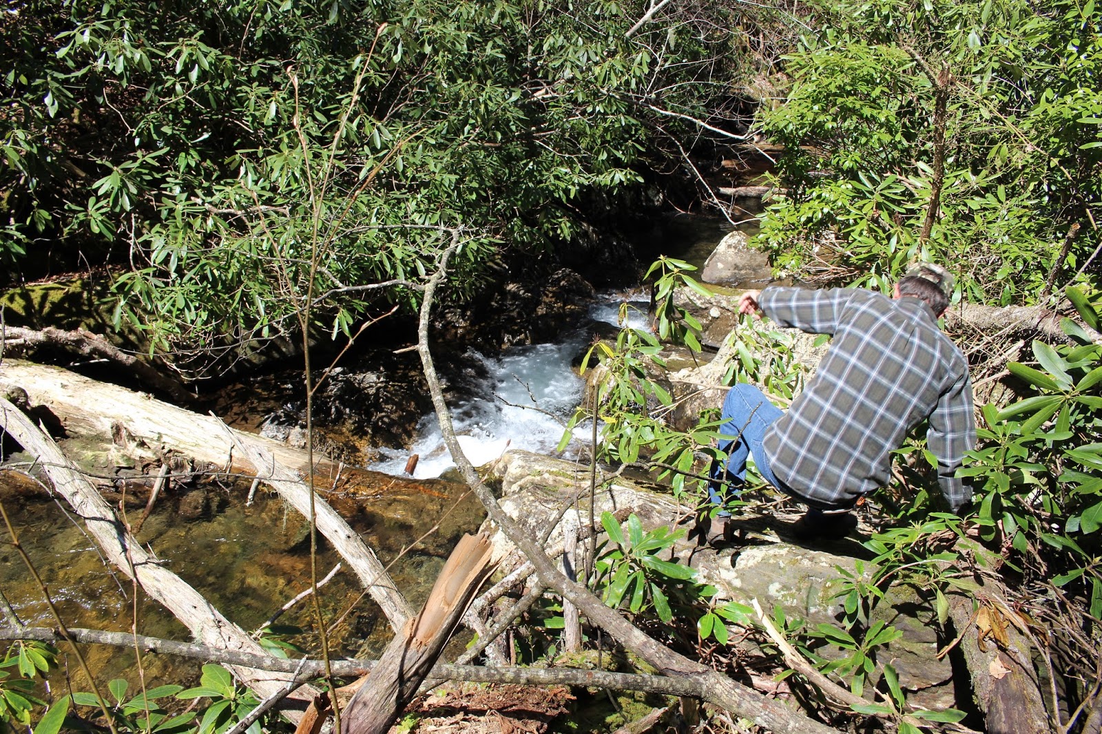
We realized we would probably not get the best vantage of the falls from the base, but we did it anyhow.   We worked that hard to get here so might as well.   The terrain is  so steep and rocky and choked with downed trees and rhodo it doesn't give you much choice where to go or to stand.


Kenny climbing around on the rocks, logs and sticks at the base of Wright Creek Falls.  Getting to the bottom was more climbing under and over rhodo and hanging on to roots and shrubs.
Once we had seen all we wanted and taken photos we headed back slowly.
We ate lunch at the vehicle and rested.  We were thrilled we were able to find it and enjoy seeing this falls.   It was worth it to us.   I didn't get to see any wildflowers, but I had a backup plan for that.
I didn't want to do a lot after the exertion of the first bushwhack.  Kenny also didn't get a lot of sleep the previous night and craved an early return home.   I figured we could stop by Jeffrey Hell and I'd check out a few flowers there and we would go home.


Jeffrey Hell 


     We headed back the Skyway toward Tellico Plains.  It was a beautifully clear day today.   
We stopped by Jeffrey Hell trail. Kenny did not want to go with me so I went alone.  He kicked the seat back and rested while I hiked a little more.   It was like going back a month in time being here at this elevation.   Carpets of spring beauty all along the slopes by the Skyway including here. 
I saw loads of dutchmans breeches, squirrel corn, trout lilies, spring beauties, violets of blue and yellow, toad shade trillium, sweet betsy, cream and red wake robin.   It was a worthwhile stop. 

The green on the slopes is spring beauty.  goes on and on like this. 

These little bitty pink and white striped flowers are what you see in Spring beauties. 
Some are a little deeper pink.


Jeffrey Hell trail is a good Spring wildflower trail.   It was early though for up here. Not  a whole lot blooming yet.

Dutchmans britches all over this hill.

Closer view of Dutchmans britches .

Saw smaller amounts of squirrel corn. It is a relative of bleeding heart.


 Saw lots of trout lilies.  This specimen was six inches tall!
Saw lots of Sweet Betsy.

Saw some cream wake robin. It was very pretty.

Purple Toad-shade  trillium. Saw a few of these.

We had a gorgeous clear view from the Skyway today.  This photo of Spring in these mountains
is the first one I've taken that really shows the bronze and red tones of Spring blooming trees
as well as the pea greens!  

            We had a good day. Perfect weather. The plan came together for us this time.
Saw a lot of beauty.  Got home in time for Kenny to rest while I fixed dinner.  

Below is a short video of Wright Creek Falls from the different views up top and down at the base.


Monday, August 17, 2015

Alarka Falls and More With Friends


Pink Turtleheads


Alarka Falls, Bradley Branch Falls, &  Wrights Creek Falls 


Dana & Kenny Koogler
Mike Gourley
Mike Maples

Sunday August 16, 2015

Photos are here starting with frame 507


Photos for the rest of the trip are here
beginning with frame 289


Bradley Branch Falls and Wrights Creek Falls 


     Sunday we got up early and met Mike Gourley and Mike Maples at Sugarlands Visitor 
Center.  We had planned a trip back to Alarka Falls so they could see it for themselves.  We had 
discussed going into the headwaters exploring, but that idea was a poor one. Rich had a startling
rattlesnake encounter last week . It is Dog Days.  Between the two things the prospect of bushwhacking in an area devoid of trails was not appealing. Kenny flat refused to do it.  
Rich wanted to go, but was not keen on it at this time of year. We put that idea off until 
Fall when things cool down and the snakes go to bed.   

      Kenny had met Mike Gourley and hiked with him before.   I introduced him to Mike Maples.
I had met Mike before and have been familiar with him for a long while.  Today would be the first time we would hike together!  I felt very fortunate indeed.   We talked it over and quickly decided
that we'd just take Kenny's truck and all ride in style.  I love me some wild eyed Southern boys and pickup trucks.  We decided to go to the base of Alarka Falls and climb up to the top, visit the various
drops of it, then climb back down.  We'd eat some lunch and then go round to the Qualla Boundary to explore some short waterfall hikes.   All of today's adventures would be new for the two Mikes.
The Qualla Boundary waterfalls would be new to all of us.  I had waypoints for all of them as did Mike Gourley.   Kenny's navigation system in the truck takes the decimal style that I had.  

       We realized on the way down the road that we had taken off without the cooler which
contained our beverages and lunch.   We got there with snacks and everything else important but that.
We made a quick detour in Cherokee on the way to our hike and grabbed some drinks and Subway 
sandwiches.   Problem solved.    

      I had brought a printed, bound copy of the Alarka Laurel Trail Guide with me. 
I wanted to see how useful it could be when put to practice.   Kenny disputed me on the 
exit and the direction of travel on the US 74 Expressway. I pulled out my written instructions and voila!  I had it right there in black and white.    I think this is going to be very good!

           The drive back to Alarka at the base of the falls trail is an experience in getting to 
the back woods.  Both Mike Gourley and Mike Maples are accustomed to it so they like us were not
put off in the slightest.   The sort of isolation in a place like that can be unsettling to some 
persons.   We lived in an Ag-Forestal District for decades so it seems natural to us.  

        We gathered our gear and hit the trail.   We passed by a few side trails that cut over to 
the stream.   We stopped for photos of a few smaller, scenic cascades on the hike up. 
We approached the base of the falls and  saw an owl!  It hung around for awhile and we 
were able to enjoy seeing it and get some photos.   I had seen an owl hear once before.
I realized today what the message of the owl was for me and what Alarka has been trying to 
tell me.   It was good to be there today.  It is such a special, beautiful place and I felt great getting
to share it with my friends.  

Hooty Hoo to you and you!  Owl in the forest at Alarka Falls. 


Alarka Falls from the main, first vantage at the base of it.    We spent some time goofing off here
and taking photos.  It is hard to take it all in.   It was such an easy hike up to that point.  
Mike Maples and Mike Gourley were thinking this was it.  I explained that there was a lot more.
We would not be able to see it from here. We would have to continue climbing if we wished to 
see the rest of it.  These two mountain goats don't mind it at all.   I knew they would find it easy.
It is not easy for me, but I surprised myself in a good way.   Climbing up the mountain to see it is
far easier than climbing down. It is also much easier than hiking out to it, climbing down, then climbing back up, and hiking all the way out.   It appears the manway up the slope is being traveled and has been improved.  Downed trees are now gone.  The way is easier and if you stay over away from the brink of the falls you can save yourself a lot of trouble and worry.   

          We climbed up and went over to a few drops of it for photos.   The climb up was tough for me.
I was stunned beyond belief when we got to a point where the trail turned and went down and right.
We went a few feet and I was standing looking at the little homemade platform and cable at the top of the falls! I exclaimed "We're here! We are at the very top!"   From there I went out and got photos of the very top cascade which is pretty.  Kenny waited on me and set up his Fantasty Football league.
Mike and Mike began climbing down to start photographing the drops of the falls below us.


     Uppermost Cascade of Alarka Falls.  

One of many slides and cascades on the way down. I read today that the height estimate for this falls is 280 ft.  I had said 200,but felt that was probably on the conservative side.  

     I was glad to not be here alone and to have Kenny with me.  I began remembering last September
being there with Cathy. We got way off course and got too close to the brink of the falls both going down and climbing back up.   I could see the mistakes I made as I went down the manway this time.
By the time we got to the next drop where we stopped to take photos my hands were trembling and I was having to take some slow, deep breaths.  Kenny reassured me and I calmed down pretty readily.

           We got some photos of the falls and the spray and the terrain made it really tough.

Middle drop of Alarka Falls. This one is my most favorite view of it.  

Mike Gourley liked it best too.  
Mike Maples at the brink of the drop below me.  Masses of pink turtlehead flowers in the foreground.


  Once we got done taking pictures here we packed up and headed down.  It went a lot better than 
previous times.  Karma really is a bitch.  I was telling Mike Maples a story about Mike Gourley falling at Smith Branch and rolling and I fell right then.  Mike Gourley was behind me and saw it and laughed at me.  Next HE fell and I got to laugh at him again. Mike Maples laughed at both of us.
Kenny remarked that Mike Maples was so nimble he was like a squirrel!    It makes me so jealous.

   We scarfed down some lunch back at the truck.  We loaded up and headed to hunt for more waterfalls.   The GPS tried to tell us the next batch of falls was thirty three miles away.  I knew that could not be correct and it wasn't.    We headed back toward Cherokee and the Qualla Boundary.
We stopped on the way back out Alarka Road for the two Mikes to get some photos of the old log
cabins in the area.     Once we got headed in the right direction on the 74 Expressway the distance 
dropped to fifteen miles.   

  World Waterfall Database is an excellent resource.   We had four green lighted falls shown on the list in one little area.  Crowe Hill Falls, Reed Falls, Bradley Branch Falls and Wrights Creek Falls.
My assessment of it based on google maps and the satellite view was that we'd find them all, but 
that Wrights Creek Falls and Bradley Branch Falls would be the two best ones.   Turns out that was how it went.  Waterfall hunters are never completely satisfied if they find all the falls easily, simply every time.   We have to have a little mystery and challenge left.   Crowe Hill Falls would be the 
mystery of the day. I will expound on that later in the trip report.  

     Mike Gourley sitting in the back with his handheld GPS turned out to be a far more sensible 
and effective navigator than Kenny's truck system!  He doesn't try to loop you ten miles out of the way to make a U turn either!   He even lined them up along the road as to what we would come to first.   Reed Falls is about 15 ft high, visible from the road. Not much water and has a house at the top of it.   Crowe Hill Falls we found, but the given way point was a two foot tall slanting, wet rock in a creek that looked like a drainage ditch.   Bradley Branch Falls is beside Wrights Creek Church.
You can pull in there and it is about ninety feet high.  It needs more water volume to be spectacular, but is so easy to access that it would be worth including in a return trip if we've had good rain.

 Bradley Branch Falls

    Cranefly orchids by Bradley Branch Falls.  Saw lots of these pretty, native orchids.


      We laughed and carried on. Mike Maples teased me about having pooped my pants because my backside was grubby dirty from all the falling around and scooting down dirt banks.   We were all clowning today and it felt mighty good to be silly.    

           We moved on to the last falls of the day which turned out to be the pick of the litter out of this batch of four waterfalls.     Wrights Creek Falls is located behind the Waterfalls Church. It is an easy 150 yard walk back there to see it. It is only about fifteen feet high, but so scenic.   It has rocky grottoes and old stone structures around it.  It is shaded for much of the day making it a good place to get waterfall photos.    We strolled back through gaura that was seven feet tall, golden wingstem about six feet tall, purple new york ironweed, four foot high orange spotted jewelweed.  The setting there in this residential area of the Qualla boundary is idyllic.    Being there with my husband and my friends was excellent.  

        Wrights Creek is a very healthy stream with a good Summer time flow.   That being said take along your water shoes or prepare for wet boots getting to the falls.   You pass a stone BBQ pit on the way to the falls. Mike Maples explained to me that style of old BBQ pit is a 'blacksmith style". Make sense. I remember a lot of folks having those when I was a little girl.    Right beyond that was a stone structure like a little house.   It was set in a stone grotto cut out of the bank. 

Old BBQ pit


Stone house by Wrights Creek Falls

Rock grotto within the stone house
 Rock outcrop you have to go round to reach the falls.
Wrights Creek Falls! Gorgeous!


   We had plenty of time to check out the waterfall and enjoy the cool green setting.  Mike Maples
explored up the creek above the falls.   I remarked that he and Cathy were cut from the same clothe. They both like to go up the creek or amble around to see what else they can find!

      
Below is a mellow video of Wrights Creek Falls.  It sums our day up very well.


I enjoyed my day with my hubby and our pals.  It was great.  Exactly what I needed.


  Solving the Mystery of Crowe Hill Falls

      I mentioned in the trip report that we found Crowe Hill Falls, but it was piddley.  The waypoint was dead on it.    World Waterfall Database has a criterion for what qualifies as a waterfall.  It has to be fifteen feet tall to make the cut.  I emailed them and related to Bryan what we found , and that I felt it should be removed from the database.  Making a long story short, it turns out that the way point  is incorrect and Crowe Hill Falls is a five foot tall cascade we saw on Wrights Creek on our way up there.   It is a pretty cascade,but still not big enough to be included on the database. I don't know what they'll decide to do about it.   Mystery solved? Maybe si, maybe no.   We passed a road
later in our day going through Cherokee that said "Crowe Hill Falls Lane". 


***Magicmomma's Crystal Ball of the Future***


I see finding more waterfalls up there. 
I see a movie made from the headwaters to the base of the falls. --
I see the U.S. Forest Service removing the trash barrel.
I see the Mud Pit  pull off blocked to further vehicle access.
I see the trail to the top of the falls cut back.
I see myself hiking the trail from the Red Spruce Bog all the way
round to the Top of the Falls trail. 
I see the property owners at the bottom along Alarka Road
telling me it IS okay to visit Fall Branch Falls.
I see me and my pals and my hubby going to Mingo and Upper Mingo Falls.
I see a guidebook completed for Alarka Laurel!

Edited to Add ** as of 6/9/2021
I believe I have found an additional waterfall at Alarka. Perhaps two of them.
One on Huckleberry Creek, the other down the road on a small side branch below Gunter Cemetery

  I have made a movie of the falls from its headwaters to the base of the falls.

The U.S. Forest Service did remove the trash barrel and the place is a bit cleaner.
The mud pit is blocked off to access though a new one has been stirred up at the parking spot for top of the falls trail.

 Plan to go cut the trail to the top of the falls back this Summer

I do not know if I will EVER hike from the spruce bog to the Top of the Falls Trail.  Thanks to the brush.

I did get to go see Fall Branch Falls in March of 2016 or so. Same year I finished my research and made the movie.  It is a nice falls though for me it was one and done. 

  Mike Maples passed away in 2019  years ago.  We never did go back to Mingo and Upper Mingo Falls. (click the link to see his photo and obituary) 

I did finish my Alarka Guide. 

As of 6/6/2021 I adopted Alarka Falls as my Waterfall Keepers project.  
I should have done this all along.   It is done in honor and in memory of Walton and Annie Dee Smith who graciously cared for the area and championed the Nantahala National Forest.    May they rest in peace.   I have reached out to their daughter in law to try to let them know of the service, but I've yet to hear back.


**Crowe Hill Falls Mystery Update** 
Back in May when we went to Cherokee to camp for Spring wildflowers...
I saw the Crowe Hill Falls sign again in a residential area.  I came home and researched it further.   I believe I may have found the falls. It was not where the original location was indicated.   Not even close.  It may be on a hill in this residential area, but it is private property.  The topography and elevation profile indicates there should be a cascading type falls there.    

Saturday, August 8, 2015

Alarka Falls with Friends


Carolina lily with pipe vine swallowtail

Alarka Falls with Friends

Thursday August 6, 2015

Dana Koogler
Linda Francis
Pat Serio


   I had wanted for some time to show my friends around one of my most special places.
I invited Linda and Pat to go with me to Alarka, and they accepted.    We planned to meet up at my house and car pool from there.    Pat graciously prepared homemade chicken salad and potato salad.
Linda made trail bars from scratch.  We had fruit and pita chips and hummus and sweet tea.
The ride over while long, seemed short thanks to the laughter and pleasant, rich conversation.

         We started off at Alarka at the base of the falls. We had our picnic lunch and savored that.
Once we had our mess picked up we hit the trail.  It is nice to report the litter at the trail head was minimal, but I still picked up what I found.   It is also nice to report that there is now an actual trail 
to the main drop of the falls!  It is in pretty good condition. Still slippery and rocky in places, but better than previous means of getting there.  We had a brief rain shower and had to don our rain gear.
It let up and we did not leave them on long as it was hot wearing plastic. 

        The weather was overcast with periods of sun breaking through.  It was nice and cool compared to the flat lands.    I can also say for certain that the trail I was on last week that is unmarked DOES for sure come out down here at this parking area.  I also solved the mystery of the huge map error on the TI Nantahala National Forest Map.   It shows it is possible to go from the base of the falls to the top via a road.  It is shown that way because it USED to be possible to do so.  What I am now calling a trail along the Cold Spring Branch drainage to the west of the falls was a 4WD access road that
is now gated and used as a trail.   It would bring you out along Conleys Creek Road, but it will not
take you to the top of the falls. 

           We enjoyed the falls. Plenty of water coming over today.  They seemed to find it as pretty as I did.   It is truly impossible to see all the drops of the falls as it is two hundred feet worth of waterfall.
It is such rugged terrain that going up or down is tough and there is no trail except to the beginning of the top part and to the base with nothing between.


       Alarka Falls from the base.. the main drop


Below is a short video of the falls


         We hiked back out and had to take our time because of the wet rocks which were greasy slick.
We drove back round to the express way and went round to the top part.  We wanted to check out the Summer wildflowers at Big Laurel.   I also did pick up some more trash,but not all of it. Some had already been picked up by me the previous week and some was picked up by someone else.
We hiked various parts of the trails to get these ladies a sampling of what is here.  My camera messed up and so I did not take photos after we got up there.  I was the wildflower trail guide. It turned out to be a minor problem thankfully.  My battery charger malfunctioned and did not charge the batteries. It lied to me and green lighted saying it had finished. I was relieved to find that it was not the camera.
I have since gotten the problem solved and all is well.  I will keep an eye on the battery charger and if it happens again I will do away with it.  

         I had a good time and we all had fun.  We were the only hikers on the trails all day.
We saw one other vehicle up top.  Guys in a jeep.   It was a long day and we did not get home until very late.  I appreciate my friends spending time with me and sharing this special place.

Linda asked me if there was a guide for this place.  I told her there is not unless you count Kevin Adam's book which gives directions to the base of the falls .  I have decided to create a map and
a guide that will describe the trail system.   I have also decided to shoot a video that starts in the headwaters of the creek and goes down the entire falls.   Like I told someone yesterday...
I'm bracing myself cause this is gonna hurt.  ;-D

     No trail into at least one portion of the headwaters.  No trail down the falls.


Tuesday, January 20, 2015

Mitchell Lick Scouting Trip

Mitchell Lick Scouting Trip 

Jan. 2015
 Dana & Kenny


Mike Gourley, Bob Marshall, and myself had discussed a shuttle hike from the Cherohala Skyway
all the way through Snowbird Wilderness to see the various waterfalls.   Someone in the past told me
they had done the trip that way and it was the ONLY way they'd ever go see Upper Falls on Snowbird 
Creek again.   Rough, but easier coming down that climbing up.    I also became aware thanks to Kevin
Umberger's doings that it was an area that is a maze of old logging roads and a good place to get lost.
I had a tough experience there hiking in the past and knew first hand he was correct.   It is not a place I'd
ever go hiking alone.    He had questions about where in the world "Mitchell Lick" was??

     Kenny and I decided to scout it and find out for ourselves.  It was rough going, but we made it there.
We stopped and had lunch at the gap at the top of the mountain.   It was so cold and the wind in the gap
was blowing pretty stiffly.    The only time we got real cold all day was sitting there trying to eat lunch in 
that infernal wind.      We motored on again and found ourselves in the headwaters of a stream out further.


         We finally got oriented and continued and made it down to Mitchell Lick.  
It is where the old King Meadows Trail #154 and Snowbird Trail #64 come together.   It is a large, nice campsite.   The intersection there also heads west toward State Line.  It is a lonely, remote, isolated spot
upon the earth.     It was hard getting there. It was hard getting back.  At the end of it all I was satisfied 
that I could find my way down through there especially with company and the GPS. 


Friday, September 26, 2014

North Carolina Mountain Treasures Buck Creek Serpentine Barrens


New England Asters growing in profusion along Highway 64
near Murphy, NC 
Buck Creek Serpentine Barrens 
Sunday September 21, 2014

Dana & Kenny Koogler 

Hike distance approx 4 miles


Pictures are here:  


        I recently ran upon something that has captured my attention and my heart.
I was searching for information about places to go and things to see while planning
a camping trip to the Nantahala area.   I sat down with the DeLorme Atlas & Gazetteer
for North Carolina and began looking at land forms.   I would then attempt to look up
information about them.   It was during this time that I ran onto a website that contained
an electronic book about North Carolinas Mountain Treasures.  Subsequent searches
for information about various places mentioned in there turned up a blog series written by my friend Jenny Bennett!  I realized in sorting through the list of 41 places that I had already 
visited twenty-one of them! I was aware they were "treasures" and how valuable they were
long before the material came to my attention. I am sure Jenny was way ahead of me on that.

      What are these "treasures"?  They are areas of wild lands with public access. Available for
people to use. Little known.  These places are unique, beautiful areas in need of permanent
conservation and permanent protection. The goal of the book is to increase awareness that these
areas exist. It is to encourage responsible visitation. It is to hopefully get folks to write their
congressional representatives asking for measures that will permanently protect them.
Wilderness designation means permanent protection. Wilderness study areas fall under different
guidelines and the protection is NOT permanent, but can be undone.  National Forests can be logged and mined or sold.  Those sorts of designations only provide temporary protection.
 The areas mentioned are rich botanically, historically, and are of great scenic value. 
Spots which are special and receive less visitation are what I crave.   These kinds of spots
provide a more restorative outdoor experience. Feeding the souls craving for lonely places.
At the end of this blog entry look for a list of the places I have already visited. I may re-visit them
and do a write up on each one, or I may simply star old blogs about those places as NC Mountain Treasures.   

       The first area I decided to check out was Buck Creek Serpentine Barrens.
I am a botany nut and a Science nerd from way back.  I was curious as to what serpentine
was?  Serpentine is a kind of rock.  It isn't found just anywhere.  Areas where it occurs
the soil is different than other places. The soil may be nonexistent or down to a depth of
about 20 cm.  It is high in magnesium and iron while being low in calcium, phosphorus, and 
 nitrogen.  The soil is often high in nickle and chromium.  The unique combination of soil 
is often toxic to plants. What can grow in a place like this?  Specialized plants that grow
slowly.  Grasses. Wildflowers. Scrubby, small trees like what I call bull pines.  Shrubs. 
The science aspect of it and the idea that specialized, different wildflower populations 
could exist here really had me stoked to check it out!

        We headed out to visit and it is in the Hayesville, NC area.  I am not going to provide
directions to this special area. I will tell you though that for anyone from the Maryville or 
Knoxville area wishing to visit that vicinity: Avoid Highway 129.. We took Hwy 411 South to Hwy
68 South. Route 294 SE to Hwy 64 East.  Went through Murphy on to Hayesville without a hitch.
It is a good road the whole way and a beautiful drive with little or no traffic!  Much better than
anticipated.  We took the grill with us to picnic and cook out, but planned to stop somewhere on the way home to eat.  Murphy, Hayesville, Madisonville all have good places to stop and get a bite to eat.   Picnicking here was pretty. We did not find any facilities this far down specifically for that, but it was a quiet, beautiful area to eat lunch.  


Masses of wildflowers lined Highway 64.  Appalachian sunflowers, New England Asters, goldenrod,
coneflowers, purple new york ironweed and pink Joe Pye weed.  As Linda says "Big Bouquets!"

    We found the area without any problems and  parked the truck.  I had to walk over  to have a
look at Buck Creek. It is a pretty stream. I looked up at the grape vines over my head while near the bridge.  Above me were muscadines!  I picked at ate a few and they were good!  The area is quiet and peaceful. We saw few others today,
and only two of those seen were hikers.    Hunting must go on  in the area because we heard
gun shots below us.  Kenny is not bothered by it, but it always messes with me when I'm hiking
and hear someone shooting.   We later found where the shooting was coming from and it was not
as close as it sounded.   


Above: Buck Creek viewed from the bridge
Below: Wild muscadines

    The path was even, grassy and pleasant.  We were not sure where we were going exactly so
we ended up hiking about twice as far as what we should have.  No matter, we enjoyed the easy walk
and found it just the same.   We saw lots of pretty wildflowers along the way.  Parts of the path were
gravelly and different looking. I saw spots with reindeer moss and lichens growing.  Nodding ladies tresses
were abundant.  Other species of wildflowers were goldenrod, greenheaded cone flower, asters,
mountain gentian, stiff gentian, fringed gentian, indian paintbrush, coreopsis, grass of parnassus, deer tounge grass, joe pye weed, ironweed, phlox, Canadian burnet, silverrod, sneezeweed, and jewelweed.  It is worth noting that we also saw cowbane! I read somewhere this is an indicator species and often lives where other interesting wildflower species live such as orchids.  The only native orchids we saw today were nodding ladies tresses. I did see
rattlesnake orchids but they were in the woods not in the barrens and they were way past peak.
I feel certain we only saw a smattering of what grows here. I am betting that subsequent trips during
different times of year would yield some interesting, unusual finds.

    We noticed the leaves on the sourwood trees beginning to turn red.  A little Fall color is on its way.
We wandered around the grassy barrens using care not to step on any wildflowers or snakes!
We did not see any snakes in the tall grass, but we watched close for them. It is cooling off, but I am
sure they are around. It warmed up nice during the day. We had perfect weather and the perfect
temperatures for hiking.   We could hear the creek murmuring.  We were treated to a pretty view
of the mountains across the barrens.    True to what I had read we were wading around in grasses,
wildflowers, a few scrubby pines and some shrubs. 

 
 Nodding Ladies Tresses


Fringed Gentian


View across the way.


http://cumberlandgal.smugmug.com/Hiking/wilderness/Buck-Creek-Serpentine-Barrens/i-zh427Kf/0/M/Buck%20Creek%20086-M.jpg
What its like in a serpentine barren.  At least we did not see any serpents in the barren. :-)

Grass of parnassus growing.

    It is worth mentioning that Grass of Parassus grows here. It is a rather rare species.
It always comes to mind as a wet area species of wildflower. Stream banks. Sides of cliffs that
stay perpetually wet. Places like that. So what's it doing growing in a barren? I think of those as dry areas
generally speaking.  I can't speak for all areas considered barrens, but these barrens have something else
going for them that attracts flowers and plants that like moisture.  Some of the types of rock here
deteriorate and form clay soil.   Serpentine soil and kaolin .. or clay.. are often found together.
Clay soil holds water.  The areas of the barrens where clay is abundant have a perched water table.
We went to another area in the vicinity and got to see an example of that first hand!    It made for
some squishy walking.

       It was past lunch time and we were growing hungry and tired of fretting with the weeds and
briars.  We headed back to the truck.  We parked at a nearby campsite and  fixed lunch.
Kenny grilled hamburgers on the tailgate.  It was marvelous!  Talk about a cheeseburger in paradise!
Someone had made a homemade bow and hung it in a tree. They must have camped with kids.
They had also dammed up the creek while playing.  We used to do that as children to make us a better
swimming hole.   I feel fortunate to have grown up an outdoorsy, country girl. I learned back then to appreciate the simple pleasures of life.  It has become a lasting part of who I am. Sharing times like this
with my favorite guy is the BEST of times for me. 


Short pretty video of Buck Creek and its riffles. It also shows Kenny grilling!


     We explored the area a tiny bit more after lunch and discussed what to do next?
I wanted to hike to the top of Boteler Peak, but that was going to be a six mile round trip hike.
I knew Kenny was not going to be up for that at three in the afternoon and then driving
a long way home.. then going to work the next day.  I did not argue about it. We tried to come
up with an alternative plan for something short in the general area.  We opted to go by
Fires Creek and see Leatherwood Falls.   We passed a nice overlook on the way back toward
Haysville and this time we stopped to check it out.  It is the Shooting Creek Bald overlook.


  View from the Shooting Creek Bald Overlook along Hwy 64

           We made our way back toward Fires Creek. We had been there once before a number
of years ago.  It was bear chase season and the water level was low. We had NOT been impressed.
We decided to give it another try just the same.  We turned out to be very glad we did!
It is a nice place in a quiet area and very family friendly.  Everyone we ran into was in good spirits.
Happy to share info and help orient us as we waded through their picnic sites. Excuse me!
Leatherwood Falls is visible from the picnic area.  There is a trail to hike to it and see its upper portions.
The best view and photo of it is to be had by wading the creek and getting right in front of it.

   We hiked up the trail. It was a pretty good trail, but not much to see. Thankfully it was short.
The upper falls is there, but it is a little humdrum.  A couple sat up there on the logs in front of the upper
parts of the cascade having some sort of discussion about relationships.  I hate those sorts of talks.
I hate to have them. I hate to hear them.  We left out of there.   We went back down the trail
and decided the best thing was to ford the river and see the falls that way.

       The stream is beautiful. I enjoyed the crystal clear waters of the stream more than I did the waterfall.
Fires Creek WMA is not part of the North Carolina Mountain Treasures, but it contains one spot that IS
listed.  High above us was Tusquittee Bald and that spot is listed. We will have to come back to see it
when we have more time!   In keeping with my new and improved personal philosophy of sharing
information instead of keeping secrets all the time...    I am going to give you a heads up on a potential
waterfall in the area. I read from two different sources that there is another waterfall in Fires Creek WMA.
One source was this page from the Blue Ridge Highlander.  Leatherwood and Bald Spring Falls
The second source I am sorry to have misplaced. It was someone's personal blog. Should I locate it,
I will amend this blog entry to include it.   Reasons to believe this might be true?

1. Leatherwood Falls really does exist.
2. There really is a Bald Spring Branch and from the looks of the topo it might well have a waterfall on it!
3. Mentioned in two sources which is usually confirmation.

Reasons to doubt the validity?

1.  Leatherwood Falls is not 100 feet tall. The listing in Blue Ridge Highlander mentions a pair of 100 ft falls.
2. The area by Bald Spring Branch has a trail right by it and the trail kiosk does NOT list it as an attraction.

Kenny believes if it existed we'd know about it and it would be mentioned in a guidebook or at the kiosk.
I am willing to believe it might exist and go back to look for it.  The area does not get a huge amount of foot
traffic. It is used by hunters and hunters most often don't take pictures, write blogs, share trip reports, etc.
They are hunting game. Not waterfalls!


Hiking to Leatherwood Falls along the trail.. You can see the creeping in of Autumn. The leaves just
beginning to change.


Leatherwood Falls. Very pretty.  Better than last visit for sure!  Much of the trees and shrubs and growth
that covered the falls has been taken down by some trees falling.


Fires Creek flowing ever on....


We forded the stream and boy was it slippery! It was deeper than it looked too. I didn't fall in, but
I did get my butt wet. I had to do a quick change in the parking lot just to be dry to ride home.
One of the cutest things we saw today was a little boy fooling with his families two pitbulls.
He was trying to get one of them into the stream and the dog was going, but not liking it.
The little boy's mom said they liked water, but they were used to the warm lake.. not the cold creek!
The little boy was my kinda guy. He jumped right on it and went under. He came up grinning.
I said to him "Its not cold, is it?!" to which he shook his head no!   He knows how to have a
good time and make his own fun. 


Above is a short video of Leatherwood Falls. It is about 25-30 ft high.


       Here is a list of NC Mountain Treasures we have already been to.  I will just go ahead and say now
I expect knowing me I will go back and re-visit every one of them if the chance comes along.
One example of an area I've visited, but will return to see is Santeetlah Headwaters.
I have been to Huckleberry Knob, but there is so much more to see than that tiny corner of it! You
may also have been to visit these areas without even realizing the significance of it.

Unicoi Mountains Conservation Area
Upper Bald River Wilderness Study Area
Snowbird Creek Wilderness Study Area
Sycamore Creek
Joyce Kilmer-Slickrock Extensions
Santeetlah Headwaters

Ash Cove--I visited Teyahalee Bald, but want to return.
Southern Nantahala Wilderness Extensions
Alarka Laurel
Panthertown Valley
Middle Prong Extension
Shining Rock Wilderness Extension
Daniel Ridge
Linville Gorge Extensions
Wilson Creek
Harper Creek
South Mills River
Pink Beds
Lost Cove
Nolichucky Gorge
Highlands of Roan


    Get out and see these beautiful, unique areas off the beaten track for yourself.
Write to your congressional reps and express your desire to protect these areas permanently!