Showing posts with label Pickett State Forest. Show all posts

Tuesday, November 19, 2024

Black House Mountain Four Wheeling


Fall leaves at Black House Mtn along the road


Black House Mountain Four Wheeling

Friday Oct. 25, 2024

Kenny & Dana Koogler 


  We cancelled our camping trip to Adventure Village in Western North Carolina on account of the storm damage to roads.  The campground was open so we have a rain check there now. Hopefully we can go in Spring of 2025.  I want to work on my hybrid trillium research there in late April early May.    We had a rain check at Maple Hill Campground in Jamestown, Tennessee since Spring 2024.    (Click the link embedded in this paragraph for the photo album)We decided to take advantage of it and booked a stay for the last weekend of October.    The hope was to visit with Sharon again and do some hiking and four wheeling.
We also thought we'd finally get to take Nelson Matthews to see Frank's Flume this trip.  Two Autumns back I had such a magical experience on Skinner Mountain I was hoping to duplicate it.
I had a poster sized photo blown up of my favorite scene from that day.    I would dream of it sometimes.   Standing in the forest where the light is russet and gold with rain drizzling and leaves fluttering down like copper confetti.     I realized we'd be a couple weeks earlier than we were that trip, but we'd chance it anyhow.   

Below:  monolith down in Lost Cane in a forest of copper beech trees.  My favorite.  November 2022


     We arrived Friday afternoon and Maple Hill was looking beautiful!   Ken Edenfield and his family have moved back and have built a lovely home at the edge of the property.   The maple leaves and sumac and goldenrod in the fields were glowing with color.   The skies were blue and sunny.    A nice breeze fluttered the leaves.    The campground has been expanded and improved.
I realized it had been far too long between stays.   I felt like I had come home.    I love this place.
Lots of great memories.     A few families have permanent sites here and they decorate for the season.   One family had Halloween decorations out.    We set up the camper and got a bite of lunch and prepared to go riding on Blackhouse Mountain.  

Below is a photo of Maple Hill Campground and the pretty Fall trees. 
Below: another view out across the campground
Below: the trees in the middle of the traffic circle at the campground


      It had been a decade since I went riding at Pickett State Forest/Black House Mountain.
I was looking forward to it.   We wore it out for awhile riding in Spring, Summer, and Fall. 
It is usually one of two ways very dusty or very muddy.     It is a fun place to ride, but rather popular and crowded.     We headed up the road toward the state forest and parking area.
Much has changed since our last visit.    Pogue Creek Canyon has been established as a hiking destination by the state.   A parking area for riders has been set aside which is good.  

Below:  a partial view to the north driving out Black House Mountain Road
Below:  Black House Mountain Road... most of the Fall colors were right by the road edges


  We parked the truck and while Kenny unloaded I got out in the woods and walked around.  The sun shining through the forest canopy was golden and beautiful.   Leaves were fluttering down around me.  Reds, orange, browns, golds, yellows, mixed with a few greens under bluest skies.  It was true Autumn Splendor. 
above:  the woods around the parking area 
Below:  looking straight up through the trees


Below:  bright yellows and orange leaves

Below: golden sunbeams down through the trees


Below: zoomed in on the forest canopy and the rainbow of Fall colors


  We loaded up the RZR and set off.   We headed out the road and the plan was to start by going to the Mineral Lake.  Just the ride out the rest of Black House Mountain Road was very pretty alone.    We found the turn to Mineral Lake which takes off to the left of the main road and headed that way.  We hadn't gone far until we encountered the first other four wheeling folks of the day.  It was a group of four jeepsters. They were tackling a rough hill.  We pulled over into a work around since we wanted to go around them.  We did stop to talk to them a little.  One man said he spoke with a local fellow that morning and the guy indicated that the trails on the north side were all closed off.   The story sounded like someone was messing with the rider trying to possibly run off out of towners.   We told him we thought so since far as we knew the trails were open.    I hate to see anyone done dirty or lied to.   Out of towners have as much right to be there as anyone in my book.     

      We made it to Mineral Lake without any trouble.   The jeeps were having to take it easy, but we tore through there and got to the lake ahead of them.   We had it to ourselves for a few minutes.    It was way prettier than I'd remembered.  Blue green waters under blue skies surrounded by red dirt and fiery red and yellow leaves.   Quite a scene.  The breeze rippled the leaves and water surface.   It was lovely.   


     Below is a short video of the lake scene by itself.   It better illustrates what it was like than any photo.  


      Below is a photo of the view out across Mineral Lake. 

Below: another view that shows the other edge of the woods more.


  We took in the scenery at the lake for a bit then heard the jeep folks right behind us.  We decided to get going and leave it to them.    We went on past the lake and made a fun loop by turning right on the other side of the lake. It brings you out through a pretty forest and eventually back to the main road.  
I had forgotten how fun this could be!    We used to ride here with Buck, Kenny's best buddy.  We have missed him since he passed on, but at least we have lots of great memories of trips past. Meals shared in restaurants and in our home.    I remember the first time I ever experienced Pickett State Forest riding was with Buck and friends.  The ride back out that evening we were flying down the trail. Kenny was whipping the machine up on the side banks of sand.  It was so fun I laughed until my sides were sore. 

 Once back out on the road we went back to where the trails go to the north.  We hadn't gone far until we encountered a chain blocking access along with signage.  Sure enough the trails heading to the north toward Kentucky were closed! We checked another one nearby and found the same thing.   While we did not check every single one, the two main trails were indeed blocked off.  We spoke with someone later who indicated this is a temporary thing. They are logging and this is just until they are done. 
Guy said the trails would be reopening in early 2025.   I guess we'll see.   The roads have been graveled and graded for the purpose of hauling out logs.  We did hear from the same guy that the state forest is accessible from the Kentucky side.   I hope we get the chance to find out.   


Consequently access to the following is not possible from the south.

  • Car Hauler
  • Storybook Cliff
  • Tea Cup
  • Carpenters Arch or Rock House
  • Wagon Gap Overlook
  • Yellow Doors Overlook
  • Sunnybrook Sandwich Shop
  • Hall Hollow
  • Jimtown
  • Granny's Crack
  • Giant Fireplace
If you have info I wish you'd contact me and let me know the time frame of the closures and if it is indeed possible to get there from the Kentucky side? 


   Thankfully we were running Lifetime Maps.   We saw where there were two overlooks on the accessible side.  We figured we'd at least hit those. One was the Wow Overlook. I recalled being there before.    The Lifetime Maps said the other was the PS Overlook.  That puzzled me.
I didn't recall that one at all, but I did remember some of the trail to it.

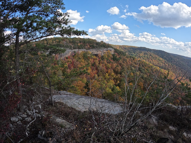
    We enjoyed a pretty ride out to the Wow Overlook.  We had it to ourselves!
It was glorious.   It was way prettier than I remembered.   The views went on forever into the distance.  Rocky bluffs to the left. Autumn colors on into the distance.  

Below is a video of the ride to Wow Overlook and the overlook itself.


Below are some photos of the Wow Overlook
This one is the view straight ahead. The terrain appears to flow toward the overlook.  I'm not sure if it really does or if it is an optical illusion. Either way it is impressive!  
Below: looking over the northwest or right side of Wow Overlook

below: the rocky edge of Wow Overlook
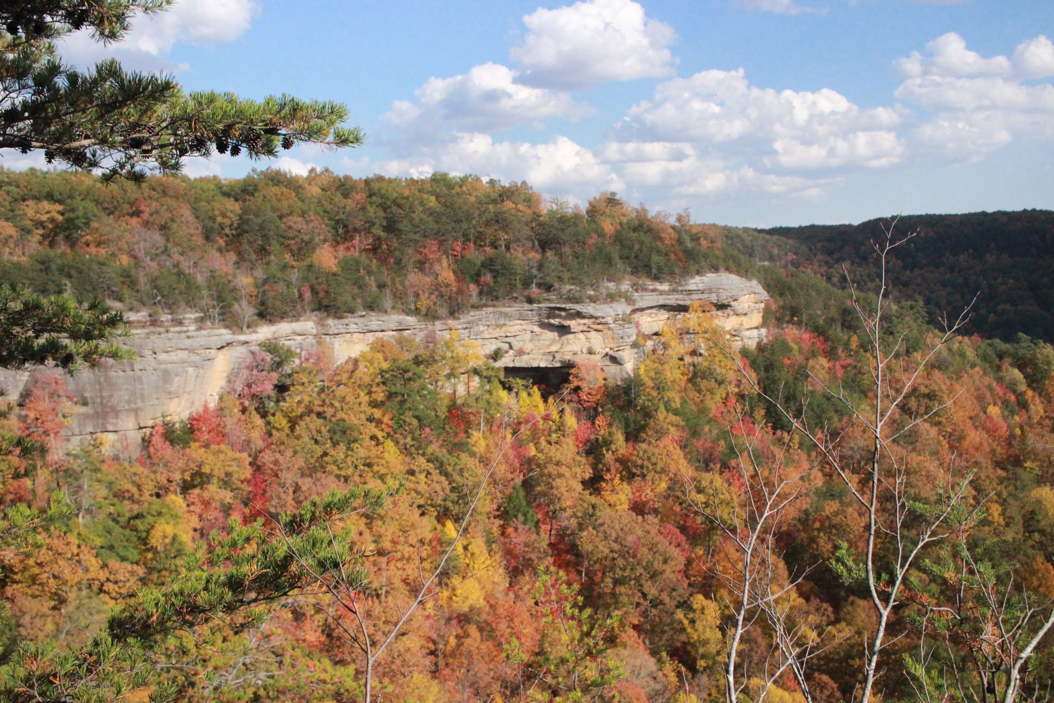
Below: looking left toward the bluffs from Wow Overlook. Bold Fall colors!  We thought perhaps PS Overlook was there looking back toward Wow.  

Below: the next three images were taken of the Wow Overlook by my Go Pro.   The first one immediately below has that fish eye look.  


  We reveled in the view at Wow.   It was truly grand stand!    We then loaded back up and headed to find "PS Overlook".     It was one of the more funny, exciting moments of the day.   We wound through the forest using Lifetime Maps.  I began to have this feeling that something was very wrong.  
We went down a big gully.  We met other riders that warned us it was a little rough. 
We crossed what must have been Williams Creek.   It was just a trickle today.    We turned right and trended downward.   It looked perilously close to the drop off of a bluff.   I refused to go further. 
Kenny got out and walked a short distance to scout it. He came back quickly with wide eyes and head shaking like "Nope. Nope."  I had been right.  This was NOT the way.  A quick glance at the Lifetime Maps and we were off the trail!
Below are a couple photos of the two times today we screwed up and got off trail.
The two blue lines heading out from the red loop are the mess ups!  


  We went back and course corrected getting back on track to head to PS Overlook which was included on Lifetime Maps.   We went to where it was supposed to be and checked in two or three spots along the bluffs.   We never did find it.    It was beautiful in the forest here!  But as far as getting to a rock outcrop or any spot with a vantage point ... no. It doesn't exist.  After we got home I found a video by Michael Davis and he mentions them trying to find it.  It is non existent.  I'm going back and take way points of the terrain at Wow.   I can then perhaps find a way to the opposing bluff. I will at least be able to determine if it is even possible.


     PS Overlook needs to come off Lifetime Maps. I believe someone put that sucker on there as a snipe hunt prank!     No matter. We had fun and no one got hurt.   The woods there at that spot in Autumn are worth seeing unto themselves.

above: looking down this path was deceptive. Right around the corner it drops off sharply.  
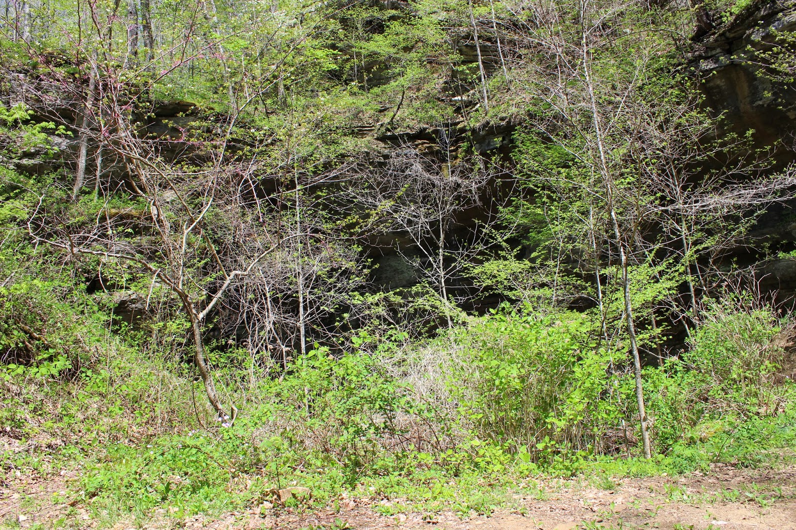
Below:  the forest was open at the so called PS Overlook


Above: we are the purple line with the pin. PS Overlook is at the blue line
Below: my favorite scene from that spot... you can see the edge of the bluff line tantalizingly close, but there is no view and really no good way to reach it. 


  We were satisfied at our half day adventure so we headed back to the truck.    It was fun and reminded me not to be so quick to write off areas we have worn out in the past.   Go back and see them again with fresh eyes later! 

       Below is a video of the search for PS Overlook.  It better shows what that experience was like.


Monday, May 12, 2014

Jamestown Camping Trip--Day 2--Pickett State Forest and Kentucky Four-wheeling

White form of birds foot violet @ Pickett State Forest, TN


Jamestown Camping Trip Part 2
Pickett State Forest & Kentucky Four-Wheeling

Dana & Kenny Koogler
Sat. April 26, 2014


Pictures are here: Pickett SF Pix


    We woke up Saturday morning and opted to make breakfast simple so we could get on the
trail.  We just had cereal and coffee and juice.    We gathered our belongings and set off for the day.
We had a couple things we wanted to scope out on the way to Pickett State Forest to ride.
We had been hiking back in the Fall to the new state natural area.  Pogue Creek.  We reached it from
an access we found on the west side.  I wanted to find an access from the east side as it would be much closer to where we'd be today.    The landforms we hoped to see were more on the eastern side.
We also wanted to find access to two waterfalls on the Tennessee landforms database which lacked
 photos.   I had a feeling we'd been looking too far north for the road to reach these.


       We headed up the road and I realized we were passing through an area called Sharps Station.
I called haw and Kenny turned us around.  I put in the waypoints for those falls since they'd be the closest thing to us.  Sharps Branch Falls and Stewart Creek Falls lay to our west.
 We found an access alright but it is restricted owing to the fact it is a gated community.
We also found Basin Road which we'd been looking for too far north.  We tried an assortment of ways to reach the falls. No luck.  All had to cross private property.  We set that aside for now and continued on checking for an eastern access to Pogue Creek.   Long story short that did not pan out either after multiple variations on the attempt.  Private property. Locked gates.    The lay of the land at another place Kenny wanted to try was not going to work and I knew it.  A cliff lay between our
position and the land forms with no way off.     However... It appears the DCNR is working on a parking area in the vicinity so that may be coming. I will share whatever I learn.

             We had plenty to do today.  Kenny had been hankering to ride at Pickett and practice navigating the trails here.   I had been busting to get back to see a huge arch in Wayne County, Kentucky.  I had been there before but I wanted to go back and go in the cave.     We unloaded on
Blackhouse Mountain Road.  The forest here was looking more like the month of March!
It was still not leafing out like back home.  Birdfoot violets lined the road in great patches.


Top--Sandy trail winding through Pickett State Forest, TN
Bottom-- Masses of birdfoot violets along the road.


   We crossed over the top of Carpenter Rock House and swung on past it and down to go check it out. Just past that is the pretty arch pictured below.  We talked to some very nice fellows there.  They were from Somerset, Kentucky.


Top-- Looking up at the sun shining through the trees along the bluff. 
Bottom--arch and sunshine.

     We departed from the first small arch at Pickett and continued north west toward Kentucky and the big arch.   It was further out there than I remembered, but it was a pretty ride and enjoyable.
Pickett is getting overused to the point the main trails are rutted, wallowed out and eroded.  They stand in mud and more mud and more mud ..... It is a stark comparison to Royal Blue who actually maintains their trails. They re-route and give an area a chance to rest and recover.  We began seeing
the trails have less people and consequently less wear as we got further out.  We managed to find the big arch.  It was so overgrown with trees and greenery this time of year it would be very easy to just
miss it!  The waterfall flowed from the top falling down the far side of it.  


 Top--The arch is here, but hidden!
Bottom-- the un-named wet weather falls flows from the top.

     We stopped to go check out the big arch.  We had come prepared with more lights to go in the cave this time.  Kenny went ahead of me and was already down in the pit under the arch while I was still fiddling with camera equipment.  I stopped at the lip of the pit to look around.  The waterfall in the cave was roaring. I looked ahead of me at the small path leading into the pit and saw something strange.  I had to do a double take.  I saw a ball of light.  It looked like a rainbow that was ball shaped.  Kenny was already down there and I shouted to him over the noise to look at it. I felt like
I was seeing things.  It could not be real. I felt that as soon as I moved closer it would vanish.  He called back to me that he saw it too!  I snapped a photo from where I stood to be sure I would not miss the chance.  Once I had that image captured I moved down the path closer to it. 
Ball of Rainbow in the pit!

  I was thrilled that instead of vanishing .. the closer I got the bigger and brighter the rainbow grew!
I got some better photos of it.  I finally was so far into the waterfall's splashing that I had to put the camera away to avoid ruining it.  I moved even closer and Kenny stood behind the falls. I could see a large double rainbow! He could not see it as he was behind it.  I just stood there and enjoyed it for a little bit.   Finally I got moving and went on down to the cave with him. 
Closest view of the rainbow I was able to get. 

        We crawled down in the cave.  The waterfall ahead of us roared. Kenny was behind me. I made a good start of it.  I entered the cave wading in an underground stream and was moving along pretty good.  Kenny went up to a passage that seemed to go to the top of the waterfall.  I was moving in tight quarters.  I had only an inch or two of clearance over my head.  Cave crickets clung to the cave walls.  I knew in my mind they were harmless and would not bother me.  I was overcome by the noise and claustrophobia. I went back out.  Kenny came down to join me.  He tried to help me focus and calm down.  I went forward again trying to remain calm.  I got within inches of the waterfall.
I felt consumed by panic. I had to get out! Kenny went ahead to see the falls.  He cried out with an expression of disappointment.  It was only about four feet high.  He laughed and said that I hadn't missed much. I went on out.  This place is something to see!


Top- Inside the cave. Odd looking rock and underground stream
Bottom-- view looking out of the cave. where I wanted to go!


 I backed up under the arch to get this view of the entire falls.  It is quite large and beautiful.

  I spent some time exploring the cave. Kenny went in the lower entrance. He finally came back out and said that the stream went through the whole cave.  He also said that it appeared while at one time you could go in one entrance and come out the other.. that the passage had collapsed making it possible only for water and light to go through.  At this point it is too tight for a man to make it past.
We went down the hill and I explored the stream area.  It was a nice setting. There are no major falls upstream that I saw, but a few pretty cascades. 

   We decided to head back toward the main trails section and check out some overlooks.
We stopped by one I had never been to before.  I felt an odd dragging sensation and looked down. Here is what I saw:
My eight year old worn out hiking boots. Kenny repaired them with shoe goo. Wading the stream in them caused them to just totally blow out. Here is what we did to help them hang on for one more day. I had a back up pair of boots back at the truck.
Black electrical tape! It kept them together until I was back at the truck!

Here is the view from that overlook. It was quite scenic.


  Next we ended up at the top of Car Hauler!  Kenny had gotten mixed up and we came out at the top of it instead of the base.  It was the only time all day the navigation got the best of us.   It was no big deal. Car Hauler is not something we do unless we're in a group.  It is a good place to get hurt and be a long way from help.   I realized for the first time today that a wet weather falls goes down beside the car hauler! 


Car Hauler


Wet weather stream falling beside Car Hauler


    We stopped and had lunch.   We soaked up the warm sunshine and pretty skies.
Here are a couple shots from the overlooks:


Top--Wagon Gap Overlook
Bottom--Yellow Doors Overlook


   We went just cruising around and went down to the blue lake for awhile.  Kenny had a notion we might be able to find an access for Pogue Creek out that way. I did not agree, but was game to explore.   It turned out I was sadly correct. The trail does go off the bluff and in the right general direction, but it does not provide access. It just goes out to a point of land with that lake still above the valley floor.   So  much for that idea.  

    
Pretty blue-green lake.  

    We headed back to the truck having ridden about 30 miles.  We were relaxed and happy.
Some things we planned did not work out. Some worked out just fine.  I was feeling good about life and having a fine time.  I sat down on the trailer and tried to get those wet, ruined boots off.
I laughed every time I looked at them.  I wondered if I'd have to be cut out of them as I'd been taped in?  I did not. I was able to get them off my feet. 

     We headed back to the camper to enjoy a nice dinner and some time to do nothing.
We had steaks marinated in Jack Daniels marinade on the grill. We had baked potatoes.
We had corn on the cob and veggies.   It was good stuff.   We watched tv and just relaxed.
It was a good day.

Here is a video of Wagon Gap Overlook


Wednesday, October 17, 2012

Fentress County Camping Trip--Blackhouse Mountain

Fentress County Camping Trip


Dana & Kenny Koogler 
Thu. Oct. 4-Sunday Oct. 7th, 2012


      We had planned to run away from home to the Cumberland Plateau for a weekend to ourselves.   We camped at Maple Hill Campground which is convenient to all we like to do in the area.   Once we arrived and got settled we headed out to explore.   

        We hiked down into Buffalo Cove and enjoyed the scenery.  We found one of the caves and I believe it is Stephens Cave.  We found another one I don't know the name of. We went in the one cave, but not the other.  The weather was perfect and we soaked up the sunshine and blue skies and breezes.     The goldenrod waved in the wind down in the cove and the smallest bit of Autumn color was starting to appear on the mountains.   

       We then went to Sharon & Johns to park the truck.  We wanted to ride the River Trail today.   I stood looking forlornly at the picnic table through the gate at Sharon's.  The place just isn't the same without the gang.   We then headed down the road on the Rhino in the afternoon sun.   A nice day for a ride.   We were soon met with the river trail's cobblestone surface and something we had not counted on.  WATER! Lots of water.  The trail was flooded. Higher water levels than last Autumn.  The water was clean out in the trail from the river.   Portions of the trail were several feet under water.   We figured we might make it to the first ford and across.  We did with me laughing like wild hyena. Wheezing and giggling all the while.   The water was swift enough it was pushing us down stream as we tried to ford.     We made it and instead of going along the river trail where we'd be encountering one ford after another we headed UP the bluff.  

       The trails were pretty up there, but we had no idea where we were going and the wind storms in the past months had us encountering many downed trees.   Some were able to be cut out of the way and some we worked a way around them.   We passed a huge cave up there that was fenced to prevent folks from falling into it.  It was a pit type cave at the base of a bluff and truly scary to me.   We rode through hemlock hollers and glens with streams pouring down and massive boulders.  I could tell we were on the hip of the mountain and no views would be possible from here.   Unless you can reach the bluff line you're just down in there to ride and not look or see much.  We had a nice ride, but no destination and limited time.  We had to turn around and head back to make it across that deep river before it got dark.   Going back across went better than we'd expected and the whole thing turned out to be a fun little adventure.  


Buffalo Cove
Below is a short, funny video of fording the deep river!


      We headed back to the camper very tired to eat dinner, rest and get ready for a full day of riding the next morning.   We had planned on riding the entire river trail the next day which was no longer an option due to the water levels.   We decided instead to go ride Blackhouse Mountain and Pickett instead.

   The following day we got an early start and headed up to Blackhouse Mountain to ride.
We'd never been here without our merry band of much more experienced friends who knew their way around.   Finding our way around today would be something of a challenge even with the GPS and all Dan's trails entered.   The day was cool and sunny and perfect for riding.  We'd had enough recent rain to keep the dust down.  The Autumn colors were really coming out in this area.  We were a little further north and at a higher elevation.  For a beautiful Autumn day we saw very few others parked to ride today.


Blackhouse Mountain Road, TN


     We found the first overlook which I think is called Wagon Gap Overlook.
It was beautiful.  Just rocky cliffs and forest in view for miles.  We watched a hawk soaring and screaming there.  We tried to find the mineral lake which resulted in a spell of very pretty, but aimless wandering.  We could see it on the GPS, but every trail we tried to descend to it was just ambling up and down instead of heading DOWN closer to it.
We encountered another couple in a RZR.  Kenny pulled over to ask them if they knew how to get to the lake?  They did and as we sat and gabbed they got to asking if we'd see Granny's Crack, this arch, that arch to which we replied NO!  They were Shannon & Ronnie Privet and very graciously offered to show us these special places.  What luck!
We went with them and had a grand time.   They are really nice and so much fun.

      We found the mineral lake with their help and it was just as pretty as the first time we saw it.  

Mineral Lake at Blackhouse Mtn.

     We followed them onward to another rock house and an arch which do not have names that I'm aware of.   The really sad part is that when we were here before we drove OVER THE TOP of the rock house and did not realize it was down there! 


Kenny, Buck and friends at overlook
Above photo substituted for lost one. Kenny, Buck and friends at an overlook

We continued on to Granny's Crack which was where they'd planned to cook lunch.
We stopped and rested. Ate lunch. Socialized. It was very relaxing and such a cool place!
The smoke from the fire puffed out through a crack in the top of the arch! It was really neat. 


Granny's Crack is another arch that is a combination rock house/arch/cave they showed us! Shannon & Ronnie built a fire and cooked hotdogs for lunch!

   We continued on after lunch and the trails were all kinds of muddy fun!  We were laughing and carrying on.  Ronnie went through one mud hole that I was just sure they'd get stuck in.  No getting stuck, but sopped with mud!  Poor Shannon really got the worst of it.  She'd tried to tell him she remembered that mud hole was just too deep and to go round it.  Too late!  The floor boards filled up with about six inches of murky, muddy water. So thick it clogged the drain holes!  They finally got the RZR drained and continued. She stopped later to rinse her feet and shoes off in a creek with clear water.


Shannon & Ronnie in the RZR ahead of us.

     We followed them onward through the prettiest hemlock forest that now had changed from bright golden Autumn to deepest green gloom.   It was beautiful.  We rounded a bend and there to one side was one of the biggest arches I've ever seen.  It was jaw dropping beautiful. It has no name we were aware of.  It is massive and very interesting in its formation.   It has a cave beneath it which we crawled into.  Ronnie says that sometimes it has a waterfall flowing down the sides of the cliff.  


We were intrigued and after a little picture taking climbed down into the pit. The next thing I knew I was entering a really fascinating cave. It had three passages near its start.  We could hear an underground stream just out of sight. I kept going and going, but I could not see the underground waterfall. It was just out of sight and I had a poor light with me.
I was determined to become a caver. I was determined to return and see this place again and explore it properly.   Rope. Lights. Helmet. Boots. Cave Woman Gear!

Just thinking about it drives me mad! I guess I've felt myself inching closer to this decision, but there have been others who were watching quietly and knew it was coming.  I was going over to what Alfred & Kristen call The Dark Side. My natural curiosity and thrill seeking have lead me to this.

Waterfall arch cave that Shannon and Ronnie showed us.


Inside the cave looking out. Very cool!

 We continued on completing a loop back to the big intersection on the trail system.
We were able to take Shannon & Ronnie to show them an overlook they'd not visited.
Storybook Cliffs.  The sun was sinking low and the air was cooling off.   We were running out of light, but no matter.  We took in the view and when we left we enjoyed a night ride!
It was great! I got to see all kinds of bats in the head lights swooping around. Some small. Some big!  I might as well get used to bats. I've got a feeling I'll be seeing more of them in the future.  Here's to great new friends who are a blessing and a joy!  I look forward to more fun with y'all.  Thanks for a lovely day and lots of laughs.  It was perfection!


Storybook Cliffs in the gloaming.