
 Above: rusty metal tie down for the spike plates

Elk Gap Tunnel
Sunday February 4, 2024
Dana & Kenny Koogler
Photos are Here Royal Blue Waterfalls & Elk Gap Tunnel
I have mentioned on my updates page that my knees will need replacing. I did not mention that I have been super sick the past week. I was in bed a lot with shortness of breath. Kenny had to work Saturday. I had Friday and Saturday to finish getting well. Sunday we needed to get out and do something fun. Just the two of us. The weather turned out to be really nice. It was chilly, but the sun was out. The skies were blue. Waterfalls are gushing now. Our plan was to visit a couple waterfalls in Campbell County. We'd then go on to Elk Gap Tunnel. It is situated near a church so we'd have to wait until services were over.
We stopped by Royal Blue to park and unload. We'd hit these few falls we hadn't visited in awhile. We were there in Summer with friends, but the waterfalls were just damp rocks.
We parked at Eagle Rock Campground. It is huge and so nice! I hardly recognized the place it has changed so much.
Flatwoods Falls

Below photo is a little closer view of Big Foot.


We used the RZR today to get the distances down to where I could handle them. I hiked 4 miles a month or so back. It was excruciating, but today with cutting that distance in half I was alright. We parked at Eagle Rock Campground and headed out from there. Flatwoods Falls is not far away. It is the second right turn off Flatwoods Road head northeast.
We pulled up at the trail to the waterfall. Kenny had to investigate which way we'd go down.
He fussed over me like a mother hen. The terrain was steep and slippery, but by taking my time I was ok. I picked my path and was comfortable. There used to be a set of wooden steps descending to the base of Flatwoods Falls. They were very slick in wet or icy weather. They eventually rotted. I took photos of what was left of them.


Above: This photo does little to illustrate the steep, slippery terrain to the base of the falls. You're pretty close to the edge going down that slope.
Below is a little bit of the step ruins. The remainder of them is a pile of poles and rotten lumber down near that clump of trees.

Above: A little of what remains of the steps.

Above: Flatwoods Falls from the base-- Canon Camera. Manual setting.
Below is a shot of the upper portion of the falls.

Below is a video of the beautiful Flatwoods Falls including the upper drop.
We enjoyed checking out the falls with some nice flow on them. We did not stick around too long. I began my careful trudge back up. I have become a huge fan of uphill. It is much easier on the knees!
We headed on down Ollis Creek Trail in the direction of Thirteen Hollow Falls.
We hoped to see that and add to it Patricia Falls which is in the next drainage over. I wasn't at all sure if we'd find Patricia Falls. I had the way points, but knew it was going to be a short bushwhack. We'd have to see about that.
On our way along Ollis Creek Trail we noticed a couple things. It is a nice trail, but it was very muddy and eroded. Its condition made worse by very recent logging above the trail. The trail is far enough above the old Lafollette Reservoir that the silt and mud don't end up in the water enough to change the pretty green color. It does end up in Ollis Creek at other points along the way. Yellow Branch Falls was more churned up and muddy than usual. The trail looks horrendous in the vicinity of the logging. I hope I am wrong, but I doubt they'll do anything to clean up behind themselves. I would love to see the TWRA plant some trees back to grow in place of what was cut.
Another thing is that we could tell where parts of the trail have been raised above the former track. It moves it out of the damaged areas to give those a chance to rest. One cool thing we saw on that part of the ride was a huge bull elk! He was alone and looked pretty healthy to me. He was still sporting a full rack of antlers! He looked to be an eight to ten pointer. Kenny remarked this was the furthest out we'd ever spotted one in Campbell County. I would agree.
We have had some very cool wildlife encounters at Royal Blue. We see lots of elk. We see turkeys, deer, hawks, herons, and one day we had a bobcat sighting. He was not scared of us one bit and sat in the woods near us just relaxing until he walked calmly away. The prettiest thing we've seen was a large black wolf with golden eyes! It pays to visit different places and keep a sharp look out.
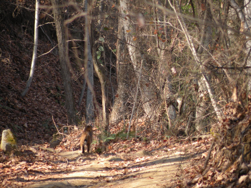
Below is a very grainy cell phone picture of a bull elk. It is in there, but you have to look closely. Center of the image.

Below is an image taken by me on another trip that most closely resembles the bull elk we saw today minus the trees. This was also taken at Royal Blue, but up near the tower.


Thirteen Hollow Falls
We didn't take long to reach the left turn off Ollis Creek Trail for Thirteen Hollow. I had the waypoints for Patricia Falls with us. I had studied the map and shown it to Kenny. Thirteen Hollow is on one side of a V shaped confluence of Laurel Creek. Patricia Falls is a scenic fifteen foot drop adjacent to it on the other side of the V. It was found and documented by none other than Daniel Jack Hutchison! A nice little find. Neither of these falls would be worth a special trip on their own, but while in the area, both are worth a look when we've had ample rain.
Kenny pulled past the point where we usually parked and climbed down the embankment to reach Thirteen Hollow Falls. I asked him why? He said he just had a feeling we needed to suss it out a bit further. He pointed out all the times we've made things harder than they had to be. I couldn't argue with that. He jumped out of the machine and took off walking. Meanwhile I plugged in the coordinates for the falls and let the GPS be getting oriented. I no more than had it acquire the satellites when he popped back up and said "Let's go this way!". He had indeed found a FAR simpler way to reach the falls! I went ahead and changed the GPS over to looking for Patricia Falls so we could do that next. I looked around and we were walking along an old road bed! We left it and walked gradually down the bank toward the falls. In no time we were there at the base! He was right. We had indeed been making the approach to this waterfall far harder than it need be! Well done!
Directions to Thirteen Hollow Falls :
Click the link at the top of the paragraph in this trip report. It will open to the TN landforms page about the falls and give you maps and the waypoints for it. It also shows up on lifetime maps but only says something like RB Waterfall.
Follow Ollis Creek Trail out from Flatwoods Rd heading east.
You will come to a trail sign for Thirteen Hollow. Turn LEFT onto this trail and drive
less than 1/2 mile to where the trail fords Laurel Creek. On your RIGHT is a pull off.
Park here. There is a sign indicating foot travel only beyond this point. You will find yourself on on old logging road that parallels Laurel Creek briefly. Don't follow the road more than 75 feet, but continue along it listening for the sound of the falls. You are parked within sight of the brink of them. Leave the old road and walk gradually down the slope. The woods are pretty open here in any season. Follow the terrain down and you will be able to scramble down the bank to the base of the falls within sight of them.

Above: This is the ford of Laurel Creek on Thirteen Hollow Trail. The falls is 200 feet from this to the left.
Below: Thirteen Hollow Trail from the point where we parked looking toward its far end. We continued in that direction to make a loop and avoid backtracking the very muddy, rutted Ollis Creek Trail.
 |
| 13 Hollow Trail above |
Below: 13 Hollow Falls is 26 feet high

Patricia Falls
Next we climbed back up the bank to the old road and decided to try to find and view Patricia Falls which is on the next drainage over. The old road headed in that direction. We were pleasantly surprised to find it was very open and in good condition. The going was easy. It was level and took us right to the falls. The problem then became getting to the base. It is a fifteen foot falls with two drops. One is about six feet and the other nine feet high. We studied the possibility of going up past it, fording the stream and descending to the base on the opposite side. That turned out to be an even worse task. The stream is an easy rock hop, but the terrain on the far side goes from gently sloping to cliffing out. The climb down from the old road on the near side has a ten foot drop requiring rope. We did not bring any. Kenny was already very stressed out as to the chance of me harming myself. He did not want me to do further damage to my knees. I could see the falls from here and quite honestly it wasn't worth the effort today to climb down to see it up close. He got a couple photos from the brink and a short snippet of video. If you click the link above this paragraph it takes you to the TN landforms info page on it. You can easily figure from my description how to FIND It. Getting down there will be up to you. We will return to reach the base once my knee surgery is healed, and we've had ample rain. It is worth seeing based upon Daniel Jack Hutchison's photo of it. I would add it together with a future trip to visit several falls in one day. It is only about 0.10 mile walk on the old road from Thirteen Hollow Falls to where you can see Patricia Falls down over the bank.
Future trip to reach the base I would go to Thirteen Hollow and work my way downstream and then back upstream to where I could see both drops.

Below are two shots of the old road we walked to reach it from 13 Hollow Falls
 The photo above is looking back in the direction of 13 Hollow

Below the image is where the road continues past Patricia Falls. Easy traveling.


Below is a short clip of Patricia Falls taken by Kenny.
We walked back to the RZR and ate lunch standing around. It was a quick bite and then we were on our way. We headed out the remainder of the short 13 Hollow trail. We passed some pretty old tailing ponds from the mining days. The water was jade green. We did not see any water birds or raptors today. These old ponds are surprisingly clean and sometimes have fish in them. They are clean enough for birds to find prey and build nests.


Above: looking out the windshield of the RZR at the muddy trail.
Below is a short snippet of the ride
It didn't take us long to get back to the truck. We wanted to load up and head to see Elk Gap Tunnel. The morning worship service was over, but they have evening service at six p.m. so we had to try to time our visit between the two. Pioneer is only ten minutes further away so it wasn't a problem to work that out.
Note to self: Eagle Rock Campground is very nice looking. They have full hook ups for RV camping. They also have cabin rentals in different sizes. Two tiny homes. Two large cabins. Three very small "two butt" cabins. It is good to know because sometimes we want to stay, but don't want to de-Winterize our Fifth Wheel camper for only a night or two. It would be fun to come here in Spring with the camper. Royal Blue is actually a great Spring wildflower destination. My Spring wildflower season is looking highly suspect. I HAVE plans, but they will likely need to be modified based upon my surgery and mobility.
Elk Gap Tunnel
We arrived in Pioneer at 2:30 p.m. We parked and climbed down the bank
and across a shallow stream. The abandoned railroad tracks are just across the stream. We walked 0.30 miles up the tracks to where we found the tunnel's south portal. Along the way we passed a couple old chimneys. The slopes around us to the east were covered in kudzu vines now dead and gray from the Winter. We noticed a board laid across the small stream like a bridge.
We came to one point where water had seriously ponded up along the left of the tracks.
A short distance further and a stream flowed down out of the hills and split into two directions. Part of its flow went toward the mouth of the tunnel and through it. The other part flowed opposite and into a pair of culverts and under the tracks.
Before we got to the point where the stream split its flow we could see the mouth of the tunnel.
Vines now dead and brown hung from the top of it like drapes. Elk Gap Tunnel is not part of the old Rat Hole Line. It is something separate. It was the old Kentucky & Ohio or K & O Railroad. I have a link here you can click to read a fascinating article from the historic archives of Campbell County. It is about taking the train from Knoxville to Jellico on this railroad.
The article specifically mentions the Elk Gap Tunnel. It says it is 1,799 feet long and is the highest point between Knoxville and the state line with Kentucky. It mentions it having a curve to the tunnel and tracks. This I agree with, but the measure of 1,799 may be accurate, but I dispute that. I measured it at 1854 feet or slightly longer. Interesting things we saw along the tracks included a switch to a side track that is only partially disabled. We saw massive rusty bolts and nuts, railroad spikes, tie down clips. Equipment for maintaining and building the tracks. Sections of the disabled switch lay there having been removed, but not discarded.
The marker for the switch stands like a sentry there after all these years of being idle.
It was apparent walking through the tunnel that the flow of the stream gets significant enough to wash mats of debris and chunks of logs into the tunnel!


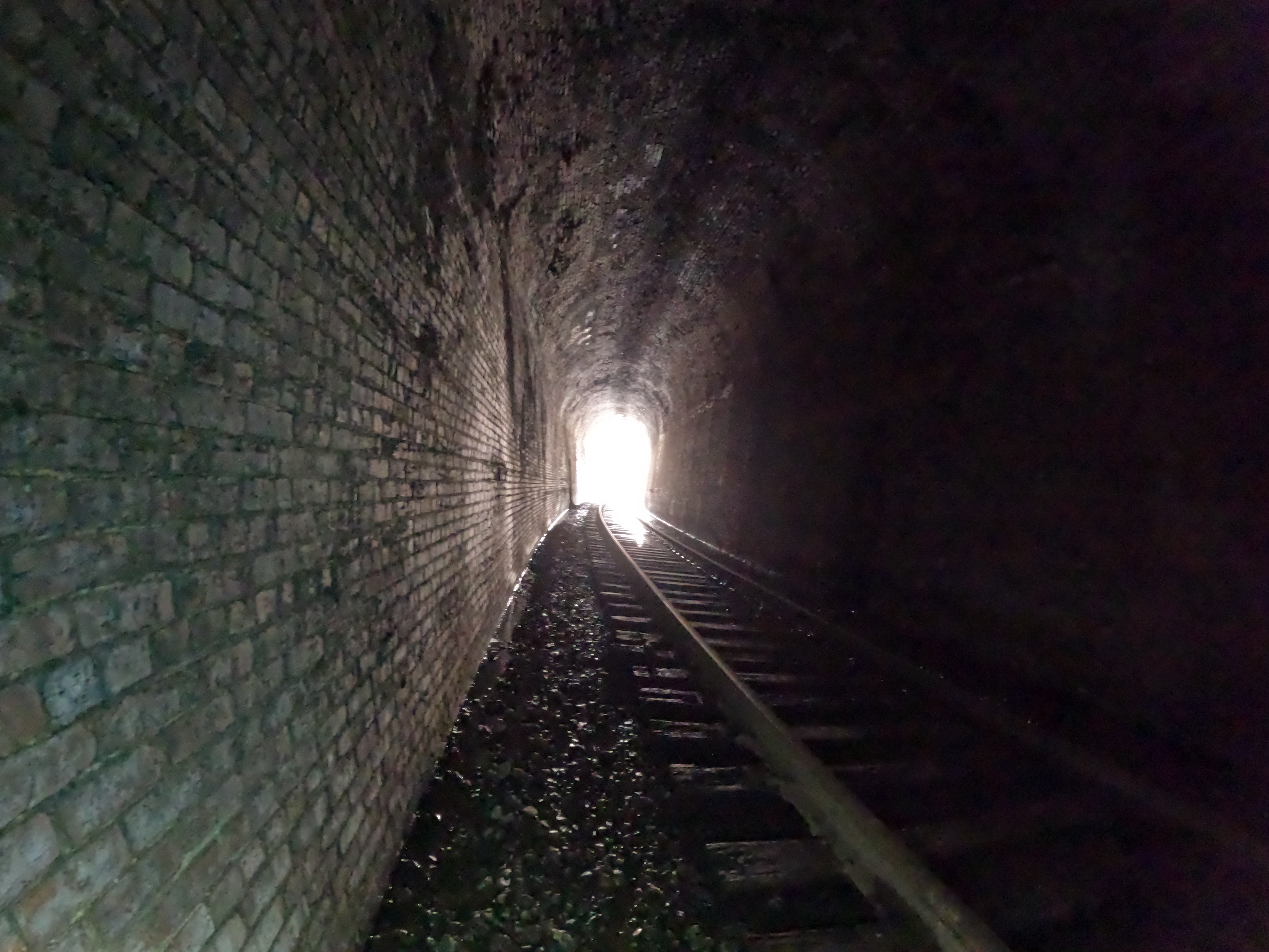
Below: an image of when we could see light at the end and you could notice the curve in the tunnel. You can glimpse Kenny far ahead of my slow ass with his flashlight and annoyingly healthy knees! You can see the left of the image that there is a stream flowing inside.

 Above: entering the south portal of Elk Gap Tunnel. It is all bricked.
 Above: The tracks approaching Elk Gap Tunnel. to the left is the stream flowing out of the holler and splitting in two directions. It is shown in the video and illustrates it better.
 Above: the switch to the side track


Above: We have approached the side track. You can see the tunnel mouth in the distance. Hwy 297 is to the right. The tunnel passes beneath it.
We hiked on through the tunnel. It was shorter than Indian Gap Tunnel and not quite as wet and squishy. It was still wet, but more slippery! We counted nine cut outs in the side walls. Seven on the west and two on the east side. I learned those are called "refuges" and are put there as a place for railroad workers to step safely aside while doing track maintenance if a train approaches. Railroad spikes were driven into the western wall at intervals. I'm not sure why. Perhaps a way of measuring distance and spacing the refuges out?
Kenny mentioned on the return hike that this tunnel was further underground than Indian Gap had been. I didn't much like thinking on that and asked him to be quiet about it.
That was a real "Yikes!" moment. We made it safely through and back without any trouble.
It was quite satisfying to finally have seen it. It was worth the effort. I will say that I think I'm one and done with this tunnel.
We made our way back to the truck. I was pleased to have been able to get out and walk today. It wasn't pain free, but easier than hiking four miles. Half that distance today didn't cause me any trouble. It had to be good for my lungs to help clear and heal them to get some fresh air and move around.
Back at the truck we headed for home and I dutifully iced my knees while sipping hot coffee with two fat cats piled up on me. It was a great day!
Below is a video of our hike through the tunnel. It is shorter than the video of Indian Gap Tunnel. I edited it pretty heavily. I only videotaped through and the North portal. Not the return trip. Nothing new to see on the trip back.
Thanks Butch for the info on the tunnel. Far as I can see my video of the Elk Gap Tunnel is the only one out there on YouTube.


