Kenny and I were born and raised in Virginia. We lived there until twenty-four years ago.
We were accustomed to snow and plenty of it. Bitterly cold temperatures, snow and ice that lay on the ground most years until you had Mud Season in March. East Tennessee and the foothills of the Great Smoky Mountains has much less predictable weather. We have had Februarys that were False Spring and 70 degrees. We have had sub zero Winters. One thing we have far less of is snow. Especially not significant amounts of it. Most of the time you get a few inches and by 3 pm that same day it is melting or gone. We finally got 8 to 10 inches of snow and the just right temperatures to have it stick around a couple days. We went to Ace Hardware in Townsend and purchased four tobaggan sleds. We brought our sliding saucers we've had since Jared & Crystal were little. We went over to the farm in Townsend to go sledding as the Whole Fam Damily!
above and below: Out front of Ace Hardware in Townsend. They had the best deal on sleds!!
Kenny finally broke out his solo stove I bought him two Christmases back. He built a fire at the top of the hill. We parked at the bottom. The snow was dry and powdery which is very unusual for our area.
Below: The first morning of snow from our front lawn. Our house looks cozy.
The first day we just mainly went up and down the hill on foot. A few trips were made up and down with Jason's side by side, but we all got plenty of exercise. The farm is extremely hilly and a great place for sledding. The only obstacle was Papa's Quonset Hut at the base of the hill.
We managed to avoid hitting it the entire time! Michael managed to pull off the most crazy and daring ride of the day by going down the front yard, crossing the road, and ending up in the pond not once, but twice!
I wore it out. I think Adam and I made more trips up and down that hill than anyone else.
I had the most crazy wreck of the day. Tessa wanted someone to go down the hill with her on the sliding saucers. No takers, so Nanny said okay. I'll go. We went down together, but somewhere along the ride I spun out and headed to the left minus my hat and my saucer. I rolled bodily across the snow six or seven times. You could see the imprint the next day where I carved my own path. It was hilarious. I had snow caked in my hair. I stood by the fire at the hilltop warming up and felt a chunk of snow slide down my back and the crack of my behind! Now THAT's what I call a wreck!
Below: Olivia and Crystal in the distance. The solo stove is fired up.
Below: First day of sledding.
Below: my glove finger in the corner of the frame... sorry. Quonset hut and up way in the distance Grandmother's house. That is the hill we came down.
Below: just looking at the tree line during the snow storm. Day 1
Below: Day 2 of sledding. It had stopped snowing and was clear and cold. You can see the mountains in the distance.
Below: Looking out over Townsend. Grandmother's house in the right corner.
Below: Day 2 Michael Rowan and Brooke. Our RZR. We brought it day 2. By now I was sporting a bite shaped bruise on my right wrist, my back was bruised and my left hip.
Below: Day 2... Brooke and Emma and Mia and Papaw Kenny
Below: Crystal Mia Tessa and Gabe and Papaw Kenny
The first day we went sledding until it got to be supper time. We went into Grandmothers after we dried off and shed our boots and coats. We had taco soup and was it ever good! It was great to see one another and fellowship.
I have mentioned on my updates page that my knees will need replacing. I did not mention that I have been super sick the past week. I was in bed a lot with shortness of breath. Kenny had to work Saturday. I had Friday and Saturday to finish getting well. Sunday we needed to get out and do something fun. Just the two of us. The weather turned out to be really nice. It was chilly, but the sun was out. The skies were blue. Waterfalls are gushing now. Our plan was to visit a couple waterfalls in Campbell County. We'd then go on to Elk Gap Tunnel. It is situated near a church so we'd have to wait until services were over.
We stopped by Royal Blue to park and unload. We'd hit these few falls we hadn't visited in awhile. We were there in Summer with friends, but the waterfalls were just damp rocks.
We parked at Eagle Rock Campground. It is huge and so nice! I hardly recognized the place it has changed so much.
Above and below: Eagle Rock Campground and Big Foot. Top photo shows our machine.
Below photo is a little closer view of Big Foot.
We used the RZR today to get the distances down to where I could handle them. I hiked 4 miles a month or so back. It was excruciating, but today with cutting that distance in half I was alright. We parked at Eagle Rock Campground and headed out from there. Flatwoods Falls is not far away. It is the second right turn off Flatwoods Road head northeast.
We pulled up at the trail to the waterfall. Kenny had to investigate which way we'd go down.
He fussed over me like a mother hen. The terrain was steep and slippery, but by taking my time I was ok. I picked my path and was comfortable. There used to be a set of wooden steps descending to the base of Flatwoods Falls. They were very slick in wet or icy weather. They eventually rotted. I took photos of what was left of them.
Above: The Flatwoods Falls from the base with the Go Pro
Above: This photo does little to illustrate the steep, slippery terrain to the base of the falls. You're pretty close to the edge going down that slope.
Below is a little bit of the step ruins. The remainder of them is a pile of poles and rotten lumber down near that clump of trees.
Above: A little of what remains of the steps.
Above: Flatwoods Falls from the base-- Canon Camera. Manual setting.
Below is a shot of the upper portion of the falls.
Below is a video of the beautiful Flatwoods Falls including the upper drop.
We enjoyed checking out the falls with some nice flow on them. We did not stick around too long. I began my careful trudge back up. I have become a huge fan of uphill. It is much easier on the knees!
We headed on down Ollis Creek Trail in the direction of Thirteen Hollow Falls.
We hoped to see that and add to it Patricia Falls which is in the next drainage over. I wasn't at all sure if we'd find Patricia Falls. I had the way points, but knew it was going to be a short bushwhack. We'd have to see about that.
On our way along Ollis Creek Trail we noticed a couple things. It is a nice trail, but it was very muddy and eroded. Its condition made worse by very recent logging above the trail. The trail is far enough above the old Lafollette Reservoir that the silt and mud don't end up in the water enough to change the pretty green color. It does end up in Ollis Creek at other points along the way. Yellow Branch Falls was more churned up and muddy than usual. The trail looks horrendous in the vicinity of the logging. I hope I am wrong, but I doubt they'll do anything to clean up behind themselves. I would love to see the TWRA plant some trees back to grow in place of what was cut.
Another thing is that we could tell where parts of the trail have been raised above the former track. It moves it out of the damaged areas to give those a chance to rest. One cool thing we saw on that part of the ride was a huge bull elk! He was alone and looked pretty healthy to me. He was still sporting a full rack of antlers! He looked to be an eight to ten pointer. Kenny remarked this was the furthest out we'd ever spotted one in Campbell County. I would agree.
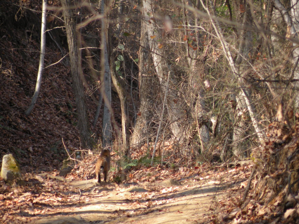
We have had some very cool wildlife encounters at Royal Blue. We see lots of elk. We see turkeys, deer, hawks, herons, and one day we had a bobcat sighting. He was not scared of us one bit and sat in the woods near us just relaxing until he walked calmly away. The prettiest thing we've seen was a large black wolf with golden eyes! It pays to visit different places and keep a sharp look out.
Below is a very grainy cell phone picture of a bull elk. It is in there, but you have to look closely. Center of the image.
Below is an image taken by me on another trip that most closely resembles the bull elk we saw today minus the trees. This was also taken at Royal Blue, but up near the tower.
Above: a photo of the bob cat we saw at Royal Blue. He's trotting away from me.
We didn't take long to reach the left turn off Ollis Creek Trail for Thirteen Hollow. I had the waypoints for Patricia Falls with us. I had studied the map and shown it to Kenny. Thirteen Hollow is on one side of a V shaped confluence of Laurel Creek. Patricia Falls is a scenic fifteen foot drop adjacent to it on the other side of the V. It was found and documented by none other than Daniel Jack Hutchison! A nice little find. Neither of these falls would be worth a special trip on their own, but while in the area, both are worth a look when we've had ample rain.
Kenny pulled past the point where we usually parked and climbed down the embankment to reach Thirteen Hollow Falls. I asked him why? He said he just had a feeling we needed to suss it out a bit further. He pointed out all the times we've made things harder than they had to be. I couldn't argue with that. He jumped out of the machine and took off walking. Meanwhile I plugged in the coordinates for the falls and let the GPS be getting oriented. I no more than had it acquire the satellites when he popped back up and said "Let's go this way!". He had indeed found a FAR simpler way to reach the falls! I went ahead and changed the GPS over to looking for Patricia Falls so we could do that next. I looked around and we were walking along an old road bed! We left it and walked gradually down the bank toward the falls. In no time we were there at the base! He was right. We had indeed been making the approach to this waterfall far harder than it need be! Well done!
Directions to Thirteen Hollow Falls :
Click the link at the top of the paragraph in this trip report. It will open to the TN landforms page about the falls and give you maps and the waypoints for it. It also shows up on lifetime maps but only says something like RB Waterfall.
Follow Ollis Creek Trail out from Flatwoods Rd heading east.
You will come to a trail sign for Thirteen Hollow. Turn LEFT onto this trail and drive
less than 1/2 mile to where the trail fords Laurel Creek. On your RIGHT is a pull off.
Park here. There is a sign indicating foot travel only beyond this point. You will find yourself on on old logging road that parallels Laurel Creek briefly. Don't follow the road more than 75 feet, but continue along it listening for the sound of the falls. You are parked within sight of the brink of them. Leave the old road and walk gradually down the slope. The woods are pretty open here in any season. Follow the terrain down and you will be able to scramble down the bank to the base of the falls within sight of them.
Above: This is the ford of Laurel Creek on Thirteen Hollow Trail. The falls is 200 feet from this to the left.
Below: Thirteen Hollow Trail from the point where we parked looking toward its far end. We continued in that direction to make a loop and avoid backtracking the very muddy, rutted Ollis Creek Trail.
13 Hollow Trail above
Below: 13 Hollow Falls is 26 feet high
Below is a video of Thirteen Hollow Falls. I began filming at the ford of the creek for two reasons. 1. It is a pretty spot and it was quiet and serene. 2. To give you an idea what the spot looks like in case you want to go see these falls on your ride. Definitely worth turning aside for when we've had adequate rain.
Next we climbed back up the bank to the old road and decided to try to find and view Patricia Falls which is on the next drainage over. The old road headed in that direction. We were pleasantly surprised to find it was very open and in good condition. The going was easy. It was level and took us right to the falls. The problem then became getting to the base. It is a fifteen foot falls with two drops. One is about six feet and the other nine feet high. We studied the possibility of going up past it, fording the stream and descending to the base on the opposite side. That turned out to be an even worse task. The stream is an easy rock hop, but the terrain on the far side goes from gently sloping to cliffing out. The climb down from the old road on the near side has a ten foot drop requiring rope. We did not bring any. Kenny was already very stressed out as to the chance of me harming myself. He did not want me to do further damage to my knees. I could see the falls from here and quite honestly it wasn't worth the effort today to climb down to see it up close. He got a couple photos from the brink and a short snippet of video. If you click the link above this paragraph it takes you to the TN landforms info page on it. You can easily figure from my description how to FIND It. Getting down there will be up to you. We will return to reach the base once my knee surgery is healed, and we've had ample rain. It is worth seeing based upon Daniel Jack Hutchison's photo of it. I would add it together with a future trip to visit several falls in one day. It is only about 0.10 mile walk on the old road from Thirteen Hollow Falls to where you can see Patricia Falls down over the bank.
Future trip to reach the base I would go to Thirteen Hollow and work my way downstream and then back upstream to where I could see both drops.
Above: a shot of Patricia Falls from the bluff above it.
Below are two shots of the old road we walked to reach it from 13 Hollow Falls
The photo above is looking back in the direction of 13 Hollow
Below the image is where the road continues past Patricia Falls. Easy traveling.
Below is a short clip of Patricia Falls taken by Kenny.
We walked back to the RZR and ate lunch standing around. It was a quick bite and then we were on our way. We headed out the remainder of the short 13 Hollow trail. We passed some pretty old tailing ponds from the mining days. The water was jade green. We did not see any water birds or raptors today. These old ponds are surprisingly clean and sometimes have fish in them. They are clean enough for birds to find prey and build nests.
Above and below: Tailing ponds at Royal Blue
Above: looking out the windshield of the RZR at the muddy trail.
It didn't take us long to get back to the truck. We wanted to load up and head to see Elk Gap Tunnel. The morning worship service was over, but they have evening service at six p.m. so we had to try to time our visit between the two. Pioneer is only ten minutes further away so it wasn't a problem to work that out.
Note to self: Eagle Rock Campground is very nice looking. They have full hook ups for RV camping. They also have cabin rentals in different sizes. Two tiny homes. Two large cabins. Three very small "two butt" cabins. It is good to know because sometimes we want to stay, but don't want to de-Winterize our Fifth Wheel camper for only a night or two. It would be fun to come here in Spring with the camper. Royal Blue is actually a great Spring wildflower destination. My Spring wildflower season is looking highly suspect. I HAVE plans, but they will likely need to be modified based upon my surgery and mobility.
Elk Gap Tunnel
We arrived in Pioneer at 2:30 p.m. We parked and climbed down the bank
and across a shallow stream. The abandoned railroad tracks are just across the stream. We walked 0.30 miles up the tracks to where we found the tunnel's south portal. Along the way we passed a couple old chimneys. The slopes around us to the east were covered in kudzu vines now dead and gray from the Winter. We noticed a board laid across the small stream like a bridge.
We came to one point where water had seriously ponded up along the left of the tracks.
A short distance further and a stream flowed down out of the hills and split into two directions. Part of its flow went toward the mouth of the tunnel and through it. The other part flowed opposite and into a pair of culverts and under the tracks.
Before we got to the point where the stream split its flow we could see the mouth of the tunnel.
Vines now dead and brown hung from the top of it like drapes. Elk Gap Tunnel is not part of the old Rat Hole Line. It is something separate. It was the old Kentucky & Ohio or K & O Railroad. I have a link here you can click to read a fascinating article from the historic archives of Campbell County. It is about taking the train from Knoxville to Jellico on this railroad.
The article specifically mentions the Elk Gap Tunnel. It says it is 1,799 feet long and is the highest point between Knoxville and the state line with Kentucky. It mentions it having a curve to the tunnel and tracks. This I agree with, but the measure of 1,799 may be accurate, but I dispute that. I measured it at 1854 feet or slightly longer. Interesting things we saw along the tracks included a switch to a side track that is only partially disabled. We saw massive rusty bolts and nuts, railroad spikes, tie down clips. Equipment for maintaining and building the tracks. Sections of the disabled switch lay there having been removed, but not discarded.
The marker for the switch stands like a sentry there after all these years of being idle.
It was apparent walking through the tunnel that the flow of the stream gets significant enough to wash mats of debris and chunks of logs into the tunnel!
above: South Portal of Elk Gap tunnel. Notice here there is water flowing on BOTH sides of the tracks!
Above: North portal of Elk Gap Tunnel. I can't find any way except through the tunnel to view this portal. Finally getting here confirmed this.
Above: Looking at the railroad cut just beyond the North Portal. Water flowing in a stream on the left side of the tracks now.
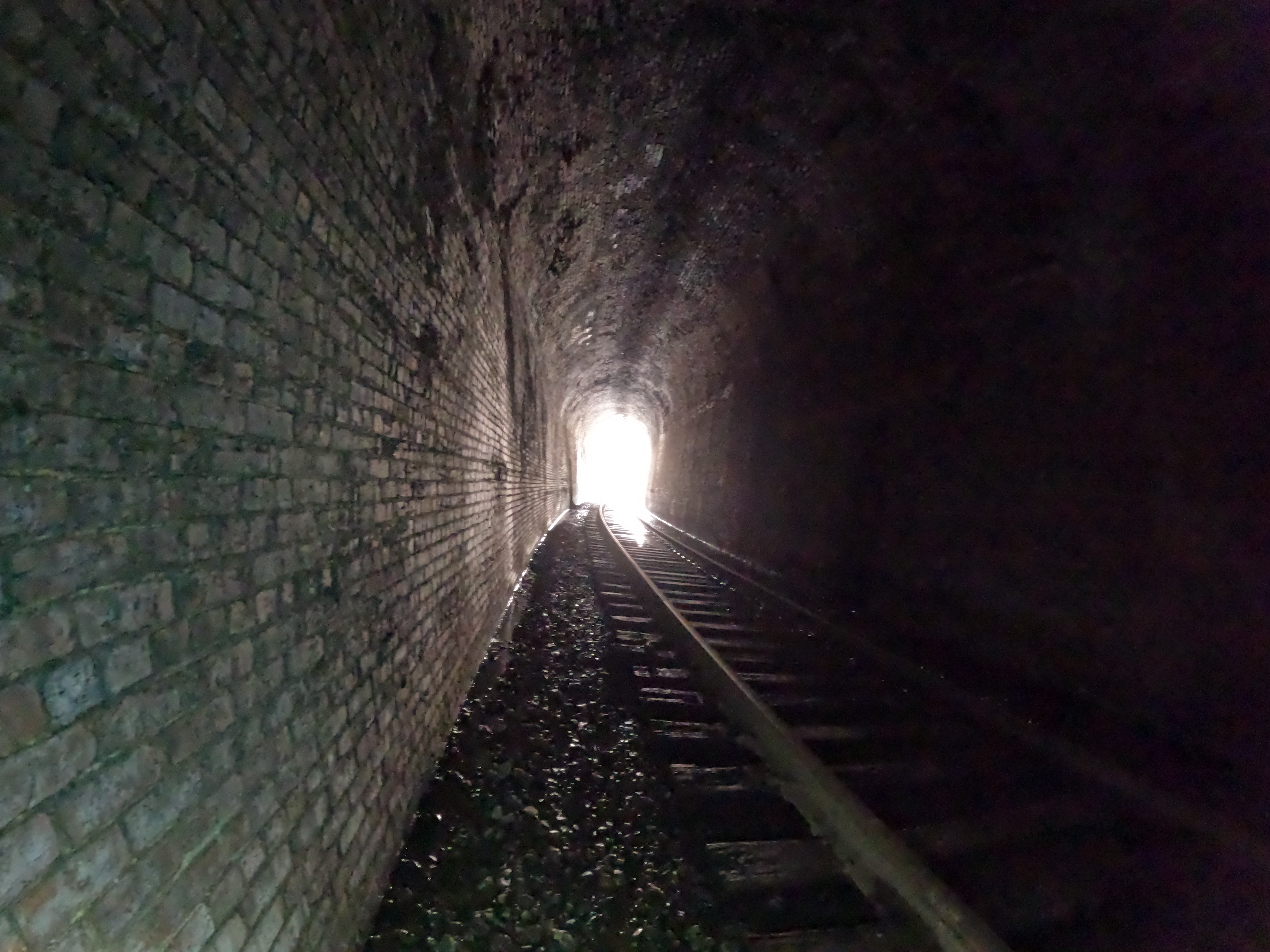
Above: Approaching the north end of the tunnel from inside.
Below: an image of when we could see light at the end and you could notice the curve in the tunnel. You can glimpse Kenny far ahead of my slow ass with his flashlight and annoyingly healthy knees! You can see the left of the image that there is a stream flowing inside.
Above: entering the south portal of Elk Gap Tunnel. It is all bricked.
Above: The tracks approaching Elk Gap Tunnel. to the left is the stream flowing out of the holler and splitting in two directions. It is shown in the video and illustrates it better.
Above: the switch to the side track
Above: We have approached the side track. You can see the tunnel mouth in the distance. Hwy 297 is to the right. The tunnel passes beneath it.
We hiked on through the tunnel. It was shorter than Indian Gap Tunnel and not quite as wet and squishy. It was still wet, but more slippery! We counted nine cut outs in the side walls. Seven on the west and two on the east side. I learned those are called "refuges" and are put there as a place for railroad workers to step safely aside while doing track maintenance if a train approaches. Railroad spikes were driven into the western wall at intervals. I'm not sure why. Perhaps a way of measuring distance and spacing the refuges out?
Kenny mentioned on the return hike that this tunnel was further underground than Indian Gap had been. I didn't much like thinking on that and asked him to be quiet about it.
That was a real "Yikes!" moment. We made it safely through and back without any trouble.
It was quite satisfying to finally have seen it. It was worth the effort. I will say that I think I'm one and done with this tunnel.
We made our way back to the truck. I was pleased to have been able to get out and walk today. It wasn't pain free, but easier than hiking four miles. Half that distance today didn't cause me any trouble. It had to be good for my lungs to help clear and heal them to get some fresh air and move around.
Back at the truck we headed for home and I dutifully iced my knees while sipping hot coffee with two fat cats piled up on me. It was a great day!
Below is a video of our hike through the tunnel. It is shorter than the video of Indian Gap Tunnel. I edited it pretty heavily. I only videotaped through and the North portal. Not the return trip. Nothing new to see on the trip back.
Thanks Butch for the info on the tunnel. Far as I can see my video of the Elk Gap Tunnel is the only one out there on YouTube.
Our original plan for today was to drive up to Pioneer and visit the Elk Gap railroad tunnel.
We then planned to go on around to Huntsville and ride Royal Blue to see Thirteen Hollow Falls, Flatwoods Falls, and Patricia Falls. The reasoning was that I had to limit the amount of hiking because of my bad left knee. It was bitterly cold and windy. The snow had become covered with a sheet of ice. The day before we went to town, and I slid on black ice in a parking lot. It hit me Saturday morning that I was being foolish. I was believing what I wanted to be true not reality.
Images of the packed snow and ice on railroad tracks flashed into my mind's eye. I knew I was putting myself at high risk of taking an already painful knee to the next level of damage. I took a tenth step... "Continue to take a personal inventory and when you are wrong promptly admit it. "
I was wrong so I admitted it. Kenny laughed and asked me "Well, what else could we do?"
I had a backup plan thankfully. We would head south where they'd had less snow and ice!
Down the road we went toward Madisonville. We'd stop at Bert's Hometown Grill and eat lunch.
Then we'd motor on down to visit McFarland and Turtletown Adit for the first time in Winter.
I wanted to get some photos of the waterfall at Turtletown and some video footage. I also wanted to get photos of an area cabin before it rotted down. I wanted video of Buck Bald. We'd find plenty to do.
McFarland and Testing My Directions
Things I remembered to take:
backpack
rope
hiking poles
camera
Go Pro
batteries
GPS
chainsaw.
What Did Dana Forget?
The MAP!
Kenny suggested we stop at the visitor center in Tellico Plains and buy a map. I had an idea to save us. I looked up my blog while we still had a phone signal.
I screen shot the directions for McFarland. I figured what better way to test them out than apply them to myself? I made double sure they were complete and readable. Turned out great and they worked like a charm. No problems. I have included them at the top of this post and tweaked them a bit. Now there are directions approaching from North and South. No one wants to drive 12 miles to Ducktown and turn around and come back.
I reckoned that despite our past wanderings and gaffs we might be better off today.
What we lack in smarts we make up for in lots of experience. Sure enough we'd have found it without the directions.
We went in a slightly different way than my directions indicated. We went down to the main road near the Farner Post Office and turned there. My directions coming in from the north are written just as we executed them today. The only thing that messed with us a little after all these trips to the area over the decades? Turning onto Duggan Road in the village! The road sign is not visible coming from this direction. Additionally, the road looks very, very narrow like the lane to someone's house.
It is actually just a narrow country road with lots of residences clustered close. The good news is that they have the sign back up for Turtletown Falls trailhead. You can't miss it from Farner Road. I will never forget the first time I hiked to Turtletown Falls. I was with Bill Stowell and Craig DeLoach. I think it was Winter also. We had a heck of a time following Greg Plumb's directions in Waterfalls of Tennessee. The roads back then had some very questionable names like "Welfare Road" and "Negro Creek Road". By the time I made a return visit with Kenny those were replaced with better road signs. It was a funny day because of our struggling to find the place and how we'd fuss among ourselves.
We approached the turn to McFarland Adit today. We managed to get everything correct. The neon survey tape on the nearby tree marking the proper turn was gone. Yet we knew which one it was. The road was in rocky, but fair shape. One thing for certain, the road isn't going to have pot holes. It is too rocky. I had forgotten how narrow this road was. We wound gradually down to the access.
Above: a view of the road and the icicles from inside the jeep. You can see the tree hanging down. It has been cut out of the way.
Below: The entire bluff was like this. Icicles upon icicles. Quite pretty.
Icicles glazed the surrounding rock bluffs. Down below us a small feeder stream was half frozen. The area is so far down in a hole it gets very little sunlight. Today was a high of 18°
We parked the jeep and got out. The wind was still when we first arrived, but that did not last.
I took stock of the mossy cement structures that were a lot more visible in Winter. I wondered aloud what they were for? I read a good blog written about the area about the same time I first visited. It says they were structures to do with the "blower building" and "compressor building".
I am not sure, but I think Bruce Roberts may be the author of that blog? It was very interesting and well done. I spoke to Kenny about it and he explained that he was not sure what the "blower" building would have been. He did know that the compressor building was likely used for compressed air like a giant, industrial sized air compressor for tools out there in the boonies.
Kenny had questions I learned answers to. He wondered how they got the supplies there into the mountains? He wondered where they'd have kept them since this spot was pretty narrow.
I learned from the same blog entry that we need to walk that lower road and do some investigating. There is more down there in the way of interesting ruins. The lower McFarland Road was closer to the railroad tracks. This was where they brought the supplies in by train.
They had sidings to set cargo out of the way. They also had a hotel with a cistern for water.
The hotel is long gone, but the cistern remains. Blocks from the former conveyor belt are still embedded in the bank between the lower road and upper road! This was how they got the supplies there, staged it, stored it, and brought it up to the work area as it was needed!
Below: First looks at the access in Winter. Never been down here in Winter before.
If you enlarge the photo to full size by clicking on it you can see the little arch above the diverter spillway for the creek.
Above: Looking back down the narrow corridor between the two banks. A little sun light.
The wind began to blow and swirl down in this narrow spot. It was chilly!
Above: This is McFarland.. the door is to the portal access to the pipeline. I love the glaze of ice on the left. Despite how cold it has been and still was... the little stream was still flowing. Crusts of ice formed around the edges.
Above: I'm standing back to get a better view. The Go Pro does a great job of getting the whole scene.
Kenny did not tarry, but went back to see the cement plant and got in the jeep. He was over this cold weather. He is too skinny to have much insulation unlike Big Booty Judy here.
I heard something and turned to look. Another vehicle had pulled up. A family with a mom, dad, and two cute little girls got out. The little girls were full of vinegar. They were excited. I stopped to speak to them. I asked them if they'd been here before? They replied yes, many times. The dad told me the girls loved it and call this place "The Dwarf Mine" like Moria in the Hobbit movies.
Above: an illustration of the entrance to Moria
Above: the stream flows down toward the cement plant.
Below: Looking at the cement plant
Above: Stream with crusts of ice.
Above: A glimpse of the weak light of Winter Sun that provides only slight warmth.
The family of four loaded up and pulled over toward the cement plant ruins. They had to move in order for us to get out. Though the ground was frozen it was no place to mess around and get stuck.
We stayed on the road much as possible. We headed on out. Kenny was now wavering back and forth between wanting to turn right and go to the Apalachia Power House and then No! Let's go to Turtletown Adit and then Buck Bald. Finally the second option won out. I told him I was good with whatever he wanted to do. I was just glad to be out.
Below is a video of the McFarland portion of the day. It does a pretty good job of illustrating the road, the ice and the ruins.
On to the Turtletown Adit
What is an adit? It is a horizontal access passage to a mine or in this case a pipeline.
I learned from reading the plans for the dam, pipeline, and powerhouse that there are seven of these access ports. I did not know that! I can't help wondering where the others are? I also wonder if two of the accesses are located on either end being very near the powerhouse or dam? I studied the Cal Topo map and I've got a couple guesses where others may be. It seems unlikely for TVA to place portals for access without roads. I wonder if one is down Butler Ridge Road and the other is down Smith Creek Road. I think I see one on Smith Creek Road. I also think I see one less than half mile up from the power house.
Kenny quizzed me about the visit we made to the power house. Did we have to back track or did we come out some other way? I told him I was unsure, but I knew the McFarland Road had one way in and out. It dead ends at the power house. He did not want to backtrack. I did not want to play guessing games on a cold, short Winter day. We'd play it safe and head back to Turtletown Adit.
We turned onto the steep incline of the rough road that takes you there.
It is #23A and signed as such. There are gates, but they are both open. The road was not as rough as I recalled. Thankfully we did not have to get the chainsaw out, but I was reassured having it. There are lots of ruts and very narrow spots owing to erosion and trees being down. Someone has come along and cut the trees out, but only just.
Tight squeeze in places. We found two trees down across the upper section of road that leads directly to the top portion of the pipe.
We got our first glimpses of the creek and the pipeline. Turtletown Creek was flowing wonderfully today. Kenny mentioned to me that it looked to him like someone had been down there and done some work recently. He knew from his work that Santeetlah Dam and this section of the Apalachia pipeline were scheduled for maintenance and repairs. We did not have to go far to see that TVA made good on their promise! The underside of the pipe as it passed above the access road was gushing a mini waterfall the two previous visits. Today it was bone dry!
Below is a photo of what that spot used to look like. It was leaking, but pretty!
Below are two views of the pipeline viewed from the west side access road.
Above: The coupling near the cement was where the pipe was leaking badly. It is now 98% better. It was trickling just a little. Someone has a Trump campaign sticker on the pipeline. Some folks never give up. 😉
We checked out the pipe. Saw it had been repaired. I could hear water pretty strongly despite the leak being fixed. Upon checking around I found a spring dripping from the bluff to one side. The rock was making it seem louder. It was not like this on previous trips.
Above: dripping springs of water making a loud noise
Below: Two views of the icicles here.
Above: Small stream of water flowing away from the spring
Below: structures of concrete similar to what was up at McFarland. I think I read this was part of the compressor building. We found a spot down the road toward the tracks that must have been part of the conveyor they used to transport materials from train tracks to the work site.
Below: This road continues toward the railroad tracks.
Once we had done all the looking around we cared for at the first spot we headed down to the railroad tracks. It is a narrow, dirt track, but there are two good spots to turn around down toward the railroad. Look for a pull out on the left and a wide spot on the right.
Above: looking up the tracks in the direction of McFarland. It would be very cool to get down close to the Hiwassee River and walk along it. It was green as jade the day we visited. We couldn't get close.
Above: arriving at the railroad tracks at the end.
Below: Looking upstream on Turtletown Creek from the crossing
Above: The Hiwassee River confluence with Turtletown Creek and another side stream viewed from the train tracks.
Above: Frozen small side stream flows toward Turtletown Creek near the tracks.
The spot near the railroad bridge was pretty, but not as pretty as in Spring. We did not linger here. There wasn't that much to see and we had been here before.
We began working our way back. We stopped and checked parts of the stream for waterfalls and cascades. The streams here are pretty, but many of them lay down in the bottoms of these hollers and don't drop suddenly enough to form waterfalls.
I noticed a berm of earth that looked to be moved by man. It lay between the parking pull off and the west side of the pipeline. It looked like what was left of a ramp of earth. I also noticed a flat spot connected to it as if it had been a pull off road or siding to park equipment. I later learned of the conveyor system so I can't help wondering if this wasn't what used to be here? I am betting this was the conveyor to bring equipment from the tracks to the work site? Much more straight forward down here.
We stopped by the pipe again for me to take in the views. Kenny noticed a few chunks of cement and man made debris in the stream beneath the pipe. I am not sure what went on there. Just above this spot along Turtletown creek is one green pool of water and a low cascade that is rather pretty. I don't know where I got the notion there were more falls along this stream down here? This one was it. I guess I was telling myself what I wanted to be true.
Above: Looking upstream on Turtletown Creek beneath the pipe.
Below: Looking downstream in the same spot you can see the chunks of cement. There is a long, concrete structure in the middle of the stream that is a mystery to me.
Above: Pretty cascade on Turtletown Creek. Right below the road. It isn't much but worth a stop since we were down here.
We continued creeping out the road climbing out gradually. There is one really tight kiss your butt turn on this road. We spotted a side road dropping off the right and heading down toward Wolf Creek. It was gated, but worse it had been out of use so long trees have grown up in it. The saplings are a few inches in diameter. I later looked to see where this went. It does appear on maps and goes in a couple directions, but chiefly along Wolf Creek. They are just access roads. I did some looking on the topo map, and there is potential for some off trail waterfalls.
Below is a video of Turtletown Adit today.
We were very glad to get back out to the main road and see some pavement again.
We had grown tired of being jostled back and forth. We headed back toward Coker Creek.
We would make a stop off at Buck Bald. Before heading to the bald I had Kenny pull over for me to photograph a pretty, but run down log cabin. It has seen better days. I wanted to get a photo of it before it is gone.
Above: Log cabin by the side of SR 68 near Buck Bald. I'd love to know the history of it. It sure is in a pretty setting. This might need to be a painting some day.
Below: a view of the cabin zoomed in closer.
I am including a photo of the sign for Buck Bald below. It is damaged and is only visible heading south. No sign heading north!
We made the turn for Buck Bald. You can see it barely visible above in the photo on the far left top of the picture. The road takes you a couple miles back there past some homes until it winds its way to the summit. There is a point where the road Y's. Take the left turn to go to the summit. The road heading right is Old Hwy 68 and comes out down on River Road before the Shadwick Branch Rail crossing that goes overtop SR 68. I thought we had driven this, but I was mistaken. We will have to check that out next time.
We did not see another soul on this road today until we were leaving. We finally passed one vehicle. We had the summit to ourselves. It was cold, windy, and quiet.
The bald provides a 360° panoramic view. It is very pretty. The one picnic table of stone is broken, but has been replaced by a single wooden table in good shape. There are three or four wooden steps to lead up to the grassy bald.
Above: view from Buck Bald to the Northeast and what may be Beaverdam Bald. We could see a tower atop it.
Above: Looking toward the Unicoi Crest the mountains are still partly snowy.
Above: Kenny is over it and heading to the jeep.
Above: broken picnic table atop Buck Bald
Below: View to the south
Above: View to the hazy south west
We enjoyed the views up on the bald. Kenny pointed out a cell phone toward toward Coker Creek he set with the crane years back. I thought I got it in video, but you can't see it. We enjoyed the scenery, but tired of the cold we loaded up and headed for home.
Below is a video of the views on Buck Bald.
Notes to Self for Future Trips:
Look for other access points to the pipeline. There are five more.
Drive Old Hwy 68 from Buck Bald area down to River Road.
Check Watertank Branch for cascades
Drive River Road and get video of spring.
Get photos and video of the RR trestle over Shadwick Branch and SR 68.