Showing posts with label Yellow Creek Falls. Show all posts

Tuesday, June 23, 2020

New Years Day Hikes 2020

Old tire in the creek at Lawson Falls 


New Years Day Hikes-- Morristown Area Waterfalls 


New Years Day Jan. 1, 2020

Kenny & Dana Koogler


   Kenny and I were wanting to get out and see something neat on New Years Day.  He mentioned the waterfalls we'd still not seen up above Morristown.   We were growing gradually stronger, but still knocked down pretty bad by the flu or the rona or whatever that mess was.   We finally decided we'd try it.   We set off up the road toward Morristown and beyond.    We had a list of falls off Tennessee Landforms we wanted to check out.  

     We started off with Lawson Falls.  It looked like it would be a nice one and not too hard to find or visit.   We found it. It is private property, but within easy sight of a traveled road.  It is visited and the evidence is there in the creek.   The stream was lack luster, but we found it and it was not hard to reach.  We walked up the stream and the banks.  An old tire and wheel lay in the stream along with a little bit of other refuse.    

Below are images of Lawson Falls
IMG_8563.JPG
Lowest drop

   IMG_8568.JPG

Middle drop
IMG_8574.JPG

Next in line heading toward the top

IMG_8589.JPG
   Uppermost falls
IMG_8591.JPG
A broader shot of the upper part for scale.

IMG_8599.JPG
Kenny down at the bottom. You can see the road in the distance.

   We were not terribly impressed, but I will say that if you could catch this falls after a heavy rain it would no doubt be prettier.

     Next we moved on to a waterfall we'd visited once before.  All we did was see it.  We were astonished to find so much trash along the slopes. I would not attempt to get down there to photograph the falls that day.  Today I would force myself to deal with it.   We both would.  We headed to Yellow Branch Falls.  Another one of those that fit in the private property, but right beside a road.
I got out and took photos of the lowest drop.  It was not too bad.
Below you can see the falls and the bridge abutment or whatever that manmade structure is.
IMG_8601.JPG

IMG_8604.JPG
Another shot of the falls minus the bridge pier.

  We went up the road a bit further and found a place wide enough to pull over.
We picked our way down the steep slope toward  the creek.  Yellow Branch Falls was in easy sight of our position.  Between us and the falls was a mountain of garbage. IMG_8618.JPG
and more garbage down over the bank.
IMG_8626.JPG


A real pity because the falls are attractive and there was some sort of mill here in the past. See the old rock foundations?
IMG_8625.JPG


    The stench from the garbage was so bad even in cold weather I thought I'd be sick.   We were walking atop old mattresses and  couch parts and so forth.  I suddenly couldn't wait to get out of there.  I snapped my photos and hurried to leave.  I was sure we were atop a human corpse or the rotting carcass of some animal.   Jaw bone and teeth of an animal. At least I think and hope it is an animal.
IMG_8624.JPG
Yellow Branch Falls below
IMG_8632.JPG


   We hurried out of there.  We got to the vehicle and got out the Go Jo wipes and hand sanitizer and scrubbed our hands and wiped our shoes off before getting in the jeep.  Gross!!!  I won't return here.  Last trip for this one.

  We drove up the road and stopped so I could get a photo of the church and the American Flag.

IMG_8636.JPG
Old glory under blue skies!
IMG_8638.JPG

  Next we mosied on to McGinnis Falls. It would be new to us both.
IMG_8652.JPG
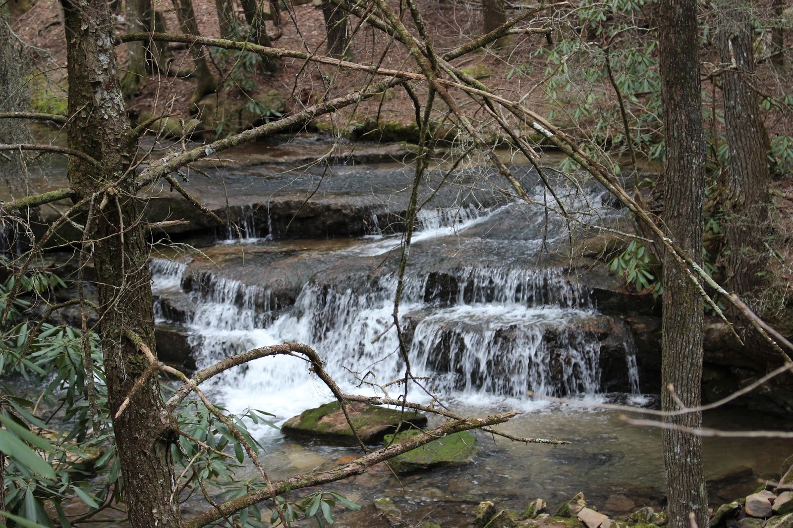
Another so so waterfall.  At least this one was not littered.

Below are some roadside cascades we spotted on the way
IMG_8667.JPG

  Last of all we drove the short distance further to see Simmons Falls.
It was another so so falls.
IMG_8678.JPG

Simmons Falls is beside a driveway and a road

    We had satisfied our curiosity about these falls, but the results were disappointing.   We decided we were over it and were ready to head back toward town.  We went through Morristown and stopped to have a late lunch/early supper.   It was at the Davey Crockett (ask me again and I'll pee in your pocket) Restaurant.  It was gross.  I won't go back.    We set off to go home.  Then things got funny.

    Morristown is kinda spread out along route 11.   They are doing roadwork to make yet another connection to the interstate.   It is very confusing.   Kenny has a habit that drives me crazy, but it will never change.   He gets somewhere back in the boondocks and thinks about what a long drive it was.  He wants to figure a better way out of there.  We had been on this trip before so we got to go through this same conversation and procedure again today.    We did this at Simmons Falls trying to figure out the best way out of here?  We both hate Rutledge Pike because it is a monotonous drive that seems like it will last forever.   The only alternative was to reverse course and head back toward Morristown.   I wanted to do this because it was speedier, better scenery and we could stop to have a nice meal.   

      We got out in the jeep and had to go through the procedure again.  Best and shortest way home?  Kenny is trying to cipher it out.  We were driving down route 11.  He said he'd drive to Jefferson City then hit the interstate and on home.
I made a big mistake.  Driving down Rt. 11 I remarked "you know they were building that new ramp to connect to the interstate last time we were  here."  We were coming up on it.  Kenny immediately seizes on that idea and we turn left onto that new road.   I then kept thinking outloud. "I know when we got on this last time it wasn't finished. I can't remember if we ever connected with the highway or not?"  Kenny now goes into a swivet.   "Oh.. now what should we do? Keep going and maybe have to turn around or bear right?"  He says "Aw hell, I'll just go this way. It has to come out somewhere."    I had never seen him quite this way before.   I got tickled and yet resigned myself to my fate.
I put a coat over my head and said "I'm checking out." I was going to nap through it and just whatever happens happens. 

   I lay there under the coat with the seat kicked back.  The thoughts of how ridiculous we are hit me.  I began laughing so hard I couldn't make any sound.  Kenny saw the coat shaking so he knew I was under there hee hawing at him.

     I got my rewards by getting to see the look on his face when our "new route" brought us out only a few miles down the road in Jefferson City back out on Hwy 11.   We'd just gone round our elbow to get to our asses.

           I never did get to take my nap, but Kenny did quit fretting about the route.  We did make it home. I'm not saying I'll never go back to that area exploring, but the waterfalls up there for the most part are not worth the trip. Elrod Falls being the notable exception.
Black Sheep (Roads Scene) | Movie black, Actors

I'm Your GPS GIF - GPS ImYourGPS - Discover & Share GIFs


Below is a video of Yellow Branch Falls.  I focused on the falls and off the garbage intentionally.


Thursday, March 24, 2016

Galivanting Around Starr Mountain


Peach blossom on an ancient tree on Starr Mountain


Galivanting Around Starr Mountain


Dana Koogler 

Thursday March 24, 2016


Pictures are here starting with frame 134:


   Today's forecast called for a high chance of rain.  I got on Weather Underground and checked the 
forecast for an assortment of different areas. I wanted to see which direction gave me the best chance of having a good day to hike and explore before the rain hit.    It was supposed to be mainly in the afternoon in the Etowah area so I went that way.  One of the vehicle access points to the top of Starr Mountain was closed very recently.  It was the shortest way and the best road.  I thought I remembered how to get up there via the other road, but I wanted to be sure. I decided today would be a good day to make certain.   I headed down the road toward Reliance and braced myself for a long drive on a curvy road.


             I stopped for a restroom break at Quinn Springs.   I began checking all along the road
and the various picnic pull offs for Spring wildflowers. I didn't find any to speak of.  I saw  a couple along the road real high up where there was no way to get a good look at them. Also no place to pull over.   I continued on toward Bullett Creek. On my way I did see a great big cluster of bloodroot
growing on a bank. The shoulder of the road was wide so I pulled over for that.
 I like it when I am driving and I know when I want to pull over and don't have to tell Kenny or worry about who might not like it. The slope was covered in bloodroot! Worth a stop.
 Above and below: Bloodroot blooms


          Note to self..... go back and get pictures of the old church I passed. I had never paid it any mind before.   It was near these flowers along the Tellico Reliance Rd. It was just before them.


    I continued toward Starr Mountain and I flagged down an old timer in a pickup truck. He was very hard of hearing, but I finally got it across to him that I wanted to know for sure if the road was open all the way to the top?  They had been doing controlled burns and I didn't know if they closed the road for that.  He assured me it was open and I thanked him and continued.   The road going up to the mountain top is narrow in places with no guardrail and a sheer drop off. It is one of those roads where you would not want to meet anyone coming the other way.   I didn't have any trouble though. I only saw one other vehicle all day in the area.   I saw no other hikers.
I went up to the mountain top and checked out some of my favorite wildflower areas.  The controlled burns had the mountain looking frazzled, but the flowers did not mind. They were coming up right through the ashes.


 Peach blossoms from an ancient tree. We had a couple peach trees in our yard as a kid.  They were volunteer clingstone peaches.  The trees looked just like this one. Very very old.  We canned peaches every Summer from them. Sticky work for sure!

 A pretty day so far on Starr Mountain. You can see the burned over areas above and below.
Controlled burns help maintain ecosystems and animal habitats. They reduce the fuel load by burning it off a little at a time. If this is not done a forest fire can easily get so hot it kills all life on the mountain including the microbes in the soil. It sterilizes the area once it gets so hot.  It takes a long time for  the land to recover from a fire that hot. The land recovers rapidly from a controlled burn.   Some types of pine trees need fire for their cones to open and for the seeds contained in them to germinate.  Woodpeckers depend upon tall pine trees for nest building.  I could smell the pine smoke from here all the way at my house several counties away and see the haze yesterday.  Today it is all gone.

   
 Redbuds were in bloom. Dogwood trees, Sarvis berry trees, and the hercules Club tree had lime green tennis ball looking leaf  buds!
 Green tennis balls on these attractive shrubs. 

The creek is sandy and clear today.  Easy to cross here.


These gorgeous trout lilies were carpeting the area around the creek. They were growing the BEST in the burned over areas!  These are Erythronium umblicatum.  The other sort.. Erythronium americanum were also here.  These I liked best though.


I went all over the mountain top looking for flowers.  I had a good time. I found everything I hoped for.  I was also pleased at finding the road open and no beer hounds up there with me today.  


Closeup of an Oconee Bell.  I found these today, but they were fading very fast.  Only a few left blooming and most of them had shed their bloom.

      I found me a spot to sit in the sun and eat lunch. It was 12:45 and I was ready to eat.
I had me a peanutbutter and nanner sammige with homemade strawberry jam. It was delish!
I had some energy now so I was ready to get down off this mountain and continue hiking at the foot of it.   I wanted to check out some of the falls while they should have plenty of water on them.     I  leisurely drove back down taking care on the narrow parts of the road.  I turned on the iPod and sang along as much as I wanted to.  

    I passed the only two persons I saw on the mountain today.  Two Spring break fellows who had taken their dogs out for a walk.   They waved at me and I kept going.   I passed Upper Yellow Creek Falls on the way.  I am going to climb down sometime and get a better image of it.  It would be worth it during good water flow.  


Upper Yellow Creek Falls is a short distance down from the road intersection and camp site.

  I pulled over where I knew Kamama Falls was supposed to be. I could see it down there in the distance. I had rope with me, but I thought better of it. I could not tell how the approach would be. I did not think it wise to do it solo.  It is steep terrain and lots of rhodo. It has been photographed from the base by all of ONE person.  I will hope to get to the base of it sometime, but it was not going to be today.  

        I pulled over at the widest parking area near the manway for the falls. I grabbed my gear and began the gradual downward descent to the stream. 
 This is a massive rock formation that is like a wall you have to go along on the way down. It is once you get closer to the creek.  


Got a good photo of Yellow Creek's main falls today. Overcast and plenty of water makes for good photos. 

     I went down further until I clambered to Bullett Creek Falls.  I could hear it roaring long before I ever got near it.  
 It was looking great today!  Not much hot rock in the shot and great volume. 
While I was at Bullett Creek Falls the wind got up and the skies turned dark and threatening. I mosied on over to the lower Yellow Creek Falls. I call it Deer Horn Falls. The rope swing used to have a deer antler on there as a handle. 

Lower Yellow Creek Falls and its beautiful blue swimming hole. 

    I passed through Camp Crud on the way to the lower falls.  It is not quite as bad as it was the first time I went there. It did not have drugs or drug paraphernalia today, but the gear stash, graffitti, garbage and the excavation under the bluff was horrible.  Two legged pigs as Rich calls them. The kind of people our world can do without.  They can't go anywhere without destroying it.  

The images below are only a few vignettes of Camp Crud. Behold it in all its terribleness! 


This photo and the upper one both show the excavation under the bluff. WTH?  

   I never thought I'd have the nerve to come down here alone and see these falls because of this place here.  I did it though. Thankfully whomever is doing all this yuck-a-muck camping was not there.  This is private property and there is NOTHING the forestry service can do to put a stop to it. Alerting the landowners would be shooting myself in the foot too.  It would probably result in access to the area being lost.    This part is a depressing situation, but the property line is just below the lower falls of Yellow Creek. Everything from there down is private land and they can do what they want. I doubt the land owners are responsible.  I'd guess more of the type of lowlife that trashed and does drug deals on top the mountain.  I found  spent shotgun shells scattered round and wadding from them too.  Lots of beer cans.  A good combo, eh? Beer Drinkers and Hell Raisers with shotguns.


   When I left I made that steep climb back up the mountain and out of that hole. The weather was windy and rain was coming soon.  The skies were dark still.  By the time I got to Tellico Plains it was raining.  I was pleased that I accomplished pretty much all I set out to do today. 
I love it when a plan comes together!  For once I gauged the weather right and had fun and managed to get going before the bad stuff hit.  We need the rain so it was good to get that too.

Below is a short video of the three falls I saw today at the foot of Starr Mountain.


Tuesday, February 28, 2012

Hiwassee Area Waterfalls


Daffodils blooming on the banks of the Hiwassee River


Yellow Creek, Bullett Creek and Deer Horn Falls Hike

Dana & Kenny Koogler
Sunday Feb. 26, 2012
*Repaired blog 


     Sunday we headed down to Monroe County into the Cherokee National Forest, TN
to hike to some off trail waterfalls.  We were itching to get outdoors and  enjoy the pretty weather of early Spring.  We had comfortable temperatures, abundant, recent rainfall, blue skies and sunshine!
Spring flowers are popping out in the form of periwinkle, daffodils, tulips, crocus, forsythia and the maple trees are wearing bold red buds! 

        We parked and climbed down the steep bank to first Yellow Creek Falls.

Yellow Creek Falls on a subsequent visit.  You can see the sun shining at the top of the falls.


     Next we headed downstream to find Bullett Creek Falls which drops in to the gorge from the opposite direction from a separate stream.  It has a beautiful setting including a 
deep green plunge pool.


Bullet Creek Falls was thundering today!
Bullett Creek Falls with a rainbow on the right.

Last we turned and went back upstream to find Deer Horn Falls.  It is a long series of cascades in a tight rhododendron tunnel that empties into an aquamarine plunge pool.  The high cliffs here make it deep, dark and foreboding. Deer Horn Falls on Yellow Creek has a beautiful aquamarine punchbowl at the base.  Cherokee National Forest, TN

Deer Horn Falls aka Lower Yellow Creek Falls 

     We climbed back out of the gorge and ate a quick lunch in the jeep.  We took our time driving back to Reliance. I wanted to undertake something I'd been thinking of for a long time. I planned to photograph some of the pretty scenery along the way instead of just driving past it today. I'm very glad I did. I have begun a photo project titled Rural America that I will add to over time.


Grand old house along the Hiwassee River


Webb's Store in Reliance, TN on the banks of the Hiwassee River.


    We had an excellent outing! I was so happy to spend some R & R time with my husband.  It was good to not have much going on today. For all today's pretty weather we could not believe that the Daytona 500 NASCAR Race was rained out!