Sat. Nov. 15, 2025-- I am making a note here to say that after nearly 12 years of blogging, I had a mishap. I was over half done with typing this trip report last night when I lost ALL my work.
One time in twelve years isn't bad, but it was very discouraging. I am starting over fresh today. I hope it will be even better than it was. I am going to keep it down to the condensed version as I don't think I have the gumption to do more than that right now. Remember, Back up all work!
Friday Oct. 31 we decided late in the evening that on Saturday morning we'd get up and go out to Gobey. The weather had cooled down a lot making it a great time to hunt for off trail stuff. We'd had rain so the original plan was find Boogs Den cave then go over to Devonia and hunt waterfalls. We set out at a decent time Saturday morning. It felt great to be actually carrying out a plan instead of merely talking about it. It was nice too that it wasn't such a long way from home. We parked, unloaded, stowed all our gear in the RZR and set off. The temperatures were in the upper thirties. The weather was calling for a clear day that should warm up some.
We had to cover some of the same ground today as we had our last ride out here. Kenny pulled up Lifetime Maps and showed me the way we needed to go. He suggested taking a slightly different course to find the cave. It would run us by Shroom Rock which we had never visited.
We realized Friday night we had also never visited Gobey during Autumn. We were to find out we were indeed late to the party.
We started enjoying beautiful Autumn colors almost immediately. The climb up to Shroom Rock was pretty and fun. It wasn't a long ride until we got arrived at Shroom Rock and got out of the machine to see it for ourselves. It indeed looks like a giant mushroom made of stone.
above: I liked the bright red leaves against the blue sky
Below: the trail we rode had large rocks all along it.
Below: Shroom Rock was impressive
Below: the climb up the mountain to Shroom Rock was pretty
Below: partial view on the ride to Shroom rock
above and below: spot we stopped to look around at Shroom Rock. Kenny with our RZR.
Next we pushed onward along the Rock Ledges Trail toward the next thing the map program indicated. It pointed out "Home Site" and "Graves 1858". We enjoyed the crazy climb and jostling around among golden leaves. Towering rock bluffs and mountains made it enjoyable also.
Below is a video clip of that section of our ride
We did find the "home site" and I found one possible grave stone. A fellow on Facebook showed me a photo of one of the for sure graves. Just before that spot we passed the big turn with the three crosses and a nice view.
Below: a pretty view from three crosses in Fall
Below: three crosses for three dead men
Below: this is what sat at the homesite. a flat area where a house may have stood. This is all that remains.
Below: backed up to give a broader look at the home site
Below: what may be a grave marker
Below: asters blooming late into the season
We kept going along Rock Ledges Trail and began to see familiar terrain where we needed to stop to hunt for Boogs Den cave. This is as good a place as any to include a snippet about where it got its name. It was named for a man who lived in the area called Boog Davis. He hid in the cave during the American Civil War. He did not want to fight on either side. Barbara's book outlines the specifics as to what his reasons were. Tennessee seceded the Union by only one vote. It was split almost down the middle in sentiments for and against the war. Mr. Davis found himself caught between the devil and the deep blue sea. God will have to be his judge as to whether he did right or wrong. I think it is possible many East Tennessean's had the good sense to see that there is no such thing as a winnable war. Everybody loses in one way or another. We followed a side path that led up to the rock ledges. We began to hunt for a cave.
Below: view from the top of Rock Ledges
Below: I am standing on one part of Rock Ledges and you can see Kenny in his orange on another part.
Below: at one point I thought the cleft in the rock face might be the cave. It wasn't but we were getting closer.
Below: I am working my way along the base of Rock Ledges toward the sound of Kenny's voice. He was yelling to me that he had found it!
Below: looking up at the bluff from its base as I work my way slowly along toward Kenny
I was encountering lots of briars and vines and hitchhiking seeds. It made me glad we had seen wisdom of waiting for colder weather to make this attempt. I kept going toward Kenny and sure enough there he stood in front of a cave entrance with a tree growing near the mouth of it! Just as described in the book! We were thrilled to have found it. We spent longer than we realized exploring the area. We found NO graffiti and only one piece of human trash. A long mashed plastic gallon milk jug. It was not 100% pristine, but nearly so. This lets me know that the folks who are aware of it and visit here are good stewards of landforms and history.
Below: the mouth of Boogs Den cave. It is formed in an interesting way. Bryan told me it is made this way because it sits on the Tennessee Valley Divide. It is cleft from the top upward. The tree grows near the base of the bluff and if you look up through the split you can see its upper limbs bend over the top entrance to the cave.
Below: Looking out the mouth of Boogs Den. I liked the layered look of the rock.
Below: you can really see the split where the cave is on the divide line & the tree bending over it.
Below: I am looking up through the split in the cave ceiling
Below: sunbeam illuminates the cave all the way to its back parts
Below: Kenny looking of the cave mouth for scale!
Below is one of my doodles of how the cave seems to be. I want to go back and check it out from the top next go round.
Below is a video of Boogs Den Cave
Eventually we snapped out of our trance and realized that if we were going to see anything else today we had to get on with it! We went back to the machine and had a quick lunch and something to drink. We motored onward. The next part of the ride was fun, but repetitive since we'd seen it before in June. I did take some photos, but not many.
Below: This is a view coming off the back of the mountain toward Pilot Mountain. Below: a snapshot of fiery red sumac leaves and puffy gray goldenrod gone to seed
Below: We passed through this stand of pine trees on the ride off Pilot Mountain.
We got down off Pilot Mountain and back round to Gobey Road. We headed outward to the end past the gates. We began seeing lots of rigs parked for folks to ride. Then we began seeing riders! Lots of nice people had the same idea, but despite that it was not crowded and we only saw them along the main road. We didn't encounter anyone on the trails themselves.
We did see a coal storage bin today on the ride up to the mountain top at the end which we had never noticed before. Something to be said for every season. The colors out here were amazing!
above and below: pretty colors looking off the mountain top near the end of Gobey Road
Below: a trail intersection today
I asked Kenny where we were going? He told me we had to get to a big intersection near the mountain top. It didn't take too long until we got there. He stopped and showed me on the map program where we were. He then proceeded to show me what we needed to do to get where we were trying to go look for waterfalls. He looked at the map and then at me and said "It's a long ways." You may believe me when I say I can control my mouth. I didn't say a word, but my face gives me away every time. Kenny took notice of my horror and then began trying to back pedal. "Well, it's not THAT far. " which was followed up by a lot of wild equivocating. I call it "talking out of boths sides of yer mouth."
Then I had my second epiphany of 2025. I recognized that Kenny had the rabies again! He loses his mind and gets over ambitious like a beagle on the scent of game in the woods. I don't do the chasing rabbits thing too often. It was already four o'clock pm. The day had darkened and was turning cooler. The long established pattern over the years of misery trips in the RZR where the ride got too long to suit me. The conditions got too uncomfortable. I bucked up and said "Oh hell no!" Not doing that today. " Kenny knew better than to test my resolve so he began heading back off the mountain.
He did not go without a bit more equivocating. He doesn't mean to lie to me, but he lies to himself and believes it so he is crazy. One of us has to remain sane and reasonable. That would be me!
I convinced him that the trip was too ambitious for a short Fall day. It needed to be two trips instead of one. I did not want our good day to become a misery trip. Let's instead go back down the mountain enjoying the scenery and hit some of the good spots on the way. He agreed that was a fine plan. I actually got it on video tape him admitting that he was glad I had sense to talk him off the ledge. We enjoyed seeing the Emory River and its historic railroad bridge ruins and Fall colors.
We stopped in Oliver Springs and got groceries for me to cook us a nice hot meal at home. We arrived home tired and dirty, but in good spirits. Not exhausted and me angry.
It was a far better plan. We will return and hunt the waterfalls we wanted to see, but we will try to find a parking spot closer to them or head there first.
above: Emory River and a set of railroad bridge abutments
Below: a cascade across the Emory River
Below: second set of bridge ruins on the Emory River
Below: close up of leaves on the river
Below: colorful red leaves and a small cascade at the second set of bridge ruins
I leave you with a short video clip of the Emory River, bridge ruins, cascades and beautiful colors.
Gobey is pretty in Any season and as Kevin Crites put it "Now you see why I spend so much time up there!" Indeed I do my friend. You are a wise man. There is hope for me yet. I am learning how to manage my sweet, but overzealous husband and his trail rabies.
Several years ago we met up with friends in Winfield, Tennessee and did some four wheeling.
It was a fun and very scenic ride. It was mid March and I always thought I'd like to return to see it in another season. We talked about it two weeks back, but decided against it. We were unsure that we could put together enough trails to make it worthwhile. During this past week I ran across purely by luck... a website called OnX maps. I did some checking out the suggested routes on their site. One was Little Rock Creek Road. I told Kenny about it. We got to looking on Lifetime Maps and realized that it would be the perfect loop to add to Capuchin Creek Trail.
We were convinced we needed to give this a try. It was decided we'd head that way Saturday morning and make a day of it.
We needed a day out together. Just us. We packed our stuff including lunch and chainsaw. We left the house around 8:30 a.m. and arrived in Winfield, Tennessee around 10:15a.m. We parked at Lee's Food Market which we learned was okay to do, but should have parked on the opposite side of the lot. We set off from there and drove the short distance up the main highway to Pleasant Grove Road. We wound through the pretty residential area and before long came upon a spot where we left the road for the trail to our left. It was rugged and red dirt climbing through trees and weeds. The woods smelled of the coming of Autumn. The fields were laden with tall wands of purple ironweed, goldenrod, blue lettuce, golden wingstem,
sunflowers, and other late season blooms. The trees surrounding us were beginning to show some pretty Fall colors!
Below: a view out the windshield of us climbing the hill on the trail near the beginning.
It was fun since this was covering new territory for us. We were running Lifetime Maps on a tablet which is great for navigation. Kenny had spent a good deal of time reviewing the trails prior to our arrival. It shows you when you are on the trail and lets you know when you are off it. He runs Google Earth satellite view as a safeguard and a backup plan. Good thing since we had to refer to it at least three times. Lifetime Maps has its limitations to be sure. It is pricey.
It also lacks the ability to SEARCH the database for what you want to find. That is the thing I dislike most about it.
We rambled through woods up and down hills and the trees varied from green tunnels to fiery Autumn looking mountain tops. The ever present ragweed stood seven feet tall in many areas along the trail. This is the bane of my existence. Fall is my worst season for allergies.
I have sneezed, coughed, had watery eyes, a runny nose. Someone once asked me "If you have allergies why do you spend so much time outdoors? " My reply was that I wasn't going to allow allergies to dictate to me how I lived my life. They laughed and said that was what they figured. That I must have a "Damn the torpedoes! Full speed ahead!" view of life. That is a fair statement.
Eventually we came out at the first clearing of the day. It was atop a set of rolling hills with a powerline cut crossing them. The view in either direction was pretty. We stopped to get our bearings here and enjoy the scenery.
Above: The view to the Northwest at the powerline
Below: Steep dirt bank with Kenny above me
Below: Once you climbed that steep embankment this was the view to the Northeast
We continued down and north by northeast into Kentucky. We encountered a couple more partial views. Below is one of those. It was a bluebird day for sure. The temperatures were seventy five degrees and sunny with a nice breeze. The air was clear. The fragrance of Fall advancing in the form of crispy, brown leaves and various weeds going to seed. Many of them are aromatic and I associate that scent with Autumn.
Above: photo of our RZR and Kenny at that first powerline overlook
Below: great mullein in bloom
Above: this may be boneset. It has a slightly aromatic smell.
I am reminded of one of the reasons I need to take more photos and video as I type this report. When we travel new terrain especially places that don't have a lot of outstanding features it is hard for me to recall the details of the trip a week later. I remember after the power line overlook we didn't see a lot of stand out features. We did take one wrong turn and within 100 yards or less realized it thanks to Lifetime Maps. It shows you the trail and your OWN path of travel is highlighted in deep purple. When you start to see a deep purple line on a white background it means you are off the trail.
That doesn't mean the trail doesn't go somewhere, but if it is not mapped on Lifetime it is a complete unknown so we corrected course. I want to test Lifetime maps in an area we are extremely familiar with. Skinner Mountain would be a great testing ground. I've written a guide on that area and the maze of trails covering it. I want to run out a purple line on white background there to see what they have missed!?!
I remember that once we corrected course we popped out on a road that had we followed it went out to Stephens Knob in Kentucky. It was FR6286. It dead ended and we opted to leave that off the trip for today. We were beginning to wise up and realize this ride was going to be a bit more of a challenge and longer than we'd imagined. I think in both our minds we figured we'd be lucky to make a days ride out of all that trail put together. These are moments when our lack of imagination can truly punish us.
We continued along Little Rock Creek Road passing the cemetery. We spotted the sign for Rock Creek Cemetery. We saw a couple machines pulled over there. I had no interest in seeing the graveyard. We continued. We began to see people riding now on four wheelers and side by sides.
It was by no means crowded, but just a few folks out enjoying a beautiful day like us.
We passed a large meadow of wildflowers just down from the cemetery so Kenny pulled over for me to take pictures. It was pretty! More purple ironweed, goldenrod, lots of spotted jewelweed spangling the roadside with deep red orange polka dots. We could see butterflies feasting on nectar. I could hear, but not see hummingbirds enjoying the jewelweed. It was one of the best spots along today's ride.
Above: my favorite view of what may be Anderson Mountain in the background across that lovely meadow of flowers. You can see the ragweed spikes in this photo too. Achoo!
Below is another glimpse of this pretty spot. This is one of my favorite times of year for this reason.
If we ever do move further out to the country I am letting part of my place grow up in stuff like this.
Below: goldenrod in bloom up close
Below: jewelweed by the road was attracting lots of humming birds. I have had so many in my yard this year. I planted balsam and they have swarmed it. I have four feeders out. One of the little hummingbirds is my friend. He comes to remind me when the feeders are low and to say hi. He also hovers near my ear and shoulder. Clearly he is unafraid of me.
The next part of the ride took us down that gravel road along our first views of Little Rock Creek.
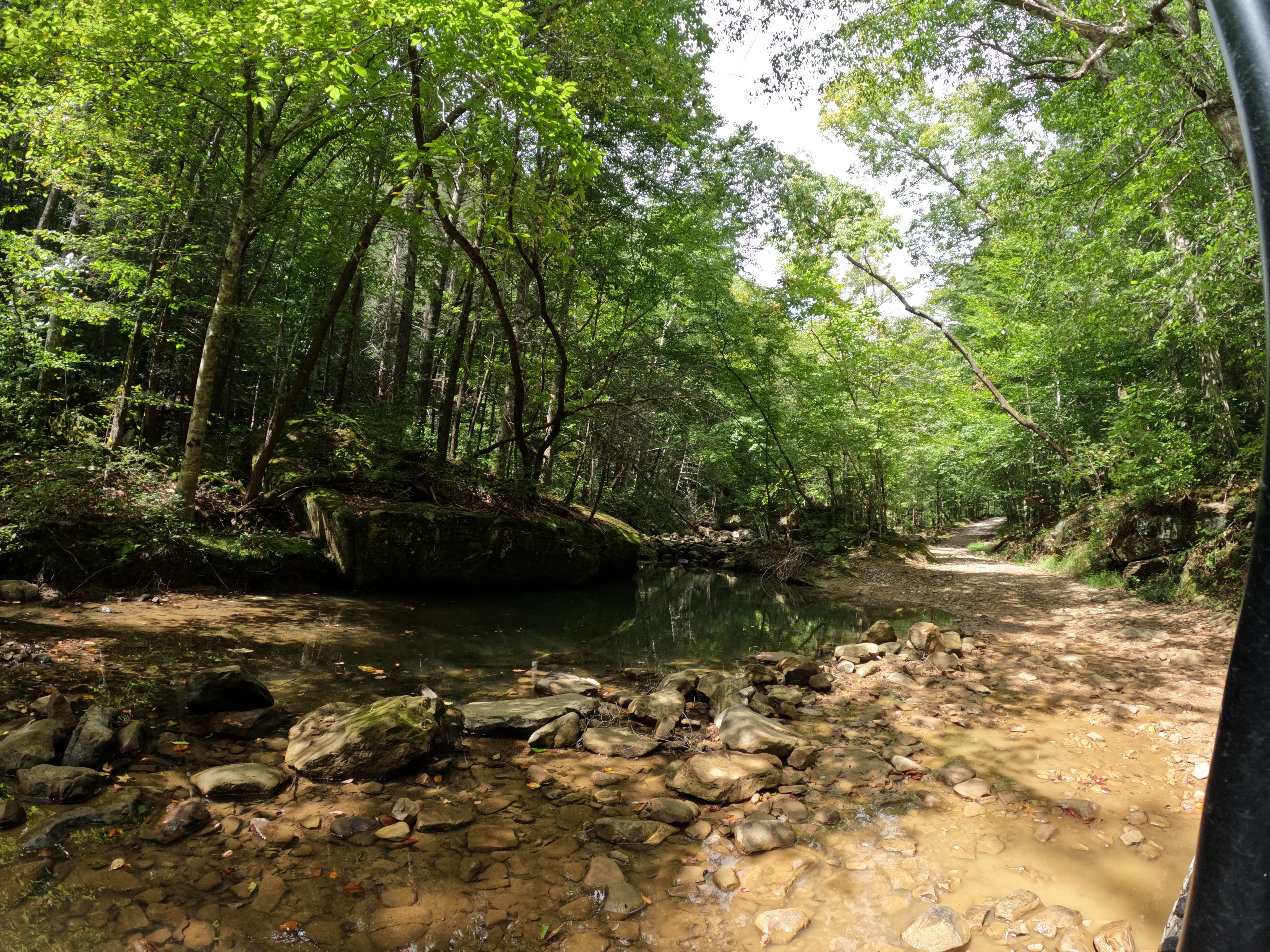
It was pretty. It didn't have lots of water in it, but enough to have some spots worth stopping for.
We pulled over where we could to enjoy seeing it. It is a gorgeous area and I'd definitely come back when we've had more rain. NOTE To Self: This creek has cascades on it and probably some wet weather falls. It also looks to be a prime Spring wildflower area!
Below: a pretty spot along Little Rock Creek
The Muddy Mile
We knew we had to turn and go back south to pick up Capuchin Creek Trail. We thought we had ridden most of before. We were wrong. Today we actually did cover 3/4 of it, but last trip was only a piece of that trail strung together with lots of other stuff. It was near a lot of human habitation. Today was not. The connector trail we encountered was called The Muddy Mile. We are in drought conditions so we were not terribly concerned. How muddy could it be this time of year? Oh we were to find out.
At first the trail went along by the stream. It was rocky and looked about like much of the other terrain we'd covered. The ground began to become wetter, softer and muddier. We started encountering the type trail where there is a SERIES of mud holes side by side. One after another. You might be fortunate to find a work around that avoids the worst of it. We picked our way through there best we could. Finally we ended up in the crux of the place. None of the mudholes looked particularly doable. Save one. It cut through the center and headed toward the creek. The crust of it was dried. I foolishly said "Let's try this one. It doesn't look too bad." Unfortunately Kenny agreed with me that we should try it. We did and it soon became apparent we had been deceived. The surface was gray, dried mud, but beneath that was squishy, black mud. We were pushing it and sinking in.
Finally even in four wheel drive we were stuck. The machine was sitting down in the hole with the edges of the mudhole higher than the doors. Kenny managed to climb out and once ahead of the machine it supported his weight. He hooked up the winch to a tree straight out from us and began to try to hoist us out of the predicament we were in.
Wheels began spinning. The winch was struggling. Mud began flinging up the sides at first. Next thing I knew the machine and the winch caught another gear and mud began slinging in the BACK window. I could feel big blobs of gooey mud sticking to the back of my head and hair. Ick!
Just when we began to wonder if we'd get out the machine grabbed more solid ground and we came up out of there! Halleluyer! I was relieved and had one of my laughing fits. Kenny had one of his cursing fits!
Above: This is how the low water ford looked. Who would worry about mud after seeing this?
above and below: signage for the Muddy Mile. Can't say we weren't warned.
Above: a pretty hole of water along the stream
Above: The worst spot along the Muddy Mile. Stuck. That's what we were!
Below is a video of us stuck and trying to get out. It is funny now that it is over. Who am I kidding? I get tickled at stuff like this when I am there. I try not to laugh too much lest I piss off the Big Guy.
Once we came unstuck we were able to check the satellite view and Kenny did a little quick recon on foot. He figured out we weren't even ON the trail. It was the second time today we'd gotten off course. Once we got on the trail again it was far simpler to finish that muddy section.
At the end of that part we encountered a pretty spot along the creek. It was one of my favorite views of the day.
Above: prettiest spot along Little Rock Creek today.
We continued ever onward and found ourselves at last on Capuchin Creek Trail. It is a pretty popular trail with the jeep crowd in particular. We began seeing side by sides and jeeps. It is a better trail with what would in normal water times be many, many creek crossings. Today it reminded us of the very rocky Bryants Cove trails down in Sequatchie County. It wasn't as bad as that. Bryants Cove during dry times is so much like a rough cobblestone road you will be aching for some smooth terrain. It can seem endless. At least the muddy spots along Capuchin Creek had a rocky bottom in them and you didn't have to fret over getting stuck.
Above: One view of Capuchin Creek Trail
Below: Another view of Capuchin Creek Trail. It has been discovered that this route is a prehistoric East-West Migratory trail for the Native Americans. Its western end was around Strunk (Silerville) Kentucky.
Below: a pretty spot where lots of pink Joe Pye Weed grew above the trail.
Above: Burned up vehicle we encountered on the ride today.
Below: We road Capuchin Creek Trail and eventually came to a point we had to make a decision. We had to decide which route to take to close our loop. We were both growing tired of the ride and wanting to wrap things up and head back. There needs to be A LOT to see to make the mileage worthwhile. Today was pretty and had its moments and redeeming qualities there weren't a lot. We opted to try a short, difficult trail that would put us over on Chitwood Mountain Road quickly. It proved to be a bit harder to spot than we expected. A super brief wrong turn and in 50 feet we corrected course. Kenny said "We had to miss it. I didn't see anything else, did you?" to which I replied yes! I sure did. I pointed it out to him and we tried that way. At the start it seemed fine, but he is pretty savvy. He remarked about the fact the trail didn't see much use. That bothered him. It was just around a bend we spotted a massive downed tree near the edge of a bluff. Clearing it would be hot, difficult, dangerous work.
Nope. We'd just take the longer, more traveled route. So that is what we did.
Now I was tired and about over this. We came to a point above Hole in the Earth. I took the shot of the view below. It was very pretty, but it was the last photo I took or video for that matter. I was over it.
Below: view above Hole in the Earth
We rambled onward out Chitwood Mountain Road and finally arrived on blacktop road. We were mighty glad to see it. A short time later we closed our loop coming out at Winfield Park and back up the main road to Lee's Market where we parked. I was worn out and so dirty. I took a quick bathroom break and helped Kenny load the machine. I climbed in the truck and began wiping off with Handiwipes. I was so tired. I told Kenny we were stopping on the way home to get supper. I was not cooking tonight. I was going to shower and go to bed. It was a fun day in all, but unless we visit this in another season with more water flowing or flowers to see I doubt it will ever be a favorite.
I made a video I'm putting here below to show the highlights of the day. A "Readers Digest Condensed Version" of the trip.