

Daffodils bloom along Catoosa Road
Cove Branch Falls in Catoosa
Dana & Kenny Koogler
Saturday March 20, 2019
26.5 miles of four wheeling round trip
2.2 miles of bushwhacking round trip completely off trail
26.5 miles of four wheeling round trip
2.2 miles of bushwhacking round trip completely off trail
Pictures are here starting with frame 102
Catoosa Pix
 Above: We found the gate unlocked and the road accessible today as it should have been.
 Above: unloading on a pretty day
 Blue skies and puffy clouds. Rural isolation. We saw a total of three vehicles all day.
 Above: Ancient pear tree. Wonder who planted this?
 Above: Close up of pear blossoms. The tree was swarming with honey bees!
 Above: This was likely some one's home site long ago. Field of daffodils under an old oak tree.
 Above: Close up of daffodils.
Catoosa Pix
A month or so back we made a failed attempt to visit Cove Branch Falls and Little Cove Branch Falls. We were not aware that the area of Catoosa we needed to access was gated for a month. We put it on the short list and planned to try again as soon as the gate opened. We kept our word and visited the first day we could. Saturday March 30. From February 1st through the last Friday of March.. the gate is locked. Yesterday was the first day it was opened. We had asked friend Doug Holder if he'd join us, but he said he had a race to run. He is the one who alerted us to the existence of this waterfall! Cove Branch Falls was clearly visible from a satellite view of Daddys Creek.
Before any of us could visit we saw where friends Jason Horton and John Lane had beaten us there. They did not know we were aware of it and vice versa. The good thing is they knew of the second falls existence.


Kenny and I are not spring chickens like those two and cannot keep up with them.
They are two hard core hikers/bushwhackers. We are old and slow and out of shape. Kenny even when he was in shape did not like backpacking and long hikes. Anything over seven or eight miles was a no go for him then. He'd occasionally be talked into or tricked into hiking something longer, but it was rare. The idea of a ten mile round trip hike that included at least a mile to mile and a half of bushwhacking was not appealing to him. Honestly I don't know if I could do it at this stage of the game. I am losing weight and getting in shape, but I have a long way to go on that journey.
We would have to visit it our own way. Kenny hooked up the RZR and we'd make it a more manageable distance by four wheeling out there and then bushwhacking. Doug, Kenny and myself had studied the map and figured we could get out the gravel road and then follow the dirt roads to get closer. Figured we could drop down off the bluff in the next drainage over from Cove Branch or possibly even two drainages over. I had studied the topography and drawn a track and then looked at the elevation profile for it. It was surprisingly manageable and nowhere near as steep as I'd expected.
I figured on about a mile or less of off trail. I was right, but not in the way I thought.
Below: Daddy's Creek near the bridge. Our first time ever seeing it.

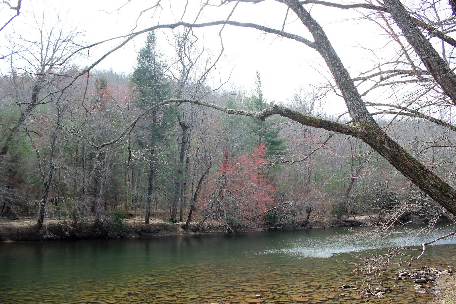
 Above: Another view of Daddy's Creek and the forest on the far shore.
 This big hollow is where Staples Branch comes down to meet Daddys Creek.
Below: Bridge over Daddys Creek was underwater a few weeks back! It is still sturdy,but looks worse for wear.


We did not have much trouble finding our way. We had done a lot of studying up and I had plugged in waypoints for crucial turns on the route. Kenny was wanting to wing it, and we made a couple brief wrong turns only traveling a few hundred feet before he'd correct himself. The second time he did that I got out the GPS and started using the coordinates I brought along. We had no more snafu's afterwards. The forest at Catoosa is mostly hemlock and oak. It is quite pretty. The fields up at plateau level are feed plots mixed with native grasses and wildflowers of all sorts. Some fields are boggy areas. Some fields are sage fields. We were riding along Catoosa Road when I looked to my right and saw an owl! A barn owl! He was beautiful. I did not get a photo. I wasn't quick enough. I seldom am. I considered it a good sign.

Above is a photo of an owl I was blessed to photograph. It was also seen during daylight
and in the Cumberland Plateau! Same type owl.. a great gray owl.
The roads and trails today at Catoosa were very dusty. I wasn't really expecting that considering how very wet and rainy things have been. By the end of the day I was covered in dust. I was breathing it in, my eyes gritty, and could feel it all over and taste it. I will take mud over dust any day. We survived it though. I asked a local fellow about "Dripping Spring" if it was anything neat? He said no, it was nothing special. He hit the nail on the head. We found it exactly where it was supposed to be by the trail, but it was just a slight depression in the ground with a little green pond scum and water. We figured we'd get to a point where we'd have to pull over and walk to the bottom of the gorge working our way down a slope. The trail continued all the way to Daddys Creek and a sandy beach. You could have bought us both for a nickel. The shores were dotted with bright yellow trout lilies and white bloodroot growing in the sand. I also saw yellow violets and wood anemone. First really pretty wildflowers of the day. Along the road we saw peach blossoms of bright pink. Sarvis berry bloomed along Daddys Creek along with red maple buds.
I walked over to the stream. A very isolated stretch of Daddys Creek flowed past shimmery green.


Someone had a fire ring on the beach and had hung a grill grating on a tree limb. I imagine this would be a nice place to camp and swim. The sun shone down warmly on us. We packed up our gear and set out in the direction of the falls. Massive boulders are mainly along the shores of Daddys Creek in this area. I am sure downstream there must be islands and boulders in the main channel.
Evidence lay scattered in the limbs of trees and shrubs and scattered on the shores of how high the waters were a few weeks back. The flooding here would have prevented us from getting anywhere near the shore. All that was underwater. High above us somewhere on the bluff was a new section of the Cumberland Trail. We knew it did not lead to the falls though. No trail does. It is 100% bushwhack.


Round lobed hepatica blooms on the river banks.
We had to vary our path from immediately along the stream to moved over into the woods. We crawled over boulders and rocky shoals. We side hilled it in spots which is slow going and painful.
We saw flags, but I wasn't sure if following them was a good idea or not? Some looked like boundary markers more than a route to anything. It was tedious and slow going, but we just took our time and pushed on. We came to a boulder field covered in moss and leaves. Each step in a place like this better be tested with a pole before putting your weight on it. Check for holes and check for solid ground. We saw immense bluffs above us to our left. Sometimes going along a bluff line can be easier, but we stayed with our general path most of the way.
The woods were fairly open considering other stuff we've struggled through. Finally we got to a point we could hear then see the falls! We had to climb down a slope of rhododendron into a patch of enormous boulders. Cove Branch Falls cascaded down the cliff in all its majesty! It was worth every ounce of effort and struggle. We sat and took pictures. Ate lunch beneath the towering cliffs that surround the falls. The plunge pool at the base of the falls was a pretty shade of blue.


Another glimpse of the falls minus the trees. You can see a bit more of the plunge pool here.
We sat down and ate lunch. I was so tired I had gumby legs. Every time I'd pick up a foot to take a step I was trembling. Time to rest. We sat and enjoyed the cool breeze off the falls and the incredible beauty of it. Kenny said a couple times. Worth every minute to get here. It really was.
We may be getting old and out of shape, but we haven't completely given up. We still find a way and get it done. Finally tired of taking pictures and video I packed up my gear and prepared myself for the hike back. It usually ends up being a little easier since it is now a known quantity and we often avoid some of the harder terrain and mistakes. We worked our way back gradually to the RZR.
We made it there and back in one piece. Tired but happy. I am tough, but only to a point. Now all I wanted was a shower, a hot cup of coffee, a hot meal and my comfy clothes. I wanted all that sweat and grit off me. We stopped on the way home and grabbed a quick bite at a drive thru. No going in for us. Too dirty as usual!
Below is a video of Cove Branch AKA Fire Rake Falls
No comments:
Post a Comment
Thanks for reading and commenting. I enjoy hearing from those who read & make use of my blog. I have made some wonderful friendships through emails from readers. I respond to all comments and emails. I appreciate folks reaching out to let me know when my blog entries are not functioning correctly or if the situation somewhere has changed. Many Blessings to you!
Dana 🐝