Above: I am holding a chunk of what must be rock blasted off somehow during the railroad building operations in this area. It has tool marks in it for sure.
(All tunnels & bridges we visited are featured on this page)
Links to all waterfalls but one.. a wet weather one.. are found as highlighted links embedded in the trip report.
Kenny has been working a job where he is the only crane operator allowed on site because of some snafus at the outset of the thing. It is good pay, but it is limiting in that you work when they say. Not much way around it. He finally had enough and needed a break and I needed us to do something together as a couple again. He's my husband, but he's also my partner in crime so I miss him when he's not around to go have adventures. We talked it over. We needed to make it count. Finally we settled on heading out to Nemo to check out railroad tunnels and get some shots of the beautiful green Emory River.
above: Nemo Bridge is a preserved steel truss bridge over the Emory River. It parallels the current day road bridge. I am glad they did not take it down.
Below: the Emory river upstream of the bridge
We set out early in the morning to make sure we had plenty of time to do what we wanted. We had a long list of stuff to do and see. We took along a picnic lunch. We had never had the RZR and this rig out to Nemo before so we weren't sure how this was going to play out. We'd never tried to park at the bridge before. We arrived to find a few other folks had the same idea. While he unloaded the machine I strolled over to the Nemo Bridge to get some photos and video footage.
I returned to the truck to find Kenny chatting with a young couple in a pickup they were using to go four wheeling! We did not know we'd have the opportunity to make two nice new friends today, but we sure did! This is how and when we met Paul Baker and Macy Osgood! We kept running into these two fun persons early in the day. They were like us in that they love to explore and they are very willing to share information as well as receive it. I look forward to getting to know them better and do more stuff with them.
We started off by heading toward the Nemo Tunnel, but turned and went down near the Obed River first. I spotted a set of bridge piers I'd never noticed before. I wanted to check those out.
Above: neat set of bridge supports below Nemo Bridge. I had never noticed them before.
We now continued toward the old tunnel 24.. Nemo Tunnel. We stopped just past it so I could get a shot of the south portal of the new tunnel that is on the live railroad track. It was splashed with racist and homophobic graffiti as well as Misti Loves ?? so and so. Paul and Macy pulled up about that time and also remarked how terrible it is for people to be so ignorant and sloppy as to do this. I have to agree. I have a photo below that I dressed up with a rainbow for ALL God's children of every color, gender, and sexuality. He made and loves us all. No sense in that. Someone else thought so too because happily one week later we came back and found the graffiti gone!! Painted over. Whoever you are..... big Thank you!! We got to talking and Paul said there should be a waterfall on the opposite side of the tunnel, but he wasn't sure where. I knew of one falls that we were going to see today. I wondered if they were the same?
I hope whoever painted those messages sees this and knows..... not everyone feels that way.
We went onward toward the old tunnel and went through because it is fun, but also we needed to get to the other side where lots of the stuff we wanted to see was located. There is a bypass trail that avoids the tunnel for people on foot or anyone who just doesn't want to go through it. It had a lot of water in it today.
Below: photo from where we came back through Nemo Tunnel
Below: photo of the south portal of Nemo Tunnel
Below is a video of the ride through Nemo Tunnel
The drive through the tunnel was fun as always. It is an abandoned tunnel and in pretty good condition. The old tracks have been removed also. It has varying amounts of water through the year, but I've never seen it dry. Once on the opposite side we drove along the trail that goes the same direction the live tracks go. It heads up river. We got to see the opposite end of the live track tunnel. It was unremarkable except to say there was no graffiti. A short distance later we spied Nemory Falls on the opposite side of the tracks down in a holler. It was flowing great today. We pulled well out of the way on the edge of the trail away from the tracks. We carefully listened and looked for tracks and crossed over them to see the falls up close. It was worth the stop.
Below is a photo of the falls.
Here is a video of Nemory Falls that shows it off better than a photo can.
Once we'd had a chance to see Nemory Falls we continued up the river toward a point I'd seen marked on Google maps as Nemo Tunnel Lookout Point. It is just that. It is a spot where you can look at the river and the surrounding territory. It is not spectacular especially on an overcast day, but it is a nice spot. It gives you a view of where the Obed River and Emory River meet.
Above: View from Lookout point. It is looking straight up the Obed River.
We pressed onward looking for tunnel 23. We arrived at the current day trestle that the rail line crosses. It is a pretty spot and quite an engineering marvel. We stopped to look around to see if there was a way to any of the abandoned tunnels from here. I also just wanted to check out the spot and see the river. The Emory is green as jade in Winter. It is beautiful. While we were there poking around we had the good fortune to see a couple trains cross the trestle. It is a powerful sound and exciting!
Below are four photos that show the train passing overhead.
Below is a shot of the Emory River near the trestle.
Below: looking directly up at the now empty trestle. It has a catwalk on it, but I'd not get on it. It is illegal and dangerous.
Above: A view of the mighty trestle that enters the mountain on the opposite side.
Below is a video of the train crossing the trestle.
We found no further access to old tunnel 23 from here so we doubled back.
We went out the trail and turned and headed in the direction the GPS indicated.
We were riding along when I looked over and spotted it. It sits across the tracks and down over the current day rail bed in a low area. We parked and walked over there to see it. Kenny felt uneasy leaving the machine where it might be in the way of other riders. We've had friends get machines stolen and he is very paranoid about this happening. He went back to get it to park it on the same side as us.
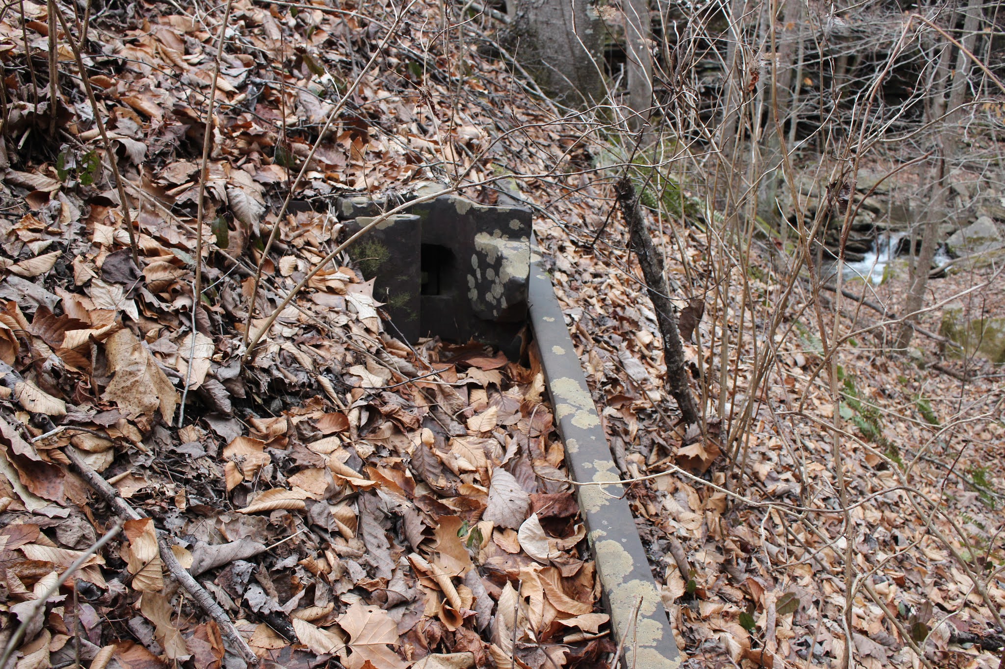
A train was coming so I yelled at him and he saw it and waited for it to pass before moving the RZR. I got another video of a train which was nice. I stood there watching the train from a safe distance I looked down and saw the old iron capstone for the tunnel lying to one side. It had fallen off. The number was no longer readable.
Once across we took the RZR and went through the tunnel. It was in good condition in fact dry all the way through except for at the very start and that was maybe 10 feet with stepping stones to help you stay dry. It was cool to venture through and come out to the north side. Now we were on the old railroad grade which we needed to find in order to continue our trip.
Below is a video of tunnel 23 on either end, the train passing, and riding through it.
Below: The south portal Old Tunnel 23
Above and below: two freight cars I liked the color of.. The graffiti on the one is actually rather nice.
Below: The end of the freight train disappearing into the tunnel past old 23. I am not sure of the number of that since many of them were bypassed. That final tall car is supposed to be a car carrier or for tall cargo.
Above: North portal of Old tunnel 23. it is rugged.
Above: The RZR pulled on down the former rail bed. We parked here and walked.
Walking the old railbed was not too bad. A few downed trees and briars, but we've done far worse. We had not gone far when we I began to hear water spattering again. It was the second wet weather falls of the day. It was not quite as impressive as Nemory Falls, but still nice to see.
Above: bonus waterfall I'll call it.
Above: Walking the former rail line
Below is a video of the "Bonus Waterfall"
Once we'd got out on the old railbed it did not take very long to walk it to the place where it ends on a bank above the Emory River. Out in the distance we could see jade green water and foamy white waves of the rushing Emory River at high water. At the end of the rail grade there was a concrete support and a rusted cable going off through the trees into the distance. A couple large bridge supports are at the river bank as well as in the river itself. Across the river in the distance is supposed to be Old Tunnel 22. We very much wanted to see it today, but the river was far too high to wade it safely. We reasoned that would have to wait for another day. We spent some time checking out this pretty area. The scenery here was more than worth the walk.
Below: My favorite scene from the day.
Kenny along the river bank
Above: waves rushing past the bridge piers
Above: Until you get to these and stand beside them no photo can really show you how large they are. Quite imposing!
Here is a video of the spot at the end of the river where the second set of bridge piers were.
Having found several of the spots we were hunting today we reversed course and headed back toward Nemo Bridge and the main parking area. We had eaten lunch while at Tunnel 23 so we decided next to head along the railroad live tracks to see if we could find the waterfalls down that direction.
We went down the tracks at first on the right hand side. Then you come to a crossing with a signal. We crossed here and continued on the left side which is now wider and safer. There are a couple places along it where pull offs are dug into the bank so you can get further away from the tracks and also to turn around.
We easily found Railroad Falls right beside the path. It was flowing awesome today. It comes down the mountain, over the falls and flows under the tracks through a culvert. According to Kenny's friend and co worker, Hopper, who lives in the area, all these falls along here are wet weather. Bear that in mind before planning any visits.
Below is a vertically oriented shot of the falls main part. It is hard to get back far enough for a horizontal composition and I was NOT going to stand on the tracks!
Below is a video of Railroad Falls and Upper Railroad Falls which we found and documented today.
Below: Railroad Falls is neat in that you can get round to lots of various angles to take photos of it. Here it is disappearing into a culvert to flow into the Emory River.
Mossy stonework culvert above
Above and below: two different views of Upper Railroad Falls which is within sight of the lower falls. If you click the link for Railroad Falls and scroll to the bottom of the page the info for that falls is there.
Another pretty cascade on this little stream
We loaded back up and headed down stream. I knew there was one more falls documented further down. I also could see more waterfalls on Crooked Fork from a satellite view. That is the same stream Potters Falls is located on.
Spotted Rock Falls is the name of the final documented falls along the railroad tracks. We were heading toward that or so we thought. We quickly happened upon another falls and I wrongly believed we had arrived at it. It is very small and I was not particularly concerned about seeing it. Certainly I'd not have made a special trip for it. I figured since we were already here... why not?
I looked into the woods and was astonished. It was bigger than the photo had shown. I figured that was on account of ample water coming over it. It probably just looked more impressive with greater flow. We pulled over and found us a spot to clamber down the bank to check it out. Near the start of the little off trail to see the falls we spotted a broken telephone pole and some kind of equipment. We also saw an old steel rail embedded in the ground. Saw some knocked down woven wire fencing and posts. I know the pole and its cross member was some sort of communication set up. I know they used something called tell tales to signal an upcoming bridge or tunnel. I am not sure that is what this is, but maybe. It does not look the same as historical photos of the way the old set up was. I am betting it is some sort of signaling device, but probably more recent in its origins.
Old steel rail and some larger device attached to it. Maybe someone out there can tell me what this stuff is?
Below: cross piece with some type communications equipment
Below; another mossy green culvert of some fine stone work!
Below: a photo of the whole falls of Bear Branch Cascade taken from the path high up. This makes it easier to see the entire thing although trees obscure part of the view.
Above and below: two views of the low, wide, Bear Branch Cascade. Turns out this is NOT Spotted Rock Falls. Nowhere close. You cannot reach that falls from here as it lies past the Crooked Fork Trestle. You have to come in another way.
This was a really pretty spot and we enjoyed it.
I am NOT including the waypoints or page from Tennessee Landforms right now. The reason is that after I submitted it to Tom I later looked back at something and noticed an error. He put it up in Gobey where another falls is located. So the Bear Branch page right now is inaccurate. It is less than 1/4 mile past Railroad Falls and is in easy view of the path so you cant miss it if you go looking. Once the correction is made I'll add it here.
We headed back up toward the parking area where we started off. We went down along the river again for awhile. I saw a pair of wood ducks. It was beginning to mist rain a little. We went across the bridge and up the road trying to check out an area Paul and Macy told us about. We really did not not the time, but what the heck. We checked out the Rock Creek Campground which is very nice for tent camping. Kenny believes there should be a falls back behind the campground. We went looking, but did not go far enough. We'll hopefully go look again and find it. It is off trail for part of the way.
Below is a video of Bear Branch Cascade
To conclude the trip report. We had a great time. We loved it so much we turned round and went back shortly thereafter to tackle finding stuff we'd missed or not had time for.
In the What Did We Miss Category
Crooked Fork Trestle
Rock Creek Double Trestle
Old Tunnel 19 & 20
Old Tunnel 22
It is a fascinating area and surprised us at what we'd missed. According to Paul there is more!
**Thanks to Jerry Williams for noticing and mentioning the corrections on the photos and trip report I needed to make. I had incorrectly thought that the river below the Obed stayed the Obed and the Emory ended. He noticed it and straightened me out so I could correct the trip report and any photo captions. I found a map I had been referring to that was the culprit on some website. Its was incorrectly labeled and I took it for gospel.
No comments:
Post a Comment
Thanks for reading and commenting. I enjoy hearing from those who read & make use of my blog. I have made some wonderful friendships through emails from readers. I respond to all comments and emails. I appreciate folks reaching out to let me know when my blog entries are not functioning correctly or if the situation somewhere has changed. Many Blessings to you! Dana 🐝


No comments:
Post a Comment
Thanks for reading and commenting. I enjoy hearing from those who read & make use of my blog. I have made some wonderful friendships through emails from readers. I respond to all comments and emails. I appreciate folks reaching out to let me know when my blog entries are not functioning correctly or if the situation somewhere has changed. Many Blessings to you!
Dana 🐝