
 Above: turks cap lily at Tipton's Creek NC

Tellico Plains Camping Trip July 2022
Dana & Kenny Koogler
Andy Milsaps and Harley Smith
Randy and Sandra Brummett
July 22 Friday thru Tues. July 26, 2022
We had a rare opportunity to go camping for a get away weekend in late July.
It worked out extra good that some of Kenny's co workers and their spouses were heading down there to the same area we were. I got to finally meet Randy and Sandra Brummett and just loved them. I also got to see the sweet couple Benji and Tammy Shaw. I did not realize that Randy and Tammy are siblings! Andy Milsaps and Harley Smith, his little buddy, Becky Smith's daughter came by also. Anyhow it was old home week at State Line. Wonderful people and a relaxing time.
We had never camped at State Line before. Some of the things on my list I wanted to scratch off were to revisit Tellico and Upper Tellico Falls. I also wanted to bushwhack or creek walk up to Peckerwood Falls since it was so near the others. I wanted to get to Gnatty Branch Falls. I wanted to make it over to Murphy, NC via Davis Creek Road. I knew there was supposed to be a waterfall along it though I had no idea where. I also believed it would possibly be a good Summer wildflower drive. I wanted to hit up the Murphy River Walk. I hoped while we were here I could get up toward Santeetlah Creek. I believed I had found a waterfall in that drainage and wanted to check. We also discussed hiking to Goat Falls. All these items had been on my wish list for a couple years.
Day 1--Quit Ruirnin' My Life
The Friday we arrived we did not get there until midday. Kenny had asked me if I thought it would be a good idea to bring the RZR. I told him no. I just didn't think we'd use it that much for one thing. I also had a bad feeling about it. He really, really wanted to bring it so I finally relented. I rationalized that with gas prices being what they were it might save us some fuel putting around on backroads. We set out toward North River on the side by side. It was getting late, but I figured we could take a ride and go down over the bank to see Meadow Branch Falls. We got behind a couple vehicles creeping along. One was a pickup truck. They finally pulled over in a wide spot to let us pass. We did pass them and as soon as we did I knew we were sunk. It was forest rangers. They hate side by sides down here or at least they seem to. This was what I was hoping to avoid.
We got a ticket for not having seat belts on. That was legit. We got a warning about the non compliant windshield. We got a warning about Kenny's LED light bar. It was a real buzz kill. Make a long story short we found out that it is indeed true that the windshield needs to be DOT approved. We also found out these weren't ordinary forest rangers. They are federal marshals working in that capacity because of the shortage of rangers. The one guy was training the other so it was a by the book day every single day while this was going on. The one guy who was a little older... you could tell he did not want to do this. He was trying to put us at ease and smooth things over. I could feel his discomfort at the whole situation.
He ended up going back to the truck and making the younger dude.. the trainee do the ticketing and finish the job. Young blood was in a pissy mood without one qualm about writing tickets or ruining someone's day. Once they left we turned around and headed back to camp. I was over it. I told Kenny to put the machine up and not get it out again far as I was concerned. Later in the weekend Randy got a ticket for blocking a gate by 2 inches. Same dudes. Where they were hiking there was nowhere else to park! We heard from our buddies that some guy got pulled over for drunk driving and lead away in cuffs. Day one was a bust.
Day Two--- A Fresh Day With No Mistakes In It
The second day of our trip we got up and were well rested and in better spirits. We planned to go up to the old Upper Tellico OHV area to hike to the falls. The order we would arrive at them on the way in would be Peckerwood Falls, Tellico and then Upper Tellico Falls. We decided the most logical way was to do the closest first. Peckerwood Creek Falls it is. The hike is only a little over half mile one way. Approximately a quarter mile of it is a complete creek walk/bushwhack. That sounds mighty short and should be easy. Oh it was anything but easy. We have done worse, but it was pretty tough. We forded the Tellico River which is an over the top of your boots wade almost anytime of year.
Below: The Tellico River up here is more narrow than down near Tellico Plains. The hazy appearance is from advection fog coming off the cold waters of the river. Everything around was mossy and green.


Tellico and Upper Tellico River Falls Directions
Once across the Tellico we hiked on a path a very short distance to where we had to ford Peckerwood Creek. It was running fairly well today and was not a rock hop, but a wade. It is a tributary stream so was narrower than the river. We could see very quickly that the simplest way to do this was going to be to stay in the stream as much as possible. The banks on both sides were thick with rhododendron. One thing about staying in the creek is that there are quite a few pretty pools and cascades on the way. It is nice and cool in Summer. Today in these mountains it was far cooler than back in the flat lands. We came to a wide pool and a low cascade and this was the first place we had to climb up.


I am showing all these photos and steps because it helps explain for those that don't do this stuff how come it took 1 hour to travel a quarter mile. Everything takes many moves to negotiate. Somewhere during the crawl up this falls I snapped my thumbnail off down into the quick. It did not hurt as I did it, but upon putting it in the cold water it hurt like a sumbitch. Kenny pointed out that if I was going to get back to doing this sort of raking around in the woods and creeks I needed to get my nails cut far shorter! Before the weekend was out I snapped off another one down into the quick though not as bad.
We pressed onward this time on the creek right. We had more places to climb around, but some of those were so bad I had to put the camera away. I needed all my focus and my hands free. I was also watching out for snakes. Thankfully we did not see any today. I tend to attract them though I don't know why. I have had Mike Gourley tell me this before that if he was hiking with me we'd better be extra watchful and he is not wrong.

Above: our first look at Peckerwood Creek Falls. I had the GPS running to let us know when we arrived at the falls. Standing here it did not beep. That means you are not yet at your destination. Because of this we continued on creek left. It was more struggle and contortions to continue. Kenny insisted we keep going. To be fair you couldn't see real well what lay ahead because of the terrain. You surely don't want to stop just shy of the goal. We kept going and arrived at a flat rocky spot. Finally the GPS unit beeped. The waypoint was taken just above the top of the falls. We had gone a tiny bit further than was necessary.

Below is the flat rocky place where the waypoint indicated we had arrived. The waterfall is just down over the brink of this. From here you cannot see what is below.

We decided to try a different way to get back down. Instead of returning the way we'd come we went to the river right and worked our way down through the rhododendron. It was pretty rough.

Above : a view of the rhodo tangle that is inescapable. We found a few patches where the vegetation was thinner, but they were small, few and far between.
We worked our way downstream through this mess that did not let up. I am so out of practice doing this sort of thing that by the time we got down toward the bottom I was claustrophobic. It may sound silly, because you are outdoors, but being in the confines of this sort of thicket can give a person claustrophobia. I have army crawled through miles of it in the past. A mistake I have not repeated. At least not yet. I could hear the creek and all I wanted was to get to it. I felt so much relief when I could see open ground again and water. The bushwhack was worse than the creek walk. I was constantly waiting to get snake bitten.
We came out at the crossing of the Tellico River! We sat down and thought we'd eat our lunch here or a snack. It began to pour down rain. We left our boots on and forded the stream and headed for the truck as fast as we could go. We got there drenched. We got in the truck and ate lunch while the rain continued.
Finally the thunder storm let up and the sun came back out. Kenny asked me what I wanted to do next? Though I was tired and wet I was determined to get to the other waterfalls. I figured there was no use quitting now when we were this close. Those two falls were only 3/4 mile further. Back we headed to ford the river for the fifth time today. No sense bothering with water shoes at this point. We knew from past experience that at least these falls had a trail the entire way.
Covering that mileage with a trail took far less time and effort. The hike is very pretty besides. Today instead of seeing milky gray water coming down the stream we saw sparkling clear, clean water. The forest was deep and green and quiet.
The sunbeams were making their way through the forest canopy. Fog rose from the cold mountain waters in wisps. We decided to visit Upper Tellico Falls first then double back to the lower falls. It was visible down below us with a sheer drop off at the vantage point.

Below is a video of Upper Tellico Falls
We enjoyed the view of the upper falls from the overlook. We were grateful to be able to get a clear look at it without having to find our way down. We backtracked to the lower falls. Here we tied off a rope and used it to descend the slick, muddy slope to the base of the falls. It could have been done without the rope, but it sure made it easier and safer.
The lower falls is not as large or impressive, but it is easier to access. The forest here is a vibrant green in Summer. The wisps of fog filtering up through those green leaves and the sunbeams shining down were magical. It did me a lot of good just being out in nature. Recapturing my old self a little at a time.


Below is a video of Lower Falls on the Tellico River. At 1:38 you can really get a good look at the advection fog rising up through the trees! The video shows much better the pretty symmetry of the waterfalls hour glass shape.
Once we had seen all we cared to see we climbed the rope back up to the trail. We began our easy trudge back to the vehicle. We forded the Tellico River for the sixth and final time today. We were too tired to care about walking up to Fain Ford as we discussed, but that will just be a reason for a return trip. Once back at the truck the drive to the camper was cake being that close. One thing about State Line: It was convenient to many of the things we wanted to do and see. Back at the camper we shucked off the wet boots and hung them up in the sun. We went in and showered off the dirt and got dry at last. I lay down and rested a spell. We got up and fixed a nice dinner on the grill. We enjoyed a fire and the sounds of the forest.
Day Three-- Davis Creek Road to Murphy River Walk
The day after the big waterfall hike we were stove up and sore. We slept in and enjoyed a leisurely cup of coffee and breakfast. We decided we would make the trip over to Murphy via Davis Creek Road. We'd see what we could get into?
It would not be strenuous. We could hit up the river walk while over in town.
The drive over via Davis Creek Road turned out to be extremely pretty. It had one spot where there was a view at Harshaw Gap. We saw lots of beautiful Summer wildflowers. I discovered Michigan lilies for the second time in the mountains of NC. We found the little waterfall on Dockery Creek. We saw lots of pastoral scenery. Somehow in all our excitement we missed the turn for Hanging Dog Recreation Area. We will have to try that again.
Below: We saw lots of smooth flowering raspberry


Below: Michigan Lily.. it is past its peak bloom. They are closely related to turks cap lilies. Unlike the turks cap they lack the green center star. Yet they grow on tall, multi bloom stalks. They are usually a deeper red color to peachy pink. The petals recurve back to but not past the center of the flower. There are other minor differences with leaves. This is one of those species of wildflowers that is debated among botanists as to "It's a separate species" and "No its not. It is the same thing as turks cap." to "It is a subspecies of turks cap". I don't have time for that.

Below: We also found quite a few Carolina lilies. These also lack the green center star. The throat of the lily is cream colored. They tend to have far fewer blooms and grow on shorter stalks. I found some examples where Carolina, Michigan and Turks cap lilies were hybridizing as well!

Below: is a partial view at Harshaw Gap


Below: The lower drop of Dockery Creek Falls.

Below is a video of Dockery Creek Falls

Murphy River Walk
Once in Murphy we found ourselves in unfamiliar parts of the town since we came in the back way. The good news was that we came right by the Murphy River Walk or a big chunk of it. It took us a minute to figure out the best way to access it and park out of the way, but we got it done. One unexpected thing that happened today was that we completed driving the remainder of the Joe Brown Highway! It starts at Coker Creek Tennessee and runs to Peachtree Street in Murphy, NC.
Here is a Map of Murphy River Walk
We parked the truck and walked down past a gate to start our trek. We parked along Tennessee Street at a pull off. We hiked down first to see the old railroad trestle across the Valley River. It is quite pretty. We walked around to the Hiwassee River under the old railroad tracks and bridge. It is a swamp here and the trail is on a board walk. We saw buttonbush and wild cotton in bloom.

Above and below railroad bridge over the Valley River

Below: This part of the River walk is on a plank floating type affair

It is another native species that grows well in wet areas as it likes lots of water and sun. It is a great pollinator garden plant for bees, butterflies and hummingbirds. Plus it is pretty.

Below: buttonbush bloom
Buttonbush is a great pollinator plant. It feeds hummingbirds, lots of types of butterflies, moths and caterpillars. It is pretty and the berries are edible to humans and various types of wildlife. It is easy to grow as it is a native species.

Below: a view of the Hiwassee River from the river walk


This is way cool!

Below: a sign that tells the story of Leech Place.. the Cherokee legend

Below: a pair of wood ducks on the river


Day Four-- Santeetlah Creek Falls and Wolf Laurel Logging
We woke up on day four and decided to try to head back into Santeetlah Headwaters to see if I could locate the waterfall I believed existed with Kenny's help. I had been able to hear it when I was there, but not see it. We would then ride up toward Wolf Laurel and see some pretty flowers and some waterfalls.
Kenny had not been back in Santeetlah Headwaters as far as I had. We went and did find the waterfall and it is real. It is worth seeing. It was a thicket of the worst rhodo and a steep bluff with no apparent way down. We realized we had to do two things. 1. Wait until cooler weather. 2. Find the way down. We worked on the way down a bit more,but it did not reveal itself until after I returned home to Walland. The info gathered in person from the visit coupled together with topo maps online at home figured it out for me. It would not be easy, but not real hard either. Bonus into the deal I found a great video of the waterfall. Another lady, a geologist found it in her studies and made a nice video of it. This doesn't hurt my feelings one bit. Matter of fact it was a nice preview. It means it will be worth the work to see!
We drove on up toward Wolf Laurel. This is usually one of my favorite Summer wildflower spots. Today I began to see things that distressed me. The road was in fine shape which was nice. I remembered that a year ago an announcement was made that the road was closed for maintenance. I have been there many times so it did not upset me. I knew periodically things have to get taken care of. What I did not realize until today was that the so called maintenance was a necessary solution to a problem created by the forestry service. It is a department of agriculture branch and as such they treat trees like a commodity. They logged the area so heavily and damaged the road so bad it was skint and had to be repaired... not maintained. It was sickening. It put me in a very dark mood.
It wasn't enough that the clear cut logged, but their cutting along the road caused landslides from ball hooting the log loads. It also messed up the access to lower Cold Spring Branch Falls. It was unrecognizable. I saw very few Summer wildflowers. The damage from their bushhogging caused locust trees to be hanging down into the road now. What a mess!
Below: rose gentian blooms by the road


We got to the end of Wolf Laurel Road and tried to decide what to do next?
In a moment of pure synchronicity the sky was opened up and crying. Just like my heart was for the destruction wrought on this beautiful place. I know in time it will recover, but I wish that the forestry service would take a bit more care and employee industry best practices to harvest timber. The rain beat down and the fog swirled and the mountains grew dark and dismal as my mood. I don't often feel this way, but today I soaked up the mood of the place. I was done. Kenny could see what this was doing to me and took me back toward the camper.
I got in and put on warm, dry clothes. I laid down and took a nap under some fluffy blankets and got warm. When I woke up the rain and stopped though the skies were still a bit gray. We had a nice visit with the man camped next to us who was super friendly. He was former law enforcement and shared with us a nice new map he'd bought. He also shared some local knowledge about what had gone on in the area with the marshals. It helped confirm what I suspected about the entire situation. We won't be bringing the side by side down here anymore. It just isn't worth it.
Day Four-- Home
I was ready to go home the next day. We packed up pretty quickly. We stopped in Madisonville on the way out to eat lunch at Bert's Restaurant. It was great to go and great to get home. Things did not work out exactly as planned, but then they seldom do.
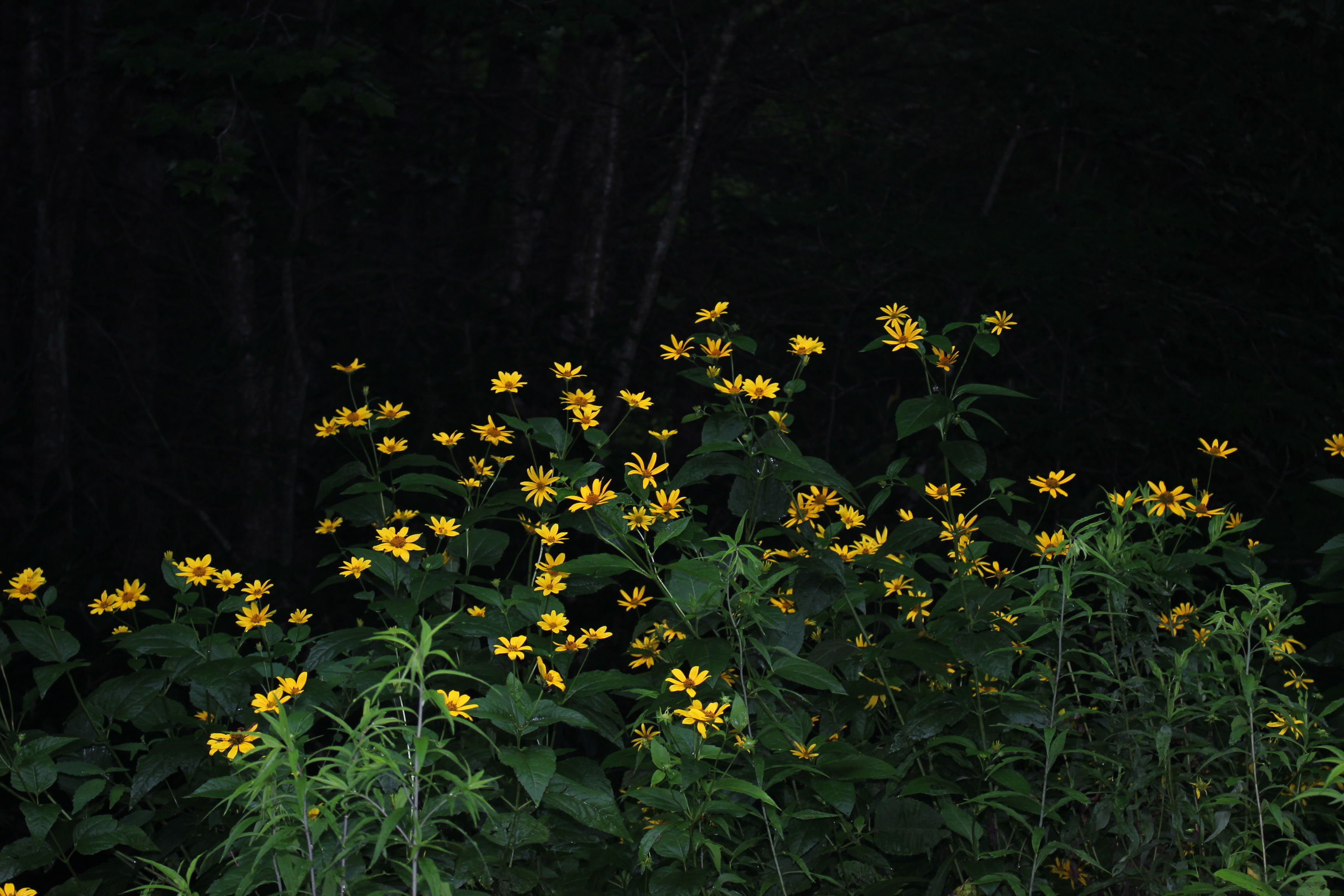
Above: a pretty patch of yellow sunflowers at Santeetlah Headwaters
No comments:
Post a Comment
Thanks for reading and commenting. I enjoy hearing from those who read & make use of my blog. I have made some wonderful friendships through emails from readers. I respond to all comments and emails. I appreciate folks reaching out to let me know when my blog entries are not functioning correctly or if the situation somewhere has changed. Many Blessings to you!
Dana 🐝