
Friend John Quillen wrote one of his interesting articles for Cityview magazine. It was about the Meigs Line. He knew I'd probably be keen to read this one, and sent me the link . It was fascinating for an outdoors person, off trail hiker, and history enthusiast. I have tried returning the favor by researching Quillen Mountain for him. Coming up with a rational and simple approach. I don't want my buddy to get his butt shot off. 😁
The Meigs Line is a survey line run by Col. Return Jonathan Meigs and Major Thomas Freeman, a surveyor. Meigs was a Revolutionary War hero and well respected. He was an Indian agent and the best of diplomats between settlers, Native American's and the government. Others had done this survey before trying to define a boundary between the Indian lands and settler's land. Col. Meigs wisely included a large delegation of Cherokee Indians to assist and supervise. The two nations worked together to resolve a longstanding conflict.
Below are the reviews of the two books I bought on the subject.
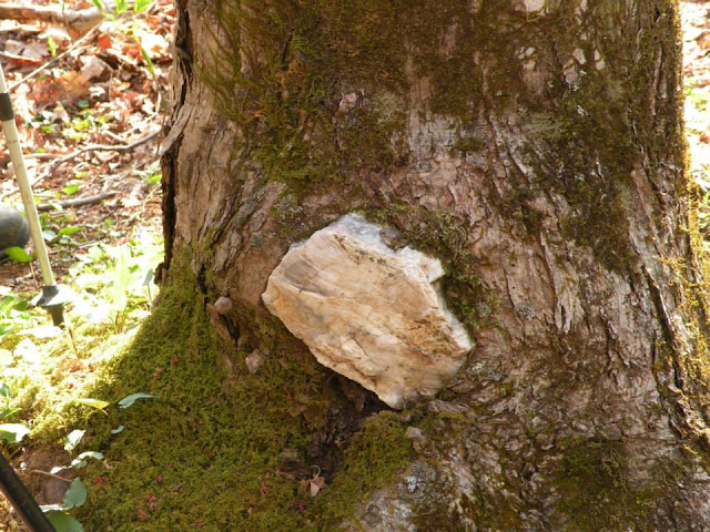
Below is a photo of a quartz rock embedded in a tree. This is part of the Meigs Line markings. It was a commonly practiced by the Cherokee people.
Meigs Line by Dwight McCarter & Joe Kelley

Above: photo I took of the front cover of my copy of the book
Boundaries: The Meigs-Freeman Line by William R. Thomas

I ordered this book at the same time as the McCarter book. I ordered it because I have a serious case of FOMO. (Fear of Missing Out) I am almost insatiably curious once on a given subject. I also remembered the name William R. Thomas and suspected he was the same Bill Thomas who authored the now out of print The North Carolina Sierra Club's Guide to the Jocassee Gorges .
I have long sought a copy of this book, but thus far been unsuccessful. I figured if it was the same man at least I'd own something he had written. It seemed the next best thing. I have a penchant for books and the idea of one being out of print and unavailable just torments me.
Boundaries book arrived first and I began reading it. It was a slow and at that point boring read. The book is far thinner and contains many illustrations, charts and scanned in copies of letters and documents. I found it tough to get interested in. I set it aside. I read the McCarter book voraciously. Once I finished it I waited a day and then began again in earnest to read the Boundaries book. It was a better read the second time around. Once the McCarter book on the subject fired my imagination and informed me I was able to read it with a fresh perspective. It was a good book to help round out my knowledge of the topic. I recommend reading it for the person who is into maps, history, details and the particular way mistakes can wind up mattering long into the future!
Things I learned from the Boundaries book on the Meigs-Freeman Line:
I learned that longitude was primarily used in surveying. Latitude was an unbelievably complicated matter to figure out. It required calculations, figuring star positions. In order to cipher out latitude and do it correctly one had to be an astronomer! No kidding!
I learned that the 35 ° parallel North was incorrectly placed. It is a circle of latitude 35° north of the equator. It should define the southern border of Tennessee, the boundary between North Carolina and Georgia in our region. If you've ever wondered about the whole Tate City, NC/Georgia thing... well this helps illustrate the point. The difficulties of defining borders and who is responsible for what.
No wonder Tate Citian's just shoot first, ask questions later. They figure law enforcement is likely forever locked in a battle of "Hit ain't my job!" to come help them.
I learned of the vital importance of those ancient, hand drawn maps. They are beautiful in their detail and craftsmanship. As recently as 2002-2003 the old maps from those days were pulled out and referred to for use in the survey of Gorges State Park, NC. Later digging turned up more copies of very old maps! They are treasures and more important resources than you'd ever imagine after all these centuries!
I learned from the Boundaries book that part of the difficulty in dealings between settlers and the Cherokee Nation lay in the different forms of government. The United States was supposed to be a democracy. The Cherokees were way ahead of us in this regard. They had the most pure form of democracy that has ever existed. They did not know exactly how to answer the Europeans when they asked to speak to their leader because they did not have a "king" or supreme ruler over one and all.
There were many Chiefs and well respected persons of both genders. In order to undertake a project or find a solution to a problem they got everybody together and talked it over the way we should all do.
I learned the quality of the character of men who were Indian agents such as Col. Meigs.
There were many like him who genuinely cared for the Cherokee people. They wanted to protect their way of life from outside influence. They wanted fairness for both settlers and Native Americans.
Col. Meigs kept his word to the Indians by pleading the case of five Native families who were found to be settled north of the boundary survey line. He plead that they be allowed to stay and keep their land and homes. He also wrote that he worried that the settlers who were the furthest out along the border were "of the lowest sort" and made a poor impression on the Indians as to the character of all whites or settlers. He wanted to keep an eye on those types to be sure they did not take advantage of the Indians or harm them in any way.
Moral Lessons Learned from Meigs Line
John shared with me that he would be interested to know my take on the book once I had read it.
He indicated he had mixed feelings about it. He felt it spoke to the arrogance of the National Park Service. I read it with an open mind and re-read parts of it a second time. I also came away with mixed feelings. Bittersweet emotions about it all. The telling of Vinn Garoon's tales and years of wisdom as a ranger and his commentary on the changing times really woke me up.
My how things changed. Back in the early days of the formation and running of the Great Smoky Mountains National park the rangers had quite a different relationship with the area residents and park visitors. They became familiar with area residents and grew to like and trust one another. The rangers were good to the people often offering rides to folks who were walking. Dwight McCarter and his dad being some of the folks picked up by ranger Garoon, and his coworkers when he was a child. Ranger Vinn commented that they could no longer extend that courtesy to people because they did this for a man, and he fell out of the bed of the pick up truck. He was injured and sued the National Park and won. Rules change. Attitudes change.
Litigious America and that River Boat Gambler mentality that exists have helped drive a deep wedge between park service workers and the folks they are to serve. The lawsuit happy types "Let's see what this will get me cause I ain't got nuttin' to lose!" and the park service and the federal government feeling ever more inclined to CYA. (Cover Your Ass). I get that as a medical professional. I long ago said that folks were going to have to decide if they wanted doctors and nurses or not owing to their lawsuit tendencies.
It became an ever widening gap of Us Versus Them mindset.
It wasn't planned or orchestrated. It is just life and human failings. There really aren't so much big conspiracies as their are consequences of various events.
It has lead to what might be perceived as arrogance on the part of the National Park Service. Forgetting that they are public servants. Not adversaries or rulers. The flip side of that coin are the tourists and area residents who are unappreciative and accusatory, and hypercritical of all that is done instead of looking for the good.
The change in attitudes lead to a loss of trust between area residents and the rangers.
Where they used to be willing to quietly tell what they knew of criminal activity going on in the area and cooperate with the rangers they did so less and less. This made the park less safe and the rangers jobs more difficult.
The change in rules as well as attitudes lead to harm for everyone. There existed back in the day a well established network of area residents who were citizen man trackers. They were experienced woodsmen who could initiate a search for a lost person before the rangers even had time to mobilize.
Often times the lost person was found quite quickly because of these helpers. We fuss about dogs in the woods and on the trails now days as they are verboten. Back in the day those same area resident man trackers employed dogs to scent missing persons. Chief Birdtown was one example cited in the book.
The most recent example I can remember of citizens coming together to help locate the missing in the park were back in 2015 when Jenny Bennett went missing. Brian Reid was one of her good friends, and an experienced off trail hiker. He heard where her vehicle was found helping lead the rangers up Lester Prong to where they found her body. Rest in Peace, Jenny.
I loved the idea of the Cherokee nation and the settlers working together to resolve conflict.
It bothers me to this day the historical accounts of all Europeans believing themselves superior to the Native Americans. It is the worst sort of arrogance. It has lead to a tragic loss of life, property, and culture. The eternal optimist in me wishes for a different outcome. One where settlers did not rob the tribes of their land, decimate their people with diseases, and destroy their culture. Where we ended up with a melding of both cultures keeping the best of both. Limiting the worst of both.
I find it poignant today that the Cherokee people want to rename Clingmans Dome "Kuwohi" which is its original name. Governor Bill Lee and the Tennessee legislature have passed a resolution backing the Cherokee Nation's petition. They are encouraging other states to follow suit. I think it is magnificent. But if it were up to me they'd be the ones calling the shots while we'd be asking permission. This has happened before in the renaming of Mt Rainier back to Denali.
Restore Kuwohi
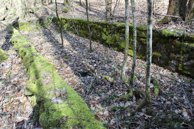
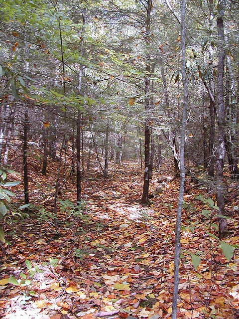
Photos of the places along it I have been


Below: Tree carvings along Bent Arm. According to the book there are many more carvings and glyphs out there if you look for them!


Above: Part of the Bent Arm Manway
Below: The remains of the Blanket Mountain Fire Tower
Below: a short stretch of the old Marks Cove Manway
No comments:
Post a Comment
Thanks for reading and commenting. I enjoy hearing from those who read & make use of my blog. I have made some wonderful friendships through emails from readers. I respond to all comments and emails. I appreciate folks reaching out to let me know when my blog entries are not functioning correctly or if the situation somewhere has changed. Many Blessings to you!
Dana 🐝