(cued up to the first picture in this series click right arrow to advance)
Kenny is still going strong on this job site he is tied to. It will be coming to a close in about a week or ten days, but I had another Saturday to occupy myself. I thought about what I wanted to get into. I decided I wanted to try going to Gobey all by myself. I wanted the quiet and beauty I would find there. I wanted to prove to myself I could do it alone. I could get an idea how the bloom was progressing.
I could see the pretty green waters of the Emory River again. I had reviewed some bookmarked material and photos on the computer. I realized we had missed Mahan Village completely. I knew it was there, but it still had a building left and we missed it. Once I saw that it was settled in my mind. I reviewed the map as to the position where Mahan Village should be and got waypoints ready. I prepped my gear and laid it all out. Next morning I packed up the jeep and headed out to Morgan County. The drive is an easy one with pretty scenery most of the way.
I had thought I was going to hunt up a missed bridge in Wartburg, but decided to save that for later in the day if I still felt like doing it. I arrived at the turn for Gobey to see a whole lot of folks preparing to take off riding in RZR's. I pulled over at the first bridge to take photos of the river. They passed me flying down the road. I noticed that I was way early for flowers as I suspected. The areas I was seeing were brown, dead, and not one green thing popping up.
Above: The Emory River was indeed green today, but instead of being the beautiful green or blue-green it was milky green. We'd had a lot of rain the previous day so no surprise there the water would be turbid.
I continued out the road and went through the expected moment of self doubt "Am I going the right way?". said my internal monologue. A moment or so more and I began to see familiar houses and the confusion and doubt cleared up.
I stopped to take a photo of my favorite red barn. It is an odd shape, but there are not one.. but two of these in the area.
Below is the pretty red barn with the airplane hangar design!
It was a bluebird day with pretty clear skies, sunshine, and cool temperatures.
I had a nice breeze. I was enjoying seeing daffodils all along the road. The rural scenery alone is worth the drive out here in any season. I soon came to an old cabin up on the slope above me. Someone has really cleaned this abandoned home site up and got it looking better. A garage of new construction was just over from this cabin.
Below: log cabin sitting above the main road.
I proceeded up the road and soon arrived at the first gate which is Sang Branch. I wanted to go across to see the old stone walls, and check for wildflowers on the opposite side of the river in the sandy soil. I was able to ford the river here without any difficulty and didn't even end up with any water in the floorboards.
I stopped as soon as I was across and pulled over to the side out of the way.
I took time to walk up the trail and explore. Forsythia shrubs were blooming all around. Mainly they were on the opposite side of the branch. I did not go over there to look, but from all appearances I am betting it was a home site. The stone walls next to the stream were covered in furry green moss. I saw lots of trout lilies up and in bud, but not open yet. I saw lots of toothwort and a few sprouted daffodil leaves. The stream itself was running well and was nice and clear.
Above: mass of forsythia blooms against a blue sky. You can se the mossy stone wall in the background. Beyond this was likely a house.
Below: beautiful Sang Branch flows down the mountain to join the Emory River.
Below: a look out across the field at the long, long rock wall next to the stream!
Above: Sang Branch spills into the Emory River
Above: first sweet betsy trillium of 2021!
Above: bloodroot opening up by the stream.
I continued my journey by fording back to the main road and going upstream toward the next gates. They begin #1 Sang Branch and go up to #5 ending with Emory River Headwaters out near the site of a former coal plant.
Below is a video of Sang Branch today
Next I turned aside to one of the many roads on the left. It had a pretty creek flowing down along it. I wanted to explore to see what I'd find. I did not find much, but did get out and stroll along the creek bank enjoying the woods and the few wildflowers I saw. They are still very early up here. I saw toothwort, trout lilies in tight bud, and a few long spurred violets. The stream itself was spectacularly clear. I loved the sound of it as it flowed over rocks and tiny cascades.
Below: a look at the creek and how clear the waters were!
Below is a look at some toothwort
And below a pretty Confederate violet
I returned to the main road and went on up toward the north western end for it eventually dead ends for vehicle travel. A rough four wheeler trail continues and can take you out to Devonia if you know how to follow it. I've never been all the way through there. I'm not sure Kenny has either. I stopped off next at Macedonia Church. I got out to walk around and stretch my legs. I was getting hungry so I enjoyed the sunny spot to have my sandwich and something cold to drink. I walked down to check out the crosses by the church and the view upstream of the river.
Below is a short video of this sparkly stream
Above: Macedonia Church
Above: three wooden crosses by the church. Perfect here at Easter time!
Above: Looking upstream on the Emory River behind Macedonia church. I noticed how the river is looking muddy and murky the further up I went.
Next I continued and came to a huge quince bush by the road which was in full flower. It was so pretty. I stopped to check this out and get some photos. Behind me was a nice view of the mountains to the northwest.
Above: the pretty view of the sky and the mountains
Below: biggest quince bush I ever saw!
Below: a closer look at the coral colored blooms with their bright yellow centers. Quince is a fruiting shrub. Quince was planted as ornamentation for yards back in the day and almost always means there was a house at a spot where you see these. The fruit also makes a nice tart jelly which I like!
I had been counting gates and knew I should be getting close to gate #4 and Rayder Branch which is near the site of the old Mahan Village. It was a thriving community at one time. Gobey is now a ghost town compared to its former glory days of the lumber and coal industry. Now there are far less people living in the area. You find a lot of gas wells in the vicinity.
I did not try to ford the stream at gates 3 or 4. Not much across there I wanted to see plus the stream bank drops off steeply. I was trying to be somewhat careful as I had no phone signal, and was a long way from help if I got stuck. Just past the gate for Rayder Branch I ran upon what I'd been looking for... Mahan Village! It sits immediately by the road in easy view! The only thing left is a set of bridge supports and one old building which was the former company store. I could not explain how we managed to miss this on previous trips? The area had been freshly cleared of excess brush and weeds around the old structure. It almost had to be buried heavily beneath vegetation. I was careful where I drove since the bush hog activity had left sharp pongee sticks protruding from the ground. I walked back through the field to check out the bridge supports where the railroad crossed Rayder Branch. I inspected the old store building. It is a mess of broken glass.
Above: old store building in clear view of the road
Below: a look inside revealed tons of broken glass
Below: the door is gone and the block wall is damaged.
Below: the far end of the company store building is also blown out. if the front looked anything like this when we were here before no wonder we missed it!
Below: one of two bridge supports just this side of Rayder Branch
Next I continued toward the end of the road and my turn around spot. This section is not as pretty or interesting in my experience or opinion. Gate #5 was shut today which did not matter to me. I walked over to look for wildflowers. I found a few. The creek up here was like the Platte River out west. in Nebraska.... Too thick to drink.. to thin to plow.
Below: a look upstream revealed the Emory River Headwaters to be murky, muddy brown!
Below is a look at the bridge that crosses the Emory River at Gate #5
Below: rue anemone blooms in this area
Below: another Sweet Betsy trillium
I stopped here and lingered awhile enjoying the quiet. I finished up my lunch.
I then reversed course and headed back. I stopped off by a few of the side roads to the left to explore, but did not find much. It was fun running through the mud and splashing. My jeep handled great.
I stopped by an old chimney at a former homesite to get some photos.
I got to see the old tater hole, the chimney, lots of pioneer junk including the coils from a mattress, old tin cans, glass jars and bottles, corrugated tin from a roof, and the former sidewalk and steps! The daffodils bloomed all around this pretty spot. It must have been something to see back in the day.
Above: a mossy set of steps where the house used to stand. Daffodils in full bloom. Wonder how long ago they were planted? My guess would be the 1930s.
Above: old brick chimney of the house ruins
Below: tater hole that was beneath part of the old house
Lastly at the house ruins... there is a pretty spring branch that flows down the hill. I am betting this was their water source.
Just past the old house site and chimney... was a narrow, rough gravel pull off that goes down to the river. It is a very pretty spot. I took a chance and pulled the jeep down there. It just barely had room enough to go on the trail, but it handled the rocky, loose dirt just fine. I had neither trouble going down nor coming up out of there. It surprises me how much traction and torque that little machine has. I got my jeep turned around after a 17 point turn technique in the tight space. I wanted to be heading the right direction in case anyone else pulled down here. I needn't have worried. I saw very few vehicles all day. I gathered my camera gear and walked down to the river to take pictures and shoot video footage.
The Emory River is pretty and blue here sometimes. Today it was milky green , but still pretty. A low, wide cascade crosses the stream here. Just below that are a set of bridge supports from the former Emory River Lumber Company railroad.
If you go on down past that there is a nice fishing hole in the bend of the river.
Above; pretty cascade across the Emory River
Above: Looking downstream at the bridge supports .
Below is a nice video of the cascade
I did not stick around here today as much as I thought I would. The river was milky looking. No wildflowers were in bloom. I was a tad bit concerned wondering if my jeep was going to come up out of that hole? It bit in and went up out of there just fine. I was getting a little tired and thought I'd just head home, but I passed a spot where I could see another cascade and a second set of old bridge supports. I couldn't stand it so I pulled over. I'm glad I did. I walked out the former railbed to the end where what is left of the old bridge stands.
Below: former railbed is flat as a fritter going straight out through the forest. The sides are built up and gently sloping. Once at the end there is a faint path off the side and down to the stream.
Above and below: a couple sidelong glances at the bridge and cascade
Below: there is nothing like standing by these old bridge abutments to help you realize how large they truly are
I wanted to get a different photo and video of this spot than I had previously.
I took a look around and found a spot downstream where the river split in two around a gravel bar. It was a much shorter, shallower spot to ford the stream.
I picked my way across quick and careful and only ended up with a slightly damp heel. I was able to position myself to get some good images.
Above: the river down here at this spot was far prettier than anywhere else today. It was cleaner and clearer. I hope to have a chance to return to see flowers as they emerge and catch the river looking its best!
Below is another look at the supports on the far side of the stream
And below is a last shot of the beautifully colored and textured pebbles in the stream near the gravel bar.
I concluded my day with a leisurely drive back through the rural setting of farms, houses, old buildings, and pretty Spring flowers in yards. I stopped off in Oliver Springs briefly to get half dozen items I needed so I did not have to go in the grocery store proper. I wanted to get home because Gabriel, our grandson and my granddog Tippy.... his pup were coming to spend the night. We planned to go to church the next day. Gabe was not happy with me when he found out where I'd been. I confessed to him and Kenny that I got confused on which road to the left lead up to the waterfalls we found last year. This was the only thing that got me out of hot water with Gabe. He knows now that he must return with me and Papaw to show me which way to go. All in all it was a very nice day and so relaxing.
I missed Kenny, but we will try to make time for a return trip and a picnic.
Final photo is a picture of Gabe & Tippy when they woke up on Monday. Two cuties! We had so much fun playing.
Gabriel age 4 and Tippy age 1. Up and getting ready for preschool. This is his room at our house.
Below is a video of the last spot in the river where I stopped and waded out.
Above: I am holding a chunk of what must be rock blasted off somehow during the railroad building operations in this area. It has tool marks in it for sure.
(All tunnels & bridges we visited are featured on this page)
Links to all waterfalls but one.. a wet weather one.. are found as highlighted links embedded in the trip report.
Kenny has been working a job where he is the only crane operator allowed on site because of some snafus at the outset of the thing. It is good pay, but it is limiting in that you work when they say. Not much way around it. He finally had enough and needed a break and I needed us to do something together as a couple again. He's my husband, but he's also my partner in crime so I miss him when he's not around to go have adventures. We talked it over. We needed to make it count. Finally we settled on heading out to Nemo to check out railroad tunnels and get some shots of the beautiful green Emory River.
above: Nemo Bridge is a preserved steel truss bridge over the Emory River. It parallels the current day road bridge. I am glad they did not take it down.
Below: the Emory river upstream of the bridge
We set out early in the morning to make sure we had plenty of time to do what we wanted. We had a long list of stuff to do and see. We took along a picnic lunch. We had never had the RZR and this rig out to Nemo before so we weren't sure how this was going to play out. We'd never tried to park at the bridge before. We arrived to find a few other folks had the same idea. While he unloaded the machine I strolled over to the Nemo Bridge to get some photos and video footage.
I returned to the truck to find Kenny chatting with a young couple in a pickup they were using to go four wheeling! We did not know we'd have the opportunity to make two nice new friends today, but we sure did! This is how and when we met Paul Baker and Macy Osgood! We kept running into these two fun persons early in the day. They were like us in that they love to explore and they are very willing to share information as well as receive it. I look forward to getting to know them better and do more stuff with them.
We started off by heading toward the Nemo Tunnel, but turned and went down near the Obed River first. I spotted a set of bridge piers I'd never noticed before. I wanted to check those out.
Above: neat set of bridge supports below Nemo Bridge. I had never noticed them before.
We now continued toward the old tunnel 24.. Nemo Tunnel. We stopped just past it so I could get a shot of the south portal of the new tunnel that is on the live railroad track. It was splashed with racist and homophobic graffiti as well as Misti Loves ?? so and so. Paul and Macy pulled up about that time and also remarked how terrible it is for people to be so ignorant and sloppy as to do this. I have to agree. I have a photo below that I dressed up with a rainbow for ALL God's children of every color, gender, and sexuality. He made and loves us all. No sense in that. Someone else thought so too because happily one week later we came back and found the graffiti gone!! Painted over. Whoever you are..... big Thank you!! We got to talking and Paul said there should be a waterfall on the opposite side of the tunnel, but he wasn't sure where. I knew of one falls that we were going to see today. I wondered if they were the same?
I hope whoever painted those messages sees this and knows..... not everyone feels that way.
We went onward toward the old tunnel and went through because it is fun, but also we needed to get to the other side where lots of the stuff we wanted to see was located. There is a bypass trail that avoids the tunnel for people on foot or anyone who just doesn't want to go through it. It had a lot of water in it today.
Below: photo from where we came back through Nemo Tunnel
Below: photo of the south portal of Nemo Tunnel
Below is a video of the ride through Nemo Tunnel
The drive through the tunnel was fun as always. It is an abandoned tunnel and in pretty good condition. The old tracks have been removed also. It has varying amounts of water through the year, but I've never seen it dry. Once on the opposite side we drove along the trail that goes the same direction the live tracks go. It heads up river. We got to see the opposite end of the live track tunnel. It was unremarkable except to say there was no graffiti. A short distance later we spied Nemory Falls on the opposite side of the tracks down in a holler. It was flowing great today. We pulled well out of the way on the edge of the trail away from the tracks. We carefully listened and looked for tracks and crossed over them to see the falls up close. It was worth the stop.
Below is a photo of the falls.
Here is a video of Nemory Falls that shows it off better than a photo can.
Once we'd had a chance to see Nemory Falls we continued up the river toward a point I'd seen marked on Google maps as Nemo Tunnel Lookout Point. It is just that. It is a spot where you can look at the river and the surrounding territory. It is not spectacular especially on an overcast day, but it is a nice spot. It gives you a view of where the Obed River and Emory River meet.
Above: View from Lookout point. It is looking straight up the Obed River.
We pressed onward looking for tunnel 23. We arrived at the current day trestle that the rail line crosses. It is a pretty spot and quite an engineering marvel. We stopped to look around to see if there was a way to any of the abandoned tunnels from here. I also just wanted to check out the spot and see the river. The Emory is green as jade in Winter. It is beautiful. While we were there poking around we had the good fortune to see a couple trains cross the trestle. It is a powerful sound and exciting!
Below are four photos that show the train passing overhead.
Below is a shot of the Emory River near the trestle.
Below: looking directly up at the now empty trestle. It has a catwalk on it, but I'd not get on it. It is illegal and dangerous.
Above: A view of the mighty trestle that enters the mountain on the opposite side.
Below is a video of the train crossing the trestle.
We found no further access to old tunnel 23 from here so we doubled back.
We went out the trail and turned and headed in the direction the GPS indicated.
We were riding along when I looked over and spotted it. It sits across the tracks and down over the current day rail bed in a low area. We parked and walked over there to see it. Kenny felt uneasy leaving the machine where it might be in the way of other riders. We've had friends get machines stolen and he is very paranoid about this happening. He went back to get it to park it on the same side as us.
A train was coming so I yelled at him and he saw it and waited for it to pass before moving the RZR. I got another video of a train which was nice. I stood there watching the train from a safe distance I looked down and saw the old iron capstone for the tunnel lying to one side. It had fallen off. The number was no longer readable.
Once across we took the RZR and went through the tunnel. It was in good condition in fact dry all the way through except for at the very start and that was maybe 10 feet with stepping stones to help you stay dry. It was cool to venture through and come out to the north side. Now we were on the old railroad grade which we needed to find in order to continue our trip.
Below is a video of tunnel 23 on either end, the train passing, and riding through it.
Below: The south portal Old Tunnel 23
Above and below: two freight cars I liked the color of.. The graffiti on the one is actually rather nice.
Below: The end of the freight train disappearing into the tunnel past old 23. I am not sure of the number of that since many of them were bypassed. That final tall car is supposed to be a car carrier or for tall cargo.
Above: North portal of Old tunnel 23. it is rugged.
Above: The RZR pulled on down the former rail bed. We parked here and walked.
Walking the old railbed was not too bad. A few downed trees and briars, but we've done far worse. We had not gone far when we I began to hear water spattering again. It was the second wet weather falls of the day. It was not quite as impressive as Nemory Falls, but still nice to see.
Above: bonus waterfall I'll call it.
Above: Walking the former rail line
Below is a video of the "Bonus Waterfall"
Once we'd got out on the old railbed it did not take very long to walk it to the place where it ends on a bank above the Emory River. Out in the distance we could see jade green water and foamy white waves of the rushing Emory River at high water. At the end of the rail grade there was a concrete support and a rusted cable going off through the trees into the distance. A couple large bridge supports are at the river bank as well as in the river itself. Across the river in the distance is supposed to be Old Tunnel 22. We very much wanted to see it today, but the river was far too high to wade it safely. We reasoned that would have to wait for another day. We spent some time checking out this pretty area. The scenery here was more than worth the walk.
Below: My favorite scene from the day.
Kenny along the river bank
Above: waves rushing past the bridge piers
Above: Until you get to these and stand beside them no photo can really show you how large they are. Quite imposing!
Here is a video of the spot at the end of the river where the second set of bridge piers were.
Having found several of the spots we were hunting today we reversed course and headed back toward Nemo Bridge and the main parking area. We had eaten lunch while at Tunnel 23 so we decided next to head along the railroad live tracks to see if we could find the waterfalls down that direction.
We went down the tracks at first on the right hand side. Then you come to a crossing with a signal. We crossed here and continued on the left side which is now wider and safer. There are a couple places along it where pull offs are dug into the bank so you can get further away from the tracks and also to turn around.
We easily found Railroad Falls right beside the path. It was flowing awesome today. It comes down the mountain, over the falls and flows under the tracks through a culvert. According to Kenny's friend and co worker, Hopper, who lives in the area, all these falls along here are wet weather. Bear that in mind before planning any visits.
Below is a vertically oriented shot of the falls main part. It is hard to get back far enough for a horizontal composition and I was NOT going to stand on the tracks!
Below is a video of Railroad Falls and Upper Railroad Falls which we found and documented today.
Below: Railroad Falls is neat in that you can get round to lots of various angles to take photos of it. Here it is disappearing into a culvert to flow into the Emory River.
Mossy stonework culvert above
Above and below: two different views of Upper Railroad Falls which is within sight of the lower falls. If you click the link for Railroad Falls and scroll to the bottom of the page the info for that falls is there.
Another pretty cascade on this little stream
We loaded back up and headed down stream. I knew there was one more falls documented further down. I also could see more waterfalls on Crooked Fork from a satellite view. That is the same stream Potters Falls is located on.
Spotted Rock Falls is the name of the final documented falls along the railroad tracks. We were heading toward that or so we thought. We quickly happened upon another falls and I wrongly believed we had arrived at it. It is very small and I was not particularly concerned about seeing it. Certainly I'd not have made a special trip for it. I figured since we were already here... why not?
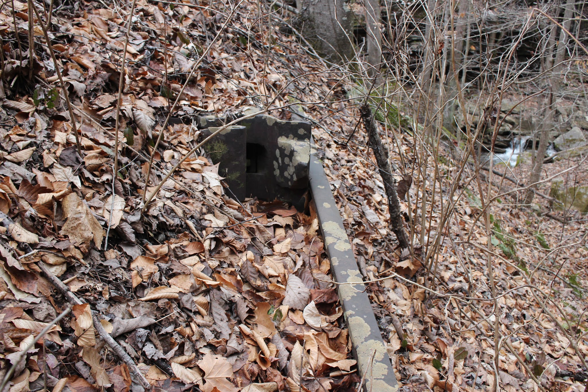
I looked into the woods and was astonished. It was bigger than the photo had shown. I figured that was on account of ample water coming over it. It probably just looked more impressive with greater flow. We pulled over and found us a spot to clamber down the bank to check it out. Near the start of the little off trail to see the falls we spotted a broken telephone pole and some kind of equipment. We also saw an old steel rail embedded in the ground. Saw some knocked down woven wire fencing and posts. I know the pole and its cross member was some sort of communication set up. I know they used something called tell tales to signal an upcoming bridge or tunnel. I am not sure that is what this is, but maybe. It does not look the same as historical photos of the way the old set up was. I am betting it is some sort of signaling device, but probably more recent in its origins.
Old steel rail and some larger device attached to it. Maybe someone out there can tell me what this stuff is?
Below: cross piece with some type communications equipment
Below; another mossy green culvert of some fine stone work!
Below: a photo of the whole falls of Bear Branch Cascade taken from the path high up. This makes it easier to see the entire thing although trees obscure part of the view.
Above and below: two views of the low, wide, Bear Branch Cascade. Turns out this is NOT Spotted Rock Falls. Nowhere close. You cannot reach that falls from here as it lies past the Crooked Fork Trestle. You have to come in another way.
This was a really pretty spot and we enjoyed it.
I am NOT including the waypoints or page from Tennessee Landforms right now. The reason is that after I submitted it to Tom I later looked back at something and noticed an error. He put it up in Gobey where another falls is located. So the Bear Branch page right now is inaccurate. It is less than 1/4 mile past Railroad Falls and is in easy view of the path so you cant miss it if you go looking. Once the correction is made I'll add it here.
We headed back up toward the parking area where we started off. We went down along the river again for awhile. I saw a pair of wood ducks. It was beginning to mist rain a little. We went across the bridge and up the road trying to check out an area Paul and Macy told us about. We really did not not the time, but what the heck. We checked out the Rock Creek Campground which is very nice for tent camping. Kenny believes there should be a falls back behind the campground. We went looking, but did not go far enough. We'll hopefully go look again and find it. It is off trail for part of the way.
Below is a video of Bear Branch Cascade
To conclude the trip report. We had a great time. We loved it so much we turned round and went back shortly thereafter to tackle finding stuff we'd missed or not had time for.
In the What Did We Miss Category
Crooked Fork Trestle
Rock Creek Double Trestle
Old Tunnel 19 & 20
Old Tunnel 22
It is a fascinating area and surprised us at what we'd missed. According to Paul there is more!
**Thanks to Jerry Williams for noticing and mentioning the corrections on the photos and trip report I needed to make. I had incorrectly thought that the river below the Obed stayed the Obed and the Emory ended. He noticed it and straightened me out so I could correct the trip report and any photo captions. I found a map I had been referring to that was the culprit on some website. Its was incorrectly labeled and I took it for gospel.