I have been trying more lately to actually get out and see the places I list or daydream about. Instead of just making lists and then going off on some new tangent... sticking with the list! I had long admired the old railroad grade passing by Middle Fork Falls in the Oliver Springs area. I had visited the main falls by the road before, but had not taken the time to explore further.
I decided to do something about that. I had a long list of spots to check out in Morgan County. I spent a fair amount of time doing my homework. I study the waterfalls, abandoned railroad lines, or whatever I'm hunting. I also try to find logical, safe, out of the way spots to park. Failure to do this can lead to finding a feature, but then not being able to access it.
I got up on a sunny Winter day and drove out to Morgan County with my gear and food packed. I parked at the Middle Creek Church and walked from the parking lot across Hwy 62 down Back Valley Road. I had seen a pull off across from the falls, but since the church parking lot was so close I opted for that instead. I figured it was safer. It only took me a couple minutes to find myself at the brink of the falls. I could see the top of it from the road.
It is situated down in a holler by the road. I had to approach it from a bit downstream in order to go safely down the embankment. It was clear to me based on the manmade improvements and signage it is a baptizing hole for the local church. It is a small, but very pretty falls and worth the short trek to see. It would not be worth making a special trip for on its own. It is 10 feet high.
Above: Geise Creek Falls has a pretty blue hole of water. The morning sun creates golden and russet woods surrounding it.
Below is a video of it:
I wanted to see Back Valley Falls which is very near the first falls.
The link above is the Tennessee Landforms page for it. Looking at the photograph on that page it is not too impressive, but I had seen a different photo by Chris Oliver on Flickr. It was a very nice 14 footer during higher flows. I knew today it would be running well.
I could not identify a spot along the road where I felt safe pulling off. The road is pretty well traveled and very curvy. I just had a bad feeling about it.
I picked out a spot to park, but I could not tell if it was okay or not? I later found out from a friend that would have been okay. I will have to try again to visit it. I won't make a special trip, but will batch this visit together with other sights and make a day of it in the future.
Once back at my jeep I continued further up the road toward Middle Fork Falls. It is across from the Beech Grove church. It is a nice roadside attraction and visited by a fair number of persons. There is a good sized pull off by it. There is a lower falls and there are un-named falls dropping in from wet weather drainages downstream. I had only taken time to visit the main falls. Today I would remedy that.
Below is a photo taken from the brink of the falls. I loved the blue hole of water at the base.
I walked on down to the base of Middle Fork Falls and set about seeing it from different vantages. I was blessed to catch a rainbow in the falls in the photo above!
Below is a shot that is just the obligatory front of the falls photo. It is a nice one.
I have been to this falls too many times to count so I did not tarry at the base of it. I walked back up to road level and entered the woods above the falls. I was heading for the path of the abandoned railroad grade that is on the opposite side of this stream. I soon got a treat I had not counted on.
From over here you get an unobstructed view of the entire Middle Fork Falls and what's better is that it is far enough away from it to get a really good look at the complete falls!
Below: a photo of the chunks of ice and snow still lingering in the shady spots
Below: A great view of Middle Fork Falls including the upper cascade from the old railroad line.
Below is a video of Middle Fork Falls from many view points
One of the things that happened by waiting 18 months to write a blog entry is the forgetting of way too many details, history, and the source material for the historical facts. I found the video I made of "Stevens Switch Spur" on YouTube and thought "Oh! this is cool. I want to know about that. I want to go there!" only to realize that: 1. It was my video and 2. I HAD been there. It was at that point I got down to brass tacks about fixing and catching up my blog.
I will attempt to briefly explain how that rail line came to be.
I cannot guarantee the historical accuracy of the info. If anyone reads this and knows it is incorrect it will not offend me to be brought up to speed.
I welcome it! I did finally learn that Tom Dunigan has the "Stevens Switch Spur" on the Tennessee Landforms page for Middle Fork Falls and mentions it there. It is the ONLY place I can find reference to it.
Below: the old prison mine on Brushy Mountain. Coal was hauled out of here and put on a train from here.
It appears the stretch of railroad ran from Brushy Mountain Prison and the Frozen Head Coal mines all the way through Petros, Stephens, Coalfield and then bears south/southwest toward Harriman where it ties into the Norfolk Southern active line near Hwy 61 today. It was the Southern Railway line or a spur of it. Next time I am over that way I want to make a point to check out that spot to see what goes on there? I also want to see if there are still minnow rearing pools along the edges of the Emory River the way the old map shows?! The freight trains brought coal out of the mountains and if you look at the old maps there are former mines all along the route of the abandoned line. Note to myself: Yes, I did search the term "Stephens Switch" to see if the spelling Tom used and I copied was incorrect. It yielded nothing.
Below: This photo was taken at the start of the old railbed
Below: the second photo is taken a bit further down from the main falls on the old rail grade
Below: a tiny cascade drops off the rocks near the old railroad grade
Below: down toward the Lower Falls on Middle Fork I found this well constructed stone drainage culvert. You can see drainage structures like this all along this stretch.
Above: I am about mid way down what you can hike of the railroad grade
Above: a mossy cross tie from the railroad tracks
Above: some hollowed out logs along the way
Below: one of the side streams that has an un-named falls on it.
Above: crumbling banks at the end of the line for me.
Above: Another un-named side stream with a falls before the end of the railroad line. It is cluttered with debris.
Above: these rocky bluffs were above the side cascades
Above: You can see the railroad bed keeps going, but for me this was the place to stop. The banks on either side were so loose and crumbling that had I climbed down here I'd not have been able to go back up the other side. The only way out of here was down the stream/waterfall that helped erode this spot. It was unsafe.
Above: A nice series of cascades on Middle Fork that lies between the upper and lower falls
Above: moss coated rock formations on the banks around the stream
Above: Looking down into the gully between the two parts of the railroad grade. The photo does not illustrate very well how deep this is.
Above: I get my first glimpse of the lower falls. No matter what I tried I could not get a satisfactory vantage point to view the falls from over here. I had to turn around and go back. I was not giving up though.
Back at my jeep I sat down and ate lunch and got something to drink.
I then walked down the road and was able to very carefully get a photo and video of Lower Falls on Middle Fork. Below is the photo. It was a fun day and I really enjoyed myself. It felt great to scratch something off my bucket list that had been on there for so long.
And finally below is the video of the lower falls.
It is note worthy that while hunting for historical information on this trip I did turn up a couple interesting abandoned railroad history bits.
In following the old map to see where the old railroad ended up I found that a large chunk of abandoned railroad crosses Ish Creek and still has bridge supports in two spots! I want to go check all that out. I think it is possible there is an abandoned tunnel in Greenback area. We shall see.
Below is a map of the spot along Ish Creek across from the boat ramp
**Notes to self** Three contributing factors in me thinking this blog entry had already been written were 1. I used the Geise Creek Falls photo on the front page as a cover. 2. I posted the trip photos complete with captions on Facebook. 3. I posted the videos to Youtube.
It is a good thing I did post the photos on FB because by the time I wrote this I cannot find my original photos on my computer. They may have been deleted. I also have not come up with any on my Smugmug photos account.
One of my New Year's Resolutions was to make a sincere effort to be better connected to friends and family. I have done a good job so far, but it is early in the year. No time to let up now. I went hiking with TennGreen and friend Gary Free on Saturday. We were tired and cold and it was late in the day so we opted to only go as far as Rylander Cascade after our Dog Cove hike. I talked to Jay on the phone and via Facebook messenger. We made plans to go visit Dry Creek Falls on Wednesday morning. It is the perfect time of year for it since these water flow of these falls dries up at times of low rainfall. I had only been once before, but Jay had never been. I found out Saturday that Ranger Randy Hedgepath had also never been so I invited him to join us. He did not show up Wednesday morning so he either did not get the message or he had things to do.
We met at the Lost Creek Parking Area around 9:30 am on Wednesday.
We carpooled down to Rylander Cascade parking area a mere quarter mile leaving Jay's SUV at Lost Creek. I need not have worried that parking was limited at the smaller lot. We only saw one van there this morning and he left before we even got on the trail.
It was a cold day that was only supposed to warm up to a high in the mid thirties, but considering the forecast called for the frigid air of a Nor'easter to descend upon us by Saturday morning ..... the temperatures and weather today were ideal! It was an uphill climb for a portion of the hike so we would warm up a plenty.
The trail to Dry Creek Falls passes Rylander Cascade half mile into the hike.
We turned aside to see the pretty falls, but the afternoon light is certainly better for viewing it. The morning's dappled light has the cascade in part shade and part sun making for not the best photos. It was sure good to be spending time with Jay.
He is a fine person to have as a friend. His appreciation of nature and it's beauty along with his humor really are a blessing. We stood for a few minutes soaking up the pretty sight of Rylander Cascade flowing down the lower part of the slope.
It comes out of the bank above at a spring, flows down as a falls and re-enters the ground at a swallet. Dry Creek comes down the holler to this point and also enters the ground being drunk up by the same swallet. The rock forms and spires here at this little cascade are fascinating. They make for a scene that you just don't find anywhere else.
Rylander Cascade and rock spire
Below is a video of Rylander Cascade
The hike to Rylander is pretty straight foreward. It is very rocky, uneven terrain up to this point. Once we had checked out the cascade we turned right and headed uphill gradually on the path up the holler. Kenny and I first hiked this several years earlier when there was no trail at all. It was not the hardest bushwhack we'd ever done, but today having the trail was certainly not wasted upon me. It was so nice. This trail also goes in to Virgin Falls from the opposite direction than the usual approach. The trail parking and use at the upper lot at Scotts Gulf is usually packed and overflowing on weekends.
We pressed on huffing and puffing a bit as we gradually ascended to ground that leveled off in spots. It was a merciful relief to have a few steps on flat ground. The trail is well constructed, flagged and signed. We crossed a few spring seepages and perhaps in two or three spots the trail was a little muddy. The forest is comparatively open. It allows for some views of the surrounding terrain. The area is full of pretty rock formations, pretty trees, and occasional views of Dry Creek below. Now and then you can see the cascades and rills of the stream as it winds its way down the holler among large boulders. We saw a few pretty pools of water as well as some slides.
We arrived at the split where a right turn takes you on toward Virgin Falls and a left turn takes you toward Dry Creek Falls. It is only 0.30 miles further past Rylander Cascade to this point. It is unmistakably signed so no worries about missing it. From here we were encouraged to see we only had 0.70 miles further to Dry Creek Falls. The day was cool, clear, blue skies, a few puffy clouds and sunshine trying to beam down on us through the forest canopy of Winter.
We passed a large round opening of a possible cave on our right!
We did not explore it, but stopped to look in. The trail here is flat and narrow.
I noted that the path the trail takes is the course Kenny and I took on our return from Dry Creek Falls. We stuck closer to the stream on our original bushwhack. This was good from the stand point of a. you get to see all the pretty spots in the creek and b. you don't worry about missing the falls since it is ON this stream.
The odd thing about Dry Creek Falls ? It occurs in terrain that has remained somewhat flat and you would not really expect to find a falls, but all it takes for a waterfall is a stream and one topo line. It is not a huge waterfall, but quite pretty. It is a thirty five foot falls with an upper falls of seventeen feet high.
Soon the terrain smoothed out and our trail trended down toward the creek.
It was at exactly the spot where Kenny and I forded the first trip. You ford in a spot that is only a few inches deep. It was above the slides and cascades we could see from high on the trail. The remainder of the hike is on the opposite bank. The closer you get to Dry Creek Falls the more evident it is why you cannot approach from the right. The bluff line here gets steeper and pinches you off.
The forest has changed now from oaks, hickory and poplar to a hemlock gorge.
It is shady and fairytale like. The stream gets prettier here. The rocks are green from algae and moss. Placid pools form along it with small rifles and cascades.
The trail is open and soft underfoot most of the way. We had one small stream to cross that was an easy step over. It is a side drainage that flows into Dry Creek from a spring in the headwaters.
We heard something mechanized ahead of us like a leaf blower or maybe a chainsaw in the distance. We never did figure where it was coming from.
Soon we approached the falls. We could hear it. I made Jay go first since it was his first time seeing it. Flat shady woods with a pretty stream is suddenly a nice sized spray of white water spraying over the cut in the bluff!
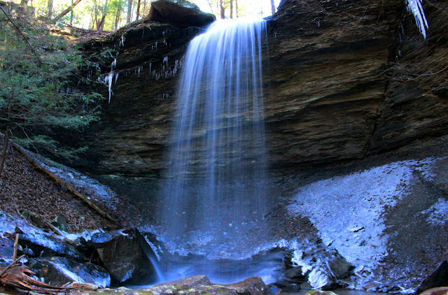
Dry Creek Falls 35 ft. surrounded by icicles and crusts of ice.
Below is a video of Dry Creek Falls
We spent time enjoying the view here and soaking up the beauty of this scene.
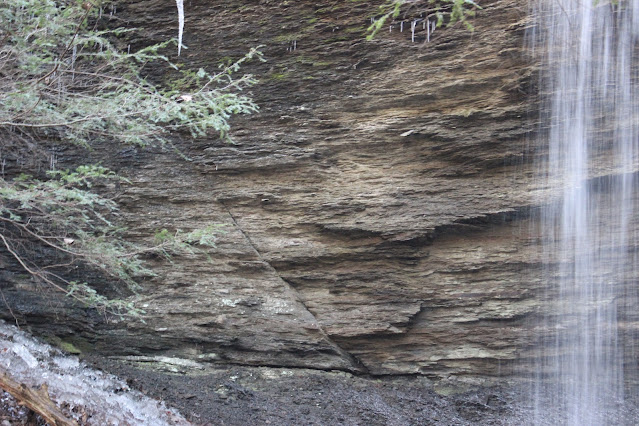
It felt marvelous to be out enjoying life. Each hike and each reconnect with friends restores a piece of my soul I have neglected for months. I am finding myself and growing healthier with each experience. I noticed something today I had not paid attention to previously. There are two fractures in the rock that are somewhat symmetrical. It looks like the rock form that the falls comes over settled creating an inverted trapezium with its shorter side at the base. I am guessing water did this, but I am no geologist. See the image below
Dry Creek Falls with its fracture lines in the bluff.
Below are a few images of the surroundings.
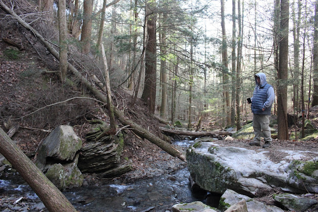
Above:Jay is checking out the creek
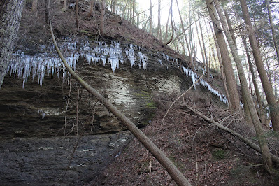
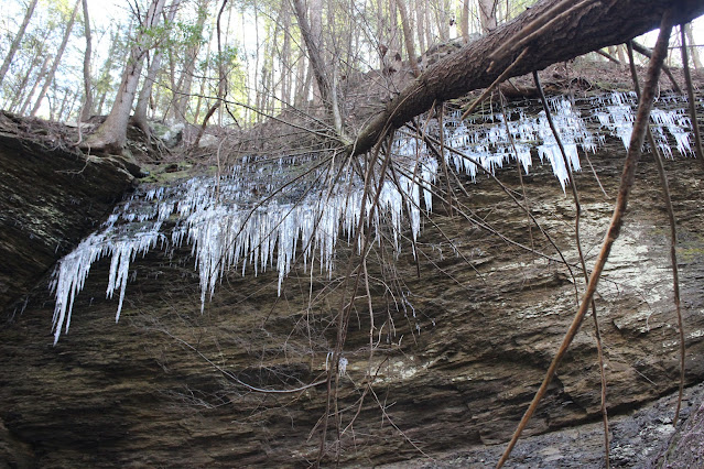
Icicles and downed trees on the bluff
Above: left fracture line at Dry Creek Falls
Right hand fracture line Dry Creek Falls
Patch of ice by the base of the falls
I told Jay the upper falls was a bit further upstream. I wanted to go see it. I figured trail or no trail we did not walk this far to turn back without seeing it.
It is a mere 250 feet upstream past Dry Creek Falls. Turned out there is a trail .. a good one.. all the way there! We were delighted at how easy the climb was and the earth under foot was soft duff.
The upper falls while not as large is as pretty if not moreso. It is a lovely little cascade with a sparkling clear blue pool at its base. We enjoyed its beauty and the deep shade of the hemlock forest. The sun was climbing higher now and it was heading toward noon. I stood checking out the sunbeams peeping through the forest canopy. The sun gradually crept to the side of the tree it hid behind. It seemed like a pretty good comparison to what I feel taking place in my heart and mind. I told Jay how much I appreciated him taking time to come with me.
I realized and said so how when you neglect your friends you lose a little piece of yourself. He and other friends remind me not to take life too seriously. His sense of humor lets you know he has figured that out long ago. He has many facets I am finding. A deeper faith than I knew. A man who can think on the serious side of things with wisdom and humor. A rare and pleasant combination.
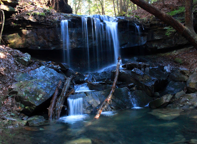
above: Upper Dry Creek Falls and its blue pool.
The sunbeams peeping down into the hemlock forest over the bluff. Upper Dry Creek Falls.
We finally turned and headed back down for our return hike. It was much easier and shorter. No mishaps with anyone falling in the creek! That was good!
The hike back took 45 minutes to an hour. I did not time it precisely. The pace made for easy conversation time. Jay shared some stories that really blessed me. I need to meet his friend Deb Morgan. They have been friends far longer and this lady sounds like fun. He says we think a lot alike. Both deep thinkers. I hope I get to meet her some day and spend some time with them both.
We were also discussing looking forward to coming Spring and warmer temperatures. Planning hikes to see flowers! Yellow lady slippers here we come!
We have an upcoming family camping trip in March. I hope we can all get together then since we'll be out in the plateau.
We made it back to the vehicle and were ready for lunch. Jay helped me tote the stuff to the side. I set up the pocket rocket stove and heated us up some pasta e fagioli soup. It was good even if I did scorch it a little in the original cooking.
I told Jay not to attempt to make soup in an enamelware dutch oven. It is just asking for trouble. I was so impressed with how good it cooked my pot roast I used it for soup. Big mistake. Low and slow is good... high temperatures are a recipe for disaster!
We visited for awhile over lunch, but it was growing colder. I told Jay I hoped it wouldn't hurt his feelings, but I really did not want to hike in Dog Cove today? He was glad I did not want to. He was tired and cold also. We packed up the stuff and headed back to his vehicle up the road. We never saw any other hikers today at all. Not at Lost Creek or Dry Creek. It was a cold Wednesday in Winter so I guess that is why.
I gave my friend a big hug and another thank you. We had an awesome day.
My knee that had been bothering me was feeling a lot better and I was glad of it.
We parted ways and headed back toward home. I had thought I'd feel like stopping briefly by Page Cemetery to see the old comb graves, but I did not. I also did not stop to see the monument to the old house along Highway 70. I just headed home.