

Meadow Beauty growing by the Emerald Cove at Belle Ridge
Belle Ridge Camping Trip
Dana & Kenny Koogler
Thursday 8/6 through Sunday 8/9, 2020
Belle Ridge Pictures here
(Click arrow to the right to advance the frame)
Day 1- Belle Ridge and Exploring in the county
We arrived Thursday just before lunch at the campground. We checked in and got set up. We went to Cookeville to grab lunch and get our groceries. I got in touch with Jay about the next day's meeting time and place. We used the remainder of the day to go four wheeling here at Belle Ridge.

Above: Kenny's new truck and our camper behind it.
It was the first time we'd ever camped here. It was also the first time we'd been riding here in Summer. The campground was great. It has about anything you'd ever want or need. The sites are spacious, well maintained, and easy to use. The electric service is good. No cable but you can even get tv shows with an antenna here. We got a phone signal. We had actual Wi-Fi service.
It was a real treat.

Above: office at Belle Ridge was open, but you approach the worker at a window. You don't go in the office now with the corona pandemic happening.
We hit the trail system with the RZR. I did not expect Verble Hollow Falls to be much as we've been dry lately. I did hope for maybe finding some native orchids in the woods and possibly some pretty wildflowers.
The trails were in good shape except for the one now marked on the map as "Impassable". I am not sure, but I think that might have been owing to the flood suffered back in April. The dam broke on an area lake up and across from Belle Ridge. The waters from the lake flowed down into the gorge. The damage was ultimately not as bad as I'd imagined. I think it is trail #156.

Above: I love the old red barn at the campground.
Stamps Hollow and the falls there was dry. No falls. No stream. Arrowhead Falls was barely trickling. The woods were pretty and green.
We saw a lot of nice yellow sunflowers along the trails and some pale pink Joe Pye weed, but not a lot of other flowers. The weather was blue skies and sunny. It was hot, but down in the gorge on the trails it was cooler especially in the shade. It had been awhile since we went riding so we enjoyed it. It was nice to get to see what the trail system and woods look like in another season.
Below: vibrant green woods where the trails go all over the place.

We went down to see Verble Hollow Falls knowing it would run year round even if it was low flow. It was running, but the good part was that the lower volume of water allowed me to get very close to the falls for pictures.

Above: if you stand facing the falls this is to the far left

Above: main falls
Below: isolation shot of the bottom of the falls.

Below: the area around the falls

Below is a video of Verble Hollow Falls. I had to add a little music overlay to this despite my original plan being to just keep it natural. The waterfall sounded like it was down in a tin can. Reminded me of an old 78 recording. I think it was from being so close up on it maybe ?
Below: I came back to Kenny taking a snooze in the machine. :-)

Below: pretty yellow flowers sway beside the trails

Below: we drove through these neat boulders which are huge!

Below: muddy trails!

below: ferns and moss down in the hole where the falls are

We saw a lot of the same sort of thing down in the holler so we headed back up after a couple hours. We went to the overlook. It was a pretty view and worth the stop.

Below: The view down the holler toward the west

Next we went by the rock beach. Kids and parents were swimming in the area close to the shore where it was shallow. A large group of boys was out in the deep playing king of the platform! They were comical to watch.
After we visited Rock Beach we continued on toward the trails for hiking.
We had never visited Emerald Cove in any of our previous trips. It was a short walk down to it. It was very pretty. It is a small spring fed pond in a lovely setting. Tall spires of pale pink Joe Pye weed waved in the breeze. Goldenrod bloomed along the path as did bright pink dots of meadow beauty. Little blue black darner damselflies zipped and lit. Dragonflies did all sorts of fancy flying around me and lit on my arms and shoulders. Maybe they thought I was a weed.
Glad I am not totally freaked out by insects. They are sweet little creatures.
Tiger swallowtails, buckeyes and pipevine swallowtails fluttered in the forest around the rim of the pond. The hemlock forest surrounding the pond is deep and dark and thus far healthy. It has lots of fish in it many large ones. It is a catch and release fishing set up.
Below: the fishing pier at the pond

Below: easy to see why they call this Emerald Cove


Above: tall delicate pink wands of Joe Pye Weed at the edge of the pond

Above: the little walk way to the bottom was pretty with the neon green moss on the rocks

Below is a video of Emerald Cove. I left this one natural as the water sounds and natural quiet were soothing.
Once we'd finished our exploring up we headed back to the camper. We relaxed for awhile and prepared dinner. Once that was over we were restless and wanted to get out to explore some more. We rode over toward Monterey to prowl. Once there we set out into the county to hunt for Table Rock. Long story short.. this evening we had a pretty hike, but no luck finding it. We squished through mud and muck. We wrangled briars and poison ivy and weeds all for nothing. We did see some pretty scenery and a nice fiery sunset over a corn field and the low knobs of Putnam County. We saw a massive chestnut oak tree on the way. We saw the pretty and quaint Rock Springs Community church.

Above and below: Huge chestnut oak tree. Image below you can see the path is an old road.


Above: Rose pinks were thick in these woods and fields.

Above: the path looks pretty good here. It is more open.
Though we did not find Table Rock we did learn more with this outing.
Every attempt is a little more information. We did see the most tumble down shack in the edge of the woods.
Below: soft evening light over the Walker Cemetery area.

Below: photo of the Rock Springs Community church. In the woods beyond the trees you can see the soft pink light of evening.

Below: fiery sunset over a corn field on our drive back to the camper.

We gave up and headed back to the camper for the evening. We were at this point just thankful not to have been snake bitten or gotten stuck out there in the dark.
Day 2--Burgess Falls, Fancher Falls & Two Hard Heads Won't Give Up Easy
We got a quick breakfast on Friday morning and packed up our stuff for the day. We were on somewhat of a schedule today since we had a boat rented and plans made with a friend. We met Jay at the Cookeville Boat Dock at 9:30 a.m.
We went through the last signing of papers and the boat dock employee went over a check list of things with us. They have restrooms at the boat dock so we took the opportunity for a pit stop prior to setting off. She was going over the check list and warning us about not damaging the boat. She told us we were advised not to try to go to Burgess Falls or Fancher Falls. My heart sunk into my shoes. The water level was low and it would be easy to damage the propeller on the boat. A nice $100 fine if you do. I was still coping with this when she walked away. Nothing for it now I thought. Kenny reassured me we'd just try to see how close we could get while being cautious. She said it would be more possible to reach Fancher Falls. It was closer to us at this point so we headed there first.
Center Hill Lake is very pretty. The pontoon boat ride was awesome. It had been years since I was on one. It was great to see Jay again and we hoped for a better day. We saw lots of cranes flapping and fishing in the lake. Every little bit a silver bellied fish would jump. We saw one spot where the water was "boiling". A closer look revealed fish in a feeding frenzy on insects. We saw a kingfisher or two. Dragonflies were zipping round the lake. One lit on the boat railing.

We had been given a map of the lake before we set out, but I had the GPS running and the coordinates leading us to the falls. The lake was totally unfamiliar to us, and it has lots of coves and bends. It would be easy enough to get lost or not find the falls. We soon pulled into the cove where Fancher Falls was supposed to be. Kenny kept a close eye on the depth finder. We got close as we could safely then pulled over to the side to tie off and walk. It was wonderful news. We were within sight of the falls!

Above: the cove Fancher Falls sits in.
Below: one of the first glimpses of Fancher Falls

Fancher Falls drops eighty feet into Center Hill Lake in a secluded little cove. Looking up at the bluffs around it you can see houses in two spots. Mist Falls drops an equally impressive distance into the same gorge right next to it. Mist Falls is a thinner waterfall from a smaller stream. The only way to access the falls in here is by water. For me it would be too much of a paddle in a kayak to visit both Fancher Falls and then turn around and paddle to Burgess Falls and back. Thus the need for a pontoon rental.
We tied up on the stream's right bank and walked from there the short, rocky, muddy distance to the falls. Several folks were already there. A couple family groups with kids were playing in the water and around it. They had all paddled here today. I stood taking it all in and making my photos and shooting video. It was wonderfully cool here with the rush of the water and the fine mist stirred up by the falls. The green trees gave shade along the edges of the cove. Once I'd seen enough I waded into the plunge pool and gave over to the experience fully.
 Above is a photo of Mist Falls
Below is a better shot of Fancher Falls

Below is a video of Fancher Falls
We went through the last signing of papers and the boat dock employee went over a check list of things with us. They have restrooms at the boat dock so we took the opportunity for a pit stop prior to setting off. She was going over the check list and warning us about not damaging the boat. She told us we were advised not to try to go to Burgess Falls or Fancher Falls. My heart sunk into my shoes. The water level was low and it would be easy to damage the propeller on the boat. A nice $100 fine if you do. I was still coping with this when she walked away. Nothing for it now I thought. Kenny reassured me we'd just try to see how close we could get while being cautious. She said it would be more possible to reach Fancher Falls. It was closer to us at this point so we headed there first.
Center Hill Lake is very pretty. The pontoon boat ride was awesome. It had been years since I was on one. It was great to see Jay again and we hoped for a better day. We saw lots of cranes flapping and fishing in the lake. Every little bit a silver bellied fish would jump. We saw one spot where the water was "boiling". A closer look revealed fish in a feeding frenzy on insects. We saw a kingfisher or two. Dragonflies were zipping round the lake. One lit on the boat railing.

We had been given a map of the lake before we set out, but I had the GPS running and the coordinates leading us to the falls. The lake was totally unfamiliar to us, and it has lots of coves and bends. It would be easy enough to get lost or not find the falls. We soon pulled into the cove where Fancher Falls was supposed to be. Kenny kept a close eye on the depth finder. We got close as we could safely then pulled over to the side to tie off and walk. It was wonderful news. We were within sight of the falls!
Above: the cove Fancher Falls sits in.
Below: one of the first glimpses of Fancher Falls

Fancher Falls drops eighty feet into Center Hill Lake in a secluded little cove. Looking up at the bluffs around it you can see houses in two spots. Mist Falls drops an equally impressive distance into the same gorge right next to it. Mist Falls is a thinner waterfall from a smaller stream. The only way to access the falls in here is by water. For me it would be too much of a paddle in a kayak to visit both Fancher Falls and then turn around and paddle to Burgess Falls and back. Thus the need for a pontoon rental.
We tied up on the stream's right bank and walked from there the short, rocky, muddy distance to the falls. Several folks were already there. A couple family groups with kids were playing in the water and around it. They had all paddled here today. I stood taking it all in and making my photos and shooting video. It was wonderfully cool here with the rush of the water and the fine mist stirred up by the falls. The green trees gave shade along the edges of the cove. Once I'd seen enough I waded into the plunge pool and gave over to the experience fully.
I swam and flipped over to swim on my back toward the falls. There is nothing like seeing a waterfall this way. Nothing comes close. Bluest skies above and sunshine. Green leaves. The tumbling waters of the falls and all the tiny rivulets of water near the bottom. It was worth every penny and every ounce of effort to get here. Two little girls swam across ahead of me and squatted down under a rock ledge. They were so cute huddled together talking. I did not get in any hurry to leave, but at last we did have to move on since we had yet another part of our adventure to experience.
Below is a better shot of Fancher Falls
Below is a video of Fancher Falls
And below is a video of Mist Falls
We hiked back to the pontoon and boarded. It was easier getting on that it was getting off. We took our time and showed all possible consideration for those in kayaks. We didn't want to be "those guys" who create wakes and make difficulties for others. Though we saw a good number of people today it wasn't quite the gaggle I had expected. The boat ride to Burgess was very pleasant. I was now at the point where I felt confident our day was going to be successful. I was relaxed and enjoying the trip. I was ok with whatever happened. I plugged in the GPS coordinates for Burgess Falls to help guide us. It is also useful as a distance measure to something you cannot see. The depth finder indicated that we'd best stop. A fellow boater with an inboard motor cautioned us about some rocks up ahead. We easily saw them, but were thankful for the concern. We were able to get a good bit closer than I'd expected. We were within 0.10 mile of Fancher and this said 0.20. You can see 0.10 mile on open terrain. It might be a squishy trip, but we'd make it. A pair of kayakers we talked to were able to advise us to try walking on the right bank , as we had with Fancher Falls. The left looked doable, but was more difficult and muddy. It was slow going, but we made it up around the bend to the beautiful and massive Burgess Falls!

It was visible quickly, but even before that we could hear the roar of it as we approached.
We could see there were already people there ahead of us which was no surprise. Lots of kayakers, but not an overwhelming number. I learned quite a few things today.
- There are the ruins of an old powerhouse at the base of Burgess Falls
- It is not always possible or easy to paddle up to the falls or any falls on this lake when water levels drop low enough.
- The powers that be are merely placating the public with "We're not going to fix the steps to the bottom of the falls right now." when in fact they are NEVER going to fix them. I wrongly believed lack of funding was the problem. It is not. They have learned their lesson from Cummins Falls and will never encourage folks to walk to the base by way of stairs. That leaves too much room for harm. Visitors have proven they have very poor judgement and very little ability to correctly assess the risk versus reward in such endeavors. Ma and Pa might bring their tiny tots or grandkids down the bluff and end up getting Junior hurt. Thus another law suit or insurance claim against the state.
- I also learned that Eddie Ramos of Kayaking Adventures of Tennessee is a stand up guy. He was right there on the spot lending me.. not a paying customer, but a stranger... a hand. Pointing out the better, safer, easier way to walk round to the bottom of the falls. He is also an extremely wise and professional guide. I spoke with a ranger about him on the hike out who mentioned to me that the state is going to be hiring guides to lead folks to these hikes and he is one of them.
- Paddling to the base of Burgess Falls or boating to it is going to be forever THE way to see it from the base.
I took my time at the base of Burgess Falls enjoying the view under the clear blue skies. It is powerful and impressive. Up on the rim of the gulf I could see people..all of them rather young.. looking down over the edge. One gal I'm sure was posing for a "selfie", but to her credit at least she stayed a safe distance back from the brink of the falls while doing so. I wondered to myself what accounted for the appearance of a central rock up high on the falls that looks like it was sawn off clean? It looks anything but naturally occurring.
I've not yet run onto anyone who knows. I finally began to pick my way back through the rocks toward the old power house. I wanted to get some images of that and ponder it a little. The roof of part of the structure is missing.
See in the image below

I've not yet run onto anyone who knows. I finally began to pick my way back through the rocks toward the old power house. I wanted to get some images of that and ponder it a little. The roof of part of the structure is missing.
See in the image below


Above: looking at the end of the second structure
Below: Jay stands along a nice looking rock wall that is part of the original power house. The path to the falls runs atop it.


Above and below-- views of the ruins of the power house

We made our way back toward the pontoon greeting other boaters as we went. Everyone was very pleasant and in good spirits.
Back on the pontoon we got something to drink and ate some cantaloupe.
Finally we began our trip back to the boat dock. I was on top of the world. It had finally all worked out. What a great birthday present this had turned out to be. I'd much rather have an experience and make a memory than collect more stuff.
We finished up our return of the pontoon and said our good-byes to Jay. He is such a terrific friend. I always look forward to the next adventure with him.
Below is a video of Burgess Falls and some of the boat trip.
Idle Hands Are the Devil's Workshop _Proverbs 16:27
We got back to the camper and rested and fixed supper. We grilled out steak and baked potatoes and corn on the cob. Once dinner was over we were restless again. It didn't take long til we were hankering to go on the prowl some more. Back to the county to "fry fry a hen". Not to be so easily outdone by Table Rock.... we'd go another route! So that is what we did. We came in via another way, but it ended up on the same darn path as before in the weeds, the briars and brush. At least today we had our snake proof gear on. We clambered up the mountain slopes toward the summit. I had the distinct feeling we were "doing it again". Probably making this harder than it had to be. I was suddenly no longer willing to exert myself in this sticky Summer heat in the weeds and thick forest. Kenny hit upon the same conclusion at the same time. We laughed like fools at ourselves for the dumb stuff we try. We headed back down the mountain. We needed better information and a different approach.
Above: the patch of red in the photo is all you can see of Kenny ahead of me in the brush.
Below: a ravine below us that while pretty was not distinctive enough to warrant this level of energy expenditure.

Below: one of the few interesting finds this evening was a large ruffly mushroom

We got out of the woods and headed back toward Monterey. I decided since it wasn't late I wanted to stop and see the historic depot and the train.. The South Wind. I was under the mistaken idea these tracks were abandoned. I later learned from an individual on a Facebook railroad history group that is not the case. He took time to disabuse me of that notion. Thankfully I am not now a greasy spot on the tracks in Monterey. We were treated to a lovely sunset with colors of every hue in the rainbow. I got some photos that turned out great.
I was a kid who grew up near the railroad tracks. I often heard stories of various happenings on and around the tracks. My mom and cousins and aunts and grandparents talked about The Cooling Board.. a board stuck up in a tree near the tracks where folks got off the rails. They'd walk down to the house past the spring. A cooling board for anyone who doesn't know... is a board or a cane mat where they laid out the body of the deceased to cool off gradually. This helps prevent the unfortunate and scary sitting up of the corpse later. Yeah. We're a little on the backwoodsy side in this family.
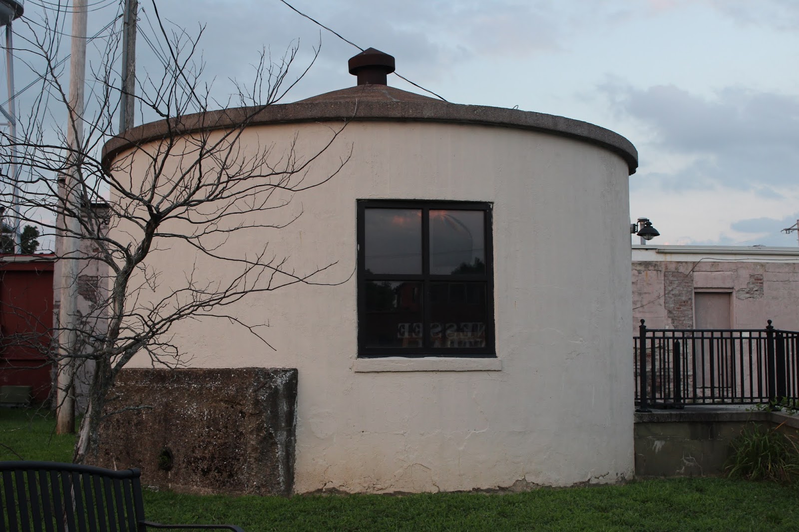
Above; round building in Monterey by the tracks. It is neat looking, but I don't know what it is.

Above: another view of the round building with the water tower in the background.

Above: Like Bill Grogan's Goat...I was on the railroad tracks.
Looky here at that beautiful sunset.

Above: view of the depot from the tracks side
Below: view of the depot from the town side

Below: I liked this shot of the South Wind passenger car with the red glow of the setting sun in the window

Below: an image of the caboose

Having done all the damage we could for one day we stopped by the Red Box and got a movie and went on home. I feel like that movie is a killer of brain cells. I give Grand Isle starring Nicholas Cage a 2 thumbs down!
Day 3- The Best Laid Plans of Mice & Men versus God's Plan
We got up Saturday morning very excited at our planned adventure. We drove all the way down the road to Warren County to try to visit Rocky River. We had all sorts of exploring we wanted to do. On the way down we tried to go by several features I wanted to see. Two abandoned bridges and one historic church. It quickly became clear that trying to visit these sorts of things with the trailer towing the RZR was a bad idea. It puts too much strain on Kenny who is the one trying to get into and out of these areas. I gave up on that in frustration having to admit it was foolish. He missed a turn somehow and we ended up going around our elbow to get to our butts. We finally got into the Rocky River area and began our attempts to see things. One after another we found them now private property and off limits. I was aggravated and so was he. I am not the sharpest tool in the shed, but I know when the universe appears to be blocking you quit fighting it. It is to me a clear signal that you aren't doing what you're supposed to be doing on a given day.

Above: Mountain Mint in bloom. It smells so good!
I knew her first name was Amy.

Above: Pale spiked lobelia
Below: A huge clump of rose pinks along the roadside

We had some familiarity with the area having done some exploring and hiking here before. We turned east on Dry Hollow Road and continued in that direction til we turned left onto Shiloh Road. It is the road that runs past Hippie Jack Stoddarts place. I stopped to take pictures of Healy's Covered bridge from the road.

We kept going and I began to wonder if we'd find a place to start? Kenny was beginning to feel the same way. He stopped Tennessee style in the middle of the road and got out to ask a fellow he saw out in his yard. The difference between this area of the country and Warren County is remarkable. The guy was just as friendly and helpful as could be. Told Kenny where to park. Where some of the trails went to and wished us a good day of riding. We pulled over where he indicated was an ok place to park along Puncheon Creek Road. We unloaded and took off. It was great fun. We saw some oil wells, gas wells, a tent grave cemetery, some Summer wildflowers, a pretty creek, and before long we came down a winding gravel road to an old cabin and barns.

Above: West Obey in the sunshine. We saw a lot of needlenose gar swimming in this hole of water. Below is an image of one of the larger ones.

Below: Summer wildflowers frame the river bank

Below: Puncheon Creek

We passed a busted up old truck in the woods at the top of a ridge.
My guess is that's where she stopped and that's where hit'll set.

Below: neat old cabin in the woods we passed.

We found ourselves back at the metal bridge over the West Obey we'd seen earlier. We pulled down there to check out the creek.

Pretty old metal bridge and river banks

It was hot and I was tired of being still. I got out of the machine to take pictures and play in the water. Kenny went up the road without me to inspect something. About the time I was putting my boots back on and he was getting back to me.. I heard the sound of approaching four wheelers. I mentioned it to him, but he is hard of hearing so he couldn't make it out the sound.

Above: West Obey looking toward the bridge
I got in our machine and got ready to have a cool drink of tea when this group of people pulled up in three different machines. All of them smiling. I heard someone say "Is that Dana?" Somehow I just knew. It had to be Amy!
The Jesus bumps rose up on me. I turned around and laughed and ran to give her a hug. She ain't scared of no corona virus anymore than I am. Here is this beautiful smiling blonde haired lady with a smile that would melt your heart. She and her man and her friends. We were so excited. They were not even supposed to be in the area today, but something changed their plans. I told her of the rotten start to our day and what I'd said on the way in here. We had a good laugh about that. God's plans are always better than mans. 100% of the time.
Don't fight it.
We went riding with these folks the rest of the afternoon. I've not met anymore generous, helpful, friendly people. I enjoyed each and every one of them. Lisa, Lee, Joe, Mike and Amy. A day that started off badly sure ended on a fine note. We had fun with them and made a bunch of new friends.
The only thing we'd have time to accomplish was a ride to The Round House. Amy knew I had wanted to see it. Today would be the day. The ride to it was complicated with twists and turns and huge mud holes. We were warned it wasn't some place you should attempt to go alone. I agreed especially after seeing how remote it is. Trouble comes to you out here you're a long way from help with zero cell phone service.
Below is a first hand look at the mud holes and how stuck you can get.

Above: a group of nine or ten jeepsters negotiating the mud holes and ruts on the way back through Hickory Flats to the round house.
We finally started up a hill and the neatest little building came into view. We passed it and lo and behold.. we sat before the Round House.

I heard tell of how this came to be built and the age of it. Folks had apparently told that their great grandparents lived in it. Kind of difficult since I knew the construction was of a much more recent era. Chuck Sutherland had reached out to a nice young woman named Emily who is his friend. She said yes, she knew the history of it. It was built by her father. She stated it was the first dome he built. Her dad is "Fuzzy". She also told there was an icosa next to it. That has to be the "second round house" that was mentioned to me. She also said it was up behind Jack Stoddarts which is exactly right.


Below: a look inside

Below: everyone outside the round house

We checked the place out and then since Amy had to get going and the day was getting late we headed out. They hung with us til we were back on familiar territory then we said our good byes promising to get up with them again. Kenny had made plans with them for the following day. Joe graciously agreed to let us park the camper at his house for the day. I wanted to go, but had misgivings since the reality of things often doesn't match up with the original desires.
They went their way and we went ours heading back to the truck.
On the way we passed a spot where you could pull down to the river.
We backed up and went down there. Kenny exclaimed "Dana! Look!" to our right in the stream was an otter rolling about in the water and rocks! He climbed up on a stone and checked us out. He then waddled off to his den in the bank. I got a photo of him as he went to his den, but you can't really tell it is an otter.
But we did see him! Cute little fellow. We stopped and I got out to soak up the scenery. I could hear Jay Clark's voice in my head singing about the West Obey. The scene before me was tranquil and serene. The evening gloom was settling over the already deep green river. I felt like this was the perfect benediction to our day. It certainly ended on a happier note than it began with.

Above: I'm standing in the deep green waters of the West Obey. I love this place.
Once back at the camper and with dinner over with.. the tiredness I knew was coming settled over us. Kenny was now ready to admit he did not have the energy to deal with another day of riding, then packing up and heading home on a two hour drive. He was thankfully able to reach Mike's phone to let our new friends know. We did not want to be a no show and keep them waiting on us in the morning. I look forward to getting to know them better. I look forward to returning the favor of taking them round to see places they've not yet been.
All in all a good weekend. The best times end on a note of hope and the anticipation of future trips.
How to Do What We Did
For anyone who wants to rent a boat at the Cookeville Boat Dock here is some info.
Call and make a reservation to be sure to have a boat ready for the day you want to go. The rates are on their website. The weekday cost for a fishing pontoon.. which is what we rented is $185 plus tax plus gas. It ended up costing us around $207. You have it all day from 9 am til 6 p.m. They have a security deposit, but if you don't tear anything up there is no charge.
I'd recommend checking with them about water levels before booking anything. We were lucky. They have restrooms, a store, a restaurant, gear, at the dock. They have floatation devices on the boat which holds up to six people.
They help you with instructions and a map.
Your pilot of your boat has to be born before 1969 or have completed a boater safety course and be certified.
More specific requirements are spelled out on their website.
A less expensive way to visit the base of these falls would be to book a trip with Eddie of Kayaking Adventures of Tennessee. As said.. I'd not have the stamina to paddle to both Fancher Falls and Burgess Falls in one day, but on a weekend in the area I could do one then the other the next day. It is closer to paddle to Burgess Falls from the Cane Hollow Road access. It is closer to visit Fancher Falls from Cookeville Boat dock. The paddle is a little over 2 miles one way by my measure.
Eddie will make sure you are safe, properly equipped, comfortable as possible, and you can then relax and enjoy the experience. He was right there with a hand for me to hold and advice on staying safe and "c'mere. the path to the base of the falls is easier over here." He stays in close contact with the park rangers and Army Corps of Engineers. He is in the loop on the latest goings on and plans.
I'd definitely do that next time.
As far as camping and riding at Belle Ridge Campground. the link to their website is up top. It was awesome. It is a little more expensive, but it was way worth it. Often you get what you pay for. These folks are great and they know their stuff. You can day hike to Verble Hollow Falls for $5 per person day use fee. They no longer rent ATVs because it got to be more trouble than it was worth. The machines got torn up too easily. They are costly and a lot of maintenance work and that isn't easy or cheap. Folks who have a machine know how to use them don't need them. Folks who don't have a machine and need one mostly don't know how to use them safely. It's the old rented mule scenario.

No comments:
Post a Comment
Thanks for reading and commenting. I enjoy hearing from those who read & make use of my blog. I have made some wonderful friendships through emails from readers. I respond to all comments and emails. I appreciate folks reaching out to let me know when my blog entries are not functioning correctly or if the situation somewhere has changed. Many Blessings to you!
Dana 🐝