Visiting the Abandoned Town of McFarland
**Edited to Add as of 5/17/2021**
I heard back from the Tellico Ranger Dist. and the head guy says camping at trailheads such as what I saw at the trail for Turtletown Falls is NOT permitted.
They advised me to alert rangers to this in the future so they could handle it.
A couple years ago I became aware of the existence of the site of a "ghost town" in the Cherokee National Forest down in Polk County. Actually it is one of several that have vanished because of the changing times. McFarland, Probst, Austral, Hambright, Caney Creek are some of them. I am a fan of history so this intrigued me. I saw several videos of it and while there isn't much left of it, the spillway and cement mixing plant fascinated me. I like obscure and off the beaten track so I was determined to go visit and experience it for myself.
I can see the videos, trip narratives, or photos of others and that piques my interest. What really motivates me to go to see it for myself isn't simply to see the things they saw. That is only part of it. I want to go myself to feel the place and to see and find missed details. I don't always find that my visit turns up more than what others knew was there, but often I do. I want to see the world through my own eyes and the rest of my senses.
My daughter, grandchildren and myself attempted to find it last Summer.
Turns out we did make it to McFarland, but not the interesting part. I wanted to see the spillway and cement plant. We were below those and did not find them. We had a rattlesnake encounter that put a speedy end to the trip for the day. It was a foolish time to make such an attempt. I got to thinking about it this past Spring, and it tugged at my heart strings. I did not want another year to pass without me having visited. I decided if I wanted to see it I had best put it on the short list.
Above: the McFarland Road out closer to Farner. It is in good shape.
I did not feel comfortable wandering around back in that area solo. It took very little persuading to convince Kenny to accompany me. He likes this sort of exploring. Today we did miss the turn for it by a mile. We had to turn around and head back. I plugged in my GPS coordinates to assist us in picking the correct road this time. Once we made the turn onto the right road we were there in no time! There was the cement plant ruins. A short distance further we arrived at the mossy green spillway. It provides maintenance access to the Apalachia Aquaduct pipe.
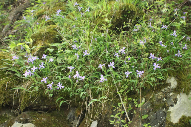
We enjoyed the drive on the backroads today. It was a perfect Spring morning. We found traffic light and the sun was shining. I believed today would be a good day. I hoped we would be successful in finding the old town. It was a point of pride. I hoped that the area would be good for seeing some nice wildflowers. I was not disappointed. Just driving the McFarland Road we saw daisy fleabane in pastel pink and white with its little yellow centers. We saw carpets of dwarf crested iris on the banks around the road. The air was cool, comfortable and fresh.
I had spent considerable time the previous evening prepping a cookout and picnic Supper for us. It is a long drive down there so we would cram the day as full as we could to make it count!
Above: daisy fleabane blooms by the road
Tiny sweet white violets were on the banks today.
Above: We saw many maiden hair ferns. They are plentiful in this area.
Another shot of the sunshine on the McFarland Road
Above: large patch of dwarf iris
Above: a white form of dwarf crested iris with only a tiny bit of color
Above: Access door for the pipeline... McFarland still visible
Above: archway and small cascade flowing under it.
Below is a video of the McFarland Spillway and cement plant
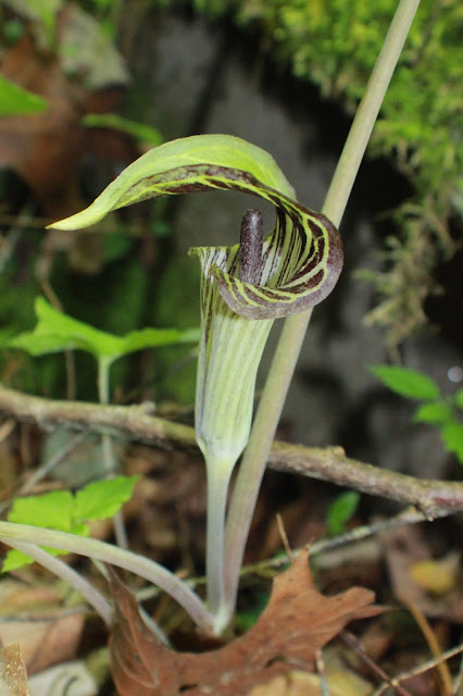
We enjoyed walking around the spillway and I walked up and down both sides of the narrow corridor enjoying the sight of the green moss and leaves. So many tiny ferns and flowers graced the slopes. I saw some very pretty jack in the pulpits. I also saw my first Vaseys trilliums of the season.
Above: vaseys trilliumnice big jack in the pulpit
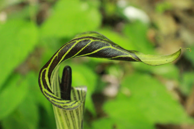
I pulled up the hood here.. this is a bishop!
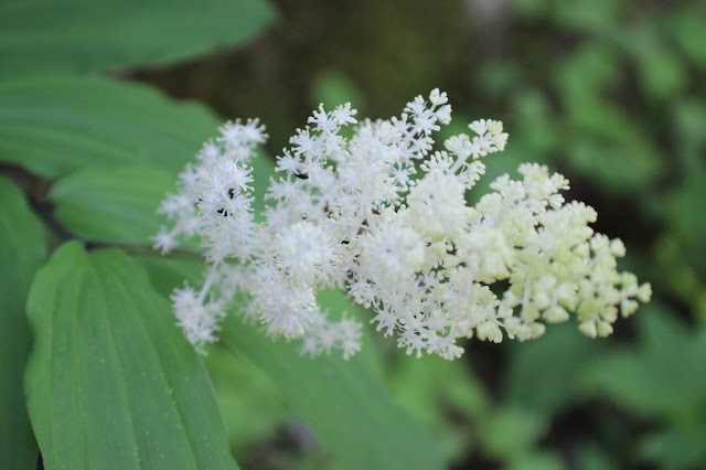
Solomon's Seal in bloom
tightly clasped jack in the pulpit
Green leaves on the banks
This retaining wall was pretty with green plants growing on it.
Looking up through the former cement plant.. the holes the concrete flowed down through into waiting trucks.
Another vantage point of the cement plant. Some fool has painted a swastika on it. Ignorant ass people.
Nice clear stream from the spillway flowing on down the mountain.
Above and below: I got a chance to photograph a native magnolia up close. It was down low near the road.
The drive out from McFarland I was on the other side now and saw new things. A large cluster of fire pinks.
Purple phacelia still in bloom and lots of it.
Zoomed in on fire pinks
We saw loads of jack in the pulpit along the road.
Solomon's Plume above:
Above and below: Catesby's trilliums were abundant and so pretty!
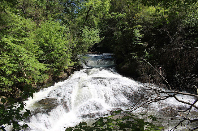
We also saw two nice waterfalls below the McFarland Road. If we go back we'll have to take 100 feet of rope and try to rappel down to see them up close. The community of McFarland was founded in 1890 when they put in the post office.
It existed to support the building and use of the Old Line Railroad between Knoxville and Atlanta.
It also existed to support the construction of the Apalachia Pipeline. So it was a support to transport and industry and energy production. Once those things were accomplished and times changed the community fell into decline.
The actually buildings and town were down on the lower road where Crystal and my grandkids and myself were last Summer. There is little or nothing there. The road is washed out very badly. It is not a long walk down there so if a person wanted to see it they would be best off just going on foot. The railroad tracks and Hiwassee River are there. Some concrete structures are there by the tracks. Not sure what that was for, but guessing it had to do with freight of some kind. Not much to see here. All the "good stuff" is up on the top road. It was a good Spring wildflower trip for sure. Any repeat trips we will come prepared to check out the undocumented waterfalls there.
Here is a link to the Heritage of the Upper Hiwassee site that has a few paragraphs about the old towns of this area. It is interesting and useful if you want to visit them. McFarland is the second paragraph down. The info here has waypoints to the town. It is to the actual site of the town. If you are interested in finding the spillway and cement plant here are the coordinates. 35.169632,-84.393993
Turtletown Adit
A few years back I was planning a visit to the Cherokee National Forest with Kenny. Sometimes to pick a place to visit I just get the National Geographic map out and study it. While I am a huge proponent of Tennessee Landforms it is not all inclusive. I am forever touting the use of Cal Topo maps because it has so much detail. Not even Cal Topo gets it all. Somethings get put on regular maps or in road atlases that are otherwise left out. I don't know who decides what gets included and what is left off, but it is wise to use a variety of source material in finding what is in a given area. Sitting gazing at the map something caught my attention that I had overlooked before. "Turtletown Adit" was indicated on the Nat Geo map of the Cherokee National Forest southern section. I could see it was a side road below Turtletown Falls. I was curious what that would be like so we visited. If you click the link here you can check out that trip report. Some excellent photos on this one that really show it off better than this trip. It was May 28, 2016 so things looked different, and were even prettier. Going later in the season you get to see tons of Indian Pinks and maiden hair ferns along with the delicate purple blooms of rhodo minus.
Above: Rhododendron minus at Turtletown adit
Below: one of my favorite pictures of lime green maiden hair ferns and the red hot blooms of Indian Pinks!

So what is an adit? It is a horizontal passage leading into usually a mine.. that provides access or drainage. In this case it is a passage leading to the pipeline for access. It is a little less than a mile below lower Turtletown Falls. On the drive in to McFarland you passed a right turn signed #23A. It goes steeply uphill past a yellow gate. This is the turn for Turtletown Adit. If you have a high clearance, four wheel drive vehicle and possibly a chainsaw... it is worth a visit. We went back today just to see it in a different season. We were very glad we did because we missed some cool stuff. Somehow we thought the road terminated just past the pipeline. It doesn't! It goes further and provides access to the railroad tracks, the trestle over Turtletown Creek and the Hiwassee River. It is an even prettier spot than we'd known! Today we found it. I don't know why we didn't explore further that day. I think looking at the trip report it was because we had several other spots we wanted to explore. That was the day Paul Gamble sent us on the infamous Shadwick Branch Snipe Hunt. I have NOT forgotten mind you. 😂😆
Today we found the road just barely passable because of many downed trees. They had been cut out of the way, but only just. Good thing we were in my jeep. It was tight in places. The road is steep and has a couple bad drop offs on the right. We got to the split down toward the bottom and pulled up close to check out the pipeline. It has a leak that has gotten worse. There is now a small pond beneath the pipe. It wasn't quite as pretty down here today as it was in late May, but it was slightly less snaky. We also took time today to explore further and found the train trestle and tracks. The access to the river and confluence of Turtletown Creek with the Hiwassee River. A truck was down there same time as us. It was a set of grandparents with their two grandsons. They were nice people just out doing what we were... exploring.
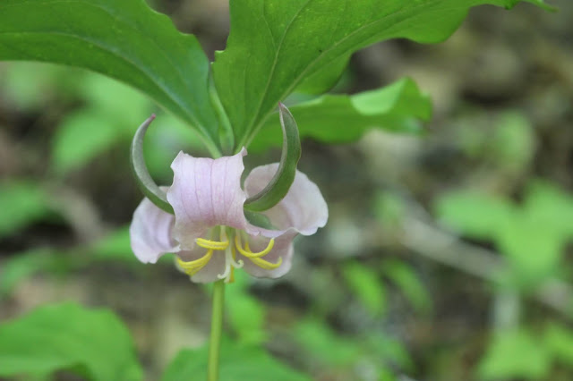
Above: Pale pink catesbys trillium we found
Below: I found a pile of pretty, soft, spotted feathers by the trillium. Some poor bird met a bad end here. I wished later that I had kept a few of the feathers. I believe if the chance comes along again I will use them to incorporate into something beautiful to commemorate the life of the bird. It never occurred to met until afterwards and then the chance had passed. They look like guinea feathers.
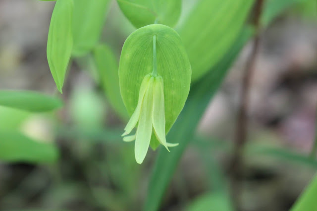
Perfoliate bellwort was also seen along the road. Quite a lot of it!
above: golden alexanders were in the woods today
Above: fire pinks up on a rocky shelf
solomons seal was in bloom also!
Below is a video of the pipeline and its leak! It is like a manmade falls. The video is only around 30 seconds long.
Below is a series of three photos that show what the upper access road is like. It brings you to the pipe and the access door.
Below is a photo with some vignetting that I liked.. it shows the pipe and how it is supported to cross Turtletown Creek. Though it is named 'creek' it is a significant body of water and is more like a river.
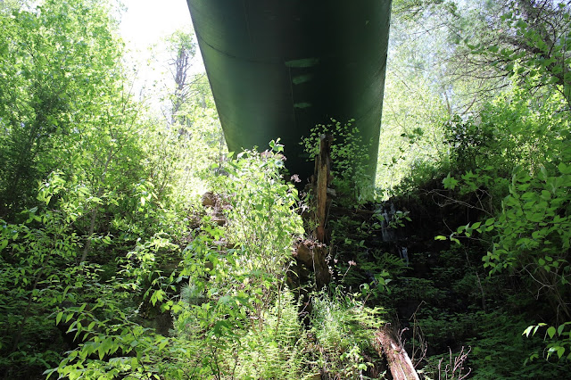
Below: today the view under the pipe was not as pretty as the first visit.
Above: opposite side of the pipe where it is leaking.
Above: a butterfly, some moths and a large bumblebee.
We pulled on down the road and parked at a wide spot out of the way. We left room for the folks in the truck to be able to get out if they needed to before we were ready to go. We walked over to the railroad tracks and checked out the trestle. We could hear the folks down below us and kids laughing. We climbed down the bank and checked out the creek and the view of the confluence of it with the Hiwassee. It is a nice area and the little boys were having a great time. Their grandfather and grandmother were introducing them to the joys of being a kid in the country. Healthier than screen time for sure! Below are several photos that show what that spot is like.
Above: beneath the trestle and looking up Turtletown Creek
Confluence of Turtletown Creek with the Hiwassee River.
Above: the trestle is a really pretty one in my opinion, but I am a cross tie walker from childhood so consider the source.
a view of the trestle from up top
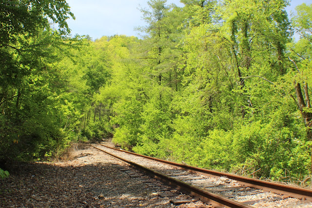
railroad tracks going north
railroad tracks going south
standing beneath the trestle looking up at the supports.
We did not tarry long here. We wanted to hike to Turtletown Falls so we pushed onward. Today was turning out to be a good day indeed!
Turtletown Falls and Settling a Bet
Turtletown Falls on Tennessee Landforms
Below: the next three photos show the erosion damage done to the trail. It was nearly lost in places. During high water you would find it necessary to go deeper into the woods on the right and hike off trail to get around it safely.
Below: Turtletown Creek is deep and milky today
above: a nice straight, smooth part of the trail
Above and below: a couple shots of pink lady slipper. I saw some today on this hike, but not as many as usual. I think it is a little early for them.
Above and below: the first cascade you see along Turtletown Creek is right by the parking area. We arrived to find the parking area very full. Some of the people there with the vehicles were camped at the trailhead. I am not sure if that is legal or not, but they did it just the same.
Below is a video of Lower Turtletown Falls
Once we got to Lower falls we sat down and ate lunch and got something to drink. We rested and enjoyed the sound of the water and the pretty scenery. We then began our hike back to try to close this loop to be able to say we had done it successfully. Kenny groused most of the way back that the other way was better to which I invited him to go back that way and I'd be waiting for him at the jeep. While this route might be tougher in his eyes at least it is shorter and there is pretty scenery the entire way. I need something to make the walk worth the trouble. It helps ease the pain of the effort.
We wound through the forest until we came to the place where the trail is along the stream and flattens out. A short time later we arrived at a set of steps that took us along a hill to the Upper Turtletown Falls. Once there we began seeing a few more pink lady slippers! The upper falls was gorgeous. It was perfection. Lots of water coming over. The spray was cool and refreshing. The slant of the evening sun coming down over the falls created a beautiful rainbow on the right side! It was rewarding to see.
Below is a video of the upper falls that shows the rainbow.
Above: Upper Turtletown Falls and the rainbow
Below: zoomed in on the right side of the falls with the rainbow in clearer focus.
We relished the visit to this beautiful spot. We were growing tired. We trudge onward at last to make the climb up out of this hole to the trail. We went up steps and switchbacks. We made the gradual climb out on the trail and finally arrived back at the split. We encountered a family with mom, dad, and three kids just past the split. They were not dressed like they were accustomed to hiking. They were already discouraged and wondering when they'd get to the falls. We told them they were about 1/4 mile from the upper falls which was more than worth it. We then told them the lower falls was another mile beyond the upper falls. They continued, but my bet is that they went to the upper falls, turned around and left after that. I doubt they tried to tackle the lower falls.
We continued on and soon were at the gate and parking area. Most folks were gone. Far fewer vehicles. I have written to the forestry service out of curiosity to learn if camping at the trailhead is okay or not? I just wonder and it never crossed my mind before this. I'll edit the report to include any answers I get. Back at the jeep I felt icky. I got some cold water to drink and ate some raspberries to quench a deep thirst. I was tired. Kenny was tired.
My original plan was to drive down to Fields of the Wood and have a picnic and cook out. I had steaks in marinade, garlic smashed potatoes, corn on the cob for grilling. It was getting late. It was already 5 pm. We were concerned about the additional drive, our fatigue level, and whether they'd have the gates open or not? Kenny persuaded me to go to Madisonville for dinner and save the other meal for tomorrow. We had done it again. Tried to cram too much into the day.
I was disgusted with myself and felt gross and unfit to go in anywhere to eat. We hate Wendy's in Madisonville, but decided to give it a try because it was fast. Oh how wrong we were. Dining room was closed. Long, long line at the drive through. Moving along at a snails pace. We became trapped and unable to get out for awhile. Finally after a 20 minute wait and only two cars served... we were able to make a break for it. Kenny said I'm going to Berts for dinner. You are fine and we are going in to sit down! I changed clothes and brushed my hair. Times like this are why I keep handi wipes and mini deodorant in my purse.
Above: a photo of Bert's Hometown GrillWe went in Bert's and were seated almost immediately. We were well taken care of by their professional staff. We had tempura shrimp for dinner and it was very satisfying for two hungry, weary persons. Way better than Wendy's. They need to get a regional manager to fix whatever is wrong there or pull the franchise and close it down.
All in all a great day, but one of our over ambitious ones.
**Directions to Turtletown Falls** I have provided the waypoint for the falls in this report. It has maps and such. Complete directions to the falls are in Gregory Plumb's Waterfalls of Tennessee guidebook. I will merely remind the reader that you passed the trailhead for Turtletown Falls along Farner Road on the right on the way to McFarland Road. It is signed with a large brown forest service sign and easy to spot. Turn on that road and follow it down the mountain to the parking area. The trail to the falls starts behind the gate in the parking lot adjacent to the stream. The simplest way to get to both falls is to stay on the path that parallels the stream down and back the same way.
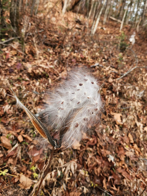
Below: Fluffy, silky native milkweed pod photos taken by Tammy Lawson and her spouse who also went to McFarland.


















Loved reading your experience. Hate you didn't get to have the cookout but you ended up with a nice meal after all. You are taking me to places I have never been and may not get to now because of my health issues. Thank you for that. It's like being there.
ReplyDeleteThank you for taking time to read and comment. Not having the cookout is a very small disappointment. It will just be impetus to go back for another trip. I pray you get fooled and get healthy enough to go once more to the places you'd like. I have experienced times when I was too sick to go or too tied down with life events to go. Your feedback is encouragement to me to keep going with the writing. Invaluable constructive criticism. Blessings to you!
DeleteGreat info and pretty pics have to go there sometime
ReplyDeleteThanks James. This would be a good place to explore further. I remembered that after re-reading my report!
DeleteThis was one of the most interesting read I have read in a long time about McFarland TN. I live on McFarland Road sand my in laws used to live at McFarland. (Town). My mother in law loved living there but they had a chance to leave and come closer to cilvilization. Thank you for this most interesting read I visit.
ReplyDeleteWow! That's high praise coming from a local. I am honored. It is a historic and beautiful place. Lots of good people both past and present. Let me know how your visit goes!? Yw and thank you for reading it and commenting. It means a lot to me.amy blessings to you and yours. Dana❤️
Delete