

Trout Lily in bloom at Gobey beside Sang Branch
Four Wheeling at Gobey
Sunday March 22, 2020
Kenny, Dana & Gabriel Koogler
I am way behind on my blogging to the point I'm almost overwhelmed thinking of the amount of work that is going to be required to catch up. Best way to eat an elephant? (Huge task=elephant)
One bite at a time. We are currently in the throes of one of the worst disasters I've seen in my life time. The novel corona virus outbreak or "covid 19" has the entire planet feeling threatened and vulnerable and understandably so. Yet in the midst of it Spring.. my favorite season... is still going to be Spring. It is still beautiful and I'm going to find the best way to enjoy it that I can. My personal beliefs are that God is the Maker and author of all life. He is still on His throne and still in control.
I've seen him carry me through many a storm in life and I know that regardless what happens to me or this planet he is still great every single day.
Psalm 91 has always been my go to scripture and it is appropriate for this time.

We have been trying to spend some special time with each of our grandchildren individually. Sunday our church services were cancelled on account of the virus threat. We were planning on taking ourselves and six year old granddaughter Tessa out to Gobey to explore. She had been
busy with crafts all week and we went hiking Wednesday. She stayed up rather late Saturday so Sunday morning she was ready to do NOTHING! Saturday Gabriel our three year old grandson, made me almost cry. He wanted to go and offered to "ride on the back" of the RZR. I hardly slept from thinking of it. Things worked out as they were supposed to. We were able to call him Sunday morning and invite him to go with us. He was thrilled. We stopped at Sonic in Wartburg and got take out and ate on the way. Gobey is only about another 10 minutes from there. We arrived at our parking spot and a quiet, overcast morning in Morgan County. The first time I ever went to this place I was astonished at the beauty of the Spring wildflowers, the scenery, the solitude, the history and the beautiful blue green waters of the Emory River.
Gobey was one of those places I felt drawn to and heeding the siren song paid off handsomely.
We parked by the bridge and unloaded. We gathered up our gear in the RZR and took off.
The Emory River has its headwaters at Gobey in the mountains. It starts off like a creek and gathers
flow from many streams as its watershed is huge. It flows toward Wartburg, Oakdale, Harriman and ends in the lake at Watts Bar or that vicinity. It grows larger and deeper as it flows from the mountains in Morgan county. A little background history is that Gobey was a coal mining town that has largely died off with the coal mining industry. The folks who live there are sturdy, resourceful folk who have traded the conveniences of living near town for the quiet beauty of rural isolation.
Most of them garden or have small farms. They are hunting, fishing, four wheeling, wood splitting, self reliant types. I have nothing but respect for that lifestyle since that is what I come from as does Kenny. We lived that lifestyle of rural isolation until 2001. I miss it dearly and Lord willing...... we will be allowed to return to that one day. The only industry that you find out at Gobey nowdays are oil and natural gas wells.

Above: Our 3 year old grandson Gabriel loves to brmmmm out as he puts it.
We headed up Sang Branch with Gabe. It was pretty, but a bit of a let down compared to the previous trip. Wildflowers still have not come out real good so there wasn't a lot to see.
Rugged terrain and massive boulders. Old mining equipment and tailings ponds.
Sang Branch itself had plenty water flowing and there are some attractive old stone walls from where folks used to live. Since that wasn't too great we'd try another spot or two along the big river.
 Above: mossy log at Ross Gap
 Gabe stands on a big boulder at Ross Gap
 Emory River at Sang Branch
 Above: section of old stone wall overgrown with moss at Sang Branch


Above: Another shot of the Emory River near where Sang Branch empties into it.

Above: Rue anemone grows near a mossy rock at Sang Branch
Below: red trillium or Sweet Betsy trillium grows also at Sang Branch

 Above: tiny pink and white Spring beauties at Sang Branch
We next went to a spot where you can pull down next to the Emory River that is especially pretty. The only people we encountered all day were a man and his son leaving as we pulled up. We parked the RZR and walked down to the river. Lots of pretty cascades and blue holes of water here in this spot. It is also where some of the old bridge supports remain. They held up the old rail line for the coal trains. We walked along downstream to see another pretty spot we'd never noticed before. A big deep green hole of water and a cascade where a side stream dropped into the main river. Gabe had to throw rocks with Papaw.
Below: Looking downstream at the river and the bridge supports
 Below: Pretty cascades in the Emory River
 Below: Gabe and Papaw

Below: The Emory River is as green as an emerald in this spot.
 Below: Pretty cascade dropping into the river.


 Gabriel Falls is what we named this one for our grandson. He was elated as it was his first time "discovering" a waterfall like this! It is not reachable from the road side of the creek. You have to ford downstream of the falls where the bank is less steep and work your way up to it on an old road. Below and above it are more pretty cascades. From the angle above you can see how blue the plunge pool is, but can't get a clear shot of the falls without the trees!
 Above: Standing directly in front of Gabriel Falls. It is lovely. It is about 20 feet high.

Above: This six foot cascade isn't much to write home about, but it is particularly scenic and worth a stop since you're right there anyhow.
 Above: Trilliums in bud at the waterfall
 Above: Holding papaw's hand at the falls. Gabe is very happy.
 Above: riffles downstream on Laurel Branch
 Above and below: Gabriel is VERY happy and having a great time . He is Mr. Outside!

 Above: Silly boy with "NO hands!!"
 Above and below a series of pretty cascades up on Laurel Branch


 Above: Very pretty green, mossy wet weather waterfall. It is 30 feet high in a rock amphitheater

 Below: bloodroot flower opening near Atlas Falls.

Below: red trillium or Sweet Betsy trillium grows also at Sang Branch


We next went to a spot where you can pull down next to the Emory River that is especially pretty. The only people we encountered all day were a man and his son leaving as we pulled up. We parked the RZR and walked down to the river. Lots of pretty cascades and blue holes of water here in this spot. It is also where some of the old bridge supports remain. They held up the old rail line for the coal trains. We walked along downstream to see another pretty spot we'd never noticed before. A big deep green hole of water and a cascade where a side stream dropped into the main river. Gabe had to throw rocks with Papaw.
Below: Looking downstream at the river and the bridge supports


Below: The Emory River is as green as an emerald in this spot.


We walked back to the RZR and went to the opposite side of Gobey Road to try to pin down which road heading up that side of the mountains lead to the waterfall Kenny had seen before. Buck had pointed out which one he believed it was and he was correct! What was neat was Kenny found more falls before we located that other one and so did I. By the time we'd gone up the road and back I had to admit this was the first time I'd ever been up that road! In all our looking we some how neglected to check this one. Now I can hardly wait to go back because I believe there may be more.
Below: partial view out over the mountains from one of the side roads we tried.


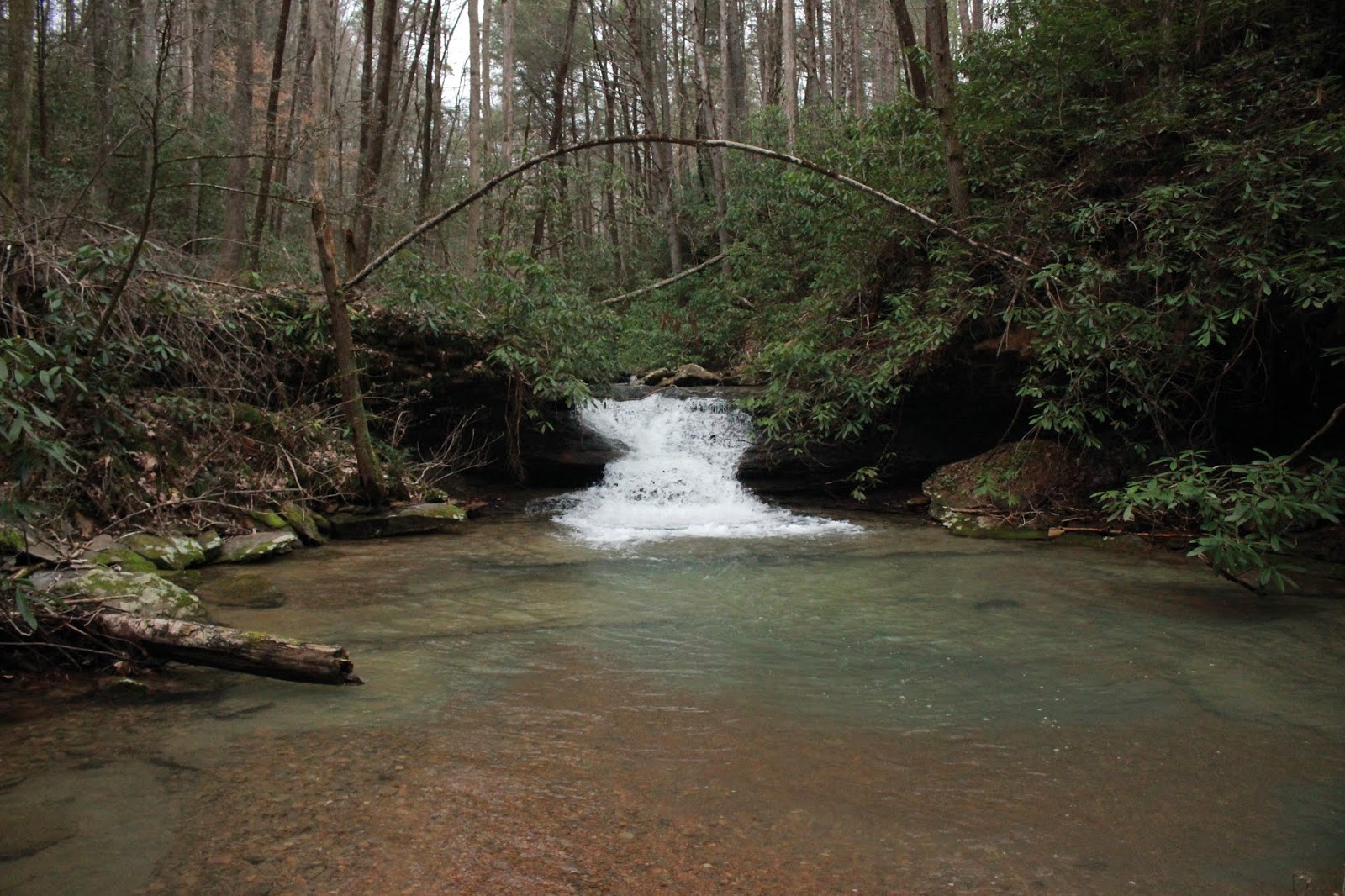


We went on up the road along Laurel Branch and there is another pretty area just before the trail dead ends. We stopped to check it out. It is a series of pretty cascades and blue holes of water.


We had to double back since the road ends along Laurel Branch. We went back up the trail that goes along Little Creek. It is a beautiful stream. We passed numerous cascades, deep holes of placid water, and quite a few attractive wet weather waterfalls on side streams. I do not submit wet weather falls to Tennessee Landforms despite how pretty they might be when they flow. Tom already has quite a few of those on the database and doesn't really want to add anymore. I agree with that.
below a rock ampitheater setting near one of the wet weather streams


Above: Little Creek is the name of this stream. It is idyllic. Lots of pretty cascades along it and deep holes of water. It is in a hemlock forest and so peaceful. It would be a good scenic drive for someone who is no longer able to hike or recovering from an injury etc.
Below: Atlas Falls is a 25 foot falls and very scenic. It is visible easily from the road and the bank here is a gentle slope with a path so you can walk right up to it.


Below: Another wet weather falls coming in off a spring branch above Atlas Falls.

We had a snack and continued on toward a spot along the Emory River I wanted to check out.
There is a series of bridge supports that is larger and the river there is really pretty jade green cascades. We found a way down to it and spent time taking pictures. Throwing in rocks and sticks. Soaking up the pretty scenery. I get the richest sense of history in some of these places. I'd liked to have seen what this was like back when the coal trains ran here.


The day had gotten away from us. Time really does fly when you're having fun. I asked Kenny what time of day it was and it was already 5 p.m. or better! We headed back to the truck. Gabe was very very sleepy and hungry. He played on the trailer while I got out the back pack stove to cook him up some ramen noodles real quick. He was ravenous. He ate really well and got in the truck with his blanket and was sawing logs five minutes down the road. He was one tired little boy.
He got awake at the house long enough to mow the yard with Papaw. Gave me time to shower off the mud and get warm. Gabe ate twice more before bedtime. Jared and Lydia let him spend the night which was so nice. I helped him get a bath before bed time. I enjoy holding him on my lap. One day before I know it he will be too big to hold or bathe!
It was a marvelous day. It worked out as it was supposed to. We'll have to try to do something fun and special with just Tessa as soon as we can. I see in my crystal ball of the future........ another trip back to Gobey to see Spring wildflowers and waterfalls and do some more exploring up Little Creek, Grimes Branch and others. I also want to visit Pilot knob to see the fire tower!
Below is a video of Gabriel Falls.
Below is a video of the Emory River
**Edited to Add** February 1, 2021
Heard from a reader Michael H, who reached out to say that ATVs are not permitted on the right side of Gobey toward Frozen Head SNA. The gated roads are left open for hunting purposes only during certain times of the year. They allow hunters to use ATVs to retrieve kills, but other than that it is off limits. We were incorrect in our interpretation of the signage out there. We can still go riding at Gobey, but will have to contain it to the opposite side. The riding on the side toward Frozen Head is actually VERY limited anyway and certainly not worth getting in trouble over. The good stuff we're finding out is on the opposite side and there we will stay.


