

Blue Cohosh closeup. See the sweat bees? They are
pollinators for this plant.
Big Sink in Springtime
Dana & Kenny Koogler
Sunday April 9, 2017
Pictures are here starting with frame 67
Here is a link to a page I have put on the front of my blog
It contains directions how to access this area from either side.
Big Bottom WMA Access Points
We got parked, unloaded ,and set out on the trail. The day was perfect. Sunshine and blue skies. Warm temperatures with a light breeze. The air smelled good and the views were clear. Driving out across the plateau seeing those pretty green pine trees ,and smelling their fragrant needles is a treat for both eyes and nose. I began seeing clusters of lavender birdsfoot violets growing along the road. I also saw one or two clumps of white birdsfoot violets! I had previously only seen that color at Pickett State Forest.
 The start of a bluebird day! Heading out Flowing Well Road .

White birdsfoot violet.
We continued out Flowing Well road. The only things blooming were the violets we'd seen, redbuds, dogwoods, and a few vernal iris. Our elevation dropped and there were more flowers and greenery. The forest here is always pretty. The advantages of seeing an area with leaves off the trees is that you can notice things usually hidden during leaf out. Down around Shop Gap we began seeing rue anemone, and purple phlox and some Christmas ferns and a few buds on the trees.

Vernal iris
Shop Gap is interesting. It is shaped like a saddle. The trail for ATV's goes off the left side of the saddle while the hiker path goes off the right! Both are rocky and rough. If you go down Graveyard Ridge Road access and stay straight you come out at Sally Gap which is a single track path. We got to the bottom of Shop Gap and followed the ATV trail down to the Caney Fork . It follows the river and in a couple places you can see the river below. Eventually you are at river level and can walk over to it. We stopped at a particularly pretty area along the river. I always like to stop here and see the color of the water, the rocky bluffs and the moss that lines the banks. Today the moss on the tree trunks and banks shone an almost neon green. The sun shined down through the forest canopy warming the day. The wildflowers grew in profusion on the sandy river bottom land. Golden ragwort grew on the far shore as far as the eye could see. The trees were just beginning to have some green leaves and leaf buds. Dwarf crested iris and phlox grew on the banks. Butterflies of black and yellow flitted by. Today the Caney Fork was full and aquamarine. Worth the stop for sure.
It contains directions how to access this area from either side.
Big Bottom WMA Access Points
We woke Sunday morning with a plan stuck to it. I had been wanting to see Big Sink in the Spring. I just knew it would have great wildflower blooms. I also hoped the falls would have more water since our drought conditions are improved. We did not get in a hurry.
We took time to fix breakfast and enjoy coffee and conversation. Kenny got out and inspected the job site which is within walking distance of the camper! We packed lunch and headed out for Big Bottom WMA.. It is on the south side of the WMA. We approached from here because it does not involve fording the Caney Fork. Spring water volumes might wash you away. The area is in rural Van Buren County.
We got parked, unloaded ,and set out on the trail. The day was perfect. Sunshine and blue skies. Warm temperatures with a light breeze. The air smelled good and the views were clear. Driving out across the plateau seeing those pretty green pine trees ,and smelling their fragrant needles is a treat for both eyes and nose. I began seeing clusters of lavender birdsfoot violets growing along the road. I also saw one or two clumps of white birdsfoot violets! I had previously only seen that color at Pickett State Forest.


White birdsfoot violet.
We continued out Flowing Well road. The only things blooming were the violets we'd seen, redbuds, dogwoods, and a few vernal iris. Our elevation dropped and there were more flowers and greenery. The forest here is always pretty. The advantages of seeing an area with leaves off the trees is that you can notice things usually hidden during leaf out. Down around Shop Gap we began seeing rue anemone, and purple phlox and some Christmas ferns and a few buds on the trees.
Vernal iris
Shop Gap is interesting. It is shaped like a saddle. The trail for ATV's goes off the left side of the saddle while the hiker path goes off the right! Both are rocky and rough. If you go down Graveyard Ridge Road access and stay straight you come out at Sally Gap which is a single track path. We got to the bottom of Shop Gap and followed the ATV trail down to the Caney Fork . It follows the river and in a couple places you can see the river below. Eventually you are at river level and can walk over to it. We stopped at a particularly pretty area along the river. I always like to stop here and see the color of the water, the rocky bluffs and the moss that lines the banks. Today the moss on the tree trunks and banks shone an almost neon green. The sun shined down through the forest canopy warming the day. The wildflowers grew in profusion on the sandy river bottom land. Golden ragwort grew on the far shore as far as the eye could see. The trees were just beginning to have some green leaves and leaf buds. Dwarf crested iris and phlox grew on the banks. Butterflies of black and yellow flitted by. Today the Caney Fork was full and aquamarine. Worth the stop for sure.


Golden Ragwort

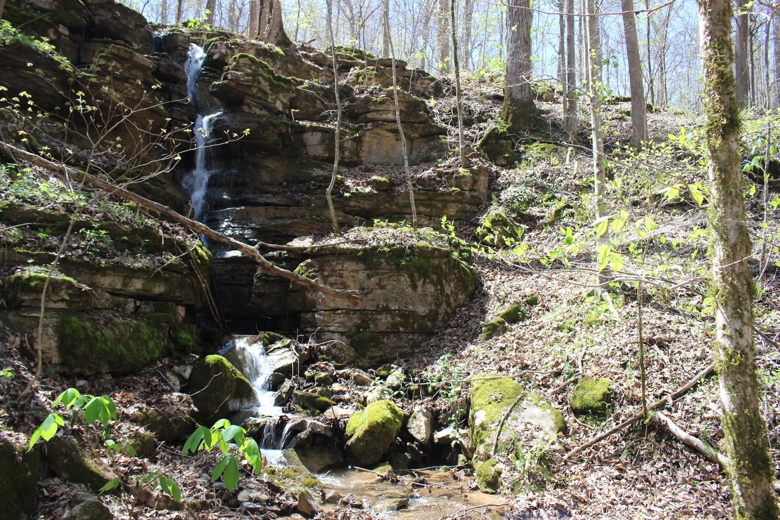
Once we took in the river view and soaked up some sunbeams we continued toward our main destination.. Big Sink. We had to pass another sink hole on the way. It is to the left of the trail heading in and easy to spot. It has a waterfall that only flows part of the time. We named it Lynnie Gal Falls for a much loved relative who passed away a couple years ago. I miss her terribly. We all do. Especially at times like Easter, Christmas, Halloween. Teresa was special. Her dad Lloyd called her Lynnie Gal. He was a mess and so was she. I can hear her laugh even now. Sure enough the falls was flowing! The sun rays and green tree leaves and wildflowers made it such a sight for sore eyes. I had thought it had a real big upper part to the falls so today we hiked up there to see. It does have an upper cascade, but it is not large.
It is another 10 foot drop.
Once we were satisfied with our stop at Lynnie Gal Falls and that sinkhole we moved on toward Big Sink. Kenny asked me if I wanted to go right to the main part of it or did I want to see it all? I wanted to see it all. I'm glad I did! It is all pretty! Big Sink is 1.6 miles long, 123 feet deep, and 0.5 miles wide. It is rectangular. It reminds me of a box canyon out west. We wound through the woods only missing our turn once. We passed a burned out old car sitting back in the woods. It has been there a long time. You have to wonder how it got there? Why was it set on fire? The trail does not run neatly from the mouth of the sink along its bottom ,and out the other end. We had to do some maneuvering to see it all either on foot or ATV. You have to go round to the mouth and come in. You go back a fair ways then have to back track and take a higher trail that runs along the rim. It goes back down to the bottom of the sinkhole just above Little Sink Falls. There are some interesting views of the rock formations and the beautiful slopes of the sink from this vantage.


Here is a closer view of the phacelia.
The map shows another trail heading away from Big Sink toward Dodson and the river.
We finally found it today. We did not fully explore it, but will need to . We jumped up a wild hog while ambling down this side trail! We came upon the lap of a fallen tree. Something began to rustle and out ran a hog! It is not the black Russian wild boar sort we usually see. This hog was a feral hog and brown! If you take a domesticated hog and turn it out in the wild within a fairly sort time it will revert to feral. I have seen these on television, but until today had never seen one for myself! He took off to the west and we did NOT follow him!
We also found that the trail headed west along the top of the ridge, but again we did not continue. It needs to be looked at because 1. It may provide an alternate route to explore Big Sink and Little Sink Branch. 2. The Cal Topo map shows another structure where this trail dead ends on the rim of the sinkhole. Checking satellite images I cannot see any man made structure there.

Below: Little Sink Branch

We back tracked and got onto the trail at the rim to continue. Across from us were slopes lined with mostly second growth sized trees leafing out. Every so often we could see spots on the opposite side where it appeared a trail was over there. Some of these may represent remnants of old logging roads, but I do want to check to see if there isn't a trail along the far rim. I believe there is at least part way. The trail turns down to the sink floor again at the confluence of Moore Branch and Little Sink Branch. Just below the confluence of the streams is Little Sink Falls. It is about fifteen feet high. I am not sure if it flows year round. I think it does, but I imagine there is far less water in Summer. A trail continues up Little Sink Branch. We have checked it out before. It is shown on the map coming back out on Long Rock Road, but we found it dead ended. It was a beautiful trail, but very rocky and rough. No waterfalls down Little Sink Branch. It is an interesting area because of the beauty of the forest and the towering rock formations.

Dwarf Ginseng was found around Little Sink Falls.
It was noon when we got to the falls at Little Sink Branch. We pulled over and sat down and enjoyed a view of the falls. We sat on a boulder underneath a rock overhang and listened to the water. We had a shady spot, but the sun was bright all around us. Purple phacelia was on the rock above us. The falls did have more water today. It was even prettier than expected. It gathers the flow of both streams and empties into the ground at the right. Today there was enough water to make a small plunge pool. On the far side there are massive boulders that form another small rock grotto. I had forgotten my tripod this camping trip. I had bright sunny conditions to add to my frustration in trying to get good pictures. I tried getting in different spots in the shaded grottoes to see if that would help. It did a little bit.

Little Sink Falls Click the link to watch the video.
Kenny had wandered down below Little Sink Falls on an old road bed. He came back saying "You need to walk down where I just was! Come see?! " I went with him and he was right.
The rocky shelves above us were coated with purple phacelia. The entire scene was like something out of Paradise. Prairie trilliums, southern red trilliums, toothwort, Canada violets, yellow violets, blue violets, dwarf ginseng, ferns, redbuds, dogwoods, all blooming .


It was such a beautiful spot we took plenty of time to absorb it. It is hard to tear yourself away from places like this. Only the anticipation of what lay ahead motivated me to keep going.
Finally we climbed back in the RZR and motored on up the trail. It is interesting to me how my mind edits hikes or rides. It leaves out stuff. I guess I just cannot remember it all. The ride was prettier and longer than I had imagined. You'd think a sink 1.6 miles long end to end would be quick. It is what is contained in that space that makes it count. The forest down here is incredibly beautiful. I did not want it to end today. Luckily there was more to come. Soon we came to the biggest oddity in this sinkhole. The house. An old house still sitting in the bottom of the sinkhole. Unoccupied for a very long time. It is fascinating. I'd love to know the history of it. Paper white narcissus bloomed in clumps near it. It appears to have been someone's home long ago.

We did not tarry long here. It is intriguing, but a little less so now that we knew it was here.
It was just shocking to see the first time! It will be interesting to see if we find more home sites down here. Black tic marks on topo maps are supposed to indicate structures.
We pushed onward and soon began to see moss covered rock piles. More signs of human occupation. We passed the mossy old chimney remains and the tater hole from under the house. A new sink hole... a small one had opened up a short distance behind it. I do not go in or near that sort of sink. It is unstable and can swallow you up if it gives way. Big Sink has been stable for many centuries I'd guess. I did see yellow kerria blooming near this spot today. I was less interested in the history of the people here than I was in seeing the natural features. All of these things lay nearer the way point given for the heart of Big Sink. The area here is so much like White Oak Sink in the Smokies. Wildflowers grow and bloom in profusion. Purple phlox , cream violets, dwarf larkspur in deep purple, pale purple and even two pink ones! I have never seen pink larkspur anywhere before . Not a nursery as an ornamental and certainly not in the wild.


Kenny went to the center of the sinkhole.He began exploring the caves. I meandered around for awhile just enjoying the scenery and flowers. Mayapples were all around like tiny green umbrellas. The deep purple swatches of larkspur were really striking. Now and then you'd have a lavender one thrown in. I was stunned when I saw the pink ones. Naturally I had to get plenty of images of those! The flowers continued on into the core of the sink. Mayapples, dwarf larkspur, violet wood sorrel, ferns, lots of squirrel corn and dutchmans breeches all around the caves and the slopes. The soil in the sink was very loamy and soft. Moss clung to everything. Kenny was nowhere to be seen. He hollered for me to come on down. He had gone in the swallet that drinks up the stream flowing here during high water. You could hear water down in the cave. It was squishy and muddy and I swore I was not going in there. Kenny kept telling me what was in there. Finally I couldn't stand it anymore and I went in. I had no light, but he had a couple. He came out far enough to light the way for me. I got filthy, scratched and bruised up, but I didn't care. I was not going to miss out. No bats in here. Only some spiders and camel crickets. The underground stream was very cool. So were the rock forms and chambers of the little cave.


Glad to be coming back out into the light! I was filthy dirty.
We crossed back over to the mouse hole cave. I had enjoyed going in this odd little formation the first time. I was tickled to get to see it again. It is even prettier in Spring. Everything is green and mossy and covered in vegetation. The rock forms are gray and convoluted. Kenny crawled in once more exhorting me to "Come on Down! " like some game show host. I took a few photos of the Dutchman's Britches growing around the opening and went in. It is a tight squeeze at first, but it is only a short distance until it opens up. It is a single chamber shaped like a cone. I have lost twenty four pounds since I was there last so it was easier to wriggle through this go round. Once inside the cave we could see four bats way up in the ceiling. We did not linger too long. We did not want to hassle them.


We satisfied our curiosity about the caves at the core of the sink. It was very cool to finally get to see the inside of a swallet. It was a first! We still had another waterfall at the back to see and possibly more falls up Moore's Branch. The stream there is so pretty coming down Moore's Branch, but it is really hard for me to call that a "waterfall" when the stream is dwarfed by the massive boulders. I expected the wildflower display to be good, and was not disappointed. Typical of some other sinkholes in the great Smoky Mountains and Cumberland Plateau.. this sinkhole contains lots of flowers including Virginia Bluebells!


We finally came to the back of the sink. The trail continues, but it leads up and out from this point. We stopped to check out the beautiful Big Sink Falls. Kenny went up Moore Branch, but I did not. It had a little more water than last visit, but it wasn't enough to motivate me to crawl up there. I enjoyed sitting at the base of the falls and basking in negative ions.
Southern Red trilliums, rue anemone, trout lilies and other beautiful wildflowers dotted the rocky terrain around the falls. Moore Branch flowed down joining with the water coming off the falls. All of it disappeared into the ground at the base of the falls. Interestingly enough there is another stream coming down beside the trail that we took when leaving. It does not make it to the bottom of the sink. It enters the ground before it gets there!
The afternoon was warm. A breeze was stirring. The new green growth of Spring was all around us. It was a really fine feeling to have gotten a chance to see this through. Quite often I have things I say I want to do, but it never materializes. It is not hard to change my mind into going elsewhere because there are so many things I'm interested in. We were both glad we picked this today and kept to it. I am filling up my mind and heart with the beauty of such days. Hobbies and interests like we participate in are hedges against the night. Everyone should have those in place.

Big Sink Falls.. a vertical composition.

Horizontal orientation of Big Sink Falls.
We followed the trail up and out of the back of the sink. We encountered enough blown down trees and laps of trees we missed the trail in one spot. Kenny got very annoyed, but he wrangled us out of there. We came up on plateau level. He took off in the opposite direction of the truck. We rambled around for awhile. We saw turkeys. We saw a few wildflowers. We rode along the rim of Big Sink before you get to Moore Branch. We also saw some of the springs that make up Moore Branch. Finally I had enough and called haw on him. We headed back to the truck. We passed two turkey hunters on the way out. We had a perfect day. Tired. Dirty. Happy. Ready to go back to the camper to rest and get clean. We would dream of the adventures of the next day.
Below is a video of Big Sink Falls.


