Showing posts with label easy hikes. Show all posts

Thursday, February 9, 2023

Frozen Head State Park Hiking--Back Valley Falls and Emory Gap Falls


Photo above is an interesting boulder near Emory Gap Falls.  I liked all the swirl patterns on it and the moss. 


Frozen Head State Park Hiking

Back Valley Falls and Emory Gap Falls

Sunday February 5, 2023

Kenny & Dana Koogler 

Hike Distance 3.4 miles round trip


  Both galleries of photos are combinations of various trips in different seasons.  The photo link to the galleries begin at the current trip. Click the right arrow to advance to the next frame. Click the X in the top right corner to get to a view of all the frames in the gallery.


  I have been worn out with family responsibilities lately.  Kenny had to work Saturday most of the day, but I got him to agree to go hike with me on Sunday.  Saturday I slept in and got some much needed rest, peace and quiet.  It feels so good to me not to have to be anywhere for a change.  No one needing taken to school or picked up from school. No one including me needing to go to the doctor or dentist.   I got a little bit of housework done and got organized for the next day.  

     I have lately gone through my videos on Cumberland Gal Channel and compared them to the photo albums I have.   I made a list of all the places I have visited yet don't have videos of.  I was shocked at how many were lacking.   I knew Kenny was not going to be in the mood having worked six days to do any extreme hikes.   I looked down my list of places and realized that I have only visited Emory Gap Falls in Frozen Head one time ever.   I also had not a single video of it.   It had been a decade since that original visit.     I decided Frozen Head would be a good hike destination.  I also wanted to go find Back Valley Falls while the streams were running well.   I half heartedly hunted it a year ago.  Today I would find it. 

      We stopped in Oak Ridge and got lunch to go at Firehouse Subs.   Back Valley Falls would be the first logical stop on our drive out.  We turned onto the side road and found a place to park.    I believed I knew where the falls was located. It was down over the side of the road and in a hole.    I remembered getting a glimpse of it last February.
The first place we stopped to try to go down I took a glance, but said no, the bank was too steep.  Instead we went across from where we parked and found a more gradual slope leading down to the stream.  From there we picked our way across the creek side and stepped over a lot of trash that has been dumped here over the years.   Yuck!   The gorge the stream was in was pretty and had lot of hemlocks. 
We followed it a ways as it snaked through the holler.  No waterfall thus far. We could see part way around another bend.   Kenny declared he did not believe the falls was down here.  He was over it.  He was not getting in the creek.  There was a faint animal path up over the bank.  We went up that and found ourselves on a finger of land jutting out with two streams converging at the end of the point.  
Kenny walked up the original stream a ways further and I waited on the bank. I looked up the second stream.  It was flowing real well.  It had some elevation loss and cascades.  I guessed it must be on this stream.   Kenny returned in a few moments dejected and there ain't no waterfall down here.   I told him I believed we were very close to it.  He didn't have much faith in me by now.  He said "We're going to see if we can just walk up this ridge to the road. You can see it right there. It is just on the other side of this brush pile.  

         We began plowing through the underbrush. I could hear the sound of cascading water growing louder.   I headed toward the stream so I could get a look for myself.   I spotted a flash of white through the trees.  We had found it!  As we got closer to the stream we could see it was a nice falls.  It would not be worth making a special trip just for this, but it was certainly worth a look while we were nearby.   

      Below: first look at Back Valley Falls


Below: looking downstream. This stream enters a second stream just a little ways further.


Above and below: two views of the terrain on the creek left.  It is steep, but if you look around a little there is a pretty good path to the road.  Hard to spot. It isn't as bad as it looks.


Below: A closer look at Back Valley Falls. It has a pretty plunge pool of green water.


Below is a video of Back Valley Falls that includes a look at how close it is to the road.   I was honest about our attempt today. Once again we made it harder than it had to be.  It is our usual M.O.  No sense lying about it. 


  If you want to see Back Valley Falls here is the waypoint from Tennessee Landforms  

It is viewable from the road.    To get there from the intersection of Hwy 61 and Hwy 62 (Knoxville Highway) in Oliver Springs turn onto Hwy 62 and head west for 2.25 miles to a LEFT turn onto Back Valley Road.   Stay on Back Valley Road for 0.65 miles and the falls is on the LEFT heading south on Back Valley Road.
It is a winding, narrow country road in a residential area.   It is tricky to find a safe place to park.  The shoulders of the road are squishy, soft mud so be careful.  
If I were to do it again I'd park at the Middle Creek Baptist Church anytime other than during Sunday service.  I'd carefully hike the shoulder of the road that short distance and not be worried with finding parking.  Where you can see the falls from the road the bank appears so steep that you would think you can't get down from there. That is not the case.  Carefully picking your way among the boulders with the falls on your right  you  gradually descend to creek level to a spot where the falls can be viewed.   The land around here is heavily posted. Go at your own risk.  Please do not litter.  There has been more than enough of that. 


   We got to Frozen Head and had lunch at the visitor center.  I had wanted to go in the visitor center for a long time, but we'd go hike and by the time we'd come out of the woods it would be closed.   Today I went in first before we ever hit the trail.  They have nice clean restrooms. They have hiking guides, maps, an information desk, and some cool souvenirs with the park logo.   I bought a Frozen Head State Natural Area patch for my collection at home.   I spoke with the ranger about potential places to RV camp in the area. She had me a list of several suggestions which I appreciated.  She also said that while the campground there was not really built to accommodate large RVs there was nothing saying you couldn't bring one.   They have no hookups whatsoever.   
We went and drove through the campground which is very nice, but impractical for our purposes.   

       We went on up to the Flat Fork parking area to begin our hike.   
On the way we passed Debord Falls, but we did not stop on the way in.  We would stop by there on the return hike.    We have visited that waterfall a fair amount recently.
We hiked out to Emory Gap Falls which is a beautiful hike with something to see the entire way.   Flat Fork has lots of lovely cascades, calm pools, and large trees.   The trail is well maintained and almost no elevation gain on the first leg of the trip.  
Once you turn left onto the Emory Gap Falls trail the terrain changes and there is a little bit of gradual uphill for about 0.30 miles.   I never even worked up a sweat.  
Today was a bluebird day with perfect weather.   At last a break in the gloom and rain with lots of sunshine today and clear skies!   We soon arrived at Emory Gap Falls. It was prettier than I remembered.   It had more water volume today than on our previous visit.   The rock outcrop to one side of the falls is impressive and quite dramatic.

Below: first look at Emory Gap Falls in its rock overhang setting

Above:  The lower part of the falls forms a pretty pool 


Above: massive rock outcropping
Above: a look downstream from the falls


Above:  I always like the textures and colors of tiny pebbles in a stream bed


Above: I am directly in front of Emory Gap Falls. This waterfall is such that you can get lots of different viewpoints to compose photos.  


     We enjoyed the falls and the pretty day.  I did not get in a hurry to leave. 
It felt great to be out getting some exercise and spending quality time with Kenny.
Finally we began our hike back.   It was extra easy because all the trip back was either downhill or flat.    We stopped by the bridge over Panther Branch where that trail begins.   I like bridges.  The setting was idyllic.   The sun sparkling on the water was so pretty. 

       We were encountering a fair number of other hikers today.  Everyone was in a great mood. They were as thrilled as we were to enjoy such a mild Winter day and getting outdoors.    We saw lots of folks with adorable dogs of all kinds!   All of them well mannered.    We stopped by the overlook for Debord Falls.   It was gushing strongly today.    Today was just perfect. 

Above : Debord Falls from the overlook
Above: looking upstream in the dappled late afternoon light from the bridge over Panther Branch


Above: looking across the bridge toward Panther Branch Trail

Below: glancing downstream from the bridge


    I could see that my months of daily, regular exercise had really paid off.  I was stronger. My pulse never got fast nor my breathing strained. I never got tired or even broke a sweat from the effort.   It is working and I am returning to my old self.   Kenny said he needed to get more exercise and I told him I agree that it would do us both some good.    I was thankful to have seen the wisdom of picking a mild hike to take him on.    Nothing ruins exercise for me faster than a toilsome, uncomfortable hike that hurts me.   I don't want to put him off or make him dread going.    He needs to get in shape gradually and carefully.  He can usually hike me into the ground.   Not today.  My dieting and clean eating and daily laps on the elliptical are worth doing.  

        Below is a video of Emory Gap Falls and the pertinent spots along our return hike.   


Directions to Emory Gap Falls at Frozen Head State Park, TN

Driving directions:  
From the intersection of Hwy 62 and Hwy 27 in Wartburg drive east on Hwy 62 for 2 miles to a LEFT turn onto Flat Fork Road.  This will pass by the current day Brushy Mountain State Prison, not the historic prison by the same name on Hwy 116 at Petros.   Stay on Flat Fork Road for 3.50 miles to the entrance for Frozen Head State Park.  Here the Flat Fork Road bends sharply right. After another 0.25 miles the road makes a LEFT turn and takes you by the Visitor Center on the right.  Follow Flat Fork Road to the end at 1.25 miles and park here to begin your hike.  

  Hike Directions:  
Here is the way point for Emory Gap Falls 
From the parking area begin hiking just past the gate on the continuation of Flat Fork Road heading east.   You will very quickly cross a wide bridge over Flat Fork stream. 
The creek here has a nice swimming hole below the bridge.     Follow the  trail with the stream on  your right.  During times of adequate rainfall there are several wet weather waterfalls dropping into the creek from the surrounding slopes.  You will arrive at Debord Falls in 0.60 miles on your right.    Continue on Flat Fork Trail for another 0.50 miles you will pass a right turn for Panther Branch Trail on your way.   
You soon arrive at a sign for Emory Gap Falls pointing to a LEFT turn.  The trail takes you back in the direction you've just come from briefly, then switches back and in another 0.30 miles you arrive at Emory Gap Falls.   

    We did this hike as an out and back.  Get you a map at the visitor center since Frozen Head has 50 miles worth of hiking trails and lots of possibilities for loop hike combinations.   
   
     I enjoyed today so much that I am planning and have already booked my lodging reservations for Spring. I will be making my Spring Wildflower and Waterfall Pilgrimage to Frozen Head State Park and vicinity.  I wanted something different. I realized how many trails there I have yet to hike.  I am really looking forward to it.

          We made it back to our truck and loaded up to head home.  
We stopped at the Oliver Springs Food City for me to get groceries.   I always like this little store.   I made it snappy and Kenny just napped in the truck.  We went home and I fixed a nice quiet home cooked meal.  It doesn't take much to make me happy.  


Wednesday, June 24, 2020

Conasauga Falls and Scenic Drive with the Family Round 1

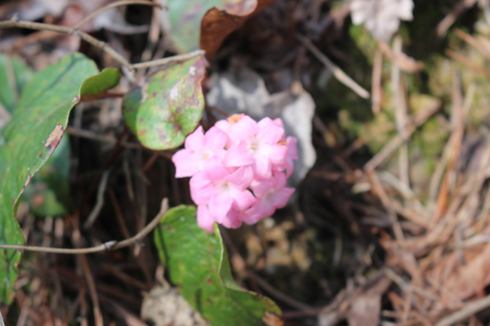
Trailing arbutus along Conasauga Falls trail. 
One of the earliest flowers to bloom in Spring. 


Conasauga Falls and Scenic Drive with the Family Round 1

3/27/2020

Dana Crystal, Michael ,Tessa

(Either X out the top right box or click the right arrow to advance. Photo 
album is a combination of several trips.  Pictures start with the photo of bright pink clump of trailing arbutus)


    This is one of the slightly abbreviated trip reports I'm catching up on. 
This took place right at the start of the corona virus crisis of 2020.   School was out because of that as well as Spring break had just started anyhow.   We were trying to get out and hike each week as a family.  
IMG_9342.JPG
      Above: Michael and Tessa start our hike

   We decided upon Conasauga Falls as a hike with other options to come later in the day.  I had long wanted to try driving Witt Road and Hot Water Road to make a loop back to Coker Creek from Conasauga.   I had been told by Nate Yarbrough it was a very pretty drive.  I still had not tried it.
IMG_9344.JPG
     Above: vernal iris likes dry pine woods

   We drove to Tellico Plains and on to the turn for Conasauga Falls trail.
We got to the end of the spur road and parked.   We saw one vehicle already there.   Another pulled up as we got out.   It was a mom and teen aged daughters.
I felt confident Tessa would be easily able to handle the 1.3 mile hike today.
It is a gradual downward hike on a good trail with switchbacks.    The day was warm and promised to get warmer.     We hiked out through the piney woods.
The forest smelled great. Fresh air and pine needle fragrance.     We saw trailing arbutus waxy pink dots along the path.  We saw vernal iris and  dwarf crested iris purple blooms also.

     We had to use care on the approach to the end of the trail.  The trail becomes more narrow and tricky.  Rocky areas and lots of tree roots.  We made it down without incident.    The stream was visible below. The kids and Crystal were really wowed by their first sight of Conasauga Falls.  It was running great today!
IMG_9346.JPG

Beautiful Conasauga Falls. You can see a teen girl standing looking at the falls about halfway up.  Great for scale!
Below: Michael throwing sticks or rocks. Tessa gets a drink of water. Crystal looks on.
  IMG_9350.JPG

Below: Michael.. my grandson age 11.  He is getting so tall!
IMG_9351.JPG
Below: Tessa has found a pretty pebble
IMG_9354.JPG


   We sat at the falls and enjoyed the cool mist and talked to the mom and her daughters a little bit.  They are home schoolers so they were not as affected schedule wise by the corona virus.   Dad worked from home. Mom was the teacher.   A pretty good set up especially for living that far out in the country.

     We made the hike back up to the top and vehicle.  We discussed what to do next. The kids liked the idea of driving through the creek and playing in the water.   I was good with that.  We figured we'd do that next since it was close.  If we had time left over and energy we'd add something else on. 

    We took my jeep with Crystal driving and me navigating round Witt Road.  I had been on it once before but only a short distance.   It is a winding gravel road.    It wasn't long til we got to the first creek ford. We pulled over to explore. 

IMG_9359.JPG

  A short stroll downstream of about 25 yards had us standing beside a pretty cascade on Conasauga Creek!  
IMG_9383.JPG
 We walked on downstream a bit further.  It was just incredible.  Lots of holes of clear, sparkling water, colorful pebbles and scenic cascades. 
IMG_9362.JPG
Conasauga Cascade. Here we are about  1/2 mile above the main falls we just visited! 
IMG_9363.JPG
Above and below
Sitting down to check out tiny pebbles.

IMG_9370.JPG

Below: Crystal is lost in thought.

IMG_9364.JPG

Below: Michael gets ready to wade the creek.
IMG_9371.JPG

Below: Not to be so easily outdone.. Tessa gets in the water too

IMG_9372.JPG
Below: path by the stream heading down along a series of picturesque cascades
IMG_9384.JPG

IMG_9387.JPG
Below:  mossy interesting boulders to scramble around above the path
IMG_9392.JPG


  We were beginning to get hungry so eventually we worked our way back toward the jeep.   We'd packed a nice lunch of sandwiches and fruit and chips.
We spied a black snake as we neared the vehicle.  The kids both like snakes and are fascinated by them.   He'd been under my jeep, but was slithering across the road.  
Mr. Black Snake... where are you going? 

IMG_9394.JPG

and he answered.. four wheeling! as he crawled across the top of a big gravel pile and down the other side of it.  Then he headed for a nearby tree and began crawling up it.

IMG_9400.JPG
Tessa ran over to the tree to watch him and talk to him.

IMG_9401.JPG
In this image above you can see where he is going.. up the tree to that small knot hole!  

Eventually he disappeared into the knot hole... all of him! Here is a funny picture with just his tail hanging out
IMG_9404.JPG

Below is a video of the snake and his doings


     The kids played in the pretty creek and we ate our lunch here at this spot.  It was really nice.    We then drove through the creek and continued onward. Below is a photo of the first creek ford.
IMG_9399.JPG


   We forded the stream several more times. The drive was glorious.  We had so much fun.  The road is rough. We took a wrong turn once and ended up in someone's driveway. Such is life in the Coker Creek area. pfffftt..
Crystal had to execute a seventeen point turn around, but we got righted and made our way round to Epperson Road and Hot Water Road and back out to Hwy 68.  We were all worn out so we headed home.    What a fun day!  The kids were already talking about coming back and bringing Papaw and Gabe.  They were discussing bringing various family members back to see this place. They were going fishing, tubing, etc.  Gee.. where do they get it?

 Below is a short video of Conasauga Falls


Below a short video of Conasauga Cascade


Wednesday, June 10, 2020

Potters Falls and Gobey with the Family

IMG_0898.JPG

Violet blooming beside Atlas Falls 

Potters Falls and Gobey with the Family 

Friday May 15, 2020

Crystal, Michael and Tessa Lindsey
Dana & Gabe Koogler


Directions to Atlas Falls-Gobey

Scroll to bottom for Potters Falls Directions


 We had been hiking each week as a family. I was the outdoor activities planner in the newly imposed homeschooling situation.   I asked Tessa, Michael and Crystal if they wanted Nanny to go hiking with them ... just us.. or if they wanted their younger cousin .. Gabe to go along too?  They had not seen him in awhile and definitely wanted him along.  They fight, but they love each other.   So we all gathered up and went.  Crystal asked to go on an outing to Morgan County.
We decided to start off with Potters Falls.  The days were growing hot and we had little man along so we knew none of us would feel like taking a long hike.

       All the grandkids spent the night at Nanny's house so that morning Crystal came over to help me get ready to go.  It didn't take too long.  We took along water toys, water shoes, towels, and a picnic.    She drove her vehicle with all of us out to the country.  All the kids have gotten used to the fact sometimes you have a bit of a drive to get to the hiking trail.  They piped up and said "We're here already?" as we pulled over to the roadside to park.  

Below is a photo of Crystal and Michael at Lower Potters Falls

IMG_0825.JPG

IMG_0829.JPG
The shady side of Lower Potters Falls

Below: Lower Potters Falls from directly in front at the base.
IMG_0836.JPG


   Potters Falls is two drops.  Potters Falls is right beside the bridge on Potters Falls Rd.  Lower Potters Falls is the smaller of the two and is approx. 0.10 mile downstream. There is a good path all the way to it.  You have to use care in getting down to the base of it by picking your way among a jumble of rocks.
Gabe had not eaten a very good breakfast this morning. I'm sure it was partly because he was so excited over the outing and having his cousins with him.
He began whining and wanting to be carried despite how easy and short the walk was.  I refused to carry him.  I tried to get his mind on something else.

  Lower Potters Falls was prettier than I had remembered.  It is not a large waterfall, but it is very scenic. The water in Crooked Fork creek was very blue.
Late Spring was upon us. The day was one of those perfect bluebird days.
Sunshine. Fresh air. Blue skies.  New, bright green leaves.  Most of the Spring wildflowers were done blooming.   We saw quite a few people here, but it was not crowded.  Parking is limited here.  No bathroom facilities either so bear that in mind.

       We walked up to Potters Falls.  A good number of children with their families were enjoying the water.   We did not see anyone doing anything stupid on or around the falls.  There is a rope swing .. actually I think we saw two rope swings.  One at the upper, one at the lower falls. I don't think I'd try either one.
I'm not sure the water depth is adequate for my bad aim.  It would be like the high diver trying to hit the tea cup of water!

    The upper falls though it has the bridge in view is still extremely pretty.
The water here is also blue.  It was cool here from the mist off the falls.  We really enjoyed it.  Gabe was really fussing and not having much fun. He was going to spread the misery around if I couldn't think of some solution.
IMG_0861.JPG
Above: Potters Falls. You can see the bridge and the road at the top of the falls.
Below: another vantage of Potters Falls
IMG_0865.JPG
Below: Crystal and Tessa in the shade at the falls.
IMG_0867.JPG

   We did not tarry long because the kids were eager to get to Gobey to see another falls and to play in the creek.   We headed the super short distance back to the vehicle.    I gave Gabe a drink and a snack to hold him over.  I took him into the woods to pee.     I had a flash of inspiration!  We had to drive right through Wartburg on the way to Gobey.  I asked if Crystal minded going through the Sonic Drive In? She did not.  Nanny treated everyone to whatever they wanted at Sonic.   Gabe went ahead and had lunch. The rest of us got a drink and a snack to hold us.  Our plan was to eat a late lunch in Oak Ridge at Freddy's.  
We all love Freddy's.  I don't eat restaurant hamburgers, but I will eat the steak burgers at Freddy's.  They are mustard, onion, pickle perfection on a bun!

        With our tummies satisfied we continued on our way to Gobey.
You get there by heading out of Wartburg on Hwy 27 North and drive 2.5 miles (from Sonic)
Turn RIGHT onto Gobey Road and follow it.  Directions for more specifics on reaching Atlas Falls are in the link at the top.

    The kids were excited. They are the happiest little people when they can explore and play in the water.  I had brought a bunch of cool toys in a basket for them.  Octonauts toys like submarines and little diving men and animals.  They are usually satisfied with rocks and sticks though.   They had a blast since Crystal was taking her Toyota Highlander "four wheeling" for only the 2nd time.  First time was down at Conasauga Creek.   Gabe had gotten bossy with Yaya (Crystal) this morning trying to tell her Nanny was going to drive and we were taking Nanny's jeep.  She informed him he was not the boss and that was not the case. We were taking HER vehicle and SHE was driving.  He was huffy about it initially.  Now seeing her in action behind the wheel and the performance of her vehicle he was thrilled! He was all about Yaya Brrmmming out!
He later told me that Yaya's vehicle was better than mine!  Boy what a change in attitudes!
IMG_0874.JPG
    above: one of the fords of Little Creek where we stopped to let the children play.  The water is shallow here and so clear!  Nice mixture of sunshine and shade for comfortable temperatures.

  We drove through the creek several times, but the first one was where we stopped for them to play in the stream.  It was a nice wide spot with a pull over.  It was shady. The stream flows down and swings round a wide, tall rock amphitheater.  It is a very cool place to explore.
Below: a photo of the massive rock amphitheater that the creek has carved out over the millenia.
IMG_0887.JPG
Below: a passing glimpse of the only folks we saw at Gobey today.  A family out on their four wheeler having fun.
IMG_0888.JPG

  We saw lots of butterflies. Tiger swallowtails and zebra swallowtails.  Tessa was enthralled with those.  IMG_0870.JPG

Above: Zebra swallowtail butterfly

We saw tiny black and white "butterflies" that we thought might be baby Zebra swallowtails.  I later identified them as Mournful Thyris moths. I had seen these before puddling with zebra swallowtails!
Thyris sepulchralis - Mournful Thyris
Above: Mournful thyris moths binomial is Thyris sepulchralis
Below: holding one of the tiny moths

IMG_0875.JPG

Below: my six year old granddaughter Tessa holds a moth.  She makes everything  a pet.
IMG_0877.JPG
Below: Gabe playing in the creek. He is totally happy and absorbed.
IMG_0878.JPG
Below: Michael playing in the creek. He has a submarine. One of the Gups from the Octonauts. He and Gabe had races and experimented to see which ones did the best.
IMG_0881.JPG

This is the Gup E

Below: Crystal and the kids playing around
IMG_0882.JPG

Below: Upstream of the ford was a spot that was shady and deeper.  Michael and I got in it and waded around.   It felt great.
IMG_0883.JPG
Below: Gabe lost in his thoughts. He loves outside. All my grandkids do. I am very proud of them.
IMG_0892.JPG
Below: Crystal, Tessa and Gabe
IMG_0893.JPG

  Looking at the photo above-- I will share an epiphany I had.
I have tried for a long time to share an emotion and a lesson with my family. Mainly my children and grandchildren.  The importance and appreciation of the privilege of being able to go outside and enjoy nature.  I value that above most things.    I had tried to inspire the rest of the family.  Kenny gets it. I know he does.   The rest of them were slower to catch on and really truly understand.
The corona virus and quarantine........ taught a lesson rapidly that I'd been trying without a lot of success to teach for years!
I made sure to tell them all what I thought.  I saw the light come on for all of them as they finally grasped the concept.  It was a refreshing moment of joy for me!

  If you are looking for a silver lining in a difficult situation... there is one to be found.  I know I've found many moments of gratitude for simply pleasures.
IMG_0894.JPG
Above: the Gup D floats downstream smoothly

   We enjoyed the creek, but the kids at once remembered we were supposed to go on to see a waterfall.  They were ready to go see it!  We drove a short distance further and came to a pull off for Atlas Falls. It is just down over the bank.
An easy walk. You can see it from the road.  They were very excited. Gabe wanted to know if he could take his toy jeep to brrrrm and pretend to go four wheeling?  I told him of course!
IMG_0895.JPG
Gabe in front of Atlas Falls with his jeep. He made it drive in the rocks to go rock crawling and he put it in the water like it was stuck or sinking! It floated down the creek. Below is a photo of Michael retrieving it for him.

IMG_0904.JPG

IMG_0906.JPG

 Don't fly, mister blue bird, I'm just walkin' down the roadEarly morning sunshine, tell me all I need to know, -- Blue Sky--Dickey Betts-- the Allman Brothers 

IMG_0908.JPG
Above: a not too good image of Atlas Falls. the dappled light made for difficult photo conditions! It did not influence our enjoyment of the falls.

below is a photo of Atlas Falls from a different trip that is a better shot to show it off properly. It really is a very pretty falls.
finally found it waterfall gobey.jpg
Atlas Falls from a different trip. Better photo. Little more water.

  The kids were getting tired and hungry. We were too so we headed back to the vehicle. We loaded up and Yaya executed a perfect 3 point turn on that narrow dirt road. She did not get us stuck in a ditch!     We headed back to Oak Ridge to eat at Freddy's.  Gabe napped on the way as did Tessa.   What a fun day! We got to the restaurant and got our tummies full of burgers and fries and icecream.   Nice cold sodas!  Yummy!  Everyone had fun.  These family outings are addictive.  I am already looking forward to the next one.

  Below is a video of both Potters Falls 

Next is a video of playing in the creek

Final video-- short clip of Atlas Falls


**Potters Falls Directions**
From Wartburg on Main Street next to Rite Aid Pharmacy.. turn LEFT onto Old Mill Rd.  Stay on that for about 1/2 mile.  Then turn LEFT onto Potters Falls Rd.
for about 1 1/2 miles to Potters Falls at the bridge. There will be space to park about four or five cars.   Park well off the road. The trail for the falls goes downstream with Crooked Fork on your left.   Potters Falls is immediately below the bridge visible from the road.  Lower Potters Falls is downstream around 0.10 mile further.  No bathroom facilities or trash receptacles here so plan accordingly.